Yuli, Hualien
Appearance
You can helpexpand this article with text translated fromthe corresponding articlein Chinese.(January 2022)Click [show] for important translation instructions.
|
Yuli Township
| |
|---|---|
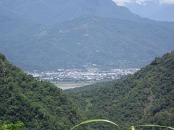
 Aerial view of Yuli Township | |
 | |
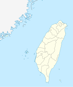
| Coordinates:23°23′15″N121°22′35″E/ 23.38750°N 121.37639°E | |
| Country | Republic of China (Taiwan) |
| Region | Eastern Taiwan |
| County | Hualien County |
| Government | |
| • Type | Township council |
| Area | |
| • Total | 252.3719 km2(97.4413 sq mi) |
| Population (March 2023) | |
| • Total | 22,305 |
| Time zone | UTC+8(CST) |
| Postal code | 981 |
| Subdivision | 15 villages |
| Website | HLYL.gov.tw |


Yuli Township(Chinese:Ngọc lí trấn;pinyin:Yùlǐ Zhèn;Pe̍h-ōe-jī:Gio̍k-lí-tìn;Japanese: Tamazato [Kanji:Ngọc lí[たまざと] ]),Amis:Posko,Bunun:Pusqu(Hanzi transliterated by 1917:Phác thạch các), is anurban townshiplocated in centralHuadong Valley,and also the southern administrative center ofHualien County,Taiwan.It has a population of 22,305 inhabitants and 15 villages.[1]
Geography
[edit]

The township is located in theHuadong Valley.
Administrative divisions
[edit]The township comprises 15 villages: Chunri, Dayu, Dewu, Guanyin, Guowu, Lege, Qimo, Sanmin, Songpu, Taichang, Tungfeng, Yongchang, Yuancheng, Zhangliang, and Zhongcheng.
Tourist attractions
[edit]This sectionis written like atravel guide.(January 2022) |
- Antong Hot Springs
- Dongfeng Leisure Farm
- Mount Chihke
- Teifen Waterfalls
- Xietian Temple
- Yucyuan Temple
- Yuli Jinja
- Walami Trail
- Yushan National Park[2]
Transportation
[edit]
Railway
[edit]Road
[edit]- Provincial Highway 9(Hualien-Taitung Highway)
- Provincial Highway 30(Yuli-Chengbin Highway)
- County Road No.193
Bus
[edit]- Hualien Bus Company
Notable natives
[edit]- Evonne Hsieh,actress
- Umin Boya,writer, director and actor
- Wu Maw-kuen,Minister of Education(2018)
Wikimedia Commons has media related toYuli Township, Hualien County.
References
[edit]- ^"YULI Township Government, Hualien".Archived fromthe originalon March 6, 2014.RetrievedFebruary 17,2014.
- ^"East Rift Valley National Scenic Area::PDA".www.erv-nsa.gov.tw.Archived fromthe originalon 29 October 2013.Retrieved15 January2022.
External links
[edit]Wikivoyage has a travel guide forYuli.
- Office of Yu Li Township(Chinese)


