Eunanoreenya, New South Wales
Appearance
| Eunanoreenya Wagga Wagga, New South Wales | |||||||||||||||
|---|---|---|---|---|---|---|---|---|---|---|---|---|---|---|---|
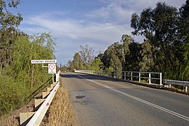
 Eunony Bridge viewed from Eunanoreenya looking towards Gumly Gumly. | |||||||||||||||
 | |||||||||||||||
| Coordinates | 35°03′54″S 147°28′04″E / 35.06500°S 147.46778°E | ||||||||||||||
| Population | 169 (2016 census)[1] | ||||||||||||||
| Postcode(s) | 2650 | ||||||||||||||
| LGA(s) | City of Wagga Wagga | ||||||||||||||
| County | Clarendon | ||||||||||||||
| Parish | Eunanoreenya | ||||||||||||||
| State electorate(s) | Wagga Wagga | ||||||||||||||
| Federal division(s) | Riverina | ||||||||||||||
| |||||||||||||||
Eunanoreenya (previously known as Eunanyhareenyha and Eunonyhareenya) is a rural suburb of Wagga Wagga, New South Wales.[2]
References
[edit]- ^ Australian Bureau of Statistics (27 June 2017). "Eunanoreenya (State Suburb)". 2016 Census QuickStats. Retrieved 27 June 2017.
- ^ "Eunanoreenya". Geographical Names Register (GNR) of NSW. Geographical Names Board of New South Wales. Retrieved 20 September 2009.
External links
[edit]![]() Media related to Eunanoreenya, New South Wales at Wikimedia Commons
Media related to Eunanoreenya, New South Wales at Wikimedia Commons

