
Collegedale, Tennessee
Collegedale, Tennessee | |
|---|---|
City | |
| Motto(s): Justice, Safety, Efficiency | |
 Location in Hamilton County, Tennessee | |
| Coordinates:35°3′6″N85°2′49″W/ 35.05167°N 85.04694°W | |
| Country | United States |
| State | Tennessee |
| County | Hamilton |
| Incorporated | 1968 |
| Government | |
| • Type | City Manager-Commission |
| • City Manager | Wayon Hines |
| Area | |
| • Total | 12.03 sq mi (31.16 km2) |
| • Land | 12.03 sq mi (31.16 km2) |
| • Water | 0.00 sq mi (0.00 km2) |
| Elevation | 791 ft (241 m) |
| Population | |
| • Total | 11,109 |
| • Density | 923.36/sq mi (356.52/km2) |
| Time zone | UTC-5(Eastern (EST)) |
| • Summer (DST) | UTC-4(EDT) |
| ZIP code | 37302, 37315, 37363 |
| Area code | 423 |
| FIPS code | 47-16300[4] |
| GNISfeature ID | 1280968[2] |
| Website | www |
Collegedaleis a city inHamilton County, Tennessee,United States. The population was 11,109 at the 2020 census.[5][6]Collegedale is a suburb ofChattanoogaand is part of the Chattanooga, TN–GAMetropolitan Statistical Area.Collegedale is home toSouthern Adventist University.The median household income is one of the highest in Hamilton County.[7]It has been ranked as one of the best and safest places to live in Tennessee.[8]The unincorporated community ofOoltewahis anenclavein Collegedale.
History
[edit]Collegedale was founded as the site ofSouthern Adventist University(then Southern Junior College) in 1916. It was incorporated under acity managergovernment in 1968. J.M. Ackerman was the first city manager, and Fred Fuller served as the city's first mayor.
Geography
[edit]Collegedale is located in southeastern Hamilton County at35°3′6″N85°2′49″W/ 35.05167°N 85.04694°W(35.051578, -85.047004),[9]in the valley of Wolftever Creek. Just west of the city center, the creek cuts through White Oak Mountain, forming Collegedale Gap.Tennessee State Route 317passes through the city center and Collegedale Gap, leading southeast 10 miles (16 km) toState Route 60and northwest 4 miles (6 km) toInterstate 75in the northeastern outskirts ofChattanooga.Downtown Chattanooga is 19 miles (31 km) west of Collegedale.Tennessee State Route 321runs through the western part of Collegedale, leading north to U.S. routes11and64just north of Ooltewah and south 5 miles (8 km) to theGeorgiastate line.
As of the2010 census,the city had a total area of 9.9 square miles (25.6 km2), all of it recorded as land.[5]
Demographics
[edit]| Census | Pop. | Note | %± |
|---|---|---|---|
| 1970 | 3,031 | — | |
| 1980 | 4,607 | 52.0% | |
| 1990 | 5,048 | 9.6% | |
| 2000 | 6,514 | 29.0% | |
| 2010 | 8,282 | 27.1% | |
| 2020 | 11,109 | 34.1% | |
| Sources:[10][11][3] | |||
2020 census
[edit]| Race | Number | Percentage |
|---|---|---|
| White(non-Hispanic) | 8,112 | 73.02% |
| Black or African American(non-Hispanic) | 831 | 7.48% |
| Native American | 27 | 0.24% |
| Asian | 410 | 3.69% |
| Pacific Islander | 14 | 0.13% |
| Other/Mixed | 508 | 4.57% |
| HispanicorLatino | 1,207 | 10.87% |
As of the2020 United States census,there were 11,109 people, 4,167 households, and 2,485 families residing in the city.
2000 census
[edit]As of thecensus[4]of 2000, there were 6,514 people, 2,049 households, and 1,528 families residing in the city. The population density was 781.6 inhabitants per square mile (301.8/km2). There were 2,199 housing units at an average density of 263.9 per square mile (101.9/km2). The racial makeup of the city was 90.55%White,4.37%African American,0.01%Native American,0.01%Asian,0.03%Pacific Islander,2.87% fromother races,and 2.16% from two or more races.HispanicorLatinoof any race were 7.74% of the population.
There were 2,049households,out of which 33.3% had children under the age of 18 living with them, 61.0% weremarried couplesliving together, 10.7% had a female householder with no husband present, and 25.4% were non-families. 20.5% of all households were made up of individuals, and 7.0% had someone living alone who was 65 years of age or older. The average household size was 2.57 and the average family size was 2.96.
In the city the population was spread out, with 19.8% under the age of 18, 25.2% from 18 to 24, 25.4% from 25 to 44, 16.7% from 45 to 64, and 13.0% who were 65 years of age or older. The median age was 29 years. For every 100 females there were 88.5 males. For every 100 females age 18 and over, there were 85.6 males.
The median income for a household in the city was $42,270, and the median income for a family was $52,337. Males had a median income of $37,819 versus $28,345 for females. Theper capita incomefor the city was $18,604. About 5.3% of families and 7.4% of the population were below thepovertyline, including 10.5% of those under the age of 18 and 4.0% of those 65 and older.
Collegedale has a largeSeventh-day Adventistcommunity and in 2005 was described as an "enclave" for the religion by Charles Reagan Wilson andMark Silk.[13]
Economy
[edit]McKee Foodsis headquartered in Collegedale. Originally launched in Chattanooga in 1934, the company moved to a facility on the campus of Southern Adventist University in 1956. McKee Foods is the producer ofLittle DebbieandSunbeltsnack foods.[14]
Arts and culture
[edit]In August 2011, the city took over control of the Collegedale Public Library, which was previously operated under theHamilton Countylibrary system. Library membership is available on a paid subscription basis, free to residents of Collegedale.[15]
Parks and recreation
[edit]Six parks are managed by the Parks & Recreation Department of Collegedale:
- East Hamilton County Parkhas a high schoolbaseball fieldand three youth fields.
- Wolftever Creek Greenwayis agreenwaywhich spans throughout the city and continues to be expanded upon by the city.
- Collegedale Dog Parkprovides dog-owners with adog parkfor unleashed dog socialization.
- Imagination Station & Pavilionis a playground and rental space located behind City Hall with a train theme.
- The Nature Nookis anamphitheatrebuilt by the East Hamilton County Kiwanis Club for the city.
- Veterans Memorial Parkis located along the Wolftever Creek Greenway and features plaques, sculptures and flags as a memorial to United States war veterans.[16]
The town has youth and adultsoftballleagues.[17]It also has fourpickleballcourts adjacent to the Imagination Station and City Hall.
Government
[edit]Collegedale was incorporated in 1968. It operates under a City Manager-Commission form of government. Five commissioners are elected by popular vote and they are responsible for choosing acity manager,who then proceeds to implement the commissions policies.[18]
On 5 August 2013, Collegedale became the first city in Tennessee to extend health benefits to same-sex couples.[19]
Education
[edit]Southern Adventist University,a private Christian university, is located in Collegedale.[20]It has an affiliated K-12 education system, Collegedale Academy, which includes Collegedale Academy Middle School, and Collegedale Academy Elementary
Wolftever Creek Elementary School and Ooltewah Middle School are the two public schools inside of city limits. Both schools belong to theHamilton County Schoolssystem.
Infrastructure
[edit]Transportation
[edit]
The city is located just off theI-75corridor.[21]Collegedale Municipal Airportis owned by the city of Collegedale and has about 120 aircraft stationed there.[citation needed]In 2003, the airport was awarded the Tennessee Aeronautics Commission's "Airport of the Year" title.[22]
Utilities
[edit]Collegedale has a recycling program which requires the public to bring their recyclables to the city public works department. The city uses recycling to reduce the costs of landfill waste disposal and offsets the cost of recycling by selling the recyclable materials.[23]Comcastprovides cable services andCenturyLinksupplies landline phone services. Electricity is supplied byEPBand the Chattanooga Gas Company supplies gas needs. The city and/or Hamilton County handles resident sewer needs and Eastside Utility District handles water services.[24]
Health & safety
[edit]The city utilizes Hamilton County Emergency Medical Services foremergency medical servicesand contracts fire & rescue services to the Tri-Community Volunteer Fire Department located in Collegedale. The local volunteer fire department, at Station 1, has 100 members and support staff and an ISO Class 2 rating.[25]The Collegedale Police Department provides police services for the city.[26]
References
[edit]- ^"ArcGIS REST Services Directory".United States Census Bureau.Retrieved15 October2022.
- ^abU.S. Geological Survey Geographic Names Information System: Collegedale, Tennessee
- ^ab"Census Population API".United States Census Bureau.Retrieved15 October2022.
- ^ab"U.S. Census website".United States Census Bureau.Retrieved31 January2008.
- ^ab"Geographic Identifiers: 2010 Census Summary File 1 (G001): Collegedale city, Tennessee".American Factfinder.U.S. Census Bureau. Archived fromthe originalon 13 February 2020.Retrieved26 January2018.
- ^"Population and Housing Unit Estimates".Retrieved25 August2019.
- ^"Archived copy"(PDF).Archived fromthe original(PDF)on 21 September 2015.Retrieved8 June2015.
{{cite web}}:CS1 maint: archived copy as title (link) - ^"20 Safest Cities in Tennessee".Archived fromthe originalon 19 June 2015.Retrieved8 June2015.
- ^"US Gazetteer files: 2010, 2000, and 1990".United States Census Bureau.12 February 2011.Retrieved23 April2011.
- ^"Census of Population and Housing: Decennial Censuses".United States Census Bureau.Retrieved4 March2012.
- ^"Incorporated Places and Minor Civil Divisions Datasets: Subcounty Resident Population Estimates: April 1, 2010 to July 1, 2012".Population Estimates.U.S. Census Bureau. Archived fromthe originalon 11 June 2013.Retrieved11 December2013.
- ^"Explore Census Data".data.census.gov.Retrieved25 December2021.
- ^Charles Reagan Wilson; Mark Silk (2005).Religion and public life in the South: in the evangelical mode.Rowman Altamira. p. 128.ISBN978-0-7591-0635-2.
- ^"History".About us.McKee Foods. 2006. Archived fromthe originalon 29 September 2011.Retrieved7 November2011.
- ^"About the Library".About Us.Collegedale Public Library. 2011. Archived fromthe originalon 12 November 2011.Retrieved7 November2011.
- ^"City of Collegedale Parks & Recreation".Departments & Services.City of Collegedale. 2009. Archived fromthe originalon 19 January 2012.Retrieved8 November2011.
- ^"Cdale Softball".Collegedale Softball. 2011.Retrieved8 November2011.
- ^"Collegedale Local Government".City Government.City of Collegedale. 2009. Archived fromthe originalon 27 September 2011.Retrieved7 November2011.
- ^"Collegedale approves benefits for same-sex couples".
- ^"Southern Adventist University".CollegeView.Retrieved7 November2011.
- ^"Welcome to the City of Collegedale, TN".City of Collegedale. 2011.Retrieved7 November2011.
- ^"Collegedale Airport Named Airport of the Year".The Chattanoogan. 22 August 2003.Retrieved20 March2014.
- ^"Recycling Information".Departments & Services.City of Collegedale. 2009. Archived fromthe originalon 27 September 2011.Retrieved8 November2011.
- ^"Utilities".Area Living.City of Collegedale. 2009. Archived fromthe originalon 27 September 2011.Retrieved8 November2011.
- ^"Fire, Rescue & EMS Services".Departments & Services.City of Collegedale. 2009. Archived fromthe originalon 14 January 2012.Retrieved8 November2011.
- ^"Collegedale Police Department".Departments & Services.City of Collegedale. 2009. Archived fromthe originalon 13 January 2012.Retrieved8 November2011.
External links
[edit]35°03′06″N85°02′49″W/ 35.051578°N 85.047004°W
Municipalities and communities ofHamilton County, Tennessee,United States | ||
|---|---|---|
| Cities | 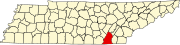 | |
| Towns | ||
| CDPs | ||
| Unincorporated communities | ||
| Footnotes | ‡This populated place also has portions in an adjacent county or counties | |
| International | |
|---|---|
| National | |
| Geographic | |