
Loire
| Loire | |
|---|---|
 The Loire in Maine-et-Loire | |
 Map of France with the Loire highlighted | |
| Native name | |
| Location | |
| Country | France |
| Physical characteristics | |
| Source | Massif Central |
| • location | Sainte-Eulalie,Ardèche |
| • coordinates | 44°49′48″N4°13′20″E/ 44.83000°N 4.22222°E |
| • elevation | 1,408 m (4,619 ft)[1] |
| Mouth | Atlantic Ocean |
• location | Saint-Nazaire,Loire-Atlantique |
• coordinates | 47°16′09″N2°11′09″W/ 47.26917°N 2.18583°W |
• elevation | 0 m (0 ft) |
| Length | 1,006 km (625 mi)[2] |
| Basin size | 117,000 km2(45,000 sq mi)[1] |
| Discharge | |
| • location | Montjean-sur-Loire[3] |
| • average | 835.3 m3/s (29,500 cu ft/s)[3] |
| • minimum | 60 m3/s (2,100 cu ft/s) |
| • maximum | 4,150 m3/s (147,000 cu ft/s) |
| Basin features | |
| Tributaries | |
| • left | Allier,Cher,Indre,Vienne,Sèvre Nantaise |
| • right | Maine,Nièvre,Erdre |
| Official name | The Loire Valley between Sully-sur-Loire and Chalonnes |
| Criteria | Cultural: (i)(ii)(iv) |
| Reference | 933bis |
| Inscription | 2000 (24thSession) |
| Extensions | 2017 |
| Area | 86,021 ha (212,560 acres) |
| Buffer zone | 213,481 ha (527,520 acres) |
TheLoire(/lwɑːr/LWAR,USalso/luˈɑːr/loo-AR,French:[lwaʁ];Occitan:Léger[ˈledʒe];Arpitan:Lêre;Breton:Liger;Latin:Liger) is the longest river in France and the 171st longest in the world.[4]With a length of 1,006 kilometres (625 mi),[2]it drains 117,054 km2(45,195 sq mi), more than a fifth of France's land,[1]while its average discharge is only half that of theRhône.
It rises in the southeastern quarter of the FrenchMassif Centralin theCévennesrange (in thedepartmentofArdèche) at 1,350 m (4,430 ft) nearMont Gerbier de Jonc;it flows north throughNeverstoOrléans,then west throughToursandNantesuntil it reaches theBay of Biscay(Atlantic Ocean) atSaint-Nazaire.Its main tributaries include the riversNièvre,Maineand theErdreon its right bank, and the riversAllier,Cher,Indre,Vienne,and theSèvre Nantaiseon the left bank.
The Loire gives its name to six departments:Loire,Haute-Loire,Loire-Atlantique,Indre-et-Loire,Maine-et-Loire,andSaône-et-Loire.The lower-central swathe ofits valleystraddling thePays de la LoireandCentre-Val de Loireregions was added to theWorld Heritage Siteslist ofUNESCOon December 2, 2000.Vineyardsandchâteauxare found along the banks of the river throughout this section and are a major tourist attraction.
The human history of the Loire river valley is thought by some to begin with theMiddle Palaeolithicperiod of 90–40kya(thousand years ago), followed by modern humans (about 30 kya), succeeded by theNeolithic period(6,000 to 4,500 BC), all of the recentStone Age in Europe.Then came theGauls,the local tribes during theIron Ageperiod of 1500 to 500 BC. They used the Loire as a key trading route by 600 BC, using pack horses to link its trade, such as the metals of theArmorican Massif,withPhoeniciaandAncient GreeceviaLyonon the Rhône. Gallic rule ended in the valley in 56 BC whenJulius Caesarconquered the adjacent provinces forRome.Christianity was introduced into this valley from the 3rd century AD, as missionaries (many later recognized assaints), converted thepagans.In this period, settlers established vineyards and began producing wines.[5]
The Loire Valley has been called the "Garden of France" and is studded with over a thousandchâteaux,each with distinct architectural embellishments covering a wide range of variations,[6]from the earlymedievalto the lateRenaissanceperiods.[5]They were originally created asfeudalstrongholds, over centuries past, in the strategic divide between southern and northern France; now many are privately owned.[7]
Etymology
[edit]The name "Loire" comes fromLatinLiger,[8]which is itself a transcription of the nativeGaulish(Celtic) name of the river. The Gaulish name comes from the Gaulish wordliga,which means "silt, sediment, deposit, alluvium", a word that gave Frenchlie,as insur lie,which in turn gave Englishlees.
Ligacomes from theProto-Indo-Europeanroot *legʰ-,meaning "to lie, lay" as in the Welsh wordLleyg,and also which gave many words in English, such as to lie, to lay, ledge, law, etc.
Geography
[edit]
The source of the river lies in the easternMassif Central,in springs to the south side ofMont Gerbier de Joncat44°50′38″N4°13′12″E/ 44.84389°N 4.22000°E.[4][9]This lies in the north-eastern part of the southernCévenneshighlands, in theArdèchecommune ofSainte-Eulalieof southeastern France. It is originally a mere trickle of water located at 1,408 m (4,619 ft)above sea-level.[1]The presence of anaquiferunder Mont Gerbier de Jonc gives rise to multiple sources, three of them located at the foot of Mount have been highlighted as river sources. The three streams converge to form the Loire, which descends the valley south of Mount through the village of Sainte-Eulalie itself.

The Loire changed its course, due to tectonic deformations, from the original outfall into theEnglish Channelto its new outfall into the Atlantic Ocean thereby forming today's narrow terrain of gorges, the Loire Valley with alluvium formations and the long stretch of beaches along the Atlantic Ocean.[1]The river can be divided into three main zones:[1]
- the Upper Loire, the area from the source to the confluence with the Allier
- the middle Loire Valley, the area from the Allier to the confluence with the Maine, about 280 km (170 mi)
- the Lower Loire, the area from Maine to the estuary
In the upper basin the river flows through a narrow, incised valley, marked by gorges and forests on the edges and a distinct low population.[1]In the intermediate section, the alluvial plain broadens and the river meanders and forks into multiple channels. River flow is particularly high in the river area nearRoanneandVichyup to the confluence with the Allier.[1]In the middle section of the river in the Loire Valley, numerous dikes built between the 12th and 19th century exist, providing mitigation against flooding. In this section the river is relatively straight, except for the area nearOrléans,and numerous sand banks and islands exist.[1]The lower course of the river is characterized by wetlands and fens, which are of major importance to conservation, given that they form unique habitats for migratory birds.[1]

The Loire flows roughly northward throughRoanneandNeverstoOrléansand thereafter westward throughTourstoNantes,where it forms anestuary.It flows into the Atlantic Ocean at47°16′44″N2°10′19″W/ 47.27889°N 2.17194°WbetweenSaint-NazaireandSaint-Brevin-les-Pins,connected by a bridge over the river near its mouth. Severaldépartements of Francewere named after the Loire. The Loire flows through the following départements and towns:
- Ardèche
- Haute-Loire
- Loire
- Saône-et-Loire
- Allier
- Nièvre
- Cher
- Loiret
- Loir-et-Cher
- Indre-et-Loire
- Maine-et-Loire:
- Loire-Atlantique
The Loire Valley in the Loire river basin, is a 300 km (190 mi) stretch in the western reach of the river starting with Orléans and terminating atNantes,56 km (35 mi) short of theLoire estuaryand the Atlantic Ocean. The tidal stretch of the river extends to a length of 60 km (37 mi) and a width of 3 km (1.9 mi), which has oil refineries, the port ofSaint-Nazaireand 40,000 hectares (99,000 acres) of wetland whose formation is dated to 7500 BC (caused by inundation by sea waters on the northern bank of the estuary), and the beaches ofLe CroisicandLa Baulealong the coastline.[10]
Tributaries
[edit]
Its main tributaries include the riversMaine,Nièvreand theErdreon its right bank, and the riversAllier,Cher,Indre,Vienne,and theSèvre Nantaiseon the left bank. The largest tributary of the river is theAllier,410 km (250 mi) in length, which joins the Loire near the town ofNeversat46°57′34″N3°4′44″E/ 46.95944°N 3.07889°E.[1][4]Downstream of Nevers lies theLoire Valley,aUNESCO World Heritage Sitedue to its fine assortment of castles. The second-longest tributary, the 372 km (231 mi)Vienne,joins the Loire atCandes-Saint-Martinat47°12′45″N0°4′31″E/ 47.21250°N 0.07528°E,followed by the 367.5 km (228.4 mi)Cher,which joins the Loire nearCinq-Mars-la-Pileat47°20′33″N0°28′49″E/ 47.34250°N 0.48028°Eand the 287 km (178 mi)Indre,which joins the Loire nearNémanat47°14′2″N0°11′0″E/ 47.23389°N 0.18333°E.[1]
- Acheneau(inLe Pellerin)
- Sèvre Nantaise(inNantes)
- Erdre(in Nantes)
- Èvre(inLe Marillais)
- Layon(inChalonnes-sur-Loire)
- Maine(nearAngers)
- Mayenne(near Angers)
- Sarthe(near Angers)
- Loir(north of Angers)
- Braye(inPont-de-Braye)
- Aigre(nearCloyes-sur-le-Loir)
- Yerre(near Cloyes-sur-le-Loir)
- Conie(nearChâteaudun)
- Ozanne(inBonneval)
- Vaige(inSablé-sur-Sarthe)
- Vègre(inAvoise)
- Huisne(inLe Mans)
- Loir(north of Angers)
- Authion(inSainte-Gemmes-sur-Loire)
- Thouet(nearSaumur)
- Dive(nearSaint-Just-sur-Dive)
- Losse(nearMontreuil-Bellay)
- Argenton(nearSaint-Martin-de-Sanzay)
- Thouaret(nearTaizé)
- Cébron(nearSaint-Loup-sur-Thouet)
- Palais(nearParthenay)
- Viette(near Parthenay)
- Vienne(inMontsoreauandCandes-Saint-Martin)
- Creuse(north ofChâtellerault)
- Clain(in Châtellerault)
- Briance(inCondat-sur-Vienne)
- Taurion(inSaint-Priest-Taurion)
- Indre(east of Candes-Saint-Martin)
- Cher(inVillandry)
- Sauldre(inSelles-sur-Cher)
- Arnon(nearVierzon)
- Yèvre(in Vierzon)
- Tardes(inÉvaux-les-Bains)
- Beuvron(inChaumont-sur-Loire)
- Loiret(inOrléans)
- Vauvise(inSaint-Satur)
- Allier(nearNevers)
- Sioule(inLa Ferté-Hauterive)
- Dore(nearPuy-Guillaume)
- Allagnon(nearJumeaux)
- Senouire(nearBrioude)
- Ance(inMonistrol-d'Allier)
- Chapeauroux(inSaint-Christophe-d'Allier)
- Nièvre(inNevers)
- Acolin(nearDecize)
- Aron(inDecize)
- Besbre(nearDompierre-sur-Besbre)
- Arroux(inDigoin)
- Arconce(inVarenne-Saint-Germain)
- Lignon du Forez(inFeurs)
- Furan(inAndrézieux-Bouthéon)
- Ondaine(inUnieux)
- Lignon du Velay(inMonistrol-sur-Loire)
Geology
[edit]The geological formations in the Loire river basin can be grouped into two sets of formations, namely, the basement domain and the domain of sedimentary formations. The basement domain primarily consists of metamorphic and siliceous fragmented rocks with groundwater occurring in fissures. The sedimentary domain consists of limestone and carbonaceous rocks, that, where saturated, form productive aquifers. Rock outcrops of granite or basalt also are exposed in the river bed in several stretches.[11]
The middle stretches of the river have many limestone caves which were inhabited by humans in the prehistoric era; the caves are several types of limestone formations, namely tuffeau (a porous type ofchalk,not to be confused withtufa) andFalun(formed 12 million years ago). The coastal zone shows hard dark stones, granite, schist and thick soil mantle.[10]
Discharge and flood regulation
[edit]

The river has a discharge rate of 863 m3/s (30,500 cu ft/s), which is an average over the period 1967–2008.[1] The discharge rate varies strongly along the river, with roughly 350 m3/s (12,000 cu ft/s) at Orléans and 900 m3/s (32,000 cu ft/s) at the mouth. It also depends strongly on the season, and the flow of only 10 m3/s (350 cu ft/s) is not uncommon in August–September near Orléans. During floods, which usually occur in February and March[12]but also in other periods,[4]the flow sometimes exceeds 2,000 m3/s (71,000 cu ft/s) for the Upper Loire and 8,000 m3/s (280,000 cu ft/s) in the Lower Loire.[12]The most serious floods occurred in 1856, 1866 and 1911. Unlike most other rivers in western Europe, there are very few dams or locks creating obstacles to its natural flow. The flow is no longer partly regulated by three dams:Grangent DamandVillerest Damon the Loire andNaussac Damon theAllier.The Villerest dam, built in 1985 a few kilometres (a few miles) south ofRoanne,[13]has played a key-role in preventing recent flooding. As a result, the Loire is a very popular river for boating excursions, flowing through a pastoral countryside, past limestone cliffs andhistoric castles.Four nuclear power plants are located on the river:Belleville,Chinon,DampierreandSaint-Laurent.
Navigation
[edit]In 1700 the port of Nantes numbered more inland waterway craft than any other port in France, testifying to the historic importance of navigation on France's longest river. Shallow-draughtgabaresand other river craft continued to transport goods into the industrial era, including coal from Saint-Étienne loaded on to barges in Orléans. However, the hazardous free-flow navigation and limited tonnages meant that railways rapidly killed off the surviving traffic from the 1850s. In 1894 a company was set up to promote improvements to the navigation from Nantes to Briare. The works were authorised in 1904 and carried out in two phases from Angers to the limit of tides at Oudon. These works, with groynes and submersible embankments, survive and contribute to the limited navigability under present-day conditions.[14]A dam across the Loire atSaint-Léger-des-Vignesprovides navigable conditions to cross from theCanal du Nivernaisto theCanal latéral à la Loire.
As of 2017[update],the following sections are navigable:
- Loire maritime: 53 km from the Atlantic Ocean atSaint-Nazaireto Nantes, no locks[15]
- Loire: 84 km from Nantes toBouchemainenear Angers, no locks[16]
- Canal latéral à la Loire:196 km fromBriaretoDigoin,parallel to the river, 36 locks[17]
- Canal de Roanne à Digoin:56 km fromDigointoRoanne,parallel to the river, 10 locks[18]
Climate
[edit]
The French language adjectiveligérienis derived from the name of the Loire, as inle climat ligérien( "the climate of the Loire Valley" ). The climate is considered the most pleasant of northern France, with warmer winters and, more generally, fewer extremes in temperatures, rarely exceeding 38 °C (100 °F). It is identified as temperate maritime climate, and is characterised by the lack of dry seasons and by heavy rains and snowfall in winter, especially in the upper streams.[4]The number of sunny hours per year varies between 1400 and 2200 and increases from northwest to southeast.[1]
The Loire Valley, in particular, enjoys a pleasant temperate climate. The region experiences a rainfall of 690 mm (27.2 in) along the coast and 648 mm (25.5 in) inland.[10]
Flora
[edit]
The Centre region of the Loire river valley accounts for the largest forest in France, theforest of Orléans(French: Forêt d'Orléans), covering an area of 38,234 hectares (94,480 acres), and the 5,440-hectare (13,400-acre) forested park known as the "Foret de Chambord". Other vegetation in the valley, mostly under private control, consists of tree species ofoak,beechandpine.In the marshy lands,ash,alderandwillowsare grown withduckweedproviding the needed natural fertilizing effect. The Atlantic coast is home to several aquatic herbs, the important species isSalicornia,which is used as a culinary ingredient on account of itsdiureticvalue.Greeksintroducedvines.Romans introducedmelons,apples,cherries,quincesandpearsduring the Middle Ages, apart from extractingsaffronfrompurple crocusspecies in theOrléans.Reine claude(Prunus domestica italica) tree species was planted in the gardens of the Château.Asparaguswas also brought from northwestern France.[19]
Wildlife
[edit]The river flows through the continental ecoregions ofMassif centralandParis Basinsouth and in its Lower course partly through South Atlantic andBrittany.[1]
Plankton
[edit]With more than 100algaspecies, the Loire has the highestphytoplanktondiversity among French rivers. The most abundant arediatomsandgreen algae(about 15% by mass) which mostly occur in the lower reaches. Their total mass is low when the river flow exceeds 800 m3/s (28,000 cu ft/s) and become significant at flows of 300 m3/s (11,000 cu ft/s) or lower which occur in summer. With decreasing flow, first species which appear are single-celled diatoms such asCyclostephanos invisitatus,C. meneghiniana,S. HantzschiiandThalassiosira pseudonana.They are then joined by multicellular forms includingFragilaria crotonensis,Nitzschia fruticosaandSkeletonema potamos,as well as green algae which form star-shaped or prostrate colonies. Whereas the total biomass is low in the upper reaches, the biodiversity is high, with more than 250 taxa at Orléans. At high flows and in the upper reaches the fraction of the green algae decrease and the phytoplankton is dominated by diatoms.Heterotrophicbacteria are represented bycocci(49%),rods(35%), colonies (12%) and filaments (4%) with a total density of up to1.4×1010cells per litre.[1]
Fish
[edit]
Nearly every freshwater fish species of France can be found in the Loire river basin, that is, about 57 species from 20 families. Many of them are migratory, with 11 species ascending the river for spawning. The most common species are theAtlantic salmon(Salmo salar),sea trout(Salmo trutta),shads(Alosa alosaandAlosa fallax), sea lamprey (Petromyzon marinus) European river lamprey (Lampetra fluviatilis) and smelt (Osmerus eperlanus). TheEuropean eel(Anguilla anguilla) is common in the upper streams, whereas the flounder (Platichtys flesus) andflathead mullet(Mugilspp.) tend to stay near the river mouth. The tributaries hostbrown trout(Salmo trutta),European bullhead(Cottus gobio),European brook lamprey(Lampetra planeri),zander(Sander lucioperca),nase(Chondrostoma nasusandC. toxostoma) andwels catfish(Siluris glanis). The endangered species includegrayling(Thymallus thymallus),burbot(Lota lota) andbitterling(Rhodeus sericeus) and the non-native species are represented by therock bass(Ambloplites rupestris).[1]
Although only one native fish species has become extinct in the Loire, namely theEuropean sea sturgeon(Acipenser sturio) in the 1940s, the fish population is declining, mostly due to the decrease in the spawning areas. The latter are mostly affected by the industrial pollution, construction of dams and drainage ofoxbowsandswamps.The loss of spawning grounds mostly affects thepike(Esox lucius), which is the major predator of the Loire, as well as eel, carp, rudd and salmon. The great Loire salmon, a subspecies ofAtlantic salmon,is regarded as the symbolic fish of the river. Its population has decreased from about 100,000 in the 19th century to below 100 in the 1990s that resulted in the adoption of a total ban of salmon fishing in the Loire basin in 1984. A salmon restoration program was initiated in the 1980s and included such as measures as removal of two obsolete hydroelectric dams and introduction of juvenile stock. As a result, the salmon population increased to about 500 in 2005.[1]
Amphibians
[edit]
Most amphibians of the Loire are found in the slow flow areas near the delta, especially in the floodplain, marshes and oxbows. They are dominated by thefire salamander(Salamandra salamandra), frogs and toads. The toads includeBufo bufo,Alytes obstetricans,Bombina variegata,Bufo calamita,Pelobates fuscusandPelobates cultripes.The frogs are represented by the Parsley frog (Pelodites punctatus),European tree frog(Hyla arborea),Common Frog(Rana temporaria),Agile Frog(R. dalmatina),Edible Frog(R. esculenta),Perez's Frog(R. perezi), marsh frog (R. ridubunda) andPool Frog(R. lessonae). Newts of the Loire include theMarbled Newt(Triturus marmoratus),Smooth Newt(T. vulgaris),Alpine Newt(T. alpestris) andPalmate Newt(T. helveticus).[1]
Avifauna
[edit]
The Loire hosts about 64% of nesting bird species of France, that is 164 species, of which 54 are water birds, 44 species are common for managed forests, 41 to natural forests, 13 to open and 12 to rocky areas. This avifauna has been rather stable, at least between the 1980s and 2000s, with significant abundance variations observed only for 17 species. Of those, five species were growing in population, four declining, and other eight were fluctuating. Some of these variations had a global nature, such as the expansion of theMediterranean gullin Europe.[1]
Conservation
[edit]The Loire has been described as "constantly under threat of losing its status as the last wild river in France".[20]The reason for this is its sheer length and possibility of extensive navigation, which severely limits the scope of river conservation.[20]The Federation, a member of theIUCNsince 1970, has been very important in the campaign to save the Loire river system from development.[21]

In 1986, theFrench government,theLoire-Brittany Water Agencyand theEPALAsettled an agreement on flood prevention and water storage programme in the basin, involving construction of four large dams, one on the Loire itself and three on the Allier and Cher.[22]The French government proposed a construction of a dam atSerre de la Fareon the upper Loire which would have been an environmental catastrophe, as it would have inundated some 20 km (12 mi) of pristinegorges.[22]As a result, theWWFand other NGOs established theLoire Vivante(Living Loire) network in 1988 to oppose this and arranged an initial meeting with the French Minister of the Environment.[22]The French government initially rejected the conservation concerns and in 1989 gave the projects the green light.[22]This sparked public demonstrations by the WWF and conservation groups.[22]In 1990, Loire Vivante met with the French Prime Minister and the government, successfully, as the government demanded that the EPALA embark upon major reforms in its approach to managing the river.[22]Due to extensive lobbying, the proposal and the other dam proposals were eventually rejected in the 1990s. The gorges zone has since been protected as a ‘Natura 2000’ site under European Union environmental legislation.[22]

The WWF were particularly important in changing the perception of the French authorities in support for dam building to environmental protection and sustainable management of its river basin.[22]In 1992, they aided the ‘Loire Nature’ project, which received funds of some $US 9 million under the EU's ‘LIFE’ programme until 1999, embarking upon restoration to the river's ecosystems and wildlife.[22]That year, theUpper Loire Valley Farmers Associationwas also established through a partnership between SOS Loire Vivante and a farmers’ union to promote sustainable rural tourism.[22]The French government adopted theNatural Loire River Plan(Plan Loire Grandeur Nature) in January 1994, initiating the decommissioning of three dams on the river.[23]The final dam was decommissioned byÉlectricité de Franceat a cost of 7 millionfrancsin 1998.[23]The basis of the decision was that the economic benefits of the dams did not outweigh their significant ecological impacts, so the intention was to restore the riverine ecosystems and replenish great Loire salmon stocks.[23]The Loire is unique in this respect as the Atlantic salmon can swim as far as 900 km (560 mi) up the river and spawn in the upper reaches of the Allier. The French government undertook this major plan, chiefly because pollution and overfishing had reduced approximately 100,000 salmon migrating annually to their spawning grounds in the headwaters of the Loire and its tributaries to just 67 salmon in 1996 on the upper Allier.[22]
The WWF,BirdLife International,and local conservation bodies have also made considerable efforts to improve the conservation of the Loire estuary and its surroundings, given that they are unique habitats for migrating birds. The estuary and its shoreline are also important for fishing, shellfish farming and tourism. The major commercial port atNanteshas caused severe damage to the ecosystem of the Loire estuary.[22] In 2002, the WWF aided a second Loire Nature project and expanded its scope to the entire basin, addressing some 4,500 hectares (11,000 acres) of land under a budget ofUS$18 million, mainly funded by government and public bodies, such as theÉtablissement Publique Loire(EPL), a public institution which had formerly advocated large-scale dam projects on the river.[22]
History
[edit]
Prehistoric period
[edit]Studies of the palaeo-geography of the region suggest that the palaeo-Loire flowed northward and joined theSeine,[24][25]while the lower Loire found its source upstream ofOrléansin the region ofGien,flowing westward along the present course. At a certain point during the long history of uplift in theParis Basin,the lower, Atlantic Loire captured the "palaeo-Loire" orLoire séquanaise( "SeineLoire "), producing the present river. The former bed of theLoire séquanaiseis occupied by theLoing.
The Loire Valley has been inhabited since the Middle Palaeolithic period from 40–90ka.[26]Neanderthalman used stone tools to fashion boats out of tree trunks and navigated the river.[citation needed]Modern man inhabited the Loire valley around 30 ka.[26]By around 5000 to 4000 BC, they began clearing forests along the river edges and cultivating the lands and rearing livestock.[26]They builtmegalithsto worship the dead, especially from around 3500 BC. TheGaulsarrived in the valley between 1500 and 500 BC, and theCarnutessettled inCenabumin what is nowOrléansand built a bridge over the river.[26]By 600 BC the Loire had already become a very important trading route between theCeltsand theGreeks.A key transportation route, it served as one of the great "highways" of France for over 2000 years.[7]ThePhoeniciansandGreekshad used pack horses to transport goods fromLyonto the Loire to get from the Mediterranean basin to the Atlantic coast.
Ancient Rome, Alans and the Vikings
[edit]
TheRomanssuccessfully subdued the Gauls in 52 BC and began developing Cenabum, which they namedAurelianis.They also began building the city ofCaesarodunum,nowTours,from AD 1.[26]The Romans used the Loire as far asRoanne,around 150 km (93 mi) downriver from the source. After AD 16, the Loire river valley became part of the Roman province ofAquitania,with its capital atAvaricum.[26]From the 3rd century, Christianity spread through the river basin, and many religious figures began cultivating vineyards along the river banks.[26]
In the 5th century, theRoman Empiredeclined and theFranksand theAlemannicame to the area from the east. Following this there was ongoing conflict between the Franks and theVisigoths.[27]In 408, theIraniantribe ofAlanscrossed the Loire and large hordes of them settled along the middle course of the Loire in Gaul under KingSangiban.[28]Many inhabitants around the present city ofOrléanshave names bearing witness to the Alan presence – Allaines.
In the 9th century, theVikingsbegan invading the west coast of France, usinglongshipsto navigate the Loire. In 853 they attacked and destroyed Tours and its famous abbey, later destroying Angers in raids of 854 and 872.[27]In 877Charles the Balddied, marking an end to theCarolingian dynasty.After considerable conflict in the region, in 898Foulques le RouxofAnjougained power.[29]

Medieval period
[edit]During theHundred Years' Warfrom 1337 to 1453, the Loire marked the border between the French and the English, who occupied territory to the north. One-third of the inhabitants died in the epidemic of theBlack Deathof 1348–9.[29]The English defeated the French in 1356 andAquitainecame under English control in 1360. In 1429,Joan of ArcpersuadedCharles VIIto drive out the English from the country.[30]Her successfulrelief of the siegeofOrléans,on the Loire, was the turning point of the war.

In 1477, the firstprinting pressin France was established in Angers, and around this time theChateau de LangeaisandChateau de Montsoreauwere built.[31]During the reign ofFrançois Ifrom 1515 to 1547, theItalian Renaissancehad a profound influence upon the region, as people adopted its elements in the architecture and culture, particularly among the elite who expressed its principles in theirchateaus.[32][33]
In the 1530s, theReformationideas reached the Loire valley, with some people becoming Protestant. Religious wars followed and in 1560 Catholics drowned several hundred Protestants in the river.[31][34]During theWars of Religionfrom 1562 to 1598, Orléans served as a prominent stronghold for theHuguenotsbut in 1568, Protestants blew upOrléans Cathedral.[35][36]In 1572 some 3000Huguenotswere slaughtered in Paris in theSt. Bartholomew's Day massacre.Hundreds more were drowned in the Loire by Catholics.[31]
1600–present
[edit]
For centuries local people used wooden embankments and dredging to try to maintain a navigable channel on the river, as it was critical to transportation. River traffic increased gradually, with a toll system being used in medieval times. Today some of these toll bridges still remain, dated to over 800 years.[37]During the 17th century,Jean-Baptiste Colbertinstituted the use of stone retaining walls and quays from Roanne toNantes,which helped make the river more reliable,[38]but navigation was still frequently stopped by excessive conditions during flood and drought. In 1707, floods were said to have drowned 50,000 people in the river valley,[39]with the water rising more than 3 m (9.8 ft) in two hours inOrléans.Typically passenger travel downriver from Orléans to Nantes took eight days, with the upstream journey against the flow taking fourteen. It was also a dumping ground for prisoners in theWar in the Vendéesince they thought it was a more effective way of killing.
Soon after the beginning of the 19th century, steam-driven passenger boats began to ply the river between Nantes and Orléans, making the upriver journey faster; by 1843, 70,000 passengers were being carried annually in the Lower Loire and 37,000 in the Upper Loire.[40]But competition from the railway, beginning in the 1840s, caused a decline in trade on the river. Proposals to develop a fully navigable river up toBriarecame to nothing. The opening of theCanal latéral à la Loirein 1838 enabled navigation between Digoin and Briare to continue,[41]but the river level crossing at Briare remained a problem until the construction of theBriare aqueductin 1896. At 662.69 metres (2,174.2 ft), this was the longest such structure in the world for quite some time.[41]
TheCanal de Roanne à Digoinwas also opened in 1838. It was nearly closed in 1971 but, in the early 21st century, it still provides navigation further up the Loire valley toDigoin.[41][42]The 261 km (162 mi)Canal de Berry,a narrow canal with locks only 2.7 m (8.9 ft) wide, which was opened in the 1820s and connected the Canal latéral à la Loire atMarseilles-lès-Aubignyto the riverCheratNoyersand back into the Loire near Tours, was closed in 1955.
The river is officially navigable as far asBouchemaine,[43]where theMainejoins it nearAngers.Another short stretch much further upstream atDecizeis also navigable, where a river level crossing from theCanal latéral à la Loireconnects to theCanal du Nivernais.
In 2022, adroughtrendered parts of the Loire unnavigable for fish and water vessels as they were partially or completely dried up.[44]
Timeline
[edit]The monarchy of France ruled in the Loire Valley for several centuries, giving it the name of "The Valley of Kings". These rulers started with the Gauls, followed by the Romans, and theFrankish dynasty.They were succeeded by the kings of France, who ruled from the late 14th century till theFrench Revolution;together these rulers contributed to the development of the valley. The chronology of the rulers is presented; in the table below.[5]
| Ruler | Period of reign | Remarks |
|---|---|---|
| Gauls | 1500–500 BC | Iron Age.Settled inCenabum(Orléans) andArabou.Trading along the Loire |
| Romans | 52 BC-5th century | Spread ofChristianityamong communities living along the Loire river banks andBenedictine Orderprospered. |
| Frankish Dynastyand feudal lords | 5th–10th centuries | Power struggles among feudal states.Charles MarteldefeatedMoorsatPoitierspreventingMuslimincursions.Attila,leader ofHunswas stopped from entering theOrléanscity. |
| Jean II | 1350–1364 | Was defeated by England. Ceded territory to theEnglish Crown |
| Charles VI | 1380–1422 | Ruled during the peak ofHundred Years' War.Was known as the mad king or ‘le fou’. Married his daughter to Henry V, the King of England, and who was also declared heir to the throne of France. |
| Charles VII | 1422–1461 | He was helped by the famousJoan of Arcto ascend the throne of France and ruled fromChinon.He also had an officially recognized mistress namedAgnès Sorel. |
| Louis XI | 1461–1483 | An authoritarian ruler, reigned fromAmboise,and had two queens |
| Charles VIII | 1483–1498 | He had strange marriages, including Anne, a four-year-old bride who married the heir ofCharles VIIIafter his death. |
| Louis XII | 1498–1515 | Married widowAnne de Bretagneafter divorcingJeanne de Valois.Anne ruled fromBloistill her death in 1514. Louis died in 1515 |
| François I | 1515–1547 | Second cousin of Louis XII. Activity centred atAmboise.Literary and architectural attainments. Influence ofRenaissance architectureand scientific ideas. Secular ideas prevailed over religious ethos.Leonardo da Vinciwas patronized who settled in Amboise in 1516. Captured in the war in 1525 with theItalians. |
| Reformist era,Wars of Religion | 1530–1572 | Internecine fights and killings among theCatholics,Protestantsand Catholic Monarchy |
| Henri III | 1574–1589 | Fled fromLouvre.Took refuge inToursand eventually killed by a monk |
| Henri IV | 1553–1610 | First King ofBourbon dynasty,Adopted the Catholic faith, Decreed theEdict of Nantes.Saumurwas established as a prominent academic centre. |
| Louis XIII | 1610– | Importance of Loire valley declined |
| French Revolution | 1789 onwards | Decline of monarchy or rule of Kings. Manychâteauxof Loire valley destroyed and many converted into prisons and schools. Reign of terror between 1793 and 1794 saw killing of counter revolutionaries by sinking ships carrying them forcibly in the Loire. |
Loire Valley
[edit]
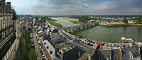
TheLoire Valley(French:Vallée de la Loire) lies in the middle stretch of the river, extends for about 280 km (170 mi) and comprises an area of roughly 800 km2(310 sq mi).[1]It is also known as theGarden of France– due to the abundance ofvineyards,fruit orchards,artichoke,asparagusandcherryfields which line the banks of the river[45]– and also as the "cradle of the French language". It is also noteworthy for its architectural heritage: in part for its historic towns such asAmboise,Angers,Blois,Chinon,Nantes,Orléans,Saumur,andTours,but in particular for its castles, such as theChâteau d'Amboise,Château d'Angers,Château de Chambord,Château de Montsoreau,Château d'Ussé,Château de VillandryandChenonceau,and also for its many cultural monuments, which illustrate the ideals of theRenaissanceand theAge of the Enlightenmenton western European thought and design.
On December 2, 2000,UNESCOadded the central part of the Loire valley, betweenBouchemaineinAnjouandSully-sur-LoireinLoiret,to its list ofWorld Heritage Sites.In choosing this area that includes the Frenchdépartementsof Loiret,Loir-et-Cher,Indre-et-Loire,andMaine-et-Loire,the committee said that the Loire Valley is: "an exceptional cultural landscape, of great beauty, comprised of historic cities and villages, great architectural monuments – the Châteaux – and lands that have been cultivated and shaped by centuries of interaction between local populations and their physical environment, in particular the Loire itself."
Architecture
[edit]Architectural edifices were created in Loire valley from the 10th century onwards with the defensive fortress like structures called the "keeps"or"donjons"built between 987 and 1040 by AnjouCount Foulques NerraofAnjou(the Falcon). However, one of the oldest such structures in France is theDonjon de Foulques Nerrabuilt in 944.[46]
This style was replaced by the religious architectural style in the 12th to 14th centuries when the impregnable château fortresses were built on top of rocky hills; one of the impressive fortresses of this type is theChâteau d'Angers,which has 17 gruesome towers. This was followed by aesthetically built châteaux (to also function as residential units), which substituted the quadrangular layout of the keep. However, the exterior defensive structures, in the form ofportcullisandmoatssurrounding the thick walls of the châteaux' forts were retained.[47]There was further refinement in the design of the châteaux in the 15th century before theBaroque stylecame into prominence with decorative and elegantly designed interiors and which became fashionable from the 16th to the end of the 18th century.[46]
TheBaroque styleartists who created some of the exquisite château structures were: the Parisian,François Mansart(1598–1662) whose classical symmetrical design is seen in theChâteau de Blois;Jacques Bougier(1635) ofBloiswhose classical design is theChâteau de Cheverny;Guillaume Bautruremodelled theChâteau de Serrant(at the extreme western end of the valley). In the 17th century, there was feverish pace in the design of châteaux for introducing exotic styles; a notable structure of this period is thePagode de ChanteloupatAmboise,which was built between 1773 and 1778.[46]
TheNeoclassical architectural style,was a revival ofClassical style of architecture,which emerged in the mid 18th century; one such notable structure is theChâteau de Menarsbuilt byJacques Ange Gabriel(1698–1782) who was the royal architect in the court ofLouis XV(1715–74). This style was perpetuated during the reign ofLouis XVI(1774–92) but with more refinements; one such refined château seen close toAngersis theChâteau de Montgeoffroy.Furnishings inside the châteaux also witnessed changes to suit the living styles of its occupants.[48]Gardens, both ornamental fountains, footpaths flower beds and tended grass) and kitchen type (to grow vegetables), also accentuated the opulence of the châteaux.
TheFrench Revolution(1789) brought a radical change for the worse in the scenarios for chateaus, asmonarchyended in France.[49]
Châteaux
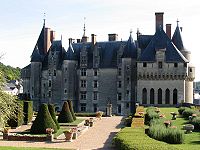
[edit]Thechâteaux,numbering more than three hundred, represent a nation of builders starting with the necessarycastlefortificationsin the 10th century to the splendour of those built half a millennium later. When the French kings began constructing their huge châteaux here, the nobility, not wanting or even daring to be far from the seat of power, followed suit. Their presence in the lush, fertile valley began attracting the very best landscape designers. Today, these privately owned châteaux serve as homes, a few open their doors to tourist visits, while others are operated as hotels or bed and breakfasts. Many have been taken over by a local government authority or the giant structures like those atChambordare owned and operated by the national government and are major tourist sites, attracting hundreds of thousands of visitors each year. Some notable Châteaux on the Loire includeBeaufort-Mareuil sur Cher–Lavoûte-Polignac–Bouthéon–Montrond–Bastie d'Urfé–Château féodal des Cornes d'Urfé–La Roche–Château féodal de Saint-Maurice-sur-Loire–Saint-Pierre-la-Noaille–Chevenon–Palais ducal de Nevers–Saint-Brisson–Gien–La Bussière–Pontchevron–La Verrerie(nearAubigny-sur-Nère) –Sully-sur-Loire–Châteauneuf-sur-Loire–Boisgibault–Meung-sur-Loire–Menars–Talcy–Château de la Ferté–Chambord–Blois–Villesavin–Cheverny–Beauregard–Troussay–Château de Chaumont–Amboise–Clos-Lucé–Langeais–Gizeux–Les Réaux–Montsoreau–Montreuil-Bellay–Saint-Loup-sur-Thouet–Saumur–Boumois–Brissac–Montgeoffroy–Plessis-Bourré–Château des Réaux
-
 Amboiseon the banks of the Loire
 -
-

-

-


Wine making
[edit]

TheLoire Valley wine regionincludes theFrench wineregionssituated along the Loire from theMuscadetregion near the city ofNanteson the Atlantic coast to theregionofSancerreandPouilly-Fuméjust southeast of the city ofOrléansin north central France. In between are the regions ofAnjou,Saumur,Bourgueil,Chinon,andVouvray.TheLoire Valleyitself follows the river through the Loire province to the river's origins in theCévennesbut the majority of the wine production takes place in the regions noted above.
The Loire Valley has a long history ofwinemakingdating back to the 1st century. In theHigh Middle Ages,the wines of the Loire Valley were the most esteemed wines in England and France, even more prized than those fromBordeaux.[50]Archaeologicalevidence suggest that theRomansplanted the first vineyards in the Loire Valley during their settlement ofGaulin the 1st century AD. By the 5th century, the flourishingviticultureof the area was noted in a publication by the poetSidonius Apollinaris.In his workHistory of the Franks,BishopGregory of Tourswrote of the frequentplunderingby theBretonsof the area's wine stocks. By the 11th century the wines of Sancerre had a reputation across Europe for their high quality. Historically the wineries of the Loire Valley have been small, family owned operations that do a lot of estate bottling. The mid-1990s saw an increase in the number ofnégociantandco-operativeto where now about half of Sancerre and almost 80% of Muscadet is bottled by a négociant or co-op.[51]
The Loire river has a significant effect on themesoclimateof the region, adding the necessary extra few degrees of temperature that allows grapes to grow when the areas to the north and south of the Loire Valley have shown to be unfavourable to viticulture. In addition to finding vineyards along the Loire, several of the river'stributariesare also well planted—including the riversAllier,Cher,Indre,Loir,Sèvre NantaiseandVienne.[52]The climate can be very cool with spring time frost being a potential hazard for the vines. During theharvestmonths rain can cause the grapes to be harvested underripe but can also aid in the development ofBotrytis cinereafor the region's dessert wines.[50]
The Loire Valley has a high density of vine plantings with an average of 4,000–5,000 vines per hectare (1,600–2,000 per acre). Some Sancerre vineyards have as many as 10,000 plants per hectare. With more vines competing for the same limited resources in the soil, the density is designed to compensate for the excessiveyieldsthat some of the grape varieties, like Chenin blanc, are prone to have. In recent times,pruningandcanopy managementhave started to limit yields more effectively.[50]
The Loire Valley is often divided into three sections. TheUpper Loireincludes the Sauvignon blanc dominated areas ofSancerreand Pouilly-Fumé. TheMiddle Loireis dominated by more Chenin blanc and Cabernet franc wines found in the regions aroundTouraine,Saumur,ChinonandVouvray.TheLower Loirethat leads to the mouth of the river's entrance to the Atlantic goes through the Muscadet region which is dominated by wines of the Melon de Bourgogne grape.[53]Spread out across the Loire Valley are 87 appellation under theAOC,VDQSandVin de Payssystems. There are two generic designation that can be used across the whole of the Loire Valley. TheCrémant de Loirewhich refers to any sparkling wine made according to thetraditional methodofChampagne.TheVin de Pays du Jardin de la Francerefers to anyvarietallylabelled wine, such asChardonnay,that is produced in the region outside of an AOC designation.[52]
The area includes 87appellationsunder theAppellation d'origine contrôlée(AOC),Vin Délimité de Qualité Superieure(VDQS) andVin de payssystems. While the majority of production is white wine from theChenin blanc,Sauvignon blancandMelon de Bourgognegrapes, there are red wines made (especially around theChinonregion) fromCabernet franc.In addition to still wines,rosé,sparklinganddessert winesare also produced. WithCrémantproduction throughout the Loire valley, it is the second largest sparkling wine producer in France afterChampagne.[54]Among these different wine styles, Loire wines tend to exhibit characteristicfruitinesswith fresh, crisp flavours-especially in their youth.[52]
Art
[edit]The Loire has inspired many poets and writers, including:Charles d'Orléans,François Rabelais,René Guy Cadou,Clément Marot,Pierre de Ronsard,Joachim du Bellay,Jean de La Fontaine,Charles Péguy,Gaston Couté;and painters such as:Raoul Dufy,J. M. W. Turner,Gustave Courbet,Auguste Rodin,Félix Edouard Vallotton,Jacques Villon,Jean-Max Albert,Charles Leduc,Edmond Bertreux,andJean Chabot.
-
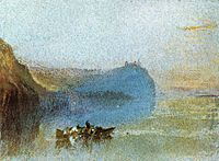 Scène of the Loire,byJ. M. W. Turner.
 -
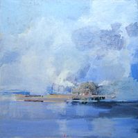
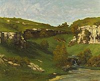 La source de la Loire,byGustave Courbet.
 -
 Portrait of the Loire,byJean-Max Albert,1988. Musée de la Loire, Cosne-sur-Loire.
 -
![Les Rosiers-sur-Loire by Jean-Jacques Delusse [fr], 1800](https://upload.wikimedia.org/wikipedia/commons/thumb/7/7e/Jean-Jacques_Delusse%2C_vue_des_Rosiers%2C_1800.jpg/200px-Jean-Jacques_Delusse%2C_vue_des_Rosiers%2C_1800.jpg) Les Rosiers-sur-LoirebyJean-Jacques Delusse,1800
Les Rosiers-sur-LoirebyJean-Jacques Delusse,1800 -


![Les Rosiers-sur-Loire by Jean-Jacques Delusse [fr], 1800](/translate/en.wikipedia.org?u=https%3A%2F%2Fen.wikipedia.org%2Fwiki%2FFile%3AJean-Jacques_Delusse%2C_vue_des_Rosiers%2C_1800.jpg&t=vi)

See also
[edit]References
[edit]- ^abcdefghijklmnopqrstuTockner, Klement; Uehlinger, Urs; Robinson, Christopher T. (2009).Rivers of Europe.Academic Press. p. 183.ISBN978-0-12-369449-2.Retrieved11 April2011.
- ^abSandre."Fiche cours d'eau - la Loire (----0000)".
- ^ab"The Loire at Montjean".River Discharge Database.Center for Sustainability and the Global Environment. 2010-02-13. Archived fromthe originalon 2011-09-28.Retrieved2011-06-30.
- ^abcde"The Loire".Encyclopædia Britannica online.
- ^abcNicola Williams; Virginie Boone (1 May 2002).The Loire.Lonely Planet. pp. 9–12, 14, 16–17, 19, 21–22, 24, 26, 27–36, 40–54.ISBN978-1-86450-358-6.Retrieved13 April2011.
- ^"Welcome to the Loire Valley".Western France Tourist Board.Retrieved13 April2011.
- ^ab"The Loire Valley"(PDF).Lonely Planet.Archived fromthe original(PDF)on 15 October 2012.Retrieved11 March2011.
- ^Montclos, Jean-Marie Pérouse de (1997).Châteaux of the Loire Valley.Könemann.ISBN978-3-89508-598-7.Retrieved11 April2011.
- ^Barbour, Philippe (1 July 2007).Rhone Alpes, 2nd.New Holland Publishers. p. 127.ISBN978-1-86011-357-4.Retrieved11 April2011.
- ^abcWilliams & Boone, p. 33
- ^Tockner, Klement; Uehlinger, Urs; Robinson, Christopher T. (2009)."5.2.1".Rivers of Europe.Academic Press.ISBN978-0-12-369449-2.Retrieved11 April2011.
- ^ab"Луара (река во Франции)".Great Soviet Encyclopedia(in Russian).
- ^New scientist.IPC Magazines. 1991. p. 46.Retrieved11 April2011.
- ^Edwards-May, David (2010).Inland Waterways of France.St Ives, Cambs., UK: Imray. pp. 109–111.ISBN978-1-846230-14-1.
- ^Fluviacarte,Loire (maritime)
- ^Fluviacarte,Loire
- ^Fluviacarte,Canal latéral à la Loire
- ^Fluviacarte,Canal de Roanne à Digoin
- ^Williams & Boone, p. 35-36
- ^abBoon, P. J.; Davies, Bryan Robert; Petts, Geoffrey E. (2000).Global perspectives on river conservation: science, policy, and practice.John Wiley.ISBN978-0-471-96062-1.Retrieved24 April2011.
- ^IUCN bulletin.International Union for Conservation of Nature and Natural Resources. 1989. p. 9.Retrieved24 April2011.
- ^abcdefghijklm"Loire"(PDF).Assets.panda.org,World Wildlife Fund.Retrieved24 April2011.
- ^abcVision for water and nature: a world strategy for conservation and sustainable management of water resources in the 21st century.IUCN. 1 January 2000. p. 22.ISBN978-2-8317-0575-0.Retrieved24 April2011.
- ^Tourenq, J.; Pomerol, C. (1995). "Mise en évidence, par la présence d'augite du Massif Central, de l'existence d'une pré-Loire-pré-Seine coulant vers la Manche".Comptes Rendus de l'Académie des Sciences.320:1163–1169.
- ^Antoine, Pierre; Lautridou, Jean Pierre; Laurent, Michel (June 2000). "Long-term fluvial archives in NW France: response of the rivers Seine and Somme to tectonic movements, climatic variations and sea-level changes".Geomorphology.33(3–4): 183–207.doi:10.1016/s0169-555x(99)00122-1.
- ^abcdefgWilliams & Boone, p.11
- ^abWilliams & Boone, p.12
- ^Abaev, V. I.; Bailey, H. W."Alans".Encyclopædia Iranica.Vol. I/8. pp. 801–803.
- ^abWilliams & Boone, p. 14
- ^Bradbury, Jim (1 February 2004).Routledge Companion to Medieval Warfare.Taylor and Francis. p. 213.ISBN978-0-203-64466-9.Retrieved11 April2011.
- ^abcWilliams & Boone, p.16
- ^Aa. Vv. (20 June 2007).Châteaux of the Loire.Casa Editrice Bonechi. p. 17.ISBN978-88-476-1840-4.Retrieved11 April2011.
- ^Moffett, Marian; Fazio, Michael W.; Wodehouse, Lawrence (2003).A world history of architecture.Laurence King Publishing. p. 330.ISBN978-1-85669-371-4.Retrieved11 April2011.
- ^Jervis, William Henley (23 February 2010).A History of France: From the Earliest Times to the Establishment of the Second Empire in 1852.BiblioLife. p. 331.ISBN978-1-145-42193-6.Retrieved11 April2011.
- ^Mellersh, H. E. L.; Williams, Neville (May 1999).Chronology of world history.ABC-CLIO. p. 188.ISBN978-1-57607-155-7.Retrieved11 April2011.
- ^Finney, Paul Corby (1999).Seeing beyond the Word: Visual Arts and the Calvinist Tradition.Wm. B. Eerdmans Publishing. p. 181.ISBN978-0-8028-3860-5.Retrieved11 April2011.
- ^Smith, Judy (November 2002).Holiday walks in the Loire Valley.Sigma Leisure. p. 167.ISBN978-1-85058-772-9.Retrieved11 April2011.
- ^Trout, Andrew P. (1978).Jean-Baptiste Colbert.Twayne Publishers.ISBN978-0-8057-7715-4.Retrieved11 April2011.
- ^Embleton, Clifford;Embleton-Hamann, Christine (1997).Geomorphological hazards of Europe.Elsevier. p. 126.ISBN978-0-444-88824-2.Retrieved11 April2011.
- ^Braudel, Fernand; Reynolds, Sian (April 1992).Identity of France: People and Production.HarperPerennial. p. 476.ISBN978-0-06-092142-2.Retrieved11 April2011.
- ^abcMcKnight, Hugh (September 2005).Cruising French Waterways.Sheridan House, Inc. pp. 178–179.ISBN978-1-57409-210-3.Retrieved11 April2011.
- ^Institut des études rhodaniennes (1971).Revue de géographie de Lyon.Université de Lyon.Retrieved11 April2011.
- ^Liley, John (6 March 1975).France, the quiet way.Stanford Maritime. p.130.ISBN978-0-540-07140-1.Retrieved11 April2011.
- ^Mahe, Stephane (17 August 2022)."France's river Loire sets new lows as drought dries up its tributaries".Loireauxence:Reuters.Archivedfrom the original on 18 August 2022.Retrieved20 August2022.
- ^Williams & Boone, p.10
- ^abcWilliams & Boone, p. 19
- ^Williams & Boone, p. 17
- ^Williams & Boone, pp. 22–26
- ^Williams & Boone, p. 28
- ^abcJ. Robinson (ed.)The Oxford Companion to WineThird Edition, pp. 408–410, Oxford University Press 2006ISBN0-19-860990-6
- ^MacNeil, K. (2001).The Wine Bible.Workman Publishing. pp.259–272.ISBN1-56305-434-5.
- ^abcFallis, C., ed. (2006).The Encyclopedic Atlas of Wine.Global Book Publishing. pp. 168–176.ISBN1-74048-050-3.
- ^Robinson, J. (2003).Jancis Robinson's Wine Course(3rd ed.). Abbeville Press. pp. 180–184.ISBN0-7892-0883-0.
- ^Stevenson, T. (2005).The Sotheby's Wine Encyclopedia.Dorling Kindersley. pp. 196–198.ISBN0-7566-1324-8.
Bibliography
[edit]- Williams, Nicola; Boone, Virginie (1 May 2002),The Loire,Lonely Planet,ISBN978-1-86450-358-6
- Garrett, Martin,The Loire: a Cultural History.2010, Signal Books.[ISBN missing]
- Pays de la Loire, waterways guide No. 10,Editions du Breil. pp 8–27, for the navigable section (guide in English, French and German)[ISBN missing]
External links
[edit]- River Loireguide, places, ports and moorings on the river in the navigable length from the Maine to Saint-Nazaire, by the author ofInland Waterways of France,Imray.
- Navigation details for 80 French rivers and canals(French waterways website section)
- (in English)Tourist Office Board Loire Valley
- (in English)Waterways In Western Loire – Free Online Travel Brochure
| International | |
|---|---|
| National | |
| Geographic | |
- Rivers of France
- Loire basin
- Rivers of Allier
- Rivers of Ardèche
- Rivers of Cher (department)
- Rivers of Haute-Loire
- Rivers of Indre-et-Loire
- Rivers of Loir-et-Cher
- Rivers of Loire (department)
- Rivers of Loire-Atlantique
- Rivers of Loiret
- Rivers of Maine-et-Loire
- Rivers of Nièvre
- Rivers of Saône-et-Loire
- Rivers of Brittany
- Rivers of Bourgogne-Franche-Comté
- Rivers of Centre-Val de Loire
- Rivers of Pays de la Loire
- Rivers of Auvergne-Rhône-Alpes