
Wjelsryp
Welsrijp
Wjelsryp | |
|---|---|
Village | |
 Wjelsryp church | |
 Flag  Coat of arms | |
 Location in the former Littenseradiel municipality | |
 Welsrijp Location in the Netherlands  Welsrijp Welsrijp (Netherlands) | |
| Coordinates:53°9′59″N5°36′24″E/ 53.16639°N 5.60667°E | |
| Country | Netherlands |
| Province | Friesland |
| Municipality | Waadhoeke |
| Area | |
| • Total | 5.95 km2(2.30 sq mi) |
| Elevation | −0.1 m (−0.3 ft) |
| Population (2021)[1] | |
| • Total | 455 |
| • Density | 76/km2(200/sq mi) |
| Postal code | 8842[1] |
| Dialing code | 0517 |
Wjelsryp(Dutch:Welsrijp) is a village inWaadhoekemunicipality in the province ofFriesland,theNetherlands.It had a population of around 463 in January 2017.[3]
History
[edit]The village was first mentioned in 944 as Welsib, and means "bankof Wille or Wilse (person) ".[4]Wjelsryp was originally a fishing village. The changingWadden Seaforced the villagers to relocate to aterp(artificial living hill).[5]
The Dutch Reformed church was originally built around 1200. In 1515, the church was burnt down by theArumer Zwarte Hoop.Its replacement collapsed in 1836. The current church was modified in 1892.[5][6]
Wjelsryp was home to 348 people in 1840. In the late-19th century, the economy switched from a fishing community to an agricultural community.[5]
Before 2018, the village was part of theLittenseradielmunicipality and before 1984 it belonged toHennaarderadeelmunicipality.[5]
Airplane crash
[edit]On 20 November 1960 aF-84F Thunderstreakof theRoyal Netherlands Air Forcecrashed at 7:50pm into a farm inLutjelollumnear Wjelsryp. The pilot and the family of six people who lived at the farm were all killed. The farm was destroyed and burned down and thelivestockwas killed.[7]
Gallery
[edit]-
 Village view
 -
 Street view
 -
 Farm in Wjelsryp
 -
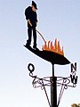 Fireman weather vane


References
[edit]- ^abc"Kerncijfers wijken en buurten 2021".Central Bureau of Statistics.Retrieved3 April2022.
- ^"Postcodetool for 8842AA".Actueel Hoogtebestand Nederland(in Dutch). Het Waterschapshuis.Retrieved3 April2022.
- ^Aantal inwoners per dorp- Littenseradiel
- ^"Wjelsryp - (geografische naam)".Etymologiebank(in Dutch).Retrieved3 April2022.
- ^abcd"Wjelsryp".Plaatsengids(in Dutch).Retrieved3 April2022.
- ^"Wjelsryp".Friesland Wonderland(in Dutch).Retrieved3 April2022.
- ^"Straaljager stortte neer: 7 doden"(in Dutch).Leidsch Dagblad.22 November 1960. p. 1 – via leiden.courant.nu.
External links
[edit]![]() Media related toWjelsrypat Wikimedia Commons
Media related toWjelsrypat Wikimedia Commons
ThisFrieslandlocation article is astub.You can help Wikipedia byexpanding it. |