A379 road
| A379 | |
|---|---|
| Route information | |
| Length | 69 mi (111 km) |
| Major junctions | |
| Northeast end | Exeter 50°42′45″N3°27′55″W/ 50.7126°N 3.4654°W 50°40′24″N3°32′08″W/ 50.6733°N 3.5355°W |
A38 | |
| Southwest end | Plymouth 50°22′13″N4°07′27″W/ 50.3702°N 4.1243°W |
| Location | |
| Country | United Kingdom |
| Constituent country | England |
| Road network | |


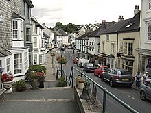
TheA379is a road in theEnglish countyofDevon.It links points on the edges of that county's two principal cities,ExeterandPlymouth,by an indirect and largely coastal route. TheA38provides a faster and more direct inland route between Exeter and Plymouth, whilst theA380provides a similarly faster route between Exeter and theTorbayarea. However the A379 serves many small coastal communities and ports along the coast. The indented nature of the South Devon coast means that the road is usually out of sight of the sea, but the many rivers and estuaries are crossed by bridges and, in one case, acable ferry.
Route
[edit]At its northeastern end, the A379 has two branches and two starting points. One branch starts with a junction with theM5 motorwayatClyst St Mary(J30), whilst the other branch starts with a junction with theA38atKennford.Both these branches were historically part of the A38, and the first crosses theCountess Wear bridgesover theRiver Exeand theExeter Canal,once infamous for the delays caused on what was then the principal route to the holiday resorts of Devon andCornwall.[1]
From the junction of the two branches, some 3 miles (4.8 km) south of Exeter city centre, the A379 heads south parallel to the estuary of theRiver Exe.AtStarcrossthe road runs close alongside both theExeter to Plymouth railway lineand the estuary, and theExmouth to Starcross passenger ferryprovides a connection toExmouthon the other side of the estuary. Beyond Starcross, the road continues through the coastal resorts ofDawlishandTeignmouth.[1]From 1991 to 1997, there was a break in the road when the section of A379 between Dawlish and Torquay was downgraded to the B3199. The only remaining roadsign indicating this is a wrong direction facing B3199 sign on a lamppost in Teignmouth Hill, Dawlish.[citation needed]
Leaving Teignmouth, the A379 crosses the estuary of theRiver Teignon the historicShaldon Bridge.The road then continues into the large resort ofTorquay,where it meets theA3022 road.The two road designations share the same physical road through theTorbayarea, although only the A3022 is signed. AtPaigntonthe two roads diverge, and the A379 follows a route throughGoodringtonbefore briefly rejoining the A3022 atChurston.[1]
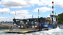
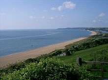
From Churston, the A379 bypassesKingswearbefore crossing thePaignton and Dartmouth Steam Railwayon alevel crossingand reaching theDartmouth Higher Ferryon the banks of theRiver Dart.This tolled vehicular ferry carries the road across the river and into the picturesque harbour town ofDartmouth.From here the A379 continues viaStoke Flemingand then along the coast atSlapton.Here the road runs behind the beach, between the sea and theSlapton Leylagoon. Turning inland, it then proceeds to the town ofKingsbridgeat the head of theKingsbridge Estuary.[1]
From Kingsbridge, the A379 passes through the villages ofAveton Gifford,where it crosses theRiver Avon,andModbury,shortly after which it crosses theRiver Erme.The villages ofYealmpton,on theRiver Yealm,andBrixtonfollow. The road then runs into the suburbs of Plymouth, bypassingPlymstockbefore crossing the estuary of theRiver Plymon theLaira Bridge.The A379 ends on the west side of the Plym, joining theA374just over 1 mile (1.6 km) east of Plymouth city centre.[1]
Trafficability
[edit]Apart from short stretches ofdual carriagewayat either end and in Torquay, the A379 is asingle carriagewayroad, and is often narrow and twisting. Like all roads in England of any significance, it issealedthroughout.[1]
The A379 crosses theRiver Dartusing theHigher Ferry,a car ferry that until 2009 had a capacity of just 18 cars, which caused congestion at busy times. A new ferryboat with a capacity of 32 cars came into service in June 2009.[2]The alternativeLower Ferrycan also be used, although this involves negotiating the narrow streets of Kingswear village.
See also
[edit]References
[edit]- ^abcdef"Clyst St Mary (M5 jnc 30) & Kennford (A38), near Exeter, to Plymouth..."The Society for All British Road Enthusiasts.Retrieved2 January2009.
- ^"The Dartmouth Higher Ferry".Dartmouth Directory. Archived fromthe originalon 23 April 2012.Retrieved27 September2011.
External links
[edit]


