
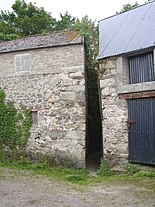
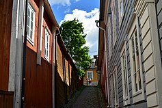
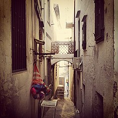
Alley

Analleyoralleywayis a narrowlane,path,or passageway, often reserved forpedestrians,which usually runs between, behind, or within buildings in the older parts of towns and cities. It is also a rear access or service road (back lane), or a path, walk, or avenue (Frenchallée) in a park or garden.[1]
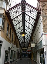
A covered alley or passageway, often with shops, may be called anarcade.The origin of the word alley is lateMiddle English,fromOld French:alee"walking or passage", fromaller"to go", fromLatin:ambulare"to walk".[2]
Definition
[edit]
The word alley is used in two main ways:
- It can refer to a narrow, usually paved, pedestrian path, often between the walls of buildings in towns and cities. This type is usually short and straight, and on steep ground can consist partially or entirely of steps.
- It also describes a very narrow, urban street, or lane, usually paved, which may be used by slow-moving local traffic, though more pedestrian-friendly than a regular street. There are two versions of this kind of alley:
- A rear access or service road (back lane), which can also sometimes act as part a secondary vehicular network. Many Americans and Canadians think of an alley in these terms first.
- A narrow street running between houses or businesses. This type of alley is found in the older parts of many cities, including American cities likePhiladelphiaandBoston(seeElfreth's Alley,Philadelphia,Pennsylvania). Many are open to local traffic.
Inlandscaping,analléeoravenueis traditionally a straight route with a line oftreesor largeshrubsrunning along each side. In most cases, the trees planted in an avenue will be all of the samespeciesorcultivar,so as to give uniform appearance along the full length of the avenue. The French termalléeis used for avenues planted in parks and landscape gardens, as well asboulevardssuch as theGrand AlléeinQuebec City,Canada, andKarl-Marx-AlleeinBerlin.
In older cities and towns in Europe, alleys are often what is left of a medieval street network, or aright of wayor ancientfootpath.Similar paths also exist in some older North American towns and cities. In some older urban development in North America lanes at the rear of houses, to allow for deliveries and garbage collection, are called alleys. Alleys andginnelswere also the product of the1875 Public Health Actin theUnited Kingdom,where usually alleys run along the back ofstreets of terraced houses,with ginnels connecting them to the street every fifth house.[citation needed]Alleys may be paved, or unpaved, and a blind alley is acul-de-sac.Modernurban developmentsmay also provide a service road to allow for waste collection, or rear access forfire enginesandparking.
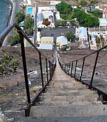
Steps and stairs
[edit]Because of geography, steps (stairs) are the predominant form of alley in hilly cities and towns. This includes Quebec City in Canada and in the United StatesPittsburgh(seeSteps of Pittsburgh),Cincinnati(seeSteps of Cincinnati),Minneapolis,Seattle,[3]andSan Francisco[4]as well asHong Kong,[5]GenoaandRome.[6]
Covered passages
[edit]
Arcadesare another kind of covered passageway and the simplest kind are no more than alleys to which a glass roof was added later. Early examples of a shopping arcades include:Palais Royalin Paris (opened in 1784); Passage de Feydeau in Paris (opened in 1791).[7]Most arcades differ from alleys in that they are architectural structures built with a commercial purpose and are a form ofshopping mall.All the same alleys have for long been associated with various types of businesses, especiallypubsandcoffee houses.BazaarsandSouqsare an early form of arcade found in Asia and North Africa.
Some alleys are roofed because they are within buildings, such as thetraboulesofLyon,or when they are a pedestrian passage through railway embankments in Britain. The latter follow the line ofrights-of waythat existed before the railway was built.
TheBurlington Arcade(1819) was one of London's earliest covered shopping arcades.[8]It was the successful prototype for larger glazed shopping arcades, beginning with theSaint-Hubert Gallery(1847) in Brussels andThe Passage(1848) inSt Petersburg,the first of Europe's grand arcades, to theGalleria Umberto I(1891) in Naples, theGalleria Vittorio Emanuele IIinMilan(1867), and theBlock Arcade, Melbourne,Australia (1893).
By country
[edit]Asia
[edit]
Alleyways are an understudied urban form historically shared by most Asian cities. They provide a setting for much everyday urban life and place-based identity, the examination of which can shed new light on the traditional idea of aglobal cityand contributes to a renewed conception ofmetropolizationas a highly localized process.[9]
China
[edit]
Hutongs(simplified Chinese:Ngõ nhỏ;traditional Chinese:Ngõ;pinyin:hútòng;Wade–Giles:hu-t'ung) are a type of narrow streets or alleys, commonly associated with northern Chinese cities, most prominentlyBeijing.
In Beijing, hutongs are alleys formed by lines ofsiheyuan,traditionalcourtyardresidences.[10]Many neighbourhoods were formed by joining onesiheyuanto another to form a hutong, and then joining one hutong to another. The word hutong is also used to refer to such neighbourhoods. During China'sdynastic period,emperorsplanned the city of Beijing and arranged the residential areas according to the social classes of theZhou dynasty(1027–256 BC). The term "hutong" appeared first during theYuan dynasty,and is a term ofMongolianorigin meaning "town".[11]
At the turn of the 20th century, theQingcourt was disintegrating as China's dynastic era came to an end. The traditional arrangement of hutongs was also affected. Many new hutongs, built haphazardly and with no apparent plan, began to appear on the outskirts of the old city, while the old ones lost their former neat appearance.
Following the founding of thePeople's Republic of Chinain 1949, many of the old hutongs of Beijing disappeared, replaced by wide boulevards and high rises. Many residents left the lanes where their families lived for generations for apartment buildings with modern amenities. InXicheng District,for example, nearly 200 hutongs out of the 820 it held in 1949 have disappeared. However, many of Beijing's ancient hutongs still stand, and a number of them have been designated protected areas. Many hutongs, some several hundred years old, in the vicinity of theBell TowerandDrum Towerand Shichahai Lake are preserved amongst recreated contemporary two- and three-storey versions.[12][13]

Hutongs represent an important cultural element of the city of Beijing and the hutongs are residential neighborhoods which still form the heart of Old Beijing. While most Beijing hutongs are straight, Jiudaowan ( chín đạo cong, literally "Nine Turns" ) Hutong turns nineteen times. At its narrowest section,Qianshi HutongnearQianmen(Front Gate) is only 40 centimeters (16 inches) wide.[14]
TheShanghailongtangis loosely equivalent to thehutongofBeijing.Alongtang( ngõ hẻmlòngtáng,Shanghainese:longdang) is a laneway inShanghaiand, by extension, a community centred on a laneway or several interconnected laneways. On its own long (traditional Chinese hạng or lộng, simplified Chinese lộng ) is a Chinese term for "alley" or "lane", which is often left untranslated in Chinese addresses, but may also be translated as "lane", and "tang" is a parlor or hallway.[15]It is sometimes calledlilong( ngõ ); the latter name incorporates the-lisuffix often used in the name of residential developments in the late 19th and early 20th centuries. As with the term hutong, the Shanghai longdang can either refers to the lanes that the houses face onto, or a group of houses connected by the lane.[16][17][18][19]
Japan
[edit]
Shinjuku Golden Gai(Tân túc ゴールデン phố)is a small area ofShinjuku,Tokyo,Japan,[20]famous both as an area of architectural interest and for its nightlife. It is composed of a network of six narrow alleys, connected by even narrower passageways which are just about wide enough for a single person to pass through. Over 200 tiny shanty-style bars, clubs and eateries are squeezed into this area.[21]
Its architectural importance is that it provides a view into the relatively recent past of Tokyo, when large parts of the city resembled present-day Golden Gai, particularly in terms of the extremely narrow lanes and the tiny two-storey buildings. Nowadays, most of the surrounding area has been redeveloped. Typically, the buildings are just a few feet wide and are built so close to the ones next door that they nearly touch. Most are two-storey, having a smallbarat street level and either another bar or a tinyflatupstairs, reached by a steep set of stairs. None of the bars are very large; some are so small that they can only fit five or so customers at one time.[20]The buildings are generally ramshackle, and the alleys are dimly lit, giving the area a very scruffy and run-down appearance. However, Golden Gai is not a cheap place to drink, and the clientele that it attracts is generally well off.
Golden Gai is well known yokocho and meeting place for musicians, artists, directors, writers, academics and actors, including many celebrities. Many of the bars only welcome regular customers, who initially should be introduced by an existing patron, although many others welcome non-regulars, some even making efforts to attract overseas tourists by displaying signs and price lists in English.[20]Golden Gai was known for prostitution before 1958, when prostitution became illegal. Since then it has developed as a drinking area, and at least some of the bars can trace their origins back to the 1960s.
Apart from drinking alleys (drinking yokocho),shotengaiand yokocho shotengais, there are the ordinary alleyways, the rojis which seem exist in all parts of the Japanese urban landscape. The roji which was once part of people's personal spatial sphere and everyday life has been transformed by diverse and competing interests. Marginalised through the emergence of new forms of housing and public spaces, re-appropriated by different fields, and re-invented by the contemporary urban design discourse, the social meaning attached to the roji is being re-interpreted by individuals, subcultures and new social movements. Thus, their existence is in danger.[22]
Vietnam
[edit]Hẻm/Ngõalleyways are a Vietnamesevernacularurban planning typology, common inHo Chi Minh CityandHanoi.[23][24]
Australia
[edit]
Sydneyfeatures a series of laneways in itscentral business districtthat have been used to provide off-street vehicular access to city buildings and alternative pedestrian routes throughcity blocks,in addition to featuringstreet art,cafes, restaurants, bars and retail outlets.[25]The Rockshas the most prominent and historical laneways in Sydney, which date to the 19th century.[26]Forgotten Songsis a popular attraction situated in Angel Place.[27]Chinatownfeatures a number of lanes and alleyways.[28]In suburban Sydney, several alleyways or laneways exist between residential lots that provide pedestrians a shortcut passage to nearby facilities on adjacent roads.[29]
TheMelbourne central business districtin is home to many lanes and arcades.[30][31]These laneways date mostly from theVictorian era,and are a popular cultural attraction for their cafes, bars and street art. The city's oldest laneways are a result of Melbourne's original urban plan, the 1837Hoddle Grid,and were designed as access routes to service properties fronting the CBD's major thoroughfares.[32]St Jerome's Laneway Festival,often referred to simply as Laneway, is a popular music festival that began in 2004 in Melbourne's laneways.
The lanes and arcades ofPerth,Western Australia are together becoming culturally significant to the city.[33][34]In 2007 modification to Liquor Licensing Regulations inWestern Australiaopened up the opportunities for small bars.[35]This was followed in August 2008 by theCity of Perthformally adopting a laneways enhancement strategy, "Forgotten Spaces – Revitalising Perth's Laneways".[36]
Europe
[edit]Belgium
[edit]InBelgiumthe equivalent term isgang(Dutch) orimpasse(French).Brusselshad over 100gangen/impasses,built to provide pedestrian access to cheap housing in the middle of blocks of buildings, and often containing a communal water tap. Several lead off Rue Haute/Hoogstraat. Since 1858, many have been demolished as part ofslum clearanceprogrammes, but about 70 still exist.[37]Some have been gentrified, for example theRue de la Cigogne/Ooievaarstraat.
Germany
[edit]
The old town ofLübeckhas over 100Gänge,particularly leading off the streets Engelswisch, Engelsgrube and Glockengießerstraße, as well as around the cathedral. Some are very low as well as narrow, and others open into more spacious courtyards (Höfe). Spreuerhofstraßeis the world's narroweststreet,found in the city ofReutlingen,Baden-Württemberg,Germany.[38]It ranges from 31 centimetres (12.2 in) at its narrowest to 50 centimetres (19.7 in) at its widest.[39]The lane was built in 1727 during the reconstruction efforts after the area was completely destroyed in the massive citywide fire of 1726 and is officially listed in the Land-Registry Office as City Street Number 77.[38][40] Lintgasseis an alley (‹See Tfd›German:Gasse) in theOld townofCologne,Germanybetween the two squares ofAlter MarktandFischmarkt.It is apedestrian zoneand though only some 130 metres long, is nevertheless famous for its medieval history. The Lintgasse was first mentioned in the 12th century asin Lintgazzin,which may be derived frombasketmakerswho wove fish baskets out ofLinden treebarks. These craftsmen were calledLindslizer,meaningLinden splitter.During theMiddle Ages,the area was also known asplatēa subriorplatēa suberis,meaning street ofQuercus suber,the cork oak tree. Lintgasse 8 to 14 used to be homes of medievalknightsas still can be seen by signs likeZum Huynen,Zum RitterorZum Gir.During the 19th-century the Lintgasse was calledStink-Linkgaß,a because of its poor air quality.[41]
France
[edit]Lyon's traboules
[edit]
ThetraboulesofLyonare passageways that cut through a house or, in some cases, a whole city block, linking one street with another. They are distinct from most other alleys in that they are mainly enclosed within buildings and may include staircases. While they are found in other French cities includingVillefranche-sur-Saône,Mâcon,Chambéry,Saint-Étienne,Louhans,Chalon sur SaôneandVienne (I sắc re),Lyon has many more; in all there are about 500.
The wordtraboulecomes from the Latintrans ambulare,meaning "to cross", and the first of them were possibly built as early as the 4th century. As theRoman Empiredisintegrated, the residents of early Lyon—Lugdunum,the capital of RomanGaul—were forced to move from the Fourvière hill to the banks of the river Saône when their aqueducts began to fail. The traboules grew up alongside their new homes, linking the streets that run parallel to the riverSaôneand going down to the river itself. For centuries they were used by people to fetch water from the river and then by craftsmen and traders to transport their goods. By the 18th century they were invaluable to what had become the city's defining industry, textiles, especially silk.[42]
Nowadays, traboules are tourist attractions, and many are free and open to the public. Most traboules are on private property, serving as entrances to local apartments.
Italy
[edit]The common Italian word for an alley isvicolo.[43]
Venice
[edit]Venice is largely a traffic free city and there is, in addition to the canals, a maze of around 3000 lanes and alleys calledcalli(which means narrow). Smaller ones arecallètteorcalle sắc lle,while larger ones arecalli large.Their width varies from just over 50 centimetres (19.7 in) to 5–6 metres (196.9–236.2 in). The narrowest is Calletta Varisco, which just 53 centimetres (20.9 in); Calle Stretta is 65 centimetres (25.6 in) wide and Calle Ca' Zusto 68 centimetres (26.8 in). The main ones are also calledsalizadaand widercalli,where trade proliferates, are calledriga,while blindcalli,used only by residents to reach their homes, areramo.[44]
Netherlands
[edit]Cities such asAmsterdamandGroningenhave numerousgangenorstegen.They often run between the major streets, roughly parallel to each other but not at right angles to the streets, following the old field boundaries and ditches.[45]
Sweden
[edit]
Grändis Swedish for an alley and there are numerousgränder,or alleys inGamla stan,The Old Town, ofStockholm,Sweden.The town dates back to the 13th century, with medieval alleyways,cobbledstreets, and historic buildings.North German architecturehas had a strong influence in the Old Town's buildings. Some of Stockholm's alleys are very narrow pedestrianfootpaths,while others are very narrow, cobbled streets, or lanes open to slow moving traffic. Mårten Trotzigs gränd( "Alley of Mårten Trotzig" ) runs fromVästerlånggatanandJärntorgetup toPrästgatanandTyska Stallplan,and part of it consists of 36 steps. At its narrowest the alley is a mere 90 cm (35 inches) wide, making it the narrowest street in Stockholm.[46] The alley is named after themerchantandburgherMårten Trotzig (1559–1617), who, born inWittenberg,[46]emigrated to Stockholm in 1581, and bought properties in the alley in 1597 and 1599, also opening a shop there. According to sources from the late 16th century, he was dealing in first iron and later copper, by 1595 had sworn his burgher oath, and was later to become one of the richest merchants in Stockholm.[47]
Possibly referred to asTrångsund( "Narrow strait" ) before Mårten Trotzig gave his name to the alley, it is mentioned in 1544 asTronge trappe grenden( "Narrow Alley Stairs" ). In 1608 it is referred toTrappegrenden( "The Stairs Alley" ), but a map dated 1733 calls itTrotz gränd.Closed off in the mid 19th century, not to be reopened until 1945, its present name was officially sanctioned by the city in 1949.[47]
The "List of streets and squares in Gamla stan"provides links to many pages that describe other alleys in the oldest part of Stockholm; e.g.Kolmätargränd(Coal Meter's Alley);Skeppar Karls Gränd(Skipper Karl's Alley);Skeppar Olofs Gränd(Skipper Olof's Alley); andHelga Lekamens Gränd(Alley of the Holy Body).
United Kingdom
[edit]London
[edit]
London has numerous historical alleys, especially, but not exclusively, in its centre; this includesThe City,Covent Garden,Holborn,Clerkenwell,WestminsterandBloomsburyamongst others.
An alley in London can also be called a passage, court, place, lane, and less commonly path,arcade,walk,steps,yard, terrace, and close.[48][49]While both a court and close are usually defined as blind alleys, orcul-de-sacs,several in London are throughways, for example Cavendish Court, a narrow passage leading fromHoundsditchinto Devonshire Square, and Angel Court, which links King Street andPall Mall.[49]Bartholomew Close is a narrow winding lane which can be called an alley by virtue of its narrowness, and because through-access requires the use of passages and courts between Little Britain, and Long Lane and Aldersgate Street.[50]
In an old neighbourhood of theCity of London,Exchange Alleyor Change Alley is a narrow alleyway connecting shops andcoffeehouses.[51]It served as a convenient shortcut from theRoyal ExchangeonCornhillto the Post Office onLombard Streetand remains as one of a number of alleys linking the two streets. The coffeehouses[52]of Exchange Alley, especiallyJonathan'sand Garraway's, became an early venue for the lively trading ofsharesandcommodities.These activities were the progenitor of the modernLondon Stock Exchange.

Lombard Street and Change Alley had been the open-air meeting place of London's mercantile community beforeThomas Greshamfounded the Royal Exchange in 1565.[51]In 1698, John Castaing began publishing the prices of stocks and commodities in Jonathan's Coffeehouse, providing the first evidence of systematic exchange of securities in London.
Change Alley was the site of some noteworthy events in England's financial history, including theSouth Sea Bubblefrom 1711 to 1720 and the panic of 1745.[53]
In 1761 a club of 150 brokers and jobbers was formed to trade stocks. The club built its own building in nearby Sweeting's Alley in 1773, dubbed the "New Jonathan's", later renamed theStock Exchange.[54]
West of the City there are a number of alleys just north ofTrafalgar Square,including Brydges Place which is situated right next to theColiseum Theatreand just 15 inches wide at its narrowest point, only one person can walk down it at a time. It is the narrowest alley in London and runs for 200 yards (180 m), connecting St Martin's Lane with Bedfordbury in Covent Garden.[55]
Close by is another very narrow passage, Lazenby Court, which runs from Rose Street to Floral Street down the side of theLamb and Flagpub; in order to pass people must turn slightly sideways. The Lamb & Flag in Rose Street has a reputation as the oldest pub in the area,[56]though records are not clear. The first mention of a pub on the site is 1772.[57]The Lazenby Court was the scene of an attack on the famous poet and playwrightJohn Drydenin 1679 by thugs hired byJohn Wilmot, 2nd Earl of Rochester,[58]with whom he had a long-standing conflict.[59]

In the same neighbourhoodCecil Courthas an entirely different character than the two previous alleys, and is a spacious pedestrian street withVictorianshop-frontages that linksCharing Cross RoadwithSt Martin's Lane,and it is sometimes used as a location by film companies.[60][61]
One of the older thoroughfares inCovent Garden,Cecil Court dates back to the end of the 17th century. A tradesman's route at its inception, it later acquired the nickname Flicker Alley because of the concentration of early film companies in the Court.[62]The first film-related company arrived in Cecil Court in 1897, a year after the first demonstration of moving pictures in the United Kingdom and a decade before London's first purpose-built cinema opened its doors. Since the 1930s it has been known as the new Booksellers' Row as it is home to nearly twenty antiquarian and second-hand independentbookshops.
It was the temporary home of an eight-year-oldWolfgang Amadeus Mozartwhilehe was touring Europein 1764. For almost four months the Mozart family lodged with barber John Couzin.[63]According to some modern authorities, Mozart composed his first symphony while a resident of Cecil Court.[64]
North of the centre of London,Camden Passageis a pedestrian passage offUpper Streetin theLondon Borough of Islington,famous because of its many antiques shops, and an antique market on Wednesdays and Saturday mornings. It was built, as an alley, along the backs of houses on Upper Street, then Islington High Street, in 1767.[65]
Southern England
[edit]- InEast Sussex,West SussexandSurrey,twittenis used, for "a narrow path between two walls or hedges". It is still in official use in some towns including Lewes,[66]Brighton, andCuckfield.[67][68]"Loughtonalso has twittens, the onlyEssexexample of use of the word and an indication of a very old street pattern "; Loughton also has a track known locally asThe Widden,a variant of twitten.[69]In north-west Essex and eastHertfordshiretwichellis common. In other parts of Essex, alley or path is used.
- In the city ofBrighton and Hove(inEast Sussex),The Lanesis a collection of narrow lanes famous for their small shops (including several antique shops) and narrow alleyways. The area was part of the original settlement of Brighthelmstone, but The Lanes were built up during the late 18th century and were fully laid out by 1792.[70]
West of England
[edit]- InPlymouth,Devonan alley is anope.[71]
- More generally in Devon any narrow public way which is less commodious than a lane may be called adrangway(fromdrang,as a dialectal variation of throng); typically it will be used on horseback or on foot with or without animals, but may also be for occasional use with vehicles.[72]The word, according toDavid Crystal,is also used throughout the West of England, Wiltshire, Hampshire and the Isle of Wight, as well as Wales.[73]
Midlands and East Anglia
[edit]- InBirminghamanentryruns between houses or through terraced houses, while agullyruns behind houses.[74]
- InDerbyshireandLeicestershirethe wordjittyorgittiesis often found[75]andgulleyis a term used in theBlack Country.[76]
- InNottinghamshire,twichellis common (SeeEast Midlands English).
- InShropshire(especiallyShrewsbury) they are calledshuts.[77]
Northern England
[edit]
- TheSnickelways of York,inYork,Yorkshire,often misspeltsnickleways,are a collection of small streets, footpaths, or lanes between buildings, not wide enough for a vehicle to pass down, and usually publicrights of way.York has many such paths, mostlymediaeval,though there are some modern paths as well. They have names like any other city street, often quirky names such as Mad Alice Lane, Nether Hornpot Lane and even Finkle Street (formerly Mucky Peg Lane). The wordsnickelwaywas coined by local author Mark W. Jones in 1983 in his bookA Walk Around the Snickelways of York,and is aportmanteau,a blend of the wordssnicket,meaning a passageway between walls or fences,ginnel,a narrow passageway between or through buildings, andalleyway,a narrow street or lane. Although aneologism,the word quickly became part of the local vocabulary, and has even been used in official council documents.[78]
- InWhitby,North Yorkshireghauts.[79]
- InScunthorpe,Lincolnshire,GooleandHull,East Riding of Yorkshireother terms in use arecuttings,8-foots,10-foots,andsnicket.
- InNorth YorkshireandCounty Durham,as inScotland,an alley can be awynd.There is a "Bull Wynd" inDarlington,County Durhamand Lombards Wynd inRichmond, North Yorkshire.[80]
- InDurham Citynarrow passages are also known asvennels.Several of these still exist and provide steep shortcuts between the major streets.[citation needed]
- Innorth-east England,includingBishop Auckland,County Durham;Durham;Hexham,Northumberland;Morpeth, Northumberland;Whitburn, South Tyneside;andNewcastle upon Tyne,Northumberland,alleys can be calledchares.The chares and much of the layout ofNewcastle'sQuaysidedate from medieval times. At one point, there were 20 chares in Newcastle. After thegreat fire of Newcastle and Gatesheadin 1854, a number of the chares were permanently removed although many remain in existence today. Chares also are still present in the higher parts of the city centre. According to "Quayside and the Chares"[81]by Jack and John Leslie, chares reflected their name or residents. "Names might change over the years, including Armourer's Chare which become Colvin's Chare". Originally inhabited by wealthy merchants, the chares became slums as they were deserted due to their "dark, cramped conditions". The chares were infamous for their insanitary conditions – typhus was "epidemic" and there were three cholera outbreaks in 1831–2, 1848–9 and finally in 1853 (which killed over 1,500 people).
- InManchesterandOldham,Greater Manchester,as well asSheffield,Leeds,Prestonand other parts ofYorkshire,jennel,which may be speltgennelorginnel,is common.[82]In some cases,ginnelmay be used to describe a covered or roofed passage, as distinct from an open alley. In theYorkshire Historical Dictionary,the entry for the wordginnelbegins, "Many dialect words have been lost in recent times but 'ginnel' survives in good health, acceptable in polite conversation and even in newspaper articles."[83]
- InLiverpool,Merseyside,the termsentry,jiggerorsnicketare more common.Entryis also used in some parts ofLancashireandManchester,though not in South Manchester. This usually refers to a walkway between two adjoining terraced houses, which leads from the street to the rear yard or garden. The term entry is used for an alley inBelfast,Northern Ireland(seeThe Belfast Entries).
Scotland and Northern Ireland
[edit]
InScotlandandNorthern IrelandtheScotstermsclose,wynd,pendandvennelare general in most towns and cities. The termclosehas an unvoiced "s" as insad.The Scottish authorIan Rankin's novelFleshmarket Closewas retitledFleshmarket Alleyfor the American market. Close is the generic Scots term for alleyways, although they may be individually named closes, entries, courts and wynds. Originally, a close was private property, hence gated and closed to the public.
A wynd is typically a narrow lane between houses, an open throughway, usually wide enough for a horse and cart. The word derives fromOld Norsevenda,implying a turning off a main street, without implying that it is curved.[84]In fact, most wynds are straight. In many places wynds link streets at different heights and thus are mostly thought of as being ways up or down hills.
A pend is a passageway that passes through a building, often from a street through to acourtyard,and typically designed for vehicular rather than exclusively pedestrian access.[85]A pend is distinct from avennelor a close, as it has rooms directly above it, whereas vennels and closes are not covered over.
Avennelis a passageway between the gables of two buildings which can in effect be a minor street inScotlandand thenorth east of England,particularly in the old centre ofDurham.In Scotland, the term originated inroyal burghscreated in the twelfth century, the word deriving from the Old French wordvenellemeaning "alley" or "lane". Unlike a tenement entry to private property, known as aclose,a vennel was a public way leading from a typicalhigh streetto the open ground beyond theburgageplots.[86]The Latin form isvenella.
North Africa
[edit]
Amedina quarter(Arabic:المدينة القديمةal-madīnah al-qadīmah"the old city" ) is a distinct city section found in manyNorth Africancities. The medina is typically walled, contains many narrow and maze-like streets.[87]The word "medina"(Arabic:مدينةmadīnah) itself simply means "city" or "town" in modern Arabic.
Because of the very narrow streets, medinas are generally free from car traffic, and in some cases even motorcycle and bicycle traffic. The streets can be less than a metre wide. This makes them unique among highly populated urban centres. The Medina ofFes,MoroccoorFes el Bali,is considered one of the largest car-free urban areas in the world.[88]
North America
[edit]Alleys in North America are primarily used as service lanes. They provide a space for utility poles, fire escapes, garage access, delivery loading zones, and garbage bin pickup.
Some historic alleys are found in older American and Canadian cities, likeNew York City,Philadelphia,Charleston, South Carolina,Boston,Annapolis,New Castle, Delaware,Quebec City,St John's, Newfoundland,[89]andVictoria, British Columbia.
Canada
[edit]Quebec City
[edit]Québec Citywas originally built on the riverside bluffCap Diamantin the 17th century, and throughout Quebec City there are strategically placed publicstairwaysthat link the bluff to the lower parts of the city.[90]The Upper City is the site of Old Québec's most significant historical sites, including 17th- and 18th-century chapels, the Citadel and the city ramparts. The Breakneck Stairs or Breakneck Steps (French:Escalier casse-cou), Quebec City's oldest stairway, were built in 1635. Originally calledescalier Champlain"Champlain Stairs",escalier du Quêteux"Beggars' Stairs", orescalier de la Basse-Ville"Lower Town Stairs", they were given their current name in the mid-19th century, because of their steepness. The stairs have been restored several times, including an 1889 renovation byCharles Baillargé.[91]
Victoria
[edit]
Fan Tan Alleyis an alley inVictoria, British Columbia'sChinatown.It was originally a gambling district with restaurants, shops, and opium dens. Today it is a tourist destination with many small shops including a barber shop, art gallery, Chinese cafe and apartments. It may well be the narrowest street inCanada.At its narrowest point it is only 0.9 metres (35 in) wide.[92]Waddington Alley is another interesting alley in Victoria and the only street in that city still paved with wood blocks, an early pavement common in the downtown core. Other heritage features are buildings more than a century old lining the alley and a rare metal carriage curb that edges the sidewalk on the southern end.[93]
Vancouver
[edit]Nearly all blocks in Vancouver were designed with an alleyway, as the majority of homes do not have front driveways. Alleyways are, therefore, the way for home owners to access their garage and to also place their garbage for collection.[citation needed]Commercial laneway typically prohibit stopping except for delivery vehicles.[citation needed]
United States
[edit]In the United States alleys exist in both older commercial and residential areas, for both service purposes and automobile access. In residential areas, particularly in those that were built before 1950, alleys provide rear access to property where a garage was located, or where waste could be collected by service vehicles. A benefit of this was the location of these activities to the rear, less public side of a dwelling. Such alleys are generally roughly paved, but some may be dirt. Beginning in the late 20th century, they were seldom included in plans for new housing developments.[citation needed]
Annapolis, Maryland
[edit]WhenAnnapolis, Maryland,was established as a city at the beginning of the 18th century,[94]the streets were established in circles. That encouraged the creation of shortcuts, which over time became paved alleys. Some ten of these survive, and the city has recently worked on making them more attractive.[95]
Austin, Texas
[edit]Several residential neighborhoods inAustin, Texas,have comprehensive alley systems. These includeHyde Park,Rosedale,and areas northwest of theAustin State Hospital.There are also numerous alleys downtown, particularly in the6th Street district,where bars and restaurants place their garbage for collection.[citation needed]
Boston
[edit]
In theBeacon Hilldistrict ofBoston,Massachusetts,Acorn Street, a narrow cobbled lane withrow houses,is one of Boston's more attractive and historic alleys. Many of the alleys in the Back Bay and South End area are numbered (e.g. "Public Alley 438" ).[96]
Charleston, South Carolina
[edit]In theFrench Quarterof Charleston's historic district, Philadelphia Alley (c. 1766), originally named "Cow Alley", is one of several picturesque alleys. In 1810 William Johnson gave it the name of "Philadelphia Alley", although locals call the "elegantly landscaped thoroughfare" "Dueler's Alley".[97]Starting on East Bay Street, Stolls Alley is just seventeen bricks wide at its start, and named for Justinus Stoll, an 18th-century blacksmith.[98]For three hundred years, another of Charleston's narrow lanes, Lodge Alley, served a commercial purpose. Originally,French Huguenotmerchants built homes on it, along with warehouses to store supplies for their ships. Just 10 feet (3.0 m) wide, this alley was a useful means of access to Charleston's waterways.[99]Today it leads to East Bay Street's many restaurants.
Chicago, Illinois
[edit]Chicago has the largest network of alleys in the United States, with more than 1,900 miles of alleyways within city limits, also ranking as one of the largest systems in the world. Alleys have been an integral part of Chicago's urban landscape since the city was first incorporated, and have grown in complexity since the 1830s, with many of the city's elevated "L" transit rail lines still running overhead today.[100][101]Although initially considered seedy and uncivilized, the utilitarian nature of alleys has afforded Chicago the ability to keep main roads and thoroughfares clear of trash, unlike other large cities in the country, while also providing additional space for residential and commercial car parking, as well as maintaining accessible electrical and plumbing utilities, both above and below ground. In 2006, the Chicago Department of Transportation began implementing the "Green Alley" program, an ongoing effort to replace hardtop alley surfaces with permeable pavers and better grading to more quickly absorb storm water runoff into the groundwater below, reducing stress on the city's infrastructure, as well as introducing lighter colored "high albedo" pavement to reflect sunlight and reduce urban heat island effect.[102]
Cincinnati, Ohio
[edit]Cincinnati is a city of hills.[103]Before the advent of the automobile a system of stairway alleys provided pedestrians important and convenient access to and from their hill top homes. At the height of their use in the 19th century, over 30 miles (48 km) of hill side steps once connected theneighborhoods of Cincinnatito each other.[104]The first steps were installed by residents ofMount Auburnin the 1830s in order to gain easier access toFindlay MarketinOver-the-Rhine.[105]In recent years many steps have fallen into disrepair but there is a movement now to rehabilitate them.[106]
New Castle, Delaware
[edit]Another early settled American city,New Castlehas a number of interesting alleys, some of which are footpaths and others narrow, sometimes cobbled, lanes open to traffic.[107]
New York City
[edit]
New York City'sManhattanis unusual in that it has very few alleys, since theCommissioner's Plan of 1811did not include rear service alleys when it created Manhattan's grid. The exclusion of alleys has been criticized as a flaw in the plan, since services such as garbage pickup cannot be provided out of sight of the public, although other commentators feel that the lack of alleys is a benefit to the quality of life of the city.[108]Since there are so few alleys in New York, filmlocation shootingrequiring alleys tend to be concentrated inCortlandt Alley,located betweenCanaland Franklin Streets in the blocks betweenBroadwayandLafayette Streetin theTriBeCaneighborhood of lower Manhattan.[109]
Two notable alleys in theGreenwich Villageneighborhood inManhattanareMacDougal AlleyandWashington Mews.[110]The latter is a blind alley orcul-de-sac.Greenwich Village also has a number of private alleys that lead to back houses, which can only be accessed by residents, including Grove Court,[111]Patchin Placeand Milligan Place, all blind alleys. Patchin Place is notable for the writers who lived there.[112]In theBrooklyn Heightsneighborhood ofBrooklyn,Grace Court Alley is another converted mews,[113]as is Dennett Place in theCarroll Gardensneighborhood.[114]The former is acul-de-sac.
Shubert Alleyis a 300-foot (91 m) long pedestrian alley at the heart of theBroadway theater districtof New York City. The alley was originally created as a fire exit between theShubert Theatreon West 45th Street and theBooth Theatreon West 44th Street, and theAstor Hotelto their east. Actors once gathered in the alley, hoping to attract the attention of theShubert Brothersand get employment in their theatrical productions.[115]When the hotel was torn down, and replaced withOne Astor Plaza(1515 Broadway), the apparent width of the alley increased, as the new building did not go all the way to the westernmost edge of the building lot. However, officially, Shubert Alley consists only of the space between the two theatres and the lot line.
Philadelphia
[edit]
TheOld CityandSociety Hillneighborhoods ofPhiladelphia,the oldest parts of the city, include a number of alleys, notablyElfreth's Alley,which is called "Our nation's oldest residential street", dating from 1702.[116]As of 2012[update],there were 32 houses on the street, which were built between 1728 and 1836.[117]
There are numerous cobblestoned residential passages in Philadelphia, many no wider than a truck, and typically flanked with brick houses. A typical house on these alleys or lanes is called a Philadelphia "Trinity", named because it has three rooms, one to each floor, alluding to the ChristianTrinity.[118]These alleys include Willings Alley, between S. 3rd and S. 4th Streets and Walnut and Spruce Streets.[119]Other streets in Philadelphia which fit the general description of an alley, but are not named "alley", includeCuthbert Street,Filbert Street,Phillips Street,[120]South American Street,[121]Sansom Walk,[122]St. James Place,[123]and numerous others.
Pittsburgh, Pennsylvania
[edit]Steps,Pittsburgh's equivalent for an alley, have defined it for many visitors. Writing in 1937, war correspondentErnie Pylewrote of the steps of Pittsburgh:
And then the steps. Oh Lord, the steps! I was told they actually had a Department of Steps. That isn't exactly true, although they do have an Inspector of Steps. But there are nearly 15 miles (24 km) of city-owned steps, going up mountainsides.[124]
The City of Pittsburgh maintains 712 sets ofcity-owned steps,some of which are shown as streets on maps.[125]
San Francisco, California
[edit]
In hillySan Francisco,Californiaalleys often take the form of steps and it has several hundred publicstairways.[126]Among the most famous is the stairway known as the Filbert steps, a continuation ofFilbert Street.[127]The Filbert Street Steps descend the east slope of Telegraph Hill along the line where Filbert Street would be if the hill was not so steep. The stairway is bordered by greenery, that consists both backyards, and a border garden tended to and paid for by the residents of the "street", and runs down to an eastern stub of Filbert Street and the walkway through the plaza toThe Embarcadero.Many houses in this residential neighborhood are accessible only from the steps.
Also inSan Francisco,Belden Placeis a narrow pedestrian alley, bordered by restaurants, in theFinancial District,referred to as San Francisco'sFrench Quarterfor its historic ties to early French immigrants, and its popular contemporary French restaurants and institutions.[128]The area was home to San Francisco's first Frenchsettlers.Approximately 3,000, sponsored by the French government, arrived near the end of theGold Rushin 1851.[129]
San Luis Obispo
[edit]Bubblegum Alleyis a tourist attraction where people have left their finished bubblegum on the walls of an alley for decades. The walls have been cleaned multiple times only to have the gum rapidly reappear.
Seattle
[edit]There are over 600 publicly accessible stairways withinSeattle,a city of hills, bluffs, and canyons.[130]For an example seeHowe Street Stairs.
Green and revitalized alleys
[edit]

Numerous cities in the United States and Canada, such asChicago,[131]Seattle,[132]Los Angeles,[133]Phoenix,Washington, D.C.,[134]andMontréal,have started reclaiming their alleys from garbage and crime bygreeningthe service lanes, or back ways, that run behind some houses.[134][135]Chicago,Illinoishas about 1,900 miles (3,100 km) of alleyways.[131]In 2006, theChicago Department of Transportationstarted converting conventional alleys which were paved withasphaltinto so called Green Alleys. This program, called the Green Alley Program, is supposed to enable easier water runoff, as the alleyways inChicagoare not connected directly to the sewer system. With this program, the water will be able to seep through semi-permeableconcreteorasphaltin which a colony of fungi and bacteria will establish itself. The bacteria will help breakup oils before the water is absorbed into the ground. The lighter color of the pavement will also reflect more light, making the area next to the alley cooler.[136]The greening of such alleys or laneways can also involve the planting of native plants to further absorb rain water and moderate temperature. In 2002, a group ofBaltimoreresidents from thePatterson Parkneighborhood approached the Patterson Park Community Development Corporation (CDC) looking for a way to improve the dirty, crime-ridden alley that ran behind their homes. Simultaneously,Community Greensalso approached the Patterson Park CDC looking for an alley they could use as a pilot project in Baltimore. This led The Luzerne-Glover block being granted a temporary permit from the city to gate their alleyway, despite the fact that it was not yet legal to gate aright-of-way.Eventually the law was changed so that Baltimore residents could legally gate and green the alleys behind their homes.
New life has also come to other alleys within downtown commercial districts of various cities throughout the world with the opening of businesses, such as coffee houses, shops, restaurants and bars.
Another way that alleys and laneways are being revitalized is through laneway housing. Alaneway houseis a form of housing that has been proposed on the west coast ofCanada,especially in theMetro Vancouverarea. These homes are typically built into pre-existinglots,usually in the backyard and opening onto the back lane. This form of housing already exists in Vancouver, and revised regulations now encourage new developments as part of a plan to increaseurban densityin pre-existing neighbourhoods while retaining a single-family feel to the area.[137]Vancouver's average laneway house is one and a half stories, with one or two bedrooms. Typical regulations require that the laneway home is built on the back half of a traditional lot in the space normally reserved for a garage.[138][139]
Toronto also has a tradition of laneway housing and changed regulations to encourage new development.[140]However this was discontinued in 2006 after staff reviewed the impact on services and safety.[141]
Other terms
[edit]English
[edit]- In Australia andCanadathe termslane,laneway,right-of-way[142]andservicewayare also used.
- In some parts of the United States, alleys are sometimes known asrear lanesorback lanesbecause they are at the back of buildings.
- In parts of Canada, Australia and the United States,mews,a term which originated inLondon,England, is also used for some alleys or small streets (see, for example,Washington MewsinGreenwich Village,New York City).
Non-English
[edit]- In India the equivalent term isGaliwhich were prevalent during Moghul Period (1526 C.E. to 1700 C.E.)
- The Frenchalléemeaningavenueis used in parts of Europe such asCroatiaandSerbiaas a name for aboulevard(such as Bologna Alley inZagreb). TheSwedishword "allé"and the German word" Allee ", are also based on this Frenchallée(such asKarl-Marx-AlleeinBerlin).
- In France, the termalléeis not used as the actual word isruelle,which is described as, "an alley between buildings, often accessible only to pedestrians. These streets are found especially in old city neighbourhoods, particularly in Europe and in the Arab-Muslim world".[143][144]Passageandsentier(path) are also used.
- Czechand some otherSlavic languagesuse the term "ulička" (little street) for alley,[145]adiminutive formof "ulice", the word forstreet.
- InMontréal,Canadaruelle(diminutive of Frenchrue,a street) is used for a back lane or service alley. There has been an endeavour to green these and some are quite attractive.[146]
- In thePhilippines,a common term iseskinita,and refers to any small passage not considered a street between two buildings, especially inshantytowns.The term is ultimately derived from the diminutive of theSpanishwordesquina,meaning "corner".
Gallery
[edit]-

-
-
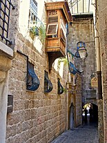
 Hagay Street,Old City (Jerusalem)
 -

-
 Peg Washington's Lane, Graiguenamanagh,County Kilkenny,Ireland
 -
 View downJacob's Ladder,Saint Helena
 -
-

-

-
 A narrow alley of theVyborg CastleinVyborg,Russia
 -


-

-

-
-
 Rue du Baron inFlorac,France
 -
 Arco di Via Tirolo,Rodi Garganico,Apulia,Italy
 -
 Breakneck Steps, Quebec City, around 1870


See also
[edit]- Avenue (landscape)– Straight path or road with a line of trees or large shrubs on both sides, also known as tree alley or allée
- Community Greens– Shared urban green spaces
- Great Yarmouth Row Houses,England
- Bubblegum Alley,San Luis Obispo, California,USA
- Mews– Type of housing above stables
- Right of way (disambiguation)
- Right of way (transit)– Legal authority to use a specific route
- Stairs– Construction designed to bridge a large vertical distance by dividing it into steps
- Street– Public thoroughfare in a built environment
- Alley house– style of terraced house fronted on an alleyway
- Laneway house– Form of housing in Canada
References
[edit]Notes
- ^"Definition of ALLEY".merriam-webster.12 July 2023.
- ^The Merriam-Webster Unabridged Dictionary
- ^"Seattle Stairway Walks".Retrieved1 December2022.
- ^"Stairways of San Francisco".sisterbetty.org.Retrieved1 December2022.
- ^"I'll take the stairs".abhk.org.
- ^Mette (29 June 2011)."5 Interesting Steps to Rome".Italian Notes.Retrieved1 December2022.
- ^Sassatelli, R.,Consumer Culture: History, Theory and Politics,Sage, 2007, p. 27.
- ^Lemoine, B.,Les Passages Couverts,Paris: Délégation à l'action artistique de la ville de Paris [AAVP], 1990.ISBN9782905118219.
- ^Gibert-Flutre, Marie; Imai, Heide (2020).Asian Alleyways An Urban Vernacular in Times of Globalization.Amsterdam: Amsterdam University Press.ISBN9789463729604.
- ^Michael Meyer."The Death and Life of Old Beijing".
- ^Kane, David (2006).The Chinese Language: Its History and Current Usage.Tuttle Publishing. p. 191.ISBN978-0-8048-3853-5.Retrieved10 October2012.
- ^"Architectural Record | McGraw-Hill Construction".Archrecord.construction. 5 October 2011.Retrieved5 August2014.
- ^Booth, Robert; Watts, Jonathan (5 June 2008)."Charles takes on China to save Ming dynasty".The Guardian.Retrieved15 January2014.
- ^Beijing Hutong:"Qianshi Hutong | Beijing Hutong".Archived fromthe originalon 16 January 2014.Retrieved15 January2014..
- ^Frommer's Shanghai Day By Day– Page 162 Graham Bond – 2011 1912 "1917 China's first shopping mall, the Sincere Department Store, Lilong, or Longtang Li means" neighborhood ", and long means" alley "."
- ^Walking between slums and skyscrapers: illusions of open space in... - Page 160 Tsung-yi Michelle Huang – 2004 "Shanghainese calllilong,their characteristic residential design, as longtang. "Long" means alley or lane and "tang" parlor or hall. "All houses are facing the lanes and lanes become the public space used by all residents. Enclosed, the whole...
- ^Postsocialism and Cultural Politics: China in the Last Decade of... - Page 196 Xudong Zhang – 2008 "As long means a lane and tang the front room of a house, longtang either refers to a lane that connects houses or a group of houses connected by lanes. Longtang however might not be so explicit as lilong for the li in lilong means..."
- ^Narrating Architecture: A Retrospective Anthology Page 474 James Madge, Andrew Peckham – 2006 "Four sketches by Feng Zikai of Shanghai's alley life: clockwise from top left: lowering a basket down to the alley to purchase... these activities were certainly not considered in the original design of the lilong, but were gradually introduced in the practice of everyday life within the community. A local writer, Shen Shanzeng, has named this special way of living as 'life in the alley' (long-tang ren-sheng)."
- ^Cities Surround The Countryside: Urban Aesthetics in Postsocialist... - Page 320 Robin Visser – 2010 "Chunlan Zhao refers to the generalization that Shanghai without its longtang is no longer Shanghai, inFrom... archway; li means neighborhood; long... means alley.... The earliest lilong compound resembled the lifang residential ward in imperial capitals, but instead of being enclosed by...
- ^abc"Golden Gai – An Unmissable Tokyo Experience".unmissabletokyo.
- ^"Hiragan Times,"Shinjuku – a Town for Everybody that Has Just About Everything"".Archived fromthe originalon 13 January 2014.
- ^Imai, Heide (2017).Tokyo Roji: The Diversity and Versatility of Alleys in a City in Transition.London: Routledge.ISBN978-1-138-94910-2.
- ^Asian alleyways: an urban vernacular in times of globalization.Marie Gilbert-Flutre, Heide Imai, International Institute for Asian Studies. Amsterdam. 2020.ISBN978-94-6372-960-4.OCLC1160036625.
{{cite book}}:CS1 maint: location missing publisher (link) CS1 maint: others (link) - ^Kim, Annette Miae (2015).Sidewalk city: remapping public space in Ho Chi Minh City.Chicago: The University of Chicago Press.ISBN978-0-226-11936-6.OCLC906576927.
- ^"Sydney Tours".sydney.Retrieved1 December2022.
- ^"Laneways of The Rocks".visitsydneyaustralia.au.Retrieved1 December2022.
- ^Wood, Simon."Sydney laneway revival".ARCHITECTUREAU.Retrieved15 September2016.
- ^"Chinatown and Haymarket".Sydney.Retrieved18 November2022.
- ^"Google Maps".Google Maps.Retrieved1 December2022.
- ^"Little Latrobe Street and the Historical Significance of Melbourne's Laneways".Public Record Office of Victoria.Retrieved25 April2020.
- ^"Melbourne Laneways".melbourneheritage.org.au.Retrieved25 April2020.
- ^Bate, Weston(1994).Essential But Unplanned: The Story of Melbourne's Lanes.State Library of Victoria in conjunction with the City of Melbourne.ISBN978-0-7306-3598-7.
- ^"Perth Public Spaces Public Life"(PDF).Gehl Architects. 2009. p. 36.Retrieved6 January2015.
- ^Romano, Mary-Anne (12 March 2012)."Perth CBD evolving to be more pedestrian friendly".Science Network WA.Retrieved6 January2015.
- ^"Bars breathe new life into Perth Lanes".The West Australian.23 February 2011.Retrieved16 June2014.
- ^"City of Perth Council Minutes"(PDF).26 August 2008. pp. 45–49.Retrieved3 January2015.
- ^Impasses de Bruxelles,Lucia Gaiardo, Région de Bruxelles-Capitale-Ville de Bruxelles, 2000
- ^ab"Tourismus-Reutlingen: An eye of a needle with world fame".Wirtschaft-Necker Alb.Retrieved5 February2010.
- ^Glenday, Craig, ed. (2009).Guinness World Records 2009.Random House Publishing Group. p.493.ISBN978-0-553-59256-6.
- ^"Regio-Report Neckar-Alb Aus der Region"(in German). E-Paper – Wirtschaft-Neckar Alb. April 2007. Archived fromthe originalon 19 July 2011.Retrieved6 November2010.
- ^Signon, Helmut (2006), Alle Straßen führen durch Köln, Greven Verlag,ISBN3-7743-0379-7and Priebe, Ilona (2004), Kölner Straßennamen erzählen. Zwischen Schaafenstraße und Filzgraben, Bachem J.P. Verlag,ISBN3-7616-1815-8
- ^unknown, France Today (4 December 2012)."Lyon's Traboules – French History".
- ^"vicolo – Wiktionary".en.wiktionary.org.8 November 2021.
- ^(calli) of Venice[permanent dead link]
- ^"Stegen in Amsterdam".Studiokoning.nl.Retrieved5 August2014.
- ^abStahre, Nils-Gustaf; Fogelström, Per Anders & Ferenius, Jonas & Lundqvist, Gunnar (2005) [1986]. Stockholms gatunamn (utgåva 3:e upplagan). Stockholm: Stockholmia förlag. Libris 10013848.ISBN91-7031-152-8.
- ^ab"Innerstaden: Gamla stan".Stockholms gatunamn(2nd ed.). Stockholm: Kommittén för Stockholmsforskning. 1992. p. 62.ISBN978-91-7031-042-3.
- ^"City Street Names".maps.thehunthouse.Retrieved1 December2022.
- ^ab"Londonist's Back Passage".Londonist.
- ^"Google Maps".Google Maps.Retrieved1 December2022.
- ^abJohn Biddulph Martin (1892)."The Grasshopper" in Lombard Street.University of Michigan. Scribner & Welford.
- ^J. Pelzer and L. Pelzer, "Coffee Houses of Augustan London,"History Today,(October, 1982), pp. 40–47.
- ^Larry Neal. "How It All Began: The Monetary and Financial Architecture of Europe during the First Global Capital Markets: 1648–1815."Archived14 January 2006 at theWayback Machine
- ^"London Stock Exchange | London Stock Exchange".londonstockexchange.Retrieved1 December2022.
- ^"Brydges Place, Covent Garden, London, the narrowest alleyway in London".urban75.org.
- ^"The Lamb and Flag".Pubs.Retrieved30 July2010.
- ^F. H. W. Sheppard (1970).Survey of London: volume 36: Covent Garden.Institute of Historical Research. pp. 182–184.Retrieved30 July2010.
- ^John Richardson (2000).The Annals of London.University of California Press. p.156.ISBN978-0-520-22795-8.Retrieved30 July2010.
- ^Chisholm, Hugh,ed. (1911)..Encyclopædia Britannica.Vol. 23 (11th ed.). Cambridge University Press. pp. 427–428, see page 428. para 2, six lines from the end.
....and by his orders a band of roughs set on the poet in Rose Alley, Covent Garden, and beat him....
- ^"January 2007 – Cecil Court".Film London.Retrieved5 August2014.
- ^"Filming in Cecil Court | thelastbookshop".Thelastbookshop.wordpress. 24 May 2011.Retrieved5 August2014.
- ^"The London Project -Home".londonfilm.bbk.ac.uk.
- ^Cairns, David (2006),Mozart and his Operas,University of California Press, p. 17,ISBN978-0-520-22898-6
- ^Sadie, Stanley (2005),Mozart, the Early Years 1756–1781,W. W. Norton & Company, pp.64–5,ISBN978-0-393-06112-3
- ^"Islington: Growth | British History Online".british-history.ac.uk.Retrieved1 December2022.
- ^"Interesting information about Lewes, East Sussex".Area Information by Quicksold.25 June 2023.
- ^StreetCheck."Interesting Information for Paines Twitten, Lewes, BN7 1UB Postcode".StreetCheck.
- ^"Lingfield villagers seek plastic bag-free zone".BBC. 7 May 2012.Retrieved1 January2014.
- ^Loughton & District Historical Society Newsletter136, April 1997Archived18 June 2015 at theWayback Machine.
- ^"A History of Brighton".Localhistories.org.Retrieved5 August2014.
- ^"Barbican Conservation Area Appraisal and Management Plan"(PDF).Archived fromthe original(PDF)on 24 September 2015.Retrieved10 February2014.Plymouth City Council
- ^Mary Palmer,A dialogue in the Devonshire dialect, by a lady [M. Palmer]: to which is added a glossary, by J.F. Palmer,1837.
- ^The Disappearing Dictionary: A Treasury of Lost English Dialect Words.Pan Macmillan,2015.
- ^Franks, Richard (20 September 2018)."A Comprehensive Guide to Brummie Slang".theculturetrip.Culture Trip.Retrieved16 June2022.
Entry – the alley between terraced houses....Gully – an alleyway, or space round the back of houses.
- ^"Walking the Jitties"Archived2 January 2014 at theWayback Machineon the Barrow Upon Soar Heritage Group website
- ^Wilson, David (1974).Staffordshire Dialect Words: A Historical Survey.Moorland Publishing Company.
- ^"Geograph:: Shrewsbury's shuts and passages".geograph.org.uk.
- ^Arfin, Ferne."United Kingdom Travel: Finding Medieval York:Walking the Snickelways and Ginnels of Medieval York"Archived2 January 2014 at theWayback MachineAbout
- ^"Whitby Walks | Whitby ghost walks with Dr Crank".
- ^The Wynd (1 January 1970)."wynd richmond – Google Maps".Google Maps.Retrieved5 August2014.
- ^Published by City of Newcastle upon Tyne Education and Libraries Directorate, 2002
- ^BBC."Putting SY on the Wordmap".bbc.co.uk.Retrieved1 December2022.
- ^"Ginnel".Yorkshire Historical Dictionary.Retrieved18 April2020.
- ^Harris, S (1996).The Place Names of Edinburgh.London: Steve Savage. p. 28.ISBN1-904246-06-0.
- ^Town and Regional Planning Programme, University of Dundee."Conservation Glossary, entry for" pend "".Archived fromthe originalon 12 February 1997.Retrieved12 May2008.
- ^"Photographs and newspaper cuttings".bpra.org.uk.Retrieved1 December2022.
- ^"Medina definition".Oxford English Dictionary.Archived fromthe originalon 20 April 2016.Retrieved9 September2014.
- ^"7 car-free cities".Mother Nature Network.
- ^"In the lanes of old St. John's – SkyscraperPage Forum".skyscraperpage.Retrieved1 December2022.
- ^"Quebec, Canada".ndsu.edu.Retrieved1 December2022.
- ^"Québec City and Area – Stairways".Québec City Tourism. 2011. Archived fromthe originalon 9 February 2011.Retrieved15 February2011.
- ^"Fan Tan Alley"Archived7 January 2014 at theWayback Machineon theVictoria's China Townwebsite
- ^Ringuette, Janis (2007)."Waddington Alley: A 1908 Street Experience".Hidden in Plain Sight.Islandnet. Archived fromthe originalon 28 April 2011.
- ^Huston, John W. (1977)."Annapolis: an eighteenth-century analysis".Conspectus of History.1(4): 49.
- ^Fahrenthold, David A. "Celebrating Annapolis's Storied Shortcuts".The Washington Post(27 January 2005) p.AA14.
- ^Backbay alleys
- ^"A Stroll Down Dueler's Alley"Archived7 January 2014 at theWayback Machineon theCharleston Gatewaywebsite
- ^Poston, Jonathan H.The Buildings of Charleston: A Guide to the City's Architecture.Columbia, SC, University of South Carolina Press, 1997, pp.136–7.
- ^"SCDAH".nationalregister.sc.gov.Retrieved1 December2022.
- ^"Alleys and the Making of Chicago's Shadow City".WBEZ Chicago.10 October 2015.Retrieved6 February2022.
- ^"Alleys".encyclopedia.chicagohistory.org.Retrieved6 February2022.
- ^"Chicago's Green Alley Program".Center for Environmental Excellence | AASHTO.Retrieved6 February2022.
- ^"City of seven hills".The Cincinnati Enquirer.4 December 2008.Retrieved17 May2013.
- ^"Walking the Steps of Cincinnati — 1998".Ohio University Press & Swallow Press.Retrieved17 May2013.
- ^Devin Parrish (January 1998)."Observer: Climb Every Hill".Cincinnati Magazine.p. 22.
- ^"CityLab – Bloomberg".Bloomberg.Retrieved1 December2022.
- ^"Most Historic Alley in Delaware".RoadsideAmerica.
- ^Gray, Christopher (23 October 2005)."Are Manhattan's Right Angles Wrong?".The New York Times.ISSN0362-4331.Retrieved1 December2022.
- ^Rosenberg, Joe (8 January 2019)."Cortlandt Alley".99% Invisible.Retrieved14 January2019.
- ^AIA Guide,p.131-133
- ^"Alleys".Forgotten New York.Retrieved1 December2022.
- ^AIA Guide,p.145
- ^AIA Guide,p.594
- ^AIA Guide,p.627
- ^AIA Guide,p.298
- ^"History"Archived7 January 2014 at theWayback Machineon the Elfreth's Alley Association website
- ^"Elfreth's Alley Museum".Elfreth's Alley Museum.Retrieved1 December2022.
- ^Campbell, Colin. "About Philadelphia: Alleys Much Treasured for Their Tiny Houses"The New York Times(18 December 1984)
- ^"39°56'46.5" N 75°08'47.5 "W".39°56'46.5 "N 75°08'47.5" W.
- ^"Google Maps".Google Maps.
- ^"Google Maps".Google Maps.
- ^"Google Maps".Google Maps.
- ^"Google Maps".Google Maps.
- ^"Pyle's Great Column on Pittsburgh".Pittsburgh Press. 19 April 1945.
- ^"Pittsburgh Steps".frontiernet.net.
- ^"San Francisco: 10 Things to Do — 3. The Stairs of Telegraph Hill – TIME".Time.ISSN0040-781X.Retrieved1 December2022.
- ^"Google Maps".Google Maps.Retrieved1 December2022.
- ^belden-place,Belden Place Official Website
- ^Sam Whiting (30 June 2006)."The limited confines of San Francisco's French Quarter don't make it any less foreign".San Francisco Chronicle. Archived fromthe originalon 1 January 2007.Retrieved23 June2007.
- ^Seattle All Stairs:"Seattle Stairs – map of all public stairs with guides to 30 walks".Archived fromthe originalon 30 May 2014.Retrieved1 May2014..
- ^ab"Green Alleys".chicago.gov.Retrieved1 December2022.
- ^"The Chicago Green Alley Handbook"Archived22 December 2013 at theWayback Machineon the City of Seattle website
- ^"Green Alleys".Trust for Public Land.Retrieved1 December2022.
- ^ab"Green Alley Projects"Archived4 January 2014 at theWayback Machineon the District of Columbia Department of Transportation website
- ^"About Us"Archived4 January 2014 at theWayback Machineon theIntegrated Alleyswebsite
- ^"archive.ph".archive.ph.Archived fromthe originalon 3 January 2014.Retrieved1 December2022.
- ^"Laneway houses appeal to boomer generation".8 November 2012. Archived fromthe originalon 8 November 2012.
- ^Vancouver, City of."Build a new house or laneway house".vancouver.ca.Retrieved1 December2022.
- ^"Livable Lanes: A Study of Infill Laneway Housing in Vancouver and Other B.C. Communities"Archived23 September 2015 at theWayback Machineon the Canada Mortgage and Housing Corporation website (November 2009)
- ^"News".Canadian Architect.Retrieved1 December2022.
- ^Crowther, William G."Toronto Staff Report"(20 June 2006)
- ^"Rights-of-Way or Laneways in Established Areas- Guidelines"(PDF).Planning Bulletin No 33.Western Australian Planning Commission. July 1999.Retrieved4 October2012.
- ^French Wikipedia article, Google translation (edited).
- ^Google translation
- ^"slovnik.seznam.cz Translation of" ulička "".Retrieved18 February2010.
- ^"Montreal's Best Alleyways".16 July 2010.
Bibliography
- DuSablon, Mary Anna,Walking the Steps of Cincinnati.Athens, OH.: Ohio University Press, 1998.
- Hage, Sara A.,Alleys: Negotiating Identity in Traditional, Urban, and New Urban Communities.M.A. Thesis, University of Massachusetts, Amherst, 2008.
- Long, David,Hidden City: The Secret Alleys, Courts & Yards of London's Square Mile.London: The History Press, 2011.
- Regan, Bob,The Steps of Pittsburgh: Portrait of a City.Pittsburgh, PA.: The Local History Company, 2004.
- White, Norval;Willensky, Elliot; Leadon, Fran (2010).AIA Guide to New York City(5th ed.). New York: Oxford University Press.ISBN978-0-19538-386-7.
External links
[edit] Media related toAlleysat Wikimedia Commons