
Boa Vista, Roraima
This articleneeds additional citations forverification.(March 2023) |
Boa Vista | |
|---|---|
| Municipality of Boa Vista | |
 Above:Aerial view of Central Civic Square (Praça dos Centro Cívico) and Helio Campos Palace (Paço dos Helio Campos),Middle:Boa Vista Matriz Church (Paróquia Matriz de Nossa Senhora do Carmo), Boa Vista Cristo Redentor Cathedral (Diocese de Roraima),Bottom:A fountain in Águas Square (Praça das Águas), Macuxis Bridge (Ponte dos Macuxis), all items from left to right | |
 Flag  Coat of arms | |
| Nickname: "BV" "Princesa do Norte" "Capital da Primeira Infância" | |
| Motto(s): "Segurança, Desenvolvimento, Integração"("Security, Development, Integration") | |
 Location of Boa Vista in theState of Roraima | |
 Boa Vista Location in Brazil | |
| Coordinates:2°49′10″N60°40′17″W/ 2.81944°N 60.67139°W | |
| Country | |
| Region | North |
| State | |
| Founded | July 9, 1890 |
| Government | |
| •Mayor | Arthur Henrique Machado (MDB) |
| Area | |
| • Total | 5,687.022 km2(2,195.771 sq mi) |
| Elevation | 90 m (300 ft) |
| Population (2020[1]) | |
| • Total | 419,652 |
| • Density | 74/km2(190/sq mi) |
| Time zone | UTC−4(AMT) |
| Postal code | 69300-001 to 69339-999 |
| Area code | +55 95 |
| HDI(2010) | 0.752 –high[2] |
| Website | www |
Boa Vista(Brazilian Portuguese:[ˈbo(w)ɐˈvistɐ],literallyGood View;figuratively "Fairview" ) is the capital of the Brazilian state ofRoraima.Situated on the western bank of theBranco River,the city lies 220 km (140 mi) from Brazil's border withVenezuela.It is the onlyBrazilian state capitallocated entirely north of the equator.
Boa Vista is the most populous municipality in the state of Roraima;[3]approximately half of the population of the state lives in the city. Commerce mostly occurs withManaus,the capital of theState of Amazonas.Business also takes place between Boa Vista and with the cities ofLethem,in Guyana andSanta Elena de Uairén,in Venezuela. These two foreign cities are the only major cities that can be accessed from Boa Vista by road, although roads connect other smaller state municipalities with the capital city. Travel by airplane is the only means of transportation with other regions of the country.
As a modern city, Boa Vista stands out among the other capitals of theNorth Regionof Brazil as it is aplanned citywith a radial plan. It was planned by the architect Darci Aleixo Derenusson who based his design for the city on one that is similar to that of Paris, France.[citation needed]The city was built under the direction of Captain Ene Garcez, the first governor of Roraima.
History
[edit]This sectionneeds additional citations forverification.(March 2013) |
The municipality of Boa Vista formed the first urban area of the state of Roraima. The São Joaquim do Rio Branco Fort, founded in 1775, is located on the banks of theUraricoera Riverabout 32 km from the capital and is considered to be of great importance to the region.
The city was created on July 9, 1890, as Boa Vista do Rio Branco. It was founded byAugusto Villeroy(Amazonas's Governor). The first mayor wasJoão Capistrano da Silva Mota,also known as Coronel Mota. After the mayor, two councillors (José Francisco CoelhoandJosé Gonzaga de Souza Junior) were appointed.
In 1943, during the middle of World War II, Boa Vista became the capital of the recently created Federal Territory ofRio Branco.The territory grew from mining operations in the area. The then Federal Territory of Rio Branco was elevated to statehood, later being renamed as "Roraima".Later, machine-based mining was prohibited (because of the resulting damage to the landscape), which ended up hindering the economy of thestateand the municipality.
In the 2010s, thecrisis in Venezuelaled to the population swelling by around 50,000 Venezuelan immigrants.[4]
Economy
[edit]
The GDP of the city was R$2,265,603,000 (2005).[5]
The per capita income of the city was R$9,366 (2005).[6]
Education
[edit]
Portuguese is the official national language, and the primary language taught in schools. English and Spanish are part of the official high school curriculum.
Educational institutions include:
- Universidade Federal de Roraima (UFRR);
- Instituto Federal de Roraima (IFRR);
- Facudade Estácio Atual da Amazônia;
- Faculdades Cathedral – Boa Vista (Cathedral-Boa Vista);
- Faculdade de Teologia de Boa Vista (Fatebov)
Tourism and recreation
[edit]- Anaua Park, a major recreational park is located in Boa Vista. It is the biggest park in thenorth region of Brazil.[citation needed]It has a Forrodromo (show place), a square, a lake and a kart-racing facility.
- Taumanam is a small artificial beach on Rio Branco. It has several stores and snack bars, and was created in 2005.
- TheAyrton Sennacomplex is the most visited tourist attraction in Boa Vista.[citation needed]It consists of Ayrton Senna, Velia Coutinho (Alimentation Square and a show place), Praça das Águas (a square where there is a water show), Millennium Portal (it was created to commemorate the 21st century), and Praça das Artes (the newest and the largest plazas in the complex).
Culture
[edit]-
 Taumanam, Boa Vista, Brazil
 -
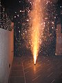 Fireworksin Boa Vista's Saint John Festival.
 -
 Velia Coutinho in Boa Vista, Roraima
 -
 Festa Juninaof Boa Vista, Brazil


Festa Junina (Saint John Festival)
[edit]
Festa Juninawas introduced to Northeastern Brazil by thePortuguesefor whom St John's day (also celebrated asMidsummerDay in European countries), on 24 June, is one of the oldest and most popular celebrations of the year. The festivities traditionally begin after 12 June, on the eve of St Anthony's day, and last until the 29th, which is Saint Peter's day. During these fifteen days, there are bonfires, fireworks, and folk dancing in the streets (step names are in French, which shows the mutual influences between court life and peasant culture in the 17th, 18th, and 19th-century Europe). Once exclusively a rural celebration, today, in Brazil, it is now largely a city festival.[citation needed]
The Civic Center
[edit]
The Civic Center, built in the form of an opened fan, starts from the banks of the Rio Branco. This design was created by the engineerDarci Aleixo Deregussonduring Ene Garcez's government, the first of its kind in Roraima.
From the Civic Center runs a system of 16 avenues, with inspiration drawn from Paris, France,Belo Horizonte,andGoiânia,Brazil. In this square are the head offices of the Executive, Judicial and Legislative branches of the state government. Other buildings of significance are the Palace of Culture, the Amazônia Bank, the Ministry of Education, and a cathedral.
The civic center also has a monument to miners.
Demography
[edit]Initially, indigenous people were the only inhabitants of Boa Vista. Boa Vista had the highest growth rate of any Brazilian capital in the 1970s, at 3% per year. Immigrants were attracted to this city due to employment opportunities generated by public service jobs for Brazilians. General commercial opportunities attract immigrants from neighboring countries. In 1950 Boa Vista had about 5,200 inhabitants. This number grew 47-fold in only 56 years to approximately 250,000 inhabitants.
According to the Brazilian Institute of Geography and Statistics (IBGE), Boa Vista had more than 375,000 inhabitants in 2018. The city grew more than 10% in just one year due mainly to Venezuelan immigration.
Ethnic groups found in Boa Vista include:Amerindians,Portuguese,Africans,Germans,Venezuelans,GuyaneseandLebanese.
Sports
[edit]There are several professionalfootballclubs in Boa Vista:
- AtléticoRoraimaClube
- BaréEsporte Clube
- GrêmioAtléticoSampaio(GAS)
- São RaimundoEsporte Clube
- RiverEsporte Clube
- AtléticoRio NegroClube
- NáuticoFutebol Clube
The city's most important stadium isEstádio Flamarion Vasconcelos,better known asCanarinho,located in the neighborhood of the same name, Canarinho. The stadium, which located in the southern part of Boa Vista, has a maximum capacity of 10,000 people.
Also located in Boa Vista is theEstádio Raimundo Ribeiro de Souza,better known as theRibeirão,which is located in a suburb of the city.
Geography
[edit]The city is situated on the western bank of the Branco River, and it lies 220 km from Brazil's border with Venezuela. It is the only Brazilian state capital located entirely north of the equator.
Climate
[edit]Boa Vista experiences atropical savanna climate(KoppenAw), with a hot, humid wet season and a very warm dry season. Being the only major Brazilian city north of the equator, the wettest and driest months in Boa Vista are the reverse of the rest of the Amazonian region of Brazil, with a hot, humid, rainy period from April to November and a very warm, dry period from December to March. Temperature fluctuations are relatively small throughout the year.
TheMaracá Ecological Stationwas established by presidential decree on 2 June 1981. The station consists of the island of Maracá between the Santa Rosa and Maracá branches of theUraricoera Riverin the municipality of Boa Vista, and has an area of 101,312 hectares (250,350 acres).[7] The strictly protected area was established with the purpose of preserving a representative sample of the Amazon ecosystem.[8]
| Climate data for Boa Vista (1981–2010 normals, extremes 1981–present) | |||||||||||||
|---|---|---|---|---|---|---|---|---|---|---|---|---|---|
| Month | Jan | Feb | Mar | Apr | May | Jun | Jul | Aug | Sep | Oct | Nov | Dec | Year |
| Record high °C (°F) | 38.4 (101.1) |
42.6 (108.7) |
40.1 (104.2) |
39.1 (102.4) |
37.6 (99.7) |
36.1 (97.0) |
35.7 (96.3) |
39.4 (102.9) |
39.5 (103.1) |
42.6 (108.7) |
42.0 (107.6) |
41.2 (106.2) |
42.6 (108.7) |
| Mean daily maximum °C (°F) | 33.3 (91.9) |
33.6 (92.5) |
34.2 (93.6) |
33.6 (92.5) |
31.9 (89.4) |
31.2 (88.2) |
31.4 (88.5) |
32.7 (90.9) |
34.2 (93.6) |
34.8 (94.6) |
34.6 (94.3) |
33.8 (92.8) |
33.6 (92.5) |
| Daily mean °C (°F) | 28.1 (82.6) |
28.3 (82.9) |
28.8 (83.8) |
28.3 (82.9) |
27.2 (81.0) |
26.5 (79.7) |
26.5 (79.7) |
27.3 (81.1) |
28.4 (83.1) |
28.9 (84.0) |
28.9 (84.0) |
28.3 (82.9) |
28.0 (82.4) |
| Mean daily minimum °C (°F) | 23.9 (75.0) |
24.0 (75.2) |
24.3 (75.7) |
24.2 (75.6) |
23.6 (74.5) |
23.1 (73.6) |
22.9 (73.2) |
23.5 (74.3) |
24.2 (75.6) |
24.5 (76.1) |
24.4 (75.9) |
24.3 (75.7) |
23.9 (75.0) |
| Record low °C (°F) | 19.5 (67.1) |
20.0 (68.0) |
19.2 (66.6) |
20.0 (68.0) |
19.0 (66.2) |
18.6 (65.5) |
17.6 (63.7) |
19.2 (66.6) |
20.2 (68.4) |
19.6 (67.3) |
20.0 (68.0) |
18.3 (64.9) |
17.6 (63.7) |
| Averageprecipitationmm (inches) | 25.1 (0.99) |
18.1 (0.71) |
30.9 (1.22) |
88.5 (3.48) |
213.0 (8.39) |
321.3 (12.65) |
267.8 (10.54) |
188.0 (7.40) |
99.4 (3.91) |
63.5 (2.50) |
60.8 (2.39) |
44.0 (1.73) |
1,420.4 (55.91) |
| Average precipitation days(≥ 1 mm) | 3 | 3 | 4 | 6 | 14 | 21 | 19 | 15 | 8 | 5 | 5 | 4 | 107 |
| Averagerelative humidity(%) | 70.8 | 66.4 | 66.3 | 70.7 | 78.9 | 84.9 | 84.2 | 81.3 | 76.2 | 74.1 | 72.3 | 72.5 | 74.9 |
| Mean monthlysunshine hours | 177.8 | 148.2 | 142.4 | 129.2 | 138.3 | 93.5 | 136.3 | 155.3 | 200.7 | 204.8 | 195.8 | 173.5 | 1,895.8 |
| Source: Brazilian National Institute of Meteorology (INMET).[9][10][11][12][13][14][15][16][17][18][19] | |||||||||||||
Transport
[edit]
International Airport
[edit]Boa Vista is served byBoa Vista-Atlas Brasil Cantanhede International Airportwith direct flights toBrasília,Georgetown(Guyana), andManaus.Boa Vista International Airport was opened on February 19, 1973, and underwent major remodelings in 1998 and 2009. The passenger terminal, runway and apron were all enlarged, and a separate taxiway was built.
Boa Vista Air Force Base - ALA7,one of the most important bases of theBrazilian Air Force,is located in Boa Vista.
Highways
[edit]
The federal government has started a project to link Boa Vista by road to Manaus and then by extension to the major centers of Brazil, by asphalting theBR-174and building several bridges in the Amazon forest, allowing a direct road link to Manaus and then on over theBR-319to the central regions of Brazil.[20]
Notable people
[edit]- Miquéias Fernandes(1950–2020), politician and pastor[21]
- Johnathan de Jesus(b. 1983), politician[22]
- Thiago Maia(b. 1997), footballer[23]
- Luiz Altamir Melo(b. 1996), swimmer[24]
- Shéridan Oliveira(b. 1984), politician and psychologist[25]
- Bianca Matte(b. 1990), Beauty Queen[26]

References
[edit]- ^IBGE 2020
- ^"Archived copy"(PDF).United Nations Development Programme(UNDP). Archived fromthe original(PDF)on July 8, 2014.RetrievedAugust 1,2013.
{{cite web}}:CS1 maint: archived copy as title (link) - ^Boa Vista, capital city of Roraima, Brazil
- ^Londoño, Ernesto (April 28, 2018)."'Their Country is Being Invaded': Exodus of Venezuelans Overwhelms Northern Brazil ".The New York Times.
- ^GDP(PDF)(in Portuguese). Boa Vista, Brazil:IBGE.2005.ISBN85-240-3919-1.Archived fromthe original(PDF)on October 2, 2008.RetrievedJuly 18,2007.
- ^per capita income(PDF)(in Portuguese). Boa Vista, Brazil:IBGE.2005.ISBN85-240-3919-1.Archived fromthe original(PDF)on October 2, 2008.RetrievedJuly 18,2007.
- ^Presidência da República (June 2, 1981),DECRETO Nº 86.061, DE 2 DE JUNHO DE 1981. Cria Estações Ecológicas, e dá outras providências.,retrievedApril 16,2016
- ^Reinaldo Imbrozio Barbosa (2006),ESEC Maracá,Instituto Nacional de Pesquisas da Amazônia - Roraima,retrievedApril 16,2016
- ^"Temperatura Média Compensada (°C)"(in Portuguese). Brazilian National Institute of Meteorology. 1961–1990. Archived fromthe originalon August 8, 2014.RetrievedAugust 19,2014.
- ^"Temperatura Máxima (°C)"(in Portuguese). Brazilian National Institute of Meteorology. 1961–1990. Archived fromthe originalon August 8, 2014.RetrievedAugust 19,2014.
- ^"Temperatura Mínima (°C)"(in Portuguese). Brazilian National Institute of Meteorology. 1961–1990. Archived fromthe originalon August 8, 2014.RetrievedAugust 19,2014.
- ^"Precipitação Acumulada Mensal e Anual (mm)"(in Portuguese). Brazilian National Institute of Meteorology. 1961–1990. Archived fromthe originalon August 8, 2014.RetrievedAugust 19,2014.
- ^"Número de Dias com Precipitação Mayor ou Igual a 1 mm (dias)".Brazilian National Institute of Meteorology. Archived fromthe originalon August 27, 2014.RetrievedAugust 19,2014.
- ^"Insolação Total (horas)".Brazilian National Institute of Meteorology. Archived fromthe originalon August 8, 2014.RetrievedAugust 19,2014.
- ^"Umidade Relativa do Ar Média Compensada (%)".Brazilian National Institute of Meteorology. Archived fromthe originalon August 8, 2014.RetrievedAugust 19,2014.
- ^"Temperatura Máxima Absoluta (°C)".Brazilian National Institute of Meteorology (Inmet).RetrievedAugust 19,2014.[dead link]
- ^"Temperatura Mínima Absoluta (°C)".Brazilian National Institute of Meteorology (Inmet).RetrievedAugust 19,2014.[dead link]
- ^"82024: Boa Vista (Brazil)".ogimet.OGIMET. December 19, 2023.RetrievedDecember 21,2023.
- ^https://mapas.inmet.gov.br/
- ^"Results".
- ^"Ex-vereador Miquéias Fernandes morre aos 69 anos vítima do novo coronavírus".Globo(in Portuguese).RetrievedApril 9,2021.
- ^"JOHNATHAN PEREIRA DE JESUS".Câmara dos Deputados do Brasil(in Portuguese).RetrievedApril 9,2021.
- ^"Thiago Maia".Soccer Way.RetrievedApril 9,2021.
- ^"LUIZ ALTAMIR LOPES MELO".CBDA(in Portuguese). Archived fromthe originalon July 26, 2019.RetrievedApril 9,2021.
- ^"Shéridan".Câmara dos Deputados do Brasil(in Portuguese).RetrievedApril 9,2021.
- ^RR, Neidiana OliveiraDo G1 (September 1, 2013)."Conheça Bianca Matte, bela que representará RR no Miss Brasil 2013".Roraima(in Brazilian Portuguese).
{{cite web}}:CS1 maint: numeric names: authors list (link)
External links
[edit] Definitionsfrom Wiktionary
 Mediafrom Commons
 Newsfrom Wikinews
 Quotationsfrom Wikiquote
 Textsfrom Wikisource
 Textbooksfrom Wikibooks
 Resourcesfrom Wikiversity
 Travel informationfrom Wikivoyage
- Site of Boa Vista's City Hall(in Portuguese)
Capital:Boa Vista | ||
| Boa Vista |  | |
| Nordeste de Roraima | ||
| Caracarai | ||
| Sudeste de Roraima | ||
| International | |
|---|---|
| National | |
| Geographic | |