
Butler, Alabama
Butler, Alabama | |
|---|---|
 Choctaw County Courthouse and Confederate monument in Butler | |
 Flag | |
 Location of Butler in Choctaw County, Alabama. | |
| Coordinates:32°5′29″N88°13′14″W/ 32.09139°N 88.22056°W | |
| Country | United States |
| State | Alabama |
| County | Choctaw |
| Area | |
| • Total | 6.75 sq mi (17.48 km2) |
| • Land | 6.75 sq mi (17.48 km2) |
| • Water | 0.00 sq mi (0.00 km2) |
| Elevation | 151 ft (46 m) |
| Population (2020) | |
| • Total | 1,871 |
| • Density | 277.14/sq mi (107.01/km2) |
| Time zone | UTC-6(Central (CST)) |
| • Summer (DST) | UTC-5(CDT) |
| ZIP code | 36904 |
| Area code(s) | 205, 659 |
| FIPS code | 01-11032 |
| GNISfeature ID | 2405351[2] |
| Website | www |
Butleris atown[2]in and thecounty seatofChoctaw County,Alabama,United States.The population was 1,894 at the2010 census.[3]
History[edit]
When Choctaw County was formed in 1847, Butler was created as the county seat. The town was located and settled in 1848. It is named in honor of Colonel Pierce Butler, a soldier killed in theMexican–American War.[4]
Geography[edit]
Butler is located in north-central Choctaw County at32°5′29″N88°13′14.46″W/ 32.09139°N 88.2206833°W(32.091526, −88.220684).[5]
According to theUnited States Census Bureau,the town had a total area of 5.6 square miles (14.4 km2), all land.[3]
Climate[edit]
According to theKöppen climate classification,Butler has ahumid subtropical climate(abbreviatedCfa).
| Climate data for Butler, 1991–2020 simulated normals (161 ft elevation) | |||||||||||||
|---|---|---|---|---|---|---|---|---|---|---|---|---|---|
| Month | Jan | Feb | Mar | Apr | May | Jun | Jul | Aug | Sep | Oct | Nov | Dec | Year |
| Mean daily maximum °F (°C) | 57.6 (14.2) |
61.9 (16.6) |
70.0 (21.1) |
77.2 (25.1) |
84.2 (29.0) |
89.8 (32.1) |
92.5 (33.6) |
92.3 (33.5) |
87.4 (30.8) |
78.4 (25.8) |
67.5 (19.7) |
59.7 (15.4) |
76.5 (24.7) |
| Daily mean °F (°C) | 46.0 (7.8) |
49.6 (9.8) |
56.8 (13.8) |
63.9 (17.7) |
72.1 (22.3) |
78.6 (25.9) |
81.5 (27.5) |
81.1 (27.3) |
75.9 (24.4) |
65.1 (18.4) |
54.1 (12.3) |
47.8 (8.8) |
64.4 (18.0) |
| Mean daily minimum °F (°C) | 34.3 (1.3) |
37.4 (3.0) |
43.7 (6.5) |
50.7 (10.4) |
59.9 (15.5) |
67.6 (19.8) |
70.5 (21.4) |
69.8 (21.0) |
64.2 (17.9) |
51.8 (11.0) |
40.8 (4.9) |
36.1 (2.3) |
52.2 (11.3) |
| Averageprecipitationinches (mm) | 5.58 (141.75) |
5.37 (136.46) |
5.86 (148.88) |
5.00 (127.01) |
4.22 (107.11) |
5.17 (131.38) |
5.56 (141.23) |
5.19 (131.88) |
3.73 (94.77) |
3.71 (94.25) |
4.28 (108.66) |
5.39 (136.80) |
59.06 (1,500.18) |
| Averagedew point°F (°C) | 36.7 (2.6) |
39.7 (4.3) |
45.1 (7.3) |
52.3 (11.3) |
61.3 (16.3) |
68.5 (20.3) |
71.8 (22.1) |
70.9 (21.6) |
65.8 (18.8) |
55.0 (12.8) |
44.6 (7.0) |
39.7 (4.3) |
54.3 (12.4) |
| Source: Prism Climate Group[6] | |||||||||||||
Demographics[edit]
| Census | Pop. | Note | %± |
|---|---|---|---|
| 1880 | 194 | — | |
| 1930 | 501 | — | |
| 1940 | 670 | 33.7% | |
| 1950 | 659 | −1.6% | |
| 1960 | 1,765 | 167.8% | |
| 1970 | 2,064 | 16.9% | |
| 1980 | 1,882 | −8.8% | |
| 1990 | 1,872 | −0.5% | |
| 2000 | 1,952 | 4.3% | |
| 2010 | 1,894 | −3.0% | |
| 2020 | 1,871 | −1.2% | |
| U.S. Decennial Census[7] 2013 Estimate[8] | |||
2020 census[edit]
| Race | Num. | Perc. |
|---|---|---|
| White | 1,185 | 63.34% |
| Black or African American | 594 | 31.75% |
| Native American | 5 | 0.27% |
| Asian | 17 | 0.91% |
| Other/Mixed | 33 | 1.76% |
| HispanicorLatino | 37 | 1.98% |
As of the2020 United States Census,there were 1,871 people, 928 households, and 659 families residing in the town.
2010 census[edit]
As of thecensus[10]of 2010, there were 1,894 people, 826 households, and 488 families residing in the city. Thepopulation densitywas 340 inhabitants per square mile (130/km2). There were 958 housing units at an average density of 171 per square mile (66/km2). The racial makeup of the city was 71.4%White,26.7%BlackorAfrican American,0.2%Native American,and 0.7% from two or more races. 0.7% of the population wereHispanicorLatinoof any race.
There were 826 households, out of which 25.7% had children under the age of 18 living with them, 39.5% weremarried couplesliving together, 17.3% had a female householder with no husband present, and 40.9% were non-families. 37.8% of all households were made up of individuals, and 16.5% had someone living alone who was 65 years of age or older. The average household size was 2.14 and the average family size was 2.84.
In the city the population was spread out, with 22.0% under the age of 18, 7.7% from 18 to 24, 22.6% from 25 to 44, 23.6% from 45 to 64, and 24.1% who were 65 years of age or older. The median age was 42.5 years. For every 100 females, there were 86.4 males. For every 100 females age 18 and over, there were 87.3 males.
The median income for a household in the city was $43,173, and the median income for a family was $67,031. Males had a median income of $49,194 versus $17,500 for females. Theper capita incomefor the city was $21,284. About 7.8% of families and 10.4% of the population were below thepoverty line,including 14.6% of those under age 18 and 10.5% of those age 65 or over.
Education[edit]
Public education is provided by theChoctaw County School District.
- Choctaw County High School (grades 7 through 12)
- Choctaw County Elementary School (grades K through 6)
Patrician Academy is a private school (grades preK through 12) located in Butler.
Media[edit]
TheChoctaw Sun-Advocateis the county's only print newspaper. TheChoctaw Sunwas established in 2003, later merging with the historicChoctaw Advocate,established in 1890, to form theChoctaw Sun-Advocatein 2006.
Radio[edit]
- WKLV-FM93.5 FM K-Love (Contemporary Christian)
WDLG 90.1 FM (Catholic)
Notable people[edit]
- Leon Bibb,first African American primetime news anchor inOhioand former member of theBowling Green State UniversityBoard of Trustees
- Eric Dubose,Major League Baseballpitcher
- Ty Herndon,country musicsinger
- Thomas Hopkins,NFL player
- Ced Landrum,Major League Baseballoutfielder
- Phillip Lolley,former assistant coach and current administrator for the football team atAuburn University
- Kendrick Office,NFL player
- Johnny Ruffin,Major League Baseballpitcher
- Donald C. Simmons, Jr.,educator, writer, poet and documentary film producer[11][12]
- Brian Witherspoon,National Football Leaguecornerback
Transportation[edit]
Intercity bus service is provided byGreyhound Lines.[13]
References[edit]
- ^"2020 U.S. Gazetteer Files".United States Census Bureau.RetrievedOctober 29,2021.
- ^abcU.S. Geological Survey Geographic Names Information System: Butler, Alabama
- ^ab"Geographic Identifiers: 2010 Demographic Profile Data (G001): Butler town, Alabama".U.S. Census Bureau, American Factfinder. Archived fromthe originalon February 12, 2020.RetrievedJune 5,2014.
- ^Owen, Thomas McAdory; Marie Bankhead Owen (1921).History of Alabama and Dictionary of Alabama Biography.Harvard University: The S. J. Clarke Publishing Company. pp.716.
Clanton alabama history.
- ^"US Gazetteer files: 2010, 2000, and 1990".United States Census Bureau.February 12, 2011.RetrievedApril 23,2011.
- ^"PRISM Climate Group at Oregon State University".Northwest Alliance for Computational Science & Engineering (NACSE), based at Oregon State University.RetrievedMarch 14,2023.
- ^"U.S. Decennial Census".Census.gov.RetrievedJune 6,2013.
- ^"Annual Estimates of the Resident Population: April 1, 2010 to July 1, 2013".Archived fromthe originalon May 22, 2014.RetrievedJune 3,2014.
- ^"Explore Census Data".data.census.gov.RetrievedDecember 8,2021.
- ^"U.S. Census website".United States Census Bureau.RetrievedJuly 11,2015.
- ^"Donald C. Simmons Jr. - InterVarsity Press".Archived fromthe originalon April 19, 2016.RetrievedApril 5,2016.
- ^[1]ArchivedFebruary 14, 2012, at theWayback Machine.
- ^Butler, AL Greyhound StationIntercity bus service
External links[edit]
- Coastal Gateway Regional Economic Development Alliance
- Butler, AL profile at Choctaw County Public Library
- Choctaw County School District
32°05′29″N88°13′14″W/ 32.091526°N 88.220684°W
Municipalities and communities ofChoctaw County, Alabama,United States | ||
|---|---|---|
| Towns | 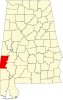 | |
| CDP | ||
| Unincorporated communities | ||
| Footnotes | ‡This populated place also has portions in an adjacent county or counties | |