
Cape May County, New Jersey
Cape May County | |
|---|---|
 Sunset onSunset BeachinLower Townshipin May 2009 | |
 Flag  Seal | |
 Location within the U.S. state ofNew Jersey | |
 New Jersey's location within theU.S. | |
| Coordinates:39°05′N74°52′W/ 39.08°N 74.86°W | |
| Country | |
| State | |
| Founded | 1685 |
| Named for | Cornelius Jacobsen Mey |
| Seat | Cape May Court House |
| Largest municipality | Lower Township(population) Middle Township(area) |
| Government | |
| • Commission Director | Leonard C. Desiderio (R,term ends December 31, 2024) |
| Area | |
| • Total | 620.31 sq mi (1,606.6 km2) |
| • Land | 251.52 sq mi (651.4 km2) |
| • Water | 368.79 sq mi (955.2 km2) 59.5% |
| Population | |
| • Total | 95,263 |
| • Estimate | 94,610 |
| • Density | 378.9/sq mi (146.3/km2) |
| Congressional district | 2nd |
| Website | capemaycountynj |

Cape May Countyis the southernmostcountyin theU.S. stateofNew Jersey.Much of the county is located on theCape Maypeninsula, bound by theDelaware Bayto its west and theAtlantic Oceanto its south and east. Adjacent to the Atlantic coastline are fivebarrier islandsthat have been built up asseaside resorts.A consistently popular summer destination with 30 miles (48 km) of beaches, Cape May County attracts vacationers from New Jersey and surrounding states, with the summer population exceeding 750,000. Tourism generates annual revenues of about $6.6 billion as of 2018, making it the county's single largest industry. The associated leisure and hospitality industries are Cape May's largest employers. Itscounty seatis theCape May Court Housesection ofMiddle Township.[5]The county is part of both theJersey Shore[6]andSouth Jerseyregions of the state.[7]
As of the2020 census,the county was the state'ssecond-least populous county,[8][9]with a population of 95,263,[2][3]a decrease of 2,002 (−2.1%) from the2010 censuscount of 97,265,[10]which in turn reflected a decline of 5,061 (-4.9%) from the 102,326 counted in the2000 census.[11]The county is part of theOcean City,NJmetropolitan statistical areaand thePhiladelphia-Reading-Camden,PA-NJ-DE-MDcombined statistical area,also known as theDelaware Valley.[12]
Before Cape May County was settled by Europeans, theKechemechetribe of theLenapeNative AmericansinhabitedSouth Jersey.Beginning in 1609, European explorers purchased land from, and contributed to the decline of, the indigenous people. The county was named forCornelius Jacobsen Mey,aDutchcaptain who explored and charted the area from 1620 to 1621, and established a claim for the province ofNew Netherland.In 1685, the court of Cape May County was split from neighboringBurlington County,although the boundaries were not set until seven years later. In 1690,Cape May(originally known asCape Island) was founded, becoming America's oldestseaside resort.
The county was subdivided into threetownshipsin 1798:Lower,Middle,andUpper.The other 16 municipalities in the county, including two no longer in existence, were established between 1827 and 1928. In 1863, the first railroad in the county opened, which carried crops from the dominant farming industry. Railroads later led to the popularity of the county's coastal resorts. The need for improved automotive access to the county led to the development of theGarden State Parkway,which opened in 1956.
The most populous place wasLower Townshipwith 22,057 residents in the 2020 census,[3]and its geographically largest municipality isMiddle Township,which covers 82.96 square miles (214.9 km2).[13]
History[edit]
Etymology[edit]

Before Cape May County was settled by Europeans, theindigenousKechemechetribe of theLenapepeople inhabitedSouth Jersey,and traveled to the barrier islands during the summer to hunt and fish.[14][15][16]During the 17th century, the area that is now Cape May County was claimed as part ofNew Netherlands,New Sweden,theProvince of New Jerseyunder the British crown, and laterWest Jersey.[14]On August 28, 1609, English explorerHenry Hudsonentered theDelaware Bayand stayed one day on land, north of what is nowCape May Point.[17]As early as 1666, the southern tip of New Jersey was known asCape Maey,named after Dutch explorerCornelius Jacobsen May,who sailed the coastline of New Jersey from 1620 to 1621.[18]In 1630, representatives of theDutch West India Companypurchased a 16 sq mi (41 km2) tract of land along the Delaware from indigenous people, and bought additional land 11 years later.[17]Due to the large number of whales in the region of Cape May, Dutch explorers founded Town Bank around 1640 along the Delaware Bay as a whaling village. It was the first European settlement in what is now Cape May County, and was populated by descendants ofPlymouth County.[17][19]
History[edit]
In 1685, the court of Cape May was split fromBurlington County,which at that time encompassed all or nearly all of South Jersey.[14]In 1690, a settlement began atCape Island(nowCape May). As whaling declined due to overpopulation, Town Bank diminished in importance in favor of Cape May, and was largely washed away by 1750.[19][20][21]In 1692, Cape May County was designated as one of the original four counties of West Jersey, defined as the land from the most northerly portion ofGreat Egg Harbor Bayto a point 20 mi (32 km) east of the mouth of theMaurice River(calledWest Creek), south to the tip of Cape May. The limits of the county were adjusted over the next two centuries, mostly the portion nearMaurice River Township.[14]The first water mill in the county was constructed in 1699 inCold Spring.Nearby, the First Baptist Church was built in 1712, and the firstCold Spring Presbyterian Churchwas built in 1718. Both churches, as well as nearby private homes, functioned as the center of early county government.[17]
In 1744, the county chose Romney Marsh – laterCape May Court House– near the county's center to become the county seat. The first jail and courthouse were built in 1764.[22][17]The county's population was around 1,000 in 1750, isolated from the rest of New Jersey by forests.[22]Cape May grew independently as America's oldestbathing resortby 1765, leading to the city's current motto "The Nation's Oldest Seashore Resort".[17][23]Amid the British blockade of the Delaware Bay in theAmerican Revolutionary War,two British ships pursued and attacked the AmericanbrigNancy,which fled to the coast atTurtle Gut Inlet(located inWildwood Cresttoday). TheNancywas abandoned and sabotaged, killing at least 30 British sailors when the brig exploded after they boarded.[24]TheBattle of Turtle Gut Inleton June 29, 1776, was the only Revolutionary War battle fought in the county.[25]
Cape May County was split into threetownshipson February 21, 1798 –Lower,Middle,andUpper.The three townships were previously established asprecinctson April 2, 1723.[14][19]During theWar of 1812,British forces raided farms in the county for food and fresh water. In retaliation, residents dug canals to the ocean, making the water no longer drinkable.[25]In 1827,Dennis Townshipwas created from portions of Upper Township,[14]101 years after its namesakeDennisvillewas founded in 1726.[17]The oldest independentboroughin the county wasCape Island Boroughin 1848, which became the city of Cape May in 1869.[14]Over the next 60 years as transport to the region improved, most of the current municipalities in the county were created.[14]Sea Grove, later renamed Cape May Point, was founded in 1875. In 1879,Ocean Citywas founded as a religious retreat.[19]Sea Isle Citywas founded in 1882, followed byWest Cape Mayin 1884. In 1885, Anglesea (renamedNorth Wildwoodin 1906) and Holly Beach (later a part ofWildwood) were founded.[14]A land development company establishedAvalonin 1887. In 1891,Woodbinewas founded on the mainland as an agriculture settlement forRussian Jewswho fled religious persecution.[19]From 1894 until 1945,South Cape Mayexisted as an independent borough until it was largely destroyed by the1944 Great Atlantic hurricane.[14][26]In 1906, the eastern coastal boundary of Cape May County was established at a point 3nautical miles(3.5 mi; 5.6 km) east of the coast.[14]The last municipalities to be established were Wildwood Crest (in 1910),Stone Harbor(in 1914), andWest Wildwood(in 1920).[14]In 1928,North Cape Maywas founded, but was dissolved in 1945 after it failed to attract development following theGreat Depression.[14][27]
DuringWorld War II,Cape May Canalwas built to connect the Delaware Bay and Cape May Harbor, completed in March 1943.[28]The completion of theGarden State Parkwayin 1955 brought hundreds of thousands of tourists, as well as a larger year-round population.[27]Since the 1970s, the mainland has become more developed, due to the high cost of building on the barrier islands. Commercial development concentrated alongU.S. Route 9inRio Grande,Cape May Court House, andMarmora.[23]Concurrent with the1980 Presidential election,Cape May County residents voted in favor to create a new state of South Jersey along with five other counties in a nonbinding referendum.[29]
Geography and climate[edit]
Cape May County is 29 mi (47 km) long and 15 mi (24 km) at its widest.[19]According to theU.S. Census Bureau,as of the 2020 Census, the county had a total area of 620.31 square miles (1,606.6 km2), of which 251.52 square miles (651.4 km2) was land (40.5%) and 368.79 square miles (955.2 km2) was water (59.5%).[1]The county is located about 150 mi (240 km) south ofNew York City,80 mi (130 km) southeast ofPhiladelphia,and 150 mi (240 km) east ofWashington, D.C.[19]To the south and east of the county is theAtlantic Ocean.[30]The location near water provides milder temperatures than surrounding areas, as well as a continuous breeze, which contribute to the area's tourism-driven economy.[19]Sea levelalong the coast is the lowest point. The highest elevation is found at three areas inBelleplain State Forestin the county's northern corner, which are approximately 60 ft (18 m) above sea level.[31]
Overall, the county is flat and coastal. Much of Cape May County lies on theCape May Peninsula,which is part of theAtlantic coastal plain.The peninsula is bounded to the west by theDelaware Bay,and to the east is 1.5 to 3 mi (2.4 to 4.8 km) ofmarshesand water channels making up theIntracoastal Waterway.[19]There are over 1,574 mi (2,533 km) of streams and rivers in the county, with theGreat Egg Harbor Riverand its tributaries covering the northern portion of the county. There are also 24,150 acres (9,770 ha) of ponds, lakes, bays, and reservoirs.[23]There are five barrier islands, measuring 32 mi (51 km) in total, that are adjacent to the mainland. The islands have gently-slopedbeachesand are largely built up.[19]There were only four barrier islands from 1922, when Turtle Gut Inlet was filled in to create Wildwood Crest, until 1945, when Cape May Canal was constructed through the southern portion of the county.[19][32][28]
Climate[edit]
| Cape May Court House, New Jersey | ||||||||||||||||||||||||||||||||||||||||||||||||||||||||||||
|---|---|---|---|---|---|---|---|---|---|---|---|---|---|---|---|---|---|---|---|---|---|---|---|---|---|---|---|---|---|---|---|---|---|---|---|---|---|---|---|---|---|---|---|---|---|---|---|---|---|---|---|---|---|---|---|---|---|---|---|---|
| Climate chart (explanation) | ||||||||||||||||||||||||||||||||||||||||||||||||||||||||||||
| ||||||||||||||||||||||||||||||||||||||||||||||||||||||||||||
| ||||||||||||||||||||||||||||||||||||||||||||||||||||||||||||
Given its maritime influence and southernmost location within New Jersey, Cape May County has a more moderate climate than surrounding areas. During the summer, the county is often 3–5 degrees cooler, and 5–10 degrees warmer in the winter.[34]Much of the county is inUSDA plant hardiness zone7a/7b, with a small portion in the county's southeastern extreme in zone 8a. This equates to an average annual minimum temperature of 0 to 10 °F (−18 to −12 °C).[35]The average temperatures in the county seat of Cape May Court House range from a low of 22 °F (−6 °C) in January to a high of 85 °F (29 °C) in July, although a record low of −22 °F (−30 °C) was recorded in January 1942 and a record high of 103 °F (39 °C) was recorded in July 1993. Average monthly precipitation ranged from 2.91 inches (74 mm) in June to 4.68 inches (119 mm) in August,[33]and annual precipitation is around 40 in (1,000 mm). The region typically gets 10 to 15 in (250 to 380 mm) of snowfall each year, much less than the mountains of New Jersey.[36]According to theKöppen climate classificationsystem, Cape May County has ahumid subtropical climate(Cfa).[37]According to theTrewartha climate classificationthis climate isDo(oceanic.) The county has windy conditions throughout the year.[38]
Owing to its location along the coast, Cape May County has experienced the effects oftropical cyclonesfor centuries. InWhale BeachonLudlam Island,core samplessuggested the passage of an intense hurricane sometime between 1278 and 1438.[39]Thenext significant hurricanein the area was September 3, 1821. Around 1800UTC(2:00 pmlocal time), theeyeof the hurricane crossed over Cape May, estimated as aCategory 4on theSaffir–Simpson scale.It is estimated that an identical hurricane to the 1821 storm in the 21st century would cause over $1 billion in damage in Cape May County, and $107 billion in damage nationwide.[40]TheGale of 1878flooded Cape May County and produced 84 mph (135 km/h) winds.[41]During the passage ofHurricane Gloriain 1985, Ocean City recorded a wind gust of 101 mph (163 km/h).[42]Hurricane Sandystruck the state on October 31, causing at least $150 million in damage in the county from its high winds and high tides. At the terminal for the Cape May–Lewes Ferry in North Cape May, Sandy produced the highest tide on record at 8.9 ft (2.7 m), surpassing the previous record of 8.8 ft (2.7 m) set by Hurricane Gloria.[43][44]
Cape May County has experienced a variety of other weather effects. In March 1962, astalled coastal stormproduced several days of extremely high tides along the barrier islands, which damaged the boardwalks of Cape May, Avalon, and Sea Isle City.[45][46]The1991 Perfect Stormproduced high tides andbeach erosion.[47]In January 2016,a blizzardnicknamed "Winter Storm Jonas" produced record high tides in the county, reaching 9.0 ft (2.7 m) at the terminal for Cape May–Lewes Ferry, surpassing that of Hurricane Sandy. Nearly every municipality in the county reported damage, and in coastal towns, the beaches were severely eroded.[44][48]Since 1950, ten tornadoes have touched down in the county.[49]
Flora and fauna[edit]

The uplands, wetlands, and open waters of the county support one of the largest concentration of migratory birds in North America. Nearly 900,000 migratory birds were observed in 1995 in Avalon. Along the Delaware Bay, 800,000 to 1.5 million birds pass through the area each spring.[30]In 1947, theStone Harbor Bird Sanctuarywas established, which was designated as aNational Natural Landmarkin 1965.[50]In addition to the 151 species of birds that frequent the county, there are two species of whales, theloggerhead sea turtle,thenorthern pine snake,two species of treefrog, and thetiger salamanderthat inhabit the waters of Cape May County. Eight species of fish and four species of shellfish populate the coastal waters.[30]
About 30% of the county is covered by forests that runs the length of the Cape May peninsula and connects with the Pinelands.[19][30]The largely unfragmented forest provides breeding grounds for thebarred owl,red-shouldered hawk,andwood thrush,and also provides habitat for insects and migratory birds. In the county'sswampyinterior, there are over 20 species of trees and 40 species of shrubs. About 42% of the county consists of wetlands. The marshes between the mainland and the barrier island are dominated by thecommon reed,narrow-leaved cattail,bulrushes,andsmooth cordgrass.Along the beach, theAmerican beachgrasspredominantly make up dune systems, along with other plant species.[30]
The county utilizes five undergroundaquifers,including two that derive from theKirkwood-Cohansey aquifer.Severe storms resulted insaltwater intrusionof the county's freshwater supply.[51]The suitable growing conditions led to West Cape May considering itself the "lima beancapital of the world ", until Guatemala surpassed it in the 1990s. The city still hosts an annual lima bean festival.[52]
Geology[edit]
The oldest rocks in the county are at a depth of 5,000 ft (1,500 m), formed during thePrecambrianera. Thesemetamorphic rocksincludegneiss,quartzite,andschist.During thePaleozoicera, the region was part of a mountainous landmass that extended from the Arctic to Mexico. Erosion during theTriassicandJurassicperiods formed valleys that gathered sediment, which deposited and layered as the coastline receded and rose. In thePaleoceneandEoceneepochs, as well as the laterMioceneepoch, the area that is now Cape May County was under water. The coastline receded again during theQuaternaryperiod.[53]
During theSangamonianinterglacialperiod, melting glaciers formed rivers that carried sediment to the coast. The Bridgeton Formation deposited silt and clay through afluvialprocess, while the later Cape May Formation deposited sand, silt, clay, and gravel. TheGreat Egg Harbor Riverin its formative stage produced adeltathat covered much of what is now Cape May County with sediment. During the most recent ice age (Wisconsin glaciation), the sea level dropped to 430 ft (130 m) below its current depth. Around 14,000 years ago, glaciers began melting, and thebarrier islandsof Cape May County formed, likely fromspitsand lines ofdunes.[53]
Demographics[edit]
| Census | Pop. | Note | %± |
|---|---|---|---|
| 1790 | 2,571 | — | |
| 1800 | 3,066 | 19.3% | |
| 1810 | 3,632 | 18.5% | |
| 1820 | 4,265 | 17.4% | |
| 1830 | 4,936 | 15.7% | |
| 1840 | 5,324 | 7.9% | |
| 1850 | 6,433 | 20.8% | |
| 1860 | 7,130 | 10.8% | |
| 1870 | 8,349 | 17.1% | |
| 1880 | 9,765 | 17.0% | |
| 1890 | 11,268 | 15.4% | |
| 1900 | 13,201 | 17.2% | |
| 1910 | 19,745 | 49.6% | |
| 1920 | 19,460 | −1.4% | |
| 1930 | 29,486 | 51.5% | |
| 1940 | 28,919 | −1.9% | |
| 1950 | 37,131 | 28.4% | |
| 1960 | 48,555 | 30.8% | |
| 1970 | 59,554 | 22.7% | |
| 1980 | 82,266 | 38.1% | |
| 1990 | 95,089 | 15.6% | |
| 2000 | 102,326 | 7.6% | |
| 2010 | 97,265 | −4.9% | |
| 2020 | 95,263 | −2.1% | |
| 2023 (est.) | 94,610 | [2][4] | −0.7% |
| Historical sources: 1790-1990[54] 1970-2010[13]2000[11]2010[10]2020[2][3][55] | |||
2020 census[edit]
As of the2020 U.S. census,the county had 95,263 people, 40,939 households, and 26,792 families. Thepopulation densitywas 378.9 inhabitants per square mile (146.3/km2). There were 99,606 housing units at an average density of 396.2 per square mile (153.0/km2). The county's racial makeup was 85.6%White,3.74%African American,0.26%Native American,0.95%Asian,and 5.95% from two or more races.HispanicorLatinoof any race were 7.83% of the population.
There were 40,939 households, of which 23.8% had children under the age of 18 living with them, 52.7% weremarried couplesliving together, 26.3% had a female householder with no husband present, 15.5% had a male householder with no wife present and 34.5% were non-families. 15.1% of all households were made up of individuals, and 15.8% had someone living alone who was 65 years of age or older. The average household size was 2.19 and the average family size was 2.70.
About 17.6% of the county's population was under age 18, 6.7% was from age 18 to 24, 29.2% was from age 15 to 44, and 27.0% was age 65 or older. The median age was 50.5 years. The gender makeup of the county was 48.4% male and 51.5% female. For every 100 females, there were 94.0 males.
The county's median household income was $69,980, and the median family income was $83,695. About 8.8% of the population were below thepoverty line,including 14.2% of those under age 18 and 6.2% of those age 65 or over.[56]
Cape May County is part of theOcean City,NJMetropolitan Statistical Area,as well as thePhiladelphia-Reading-Camden,PA-NJ-DE-MDCombined Statistical Area.[57]
2010 census[edit]
The2010 United States censuscounted 97,265 people, 40,812 households, and 25,956 families in the county. The population density was 386.9 inhabitants per square mile (149.4/km2). There were 98,309 housing units at an average density of 391 per square mile (151/km2). The racial makeup was 89.83% (87,369)White,4.69% (4,565)Black or African American,0.21% (205)Native American,0.86% (834)Asian,0.04% (36)Pacific Islander,2.47% (2,399) fromother races,and 1.91% (1,857) from two or more races.Hispanic or Latinoof any race were 6.22% (6,054) of the population.[10]
Of the 40,812 households, 21.6% had children under the age of 18; 48.3% were married couples living together; 11% had a female householder with no husband present and 36.4% were non-families. Of all households, 31.2% were made up of individuals and 15.5% had someone living alone who was 65 years of age or older. The average household size was 2.32 and the average family size was 2.89.[10]
18.9% of the population were under the age of 18, 8% from 18 to 24, 20.1% from 25 to 44, 31.6% from 45 to 64, and 21.6% who were 65 years of age or older. The median age was 47.1 years. For every 100 females, the population had 94.6 males. For every 100 females ages 18 and older there were 92.4 males.[10]
As of the 2010 census, there were 98,365 houses in the county, of which only 42% were occupied year round. There are 47 campgrounds with 17,999 campsites, greater than the number of campsites in all other counties in the state combined. There are also 18,700 hotel rooms in the county.[23]Themedian household incomeof the county was $57,168 as of 2013, the fourth-lowest of New Jersey's 21 counties. About 10% of residents live below thefederal poverty line.The county ranked last in the state in terms of residents with Assets Limited, Income Constrained, and Employed (ALICE), representing nearly one-third of the county's residents.[58]
Government[edit]
County government[edit]
Cape May County is governed by aBoard of County Commissionersconsisting of five members electedat-largein partisan elections to serve three-year terms of office on a staggered basis, with either one or two seats up for vote as part of the November general election. At an annual reorganization meeting held in January, the board selects a director and deputy director from among its members.[59]In 2016, commissioners were paid $17,973 and the director was paid an annual salary of $18,973.[60]No Democrat has won countywide office sinceJeff Van Drewdid so in 2000. As of 2024[update],Cape May County's commissioners are (with terms for director and vice director ending every December 31):[61]
| Commissioner | Party, Residence, Term |
|---|---|
| Director Leonard C. Desiderio | R,Sea Isle City,2024[62] |
| Vice Director Andrew Bulakowski | R,Lower Township,2025[63] |
| Robert Barr | R.Ocean City,2025[64] |
| Will Morey | R,Wildwood Crest,2026[65] |
| Melanie Collette | R.Middle Township,2026[66] |
Each county in New Jersey is required by theNew Jersey State Constitutionto have three elected administrative officials known as "constitutional officers." These officers are theCounty ClerkandCounty Surrogate(both elected for five-year terms of office) and theCounty Sheriff(elected for a three-year term).[67]Cape May County's Constitutional Officers are:[68][61]
| Title | Representative |
|---|---|
| County Clerk | Rita Marie Rothberg (R, 2025, Ocean City)[69][70][71] |
| Sheriff | Robert Nolan (R, 2026, Lower Township)[72][70][73] |
| Surrogate | E Marie Hayes (R, 2028, Ocean City)[74][75] |
The Cape May County Prosecutor is Jeffrey H. Sutherland, who was appointed to the position byGovernor of New JerseyChris Christieand sworn into office on December 21, 2017.[76]Cape May County, along withAtlantic County,is part of Vicinage 1 ofNew Jersey Superior Court.Atlantic Countyhas a civil courthouse inAtlantic City,while criminal cases are heard inMays Landing;the Assignment Judge for Vicinage 1 is Julio L. Mendez.[77]
Law Enforcement[edit]
The currentcounty sheriffis Bob Nolan, elected in 2017 after working in the sheriff's office for 30 years, most recently asundersheriff.[78]The first county sheriff was Benjamin Godfrey in 1692. Aside from maintaining law and order, the sheriff's responsibilities include the sale of property, overseeing the corrections facility, transporting of jurors, and collecting court-ordered judgments. The first county jail was built in 1705 in Middle Township, and the current jail was built in 1977.[79]A new facility is scheduled to be completed in August 2018, at the cost of $37 million.[80][81][82]In 2015, Cape May County had 3,332 criminal offenses, the fifth fewest of any county in New Jersey. This represented a crime rate of 35.1 offenses per 1,000 people, and a violent crime rate of 4.7 offenses per 1,000 people.[83]
Federal representatives[edit]
The 2nd Congressional District covers all of Cape May County.[84][85]For the118th United States Congress,New Jersey's 2nd congressional districtis represented byJeff Van Drew(R,Dennis Township).[86]
State representatives[edit]
The county lies entirely within the 1st Legislative District.[87]
| District | Senate[88] | Assembly[88] | Notes |
|---|---|---|---|
| 1st | Mike Testa(R) | Antwan McClellan(R) | The remainder of this district covers portions of Atlantic County and Cumberland County. |
Politics[edit]
Though New Jersey is generallyDemocraticin recent state-wide elections, Cape May County is a mostlyRepublicancounty, with the highest percentage of voters registered as Republicans of any county in the state. As of October 1, 2021, there were a total of 74,585 registered voters in Cape May County, of whom 31,859 (42.7%) were registered asRepublicans,18,498 (24.8%) were registered asDemocratsand 23,325 (31.3%) were registered asunaffiliated.There were 903 voters (1.2%) registered to other parties.[89]Among the county's 2010 Census population, 69.9% were registered to vote, including 81.1% of those ages 18 and over.[90][91]
In the2008and2012 United States presidential elections,Republicans carried the county by an 8.6% margin overBarack Obama.[92]However, in2016and2020,Republican Donald Trump won the county by more than 15 points. Despite the county's strong Republican lean, at least one Democrat has won the county in recent years. In 2018, DemocratJeff Van Drewoutpolled Republican Seth Grossman in the county by a margin of 21,595 (52.6%) to 19,003 (46.3%) in that year'scongressional election.Although, Van Drew changed his partisan affiliation in 2019 and won the county as a Republican over Democratic challenger Amy Kennedy by a margin of 34,627 (60.7%) to 21,899 (38.4%).
| Year | Republican | Democratic | Third party | |||
|---|---|---|---|---|---|---|
| No. | % | No. | % | No. | % | |
| 2020 | 33,158 | 57.24% | 23,941 | 41.33% | 834 | 1.44% |
| 2016 | 28,446 | 57.75% | 18,750 | 38.07% | 2,061 | 4.18% |
| 2012 | 25,781 | 53.61% | 21,657 | 45.03% | 655 | 1.36% |
| 2008 | 27,288 | 53.52% | 22,893 | 44.90% | 802 | 1.57% |
| 2004 | 28,832 | 56.80% | 21,475 | 42.31% | 455 | 0.90% |
| 2000 | 23,794 | 49.99% | 22,189 | 46.62% | 1,611 | 3.38% |
| 1996 | 19,357 | 42.98% | 19,849 | 44.07% | 5,830 | 12.95% |
| 1992 | 21,502 | 44.01% | 17,324 | 35.46% | 10,030 | 20.53% |
| 1988 | 28,738 | 65.14% | 15,105 | 34.24% | 274 | 0.62% |
| 1984 | 28,786 | 68.06% | 13,378 | 31.63% | 133 | 0.31% |
| 1980 | 22,729 | 59.08% | 12,708 | 33.03% | 3,034 | 7.89% |
| 1976 | 19,498 | 53.18% | 16,489 | 44.97% | 680 | 1.85% |
| 1972 | 22,621 | 70.54% | 8,729 | 27.22% | 719 | 2.24% |
| 1968 | 14,970 | 53.14% | 9,664 | 34.30% | 3,538 | 12.56% |
| 1964 | 11,390 | 43.18% | 14,943 | 56.65% | 47 | 0.18% |
| 1960 | 16,076 | 61.31% | 10,137 | 38.66% | 9 | 0.03% |
| 1956 | 16,887 | 74.02% | 5,897 | 25.85% | 31 | 0.14% |
| 1952 | 15,218 | 68.52% | 6,984 | 31.45% | 7 | 0.03% |
| 1948 | 11,227 | 64.46% | 6,031 | 34.63% | 159 | 0.91% |
| 1944 | 8,252 | 54.60% | 6,835 | 45.22% | 27 | 0.18% |
| 1940 | 9,429 | 52.55% | 8,485 | 47.29% | 30 | 0.17% |
| 1936 | 8,531 | 47.52% | 9,363 | 52.16% | 58 | 0.32% |
| 1932 | 10,112 | 57.84% | 7,160 | 40.96% | 210 | 1.20% |
| 1928 | 12,207 | 76.40% | 3,731 | 23.35% | 40 | 0.25% |
| 1924 | 8,139 | 72.37% | 2,611 | 23.22% | 496 | 4.41% |
| 1920 | 5,785 | 70.76% | 2,198 | 26.89% | 192 | 2.35% |
| 1916 | 2,904 | 56.85% | 2,097 | 41.05% | 107 | 2.09% |
| 1912 | 909 | 18.08% | 2,124 | 42.24% | 1,996 | 39.69% |
| 1908 | 2,937 | 63.27% | 1,553 | 33.46% | 152 | 3.27% |
| 1904 | 2,832 | 66.56% | 1,238 | 29.10% | 185 | 4.35% |
| 1900 | 2,253 | 62.46% | 1,109 | 30.75% | 245 | 6.79% |
| 1896 | 2,136 | 65.48% | 929 | 28.48% | 197 | 6.04% |
In the2009 gubernatorial election,RepublicanChris Christiereceived 54.34% of the vote (18,992 votes) to Democratic Governor Jon Corzine's 38.28% of the vote (13,379 votes), while Independent Chris Daggett won 6.08% (2,126 votes). In the2013 gubernatorial election,Republican Chris Christie received 23,531 votes in the county (71.6%), ahead of DemocratBarbara Buonowith 8,798 votes (26.7%). In the2017 gubernatorial election,RepublicanKim Guadagnoreceived 16,118 (53.2%) of the vote, and DemocratPhil Murphyreceived 13,566 (44.8%) of the vote. In the2021 gubernatorial election,RepublicanJack Ciattarellireceived 62.8% of the vote (24,260 ballots cast) to DemocratPhil Murphy's 36.7% (14,183 votes).[94]
| Year | Republican | Democratic |
|---|---|---|
| 2021 | 62.8%24,260 | 36.7%14,183 |
| 2017 | 53.2%16,118 | 44.8%13,566 |
| 2013 | 71.6%23,531 | 26.7%8,798 |
| 2009 | 54.3%18,992 | 38.3%13,379 |
| 2005 | 50.9%16,179 | 45.2%14,375 |
| 2001 | 49.5%17,471 | 48.5%17,118 |
| 1997 | 49.5%18,227 | 41.8%15,395 |
| 1993 | 44.2% | 53.3% |
| 1989 | 43.4%15,408 | 55.3%19,642 |
| 1985 | 74.6%23,331 | 24.5%7,665 |
| 1981 | 59.2%18,488 | 39.3%12,274 |
| 1977 | 43.9%13,307 | 52.2%15,814 |
| 1973 | 65.1%18,227 | 36.7%10,261 |
Economy[edit]
The primary job sectors in Cape May County are related to hotel accommodation, food service, retail, health care/aide, arts/entertainment, and construction.[58]Historically, Cape May County's economy was driven by whaling and farming, until seasonal resorts were built in the 19th century. These industries remain a part of the county's job sector, along withagritourism,and around 30,000 people in the private industry. The largest employer isMorey's Piers,[96]which hires 1,500 people.[97]Cape Regional Medical Centerhires over 1,000 people. More than 10,000 people are in the hospitality sector.[96]As of February 2018, the unemployment rate in Cape May County was 14.3%, significantly more than the 5.2% unemployment rate in August 2017. Each year, the unemployment rate peaks in the wintertime and drops in the summertime,[98]reflective of the county's dependence on seasonal tourism-driven jobs.[96]As of February 2018, Cape May County had the highest unemployment rate in New Jersey, followed by neighboring Atlantic and Cumberland counties.[99]
TheBureau of Economic Analysiscalculated that the county'sgross domestic productwas $5.0 billion in 2021, which was ranked 19th in the state and was a 6.4% increase from the prior year.[100]
As of 2018, the tourism industry generated about $6.6 billion worth of income in Cape May County, representing 43% of county employment. Retail, food, and beverage represented $2.6 billion, while camping and lodging represented about $2.4 billion in expenditures. Recreational activities generated $708 million in expenditures. Eco-tourism generated $670 million, and transportation costs were $390 million.[101]There is little heavy industry in the county due to environmental concerns.[23][102]
Tourism[edit]

The majority of Cape May County's industry is tourism, due to its beaches and location between theDelaware Bayand the Atlantic Ocean. During the summer season (which traditionally ranges fromMemorial DaytoLabor Day), tourists often outnumber locals 9 to 1. As of 2010, the four largest markets for tourism in Cape May County wereGreater Philadelphia,North Jersey,New York,and the Canadian province ofQuébec.[103]
In addition to sales tax, hotel occupancy tax and other assessments charged throughout the state, tourism-related business inNorth Wildwood,WildwoodandWildwood Crest,such as hotels and restaurants, are required to collect an additional 2% tourism sales tax that is used to cover costs for promoting tourism.[104]
Beginning in 1968 the county government began campaigns to attract tourists from Canada. In 1970 it established a tourism office inMontrealand later made strides to get tourists from other parts of Quebec. The county government made efforts to train tourism establishments on how to receive French-speaking Canadian tourists.[105]In 1991, Canadian tourism into Cape May County remained strong despite an economic recession occurring in Canada.[106]As of 1993, most Canadian tourists to the county wereFrancophones,who typically began their visits during the final two weeks of the month of July, when many Canadians working in the construction and garment sectors receive two-week paid time off.[107]Most of the French Canadian tourists who visit Cape May County stay in hotels in The Wildwoods or campgrounds on the mainland.[108]In the 1990s, Cape May County established aninternational tourismoffice inMontréal,along St. Catherine's Street,[109][110]but closed it around 1995, due to budget cuts. By 2010 the tourism office of Cape May County established a French language coupon booklet.[111]In 2010, Cape May County tourism director estimated that 13% of visitors to the region originated from Quebec.[103]
Beach tagsare required for beach access in some of the most popular beaches and are collected under the terms of a 1955 state law that allows oceanfront municipalities to charge "reasonable fees" for providing safety and maintenance at the beaches.[112]The highest seasonal beach tag fee in the county was $35.[113]The sale of daily, weekly and seasonal tags is a major source of revenue for the communities, with the six beachfront communities in Cape May County that charge for beach tags generating $10 million in revenue in 2016. Ocean City brought in $4.1 million in revenue in the 2016 season, the most of any municipality in the state.[114]In the 2017 budget, the projected $4.1 million in fees for beach tag and $3 million for parking were two of Ocean City's biggest revenue sources, accounting for almost 9% of the city's annual budget of almost $80 million.[115]Cape May City, with revenue of $2.2 million, was ranked third in the state.[114]Four of the five municipalities in the state with guarded oceanfront beaches available with free public access are in the county, includingStrathmereinUpper Townshipand the Wildwoods communities ofNorth Wildwood,WildwoodandWildwood Crest.[116]
Fishing and farming[edit]

Fishing has been an important industry in Cape May County since at least the 17th century, when the county's first European settlement was founded as a whaling village. In 1693, whaling proved such a successful industry thatcolonial GovernorAndrew Hamiltoninstituted a 10% tax on whale products. By the mid-1700s, overfishing had diminished the whale population in the region.[19]In the early 1800s, shipbuilding was an important industry, which declined by the 1850s.[22]Fishing remains an important aspect of Cape May County's economy. In 2016, the combined port of Cape May and Wildwood ranked the ninth largest commercial fishing port in the United States as measured by monetary value, as well as the second largest on the east coast, only afterNew Bedford.Fishermen brought in 47 million lbs (21 million kg) of seafood, mainly scallops, worth $85 million (2016 USD).[117][118]This was up from $73.7 million in 2009, when the overall market value of the port was estimated at $442 million, making it the fourth most valuable port in the country. In the 1980s, the scallop industry was worth only $15 million in the state of New Jersey. In 1990, laws limiting the catch and area of scallops led to a healthier and steadier population to harvest, which allowed for growth in the industry.[119]Cold Spring Fish and Supply Company provides 500 jobs and is the county's third-largest employer.[120]
Farming became an important industry in the county by the 19th century, when nearly 70,000 acres (28,000 ha), or about 40% of the county's land area, was involved in farming. The industry's popularity led to the first freight railroad in 1863, and continued to be a fixture of the county's economy until the 1960s.[19] There is an annuallima beanfestival in West Cape May featuring foods made with the locally grown lima beans.[121]
Education[edit]
There are 16 school districts operating schools, two of them countywide, and three non-operating school districts.
School districts include:[122][123][124][125]
K-12
- Cape May County Special Services School District(countywide for special education)
- Middle Township Public Schools
- Ocean City School District
- Wildwood City School District
Secondary
Elementary (K-8, except as noted)
- Avalon School District
- Cape May City School District(K-6)
- Dennis Township Public Schools
- Lower Township School District(K-6)
- North Wildwood School District
- Stone Harbor School District
- Upper Township School District
- West Cape May School District(K-6)
- Woodbine School District
- Wildwood Crest School District
Non-operational
- Cape May Point School District(non-operating since 1931)
- Sea Isle City School District(non-operating since 2012)
- West WildwoodSchool District
There are 25 publicelementaryand/ormiddleschools in Cape May County, including two in Avalon and Stone Harbor (which, since 2011, agree to share each other's schools),[126]one in Cape May,[127]two in Dennis Township,[128]five in Lower Township,[129][130]three in Middle Township,[131]one in North Wildwood,[132]two in Ocean City,[133]three in Upper Township,[134]one in West Cape May,[135]three in Wildwood,[136]one in Wildwood Crest,[137]and one in Woodbine.[138]
The following public high schools are in the county:
- Cape May County Technical High School[139]
- Lower Cape May Regional High School,[140]
- Middle Township High School[131]
- Ocean City High School[133]
- Wildwood High School[136]
There are also nineprivate schoolsin the county:[141]
- Bishop McHugh Regional Catholic School(Catholic; Cape May Courthouse)
- Cape Christian Academy (Christian; Cape May Courthouse)
- Cape Trinity Catholic School (Catholic; Wildwood)
- Central Bible Church (Presbyterian;Wildwood)
- Families United Network Academy (Christian; Ocean View)
- Rio Grande Baptist Academy (Baptist;Rio Grande)
- Tomorrow's World Early Education (Non-religious,Montessori;Marmora)
- Westminster Christian Academy (Calvinist;Ocean City)
- Wildwood Catholic Academy(Catholic; Wildwood)
As of 2013, 31% of county residents had at least a bachelor's degree, and 89.7% had at least a high school diploma.[58]In 1973,Atlantic Community Collegebegan offering night classes at Middle Township High School. In 1999, the college name was formally changed toAtlantic Cape Community College,and a full service campus was opened in 2005 in Cape May Court House.[142]The community college has partnerships withFairleigh Dickinson University,Rutgers University,andStockton University.[143]
The Cape May County Library has locations in Cape May, Cape May Court House, Lower Township, Stone Harbor, Sea Isle, Upper Township, Wildwood Crest, and Woodbine, as well as abookmobile.[144]Ocean City also has its own independent library.[145]
Services[edit]
Cape Regional Medical Centeropened as Burdette Tomlin Memorial Hospital in 1950, keeping that name until 2007. It is the only hospital in the county. The facility has expanded over time since its foundation, and now has 242 beds, with a staff of 1,060 people, to service the population and tourists in the county.[146][147]AtlantiCareopened twourgent carecenters in the county since the 1990s.[148]From 2010 to 2015,opioid prescriptionsrose 11%, in terms of the amount of morphine milligram equivalents (MME) per person. This rise was among the top 20% of counties nationally, and the second-highest in New Jersey.[149]In the period from 2011 to 2015, health conditions in the county deteriorated, falling to 19th in a survey of New Jersey's 21 counties for child well-being; only neighboring Cumberland and Atlantic counties were worse.[150]The countymortality ratewas 13.7%, the highest in the state, which is largely due to the county's large elderly population.[151]
Beesley's Point Generating Stationwas acoal-based power plantlocated in Upper Township that generated 447megawattsof power. The coal plant released among the most emissions of any New Jersey station.[152][153]The plant's fuel source was scheduled to be changed to natural gas, pending the construction of the Atlantic Reliability Link through the Pinelands National Reserve. In 2017, the Pinelands Commission approved the proposed 22 mi (35 km) pipeline, which would be built under area roads. In response, the New JerseySierra Cluband the Pinelands Preservation Alliance sued to stop the construction.[154][155][156]Prospectivegreen energyprojects include theDeepwater Wind-leased Delaware Wind Energy Area, located about 16 mi (26 km) southeast of Cape May. The prospective wind turbines there are capable of generating 3,500 MW of electricity.[157]
Municipalities[edit]
The 16 municipalities in Cape May County (with 2010 Census data for population, housing units and area; along with communities within each municipalities for whichcensus-designated placesare noted with their population) are:[23][158]
| Municipality (with map key) |
Map key | Mun. type |
Permanent Population |
Summer Population |
Housing units |
Total area |
Water area |
Land area |
Pop. density |
Housing density |
School district | Communities[159] |
|---|---|---|---|---|---|---|---|---|---|---|---|---|
| Avalon | 9 | borough | 1,334 | 35,028 | 5,434 | 4.93 | 0.77 | 4.15 | 321.3 | 1,308.8 | Middle Township(9–12)(S/R) Avalon(5–8) Stone Harbor(K-4) |
|
| Cape May |
3 | city | 3,607 | 45,874 | 4,155 | 2.74 | 0.34 | 2.40 | 1,500.6 | 1,728.5 | Lower Cape May(7–12) Cape May(PK-6) |
|
| Cape May Point |
1 | borough | 291 | 4,100 | 619 | 0.31 | 0.02 | 0.30 | 984.5 | 2,094.2 | Lower Cape May(7–12) Cape May(PK-6)(S/R) |
|
| Dennis Township |
14 | township | 6,467 | 37,339 | 2,672 | 64.33 | 3.53 | 60.80 | 106.4 | 43.9 | Middle Township(9–12)(S/R) Dennis Township(PK-8) |
BelleplainCDP (597) Clermont Dennisville Eldora Ocean View South Dennis South Seaville |
| Lower Township |
16 | township | 22,866 | 99,786 | 14,507 | 31.01 | 3.27 | 27.74 | 824.3 | 523.0 | Lower Cape May(7–12) Lower Township(PK-6) |
Diamond BeachCDP (136) ErmaCDP (2,134) Miami Beach North Cape MayCDP (3,226) VillasCDP (1,483) |
| Middle Township |
15 | township | 18,911 | 71,321 | 9,296 | 82.96 | 12.62 | 70.33 | 268.9 | 132.2 | Middle Township | BurleighCDP (725) Cape May Court HouseCDP (5,338) Dias Creek Goshen Green Creek Mayville Nummytown Pierces Point Rio GrandeCDP (2,670) Swainton WhitesboroCDP (2,205) |
| North Wildwood |
7 | city | 4,041 | 70,118 | 8,840 | 2.13 | 0.38 | 1.75 | 2,305.8 | 5,044.1 | Wildwood(9–12)(S/R) North Wildwood(K-8) |
|
| Ocean City |
11 | city | 11,701 | 139,654 | 20,871 | 10.80 | 4.46 | 6.33 | 1,847.7 | 3,295.7 | Ocean City | |
| Sea Isle City |
10 | city | 2,114 | 44,820 | 6,900 | 2.53 | 0.36 | 2.17 | 974.5 | 3,180.8 | Ocean City(S/R) | |
| Stone Harbor |
8 | borough | 866 | 22,528 | 3,247 | 1.96 | 0.56 | 1.40 | 619.6 | 2,323.3 | Middle Township(9–12)(S/R) Avalon(5–8) Stone Harbor(K-4) |
|
| Upper Township |
13 | township | 12,373 | 45,940 | 6,341 | 68.69 | 6.54 | 62.15 | 199.1 | 102.0 | Ocean City(9–12)(S/R) Upper Township(K-8) |
Beesley's Point Marmora Palermo Petersburg Seaville StrathmereCDP (158) Tuckahoe |
| West Cape May |
2 | borough | 1,024 | 8,590 | 1.18 | 0.01 | 1.17 | 1.165 | 895.1 | Lower Cape May(7–12) West Cape May(PK-6) |
||
| West Wildwood |
6 | borough | 603 | 7,468 | 893 | 0.35 | 0.07 | 0.28 | 2,188.4 | 3,240.9 | Wildwood(S/R) | |
| Wildwood | 5 | city | 5,325 | 67,258 | 6,843 | 1.39 | 0.09 | 1.30 | 4,082.0 | 5,245.7 | Wildwood | |
| Wildwood Crest |
4 | borough | 3,270 | 54,633 | 5,569 | 1.31 | 0.18 | 1.13 | 2,884.0 | 4,911.6 | Wildwood(9–12)(S/R) Wildwood Crest(PK-8) |
|
| Woodbine | 12 | borough | 2,472 | 9,483 | 1,079 | 8.02 | 0.00 | 8.02 | 308.2 | 134.5 | Middle Township(S/R) | |
| Cape May | county | 97,265 | 763,940 | 98,309 | 620.42 | 368.99 | 251.42 | 386.9 | 391.0 |

Recreation[edit]
Cape May County Park & Zoois located inCape May Court House.
Parks and recreation[edit]


As of 2015, 49% of the lands in Cape May County were preserved open space.[23]On November 9, 1989, the voters of Cape May County approved the Open Space Preservation Tax, which generates $4.9 million each year. Since then, the program spent $65 million to preserve open space, farmlands, and historic sites.[160]
Belleplain State Forestwas established in 1928 in northwestern Cape May County and adjacent Cumberland County, and consists of 21,254 acres (8,601 ha) of young pine, oak, and Atlantic white cedar trees.[161]Corson's Inlet State Parkwas established in 1969 near the southern end of Ocean City to protect and preserve one of the last undeveloped areas of land along theNew Jersey coastline.[162]Cape May Point State Parkwas established at the southern end of the county in 1974, having been previously used as a military base until theAsh Wednesday Storm of 1962damaged the facility.[23][163]There are 10wildlife management areasin the county, including Peaslee, which extends into neighboring Cumberland County, and Tuckahoe/MacNamara, which extends into neighboring Atlantic County.[164]
In 1942, a 40 acres (16 ha) area of wooded land was donated to the county, which housed the4-Hfair. In November 1962, county residents approved a referendum to create a park commission, which was established in 1967 to maintain the county's parks. The lands donated in 1942 became Park Central, and is now over 200 acres (81 ha). In 1978, theCape May County Park & Zoowas created within Park Central, which houses 250 species of animals. Nearby Cape May County Park East has basketball and tennis courts. Park North is the Richard M. Cameron Wildlife Sanctuary, located inPalermo.Park South is the Fishing Creek Wildlife Preserve, which is 1,700 acres (690 ha) of wetlands and trails.[165][166]The 93 acres (38 ha) undeveloped Great Sound State Park is in Middle Township.[167][168]
In 1978, theNew Jersey Pinelands National Reservebecame the first National Reserve in the United States,[169]a 1,100,000 acres (450,000 ha) region of South Jersey that spans seven counties, including Cape May. The act, and additional legislation from the New Jersey legislature, created the Pinelands Commission, which manages the growth in thePine Barrens,and coordinates federal, state, and local governments. Each county appoints a commissioner, and since January 2018, Woodbine mayor William Pikolycky has represented the county.[170][171]From 1988 until 2011, the National Park Service operated theNew Jersey Coastal Heritage Trail Route,which promoted awareness and protection of nearly 300 mi (480 km) of New Jersey coastline.[172]In 1989, theCape May National Wildlife Refugewas established from lands purchased by theNature Conservancy,and has grown in size since its establishment.[173][174]
Breweries, distilleries, and wineries[edit]
Cape May Brewing Company opened in 2011 at theCape May Airport,[175]and by 2015 was the third-largest brewer in New Jersey.[176]Tuckahoe Brewingalso opened in 2011 inOcean View,but moved to a bigger facility inEgg Harbor Townshipin neighboring Atlantic County in 2015.[177][178]In 2015, Slack Tide Brew opened inClermont.[179]In 2016, Ludlam Island Brewery opened in the former location of Tuckahoe Brewing, after originally seeking to open the facility in Sea Isle City.[180][181][182]Also in 2016, Cold Spring Brewing began operations out of a barn from 1804, as part ofHistoric Cold Spring Village,[183][184]and 7 Mile Brewery opened in Cape May Court House.[185]In 2017, Avalon Brew Pub opened in Avalon,[186]and Bucket Brigade Brewery opened in Cape May Court House.[187]Mudhen Brewery opened in Wildwood in April 2018.[188]Gusto Brewery opened in December 2018 in North Cape May.[189]
The firstdistilleryto open in the county since theprohibition erawas Lazy Eye Distillery, which opened a second facility in Wildwood in 2015 after opening its first facility in Atlantic County in 2014.[190]In the same year, Cape May Distillery opened inGreen Creek.[191]In 2017, Nauti Spirits opened in Cape May on a 60 acres (24 ha) farm.[192]
In 2007, the New Jersey Department of Agriculture designated Atlantic, Cape May, Cumberland, andOceancounties as theOuter Coastal PlainAmerican Viticultural Area(AVA) in 2007, recognizing the area as well-suited for grape growing.[193]In late 2014, local wineries sought for a distinct Cape May Peninsula AVA. As of 2015, there were six wineries in the county.[34]Cape May Winery & Vineyardopened in 1995 in North Cape May as the first commercial winery in the county.[194][195]Turdo Vineyards & Wineryopened to the public in North Cape May in 2004.[196]Natali Vineyardsopened in 2007 in theGoshensection of Middle Township.[179]In 2009,Hawk Haven Vineyard & Wineryopened to the public in theRio Grandesection of Lower Township.[197]In 2012,Jessie Creek Wineryopened in Cape May Court House, and in the same year,Willow Creek Wineryopened in West Cape May.[179]
Transportation[edit]

The indigenous population left behind a series of trails across Cape May County by the late 17th century.[14]In 1695, John Somers operated the first ferry service across the Great Egg Harbor Bay toBeesley's Pointin Cape May County.[198]Beginning in 1697 and completed in 1707, the residents of Cape May County financed the construction of a road running from Cape May to the ferry in Beesley's Point, and onward toBurlington.[17][22][199]Roads were built across the county to connect with the court house, but in low-lying areas these routes werecorduroy roads,built from a series of logs. Local businessmen built the Dennis Creek Causeway in 1803, which eventually becameNJ 47,which contributed to the growth of towns along the Delaware Bay, although people traveled to the county more often by steamboat.[22]
In August 1863, theCape May and Millville Railroadopened, connecting the county more quickly to points to the northwest. The railroad shipped freight from the county's many farms, and brought more people to the area, contributing to the development of coastal resorts. Travelers often brought their lunch in shoe boxes, leading to their nickname "shoobies".[19][200][201]By 1892, much of the county was accessible by railroad, including all of the barrier islands. A second rail line was added in 1893 that connected Cape May to a branch of therail linethat ran from Atlantic City to Camden. By the 1890s, bicycling became common throughout the county, and bikeriders successfully lobbied the county to build better roads. Between 1900 and 1915, the county government built over 100 miles ofgravel roads,a fact promoted in a county promotional brochure, but also the cause of controversies. County engineer N. C. Price was dismissed in 1903 due to accusations of poor building materials and inflated costs, and in 1921, two freeholders were jailed for defrauding the county, resulting in a smaller board of freeholders.[22][202]
In 1916, the New Jersey legislature created thestate highway system,taking responsibility for the maintenance and building of major roads.[22]In 1917, the road between Cape May and Seaville became Route 14,[203]which was renumbered Route 4 in 1927,[204]and laterU.S. 9by the 1940s.[205]The road ran the length of the state, and connected Cape May County with Atlantic County via theBeesley's Point Bridgebuilt in 1928.[206]From 1934 to 1946, the Cape May County Bridge Commission issued bonds and secured funding for five toll bridges to connect the barrier islands with each other.[207]By the 1950s, state routes 47,49,50,52,and83were established, connecting various municipalities.[205][208]
In 1956, theGreat Egg Harbor Bridgeopened, connecting the county with Atlantic County and points north and west via theGarden State Parkway.A parallel bridge carrying northbound traffic of theGarden State Parkwayopened in 1973.[209][210]The road brings hundreds of thousands of people to the county during the summertime.[27]The parkway passes through the length of the county, and has its southern terminus, known as Exit Zero, in Lower Township, connecting with U.S. Route 9.[211]Further transportation connections were made after theCape May–Lewes Ferrybegan operation in 1964, which can carry up to 100 cars and 800 people on its fleet of five boats.[28]In 1971,Route 147replaced county routes for the roadway from North Wildwood to U.S. 9,[212]and in the same year,Route 162was established for a new bridge over the Cape May Canal.[213]In 1972, U.S. 9 was relocated from its southern terminus in Cape May to the ferry; the former route was redesignatedRoute 109.[214]Route 347was designated in the 1990s as an alternate route to Route 47.[215]
The county has a total of 1,036.15 miles (1,667.52 km) of roadways, of which 730.07 miles (1,174.93 km) are maintained by the local municipality, 200.98 miles (323.45 km) by Cape May County, 74.18 miles (119.38 km) by theNew Jersey Department of Transportationand 30.92 miles (49.76 km) by theNew Jersey Turnpike Authority.[216]There are 23 bridges owned by the county, including a series of causeways and bridges connecting the five barrier islands to the mainland.[23]
There is limited public transportation within the county. The ensuing traffic congestion during summer months causes roadway congestion.NJ Transit busesoperate the following lines in and out of the county:313, 315, 316, 319,507, 509, 510,and552.[23][217]The Great American Trolley Company operates privatetrolleysin Cape May, the Wildwoods, and Ocean City.[218]The county also has a Fare Free Transportation system for limited populations.[23]There are three airports in the county. The oldest isOcean City Municipal Airport,opened in 1937.[219]In 1941,Cape May Airportopened about 5 mi (8.0 km) north of Cape May, originally asNaval Air Station Wildwood.[220]Woodbine Municipal Airportopened in 1945.[221]
In 2009, theOcean Citymetropolitan statistical area,which encompasses all of Cape May County, ranked as the sixth highest in theUnited Statesfor percentage of commuters who walked to work (8.4%).[222]
See also[edit]
- National Register of Historic Places listings in Cape May County, New Jersey
- South Seaville Camp Meeting
Notes[edit]
References[edit]
- ^ab2020 Census Gazetteer File for Counties in New Jersey,United States Census Bureau.Accessed April 1, 2023.
- ^abcdeQuickFacts Cape May County, New Jersey,United States Census Bureau.Accessed May 7, 2023.
- ^abcdTotal Population: Census 2010 - Census 2020 New Jersey Municipalities,New Jersey Department of Labor and Workforce Development.Accessed December 1, 2022.
- ^abAnnual Estimates of the Resident Population for Counties in New Jersey: April 1, 2020 to July 1, 2023,United States Census Bureau,released March 2024. Accessed March 15, 2024.
- ^New Jersey County Map,New Jersey Department of State.Accessed December 22, 2022.
- ^"Regions: North, Central, South, Shore - Best of NJ",Best of NJ,Accessed May 30, 2024. "Atlantic, Cape May, Monmouth, and Ocean County make up the Jersey Shore region."
- ^Willis, David P."'This is how wars start': Does Central Jersey include both Ocean and Union counties?",Asbury Park Press,February 20, 2023. Accessed March 31, 2024. "North Jersey is defined as Sussex, Warren, Morris, Passaic, Bergen, Essex and Hudson counties; South Jersey would be Burlington, Camden, Gloucester, Atlantic, Salem, Cumberland and Cape May counties. But for Central, things get a little tricky. It would include Hunterdon, Somerset, Union, Middlesex, Mercer, Monmouth, and Ocean counties."
- ^Table1. New Jersey Counties and Most Populous Cities and Townships: 2020 and 2010 Censuses,New Jersey Department of Labor and Workforce Development.Accessed December 1, 2022.
- ^"New Jersey: 2020 Census - New Jersey Population Topped 9 Million in Last Decade",United States Census Bureau,August 25, 2021. Accessed December 25, 2022.
- ^abcdeDP1 - Profile of General Population and Housing Characteristics: 2010 Demographic Profile Data for Cape May County, New Jersey,United States Census Bureau.Accessed March 26, 2016.
- ^ab"DP-1 - Profile of General Demographic Characteristics: 2000; Census 2000 Summary File 1 (SF 1) 100-Percent Data for Cape May County, New Jersey".United States Census Bureau.Archived fromthe originalon February 12, 2020.RetrievedJanuary 21,2013.
- ^New Jersey: 2020 Core Based Statistical Areas and Counties,United States Census Bureau.Accessed January 27, 2023.
- ^abNew Jersey: 2010 - Population and Housing Unit Counts; 2010 Census of Population and HousingArchivedJuly 23, 2013, at theWayback Machine,p. 6, CPH-2-32.United States Census Bureau,August 2012. Accessed August 29, 2016.
- ^abcdefghijklmnJohn P. Snyder (1969).The Story of New Jersey's Civil Boundaries: 1606-1968(PDF).Trenton, New Jersey: Bureau of Geology and Topography.Archived(PDF)from the original on June 5, 2012.RetrievedMarch 26,2018.
- ^Robert F. Holden (August 9, 2017)."History of the Ten Villages of Upper Township: The Island Village of Strathmere, Part 1".The Gazette of Upper Township.Archived fromthe originalon March 13, 2018.RetrievedMarch 26,2018.
- ^A Brief History of Ocean City New JerseyArchivedApril 21, 2018, at theWayback Machine,Ocean City, New Jersey. Accessed December 23, 2017.
- ^abcdefghThe Society of Colonial Wars in the State of New Jersey (1928).Historic Roadsides of New Jersey.GetNJ.Archivedfrom the original on August 22, 2007.RetrievedMarch 28,2018.
- ^"Coastal Charts".Historical Background Maps. Princeton University. 2014.Archivedfrom the original on October 26, 2017.RetrievedApril 22,2018.
- ^abcdefghijklmnoCape May County Comprehensive Plan(PDF)(Report). Government of Cape May County. 2005. p. 5.Archivedfrom the original on July 21, 2016.RetrievedMarch 27,2018.
- ^"Bizarre History of Cape May --Town Bank was once touted as a whaling town".The Gazette of Cape May.August 1, 2012. Archived fromthe originalon March 28, 2018.RetrievedMarch 27,2018.
- ^"Lower Township".Government of Cape May County.Archivedfrom the original on March 28, 2018.RetrievedMarch 27,2018.
- ^abcdefgNew Jersey Historic Bridge Survey(PDF).A. G. Lichtenstein & Associates(Report). New Jersey Department of Transportation. September 1994. pp. 117–128.Archived(PDF)from the original on July 12, 2020.RetrievedJuly 16,2018.
- ^abcdefghijkMaser Consulting P.A. (March 17, 2016).Strategic Recovery Planning Report(PDF)(Report). Cape May County Board of Chosen Freeholders.Archived(PDF)from the original on April 12, 2018.RetrievedApril 11,2018.
- ^Al Frazza."Revolutionary War Sites in Wildwood Crest, New Jersey".Revolutionary War New Jersey.Archivedfrom the original on March 29, 2018.RetrievedMarch 28,2018.
- ^ab"Southern New Jersey and the Delaware Bay: Historic Themes and Resources within the New Jersey Coastal Heritage Trail Route".National Park Service.Archived fromthe originalon April 30, 2012.
- ^Richard Pérez-Peña (August 6, 2010)."Remembering a Town Swallowed by the Sea".New York Times.Archivedfrom the original on March 29, 2018.RetrievedMarch 28,2018.
- ^abcJeffery M. Dorwart (1992).Cape May County, New Jersey: The Making of an American Resort Community.Rutgers University Press.ISBN9780813517841.
- ^abc"Bizarre History of Cape May --Cape May Canal's history runs deep".The Gazette of Cape May.June 27, 2012. Archived fromthe originalon March 29, 2018.RetrievedMarch 28,2018.
- ^Erik Larson (March 5, 2016)."South Jersey voted to secede from NJ".Asbury Park Press.RetrievedApril 19,2018.
- ^abcdeJoseph Dowhan; Thomas Halavik; Andrew Milliken; Andrew MacLachlan; Marcianna Caplis; Kelly Lima; Andrew Zimba (November 1997)."Cape May Peninsula #1".Significant Habitats and Habitat Complexes of the New York Bight Watershed. U.S. Fish and Wildlife Service.Archivedfrom the original on November 16, 2018.RetrievedApril 7,2018.
- ^"Cape May County High Point, New Jersey".Peakbagger. November 1, 2004.Archivedfrom the original on April 11, 2018.RetrievedApril 9,2018.
- ^"The Battle of Turtle Gut Inlet".Wildwood Crest Historical Society.Archivedfrom the original on April 11, 2018.RetrievedApril 10,2018.
- ^ab"Monthly Averages for Cape May Court House, New Jersey".The Weather Channel.Archivedfrom the original on July 18, 2018.RetrievedApril 23,2018.
- ^abDan Skeldon (May 3, 2015)."Cape May winemakers seek federal distinction as industry grows".Press of Atlantic City.Archivedfrom the original on April 7, 2018.RetrievedApril 6,2018.
- ^"New Jersey".Plant Hardiness Zone Map. United States Department of Agriculture. Archived fromthe original(JPG)on May 8, 2018.RetrievedMay 7,2018.
- ^Amy Harris."The Average Climate of New Jersey".USA Today.Archivedfrom the original on April 23, 2018.RetrievedApril 25,2018.
- ^"Koppen Climate Classification for the Conterminous United States".Data.gov.U.S. General Services Administration. Archived fromthe originalon January 8, 2018.RetrievedApril 25,2018.
- ^Cape May County Comprehensive Farmland Preservation Plan(PDF)(Report). Cape May County Planning Department. April 21, 2008. p. 85.Archived(PDF)from the original on March 23, 2017.RetrievedApril 25,2018.
- ^Donnelly J. P.; S. Roll; M. Wengren; J. Butler; R. Lederer; T. Webb III (July 2001). "Sedimentary evidence of intense hurricane strikes from New Jersey".Geology.29(7): 615–618.Bibcode:2001Geo....29..615D.doi:10.1130/0091-7613(2001)029<0615:SEOIHS>2.0.CO;2.ISSN0091-7613.AbstractArchivedMarch 4, 2016, at theWayback Machine
- ^Protectingnewjersey.org (2006)."New Jersey: Exposed and Unprepared".Archived fromthe originalon September 1, 2006.RetrievedJuly 4,2007.
- ^David Roth; Hugh Cobb (May 27, 2000)."Re-Analysis of the Gale of '78 - Storm 9 of the 1878 Hurricane Season".Archivedfrom the original on March 18, 2013.RetrievedApril 2,2018.
- ^Robert A. Case (July 1, 1986)."Atlantic Hurricane Season of 1985"(PDF).Monthly Weather Review.114(7). American Meteorological Society: 1395.Bibcode:1986MWRv..114.1390C.doi:10.1175/1520-0493(1986)114<1390:AHSO>2.0.CO;2.Archived(PDF)from the original on February 3, 2014.RetrievedNovember 30,2012.
- ^High Wind Event for Eastern Cape May County(Report). National Climatic Data Center.Archivedfrom the original on April 5, 2018.RetrievedApril 4,2018.
- ^abCape May County(PDF)(Report). Mount Holly, New Jersey National Weather Service. May 2016.Archived(PDF)from the original on June 12, 2017.RetrievedApril 4,2018.
- ^Al Campbell (March 3, 2016)."March 1962 Storm Left Its Mark".Cape May County Herald.RetrievedApril 4,2018.
- ^"The '62 Storm: How Bad Was It?".Cape May County Herald.March 3, 2012.RetrievedApril 4,2018.
- ^Buchholz, Margaret; Larry Savadove (1993).Great Storms of the Jersey Shore.Down the Shore Publishing. pp. 148–150.ISBN0-945582-51-X.
- ^Michael Miller; Nicholas Huba (January 29, 2016)."Jonas' toll: $67 million and counting in Cape May County".Press of Atlantic City.Archivedfrom the original on April 5, 2018.RetrievedApril 4,2018.
- ^Search Results for Cape May County(Report). National Climatic Data Center.RetrievedJanuary 31,2023.
- ^"The Sanctuary's History".Stone Harbor Bird Sanctuary.Archivedfrom the original on April 24, 2018.RetrievedApril 23,2018.
- ^Kenneth Buchhoiz; Ralph E. Good (July 1982).Compendium of New Jersey Pine Barrens Literature(PDF)(Report). Center for Coastal and Environmental Studies. p. 162.Archived(PDF)from the original on October 13, 2015.RetrievedMay 7,2018.
- ^Eric Levin (September 14, 2009)."Happy Harvests".New Jersey Monthly.Archivedfrom the original on July 4, 2014.RetrievedMay 7,2018.
- ^abCarol S. Lucey (1976).Geology of Cape May County in Brief(PDF)(Report). New Jersey Department of Environmental Protection.Archived(PDF)from the original on April 22, 2021.RetrievedJanuary 23,2018.
- ^Forstall, Richard L.Population of states and counties of the United States: 1790 to 1990 from the Twenty-one Decennial CensusesArchivedJanuary 2, 2016, at theWayback Machine,pp. 108-109.United States Census Bureau,March 1996.ISBN9780934213486.Accessed October 3, 2013.
- ^[1]ArchivedAugust 22, 2021, at theWayback MachineAccessed September 10, 2021.
- ^"Cape May County | Census Data".United States Census Bureau.2020.RetrievedJanuary 19,2022.
- ^Metropolitan Statistical Areas: New Standards and Their Impact on Selected Federal Programs(PDF)(Report). United States General Accounting Office. p. 68. Archived fromthe original(PDF)on June 24, 2004.RetrievedJanuary 22,2019.
- ^abcKelly E. Sloane (May 2015).Economic Indicators and Quality of Life in Southern New Jersey(PDF)(Report). Stockton University. p. 9.Archived(PDF)from the original on September 13, 2015.RetrievedMarch 22,2018.
- ^What is a Freeholder?ArchivedMay 18, 2015, at theWayback Machine,Cape May County, New Jersey. Accessed October 23, 2017.
- ^Gallo Jr., Bill."Which N.J. county freeholders are paid the most?"ArchivedOctober 26, 2017, at theWayback Machine,NJ,March 11, 2016. Accessed October 25, 2017. "Freeholder director: $18,973; Other freeholders: $17,973"
- ^abBoard of County Commissioners,Cape May County. Accessed September 19, 2022.Note that as of date accessed, Desiderio was listed with an incorrect term-end year of 2021.
- ^Leonard C. Desiderio,Cape May County New Jersey. Accessed September 19, 2022.
- ^Andrew Bulakowski,Cape May County New Jersey. Accessed January 30, 2023.
- ^E. Marie Hayes,Cape May County New Jersey. Accessed September 19, 2022.
- ^Will Morey,Cape May County New Jersey. Accessed September 19, 2022.
- ^Jeffrey L. Pierson,Cape May County New Jersey. Accessed September 19, 2022.
- ^New Jersey State Constitution (1947), Article VII, Section II, Paragraph 2ArchivedNovember 1, 2014, at theWayback Machine,New Jersey Department of State.Accessed October 26, 2017.
- ^Constitutional OfficersArchivedOctober 24, 2017, at theWayback Machine,Cape May County, New Jersey. Accessed June 6, 2018.
- ^County ClerkArchivedSeptember 17, 2021, at theWayback Machine,Cape May County, New Jersey. Accessed September 17, 2021.
- ^ab"2020 General Election Summary Report"(PDF).Cape May, NJ Elections.Cape May County Election Departments.Archived(PDF)from the original on September 17, 2021.RetrievedSeptember 17,2021.
- ^Members List: ClerksArchivedSeptember 17, 2021, at theWayback Machine,Constitutional Officers Association of New Jersey. Accessed September 17, 2021.
- ^Home PageArchivedMay 18, 2015, at theWayback Machine,Cape May County Sheriff. Accessed June 6, 2018.
- ^Members List: SherriffsArchivedSeptember 17, 2021, at theWayback Machine,Constitutional Officers Association of New Jersey. Accessed September 17, 2021.
- ^SurrogateArchivedSeptember 17, 2021, at theWayback Machine,Cape May County, New Jersey. Accessed September 17, 2021.
- ^Members List: SurrogatesArchivedSeptember 17, 2021, at theWayback Machine,Constitutional Officers Association of New Jersey. Accessed September 17, 2021.
- ^About UsArchivedOctober 27, 2017, at theWayback Machine,Cape May Office of the Prosecutor. Accessed February 17, 2018. "Our current County Prosecutor, Jeffrey H. Sutherland, was sworn into office on December 21st, 2017 as appointed by Governor Chris Christie."
- ^Atlantic/Cape May CountiesArchivedOctober 10, 2017, at theWayback Machine,New Jersey Courts. Accessed October 23, 2017.
- ^Donald Wittkowski (November 8, 2017)."Nolan Wins as CMC Sheriff; Morey, Pierson Win in CMC Freeholder Race; Van Drew in Senate".OCNJDaily.RetrievedApril 19,2018.
- ^"History of the Sheriff's Office".Cape May County Sheriff's Office. August 30, 2017.Archivedfrom the original on April 20, 2018.RetrievedApril 19,2018.
- ^Al Campbell (February 18, 2018)."Jail's Price Tag Now $38.5 Million; Inmates Could Have Grabbed Sprinklers".Cape May County Herald.RetrievedApril 19,2018.
- ^John DeRosier (April 27, 2018)."Cape May County set to unveil new, state-of-the-art jail".Press of Atlantic City.Archivedfrom the original on July 16, 2018.RetrievedJuly 15,2018.
- ^Al Campbell (May 25, 2018)."Jail Project Adds $500,000; Work Extended 159 Days".Cape May County Herald.RetrievedJuly 15,2018.
- ^S.P. Sullivan (May 2, 2017)."Where does crime happen in N.J.? A county-by-county look".NJ.Archivedfrom the original on April 20, 2018.RetrievedApril 19,2018.
- ^2012 Congressional Districts by CountyArchivedMay 26, 2012, at theWayback Machine,New Jersey Department of StateDivision of Elections. Accessed October 3, 2013.
- ^Plan Components ReportArchivedDecember 4, 2013, at theWayback Machine,New Jersey Department of StateDivision of Elections, December 23, 2011. Accessed October 3, 2013.
- ^Directory of Representatives: New Jersey,United States House of Representatives.Accessed January 3, 2019.
- ^2011 Legislative Districts by CountyArchivedMay 26, 2012, at theWayback Machine,New Jersey Department of State,Division of Elections, June 2011. Accessed July 18, 2013.
- ^ab"New Jersey Legislature - Legislative Roster".njleg.state.nj.us.Archivedfrom the original on March 18, 2019.RetrievedJune 16,2021.
- ^Statewide Voter Registration Summary as of October 1, 2021,New Jersey Department of State.Accessed July 28, 2022.
- ^Statewide Voter Registration SummaryArchivedDecember 22, 2014, at theWayback Machine,New Jersey Department of StateDivision of Elections, as of October 31, 2014. Accessed May 11, 2015.
- ^GCT-P7: Selected Age Groups: 2010 - State – County / County Equivalent from the 2010 Census Summary File 1 for New Jersey,United States Census Bureau.Accessed May 11, 2015.
- ^"2008 Presidential General Election Results".Archivedfrom the original on July 22, 2010.RetrievedNovember 9,2008.
- ^"Dave Leip's Atlas of U.S. Presidential Elections".Archivedfrom the original on March 23, 2018.RetrievedJuly 17,2017.
- ^2021 General Election Results: Governor / Cape May County,New Jersey Department of State,updated December 14, 2021. Accessed February 8, 2023.
- ^"Dave Leip's Atlas of U.S. Presidential Elections".
- ^abcBill Barlow (September 21, 2017)."County Looks to New Industry, Expanded Season to Retain Jobs".Cape May County Herald.RetrievedMarch 22,2018.
- ^William Sokolic (May 29, 2016)."Fewer U.S. applicants for summer jobs at Morey's Pier at Jersey Shore".Philly Voice.Archivedfrom the original on March 23, 2018.RetrievedMarch 22,2018.
- ^"Unemployment Rate in Cape May County, NJ, retrieved from Federal Reserve Bank of St. Louis".U.S. Bureau of Labor Statistics. January 1990.Archivedfrom the original on March 23, 2018.RetrievedApril 8,2018.
- ^New Jersey Counties Unemployment Rates - February 2018(PDF)(Report). New Jersey Department of Labor and Workforce Development. Archived fromthe original(PDF)on June 18, 2020.RetrievedApril 11,2018.
- ^Gross Domestic Product by County, 2021,Bureau of Economic Analysis,released December 8, 2022. Accessed July 17, 2023.
- ^Diane Wieland (May 5, 2016).2016 Cape May County Tourism Report(PDF)(Report). Government of Cape May County.Archivedfrom the original on March 22, 2018.RetrievedMarch 21,2018.
- ^Wittkowski, Donald (May 18, 2019)."Tourism Hits $6.6 Billion in Cape May County".Sea Isle News.Archivedfrom the original on January 25, 2021.RetrievedMay 19,2019.
- ^abDi Ionno, Mark."Canadian tourists continue to flock to Wildwoods as vacation destination"ArchivedNovember 9, 2014, at theWayback Machine,The Star-Ledger,August 3, 2010. Accessed July 12, 2015.
- ^Cape May County Tourism Sales Tax OverviewArchivedJanuary 24, 2018, at theWayback Machine,New Jersey Department of Treasury.Accessed January 24, 2018. "Effective January 1, 2018, businesses in Wildwood, North Wildwood, and Wildwood Crest collect a 2% Cape May Tourism Tax and a 6.625% New Jersey Sales Tax on tourism-related sales (Combined rate, 8.625%) This is in addition to the 1.85% Tourism Assessment and the 3.15% State Occupancy Fee on hotel occupancies."
- ^Degener, Richard (March 16, 2014)."Cape May offers tips on French Canadians".The Daily Journal.RetrievedMay 22,2021.
- ^Barlas, Thomas.CANADIANS VISITING CAPE DESPITE ECONOMYArchivedOctober 5, 2013, at theWayback Machine."Press of Atlantic City,July 24, 1991. Accessed August 20, 2013.
- ^Barlas, Thomas."Canadian Invasion Spreading / Visitors From Ontario Seeking Info About Cape May, O.C. Vacations"ArchivedOctober 4, 2013, at theWayback Machine,The Press of Atlantic City,July 18, 1993. Accessed August 20, 2013.
- ^DeAngelis, Martin (March 1, 2016)."Incentives keep French-Canadians filing into area resorts".The Press of Atlantic City.Archivedfrom the original on July 14, 2018.RetrievedJuly 13,2018.
- ^Lapusheski, Christine."Canadian Connection Seeks Warm Reception / New Tourism Head Busy Touting Cape"ArchivedOctober 5, 2013, at theWayback Machine,The Press of Atlantic City,February 28, 1990. Accessed August 20, 2013.
- ^Gilfillian, Trudi."Canadians invade, to county's delight / Cape May County enjoys influx of tourists"ArchivedOctober 5, 2013, at theWayback Machine,The Press of Atlantic City,August 18, 2009. Accessed August 20, 2013.
- ^Staff."Cape May, N.J., targets Canadian tourists"ArchivedOctober 5, 2013, at theWayback Machine,USA Today,February 9, 2010. Accessed August 20, 2013.
- ^St. Martin, Victoria."More than one third of N.J. beach towns that require beach badges are increasing summer rates"ArchivedJanuary 24, 2018, at theWayback Machine,The Star-Ledger,May 26, 2011. Accessed January 24, 2018. "The idea behind a 1955 state law was that towns could 'provide facilities and safeguards for public bathing and recreation,' including lifeguards, by charging 'reasonable fees.'"
- ^Hawk, Tim."9 surprising facts you may not have known about N.J. beach tags"ArchivedJanuary 24, 2018, at theWayback Machine,NJ Advance Media forNJ,July 16, 2017. Accessed January 24, 2018. "From Cape May Point to Brigantine, no seasonal fee is more than $35."
- ^abHoover, Amanda."Here's how much money Shore towns raked in off beach badges last summer"ArchivedJanuary 24, 2018, at theWayback Machine,NJ Advance Media forNJ,September 2, 2017. Accessed January 23, 2018. "Ocean City - Revenue: $4.12 million; Price: Daily-$5; Weekly-$10; Seasonal-$25."
- ^Wittkowski, Donald."Ocean City's Proposed 2017 Municipal Budget Emphasizes Capital Projects"ArchivedJanuary 24, 2018, at theWayback Machine,OCNJ Daily,March 15, 2017. Accessed January 23, 2018. "Ocean City's proposed $79.7 million operating budget reflects a healthy real estate market and should satisfy Wall Street credit-rating agencies, but will require local property owners to pay more in taxes this year, according to the city's chief financial officer.... Ocean City has the ability to tap different sources of revenue – in addition to local property taxes – to finance the operating budget. Beach tag sales and parking operations are two of the biggest revenue generators. The budget forecasts $4.1 million in beach tag sales and $3 million in parking revenue for 2017."
- ^Spoto, MaryAnn."Surfers fighting to save dwindling free beaches"ArchivedDecember 22, 2017, at theWayback Machine,NJ Advance Media forNJ,May 20, 2015. Accessed January 24, 2018. "New Jersey has five free guarded ocean beaches – Atlantic City, Wildwood, North Wildwood, Wildwood Crest and the Strathmere section of Upper Township."
- ^Jack Tomczuk (November 26, 2017)."$85 million commercial fishing industry feeds Cape May County economy".The Gazette of Cape May.Archived fromthe originalon March 23, 2018.RetrievedMarch 22,2018.
- ^"Region's ports rank highly in NOAA's" Fisheries of the US "report".Commercial Fisheries News.December 2017.Archivedfrom the original on March 23, 2018.RetrievedMarch 22,2018.
- ^Degener, Richard."Port of Cape May reels in $73.7M., climbs to fourth in nation"ArchivedMarch 3, 2016, at theWayback Machine,The Press of Atlantic City,July 26, 2009. Accessed October 3, 2013. "Scallop harvests, boosted by federal regulations that close off huge sections of the ocean to let them grow big and plump, helped the port, which includes docks in Lower Township and Wildwood but none actually in Cape May, move from the eighth largest in the country in 2007 to No. 4 in the nation last year."
- ^"Cape May, NJ".National Oceanic and Atmospheric Administration.Archivedfrom the original on June 18, 2018.RetrievedJune 18,2018.
- ^"Lima Bean Soup".Taste of Home.Archivedfrom the original on November 26, 2019.RetrievedDecember 1,2019.
- ^New Jersey School Directory for Cape May County,New Jersey Department of Education.Accessed August 1, 2022.
- ^Search for Public School Districts in Cape May County, New Jersey,National Center for Education Statistics.Accessed August 1, 2022.
- ^2020 Census School District Reference Map for Cape May County, NJ,United States Census Bureau.Accessed August 22, 2022.
- ^2020 Census School District Reference List for Cape May County, NJ,United States Census Bureau.Accessed August 22, 2022. The Census Bureau does not indicate countywide districts, and includes non-operating ones.
- ^"About Avalon Stone Harbor Schools".Avalon Stone Harbor Schools. Archived fromthe originalon April 17, 2018.RetrievedApril 16,2018.
- ^"Cape May City Elementary School".Cape May City Elementary School.Archivedfrom the original on April 17, 2018.RetrievedApril 16,2018.
- ^"Schools".Dennis Township School Districts.Archivedfrom the original on April 17, 2018.RetrievedApril 16,2018.
- ^"Lower Township Elementary Schools Student–Parent Handbook"(PDF).Lower Township Elementary School District. September 2017.Archived(PDF)from the original on April 17, 2018.RetrievedApril 16,2018.
- ^"Richard M. Teitelman Middle School Performance Report"(PDF).Lower Cape May Regional School District.Archived(PDF)from the original on April 17, 2018.RetrievedApril 16,2018.
- ^ab"Welcome to Middle Township".Middle Township Public Schools.Archivedfrom the original on April 7, 2018.RetrievedApril 16,2018.
- ^"Schools".North Wildwood School District.Archivedfrom the original on December 2, 2017.RetrievedApril 16,2018.
- ^ab"Schools".Ocean City School District.Archivedfrom the original on May 8, 2018.RetrievedApril 16,2018.
- ^"School Information".The School District of Upper Township.Archivedfrom the original on April 17, 2018.RetrievedApril 16,2018.
- ^"Mission Statement".West Cape May School District.RetrievedApril 16,2018.[permanent dead link]
- ^ab"Schools".Wildwood City School District.Archivedfrom the original on April 17, 2018.RetrievedApril 16,2018.
- ^"Board of Education Statement".Crest Memorial School.Archivedfrom the original on April 19, 2018.RetrievedApril 16,2018.
- ^"Woodbine Elementary School".Woodbine School District.Archivedfrom the original on April 17, 2018.RetrievedApril 16,2018.
- ^"About Us".Cape May County Technical School District.Archivedfrom the original on April 17, 2018.RetrievedApril 16,2018.
- ^"Lower Cape May Regional High School Performance Report"(PDF).Lower Cape May Regional School District.Archived(PDF)from the original on April 17, 2018.RetrievedApril 16,2018.
- ^"Cape May County Private Schools".Private School Review.Archivedfrom the original on April 17, 2018.RetrievedApril 16,2018.
- ^"From Dream to Reality: A Timeline".Atlantic Cape Community College.Archivedfrom the original on April 5, 2017.RetrievedApril 4,2017.
- ^"Bachelor's Degree Programs at Atlantic Cape".Atlantic Cape Community College.Archivedfrom the original on April 17, 2018.RetrievedApril 16,2018.
- ^"Library Locations".Cape May County Library.Archivedfrom the original on April 18, 2018.RetrievedApril 17,2018.
- ^"Ocean City Free Public Library".City of Ocean City, New Jersey. Archived fromthe originalon April 18, 2018.RetrievedApril 17,2018.
- ^Michael Miller (July 11, 2011)."Opening of Cape Regional Medical Center's renovated ICU continues growth trend at South Jersey hospitals".Archivedfrom the original on April 18, 2018.RetrievedApril 17,2018.
- ^Cindy Kraemer (February 12, 2015)."Cape Regional Medical Center"(PDF).New Jersey Department of Health.Archived(PDF)from the original on December 24, 2016.RetrievedApril 17,2018.
- ^"Locations & Hours".AtlantiCare.Archivedfrom the original on July 16, 2018.RetrievedJuly 15,2018.
- ^Ken Serrano (January 8, 2018)."Opioid prescriptions in NJ 2010-2015: Cape May County".Asbury Park Press.
- ^Emily Leaman (June 6, 2016)."Report: Cape May Among Worst New Jersey Counties for Kids' Health, Wellbeing".Philly Magazine.Archivedfrom the original on August 21, 2018.RetrievedJuly 18,2018.
- ^Carla Astudillo (March 31, 2018)."Why living in South Jersey could take years off your life, explained".NJ.Archivedfrom the original on July 18, 2018.RetrievedJuly 18,2018.
- ^"B.L. England Generating Station".Rockland Capital. Archived fromthe originalon September 20, 2016.RetrievedApril 22,2018.
- ^James M. O'Neill (May 31, 2017)."2 N.J. coal power plants close for good, ensuring cleaner air".Archivedfrom the original on April 23, 2018.RetrievedApril 22,2018.
- ^Tom Johnson (April 17, 2017)."Coal-fired B.L. England power plant to stay in service 2 more years".Philadelphia Business Journal.
- ^David O'Reilly."Along the hotly disputed Pinelands pipeline's path, hopes, fears, and doubts".The Philadelphia Inquirer.Archivedfrom the original on November 16, 2018.RetrievedApril 22,2018.
- ^Michelle Brunetti (February 24, 2017)."Pinelands Commission approves SJ Gas pipeline".Archivedfrom the original on April 23, 2018.RetrievedApril 22,2018.
- ^Al Campbell (April 13, 2018)."Freeholders Learn Potential Wind Turbine Farms Offer".RetrievedApril 22,2018.
- ^"GCT-PH1: Population, Housing Units, Area, and Density: 2010 - County – County Subdivision and Place from the 2010 Census Summary File 1 for Cape May County, New Jersey".United States Census Bureau.Archived fromthe originalon April 20, 2015.RetrievedMay 11,2015.
- ^Locality SearchArchivedJuly 9, 2016, at theWayback Machine,State ofNew Jersey.Accessed May 11, 2015.
- ^"Cape May County Open Space Program Guide".Cape May County Open Space and Farmland Preservation Program. 2018. Archived fromthe original(PDF)on April 19, 2018.RetrievedApril 18,2018.
- ^"Bellplain State Forest".New Jersey Department of Environmental ProtectionDivision of Parks and Forestry.Archivedfrom the original on April 8, 2018.RetrievedApril 11,2018.
- ^"Corson's Inlet State Park".New Jersey Department of Environmental ProtectionDivision of Parks and Forestry.Archivedfrom the original on December 30, 2017.RetrievedJanuary 22,2018.
- ^Clay Sutton; Patricia Sutton (2006).Birds and Birding at Cape May.Stackpole Books. p. 470.ISBN978-0-8117-3134-8.
- ^"Wildlife Management Areas".New Jersey Department of Fish and Wildlife. April 11, 2018.Archivedfrom the original on November 24, 2015.RetrievedApril 22,2018.
- ^"Cape May County Parks".Government of Cape May County.Archivedfrom the original on May 17, 2018.RetrievedMay 16,2018.
- ^"History of the Cape May County Park".Cape May County Park & Zoo. Archived fromthe originalon May 17, 2018.RetrievedMay 16,2018.
- ^Manual of the Legislature of New Jersey: 2004 Edition(Report). Skinder=Strauss Associates. 2004. p. 159.ISBN1-57741-187-0.
- ^Transcription of Commission Meeting of State House Commission(PDF)(Report). The New Jersey Office of Legislative Services. June 30, 2016.Archived(PDF)from the original on June 27, 2018.RetrievedJune 26,2018.
- ^"New Jersey Pinelands Commission | The Pinelands National Reserve".nj.gov.Archivedfrom the original on January 8, 2019.RetrievedJanuary 22,2019.
- ^"CMP Summary".Pinelands Commission. 2015.Archivedfrom the original on May 4, 2018.RetrievedApril 18,2018.
- ^"Commission Members".Pinelands Commission.Archivedfrom the original on May 5, 2018.RetrievedApril 18,2018.
- ^"New Jersey Coastal Heritage Trail Route, 2011 Strategic Plan".United States National Park Service. 2011.Archivedfrom the original on April 19, 2018.RetrievedApril 18,2018.
- ^"Cape May National Wildlife Refuge"(PDF).United States Fish and Wildlife Service.Archived(PDF)from the original on July 10, 2017.RetrievedApril 18,2018.
- ^"U.S. Public Lands".The Nature Conservancy. Archived fromthe originalon March 24, 2018.RetrievedApril 18,2018.
- ^Mary Linehan (August 15, 2012)."Council doubles economic development loan to Cape May Brewing Co".Cape May Gazette.Archived fromthe originalon September 18, 2012.RetrievedApril 7,2018.
- ^Alicia Vitarelli (August 20, 2015)."Unique products created ahead of papal visit".6 ABC.Archivedfrom the original on April 8, 2018.RetrievedApril 7,2018.
- ^Felicia Compian (April 16, 2013)."How They Make It: Tuckahoe Brewery shows how to serve up award-winning stout".Press of Atlantic City.Archivedfrom the original on April 8, 2018.RetrievedApril 7,2018.
- ^Nicholas Huba (October 21, 2015)."Tuckahoe Brewing moves to bigger digs in Egg Harbor Township".Press of Atlantic City.Archivedfrom the original on April 8, 2018.RetrievedApril 7,2018.
- ^abcJohn Howard-Fusco (2017).Culinary History of Cape May, A: Salt Oysters, Beach Plums & Cabernet Franc.American Palate. pp. 124–125.ISBN9781626195899.RetrievedApril 6,2018.
- ^Chris Castellani (June 27, 2017)."Brew Jersey: Tuckahoe Brewing Co".BestofNJ. Archived fromthe originalon June 19, 2018.RetrievedApril 7,2018.
- ^"Ludlam Island Brewery".Inglorious Beerstards. February 14, 2017.Archivedfrom the original on April 8, 2018.RetrievedApril 7,2018.
- ^Camille Sailer (March 3, 2015)."Brew Pubs Rejected, Council Splits 3-2".Cape May County Herald.RetrievedApril 7,2018.
- ^John Roth (Spring 2016)."Tapping into History".Cape May Magazine.Archivedfrom the original on June 19, 2018.RetrievedApril 7,2018.
- ^Christopher South (January 19, 2017)."1804 barn fits in, supports Cold Spring Village in Lower Township".The Gazette of Cape May.Archived fromthe originalon April 8, 2018.RetrievedApril 7,2018.
- ^"7 Mile Brewery sets grand opening Saturday".The Gazette of Middle Township.August 31, 2016. Archived fromthe originalon April 8, 2018.RetrievedApril 7,2018.
- ^"At the Shore, a wave of new restaurants".The Philadelphia Inquirer.June 29, 2017.Archivedfrom the original on April 8, 2018.RetrievedApril 7,2018.
- ^"Extinguish Your Thirst at the New Bucket Brigade Brewery".Cape May County Herald.January 5, 2018.RetrievedApril 7,2018.
- ^Ryan Laughlin (May 23, 2018)."New spots to get your munch on in South Jersey this summer".Press of Atlantic City.Archivedfrom the original on June 27, 2018.RetrievedJune 26,2018.
- ^Mark Haynie (February 5, 2019)."Cape May county brews continue to grow".Press of Atlantic City.Archivedfrom the original on August 12, 2019.RetrievedAugust 11,2019.
- ^Michael Miller (June 28, 2015)."New distillery opens in Wildwood".Press of Atlantic City.Archivedfrom the original on April 7, 2018.RetrievedApril 7,2018.
- ^Michael Miller (May 12, 2015)."Middle Township distillery ready to gin up new business".Press of Atlantic City.Archivedfrom the original on April 7, 2018.RetrievedApril 7,2018.
- ^Drew Lazor (July 27, 2017)."Farm-to-bottle: Craft distillery making vodka from Jersey sweet potatoes at the Shore".The Philadelphia Inquirer.Archivedfrom the original on April 7, 2018.RetrievedApril 7,2018.
- ^"New Jersey Wine Industry".New Jersey Department of Agriculture.Archivedfrom the original on April 7, 2018.RetrievedApril 6,2018.
- ^Howard G. Goldberg (August 27, 2000)."A Big Wine Out of a Tiny Vineyard".The New York Times.Archivedfrom the original on March 7, 2018.RetrievedApril 6,2018.
- ^Frecon, Jerome L. (May 16, 2013)."Wine Grape Twilight Meeting"(PDF)(Press release). Rutgers Cooperative Extension. Archived fromthe original(PDF)on October 5, 2013.RetrievedApril 6,2018.
- ^Charlie Toms (September 28, 2013)."Turdo Vineyards Review".American Winery Guide.Archivedfrom the original on June 21, 2018.RetrievedApril 6,2018.
- ^Kaitlin Kline (June 22, 2017)."Six South Jersey Wineries to Check Out This Summer".SNJ Today. Archived fromthe originalon April 7, 2018.RetrievedApril 6,2018.
- ^"New Jersey State Historic Sites".New Jersey Department of Environmental Protection. January 3, 2018.Archivedfrom the original on February 15, 2018.RetrievedMarch 1,2018.
- ^Early History of Cape May County(PDF).1857. pp. 169–170.Archived(PDF)from the original on April 23, 2021.RetrievedApril 11,2018.
- ^"1872: County Wall Map".Nova Caesarea: A Cartographic Record of the Garden State 1666-1888. Princeton University. 2014.Archivedfrom the original on October 26, 2017.RetrievedMarch 29,2018.
- ^Susan Tischler (February 2007)."The Excursionists: A Ticket to Success".Cape May Magazine.Archivedfrom the original on March 3, 2016.RetrievedMarch 29,2018.
- ^Jeffery M. Dorwart (1992).Cape May County, New Jersey: The Making of an American Resort Community.Rutgers University Press. pp. 201–202.ISBN9780813517841.
- ^1917 Annual Report (Report). New Jersey Department of Transportation. 1917.
- ^1927 New Jersey Road Map(Map). State of New Jersey. Archived fromthe originalon October 31, 2007.RetrievedOctober 8,2008.
- ^abMap of Pennsylvania and New Jersey(Map). Cartography byH.M. Gousha.Mid-West Map Co. 1941.Archivedfrom the original on January 28, 2011.RetrievedMarch 29,2009.
- ^Lee Procida (December 19, 2012)."Closed bridge ties Beesleys Point to the quiet life".Press of Atlantic City.Archivedfrom the original on March 2, 2018.RetrievedMarch 1,2018.
- ^"Bridge History".Government of Cape May County, New Jersey.Archivedfrom the original on March 20, 2018.RetrievedApril 17,2018.
- ^1953 New Jersey state highway renumbering(Report). New Jersey Department of Highways. Archived fromthe originalon June 28, 2011.RetrievedJuly 31,2009.
- ^"The Garden State Parkway Crossing the Great Egg Harbor Bay"(PDF).New Jersey Turnpike Authority.Archived(PDF)from the original on March 7, 2018.RetrievedMarch 6,2018.
- ^Michael Miller (March 2, 2011)."Parkway to replace southbound Great Egg Harbor bridge; demolition pushed for Beesleys Point Bridge".Press of Atlantic City.Archivedfrom the original on March 2, 2018.RetrievedMarch 28,2018.
- ^"Garden State Parkway Straight Line Diagram"(PDF).New Jersey Department of Transportation.January 1997.Archived(PDF)from the original on July 18, 2014.RetrievedAugust 19,2014.
- ^"Gotta Gripe? The Mystery of a Road at Grassy Sound".The Courier-Post.July 20, 1972. p. 3.Archivedfrom the original on December 13, 2017.RetrievedDecember 13,2017– via Newspapers.

- ^National Bridge Inventory (2008).Structure Number: ++++++++0513150(2008 ed.). Washington D.C.: United States Department of Transportation.
- ^U.S. Route Numbering Subcommittee (November 11, 1972)."U.S. Route Numbering Committee Agenda"(Report). Washington, DC: American Association of State Highway Officials. p. 427.RetrievedOctober 16,2014– via Wikisource.
- ^United States-Canada-Mexico Road Atlas(Map).Rand McNally.1996.
- ^"Cape May County Mileage by Municipality and Jurisdiction"(PDF).New Jersey Department of Transportation.July 2015.Archived(PDF)from the original on March 4, 2016.RetrievedMarch 7,2018.
- ^"313 315 Timetable"(PDF).New Jersey Transit.Archivedfrom the original on August 19, 2020.RetrievedApril 22,2018.
- "316 510 Timetable"(PDF).New Jersey Transit.Archived(PDF)from the original on September 21, 2017.RetrievedApril 22,2018.
- "319 Timetable"(PDF).New Jersey Transit.Archived(PDF)from the original on April 13, 2018.RetrievedApril 22,2018.
- "507 Timetable"(PDF).New Jersey Transit.Archived(PDF)from the original on April 13, 2018.RetrievedApril 22,2018.
- "509 Timetable"(PDF).New Jersey Transit.Archived(PDF)from the original on April 23, 2018.RetrievedApril 22,2018.
- "552 Timetable"(PDF).New Jersey Transit.Archived(PDF)from the original on June 19, 2018.RetrievedApril 22,2018.
- ^"Local Transit Trolley Service".Archived fromthe originalon August 13, 2007.RetrievedApril 22,2018.
- ^"26N Ocean City Municipal Airport".AirNav, LLC. March 29, 2018.Archivedfrom the original on April 6, 2018.RetrievedApril 17,2018.
- ^R.A. Wiedemann & Associates, Inc. (November 2008)."Cape May County Airport Business Plan"(PDF).Delaware River and Bay Authority.Archived(PDF)from the original on October 6, 2015.RetrievedApril 17,2018.
- ^"KOBI Woodbine Municipal Airport".AirNav, LLC. March 29, 2018.Archivedfrom the original on April 18, 2018.RetrievedApril 17,2018.
- ^Commuting in the United States: 2009 - American Community Survey ReportsArchivedJuly 26, 2017, at theWayback Machine,United States Census Bureau,September 2011. Accessed March 7, 2018.
External links[edit]
- Official county website
- The Cape May County Gazettenewspaper
- The Beachcomber
- Cape May County Heraldnewspaper
- Rutgers at Atlantic Cape Community College
Places adjacent to Cape May County, New Jersey | ||||||||||||||||
|---|---|---|---|---|---|---|---|---|---|---|---|---|---|---|---|---|
| ||||||||||||||||
Municipalities and communities ofCape May County, New Jersey,United States | ||
|---|---|---|
| Cities | 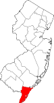 | |
| Boroughs | ||
| Townships | ||
| CDPs | ||
| Other communities | ||
| Counties |  | |
|---|---|---|
| Major cities | ||
| Cities and towns 50k-99k | ||
| Cities and towns 30k-50k | ||
| See also | ||
| International | |
|---|---|
| National | |
| Geographic | |