
Carlisle
| Carlisle | |
|---|---|
| City | |
 Carlisle Location withinCumbria | |
| OS grid reference | NY395555 |
| •London | 261 mi (420 km)SSE |
| Unitary authority | |
| Ceremonial county | |
| Region | |
| Country | England |
| Sovereign state | United Kingdom |
| Post town | CARLISLE |
| Postcode district | CA1-CA6 |
| Dialling code | 01228 |
| Police | Cumbria |
| Fire | Cumbria |
| Ambulance | North West |
| UK Parliament | |


Carlisle(/kɑːrˈlaɪl/kar-LYLE,locally/ˈkɑːrlaɪl/KAR-lyle;[1]fromCumbric:Caer Luel[2][3][4][5]) is acathedral cityin the ceremonial county ofCumbriain England. It is the administrative centre ofCumberland Councilwhich covers an area similar to thehistoric countyofCumberland.
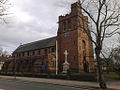
Carlisle's early history is marked by the establishment of a humansettlementto serve castles alongHadrian's WallinBritain.[6]Due to its proximity to Scotland (being located eight miles or thirteen kilometres south of the currentAnglo-Scottish border),Carlisle Castleand the city became an important military stronghold in theMiddle Ages.The castle served as a prison forMary, Queen of Scotsin 1568 and currently hosts theDuke of Lancaster's Regimentand theBorder RegimentMuseum. In the early 12th century, a priory was built and gainedcathedralstatus with adiocesein 1133 (city statusat the time meant the settlement became a city) while the county of Cumberland was created and later renamed Cumbria.
In the 19th century, the introduction oftextile manufacture during the Industrial Revolutionbegan a process ofsocioeconomictransformation in Carlisle, which developed into a densely populatedmill town.This, combined with its strategic position, allowed for the development of Carlisle as an importantrailway town,with seven railway companies sharingCarlisle railway station.Nicknamed the 'Great Border City',[7][8][9][10]Carlisle today is a main cultural, commercial and industrial centre within the British borders.
History
[edit]Ancient Carlisle
[edit]The ancient history of Carlisle is derived mainly from archaeological evidence and the works of theRoman historianTacitus.The earliest recorded inhabitants in the area were theCarvetiitribeofBritonswho made up the main population of ancientCumbriaandNorth Lancashire.[11]According toBoethiusandJohn of Fordun,writing in the 18th and 19th centuries, Carlisle existed before thearrival of the Romans in Britainand was one of the strongestBritishtowns at the time. In the time of theemperorNero,it was said to have burned down.[12][13]The Roman settlement was namedLuguvalium,based on a native name that has been reconstructed asBrittonic*Luguwaljon,"[city] of Luguwalos", a masculine Celtic given name meaning "strength ofLugus".[14]
Excavations undertaken along Annetwell Street in the 1970s dated the Roman timber fort constructed at the site of presentCarlisle Castleto the winter of AD 73.[15]It protected a strategic location on the Roman road to the north and overlooking the confluence of the Caldew and Eden rivers.[16]

The fort at Carlisle was reconstructed in 83 usingoaktimbers from further afield, rather than localalderas a possible result of the increased Roman control of the area.[17]At this time the Roman fort was garrisoned by a 500-strong cavalry regiment, theAla Gallorum Sebosiana.[16]
By the early 2nd century, Carlisle was established as a prominent stronghold. The 'Stanegate' frontier, which consisted of Luguvalium and several other forts in a line east toCorbridge,was proving a more stable frontier against thePictsthan those established deeper intoCaledonia.In 122, the province was visited byHadrian,who approved a plan to build a wall the length of the frontier. A new fort,Petriana,was therefore built in theStanwixarea of the city north of the river onHadrian's Wall.It was the largest fort along the wall[citation needed]and was completed in stone by around 130. Like Luguvalium, which lay within sight, Petriana housed a nominal 1,000-strong cavalry regiment, theAla Gallorum Petriana,the sole regiment of this size along the wall. Hadrian's successorAntoninus Piusabandoned the frontier and attempted to move further north; he built theAntonine Wallbetween thefirthsofForthandClyde.It was not a success and, after 20 years, the garrisons returned to Hadrian's Wall.[17]
At one time, Carlisle broke off from Rome whenMarcus Carausiusassumed power over the territory. He was assassinated and suffereddamnatio memoriae,but a surviving reference to him has been uncovered in Carlisle. Coins excavated in the area suggest that Romans remained in Carlisle until the reign ofEmperor Valentinian II,from 375 to 392.
Middle Ages
[edit]
The period oflate antiquityafter Roman rulesawCumbriaorganised as the nativeBritishkingdom of Rheged.It is likely that the kingdom took its name from a major stronghold within it; this has been suggested to have been broadly coterminous with theCivitas Carvetiorum,Carlisle.[18]KingUrienand his son and successorOwainbecame the subjects of a great deal ofArthurian legend.Their capital has been identified as theCairLigualidlisted byNenniusamong the 28 cities of Britain,[19]which later developed intoCaer-luel,[20]whence the city's modern Welsh nameCaerliwelydd.Rheged came under Northumbrian control before 730, probably by inheritance after Rienmelth, daughter of Royth and great-granddaughter of Urien, marriedOswy,King of Northumbria.For the rest of the first millennium, Carlisle was an important stronghold contested by several entities who warred over the area, including the BrythonicKingdom of Strathclydeand theAngliankingdom of Northumbria.In 685, StCuthbert,visiting the Queen of Northumbria in her sister's monastery at Carlisle, was taken to see the city walls and a marvellously constructed Roman fountain.[21]
By the time of theNorman Conquestof England in 1066, Carlisle was in the possession of the Scots. It was not recorded in the 1086Domesday Book.This changed in 1092, whenWilliam the Conqueror's sonWilliam Rufusinvaded the region and incorporated Carlisle into England. The construction ofCarlisle Castlebegan in 1093 on the site of the Roman fort, south of theRiver Eden.The castle was rebuilt in stone in 1112, with akeepand thecity walls.The walls enclosed the city south of the castle and included three gates to the east, south, and north called the Irish or Caldew Gate, the English or Botcher Gate, and the Scotch or Ricker Gate respectively. The names of the gates exist in road names in Carlisle today.Carlisle Cathedralwas founded as an Augustinian priory and became a cathedral in 1133.[22]In 1157, Carlisle became the seat of the new county ofCarliol(a name that was originally an abbreviation of LatinCarlioliensis,meaning "[Bishop] of Carlisle" ); in 1177 the county was renamedCumberland.
The conquest of Cumberland was the beginning of a war between Scotland and England which saw the region centred around Carlisle change hands a number of times. It was a major stronghold after the construction of the castle. During the wars, the livelihood of the people on the borders was devastated by armies from both sides. Even when the countries were not at war, tension remained high, and royal authority in one or the other kingdom was often weak. The uncertainty of existence meant that communities or peoples kindred to each other sought security through their own strength and cunning, and they improved their livelihoods at their enemies' expense. These peoples were known as theBorder Reiversand Carlisle was the major city within their territories.
The Reivers became so much of a nuisance to the Scottish and English governments that, in 1525, theArchbishop of GlasgowGavin Dunbar cursed all the reivers of the borderlands. The curse was detailed in 1,069 words, beginning: "I curse their head and all the hairs of their head; I curse their face, their brain (innermost thoughts), their mouth, their nose, their tongue, their teeth, their forehead, their shoulders, their breast, their heart, their stomach, their back, their womb, their arms, their leggs, their hands, their feet and every part of their body, from the top of their head to the soles of their feet, before and behind, within and without."[23]
Early Modern era
[edit]
After thePilgrimage of Grace,Henry VIII,concerned at the weakness of his hold on the North, employed (1539) the engineerStefan von Haschenpergto modernise the defences of Carlisle. von Haschenperg was sacked in 1543 for having "spent great treasures to no purpose"; but (by him and his successors) at the north end the castle towers were converted to artillery platforms, at the south the medieval Bochard gate was converted into theCitadel,an artillery fortification with two massive artillery towers.[24]: 243 The death ofQueen Elizabeth Iin 1603 and her succession byJames VI of Scotlandas King James I of England allowed more determined and coordinated efforts to suppress reiving. The borderers were not quick to change their ways and many were hanged and whole families were exiled to Ireland. It was not until 1681 that the problem of the reivers was acknowledged as no longer an issue.[25]
Following the personal union of the crowns Carlisle Castle should have become obsolete as a frontier fortress, but the two kingdoms continued as separate states. In 1639, with war between the two kingdoms looming, the castle was refortified using stone from the cathedral cloisters.[24]In 1642 theEnglish Civil Warbroke out and the castle was garrisoned for the king. It endured along siegefrom October 1644 until June 1645 when the Royalist forces surrendered after theBattle of Naseby.The city was occupied by a parliamentary garrison, and subsequently by their Scots allies. In 1646, the Scots, now holding Carlisle pending payment of monies owed them by the English Parliament, improved its fortifications, destroying thecathedral'snave to obtain the stone to rebuild the castle.[26][27]Carlisle continued to remain a barracks thereafter. In 1698 travel writerCelia Fienneswrote of Carlisle as having most of the trappings of a military town and that it was rife with alcohol and prostitutes.[28]
In 1707 anact of unionwas passed between England and Scotland, creatingGreat Britain,but Carlisle remained a garrison town. The tenth, and most recent siege in the city's history took place afterCharles Edward Stuarttook Carlisle in theJacobite Rising of 1745.When the Jacobites retreated across the border to Scotland they left a garrison of 400 men in Carlisle Castle. Ten days laterPrince William, Duke of Cumberlandtook the castle and executed 31 Jacobites on the streets of Carlisle.[26]
Industrial Revolution
[edit]
Although Carlisle continued to garrison soldiers, becoming the headquarters of theBorder Regiment,the city's importance as a military town decreased as theindustrial agetook over. The post ofGovernor of Carlisleas garrison commander was abolished in 1838.[29]
In the early 19th century textile mills, engineering works and food manufacturers built factories in the city mostly in theDenton Holme,Caldewgate and Wapping suburbs in the Caldew Valley.[30]These includedCarr's of Carlisle,Kangol,Metal Box and Cowans Sheldon.Shaddon Mill,in Denton Holme, became famous for having the world's 8th tallest chimney and was the largest cotton mill in England.
The expanding industries brought about an increase in population as jobs shifted from rural farms towards the cities. This produced a housing shortage where at one point 25,000 people in the city only had 5,000 houses to live in. People were said to be herded together with animal houses, slaughter houses and communal lavatories with open drains running between them. Living conditions were so bad that riots were common and some people emigrated. The problem wasn't solved until the end of the 19th century when mass housing was built west of the city walls.[31]
In 1823 a canal was built to Fisher's Cross (Port Carlisle) to transport goods produced in the city. This enabled other industrial centres such asLiverpoolto link with Carlisle via theSolway.This was short-lived and when the canal operators ran into financial difficulty the waterway was filled in.[32]A railwaywas built in place of the canal.
Carlisle became a majorrailwaycentre on theWest Coast Main Linewith connections to the east. At one time seven companies usedCarlisle Citadel railway station.Before the building of the Citadel railway station the city had several other railway stations, includingLondon Road railway station.Carlisle had the largest railway marshalling yard in Europe, Kingmoor, which, reduced in size, is operational and used by railfreight companies.
TheStrand Road drill hallopened in 1874.[33]
Modern history
[edit]
At the start of the 20th century, the population had grown to over 45,000. Transport was improved by theCity of Carlisle Electric Tramwaysfrom 1900 until 1931, and the first cinema was built in 1906. In 1912, the boundaries of Carlisle were extended to include Botcherby in the east and Stanwix in the north.[34]
Carlisle was subject to the decline in thetextile industryexperienced throughout Britain as new machinery made labour unnecessary. In 1916, during theFirst World War,thegovernmenttook over thepublic housesandbreweriesin Carlisle because of drunkenness among construction and munitions workers from the munitions factory atGretna.This experimentnationalisedbrewing. As the Carlisle Board of Control, and subsequently the Carlisle & DistrictState Management Scheme,it lasted until 1971.
During the Second World War, Carlisle hosted over 5,000 evacuees, many of whom arrived from Newcastle upon Tyne and the surrounding towns.[35]
A shopping centre (including a new central library) was built to the east and north-east of the market cross and opened in 1986.[36]The area east of the market cross had formerly been occupied by narrow alleyways of housing and small shops (on a layout which had not changed much since medieval times) and referred to locally asThe Lanes.Carlisle city centre was pedestrianised in 1989.[34]
On the evening of Friday, 7 January 2005, the rivers Eden, Caldew and Petteril burst their banks due to as much as 180 mm rainfall upstream that day.[37]2,700 homes were flooded and three people died. The city's police and fire stations were flooded along withBrunton Parkfootball stadium. The police, fire service andCarlisle United F.C.were mobilised, the latter as far asMorecambe.At the time of the flood, emergency services also had to respond to cases of car-relatedarsonin the city.[38]
City centre
[edit]Carlisle is the only city in Cumbria. The city centre is largely pedestrianised and the Lanes shopping centre is home to around 75 shops.
Carlisle has a compact historic centre with acastle,cathedraland semi-intactcity walls,as well as other medieval buildings including theGuildhallandTithe Barn.TheCitadel towers,which until 2016 also served as offices for Cumbria County Council, were designed byThomas Telford,with the eastern tower incorporating part of the 16th-century building.[39][40]The first Citadel building was a Tudor fortification replacing the medieval Englishgate, designed by theMoravianmilitary engineerStefan von Haschenpergin 1541.[41]Next to the Citadel isCarlisle railway station,designed byWilliam Titein the neo-Tudor style, considered byHistoric Englandto be among the most important early railway stations in England.[42][43]
Gallery
[edit]-
![Old Town Hall 1668–69 with 1717 extension[44]](https://upload.wikimedia.org/wikipedia/commons/thumb/d/d9/Carlisle_Town_Hall_2009.JPG/120px-Carlisle_Town_Hall_2009.JPG) Old Town Hall1668–69 with 1717 extension[44]
Old Town Hall1668–69 with 1717 extension[44] -
![Carlisle Market Cross, 1682[45]](https://upload.wikimedia.org/wikipedia/commons/thumb/a/a1/Carlisle_City_Centre%2C_Cumbria.jpg/89px-Carlisle_City_Centre%2C_Cumbria.jpg) Carlisle Market Cross, 1682[45]
Carlisle Market Cross, 1682[45] -
 Guildhall Museum, 1407
 -
![The Tithe Barn, 1470s[46]](https://upload.wikimedia.org/wikipedia/commons/thumb/a/a5/Tithebarn.JPG/120px-Tithebarn.JPG) The Tithe Barn, 1470s[46]
The Tithe Barn, 1470s[46] -
 The Citadel, 1810
 -
 Carlisle Station frontage
 -
 West City Walls
 -
-
 Traditional Barber Shop
 -
 Bitts Park
 -
 Millennium Bridge
 -
 Chinese Gardens
![Old Town Hall 1668–69 with 1717 extension[44]](/translate/en.wikipedia.org?u=https%3A%2F%2Fen.wikipedia.org%2Fwiki%2FFile%3ACarlisle_Town_Hall_2009.JPG&t=vi)
![Carlisle Market Cross, 1682[45]](/translate/en.wikipedia.org?u=https%3A%2F%2Fen.wikipedia.org%2Fwiki%2FFile%3ACarlisle_City_Centre%2C_Cumbria.jpg&t=vi)

![The Tithe Barn, 1470s[46]](/translate/en.wikipedia.org?u=https%3A%2F%2Fen.wikipedia.org%2Fwiki%2FFile%3ATithebarn.JPG&t=vi)


Governance
[edit]
Historical
[edit]Carlisle has heldcity statussince theMiddle Agesand aborough constituencyorparliamentary boroughfor centuries, at one time returning two MPs. In 1835 it became amunicipal boroughwhich was promoted tocounty boroughstatus in 1914. The city's boundaries have changed several times since 1835, most notably between 1974 and 2023, when under theLocal Government Act 1972the city and county borough and theBorder Rural Districtwere abolished and new enlargedCity of Carlislenon-metropolitan districtwas created within the newly formed administrative county ofCumbria.
The municipal borough contained severalcivil parishesor parts of parishes but these were merged into a single civil parish of Carlisle in 1904. The civil parish was abolished on 1 April 1974,[47]although parts of the urban fringe are in the parishes ofStanwix Rural,Kingmoor andSt Cuthbert Without.Carlisle unsuccessfully applied to become aLord Mayoraltyin 2002. Carlisle City Council had its headquarters at the 1960s Civic Centre in Rickergate, the tallest building in the city.
At the time of the2001 census,the population of Carlisle was 71,773, with 100,734 living in the district. In the 2011 census, the city's population had risen to 75,306, with 107,524 in the district.[48]
On 1 April 2023 the City of Carlisle local government district was abolished, and the boundaries of the City of Carlisle were redefined to cover the following wards: Belah and Kingmoor, Botcherby and Harraby North, Cathedral and Castle, Currock and Upperby, Denton Holme and Morton South, Harraby South and Parklands, Newtown and Morton North, Sandsfield and Morton West and Stanwix and Houghton.
Charter trustees were formed from the councillors that cover the said areas. They act as appropriate bodies in which historic rights and privileges of Carlisle, including the mayoralty will continue until a governance review will determine the need of acity council.
Parliament
[edit]The current member of Parliament isJulie Minns,representing theLabour Party.
Carlisle used to be within the North West England constituency of theEuropean Parliament.
Former county council
[edit]
Carlisle elected 18 county councillors to the former Cumbria County Council.[49]Its headquarters were located atCumbria Houseon Botchergate.
Former district council
[edit]Until April 2023 Carlisle was governed by adistrict council,Carlisle City Council and a County Council, Cumbria County Council. After the 2019 elections the Conservative Party ran a minority administration on the district council with the support of the Independents. The district council covered a large rural area with many villages and towns includingDalston,Brampton,Longtown,Wetheral,BewcastleandScotby.
Unitary authority
[edit]Cumberland Council,the local authority forCumberland,is aunitary authority,having the powers of a non-metropolitan county and district council combined. It operated as a shadow authority until taking up its powers on 1 April 2023.[50]Cumberland Council replaced Cumbria County Council,Allerdale Borough Council,Carlisle City Council andCopeland Borough Council.
Thefirst election to Cumberland Councilwas held on 5 May 2022. All 46 seats were up for election.Labourwon a majority of 30 seats.[51]Conservatives have 7 seats, Liberal Democrats 4 seats, Independents 3 seats and Green Party 2 seats. Turnout was 36.1%.[52]
Geography
[edit]Carlisle is situated on a slight rise, in theCumberland Ward,at the confluence of the riversEden,CaldewandPetteril.
An important centre for trade, it is located 56 mi (90 km) west ofNewcastle upon Tyne,71 mi (114 km) north ofLancaster,90 mi (140 km) south-east ofGlasgow,93 mi (150 km) south ofEdinburgh,120 mi (190 km) north-west ofYork,and 300 mi (480 km) north-north-west ofLondon.Nearby towns and villages includeLongtown(north),Penrith(south),Brampton(east),Wigton(west), Haggbeck,Harker,Carwinley,Blackford,Houghton,Scotby,WreayandRockcliffe.
Destinations from Carlisle | |
|---|---|
Climate
[edit]Carlisle experiences anoceanic climate(Köppen climate classificationCfb). In January 2005 Carlisle was hit by strong gales and heavy rain, and on Saturday 8 January 2005 all roads into Carlisle were closed owing to severeflooding,the worst since 1822, which caused three deaths.[53][54]Even worse flooding than in 2005 affected Carlisle between 4 and 6 December 2015. During this time, nearly 36 hours of incessant rainfall breached flood defences and left several areas submerged – including Bitts Park, Hardwicke Circus and Warwick Road. This left the Sands Centre (and the nearby Shell petrol station and Bitts Park), marooned from the rest of the city. As several other areas of Cumbria were also badly affected (particularly Appleby and Wigton), all trains to Scotland were postponed indefinitely, with trains on the West Coast Mainline going no further than Preston, as nearby Lancaster suffered flooding and problems with electricity supply. Prime MinisterDavid Cameronvisited the city on 7 December 2015 to assess the damage, having earlier called an emergency Cobra meeting.[citation needed]
| Climate data for Carlisle[a] WMO ID:03220; coordinates54°56′04″N2°57′49″W/ 54.93436°N 2.96364°W;elevation: 28 m (92 ft), 1991–2020 normals | |||||||||||||
|---|---|---|---|---|---|---|---|---|---|---|---|---|---|
| Month | Jan | Feb | Mar | Apr | May | Jun | Jul | Aug | Sep | Oct | Nov | Dec | Year |
| Record high °C (°F) | 14.7 (58.5) |
16.0 (60.8) |
19.7 (67.5) |
25.2 (77.4) |
28.1 (82.6) |
30.4 (86.7) |
34.5 (94.1) |
33.2 (91.8) |
29.5 (85.1) |
23.5 (74.3) |
18.2 (64.8) |
15.3 (59.5) |
34.5 (94.1) |
| Mean maximum °C (°F) | 12.0 (53.6) |
12.0 (53.6) |
14.5 (58.1) |
18.4 (65.1) |
22.9 (73.2) |
24.8 (76.6) |
26.2 (79.2) |
24.6 (76.3) |
22.5 (72.5) |
18.3 (64.9) |
14.6 (58.3) |
12.5 (54.5) |
27.8 (82.0) |
| Mean daily maximum °C (°F) | 7.2 (45.0) |
7.8 (46.0) |
9.7 (49.5) |
12.5 (54.5) |
15.6 (60.1) |
18.1 (64.6) |
19.8 (67.6) |
19.3 (66.7) |
17.2 (63.0) |
13.6 (56.5) |
10.0 (50.0) |
7.4 (45.3) |
13.2 (55.8) |
| Daily mean °C (°F) | 4.6 (40.3) |
4.9 (40.8) |
6.4 (43.5) |
8.6 (47.5) |
11.1 (52.0) |
14.1 (57.4) |
15.9 (60.6) |
15.6 (60.1) |
13.5 (56.3) |
10.3 (50.5) |
7.1 (44.8) |
4.6 (40.3) |
9.7 (49.5) |
| Mean daily minimum °C (°F) | 1.9 (35.4) |
1.9 (35.4) |
3.0 (37.4) |
4.7 (40.5) |
7.1 (44.8) |
10.0 (50.0) |
11.9 (53.4) |
11.7 (53.1) |
9.8 (49.6) |
7.0 (44.6) |
4.1 (39.4) |
1.8 (35.2) |
6.3 (43.3) |
| Mean minimum °C (°F) | −4.3 (24.3) |
−3.9 (25.0) |
−2.9 (26.8) |
−1.2 (29.8) |
0.9 (33.6) |
4.8 (40.6) |
7.1 (44.8) |
6.0 (42.8) |
3.6 (38.5) |
−0.1 (31.8) |
−2.6 (27.3) |
−5.6 (21.9) |
−6.8 (19.8) |
| Record low °C (°F) | −13.5 (7.7) |
−14.9 (5.2) |
−10.7 (12.7) |
−4.8 (23.4) |
−1.6 (29.1) |
1.7 (35.1) |
3.4 (38.1) |
2.9 (37.2) |
0.6 (33.1) |
−4.1 (24.6) |
−9.2 (15.4) |
−14.7 (5.5) |
−14.9 (5.2) |
| Averageprecipitationmm (inches) | 81.3 (3.20) |
69.4 (2.73) |
62.3 (2.45) |
49.2 (1.94) |
57.4 (2.26) |
70.5 (2.78) |
80.6 (3.17) |
89.0 (3.50) |
77.8 (3.06) |
97.9 (3.85) |
85.3 (3.36) |
98.1 (3.86) |
918.8 (36.16) |
| Average precipitation days(≥ 1.0 mm) | 14.1 | 11.6 | 11.7 | 11.0 | 10.7 | 11.5 | 12.8 | 12.9 | 12.0 | 14.5 | 14.7 | 15.2 | 152.7 |
| Mean monthlysunshine hours | 53.6 | 74.8 | 108.5 | 156.9 | 197.5 | 181.0 | 165.6 | 163.2 | 126.9 | 90.3 | 59.3 | 43.4 | 1,421 |
| Averageultraviolet index | 0 | 1 | 2 | 3 | 5 | 6 | 6 | 5 | 3 | 2 | 1 | 0 | 3 |
| Source 1:Met Office[55]Infoclimat[56] | |||||||||||||
| Source 2: WeatherAtlas[57] | |||||||||||||
Divisions and suburbs
[edit]
In the north of Carlisle are the suburbs of Kingstown, Lowry Hill and Moorville, formerly part of the parish of Kingmoor. To the south of them areStanwix,Edentown, Etterby, St Ann's Hill and Belah which were added to Carlisle in 1912. The parish ofStanwix Ruralexists but only includes a small part of Carlisle's urban area,Whiteclosegate.
To the immediate south of Stanwix is the River Eden. On the opposite bank is the city centre bounded on the west by the West Coast Main Railway line and the River Caldew. In the past industry flourished on the banks of the River Caldew, especiallyDenton Holmeand Caldewgate on the west bank and Wapping, around the former Metal Box works, on the east. West of Caldewgate and north of Denton Holme the suburbs of Newtown, Morton, Sandsfield Park, Longsowerby,RafflesandBelle Vuedeveloped in the late 19th and 20th centuries.
The eastern side of the city centre developed in the 19th century into a more affluent area along the mainA69 road.It links with the former village ofBotcherbyto which a large council estate was added in the mid-20th century and later still Durranhill Housing Estate.
South of the city centre is the Botchergate/St Nicholas area of late Victorian terraced housing similar to that found in Denton Holme and Caldewgate. The Botchergate East area until recently had older slum dwellings.
To the south west of Botchergate and St Nicholas are the former villages now suburbs ofUpperbyandCurrock.The urban area spills over the former county borough boundary intoBlackwellandDurdarin the civil parish ofSt Cuthbert Without.
Between Upperby and Botcherby is Harraby, a former village once part of St Cuthbert Without and the largest suburb of Carlisle. Harraby is subdivided into Harraby East, New Harraby, Harraby Green, Old Harraby, Petteril Bank and the Durranhill Industrial Estate. Adjoining Harraby to the south but outside the former borough boundary is the hamlet ofCarleton.
Transport
[edit]Road
[edit]Carlisle is linked to the rest of England via theM6 motorwayto the south, and to Scotland via theM74/A74towards Glasgow and the north. Manytrunk roadsbegin or terminate in Carlisle, including theA6toPenrithandLuton(historically the main road to the south prior to the opening of the M6), theA595to western Cumbria, theA69to Newcastle upon Tyne and theA7to Edinburgh.
Rail
[edit]
Carlisle became a majorrailwaycentre with, at one time, seven different companies usingCarlisle Citadel railway station.Prior to the building of the Citadel railway station, Carlisle had several railway stations, includingLondon Road railway station.Carlisle also used to have the largest railway marshaling yard in Europe, atKingmoor,which, although reduced in size, is still very much operational and used by railfreight companies likeColas Rail,DB Cargo UK,Freightlinerand very occasionallyDirect Rail Services.
Today,Carlisle railway stationis a principal station on theWest Coast Main Line.Other lines branch off toNewcastle,along theTyne Valley line;Leeds,along theSettle and Carlisle line;Glasgow Central,viaDumfriesalong theGlasgow South Western Linewhich connectsAyrandStranraerfor theStena Lineferry toPort of BelfastorP&O FerriestoLarne Harbour;and west Cumbria along theCumbrian Coast linetoWhitehaven,Barrow-in-FurnessandLancaster.Services are operated byScotRail,Avanti West Coast,NorthernandTransPennine Express.Kingmoor Traction Maintenance Depotis a major facility north of Carlisle, operated byDirect Rail Services.
Bus services
[edit]Most local bus services in the city are operated byStagecoach Cumbria & North Lancashire.Previously, local independent operator, Reays Coaches, operated a number of local routes, many of which were in competition with Stagecoach.[58]


The bus station is situated on Drury Lane, off Lonsdale Street. It has seven stands, each of which are covered by a waiting shelter, as well as a travel centre.
The present station was built in the 1990s to replace a larger station that was partially on the same site and had access from Lowther Street, where the Earls Lane shopping area is now.[citation needed]It is owned and managed byStagecoach Cumbria & North Lancashire.[59]The main operators at the bus station areStagecoach North East,Borders Buses,National Expressand Stagecoach Cumbria & North Lancashire.
As of September 2024[update],the stand allocation at Carlisle bus station is:
| Stand | Route | Destination |
|---|---|---|
| 1 | National Expresscoach services
| |
| 3 | 300 | Workington via Nealhouse, Wigton |
| 400 | Silloth via Nealhouse, Thursby, Wigton | |
| 553 | Keswick via Nealhouse, Dalston | |
| 600 | Cockermouth via Nealhouse, Thursby, Wigton | |
| 4 | 93 | Kirkbride via Kirkandrews-on-Eden, Beaumont, Burgh-by-Sands, Drumburgh, Glasson, Port Carlisle, Bowness-on-Solway, Cardurnock & Anthorn |
| 104 | Penrith via Harraby, CarletonorCumwhinton, High Hesket & Plumpton | |
| 554 | Keswick via Nealhouse, Thursby, Wigton | |
| 5 | 64 | Kingstown North via Whiteclosegate & Houghton |
| 79 | Dumfries via Stanwix, Kingstown, Longtown, Gretna, Annan | |
| 130 | Cumberland Infirmary | |
| 179 | Annan via Stanwix, Whiteclosegate, Houghton, Longtown & Gretna | |
| 685 | Newcastle via Warwick Bridge, Brampton, Haltwhistle | |
| 6 | 130 | Gamblesby via Armathwaite |
| 382 | Lockerbie via Stanwix, Kingstown, Gretna, Kirkpatrick Fleming, Eaglesfield & Ecclefechan | |
| S92 | Caldew School | |
Air
[edit]Carlisle Lake District Airportis a small regional airport located 5.8 mi (9.3 km) east north-east of the city. The nearest major airport isNewcastle International Airport,near the east coast, which is around 55 mi (89 km) away from Carlisle.
Trade and industry
[edit]
Carlisle became an industrial city in the 19th and early 20th centuries with many textile mills, engineering works and food manufacturers opening up mostly in theDenton Holme,Caldewgate and Wapping areas which lie in the Caldew Valley area of Carlisle. (One such manufacturer located in the Denton Holme area was Ferguson Printers, a large textile printing factory that had stood for many years before its closure in the early 1990s). In the early 19th century, acanalwas dug connecting Caldewgate with the sea atPort Carlisle.The canal was later filled in and became a railway line.
Carlisle was served by two electricitypower stations.James Street station was built by the corporation and operated from 1899 until 1927. Willow Holme power station, north west of the city, was built and operated by the corporation from 1923 until nationalisation of the industry in 1948. It was closed down in 1980 and demolished in 1988.
Famous firms that were founded or had factories in Carlisle includedCarr's of Carlisle(now part ofUnited Biscuits),Kangol,Metal Box (now part ofCrown Holdings) and Cowans Sheldon. Cowans Sheldon originated in the city in the mid 19th century and became one of the world's most important railway and marine engineering firms, manufacturing finally ceased in Carlisle in 1987. Others include the construction firms ofJohn Laingand Story Contracting. Pirelli Carlisle opened in 1969.[60]
The hauliersEddie Stobart Logisticswho were founded in nearbyHesket Newmarketand were once part of theStobart Group,had their HQ in Carlisle. Although they no longer have their HQ in Carlisle they still employ staff in the city. Robsons Border Transport Limited, J & W Watt Limited and F Brown (Carlisle) Limited, all substantial road hauliers, had their HQ in Carlisle.
Until 2004, Carlisle's biggest employer wasCavaghan & Gray,which became part ofNorthern Foodsand was subsequently acquired by2 Sisters Food Groupwhich operated from two sites in the Harraby area of Carlisle producing chilled foods for major supermarket chains. The London Road site closed in 2005 with the loss of almost 700 jobs as production was transferred to the nearby Eastern Way site or other factories around the UK.
There are various light industrial estates and business parks located on the fringes of Carlisle and on former industrial sites close to the city centre. The largest being the Kingstown Industrial Estate, which is located just off theA7 roadnear to theM6 motorway.
On 28 March 2005, Carlisle was grantedFairtrade Citystatus.[61]
Education
[edit]TheUniversity of Cumbriahas four campuses in Carlisle on Fusehill Street, Brampton Road, Paternoster Row and Newcastle Street. The university provides a wide range of degree courses inhigher educationsuch asInformation technology,Applied Psychology,Art,Business,Law,Media,Social WorkandTeacher Education.
Carlisle Collegeis thefurther educationestablishment based in the city.
Thesecondary schoolswithin Carlisle are:Richard Rose Central Academy,Richard Rose Morton Academy,Austin Friars St Monicas(Roman Catholic Private School),Trinity SchoolandSt John Henry Newman Catholic School.Other secondary schools in the wider City of Carlisle district are:Caldew School(Dalston),William Howard School(Brampton), andLime House School(Dalston).
Richard Rose Central Academy replaced St Aidan's County High School andSpecialistSports and Science College, and North Cumbria Technology College (NCTC, formerly Harraby School). It is sponsored by Eddie Stobart ownerAndrew Tinkler,and local businessman Brian Scowcroft. It opened in September 2008. In January 2009, there were protests by parents and pupils regarding poor quality education and school facilities. The school was found to be failing and was placed inSpecial Measures,[62]with the headmaster and chief executive being immediately replaced.[63][needs update]
Culture
[edit]Art and history
[edit]
TheTullie House Museum and Art Gallerywas opened in 1893 by the Carlisle Corporation. The museum features resident exhibits detailing the history ofRomanoccupancy of the region, Hadrian's Wall and the Border Reivers. Tullie House, named after theJacobeanmansion in which it is located, hosts travelling exhibitions. The museum has received many awards and was expanded in 1990 and 2000.[64]
The city's Guildhall Museum is based in a 14th-century house and the Border Regiment Military Museum is in the castle.
Music and theatre
[edit]Past
[edit]Her Majesty's Theatre, in Lowther Street, was constructed in 1874 as the Victoria Hall, and started screening films in 1897. An early music director at the turn of the century wasHoward Ellis Carr.After the interior was damaged by fire in 1904, it was rebuilt to designs by architects Beadle & Hope, and reopened in 1905 as Her Majesty's Theatre. Films andvariety showswere staged, until around 1919, when it staged only live productions and plays.[65]Robert David MacDonaldwas artistic director at the theatre.[66]After being briefly renamed Municipal Theatre in the 1960s, the theatre closed in early 1963 and reopened as the Regal Bingo Club in late 1963. This closed in the 1970s and the building was demolished in 1980, replaced by a car park.[65]
Present
[edit]Sands Centre Sports Hall is Carlisle's main entertainment venue which sometimes hosts touring musicians, theatre and comedians. The West Walls Theatre is situated in the city centre, an amateur theatre. The Old Fire Station opened in 2015 after being converted into a performing arts venue, it hosts touring bands, live stand-up comedy, dramas and art exhibitions.Brunton Parkstadium has hosted live music including anElton Johnconcert in 2007.[67]
Carlisle Music Festival takes place inCarlisle Cathedraleach year. The defunct Brampton Live, the largest folk festival in the north of England, formerly took place inBrampton.Over the weekend of 14/15 May 2011,Carlisle Lake District Airporthosted Europe's largest free music festival,Radio 1's Big Weekend.The festival's headline acts includedLady Gagaand theFoo Fighters.St Cuthbert's Church hosts an annual series of instrumental and chamber music concerts organised by North Cumbria Recitals.[citation needed]
Food
[edit]Every August the Carlisle Food Fair is held in the pedestrianised area of the city centre. It plays host to produce from across the continent and features local produce includingCumberland sausage,Cumberland sauce,Farmhouse Cheese and Cumberland Mustard.[citation needed]
In 2012,Fair Food Carlislewas awarded the runner-up prize in thegovernment'sBuy Better Together Challengecompetition. TheBuy Better Together Challengewas launched by theDepartment for Business, Innovation and SkillsandCo-operatives UKin December 2011 to encourage groups of consumers to work together to negotiate discounted rates for buying goods and services in bulk. The challenge received 110 entries and to seven finalists were selected. TheFair Food Carlislescheme usesbuying groupsto provide workplaces with a weekly supply of food from local businesses.[68]
Media
[edit]From 1961 to 2009, Carlisle was home toBorder Televisionwhich served Cumbria, southern Scotland, the Isle of Man and parts of Northumberland.
Initially based at studios in the Harraby area of the city, the station was controversially merged withITV Tyne Teesin 2009 as part of wide-ranging cutbacks to ITV's regional output.
As of 2009, ITV Border's news and sales operations are based at offices in the north of the city, although production of its nightly news programme,Lookaround,is based at Tyne Tees' Gateshead studios.
As of 2014, ITV Border is again producing a full regional news service, along with two hours a week of current affairs and features programming, aimed specifically at southern Scotland.
OnBBC One,the city is served by the regional programme,BBC Look North.
Television signals are received from theCaldbeckTV transmitter.[69]
The Cumberland Newsis the local broadsheet paper published on Fridays. TheNews and Staris the evening paper. Both are published by Carlisle-basedCN Group.Carlisle is home toBBC Radio Cumbria,Greatest Hits Radio Cumbria & South West ScotlandandHospital Radio Echo,which was established in 1965 and is the hospital radio station toCumberland Infirmary,24 hours a day.
Sport
[edit]Football
[edit]Association
[edit]
Carlisle is represented in English football byCarlisle United,who currently play in the third tier of English football after being promoted toFootball League Onein 2023.[70]The club has played atBrunton Parkon Warwick Road (A69) since 1909. In November 2011 plans were unveiled for the club to move to a 12,000-seat stadium in Kingmoor Park.[71]
The club's firstFootball Leaguetenure began in 1928 when it was elected to the northern section of theFootball League Third Division,replacingDurham City.Its past achievements include reaching theFootball League Cupsemi-finals (its best run in either of the two domestic cups) in 1969, and winning promotion to the top flight (then theFootball League First Division) in 1974. The club topped the English league after winning its first three games of the1974-75 season,but failed to keep up its good form and was relegated after just one season. In 1987 the club returned to theFootball League Fourth Division,and in 2004 was relegated to theFootball Conference– the first former top division club to do so – only to regain theirFootball Leagueplace after one year. In 1999, Carlisle United escaped relegation from the Football League on the final day of the season when on-loan goalkeeperJimmy Glassscored an injury time winner againstPlymouth Argyle.The 2–1 win meant thatScarboroughwere relegated to the Football Conference.[citation needed]
Though Carlisle United has rarely attracted the national football headlines, the club has fielded high-profile players. Some have achieved fame at bigger clubs after spending their early careers at the club. These includePeter Beardsley,Stan Bowles,Steve Harkness,Matt JansenandRory Delap.Many older players spent their later years at Carlisle United after playing for bigger clubs. These includeMichael Bridges,Mervyn Day,Kevin GrayandDavid McCreery.Former managers includeBill Shankly,Alan Ashman,Bob Stokoe,Harry Gregg,Mick Wadsworth,Nigel PearsonandPaul Simpson.SinceWorkingtonwas voted out of the Football League in 1977, Carlisle United were the only Cumbrian team to play senior football untilBarrow A.F.C.rejoined theEFLin 2020.
Celtic Nation F.C.was a Carlisle-based semi-professional club who played in theNorthern Football LeagueDivision One. They folded in April 2015 after a season of financial problems. Nation started out in 2004 as Gillford Park F.C. and played in theNorthern Football Allianceleague and won four promotions in 8 years. In 2012 Scottish millionaire Frank Lynch who is based in America, started putting money into the club and changed its name to Celtic Nation. After two years, Lynch withdrew his financial support and the club struggled before folding.
Carlisle Cityare a semi professional side who play in theNorthern Football League.After spending 40 years in theNorthern Football Allianceleague, they were promoted to theNorth West Counties Football Leaguein 2016, before being switched to their current league (at the same level) in 2019. They play at Gillford Park after taking over the lease fromCeltic Nationin the summer of 2015.
Northbank Carlisle was a club which played its football in theNorthern Football AlliancePremier Division. After forty years, the club decided to fold its senior team. Northbank still operates as a youth academy.[citation needed]
Rugby codes
[edit]Carlisle has two rugby union clubs: Carlisle RFC and Creighton RUFC. Carlisle RFC play at Warwick Road, alongside Carlisle United Football Club. Creighton RUFC originally played near Cumberland Infirmary but sold its ground to housing development company Story Homes in 2004 in exchange for new facilities off Cumwhinton Road, near Junction 42 of the M6. FormerEnglandrugby union captainSteve Borthwickis a native of Carlisle.
Therugby leagueteam,Carlislemerged withBarrowand left Carlisle. Amateur rugby league club,Carlisle Centurionsplayed in the National Division of the Rugby League Conference until they withdrew in 2010.
Gridiron
[edit]Carlisle Border Reiverswere anAmerican footballteam that played in Division 2 North until they folded in 2013. They rebranded as the Carlisle Kestrels in 2019,[72]the team's original name. They play at Gillford Park.
Racing
[edit]In 1904,Carlisle Racecoursewas established to the south of the city, it is now a first-class racecourse.Horse racinghas been held in Carlisle for centuries before the racecourse was formally established.
Threegreyhound racingvenues existed in Carlisle during the late 1920s. All three were independent (not affiliated to the sport's governing body theNational Greyhound Racing Club) and were known as a flapping tracks, which was the nickname given to independent tracks.[73]The first was located at Gillford Park (home of theCarlisle CenturionsRL and more recentlyCeltic Nation F.C.). The second was on pasture land in the former village of Harraby and was conducted by the Carlisle and Cumberland Greyhound Racing Sports Ltd. The third was north west of Carlisle on the Sheepmount playing fields and more recently the athletics track.[74]
Other sport
[edit]Carlisle Cricket ClubandCumbria County Cricket Clubplay at theEdensideGround north of the city centre. Cumberland is classed as aminor countyby theECB.The club has won theMinor Counties Championshiptwice. The remains of a Roman bathhouse associated with the Roman fort ofPetrianahave been excavated at the site.[75]
Carlisle has severalgolfclubs, including Stoneyholme within the city, and Carlisle Golf Club which hosts regional qualifying tothe Open Championship.
In 2012, Carlisle was one of the official stop-off points for theOlympic torchbefore it made its way down to theOlympic Gamesopening ceremony in London'sOlympic Stadium.[76]
Armed forces
[edit]
As a frontier town for over a millennium and a half, Carlisle is a military city. It is the most besieged place in the British Isles, having been besieged at least ten times, and has garrisoned troops for most of its history.[77]Cumbria's County regiment, theBorder Regimentmade its headquarters atCarlisle Castle.The regiment was amalgamated with theKing's Own Royal Regiment (Lancaster)to become theKing's Own Royal Border Regimentand subsequently theDuke of Lancaster's Regimentwhere its lineage continues. From 1720 to 1959, the regiment fought in many campaigns, including theFrench and Indian War,theBattle of Culloden,theFirst World Warand theSecond World War.[78]
RAF Carlisle
[edit]RAF Carlislealso known as14 MUwas located at Kingstown near the present-dayAsda.The station closed in 1996 after nearly sixty years in a variety of roles. First established asRAF Kingstownin 1938, it was originally a bomber station, then one of the RAF's Elementary Flying Training Schools and latterly a post-war storage facility.
RAF Spadeadam
[edit]The largest RAF station by area in the country and one of only twoelectronic warfareranges in Europe,RAF Spadeadamis located outside the City of Carlisle but maintains strong links with the local community; in 2018, it was awarded the Freedom of the City of Carlisle.[79]
Royal Observer Corps, Carlisle Group
[edit]During theSecond World Warthe air raid warning organisation No 32 Group CarlisleRoyal Observer Corpsoperated in the city centre controlled from RAF Kingstown. The association with Kingstown developed further in 1962 when the ROC ceased its aircraft spotting role for the RAF and took on a new role plotting nuclear explosions and warning the public of radioactive fallout for theUnited Kingdom Warning and Monitoring Organisation(UKWMO).[80]A new administration building and a protected, hardened Nuclear Reporting bunker was built at RAF Carlisle.[81][failed verification]The nuclear bunker was a standard above-ground structure and both the bunker and headquarters hutting were on a separate site at Crindledyke outside the main gates of RAF Carlisle. The Carlisle group was redesignated no 22 Group ROC.
The ROC constructed a smaller nuclear reporting post, Kingstown post (OS ref:NY 3837 5920), on the main RAF Carlisle site. The post was an underground protected bunker for a crew of three observers.[82]The headquarters bunker accommodated an operational crew of around 100 with dormitory and canteen facilities an operations room and life support plant.
The Royal Observer Corps was stood down and its parent organisation the UKWMO was disbanded in December 1995 after the end of theCold Warand as a result of recommendations in the governmentsOptions for Changereview of UK defence. The ROC buildings were demolished in 1996 and replaced by a cellphone communications mast. The foundations of the nuclear bunker can still be partially seen outlined in the concreted yard, which also contains the Air Training Corps hut during recent further development of the site.[83]
Legend and folklore
[edit]- Legend and Folklore
-
 The Cursing Stone

Arthurian legend
[edit]There are many legends and folkloric stories about the city during theDark Ages,such as theSir Gawain and the Carle of Carlisle,about the nephew ofKing Arthurand the "free man" of the city.
In a 14th-century poem, legend has it that Sir Gawain, one of the Knights of the Round Table, stayed at theCastle of Carlislewhile on a hunting expedition in the hauntedInglewood Forest.He then slept with the Carle's wife and killed him. This poem has strong parallels with another 14th century poem about Sir Gawain and the Green Knight. The story has since been re-adapted many times, most recently in films from1973,1984and2021.
By some accounts, Carlisle is also none other thanCamelot,the mythical seat of King Arthur's court.[84]
Curse of Carlisle
[edit]In local folklore, theCurse of Carlisleis a 16th-centurycursethat is said to have been invoked by Archbishop Dunbar ofGlasgowin 1525 upon cross-border families, known as theBorder Reivers,who lived by stealing cattle and pillaging. For the millennium celebrations, the local council commissioned a 14-tonne granite artwork inscribed with all 1,069 words of the curse. Following the installation of the stone, Carlisle suffered floods, foot-and-mouth disease, job losses and a "goal famine" for the football team.[85]In response to this, the city council considered removing the stone; however, Kevin Carlyon, the self-titled "high priest of the Britishwhite witches",proclaimed that such actions would give the curse more power. He commented that:" A curse can only work if people believe in it. I think at the moment the sculpture is a nice piece of history, but if the council destroys it, they would be showing their belief in the curse. "[85]
International relations
[edit]Twin towns - sister cities
[edit] Flensburg,Schleswig-Holstein,Germany
 Słupsk,Pomeranian Voivodeship,Poland
See also
[edit]Notes
[edit]- ^Weather station is located 3 mi (4.8 km) from the Carlisle city centre.
References
[edit]- ^Roach, Peter; Hartman, James; Setter, Jane;Jones, Daniel,eds. (2006).Cambridge English Pronouncing Dictionary(17th ed.). Cambridge: CUP.ISBN978-0-521-68086-8.
- ^Snyder, Christopher A. (2003).The Britons.John Wiley and Sons. p. 204.
- ^The Spirit of Hadrian's Wall.Cicerone Press Limited. 2008. p. 177.
- ^"List of railway station names in English, Scots and Gaelic".Newsnetscotland. Archived fromthe originalon 22 January 2013.Retrieved14 November2012.
- ^"Cairl".Dictionary of the Scots Language.Archivedfrom the original on 13 December 2018.Retrieved3 May2021.
- ^Baynes, T. S., ed. (1878),,Encyclopædia Britannica,vol. 5 (9th ed.), New York: Charles Scribner's Sons, pp. 108–110
- ^McKelvie, Gordon (2017), "Henry VII's Letter to Carlisle in 1498: His Concerns about Retaining in a Border Fortress",Northern History,54(2): 149–166,doi:10.1080/0078172X.2017.1327188,S2CID159780799
- ^McCarthy, Mike (2017).Carlisle: A Frontier and Border City.Cities of the Ancient World. Routledge.
- ^Landranger 85: Carlisle & Solway Firth.Ordnance Survey.2007.ISBN978-0-319-22822-7.
- ^"News & Star | News | Carlisle council leader says it's time to ditch 'Great Border City' tag".newsandstar.co.uk.Archived fromthe originalon 11 December 2015.Retrieved15 October2015.
- ^Celtic Tribes of Britain; The Carvetii,Roman Britain Organisation, archived fromthe originalon 25 April 2011,retrieved3 May2011
- ^Samuel Sampson (1746).The Agreeable Historian, or the Complete English Traveller.
- ^Fordun, John of; Skene, Felix James Henry; Skene, W. F. (William Forbes) (19 May 1872)."John of Fordun's Chronicle of the Scottish nation".Edinburgh, Edmonston and Douglas – via Internet Archive.
- ^Jackson, Kenneth (1953).Language and History in Early Britain.Edinburgh, UK: Edinburgh University Press. p.39.ISBN1-85182-140-6.
- ^Settling in Cumbria,Tullie House Museum,archived fromthe originalon 26 August 2011,retrieved3 May2011
- ^ab"Tullie House".iRomans, aTullie Housewebsite.Archivedfrom the original on 6 March 2012.Retrieved3 May2011.
- ^ab"Timeline of Roman Carlisle".Tullie House Museum.Archived fromthe originalon 26 August 2011.Retrieved3 May2011.
- ^Higham, Nick (1986).The Northern Counties to AD 1000.Longman Higher Education.
- ^Ford, David Nash. "The 28 Cities of BritainArchived15 April 2016 at theWayback Machine"at Britannia. 2000.
- ^John T. Koch(16 December 2005).Celtic Culture: A Historical Encyclopedia.ABC-CLIO.
- ^Bede."The Life and Miracles of St. Cuthbert, Bishop of Lindisfarne".Internet History Sourcebook.Fordham University: The Jesuit University of New York. Archived fromthe originalon 25 June 2016.Retrieved27 November2015.
- ^Tim Tatton-Brown and John Crook,The English Cathedral,New Holland (2002),ISBN1-84330-120-2
- ^"The Border Reivers - The Curse".BBC Cumbria.Archivedfrom the original on 14 November 2011.Retrieved4 May2011.
- ^abHyde, Matthew; Pevsner, Nikolaus (2010).The Buildings of England: Cumbria; Cumberland, Westmorland and Furness.London: Yale University Press.ISBN978-0-300-12663-1.
- ^Sadler, John (2004).Border Fury: England and Scotland at War, 1296 - 1568.Longman.
- ^abNanson, W (1884)."Carlisle during the siege of 1644–5".Transactions.7.Cumberland and Westmorland Antiquarian and Archaeological Society.Archivedfrom the original on 20 November 2021.Retrieved20 November2021.
- ^ "Carlisle Castle during the civil war".English Heritage. Archived fromthe originalon 5 March 2011.Retrieved4 May2011.
- ^Fiennes, Celia (2009).Through England on a Side Saddle.Penguin Classics.
- ^Accounts and Papers: Seventeen Volumes.UK Government. 1838. p. 58.
- ^Allen J. Scott, "Solway Country" (Cambridge Scholars Publishing, 2015
- ^"Carlisle - History".EDGE Guide.Archivedfrom the original on 25 June 2011.Retrieved3 May2011.
- ^"Port Carlisle".Visit Cumbria. Archived fromthe originalon 14 May 2011.Retrieved3 May2011.
- ^"Carlisle".The Drill Hall Project.Archivedfrom the original on 2 September 2017.Retrieved1 September2017.
- ^ab"A History of Carlisle".Local histories.Archivedfrom the original on 15 June 2010.Retrieved4 May2010.
- ^"The Evacuees".Holme St Cuthbert Local History Group.Archived fromthe originalon 22 July 2018.Retrieved3 March2018.
- ^Scott Parker, Mary Scott (November 2006).Memories of the Lanes.Bookcase.
- ^"Carlisle Floods January 2005".Met office.Archivedfrom the original on 5 April 2011.Retrieved25 April2011.
- ^Bernard Dolan (14 January 2005)."Message from, Bernard Dolan, to staff".Cumbria Fire & Rescue Service.Archivedfrom the original on 25 July 2011.Retrieved4 May2010.
- ^"Nisi Prius Courthouse, Associated Offices and Gate Arch, Carlisle, Cumbria".Archivedfrom the original on 20 December 2016.Retrieved7 April2017.
- ^Visit CumbriaArchived13 July 2014 at theWayback MachineCarlisle Citadel
- ^Colvin, Howard, ed.,The History of the King's Works,vol. 4 part 2, (1982), 670-1.
- ^"Citadel Station, Carlisle, Cumbria".Archivedfrom the original on 20 December 2016.Retrieved7 April2017.
- ^"10 Great English Railway Stations".4 December 2014.Archivedfrom the original on 5 January 2017.Retrieved7 April2017.
- ^"Old Town Hall, Carlisle, Cumbria".Archivedfrom the original on 4 March 2016.Retrieved7 April2017.
- ^"Market Cross, Carlisle, Cumbria".Archivedfrom the original on 20 December 2016.Retrieved7 April2017.
- ^"Tithe Barn, Carlisle, Cumbria".Archivedfrom the original on 20 December 2016.Retrieved7 April2017.
- ^"Carlisle Registration District".UKBMD.Archivedfrom the original on 30 December 2021.Retrieved1 January2022.
- ^"Carlisle Facts".7 September 2013. Archived fromthe originalon 4 March 2016.Retrieved12 October2013.
- ^"County councillors".Archived fromthe originalon 28 April 2009.
- ^"The Cumbria (Structural Changes) Order 2022".Archivedfrom the original on 14 April 2022.Retrieved9 May2022.
- ^"Cumberland result - Local Elections 2022".BBC News.Archivedfrom the original on 5 October 2022.Retrieved5 October2022.
- ^"Results of the Cumberland Council elections | Shadow Authority for Cumberland Council".Archivedfrom the original on 19 May 2022.Retrieved9 May2022.
- ^"Carlisle 'cut off' by flood water".BBCNews.8 January 2005.Archivedfrom the original on 28 April 2023.Retrieved31 December2009.
- ^"Floods leave homes without power"Archived24 January 2008 at theWayback Machineat BBC News – 8 January 2005, 23:31 UTC
- ^"Carlisle 1991–2020 averages".Met Office.Archivedfrom the original on 29 October 2021.Retrieved10 January2022.
- ^"Climatologie de l'année à Carlisle"(in French). Infoclimat.Retrieved9 September2023.
- ^"Monthly weather forecast and Climate – Nottingham, United Kingdom".Weather Atlas.Archivedfrom the original on 18 November 2021.Retrieved21 September2019.
- ^"Jobs boost from Reays Carlisle expansion".BBC News.1 October 2012.Retrieved30 September2024.
- ^Stagecoach Cumbria and North Lancashire. (2019).Annual Performance Cumbria and North Lancashire May 2018-April 2019Archived22 June 2021 at theWayback Machine.
- ^"HRH The Prince of Wales celebrates 50 years of Pirelli Carlisle".Pirelli.10 April 2019.Archivedfrom the original on 27 January 2022.
- ^"Carlisle celebrates 10 year anniversary of 'Fairtrade City' status".ITV News.21 October 2015.Archivedfrom the original on 19 June 2019.Retrieved19 June2019.
- ^"Ofsted inspection report, Richard Rose Central Academy"(PDF).Archived fromthe original(PDF)on 6 February 2009.Retrieved9 February2009.
- ^"Richard Rose Central Academy: Press Release".Archived fromthe originalon 31 January 2009.Retrieved9 February2009.
- ^"History of Tullie House".Tullie House. Archived fromthe originalon 30 September 2011.Retrieved4 May2011.
- ^ab"Her Majesty's Theatre, English Street, Carlisle, CA3".Cinema Treasures.Archivedfrom the original on 4 April 2023.Retrieved8 April2022.
- ^Jones, Sarah (28 June 2004)."Robert David MacDonald".The Independent.Archivedfrom the original on 8 April 2022.Retrieved8 April2022.
- ^"Blues army for Elton at Brunton Park".Cumberland News. 8 June 2007. Archived fromthe originalon 9 March 2012.Retrieved25 April2011.
- ^
 This article incorporates text published under the BritishOpen Government Licence:Department of Business, Innovation and Skills,Buy Better Together Challenge,published 28 November 2012, accessed 7 December 2023
- ^"Caldbeck (Cumbria, England) Full Freeview transmitter".May 2004.
- ^"Carlisle United secure promotion to League One at Wembley".Archivedfrom the original on 28 May 2023.Retrieved28 May2023.
- ^"Carlisle reveal ground move plans".BBC Sport.18 November 2011.Archivedfrom the original on 28 April 2023.Retrieved18 November2011.
- ^"Carlisle Kestrels American Football team hoping to soar again".News & Star.17 January 2020.Archivedfrom the original on 27 November 2021.Retrieved18 October2020.
- ^Barnes, Julia (1988).Daily Mirror Greyhound Fact File, page 413.Ringpress Books.ISBN0-948955-15-5.
- ^"Carlisle".Greyhound Racing Times.Archivedfrom the original on 20 June 2021.Retrieved6 May2019.
- ^"Carlisle Cricket Club Roman Bathhouse".Carlisle Cricket Club.Archivedfrom the original on 28 April 2023.Retrieved29 January2023.
- ^"Olympic torch relay to stop in Carlisle and Bowness".BBCNews.18 May 2011. Archived fromthe originalon 25 September 2015.Retrieved20 May2011.
- ^"Carlisle Castle History and Research".English heritage.Archivedfrom the original on 4 July 2011.Retrieved5 May2011.
- ^A Short History of the Border Regiment(6th ed.). Gale and Polden Ltd. 1944.
- ^"RAF Spadeadam to receive Freedom of the City of Carlisle in celebration of RAF100".Cumbria Crack.25 May 2018.Archivedfrom the original on 11 July 2021.Retrieved23 August2021.
- ^"ROC role".Archived fromthe originalon 14 May 2008.Retrieved7 April2017.
- ^Catford, Nick."Royal Observer Corps".Subterrania Britanica.Archivedfrom the original on 25 October 2007.Retrieved1 January2022.
- ^"Nuclear Monitoring Posts – Subterranea Britannica".subbrit.org.uk.Archivedfrom the original on 19 April 2020.Retrieved19 May2020.
- ^"Subterranea Britannica: Research Study Group: Sites: Carlisle".Archivedfrom the original on 15 June 2017.Retrieved7 April2017.
- ^"The legend of King Arthur: the most significant locations in Wales and England".3 May 2017.Archivedfrom the original on 3 August 2022.Retrieved3 August2022.
- ^ab"Witch warns of Curse Stone power".BBC News.8 March 2005.Archivedfrom the original on 11 October 2007.Retrieved31 December2009.
External links
[edit]- ,Encyclopædia Britannica,vol. 5 (11th ed.), 1911, pp. 341–342
- Carlisle and Hadrian's Wall Country
| International | |
|---|---|
| National | |
| Geographic | |
| Other | |