
Chukai
Chukai
Chuka | |
|---|---|
Town anddistrict capital | |
| Chukai Town Bandar Chukai | |
| Other transcription(s) | |
| •Jawi | چوكاي |
| •Chinese | Chu cái(Simplified) Chu cái(Traditional) Zhūgài(Hanyu Pinyin) |
 Chukai, Kemaman, Terengganu | |
 Seal | |
 Location of Chukai in Terengganu | |
| Coordinates:4°15′N103°25′E/ 4.250°N 103.417°E | |
| Country | |
| State | |
| District | Kemaman |
| Establishment of local government | 1942 |
| Establishment of town board | 1953 |
| Establishment of town council | 1973 |
| Establishment of district council | 1 January 1981 |
| Municipality status | 1 January 2002 |
| Government | |
| • Type | Municipal council |
| • Body | Kemaman Municipal Council |
| Area | |
| • Total | 500 km2(200 sq mi) |
| Population (2017) | |
| • Total | 171,539 (2nd)[1] |
| Time zone | UTC+8(Malaysian Standard Time) |
| Postcode | 24xxx |


Chukai(Terengganu Malay:Chuka), also known by the name ofKemaman Town(Malay:Bandar Kemaman,Terengganu Malay:Bando Mamang), is amukimand capital ofKemaman District,Terengganu,Malaysia.
The name "Chukai" (proper spelling of the Malay word:cukai) means 'taxes' inMalay.The town is so named due to its position near theestuaryof theKemaman River,whereby taxes and levies were imposed on riverine traffic, especially during the British colonial period. Chukai is the largest town in southern Terengganu, and its position between the state capitals ofKuantanandKuala Terengganuas well as proximity to the oil town ofKertehhas turned Chukai into a major commercial hub for the region. The nearbyKemaman Portserves both as a fishing port and supply base foroil platformsoff Terengganu's coast.
Attractions
[edit]The Hai Peng Coffee Shop, located just off themain Kuantan-Kuala Terengganu routeand near the town centre is famous for its finecoffees.[2]
Other attractions in the vicinity include:
- The Ma’ Daerah Turtle Sanctuary Centre (nearKerteh)
- Fireflywatching along Sungai Kak Yah (Kak Yah River) in Kampung Ibok
- The fishing village of Kuala Kemaman
- Boating andkayakingalong the Chukai River at the Bakau Tinggi Recreational Area[3]
Many beaches are within a short driving distance from Chukai. They remain idyllic, undisturbed by the fast-growing pace of development in Terengganu.
Club Med Cherating Beach is about a 15 minutes drive south away from the town centre, towards Kuantan, Pahang. Another world class resort nearby is the Resorts World Kijal (formerly Awana), about 25 minutes drive north from the town centre, towards Kuala Terengganu, the state capital.
Image gallery
[edit]-
-
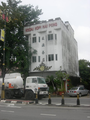
 Atrishawparked by the roadside with Chukai town in the background.


References
[edit]- ^Dept. of Urban and Rural Planning, Terengganu State Government.Rancangan Struktur Negeri Terengganu 2005-2015(Malay), 2005
- ^"Coffee, anyone?".The Star (Malaysia).26 March 2006. Archived fromthe originalon 6 November 2009.Retrieved20 March2007.
- ^Zanina, P. (2006-10-10)."Road less travelled in Terengganu".nst.my. Archived fromthe originalon 2007-04-26.Retrieved2007-03-20.
External links
[edit]Capital:Kuala Terengganu | |
| Topics | |
| Society | |
| Administrative divisions | |