
Clare, Michigan
Clare, Michigan | |
|---|---|
| City of Clare | |
 | |
| Nickname: "The Crossroads of Michigan" | |
 Location withinClare County(top) andIsabella County(bottom) | |
 Clare Location within the state of Michigan  Clare Location within the United States | |
| Coordinates:43°49′10″N84°46′07″W/ 43.81944°N 84.76861°W | |
| Country | United States |
| State | Michigan |
| Counties | ClareandIsabella |
| Founded | 1870 |
| Incorporated | 1885 (village) 1891 (city) |
| Government | |
| • Type | City commission |
| •Mayor | Pat Humphrey |
| •Clerk | Diane Lyon |
| •Manager | Jeremy Howard |
| Area | |
| • Total | 3.83 sq mi (9.92 km2) |
| • Land | 3.72 sq mi (9.63 km2) |
| • Water | 0.11 sq mi (0.28 km2) |
| Elevation | 837 ft (255 m) |
| Population (2020) | |
| • Total | 3,254 |
| • Density | 874.26/sq mi (337.53/km2) |
| Time zone | UTC-5(Eastern (EST)) |
| • Summer (DST) | UTC-4(EDT) |
| ZIP code(s) | 48617 |
| Area code | 989 |
| FIPS code | 26-15920[3] |
| GNISfeature ID | 0623335[4] |
| Website | cityofclare |
Clareis acityin theU.S. stateofMichigan.Located near the center of Michigan'sLower Peninsula,the city is located mostly inClare County,while a small portion extends south intoIsabella County.The city had a population of 3,254 at the2020 census.[5]
Clare was settled as early as 1870 and contains two listings on theNational Register of Historic Places:theClare Downtown Historic Districtand theClare Congregational Church.The city is located along the junction ofU.S. Route 10andU.S. Route 127,and each highway has a business route (Bus. 10andBus. US 127) through the downtown area.M-115also runs through the city. The convergence of these highways as well as the historic junction of theAnn ArborandPere Marquetterailroads has led to the city being nicknamed the "Crossroads of Michigan".[6]
History
[edit]Clare was founded with the coming of the Pere Marquette railroad in 1870. It was named after the county, which was named afterCounty ClareinIreland.The Clare post office opened on January 20, 1871. It incorporated as a village in 1879 and as a city in 1891.[7]
Cops & Doughnutsis a bakery that opened in 2009 in the former Clare City Bakery that dates back to 1896.
Geography
[edit]According to theU.S. Census Bureau,the city has a total area of 3.83 square miles (9.92 km2), of which 3.72 square miles (9.63 km2) is land and 0.11 square miles (0.28 km2) (2.87%) is water.[2]
The south branch of theTobacco Riverflows through the city and also contains Lake Shamrock.[8]
Climate
[edit]Thisclimaticregion is typified by large seasonal temperature differences, with warm to hot (and often humid) summers and cold (sometimes severely cold) winters. According to theKöppen Climate Classificationsystem, Clare has ahumid continental climate,abbreviated "Dfb" on climate maps.[9]
Transportation
[edit]Major highways
[edit] US 10runs along the northeastern portion of the city.
 US 127runs south–north along the western boundary of the city and merges with US 10.
 Bus. US 10is a business loop route through downtown Clare.
- Bus. US 127is a business loop route that has portions concurrent with Bus. US 10 in downtown Clare.
 M-115(Main Street) enters from the west and has its eastern terminus at Bus. US 127 / Bus. US 10 in downtown Clare.
Airport
[edit] Clare Municipal Airportis a public airport located in the northeast corner of the city limits.
Bus
[edit]- Indian Trailshas a station in Clare that provides daily intercity bus service betweenSt. IgnaceandEast Lansing.[10]
Trails
[edit]- Pere Marquette Rail-Trailis arail trailthat has its western terminus in Clare.
- Pere Marquette State Trailis a bicycle and multi-use trail that runs through the city.
Demographics
[edit]| Census | Pop. | Note | %± |
|---|---|---|---|
| 1880 | 502 | — | |
| 1890 | 1,174 | 133.9% | |
| 1900 | 1,326 | 12.9% | |
| 1910 | 1,350 | 1.8% | |
| 1920 | 1,462 | 8.3% | |
| 1930 | 1,491 | 2.0% | |
| 1940 | 1,844 | 23.7% | |
| 1950 | 2,440 | 32.3% | |
| 1960 | 2,442 | 0.1% | |
| 1970 | 2,639 | 8.1% | |
| 1980 | 3,300 | 25.0% | |
| 1990 | 3,021 | −8.5% | |
| 2000 | 3,173 | 5.0% | |
| 2010 | 3,118 | −1.7% | |
| 2020 | 3,254 | 4.4% | |
| U.S. Decennial Census[11] | |||
2010 census
[edit]As of thecensus[12]of 2010, there were 3,118 people, 1,354 households, and 764 families residing in the city. Thepopulation densitywas 919.8 inhabitants per square mile (355.1/km2). There were 1,534 housing units at an average density of 452.5 per square mile (174.7/km2). The racial makeup of the city was 85.0%White,4.7%African American,0.9%Native American,6.1%Asian,1.5% fromother races,and 1.8% from two or more races.HispanicorLatinoof any race were 6.5% of the population.
There were 1,354 households, of which 31.7% had children under the age of 18 living with them, 36.0% weremarried couplesliving together, 15.7% had a female householder with no husband present, 4.7% had a male householder with no wife present, and 43.6% were non-families. 36.9% of all households were made up of individuals, and 13.1% had someone living alone who was 65 years of age or older. The average household size was 2.22 and the average family size was 2.88.
The median age in the city was 36.1 years. 23.9% of residents were under the age of 18; 11.9% were between the ages of 18 and 24; 24.3% were from 25 to 44; 22.9% were from 45 to 64; and 16.9% were 65 years of age or older. The gender makeup of the city was 45.2% male and 54.8% female.
2000 census
[edit]As of thecensusof 2000, there were 3,173 people, 1,380 households, and 783 families residing in the city. The population density was 2,016.7 inhabitants per square mile (778.7/km2). There were 1,487 housing units at an average density of 476.5 per square mile (184.0/km2). The racial makeup of the city was 89.35%White,8.25%African American,0.60%Native American,0.50%Asian,0.41% fromother races,and 0.88% from two or more races.HispanicorLatinoof any race were 9.58% of the population.
There were 1,380 households out of which 29.4% had children under the age of 18 living with them, 40.9% weremarried couplesliving together, 13.0% had a female householder with no husband present, and 43.2% were non-families. 38.0% of all households were made up of individuals and 17.8% had someone living alone who was 65 years of age or older. The average household size was 2.20 and the average family size was 2.92.
In the city the population was spread out with 24.7% under the age of 18, 10.1% from 18 to 24, 25.3% from 25 to 44, 19.4% from 45 to 64, and 20.5% who were 65 years of age or older. The median age was 37 years. For every 100 females there were 78.1 males. For every 100 females age 18 and over, there were 72.1 males.
The median income for a household in the city was $27,299, and the median income for a family was $36,194. Males had a median income of $28,365 versus $19,861 for females. Theper capita incomefor the city was $18,006. About 10.6% of families and 16.0% of the population were below thepoverty line,including 16.3% of those under age 18 and 13.3% of those age 65 or over.
Education
[edit]The city of Clare is served entirely by its own school district,Clare Public Schools,which is centrally located within the city and serves the southeastern portion of the Clare County and the northeastern portion of Isabella County.[13][14]
Sister cities
[edit]- Ennis,Irelandsince 1986
- Nakhodka,Russiasince 1997
- Nantong,Chinasince 2005
- Surulere,Nigeriasince 2009
- Ipoh,Malaysiasince 2010
- Dharavi,Indiasince 2011
Notable people
[edit]- Fred C. Reger,Wisconsin state politician, born in Clare
- Debbie Stabenow,politician currently serving in the U.S. Senate, grew up in Clare
- Wayne Terwilliger,World War II veteran and Major League Baseball player, born in Clare
- Cody Vance,Professional wrestler currently wrestling under the name of Cody Preston for AEW, who graduated from Clare High School in 2010.
Images
[edit]-
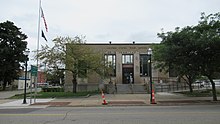 U.S. Post Office in Clare
 -
 Clare City Hall
 -
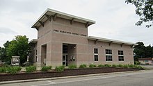 Pere Marquette District Library
 -


References
[edit]- ^City of Clare (2022)."Clare: Government".Archived fromthe originalon September 20, 2022.RetrievedSeptember 13,2022.
- ^ab"2020 U.S. Gazetteer Files".United States Census Bureau.RetrievedMay 21,2022.
- ^"U.S. Census website".United States Census Bureau.Retrieved2008-01-31.
- ^U.S. Geological Survey Geographic Names Information System: Clare, Michigan
- ^Bureau, US Census."Search Results".The United States Census Bureau.Retrieved2022-02-27.
{{cite web}}:|last=has generic name (help) - ^"Hotel History – Doherty Hotel".Retrieved2024-09-15.
- ^Romig, Walter (October 1, 1986) [1973].Michigan Place Names: The History of the Founding and the Naming of More Than Five Thousand Past and Present Michigan Communities(Paperback). Great Lakes Books Series. Detroit, Michigan:Wayne State University Press.p. 117.ISBN978-0-8143-1838-6.
- ^U.S. Geological Survey Geographic Names Information System: Lake Shamrock
- ^"Clare, Michigan Köppen Climate Classification (Weatherbase)".Weatherbase.
- ^Indian Trails(2 September 2022)."Jackson–East Lansing–Lansing–Clare–Gaylord–St. Ignage"(PDF).RetrievedSeptember 11,2022.
- ^"Census of Population and Housing".Census.gov.RetrievedJune 4,2015.
- ^"U.S. Census website".United States Census Bureau.Retrieved2012-11-25.
- ^Michigan Geographic Framework (15 November 2013)."Clare County School Districts"(PDF).RetrievedAugust 28,2022.
- ^Michigan Geographic Framework (15 November 2013)."Isabella County School Districts"(PDF).RetrievedAugust 28,2022.
External links
[edit]Municipalities and communities ofClare County, Michigan,United States | ||
|---|---|---|
| Cities |  | |
| Village | ||
| Civil townships | ||
| Unincorporated communities | ||
| Ghost town | ||
| Footnotes | ‡This populated place also has portions in an adjacent county or counties | |
Municipalities and communities ofIsabella County, Michigan,United States | ||
|---|---|---|
| Cities |  | |
| Villages | ||
| Charter township | ||
| Civil townships | ||
| CDPs | ||
| Other communities | ||
| Indian reservation | ||
| Footnotes | ‡This populated place also has portions in an adjacent county or counties | |
| International | |
|---|---|
| National | |
| Geographic | |