Davik
Davik Municipality
Davik herad | |
|---|---|
| Daviken herred(historic name) | |
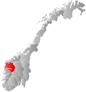
 Sogn og Fjordane within Norway | |
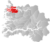
 Davik within Sogn og Fjordane | |
| Coordinates:61°53′29″N05°31′50″E/ 61.89139°N 5.53056°E | |
| Country | Norway |
| County | Sogn og Fjordane |
| District | Nordfjord |
| Established | 1 Jan 1838 |
| •Created as | Formannskapsdistrikt |
| Disestablished | 1 Jan 1964 |
| •Succeeded by | Bremanger,Eid, andVågsøy |
| Administrative centre | Davik |
| Area (upon dissolution) | |
| • Total | 655 km2(253 sq mi) |
| Population (1964) | |
| • Total | 3,437 |
| • Density | 5.2/km2(14/sq mi) |
| Time zone | UTC+01:00(CET) |
| • Summer (DST) | UTC+02:00(CEST) |
| ISO 3166 code | NO-1442[1] |
Davikis aformer municipalityin thetraditional districtofNordfjordin the oldSogn og Fjordanecounty(nowVestland),Norway.The 654-square-kilometre (253 sq mi)[2]former municipality existed from 1838 until 1964 and it encompassed all the lands surrounding the outer part of the largeNordfjordenon both sides of thefjord.Davik was located in parts of the present-day municipalities ofKinn,Bremanger,andStad.Theadministrative centerof the former municipality was the village ofDavikwhich is located on the southern shore of the Nordfjorden, although some of the municipal services were based out of the village ofBryggjaon the north side of the fjord, since that village was the largest village in Davik municipality.[3]

Davik Churchwas the main church for the municipality, and it was located in the village of Davik, in the central part of the municipality.Rugsund Church(in the village ofRugsund) served the western part of the municipality andÅlfoten Church(in the village ofÅlfoten) served the eastern part of the municipality.
History
[edit]Davik was established as amunicipalityon 1 January 1838 (seeformannskapsdistriktlaw). On 1 January 1913, the Mettenes farm (population: 3, located on the south shore of the Nordfjorden in extreme eastern Davik) was transferred to the neighboring municipality ofGloppen.During the 1960s, there were many municipal mergers across Norway due to the work of theSchei Committee.On 1 January 1964, Davik municipality ceased to exist and its territory was divided between the neighboring municipalities ofBremanger,Eid,andVågsøyas follows:[4]
- The islands ofHusevågøya,Grindøya, Gangsøya, Risøya, and all of Davik that was north of theNordfjordenand east of the village of Lefdal went to the newVågsøy Municipality.The population of this area was 1,216 at the time of the merger.
- All of Davik south of the Nordfjorden and all the islands that did not go toVågsøy Municipalitywent toBremanger Municipality.The population of this area was 1,567 at the time of the merger.
- All of Davik north of the Nordfjorden and east of the village of Lefdal (including Lefdal) went toEid Municipality.The population of this area was 654 at the time of the merger.
Name
[edit]The municipality (originally theparish) is named after the oldDavikfarm (Old Norse:Dafvíkr) since the firstDavik Churchwas built there. The first element isdafiwhich means "spear".The last element isvíkrwhich means "inlet"or"cove".Thus, the name appears to be referring to the long, skinny spear-like shape of the localfjord.[5]Historically, the name of the municipality was spelledDavigenorDaviken.On 3 November 1917, aroyal resolutionchanged the spelling of the name of the municipality toDavik,removing thedefinite formending-en.[6]
Government
[edit]During its existence, this municipality was governed by amunicipal councilofdirectly electedrepresentatives. Themayorwasindirectly electedby a vote of the municipal council.[7]
Municipal council
[edit]Themunicipal council(Heradsstyre)of Davik was made up of 29 representatives that were elected to four year terms. Thepartybreakdown of the final municipal council was as follows:
| Party name(in Nynorsk) | Number of representatives | |
|---|---|---|
| Conservative Party(Høgre) | 5 | |
| Local List(s)(Lokale lister) | 24 | |
| Total number of members: | 29 | |
| Party name(in Nynorsk) | Number of representatives | |
|---|---|---|
| Conservative Party(Høgre) | 2 | |
| Local List(s)(Lokale lister) | 27 | |
| Total number of members: | 29 | |
| Party name(in Nynorsk) | Number of representatives | |
|---|---|---|
| Local List(s)(Lokale lister) | 32 | |
| Total number of members: | 32 | |
| Party name(in Nynorsk) | Number of representatives | |
|---|---|---|
| Local List(s)(Lokale lister) | 32 | |
| Total number of members: | 32 | |
| Party name(in Nynorsk) | Number of representatives | |
|---|---|---|
| List of workers, fishermen, and small farmholders(Arbeidarar, fiskarar, småbrukarar liste) | 1 | |
| Local List(s)(Lokale lister) | 31 | |
| Total number of members: | 32 | |
| Party name(in Nynorsk) | Number of representatives | |
|---|---|---|
| Labour Party(Arbeidarpartiet) | 2 | |
| Local List(s)(Lokale lister) | 30 | |
| Total number of members: | 32 | |
| Note:Due to theGerman occupation of NorwayduringWorld War II,no elections were held for new municipal councils until after the war ended in 1945. | ||
Mayors
[edit]- 1838-1839: Henrik Didrik Echoff Friis
- 1840-1843: G.J. Lund
- 1844-1847: Peter Martin Knoph
- 1848-1849: Ole Martin Wiig
- 1850-1859: Christian Meyer
- 1860-1861: Lauritz Elstrand
- 1862-1867: Christian Meyer
- 1868-1871: John Rasmusson Muri
- 1872-1877: Ola Abrahamson Haus
- 1878-1879: Peder J. Hessevik
- 1880-1885: Hans Kristian Jenssson Lefdal
- 1886-1891: Botolv Helgeson Thue
- 1892-1895: Waldemar Bakke
- 1896-1897: Lars J. Eldevik
- 1898-1898: Daniel Follestad
- 1899-1916: Apollonius Liljedal Ronsenlund
- 1916-1937:Lars P. Lefdal
- 1938-1941: Reinert Førde
- 1945-1949: Reinert Førde
- 1950-1952: Alfred Haugland
- 1953-1959: Olav Dybedal
- 1960-1964: Alf Bakke
See also
[edit]References
[edit]- ^Bolstad, Erik; Thorsnæs, Geir, eds. (26 January 2023)."Kommunenummer".Store norske leksikon(in Norwegian).Kunnskapsforlaget.
- ^Helland, Amund (1901). "Daviken herred".Norges land og folk: Nordre Bergenhus amt(in Norwegian). Vol. XIV. Kristiania, Norway: H. Aschehoug & Company. p. 536.Retrieved28 September2019.
- ^"Komunehistoria i Bremanger"(in Norwegian). NRK. Archived fromthe originalon 31 October 2013.Retrieved29 October2013.
- ^Jukvam, Dag (1999).Historisk oversikt over endringer i kommune- og fylkesinndelingen(PDF)(in Norwegian).Statistisk sentralbyrå.ISBN9788253746845.
- ^Rygh, Oluf(1919).Norske gaardnavne: Nordre Bergenhus amt(in Norwegian) (12 ed.). Kristiania, Norge: W. C. Fabritius & sønners bogtrikkeri. pp. 408–409.
- ^"Norsk Lovtidende. 2den Afdeling. 1917. Samling af Love, Resolutioner m.m".Norsk Lovtidend(in Norwegian). Kristiania, Norge: Grøndahl og Søns Boktrykkeri: 1057–1065. 1917.
- ^Hansen, Tore; Vabo, Signy Irene, eds. (20 September 2022)."kommunestyre".Store norske leksikon(in Norwegian).Kunnskapsforlaget.Retrieved1 January2023.
- ^"Kommunevalgene og Ordførervalgene 1959"(PDF)(in Norwegian). Oslo: Statistisk sentralbyrå. 1960.Retrieved16 February2020.
- ^"Kommunevalgene og Ordførervalgene 1955"(PDF)(in Norwegian). Oslo: Statistisk sentralbyrå. 1957.Retrieved16 February2020.
- ^"Kommunevalgene og Ordførervalgene 1951"(PDF)(in Norwegian). Oslo: Statistisk sentralbyrå. 1952.Retrieved16 February2020.
- ^"Kommunevalgene og Ordførervalgene 1947"(PDF)(in Norwegian). Oslo: Statistisk sentralbyrå. 1948.Retrieved16 February2020.
- ^"Kommunevalgene og Ordførervalgene 1945"(PDF)(in Norwegian). Oslo: Statistisk sentralbyrå. 1947.Retrieved16 February2020.
- ^"Kommunevalgene og Ordførervalgene 1937"(PDF)(in Norwegian). Oslo: Statistisk sentralbyrå. 1938.Retrieved11 May2020.
- ^"Ordførarar i Bremanger".NRK Fylkesliksikon(in Norwegian). 3 March 2004.Retrieved29 May2023.
External links
[edit] Sogn og Fjordanetravel guide from Wikivoyage
- 1905 map of the municipality of Davik
- Weather information for Davik(in Norwegian)

