De Panne
De Panne
La Panne(French) | |
|---|---|
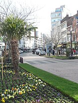
 De Panne town centre view | |
| Coordinates:51°06′N02°35′E/ 51.100°N 2.583°E | |
| Country | |
| Community | Flemish Community |
| Region | Flemish Region |
| Province | West Flanders |
| Arrondissement | Veurne |
| Government | |
| • Mayor | Bram Degrieck(Het Plan - B) |
| • Governing party/ies | Het Plan -B, ACTIE,N-VA |
| Area | |
| • Total | 26.63 km2(10.28 sq mi) |
| Population (2018-01-01)[1] | |
| • Total | 11,129 |
| • Density | 420/km2(1,100/sq mi) |
| Postal codes | 8660 |
| NIS code | 38008 |
| Area codes | 058 |
| Website | depanne.be |
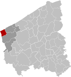
De Panne(Dutch pronunciation:[dəˈpɑnə];French:La Panne[lapan]) is a town and amunicipalitylocated on theNorth Seacoast of theBelgianprovince ofWest Flanders.There it bordersFrance,making it the westernmost town in Belgium. It is one of the most popularresort towndestinations within Belgium. The municipality includes the village ofAdinkerke.On 1 January 2011, De Panne had a total population of 10,748 on a total area of 23.90 km2,which gives apopulation densityof 449.7 inhabitants per km2.
Miscellaneous
[edit]This sectionneeds additional citations forverification.(December 2023) |
Famous people who have lived or died in De Panne includeKing Albert IandQueen Elisabeth,andJohn Aidan Liddell,VC, who died in De Panne in August 1915. The Belgian royal family lived in De Panne during theFirst World Warbecause it was located in the tiny fraction of their country that was not conquered by the Germans.
De Panne is home toPlopsaland,a theme park aimed at young children and located on the former grounds ofMeli Park.De Panne was also the place where the firstland yachtsintended for sport were built and used by the Dumont brothers in 1898. On 17 July 1831,Leopold I,the first Belgian king, sailed toCalaisfrom England, and arrived in Belgium in De Panne. The Leopold I Esplanade, which includes a statue of him, commemorates his arrival.
Since 1977, the town has hosted theThree Days of De Pannecycle race, which is held in the run up to, and traditionally used by riders as preparation for theTour of Flanders.[2]
De Panne was the site of a Belgium-England undersea telephone line laid by Siemens before the war, and therefore was used as Gort's headquarters for the evacuation of nearbyDunkirkto allow contact with England.[3]
Transport
[edit]De Panne Railway Station is located in nearbyAdinkerke.There are regularNMBStrains toBrussels.The line across thebordertoDunkirkis out of use. DK Bus run buses from the station forecourt toGare de Dunkerque.[4]A cross-border campaign groupTrekhaak-73is seeking to re-open the railway line.
Belgian Military Cemetery of De Panne
[edit]The cemetery is located at Kerkstraat 69 in De Panne, 1 km south of the church. Besides Belgian soldiers who died in the First World War there are also British soldiers who died in the Second World War. 3,744 soldiers have been buried here.[5]Nearby isAdinkerke Military Cemetery.
Images
[edit]-
Monument toKing Leopold I
-
Beach and apartment buildings
References
[edit]- ^"Wettelijke Bevolking per gemeente op 1 januari 2018".Statbel.Retrieved9 March2019.
- ^Ryan, Barry (2 April 2014)."Three Days of De Panne fighting for its place in Classics calendar".cyclingnews.Retrieved3 April2014.
- ^"George H.J. Hook & Herbert G. Hook and the 1926 cable sections".Retrieved7 February2024.
- ^(in French)DK Bus website.Accessed 10 December 2023.
- ^Description of the architecture and history of the Belgian military cemetery of De Panne,onroerenderfgoed.be. Accessed 10 December 2023. (in Dutch)]
External links
[edit]- Official website- Information available inDutchand limited information available inFrench,EnglishandGerman


