
Didsbury
| Didsbury | |
|---|---|
 The Clock Tower in Didsbury village | |
 Didsbury Location withinGreater Manchester | |
| Population | 26,788 (Census 2011) |
| OS grid reference | SJ847912 |
| Metropolitan borough | |
| Metropolitan county | |
| Region | |
| Country | England |
| Sovereign state | United Kingdom |
| Post town | MANCHESTER |
| Postcode district | M20 |
| Dialling code | 0161 |
| Police | Greater Manchester |
| Fire | Greater Manchester |
| Ambulance | North West |
| UK Parliament | |
Didsburyis a suburb ofManchester,England,[1]on the north bank of theRiver Mersey,5 miles (8 kilometres) south ofManchester city centre.The population at the2011 censuswas 26,788.[2][3]
Within the boundaries of thehistoric countyofLancashire,there are records of Didsbury existing as a smallhamletas early as the 13th century.[4]Its early history was dominated by being part of theManorofWithington,a feudal estate that covered a large part of what is now the south of Manchester.[5]Didsbury was described during the 18th century as a township separate from outside influence.[6]In 1745 a section of theJacobitearmy including theDuke of Perthcrossed the Mersey at Didsbury in theJacobite marchsouth from Manchester to Derby.[7][8]
Didsbury was largely rural until the mid-19th century, when it underwent development andurbanisationduring theIndustrial Revolution.It becamepart of Manchesterin 1904.[1][4]
TheRoyal Society for the Protection of Birdswas formed in Didsbury in 1889.[9]
History
[edit]Toponymy
[edit]Didsbury derives its name from the Anglo-SaxonDyddi's burg,probably referring to a man known as Dyddi whose stronghold or township it was[10]on a low cliff overlooking a place where theRiver Merseycould be forded. In the 13th century Didsbury was variously referred to as Dydesbyre, Dydesbiri, Didsbury or Dodesbury.[8]
Parish church
[edit]
A charter granted in about 1260 shows that a corn-grinding mill was operating in Didsbury, along the River Mersey,[8]but the earliest reference to Didsbury is in a document dating from 1235, recording a grant of land for the building of a chapel.[11]The church was namedSt James Churchin 1855. It underwent major refurbishment in 1620 and again in the 19th century, although most of the stonework visible today dates from the 17th century.[12]A parsonage was built next to one of the two public houses that flanked the nearby village green, Ye Olde Cock Inn, so-called because of the cockfighting that used to take place there. The parsonage soon gained a reputation for being haunted; servants refused to sleep on the premises, and it was abandoned in 1850. Local alderman Fletcher Moss bought the house in 1865, and lived in it for more than 40 years. In 1902, he installed a gateway complete with wrought iron gates which he purchased from the soon to be demolished Spread Eagle Hotel in central Manchester which he once owned, at the entrance to the parsonage's garden, which, because of the building's reputation, became known locally as "the gates to Hell". The parsonage is now open to the community and used as exhibition rooms for various forms of art. The gardens are still open to the public.[13]The area around St James' Church has the highest concentration oflisted buildingsin Manchester, outside the city centre.[14]
River Mersey
[edit]

Didsbury was one of the few places between Stretford and Stockport where the River Mersey could beforded,which made it significant for troop movements during theEnglish Civil War,in which Manchester was on theParliamentarianside. TheRoyalistcommander,Prince Rupert,stationed himself at Didsbury Ees, to the south ofBarlow Moor.A section of the Jacobite army including theDuke of Perthcrossed the Mersey at Didsbury in 1745 in theJacobitemarch south from Manchester to Derby.[7]Bonnie Prince Charlie crossed at Stockport.
Immigration from Europe
[edit]Jewish immigrants started to arrive in Manchester from the late 18th century, initially settling mainly in the suburbs to the north of the city. From the 1890s onwards, many of them moved to what were seen as the more "sophisticated" suburbs in the south, such as Withington and Didsbury.[15]The influx of Jewish immigrants led to West Didsbury being nicknamed "Yidsbury" and Palatine Road, a main road through West Didsbury, "Palestine Road".[16]
A growing population of German merchants and industrialists in the mid-19th century earned Manchester the nickname of "the German city". In the Didsbury area, the Souchays were a well-known merchant family ofHuguenotdescent with connections to Germany. John D. Souchay built Eltville House, a large residence on the corner of Fog Lane andWilmslow Road(a site bounded today by Clayton Avenue and Clothorn Road). The house, named afterEltvillein Germany, had a pair ofgate lodgesat its Wilmslow Road entrance and the Ball Brook ran through its large garden.[17]Other members of the family, Charles (or Carl) and Adelaide (or Adelheid) Souchay, lived nearby at Withington House on Wilmslow Road (the present site of the telephone exchange at Old Broadway). The Souchays were related to Cécile Mendelssohn Bartholdy, wife of the German composerFelix Mendelssohn.In the 1840s, Mendelssohn made several visits to Britain and stayed with the Souchays; he wrote a number of letter to friends with "Eltville House, Withington" as the return address.[18][19]The Souchays were members ofSt Paul's Church, Withington;Mendelssohn gave a recital on the newly installedpipe organthere in 1847, and the first wedding to take place there was that of John Souchay's eldest daughter in 1850. The Souchays are buried in St Paul's churchyard.[20][21][22]Eltville House was purchased by Jame Clayton Chorlton in 1888 and he renamed it Didsbury Priory. The Chorltons often opened their private garden to the public during springtime.[17]
Among the other German industrialists in Didsbury was Johann Georg Silkenstadt, a cotton merchant who moved to the area fromBremenin 1865. He and his wife Josephine Helene built Rose Bank on Palatine Road in West Didsbury in 1872. Their only daughter, Marie Louise, married William Murray Caldwell Greaves Bagshawe of Ford Hall inChapel-en-le-Frith,Derbyshire. The Silkenstadts built for Greystoke Hall as a wedding present for them next to their family home. Marie Louise died ofperitonitisin 1891, and her father died the following year. The grieving Josephine Silkenstadt created a 5-acre (20,000 m2) publicbotanical gardenopposite their house, namedMarie Louise Gardensin memory of her late daughter, and bequeathed it to Withington Urban District Council. The gardens and the Lodge were designed by the civil engineerJoshua Cartwright,and were formally opened in June 1903 byJames Kenyon.[23][24][25]
19th and 20th centuries
[edit]
During theVictorianexpansion of Manchester, Didsbury developed as a prosperous settlement; a few mansions from the period still exist onWilmslow Roadbetween Didsbury village andParrs Woodto the east and Withington to the north, but they have now been converted to nursing homes and offices. The opening of theManchester South District Lineby theMidland Railwayin 1880 contributed greatly to the rapid growth in the population of Didsbury. Easy rail connections toManchester Centralwere now provided fromDidsbury railway stationin Didsbury Village, and fromWithington and West Didsbury railway stationon Palatine Road. Didsbury station was also served by Express trains from Manchester toLondon St Pancras.Further expansion of the railways ensued when theLondon & North Western Railway'sStyal LinefromManchester London RoadtoWilmslowopened in 1909, introducing two new stations to the area,East Didsbury & Parrs WoodandBurnage.[26]In 1910, A stoneclock towerand water fountain was erected outside Didsbury Midland Railway station in memory of local doctor and campaigner for the poor, DrJohn Milson Rhodes.[27]

On 28 April 1910, French pilotLouis Paulhanlanded hisFarmanbiplane in Barcicroft Fields, Pytha Fold Farm, on the borders ofWithington,Burnageand Didsbury, at the end of thefirst flight from London to Manchester in under 24 hours,with one short overnight stop atLichfield.Arriving at 5:30 am, Paulhan beat the British contender,Claude Grahame-White,winning a £10,000 prize offered by theDaily Mail.[28]This was the first powered flight into Manchester from any point outside the city. Two special trains were chartered to the newly built but unopenedBurnage railway stationto take spectators to the landing, many of whom had stood throughout the night. Paulhan's progress was followed throughout by a special train carrying his wife,Henri Farmanand his mechanics. Afterwards, his train took the party to a civic reception given by theLord Mayor of Manchesterin thetown hall.A house in Paulhan Road, constructed in the 1930s near the site of his landing, is marked by ablue plaqueto commemorate his achievement.[29]
In 1921, a war memorial was erected outside Didsbury Library, on the opposite side of the road to the Midland Railway station. Dedicated to the memory of the 174 local servicemen who fell inWorld War I,it was unveiled byEdward Stanley, 17th Earl of Derby.AfterWorld War II,a further 67 names were added.[30][31]
Further transport enhancements came in the form of two newarterial roadswhich were constructed at the peripheral edges of Didsbury 1928–1930:Kingsway(named after KingGeorge V) through East Didsbury; andPrincess Roadthrough West Didsbury. Both were laid out asdual carriagewaysfor motor vehicles with asegregated tram trackalong thecentral reservation.Manchester Corporation Tramwaysoperated atramline from Parrs Wood via Burnage intoManchester city centreuntil 1949, when the service was closed.[32][33][34]
In the postwar years, passenger train services on the South District Line (now part ofBritish Rail) were gradually reduced, and in 1967 the line was closed as part of theBeeching cuts.For some years the old station building was in use as Station Hardware and DIY store, before it was demolished in 1982.[6][35][36]
Governance
[edit]
Civic history
[edit]In the early 13th century, Didsbury lay within themanorof Withington, a feudal estate that also included the townships ofWithington,Chorlton-cum-Hardy,Moss Side,Rusholme,Burnage,DentonandHaughton,ruled by the Hathersage, Longford and Tatton families,[38]and within thehistoric county boundariesofLancashire.[1]Didsbury remained within the manor of Withington for several centuries.
By 1764, Didsbury was described as a township in its own right.[6]It became acivil parishin 1866, and in 1876 was incorporated into the Withington Urban Sanitary District, superseded in 1894 by the creation of Withington Urban District.[39]Withington Urban District was a subdivision of theadministrative countyof Lancashire, created as part of the provisions of theLocal Government Act 1894.In 1904, Withington Urban District was amalgamated into the city andcounty boroughof Manchester, and so Didsbury was absorbed into Manchester, although it remained a civil parish until 1910. Following theLocal Government Act 1972,Manchester became ametropolitan boroughof themetropolitan countyofGreater Manchester.
Political representation
[edit]Didsbury is in theparliamentary constituencyofManchester Withington,and is represented byJeff Smith MP,a member of theLabour Party.[40]
Until 2004, most of the area formed the DidsburywardofManchester City Councilwith a section of West Didsbury contained within the Barlow Moor ward. However,boundary changesin 2004 resulted in Didsbury being split mainly between the two new wards ofDidsbury EastandDidsbury Westwhile a small section of West Didsbury was incorporated into the new ward ofChorlton Park.[41]Didsbury East is represented by Labour councillors Linda Foley, James Wilson and Andrew Simcock.[42]Didsbury West is represented by Labour councillors Debbie Hilal and Greg Stanton, and Liberal Democrat councillorJohn Leech.[43]All wards within Manchester elect in thirds on afour yearly cycle.
Geography
[edit]

Didsbury, at53°24′59″N2°13′51″W/ 53.41639°N 2.23083°W(53.4166, −2.2311), is south of the midpoint of theGreater Manchester Urban Area,4+1⁄2miles (7 kilometres) south of Manchester city centre. To the north, Didsbury is bordered byWithington,Chorlton-cum-HardyandBurnage,to the west byNorthenden,to the east and south-east byHeaton MerseyandCheadle,and byGatleyto the south.
TheRiver Merseyforms Didsbury's southern and southwestern boundaries and certain stretches of the river also demarcate the boundaries of theCity of Manchester.The area is generally considered to be roughly enclosed by Princess Parkway to the west, Kingsway to the east and the Ball Brook, just north of Lapwing Lane/Fog Lane to the north. This northern boundary is marked by a boundary stone in the front garden wall of a house on the west side of Wilmslow Road. A "country trail" passes from West Didsbury to East, named the Trans Pennine Trail (National Cycle Route62). It was sited along a disused railway track, as part of a nationwide initiative to promote cycling.[44]
Didsbury's built environment has developed around the areas of East Didsbury, West Didsbury, and Didsbury Village, which separates the two. The Albert Park conservation area, covering much of West Didsbury, places planning restrictions on development, alterations to buildings, and pruning of trees. The areas adjacent to the Mersey lie within the river's flood plain, and so have historically been prone to flooding after heavy rainfall.[45]The last major flooding was in the late 1960s. In the 1970s extensive flood mitigation work carried out along the Mersey Valley through Manchester has helped to speed up the passage of floodwater.Fletcher Moss Botanical Gardenalso acts as an emergency flood basin, storing floodwater until it can be safely released back into the river.[46]Parts of the local flood plain, much of Fletcher Moss Botanical Garden, the whole of nearbyDidsbury Parkand many of the listed buildings in the area are grouped into the St. James' Conservation area,[47]which is centred on Wilmslow Road, just south of Didsbury Village.
Neighbouring districts and places. | |
|---|---|
Demography
[edit]TheUnited Kingdom Census 2001recorded Didsbury as having a population of 14,292, of whom 87% were born in the United Kingdom.[48]A large majority of residents, 88%, identified themselves aswhite,8% asAsian,2% as mixed ethnicity, 1%blackand 1% Chinese or other ethnic group.[49]The under-16s accounted for 17% of the population, and the over-65s for 15%. The population density in 2001 was 5,276/square mile (2,037/km2).[50]In May 2021 a claim published by theDaily Mailthat Didsbury was among a number of "no-go areasfor white people "attracted media criticism.[51][52]
| Ethnic group | Didsbury East | Didsbury West | City of Manchester |
|---|---|---|---|
| White | 77.9% | 84.1% | 66.6% |
| Asian | 13.6% | 8.2% | 17.1% |
| Black | 2.1% | 1.7% | 8.6% |
| Arab | 1.8% | 1.5% | 1.9% |
| Mixed/multiple | 3.7% | 3.5% | 4.6% |
| Other | 0.9% | 1% | 1.2% |
| UK Census 2001 | Didsbury | Manchester | England |
| Total population | 14,292 | 392,819 | 49,138,831 |
| Born outside Europe | 8% | 10% | 6% |
| White | 88% | 81% | 91% |
| Asian | 8% | 9% | 5% |
| Black | 1% | 5% | 2% |
| Over 75 years old | 10% | 6% | 8% |
Economy
[edit]
As of theUK's 2001 census,Didsbury had an estimated workforce of 10,755 or 75% of the population. Economic status in Didsbury was: 48% in full-time employment, 11% retired, 10% self-employed, 8% in part-time employment, 4% full-time student (without job), 4% housewife/husband or carer, 4% permanently sick or disabled, 4% unemployed and 2% economically inactive for unstated reasons.[49]Didsbury's 48% rate of full-time employment compares with 33% in Manchester and 41% across the whole of England.[49]The area's 4% unemployment rate is in contrast to Manchester's rate of 9% and broadly in line with the 5% rate of unemployment for England.[49]
In 2001, the main industries of employment in Didsbury were 20% property and business services, 15% education, 15% health and social work, 10% retail and wholesale, 9% manufacturing, 6% transport and communications, 5% financial services, 4% hotels and restaurants, 4% construction, 4% public administration and defence, and 8% other.[49]These figures were similar to those from surrounding areas, but Didsbury did have a relatively larger education sector than other nearby wards, perhaps explained by the high density of schools in the area. A significant number of people (12%) commute to areas outside Didsbury; at the 2001 census there were 6,555 jobs in Didsbury, compared with the 7,417 employed residents.[57]
Siemens' UK head office is in West Didsbury, occupying Sir William Siemens House and the Turing building, employing around 800 people here. The head office ofBA CityFlyeris in Didsbury.[58]British Airwayshas an office with 300 employees in Pioneer House on the 292,000 square feet (27,100 m2), Dutch-owned Towers Business Park. In 2005, other tenants of the business park includedCisco,IWG,Logica,Trinity Integrated SystemsandThorn Lighting.[59][60]
Didsbury is considered to form a 'stockbroker belt',[61]as it is Manchester's most affluent suburb.[62]
Culture
[edit]The original site of Didsbury Village is in the conservation area now known as Didsbury St James,[63]about half a mile (1 km) to the south of what is today's village centre. The old village green is now the beer garden of The Didsbury pub.
The traditional independent retailers are gradually being replaced by multi-national firms, raising fears that Didsbury may lose its individual identity and become a "clone town".[64]However, independent traders continue to thrive, especially along Burton Road in West Didsbury, which celebrates its independent spirit each year with the two-day Westfest festival. The 200-year-old Peacock's Funeral Parlour, one of the few pre-Victorian buildings in the village and regarded by some as the centrepiece of the village,[65]was demolished in the summer of 2005 to make way for a new branch ofBoots the Chemists.The owner,United Co-op,blamed changing demographics for the closure of the funeral parlour; with more and more homes being occupied by young professional people, the death rate was falling in the area.[66]
Green areas
[edit]TheFletcher Moss Botanical Gardenis a 21-acre (8-hectare) recreational park south of the village centre. It is named after localAldermanFletcher Moss, who donated the park to the city of Manchester in 1919.[67]In 2008, it won theGreen Flag Award,the national standard for parks and green spaces in England,[68]an award it has held since 2000.[69]
Alderman Fletcher Moss was also responsible for restoring the gardens surrounding the old parsonage of St James's Church. Today, the Parsonage Gardens are open to the public, and the former parsonage house is now in use as an art gallery and community building.[70]
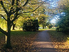
Didsbury Parkis a community park located close to the centre of Didsbury village, surrounded by residential housing. It is one of the first municipal planned parks in the city, redesigned in the 1920s to include recreational features for residents, such as bowling greens. Located within the St. James’ Conservation Area, it features preservation-order trees, grassland, woodland, and flora. An old air-raid shelter is rumoured to be beneath the football pitch.[71][72]The park includes a children's playground, a football pitch, and bowling greens.[71][72]Didsbury Parkwas also a winner of the Green Flag Award in 2008.[73]The park is used for dog walking, recreational play, picnics, and hosts events like the Didsbury Festival and Classic Car show. 'Didsbury Good Neighbours', a charity, is based in the park's refurbished pavilion, and operates an on-site cafe.[72]The upkeep of the park is managed by the volunteer group,The Friends of Didsbury Park.[74]
Marie Louise Gardens is a relatively small park to the west of the centre of Didsbury, opened in 1903 in memory of Marie Louise Silkenstadt.[23][25][75]The gardens are planted out with a number of rare and unusual tree species.[76]The park was at the centre of controversy in 2007 after Manchester City Council proposed to sell a portion of it to a private property developer.[77]
In the northern part of Didsbury lies Fog Lane Park, a large municipal green space which borders on Withington and Burnage. The park, which features playing fields and ornamental gardens, was established in 1926 by the Manchester Corporation. The park also contains basketball courts, tennis courts, a skate park and a children's play area. Fog Lane takes its name fromYorkshire-fog,a type of wild grass.[78]
- Parks in Didsbury
-

-
 Parsonage Gardens
 -
 Marie Louise Gardens
 -
 Fog Lane Park
 -
 Panorama ofDidsbury Park(March 2008)


Media
[edit]
Between 1956 and 1969, the oldCapitol Theatreat the junction of Parrs Wood Road and School Lane served as the northern studios of ITV stationABC Weekend Television.Programmes such asOpportunity KnocksandPolice Surgeonwere made in the studios. ABC ceased to use the site in 1968 when it lost its ITV franchise, on its merger with fellow ITV companyRediffusion.The site was then used briefly byYorkshire Televisionuntil its own facilities in Leeds were ready.[79]In 1971, the studios were acquired byManchester Polytechnic,who used it for cinema, television studies and theatre.[80]The building was demolished in the late 1990s to make way for a residential development,[79]but the name lives on in the form of a new theatre space in the heart of the M.M.U. campus in the All Saints area along Oxford Road, just to the south of Manchester city centre.[81]
Until 2009 Didsbury was the base for one of theManchester Evening Newssubsidiaries, theSouth Manchester Reporter.[82]
Transport
[edit]

Roads
[edit]Didsbury is close to junction 5 of Manchester'sring road,theM60 motorway.
Air
[edit]Manchester Airport,the busiest airport in the UK outside London,[83]is situated about 4 miles (6.5 km) to the south.
Bus
[edit]Didsbury is served by bus routes on theWilmslow Road bus corridor,said to be the busiest bus corridor in Europe.[84] There are frequent bus services into Manchester city centre,The Trafford Centre,Northendenand other destinations. Services include:
- 23: Stockport – Didsbury – Chorlton-cum-Hardy – Stretford – Urmston – Trafford Centre.
- 42: Stockport – Didsbury – Withington – Manchester Royal Infirmary – Manchester.
Railway
[edit]The nearest commuter railway stations to Didsbury areEast DidsburyandBurnageon theStyal Line,which runs betweenManchester PiccadillyandManchester Airport.The stations were opened in 1909 by theLondon and North Western Railway.[26]East Didsbury is served additionally by regional trains to destinations includingLiverpool Lime Street,Crewe,ChesterandLlandudno.
Until the 1960s, the suburb was also served by two stations on theSouth District LinefromManchester Central:Withington and West Didsburystation on Lapwing Lane (closed in 1961) andDidsbury station(closed in 1967, during theBeeching Axe). Both stations have since been demolished,[35][36]although new stops on Manchester's Metrolink have since risen in their place.
Metrolink
[edit]The area is served by theManchester Metrolinklight rail/tramwith three tram stops atDidsbury Village,East DidsburyandWest Didsbury.
The tram route uses a reopened section of the former Midland Railway line. Proposals were first announced in 1984 to reopen the disused line as part of theProject Light Railscheme and the former Didsbury station was to reopen under the name of Didsbury Central or Didsbury Village.[85][86]The first phase of theManchester Metrolinklight rail/tramsystem opened in 1992 but, due to funding problems, the oldtrackbedthrough Didsbury remained derelict for over 20 years[87][88]until it was reopened in 2013. Rather than reopening at the site of the old Midland Railway station on Wilmslow Road, it was decided instead to locate the new Didsbury Village tram stop further down the line at School Lane.[89]
Education
[edit]
Didsbury has a non-selective education system, assessed by theSATsexam. There are sevenprimary schoolsand twostate comprehensive secondary schools.The Barlow RC High School is one of those chosen by Manchester Council to benefit from funding made available in wave 4 of the government'sBuilding Schools for the Futureprogramme, a national scheme for the refurbishment and remodelling of every secondary school in England.[90]It is planned to replace all the current buildings, which date back to 1951. Parrs Wood and The Barlow were two of only six schools in Manchester to achieve the Manchester Inclusion Standard in 2007, awarded by Manchester Council to those schools doing innovative work to ensure that all their pupils are able to participate fully in the school's activities.[91]
There is one centre of further and higher education in Didsbury:The Manchester College,(formerlyCity College Manchester) Fielden Campus, which was opened in 1972 byMargaret Thatcher,[92]offers a variety of courses including communication and technology.Manchester Metropolitan University's Didsbury Campus, the formerDidsbury School of Education,was home to the faculties of health, social care, and education, along with theBroomhurst Hallof Residence.[93]The University closed the campus and sold the land in 2014.
Primary schools
[edit]- Beaver Road Primary School
- Broad Oak Primary School
- Cavendish Community Primary School
- Didsbury CE Primary School
- St Catherine's RC Primary School
- West Didsbury CE Primary School
- St Ambrose RC Primary School
Secondary schools
[edit]Parrs Wood, with about 2,000 pupils on its register, is much larger than the average, and is regularly over-subscribed in Year 7.[94]In its 2007 inspection report by theOffice for Standards in Education, Children's Services and Skills(Ofsted) the school was criticised for "failing to give its pupils an acceptable standard of education", and for providing "unsatisfactory" value for money.[95]However, in 2012 it came out of special measures and Ofsted deemed it a "satisfactory" school with aspects of "good teaching" and "good management".
The Barlow RC High School is an average size secondary school, with about 1,000 pupils. It too is regularly over-subscribed. It was described in its October 2003 Ofsted report as "a successful and effective school that is providing a good education for its pupils".[96]
Special and alternative schools
[edit]- The Birches School
- Lancasterian School
Religion
[edit]| Religion | Percentage of population[49] |
|---|---|
| Christian | 62% |
| No religion | 20% |
| Not stated | 7% |
| Muslim | 6% |
| Jewish | 2% |
| Hindu | 2% |
It is uncertain when the first chapel was built in Didsbury, but it is thought to have been before the middle of the 13th century. When theplaguereached the village in 1352 the chapel yard was consecrated to provide a cemetery for the victims, it being "inconvenient to carry the dead all the way to Manchester".[97]
TheBBC Radio 4Daily Serviceprogramme of Christian worship – the world's oldest continuous radio programme – is often broadcast from Emmanuel Church, on Barlow Moor Road.[98][99]Two of Didsbury's religious buildings areGrade II listed:Didsbury Methodist Church of St Paul(now an office building),[100]and theNazarene Theological College[101]which hosts theDidsbury Lectures.Didsbury was once the location of aMethodisttraining college, the Wesleyan Theological Institution; the Grade II*-listed building becameDidsbury School of Education,part ofManchester Metropolitan University.[100][102]and has now been converted to private housing.
Didsbury is in theChurch of EnglandDiocese of Manchester,[103] and theRoman CatholicDiocese of Salford.[104]It is not as religiously diverse as some other areas of Manchester, but it has the second largestJewishpopulation in the borough and two synagogues: the Shaare Hayim Synagogue and the Sha'are Sedek Synagogue.[105]
Didsbury has a medium-sizedMuslimpopulation in comparison with areas such asRusholme,LongsightandLevenshulme;a converted church in West Didsbury houses theDidsbury Mosqueand Islamic Centre.[106]
Sport
[edit]
Didsbury Sports Centre, on Wilmslow Road, is a part of theManchester Metropolitan Universitycampus. It provides a fitness suite with classes and facilities for badminton and tennis.
Didsbury has two rugby union clubs, Toc H R.F.C. and Old Bedians. Toc H, founded in 1924, plays at Simons Fields, on Ford Lane.[107]Its first team plays in the North Lancashire and Cumbria league. The club runs four senior teams and a youth section; it has run a 10-a-side competition every May since 1951, as a charity fund raiser for local hospices. Old Bedians is based in East Didsbury and was founded in 1954. It regularly fields three senior teams as well as a junior section. Desmond Pastore, believed to be the oldest rugby player in the world, was a founder member of the club and later became its president.[108]Formerly a player for Sale and Cheshire, Desmond played his last game for Manchester club Egor on his 91st birthday.[109]Bedians AFC, an amateur football club that was founded in 1928, share the Underbank Farm ground with Old Bedians RUFC.
Didsbury Cricket Clubfields four Saturday teams, two Women's teams and a Sunday team.[110]The 1st XI plays in theCheshire County ECB Premier League.[111]The Women's teams compete in the Cheshire Womens Cricket League,[112]and their junior section play in the Cheshire High Peak Junior Cricket League.[113]
It is also home to Manchester WaconiansLacrosseClub and Didsbury Grey'sWomen's Hockey Team,which do not actually play at the site but at grounds inBelle Vue,that were designed for theXVII Commonwealth Games.[114]
Northern Tennis Club, in West Didsbury, is one of Manchester's few racquet clubs; it plays host to anAssociation of Tennis Professionalstournament annually every July.
Public services
[edit]Withington Community Hospital,opened in 2005, occupies part of the site of the former (and much larger) Withington Hospital, developed on the site of aworkhousesome of whose buildings are still evident.
Didsbury is covered by the South Manchester Division of Greater Manchester Police.
The Towers,formerly theShirley Institute,was once the home of engineerDaniel Adamson– the driving force behind theManchester Ship Canalproject – and the venue where the decision to build the canal was taken.[115]The house was designed by Salford architectThomas Worthington,for the editor and proprietor of theManchester Guardian,John Edward Taylor.
Notable people
[edit]This sectionneeds additional citations forverification.(October 2020) |

- Daniel Adamson,promoter of theManchester Ship Canal,lived at The Towers (blue plaque– once theShirley Institute) on Wilmslow Road from 1874 until his death in 1890. HisGrade II listedhome, designed byThomas WorthingtonforJohn Edward Taylor,the editor and proprietor of theManchester Guardian,was the venue for the 1882 meeting at which it was decided to construct the ship canal project.[116]
- Dame Kathleen Ollerenshaw,mathematician, local politician, co-founder of theRoyal Northern College of Music[citation needed]
- Emily Williamson,a pioneer of wildlife protection, was a resident of Didsbury from 1882 to 1912. She founded the Plumage League in 1889 and went on to co-found theRoyal Society for the Protection of Birds(RSPB) in 1904. In 1989 a plaque was placed on her former home,the Croft,to honour the centenary of the organisation, although it did not actually mention Williamson by name.[117]
- Sidney BernsteinandDenis Formanwho createdGranada Television Manchesteralso lived in Didsbury during their work requirements at theGranada Studiosin Manchester.[118]
- Plant ecologistVerona Conwaywas born in Didsbury in 1910.[119]
- LordMarcus Joseph Sieff,the chairman ofMarks & Spencerfrom 1972 to 1982, was born in Didsbury in 1913.[citation needed]
- Francis French,author and noted space historian, grew up in Didsbury, and attended the same school as noted poet and novelistSophie Hannah.
- Carol Ann Duffy,the first femalePoet Laureate,lives in West Didsbury as of 2009.[citation needed]
- Nigel Henbest,astronomer, author and television producer, was born in West Didsbury in 1951.[citation needed]
- Philip Irwin,cricketer and Royal Navy officer, was born in Didsbury in 1884.[120]
- Martin Lewis,journalist, was born inWithington Hospitaland spent his earliest years growing up in Didsbury.[citation needed]
- Howard Spring– novelist and journalist forThe Manchester Guardianlived in Didsbury 1915–1930 whilst working for the Guardian. Several novels includingShabby Tigerwere based in Manchester.[citation needed]
- Broadcaster and humanitarianOlive Shapleylived on Millgate Lane 1953–1981, where she ran a refuge forsingle mothers,and later forVietnamese boat people.A street in Didsbury is named after her, Olive Shapley Avenue.[121][122]
- ActressHolliday Graingerwas born in Didsbury.
- Rik Mayalllived in East Didsbury whilst attending Manchester University in the mid-1970's.[123]
- Comedian and writerCaroline Ahernelived in Didsbury with her musician husbandPeter Hookin the mid-1990s.[124]
See also
[edit]References
[edit]Citations
[edit]- ^abc"Greater Manchester Gazetteer".Greater Manchester County Record Office. Places names – D to F. Archived fromthe originalon 18 July 2011.Retrieved2 October2007.
- ^"City of Manchester/Didsbury West ward population 2011".Archived fromthe originalon 4 March 2016.Retrieved5 January2016.
- ^"City of Manchester/Didsbury East ward population 2011".Archived fromthe originalon 9 January 2016.Retrieved5 January2016.
- ^ab"Didsbury St James Conservation Area".manchester.gov.uk.Manchester City Council. History.Archivedfrom the original on 12 May 2008.Retrieved22 July2008.
- ^Sussex & Helm (1988),p. 45
- ^abcFrance, E.; Woodall, T. F. (1976).A New History of Didsbury.E. J. Morten. p. 203.ISBN0-85972-035-7.
- ^ab"Didsbury Village: Didsbury its Lives and Times".Didsbury Civic Society. Archived fromthe originalon 15 May 2008.Retrieved20 September2007.
- ^abc"History of the Village".British History.Archivedfrom the original on 30 October 2021.Retrieved20 September2007.
- ^"Milestones".Royal Society for the Protection of Birds.Archivedfrom the original on 23 May 2010.Retrieved29 September2007.
- ^"Didsbury: Districts & Suburbs of Manchester".Manchester UK.Papillon Graphics. Archived from the original on 14 September 2007.Retrieved14 September2007.
{{cite web}}:CS1 maint: unfit URL (link) - ^"Didsbury St James Conservation Area".manchester.gov.uk.Manchester City Council. History.Archivedfrom the original on 16 May 2008.Retrieved20 September2007.
- ^Sussex, Gay; Halm, Peter (1988).Looking back at Withington & Didsbury.Altrincham: Willow Publishing. p. 40.ISBN0-946361-25-8.
- ^Cooper (2003),pp. 36–39
- ^"Didsbury St James Conservation Area".manchester.gov.uk.Manchester City Council. Didsbury St James and its buildings today.Archivedfrom the original on 16 May 2008.Retrieved20 September2007.
- ^"The Moves to the Suburbs".Moving Here, Bill Williams.Archivedfrom the original on 21 September 2007.Retrieved8 October2007.
- ^Zenner (2000),p. 72
- ^abSussex & Helm 1988,p. 29.
- ^Mendelssohn-Bartholdy, Felix (2008).Sämtliche Briefe: Februar 1847 bis November 1847; Gesamtregister der Bände 1 bis 12(in German). Bärenreiter. p. 125.ISBN9783761823125.Archivedfrom the original on 30 October 2021.Retrieved10 November2019.
- ^"Gertrude Clarke Whittall Foundation Collection – Mendelssohn Collection"(PDF).Music Division of the Library of Congress. p. 33.Archived(PDF)from the original on 10 November 2019.Retrieved10 November2019.
- ^Purver, Ian; Boyle, Roy (5 October 2011)."Church History".St Pauls Withington. Archived fromthe originalon 5 October 2011.Retrieved8 November2019.
- ^"Bid to put historic organ on the Mend".Manchester Evening News.26 March 2009.Archivedfrom the original on 10 November 2019.Retrieved10 November2019.
- ^Mercer-Taylor, Peter (28 September 2000).The Life of Mendelssohn.Cambridge University Press. pp.198–203.ISBN978-0-521-63972-9.
- ^abHartwell, Hyde & Pevsner 2004,p. 450.
- ^"Maria Louise Gardens [sic] and Lodge Palatine Road Didsbury – Building".Architects of Greater Manchester.Archivedfrom the original on 24 June 2021.Retrieved20 June2021.
- ^ab"History".The Friends of Marie Louise Gardens.Archivedfrom the original on 22 January 2021.Retrieved20 June2021.
- ^abHaywood 2009,p. 237.
- ^Historic England."Rhodes Memorial Clock (1270515)".National Heritage List for England.Retrieved7 July2020.
- ^Vivian (2004),pp. 132–133
- ^Scholefield (2004),p. 211
- ^Sussex & Helm (1988),p. 30
- ^Historic England."Didsbury War Memorial (1270517)".National Heritage List for England.Retrieved7 July2020.
- ^Crosby, Alan, ed. (1998).Leading the way: a history of Lancashire's roads.Preston: Lancashire County Books. p. 212.ISBN9781871236330.
- ^Stratton, Michael; Trinder, Barrie (2014).Twentieth Century Industrial Archaeology.Taylor & Francis. p. 126.ISBN9781136748011.Archivedfrom the original on 30 October 2021.Retrieved7 June2017.
- ^Rowley, Trevor (2006).The English landscape in the twentieth century.Continuum International Publishing Group. p. 20.ISBN1-85285-388-3.Archivedfrom the original on 20 October 2021.Retrieved7 June2017.
- ^abSuggitt 2004.
- ^ab"Didsbury Station".disused-stations.org.uk.Disused Stations.Archivedfrom the original on 20 May 2020.Retrieved18 June2020.
- ^"The Didsbury" Our History "".The Didsbury.Archivedfrom the original on 5 January 2008.Retrieved16 September2007.
- ^Sussex & Helm (1988).Looking Back at Withington and Didsbury.Willow. p. 45.ISBN0-946361-25-8.
- ^Great Britain Historical GIS Project (2004)."Didsbury Ch/CP through time. Census tables with data for the Parish-level Unit".A vision of Britain through time.University of Portsmouth. Archived fromthe originalon 16 May 2008.Retrieved20 September2007.
- ^"Jeff Smith MP".parliament.uk.UK Parliament.Archivedfrom the original on 28 April 2017.Retrieved28 April2017.
- ^Elleray, Kirsty (19 December 2003)."Boundary name row rumbles on".South Manchester Reporter.Trinity Mirror.Archived fromthe originalon 6 April 2012.Retrieved10 May2008.
- ^"Didsbury East Councillors".manchester.gov.uk.Manchester City Council.Archivedfrom the original on 5 February 2018.Retrieved28 April2017.
- ^"Councillors by Ward: Didsbury West".manchester.gov.uk.Manchester City Council.Archivedfrom the original on 3 June 2016.Retrieved6 May2016.
- ^"Cycling in Manchester".manchester.gov.uk.Manchester City Council. Signed Cycle Routes in Manchester. Archived fromthe originalon 15 December 2008.Retrieved19 September2008.
- ^"Flooding".SaleCommunityWeb.Archivedfrom the original on 1 September 2007.Retrieved16 September2007.
- ^"Exploring Greater Manchester"(PDF).Manchester Geographical Society. 1998.Archived(PDF)from the original on 13 June 2007.Retrieved6 May2007.
- ^"St. James' Conservation Area".Manchester City Council.Archivedfrom the original on 25 June 2018.Retrieved4 June2018.
- ^"2001 UK Census (Ethnicity)".Archived fromthe originalon 4 March 2016.Retrieved6 October2007.
- ^abcdefgUnited Kingdom Census 2001 (2001)."Area: Didsbury (Ward)".neighbourhood.statistics.gov.uk. Archived fromthe originalon 3 March 2016.Retrieved10 July2007.
{{cite web}}:CS1 maint: numeric names: authors list (link) - ^"Didsbury Ward"(PDF).Manchester City Council. Archived fromthe original(PDF)on 4 January 2008.Retrieved5 October2007.
- ^"Daily Mail slammed for article claiming there are 'no go areas' for white people in Britain".indy100.6 June 2021.Archivedfrom the original on 7 June 2021.Retrieved7 June2021.
- ^Siddique, Haroon (6 June 2021)."MailOnline mocked for suggesting Didsbury is 'no go' area for white people".The Guardian.Archivedfrom the original on 7 June 2021.Retrieved7 June2021.
- ^"Didsbury East (Ward, United Kingdom) – Population Statistics, Charts, Map and Location".citypopulation.de.Archivedfrom the original on 12 June 2021.Retrieved12 June2021.
- ^"Didsbury West (Ward, United Kingdom) – Population Statistics, Charts, Map and Location".citypopulation.de.Archivedfrom the original on 12 June 2021.Retrieved12 June2021.
- ^"Manchester (Metropolitan Borough, Greater Manchester, United Kingdom) – Population Statistics, Charts, Map and Location".citypopulation.de.Archivedfrom the original on 12 June 2021.Retrieved12 June2021.
- ^United Kingdom Census 2001 (2001)."Greater Manchester (Health Authority)".neighbourhood.statistics.gov.uk. Archived fromthe originalon 17 May 2008.Retrieved10 July2007.
{{cite web}}:CS1 maint: numeric names: authors list (link) - ^"Distance Travelled to Work – Workplace Population (UV80)".Area: Didsbury (Ward).Office for National Statistics. Archived fromthe originalon 3 March 2016.Retrieved8 October2007.
- ^"Our Locations".BA CityFlyer Careers. Archived fromthe originalon 22 November 2009.Retrieved12 March2010.
- ^"BA".British Airways.Archivedfrom the original on 14 November 2008.Retrieved12 March2010.
- ^Thame, David (6 September 2005)."Didsbury Towers is going Dutch".Manchester Evening News.M.E.N. Media. Archived fromthe originalon 11 February 2016.Retrieved12 March2010.
- ^"£1m house puts Didsbury into the stockbroker belt".South Manchester Reporter.M.E.N. Media. 1 March 2002. Archived fromthe originalon 12 November 2012.Retrieved15 April2010.
- ^Burdett, Jill (25 May 2005)."Didsbury's first £1m apartments".Manchester Evening News.M.E.N. Media. Archived fromthe originalon 20 April 2013.Retrieved15 April2010.
- ^"Didsbury St James Conservation Area".manchester.gov.uk.Manchester City Council. Townscape.Archivedfrom the original on 16 May 2008.Retrieved20 September2007.
- ^Towle, Nick (8 December 2005)."Fears over 'clone town' Didsbury".South Manchester Reporter.M.E.N. Media. Archived fromthe originalon 10 September 2012.Retrieved18 September2007.
- ^"Dying to Save Peacocks".BBC. 20 February 2006. Archived fromthe originalon 23 August 2007.Retrieved16 September2007.
- ^Towle, Nick (5 May 2005)."Death of a funeral parlour".South Manchester Reporter.M.E.N. Media. Archived fromthe originalon 12 November 2012.Retrieved16 September2007.
- ^"History of Fletcher Moss Gardens".Manchester City Council. Archived fromthe originalon 4 January 2008.Retrieved21 October2007.
- ^"Fletcher Moss Gardens".Green Flag Award. Archived fromthe originalon 7 February 2008.Retrieved29 September2007.
- ^"About Fletcher Moss Gardens".Manchester City Council. Archived fromthe originalon 4 January 2008.Retrieved29 September2007.
- ^Jennings, Anthony (28 October 2009).The Old Rectory: The Story of the English Parsonage.Bloomsbury Publishing. p. 111.ISBN978-1-4411-1805-9.Archivedfrom the original on 30 October 2021.Retrieved20 June2021.
- ^ab"Parks and open spaces - Didsbury Park".Manchester City Council.
- ^abc"Didsbury Park".Didsbury Civic Society.
- ^"Didsbury Park".Green Flag Award. Archived fromthe originalon 7 February 2008.Retrieved29 September2007.
- ^"The Friends of Didsbury Park".The Friends of Didsbury Park.
- ^"Manchester Parks and Gardens".John Moss, Papillon Graphics. Archived from the original on 22 September 2007.Retrieved21 September2007.
{{cite web}}:CS1 maint: unfit URL (link) - ^"Marie Louise Gardens".Didsbury Civic Society. 18 October 2020.Archivedfrom the original on 24 June 2021.Retrieved20 June2021.
- ^Wright, Susannah (7 June 2007)."Hands off our park, say 5,000 residents".South Manchester Report. Archived fromthe originalon 18 September 2012.Retrieved21 September2007.
- ^"Parks and open spaces: Fog Lane Park".manchester.gov.uk.Manchester City Council.Archivedfrom the original on 24 June 2021.Retrieved20 June2021.
- ^abGraham, Russ J."From the North".Transdiffusion Broadcasting System. Archived fromthe originalon 14 October 2007.Retrieved3 October2007.
- ^Rudyard & Wyke 1994,p. 29
- ^"Capital Theatre: About us".Manchester School of Theatre. Archived fromthe originalon 26 October 2010.Retrieved20 September2010.
- ^"SMR Profile".South Manchester Reporter.3 April 2007. Archived fromthe originalon 19 September 2007.Retrieved4 September2007.
- ^Wilson, James (26 April 2007). "A busy hub of connectivity".Financial Times– FT report – doing business in Manchester and the NorthWest.The Financial Times Limited.
- ^O'Rourke, Aidan (26 October 2006)."Didsbury as the" busiest bus corridor "".EyeOnManchester. Archived fromthe originalon 28 September 2007.Retrieved3 September2007.
- ^Greater Manchester Passenger Transport Executive (1984),Light Rapid Transit in Greater Manchester,GMPTE– publicity brochure
- ^Ogden, Eric; Senior, John (1991).Metrolink: Official Handbook.Glossop, Derbyshire: Transport Publishing Company. pp. 26–27.ISBN0-86317-164-8.
- ^Williams, Tony (30 May 2007)."Manchester to Chorlton and East Didsbury".Light Transit Association. Archived fromthe originalon 21 December 2008.Retrieved1 January2009.
- ^Cronshaw, Andy (22 July 2004)."Fight for Metrolink will go on".South Manchester Reporter.M.E.N. Media. Archived fromthe originalon 6 April 2012.Retrieved4 October2007.
- ^Kirby, Dean (23 May 2013)."First passengers travel on tram extension to East Didsbury".Manchester Evening News.Archivedfrom the original on 20 June 2020.Retrieved18 June2020.
- ^"New boost for education in Manchester as council gets funding to rebuild more secondary Schools".manchester.gov.uk.Manchester City Council.Archivedfrom the original on 4 January 2008.Retrieved16 September2007.
- ^"More Schools Achieve Manchester Inclusion Standard".manchester.gov.uk.Manchester City Council.Archivedfrom the original on 27 September 2007.Retrieved7 August2007.
- ^"Fielden Campus".City College Manchester. Archived fromthe originalon 1 June 2008.Retrieved8 October2007.
- ^"ManMet Campus".MMU. Archived fromthe originalon 22 September 2007.Retrieved18 September2007.
- ^"Parrs Wood Campus and Facilities".Parrs Wood High School. Archived fromthe originalon 5 April 2010.Retrieved22 February2010.
- ^"Parrs Wood High School".Ofsted.Archivedfrom the original on 3 October 2009.Retrieved20 February2009.
- ^Henderson, A (October 2003).Inspection Report: The Barlow RC High School(Report). Office for Standards in Education, Children's Services and Skills.Archivedfrom the original on 3 April 2019.Retrieved2 April2019.
- ^"Didsbury".A History of the County of Lancaster: Volume 4.British history Online.Archivedfrom the original on 25 May 2011.Retrieved18 October2007.
- ^"Religion & Ethics".BBC.Archivedfrom the original on 25 October 2007.Retrieved16 October2007.
- ^"Regional Churches".manchesteronline.co.uk.Archivedfrom the original on 14 October 2007.Retrieved16 October2007.
- ^ab"A-Z of Listed Buildings in Manchester".manchester.gov.uk.Manchester City Council. Listed buildings in Manchester by street (W).Archivedfrom the original on 12 June 2008.Retrieved17 October2007.
- ^"A-Z of Listed Buildings in Manchester".manchester.gov.uk.Manchester City Council. Listed buildings in Manchester by street (D).Archivedfrom the original on 4 January 2008.Retrieved17 October2007.
- ^Historic England."Administration Building at Didsbury Campus, Manchester Metropolitan University (original portion only) (1254970)".National Heritage List for England.Retrieved15 February2017.
- ^"The Church of England Diocese of Manchester".Archived fromthe originalon 27 December 2007.Retrieved7 May2007.
- ^"Parishes of the Diocese".Catholic Diocese of Salford. Archived fromthe originalon 2 May 2007.Retrieved7 May2007.
- ^"Places of Worship".didsburylife. Archived fromthe originalon 3 December 2010.Retrieved17 October2007.
- ^"SJ8391: Church near to West Didsbury, Manchester, Great Britain".Geograph British Isles.geograph.Archivedfrom the original on 4 March 2010.Retrieved17 October2007.
- ^"Team Profile".DidsburyRFC. Archived fromthe originalon 15 May 2008.Retrieved18 September2007.
- ^"History".Old Bedians. Archived fromthe originalon 23 May 2008.Retrieved17 September2007.
- ^"Rugby star, 91, honoured by Queen".BBC News. 17 June 2006.Archivedfrom the original on 21 June 2006.Retrieved17 September2007.
- ^"Didsbury CC Home".didsbury.play-cricket.Didsbury Cricket Club.Retrieved4 November2022.
- ^"Cheshire County Cricket League".cheshirecountycl.play-cricket.CCCL.Retrieved4 November2022.
- ^"Cheshire Womens Cricket League".cheshirewomenscl.play-cricket.CWCL.Retrieved4 November2022.
- ^"Cheshire High Peak Junior Cricket League".chpjcl.play-cricket.CHPJCL.Retrieved4 November2022.
- ^"Didsbury Sports (Page 2 – Bottom left)"(PDF).DidsburyCCsports. Archived fromthe original(PDF)on 13 May 2008.Retrieved18 September2007.
- ^"The Towers History".Archivedfrom the original on 11 September 2007.Retrieved2 October2007.
- ^"The Towers".manchester2002-uk. Archived from the original on 7 August 2007.Retrieved18 September2007.
{{cite web}}:CS1 maint: unfit URL (link) - ^"Made in Manchester – commemorative plaque unveiled for RSPB founder".The RSPB.Archivedfrom the original on 15 September 2021.Retrieved15 September2021.
- ^Forman, Denis (1997).Persona Granada.Andre Deutsch.ISBN0-233-98987-0.
- ^Pigott, Donald (1988). "Obituary: Verona Margaret Conway: (1910–1986)".Journal of Ecology.76(1): 288–291.ISSN0022-0477.JSTOR2260470.
- ^"First-Class Matches played by Philip Irwin".CricketArchive.Retrieved6 May2012.
- ^"Olive Shapley obituary".The Guardian.15 March 1999.Archivedfrom the original on 26 October 2020.Retrieved23 October2020.
- ^Connelly, Charlie (24 January 2019).Last Train to Hilversum: A journey in search of the magic of radio.Bloomsbury Publishing.ISBN978-1-4088-8998-5.Archivedfrom the original on 20 October 2021.Retrieved23 October2020.
- ^Wilkinson, Damon (16 September 2017)."18 famous people you never knew have lived in Greater Manchester".Manchester Evening News.Retrieved10 January2022.
- ^Halliday, Josh (3 October 2016)."Peter Hook says Caroline Aherne was physically abusive during marriage".The Guardian.Retrieved7 June2022.
Bibliography
[edit]- Cooper, Glynis (2003),Hidden Manchester,Breedon Books Publishing,ISBN1-85983-401-9
- Hartwell, Clare; Hyde, Matthew; Pevsner, Nikolaus (2004).Lancashire: Manchester and the South-East.Yale University Press.ISBN978-0-300-10583-4.Archivedfrom the original on 30 October 2021.Retrieved20 June2021.
- Haywood, Russ (2009).Railways, Urban Development and Town Planning in Britain: 1948–2008.Ashgate Publishing, Ltd.ISBN9780754673927.Retrieved19 June2018.
- Sussex, Gay; Helm, Peter (1988),Looking Back at Withington and Didsbury,Willow,ISBN0-946361-25-8
- Rudyard, Nigel; Wyke, Terry (1994),Manchester Theatres,Bibliography of North West England,ISBN0-947969-18-7
- Scholefield, R. A. (2004), "Manchester's Early Airfields, an extended article in Moving Manchester",Transactions of the Lancashire and Cheshire Antiquarian Society,Lancashire & Cheshire Antiquarian Society,ISSN0950-4699
- Suggitt, Gordon (2004).Lost Railways of Merseyside and Greater Manchester.Countryside Books.ISBN978-1-85306-869-0.
- Vivian, E. Charles (2004),A History of Aeronautics,Kessinger Publishing,ISBN1-4191-0156-0
- Zenner, Walter P. (2000),A Global Community: The Jews from Aleppo, Syria,Wayne State University Press,ISBN0-8143-2791-5
External links
[edit]| International | |
|---|---|
| National | |
| Geographic | |