
Dragon, Utah
Dragon | |
|---|---|
 Dragon Location of Dragon in Utah  Dragon Dragon (the United States) | |
| Coordinates:39°47′09″N109°04′24″W/ 39.78583°N 109.07333°W | |
| Country | United States |
| State | Utah |
| County | Uintah |
| Established | 1888 |
| Abandoned | c. 1940 |
| Named for | Black Dragon Mine |
| Elevation | 5,771 ft (1,759 m) |
| GNISfeature ID | 1437547[1] |
Dragonis aghost towninUintah County,at the extreme eastern edge ofUtah,United States. Founded in about 1888 as aGilsonitemining camp, Dragon boomed in the first decade of the 20th century as the end-of-line town for theUintah Railway.Although it declined when the terminus moved farther north in 1911, Dragon survived as the largest of the Gilsonite towns. It was abandoned after its mining operations stopped in 1938 and the Uintah Railway went out of business in 1939.
Geography
[edit]Dragon lies on the tiny Evacuation Creek at the mouth of Dragon Canyon, approximately 1 mile (1.6 km) west of theColoradostate line[2]and 65 miles (105 km) southeast ofVernal,the area's main city. This part of theUinta Basinhas been isolated and barren throughout modern times. The reason for the town's existence was theveinsof naturalasphaltcalledGilsonite,found nowhere else in the world at the time, that run southeast to northwest through this region.[3] The present-day center of Gilsonite mining,Bonanza,is about 25 miles (40 km) to the north of Dragon.
History
[edit]As the commercial mining of Gilsonite began in 1888, a significant deposit was discovered some 1.5 miles (2.4 km) up Dragon Canyon. Observers said that the vein of the black substance formed the shape of a dragon along the surface of the ground, and the operation was named the Black Dragon Mine.[2]The nameDragonwas soon given to both the canyon and the mining camp that grew up in the flat area at the canyon's mouth.[3]
The mine and town developed slowly at first, because of the difficulty of transporting the Gilsonite out of the area. The town received its firsttelegraph line,toFort Duchesne,in 1901.[4]: 213 In 1902, subsidiaries of the Gilson Asphaltum Company took over the Black Dragon Mine and began work on anarrow gauge railwayto serve the mine. In 1904 theUintah Railwayreached Dragon, where it stopped. The company also builttoll roadsto Vernal and Fort Duchesne,ferrieson theGreen River,and atoll bridgeover theWhite RiveratIgnatio,making Dragon the regional transportation hub.[4]: 202–203
As the terminal station on the only railroad ever to enter the Uinta Basin, Dragon began to boom. At the completion of the railroad, the town had a depot, warehouse, locomotive shops, store, boarding house, homes, twosaloons,and a barber shop.[3]The railroad company built the Uintah Railway Hotel in Dragon to lodge passengers.[4]: 218 A school was established in 1904.[4]: 257
Gilsonite is a flammablehydrocarbonmixture, and Dragon experienced a number ofmining accidents.In 1908, a fire started in one section of Dragon's Gilsonite vein. A nearly inextinguishable fire similar to acoal seam fire,it was still burning two years later.[3]Also in 1908, an explosion in the Black Dragon Mine killed two miners.[4]: 98 In 1910, a costly fire sparked in stored Gilsonite completely destroyed the Uintah Railway warehouse, along with hundreds of tons offreight.[3]
In 1910 apublic librarywas established in Dragon, with an unusual arrangement. The Uintah Railway would transport library books free of charge to and from any borrower along its route.[3]
At the1910 census,the population of "Dragon Precinct" (the town and surrounding area) was 287.[5]The output of the Black Dragon Mine was declining, however, and other rich Gilsonite deposits had been discovered to the north. In 1911 the Uintah Railway extended its line northward, establishing a new end-of-line town calledWatson9.5 miles (15.3 km) north of Dragon, with aspur line4 miles (6.4 km) to the southwest of Watson toRainbow,the new mining center. The loss of the railroad terminus caused a moderate decline in Dragon,[3]but because the railroad's shops androundhousewere still here, Dragon remained the stable population center in the Gilsonite mining area.[2]The railroad saw the need to encourage the shipping of diverse products, and in 1912 they built largesheep shearingpens at Dragon.[4]: 111 Enough people remained in 1917 to support a renovation of the Dragon schoolhouse.[3]The census precinct, greatly expanded but still named for Dragon, reported populations of 487 in1920and 452 in1930.[5]
By 1938, all of the Gilsonite mining activity moved still further north, to theBonanzaarea. The Dragon and Rainbow mines closed down. Trucks to Vernal andCraig, Coloradoreplaced trains for hauling Gilsonite. People started to abandon Dragon, Rainbow, and Watson. In 1939 Dragon's population was just 72, mostly railroad workers. Having lost the majority of its freight business, the Uintah Railway ceased operation in 1939.[3]The1940 censusrecorded a "South Dragon precinct" population of 10.[5]
Only ruins remain at the Dragon site. There is a rubble pile where the hotel stood, a sidewalk that ran to the old schoolhouse, some foundations, and a small cemetery.[2][6]
Notable people
[edit]- Art Pollard(1927–1973),IndyCar Seriesdriver.
See also
[edit]References
[edit]- ^abU.S. Geological Survey Geographic Names Information System: Dragon
- ^abcdThompson, George A. (November 1982).Some Dreams Die: Utah's Ghost Towns and Lost Treasures.Salt Lake City: Dream Garden Press. pp. 107–108.ISBN0-942688-01-5.
- ^abcdefghiCarr, Stephen L. (1986) [June 1972].The Historical Guide to Utah Ghost Towns(3rd ed.). Salt Lake City: Western Epics. pp. 64–65.ISBN0-914740-30-X.
- ^abcdefBurton, Doris Karren (January 1996).A History of Uintah County: Scratching the Surface(PDF).Utah Centennial County History Series. Salt Lake City: Utah State Historical Society.ISBN0-913738-06-9.RetrievedJuly 16,2012.
- ^abc"Census of Population and Housing".U.S. Census Bureau. Archived fromthe originalon February 8, 2006.RetrievedJune 7,2010.
- ^"Cemetery Database".Utah State History.Utah Department of Community and Culture. Archived fromthe originalon July 19, 2011.RetrievedJune 9,2010.
External links
[edit]- Dragonat GhostTowns
Municipalities and communities ofUintah County, Utah,United States | ||
|---|---|---|
| Cities | 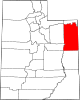 | |
| CDPs | ||
| Other communities | ||
| Indian reservation | ||
| Ghost town | ||
| Footnotes | ‡This populated place also has portions in an adjacent county or counties | |
| International | |
|---|---|
| National | |