
List of Dublin postal districts
Dublin | |
|---|---|
 | |
| Postcode areas | D1, D2, D3, D4, D5, D6, D6W, D7, D8, D9, D10, D11, D12, D13, D14, D15, D16, D17, D18, D20, D22, D24. Codes A41 – K78 later added under theEircodesystem. |
Dublin postal districtshave been used byIreland's postal service, known asAn Post,to sort mail inDublin.The system is similar to that used in cities in Europe and North America until they adopted nationalpostal codesystems in the 1960s and 1970s. These were incorporated into a new national postcode system, known asEircode,which was implemented in 2015.[1][2]Under the Eircode system, the city is covered by the original routing areas D01 to D24, along with A## and K## codes for locations elsewhere inCounty Dublin.[3]
History[edit]

The postal district system was introduced in 1917 by the British government, as a practical way to organise local postal distribution.[4]This followed the example of other cities, including London, first subdivided into ten districts in 1857,[5]andLiverpool,the first city inBritain or Irelandto have postcodes, from 1864. The letter "D" was assigned to designate Dublin[6]and was retained by the new Irish government.[5]
Dublin didn't start using postal district numbers until 1927[7]: 371 when theDepartment of Posts and Telegraphsinitiated a scheme that requested senders to add a code to each address in Dublin City and suburbs. When mail was addressed in English senders were to add an appropriate postman's walk number but when addressed in Irish, different letters were used with the same walk numbers, such asRathgar Roadbeing D3 on mail addresses in English but S3 on Irish addressed mail.[8]This scheme was not popular and within a few years became defunct. In 1961, a new postal district numbers started and these numbers were added to street signs[5]prior to which street signs only displayed the street name inIrishand English.
The number of districts was increased as the city grew, and in the 1970s, large districts were subdivided. Dublin 5 was split, with the coastal part retaining the "5" and the inland part becoming Dublin 17. Dublin 8,Ballyfermotbecame Dublin 10, along withPalmerstownandChapelizod.However, Dublin 10 was subsequently split again, with Palmerstown and Chapelizod forming Dublin 20.[9]
In 1985, Dublin 6 was divided, with some areas, such asTempleogue,KimmageandTerenurebecoming part of a new district in order to facilitate processing of mail by a new delivery office for those areas. Residents of some areas objected to the assignation of the next available number, "Dublin 26", for the new postal district, citing property devaluation: the higher numbered districts typically represented less affluent and less central areas.[10]An Post ultimately relented, and the western part of the district became known as Dublin 6W.[5][11]
Structure[edit]

Historically, the postal district appeared with one or two digits (or in the case of one district, a digit and a letter) at the end of addresses:
Sample Address, Sample Street, Dublin8
Under theEircodepostcode system, the postal district number is still retained in Dublin addresses, even though this information is also contained in the "Locator code" portion of the Eircode postcodes, e.g.:
Sample Address, Sample Street, Dublin8,D081X2Y
In most cases, odd numbers are used for addresses on theNorthsideof the River Liffey, while even numbers are on addresses on theSouthside.Exceptions to this are thePhoenix Park(along with a small area between the Park and the River Liffey), andChapelizodVillage which, although on the Northside, are parts of the Dublin 8 and Dublin 20 postal districts respectively.[5]
The numbering system is not used for some areas inCounty Dublin,such asDún Laoghaire,Blackrock,LucanorSwords,though it is used for other county locations, for exampleFirhouse,Foxrock,Kilshane,KnocklyonandTallaght.[citation needed]
| Dublin's postal districts. | |
|---|---|
| Northside,covering local government area | Southside,covering local government area |
| Dublin 1 (D1)Dublin | Dublin 2 (D2) Dublin |
| Dublin 3 (D3) Dublin | Dublin 4(D4) Dublin, Dun Laoghaire Rathdown |
| Dublin 5 (D5) Dublin | Dublin 6 (D6) Dublin, Dún Laoghaire Rathdown |
| Dublin 7 (D7) Dublin | Dublin 6W (D6W) Dublin,South Dublin |
| Dublin 9 (D9) Dublin | Dublin 8 (D8) Dublin |
| Dublin 11 (D11) Dublin, Fingal | Dublin 10 (D10) Dublin |
| Dublin 13 (D13) Dublin, Fingal | Dublin 12 (D12) Dublin |
| Dublin 15(D15) Fingal | Dublin 14 (D14) Dublin,Dún Laoghaire–Rathdown,South Dublin |
| Dublin 17 (D17) Dublin, Fingal | Dublin 16 (D16) Dún Laoghaire–Rathdown, South Dublin |
| Dublin 18 (D18) Dún Laoghaire–Rathdown | |
| Dublin 20 (D20) Dublin, South Dublin | |
| Dublin 22 (D22) South Dublin | |
| Dublin 24 (D24) South Dublin | |
| "County Dublin"; Fingal, South Dublin, Dún Laoghaire–Rathdown, and small pockets ofMeath | |


Dublin 1 (D1)[edit]
Dublin 1 includes most of the city centre north of the River Liffey, includingAbbey Street,Amiens Street,Capel Street,Dorset Street,Henry Streetand Mary Street,Mountjoy Square,Marlborough Street,North Wall,O'Connell Street,Parnell Square,andTalbot Street.This area include the General Post Office, from which distances are measured.
Dublin 2 (D2)[edit]

Dublin 2 encompasses most of the city centre south of theRiver Liffeyand takes in areas aroundMerrion Square,Trinity College,Temple Bar,Grafton Street,St Stephen's Green,Dame Street,andLeeson Street.Dublin 2 also covers the Grand Canal Dock and the City Quay areas. Dublin 2 is the location of a number of government departments and addresses such asLeinster House,Government Buildings,and theMansion House.The borders of Dublin 2 are the Liffey in the north, theGrand Canalto the south and east and Aungier, Wexford and Camden Streets to the west.
Dublin 3 (D3)[edit]
Dublin 3 encompasses areas such asBallybough,North Strand,Clonliffe,Clontarf,Dollymount,East Wall(includingEast Point),Fairview,most ofKillester,andMarino.
Dublin 4 (D4)[edit]

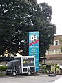
Dublin 4 includesBallsbridge,Belfield,Donnybrook,Irishtown,Merrion,Pembroke,RingsendandSandymountand contains theRDSgrounds,Aviva Stadium(formerlyLansdowne Roadstadium), and manyembassies.Long considered the city's wealthiest postcode, "Dublin 4"has acquired its own socio-economic identity.[12]
Dublin 5 (D5)[edit]
Dublin 5 includes most ofArtane,[13]centralCoolock,Harmonstown,Kilbarrack,Killester,andRaheny.
Dublin 6 (D6)[edit]
Dublin 6 includesMilltown,Ranelagh,parts ofTerenure,Rathmines(includingDartry), andRathgar.
Dublin 6 West (D6W)[edit]

Dublin 6 West includesHarold's Cross,Templeogue,KimmageandTerenure.
Dublin 7 (D7)[edit]
Dublin 7 includesArbour Hill,some parts ofAshtown,Broadstone,Cabra,Grangegorman,Oxmantown,Phibsborough,Smithfield,Stoneybatter.
Dublin 8 (D8)[edit]
Dublin 8 includesDolphin's Barn,Inchicore,Islandbridge,Kilmainham,Merchants Quay,Portobello,South Circular Road,thePhoenix Parkandthe Liberties.Notable buildings includeChrist Church CathedralandSt. Patrick's Cathedral.It is one of only two postal districts to span the Liffey.[5]
Dublin 9 (D9)[edit]
Dublin 9 includes parts ofBallymuneast of Ballymun Road (Shangan and Coultry),Beaumont,Donnycarney,Drumcondra,Elm Mount, Griffith Avenue, parts ofGlasnevin(St Mobhi,Botanic GardensandMet Éireann),Santry,andWhitehall.
Dublin 10 (D10)[edit]
Dublin 10 includesBallyfermot,Sarsfield Road,andCherry Orchard.
Dublin 11 (D11)[edit]
Dublin 11 includes most ofBallymunwest of Ballymun Road (Sillogue, Balcurris, Balbutcher, Poppintree, Sandyhill and Wadelai), Dubber Cross,Finglas(includingBallygalland Cappagh), most ofGlasnevin(Cremore, Addison, Violet Hill, Willow Park, Finglas Road, Old Finglas Road andGlasnevin Cemetery), Kilshane Cross, The Ward and Coolquay.
Dublin 12 (D12)[edit]
Dublin 12 includesBluebell,Crumlin,parts of Terenure,Kimmage,Drimnagh,Greenhills,PerrystownandWalkinstown.
Dublin 13 (D13)[edit]
Dublin 13 includesBaldoyle,Bayside,Donaghmede,Clongriffin,Sutton,HowthandAyrfield.

Dublin 14 (D14)[edit]
Dublin 14 includesChurchtown,Clonskeagh,most ofDundrum,Goatstown,lowerRathfarnhamandWindy Arbour.
Dublin 15 (D15)[edit]
Dublin 15 includesAshtown,Blanchardstown,Castleknock,Coolmine,Clonsilla,Corduff,Mulhuddart,Tyrrelstown,andOngar.While the town ofCloneeis located in Dublin's neighbouringCounty Meath,for mailing purposes it is designated as D15. This leads to a mailing quirk whereby the town's addresses could be verbalised as ending with, "County Meath, Dublin 15".

Dublin 16 (D16)[edit]
Dublin 16 includesBallinteer,Ballyboden,parts ofDundrum,Kilmashogue,Knocklyon,upperRathfarnhamandRockbrook.
Dublin 17 (D17)[edit]
Dublin 17 includesBalgriffin,most ofCoolock,andBelcamp,Darndale,Priorswood and Riverside.
Dublin 18 (D18)[edit]
Dublin 18 includesCabinteely,Carrickmines,Foxrock,Kilternan,Sandyford,Shankill,Ticknock, Ballyedmonduff,Stepaside,andLeopardstown.

Dublin 20 (D20)[edit]
Dublin 20 includesChapelizod,andPalmerstown.This is one of only two postal districts to span the Liffey.
Dublin 22 (D22)[edit]
Dublin 22 includesClondalkin,Liffey Valley, Newcastle and Neilstown.
Dublin 24 (D24)[edit]
Dublin 24 includesFirhouse,Jobstown,Old Bawn,Tallaght,and parts ofBallymount.

County Dublin (A41–K78)[edit]
These areas do not fall inside the historic Dublin postal districts and their postal routing keys came about through the newEircodesystem. This is because many of these suburbs and towns fell outside the purview of Dublin city in the past. Today, they form part of "A" and "K" DublinEircode areas.There are 12 of these districts in total. Notable locales includeBlackrock,Dún Laoghaire,Malahide,Swords,Lucan,RushandSkerries.While a small part ofBraylies inDún Laoghaire–Rathdown,for mailing purposes, the entirety of Bray is inCounty Wicklow's A98 routing area.
Later developments[edit]
SuccessiveMinisters for Communicationssince 2005 announced plans to introduce a full postcode system across the state.[14][15][16]
On 8 October 2013, Minister for Communications, Energy and Natural Resources,Pat Rabbitteannounced a postcode system for the entire country.[17]This came into effect during 2015 and gave an individual post code to every address in Ireland.[2]The pre-existing Dublin district numbers are a component of the full postcode for relevant addresses, forming part of the routing code, the first three characters of the code. For example, a code for an address in Dublin 1 would start withD01,followed by four characters, hence DublinD01 B2CD.[18]
Marketing[edit]
The districts are sometimes used in a manner similar to the sub-districts of theLondon postal districtwhereby they replace a placename. A property might be described as being "in D4", for example.[19]This public awareness of Dublin postal districts allows occasional use in marketing. Dublinnis usually abbreviated to Dn,with examples including the "D7 Restaurant", "Dtwo" nightclub, or "D4 Hotels".[20]
-
 D One restaurant
 -
 Dtwo nightclub
 -
 D4 Hotels
 -
 RhodesD7 restaurant


See also[edit]
References[edit]
- ^"New postal code system by 2011".The Irish Times.21 September 2009.
- ^ab"Ireland's new postcode system launches today – here's what you need to know".thejournal.ie.The Journal. 13 July 2015.
- ^"New 'Eircodes' being sent to Fingal addresses this month".Fingal Independent.18 July 2015.
- ^"Dubliners go postal over the right address".Irish Independent.19 July 2015.
The new regime does not yet seem to spell the end for the postal district numbering system [..] drawn up under British rule in 1917
- ^abcdef"Dublin's vanishing postal districts".The Irish Times.16 March 2015.
The postal districts in Dublin date back to 1917, when they were also introduced in cross- channel cities. Postal districts had started in London in 1857 [..] Dublin didn't start using postal district numbers until 1961, as reflected in the old green street nameplates
- ^"Ireland's new postcodes: Everything you need to know about Eircode".Irish Mirror.13 July 2015.
- ^Ferguson, Stephen (2016).The Post Office in Ireland.Dublin:Irish Academic Press.ISBN978-1-911024-32-3.
- ^Post-Líomatáiste Bhaile Átha Cliath: Dublin Postal Area,Department of Posts and Telegraphs,August 1927, pp. 1, 3, 8, 11
- ^"It's in the postcode".Irish Independent.26 September 2009.
- ^"Postcode war 'in next year'".Irish Independent.21 September 2008.
- ^"Postcode snobbery screams 'location, location, location'".The Irish Times.11 October 2003.
- ^Moore, Robert (2011). ""If I Actually Talked Like That, I'd Pull a Gun on Myself": Accent, Avoidance, and Moral Panic in Irish English ".Anthropological Quarterly.84(1): 41–64.doi:10.1353/anq.2011.0014.JSTOR41237479.S2CID1097733.
- ^Note: Most of the civil parish of Artaine – the townlands of Artaine South, Artaine West and Puckstown – lies within Dublin 9.
- ^"Ryan finalises plans for new postcode system".Sunday Tribune.3 January 2010. Archived fromthe originalon 9 July 2010.
- ^Coyle, Coloin (10 September 2006)."Upmarket Dublin survives postcode shake-up".The Sunday Times.Ireland News. UK. Archived fromthe originalon 11 May 2009.Retrieved28 September2008.
- ^Michael, Jason (21 September 2009)."New postal code system by 2011".The Irish Times.Retrieved28 September2008.
- ^Rabbitte, Minister Pat (8 October 2013)."Rabbitte Gets Green Light From Cabinet For" Next Generation Postcode "System By 2015".Department of Communications, Energy and Natural Resources.Archived fromthe originalon 22 November 2013.Retrieved21 December2013.
- ^"Frequently Asked Questions".eircode.ie.Eircode.Retrieved12 April2019.
The existing established Dublin Postal Districts 1 to 24 and 6W are being retained in the Routing Key as D01 to D24
- ^Deegan, Gordon (1 December 2020)."Co-living scheme in D4 gets green light".The Irish Times.Dublin.Retrieved28 May2021.
- ^O'Shea, Cormac (16 September 2020)."Dublin 'nightclub' to reopen its doors this week but not as you once knew it".The Irish Mirror.Dublin.Retrieved1 March2021.
External links[edit]
- Eircode(official website)
- An Post – The Post Office
- ComReg – Commission for Communications Regulation
Regions ofCounty Dublin | ||
|---|---|---|
| Cities |  | |
| Towns and villages | ||
| Counties | ||
| Other regions | ||
| Civil sub-divisions | ||
| Baronies of Dublin | ||