ED50
| Geodesy |
|---|
 |
ED50( "European Datum 1950",EPSG:4230[1]) is ageodetic datumwhich was defined afterWorld War IIfor the international connection ofgeodetic networks.
Background
[edit]
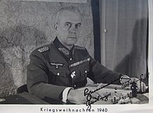
Some of the important battles ofWorld War IIwere fought on the borders ofGermany,theNetherlands,BelgiumandFrance,and the mapping of these countries had incompatiblelatitudeandlongitudepositioning. During the war the German Military Survey (Reichsamt Kriegskarten und Vermessungswesen), under the command of Lieutenant General Gerlach Hemmerich, began a systematic mapping of the areas under the control of the German Military, a large part of Europe.[2]The allies were also concerned about the state of mapping in Europe, and in 1944 theUS Army Map Serviceset up an intelligence team to collect mapping and surveying information from the Germans as the allied armies moved through Europe after theNormandy landings.The group, known as Houghteam after Major Floyd W. Hough, collected much material. Their greatest success was in April 1945. They found a large cache of material inSaalfeld,Thuringia,which proved to be the entire geodetic archives of the German Army. The shipment, 75 truckloads in all, was transferred toBamberg,and then to Washington for evaluation.[3]
Shortly after this, the team captured the personnel of the Reichsamt für Landesaufnahme, the State Surveying Service, inFriedrichroda,also in Thuringia. This group had been working on the integration of the mapping of the occupied territories with that of Germany, under Professor Erwin Gigas, ageodesistwith an international reputation. They were directed to continue this work, in Bamberg in the US zone of occupation, as part of the US-led effort to develop a single adjustedtriangulationforCentral Europe.This was completed in 1947.[4][5][6]The work was then extended to cover much ofWestern Europewhich was completed in 1950, and became ED50.[4]
The European triangulation was originally classified military information. It was declassified in the 1960s, and became the basis for the definition of international boundaries in the North Sea.[7]It was, and still is, used in much of Western Europe apart fromGreat Britain,Ireland,SwedenandSwitzerland,which have their own datums.
It used theInternational Ellipsoidof 1924 ( "Hayford-Ellipsoid "of 1909) (radiusof the Earth'sequator6378.388 km,flattening1/297, both exact). That spheroid was an early attempt to model the whole Earth and was widely used around the world until the 1980s whenGRS 80andWGS 84were established.
Many national coordinate systems ofGauss–Krügerare defined by ED50 and oriented by means ofgeodetic astronomy.Up to now it has been used indatabasesof gravity fields,cadastre,smallsurveyingnetworks in Europe and America, and by some developing countries with no modern baselines. ED50 was also part of the fundamentals of theNATOcoordinates (Gauss–KrügerandUTM) up to the 1980s.[citation needed]
The geodetic datum ofED50was centred at theHelmertturmon theTelegrafenberginPotsdam,(then East)Germany;the intent was to encourage cooperation with the socialist states during theCold War,which failed. The adjustments for later versions of the datum (ED77,ED79) used theMunich Frauenkircheas starting point.[citation needed]
Datum shift between ED50 and WGS 84
[edit]The longitude and latitude lines on the two datums are the same in theArchangelregion of north-westRussia.As one moves westwards across Europe, the longitude lines on ED50 gradually become further west than their WGS 84 equivalents, and are around 100 metres west inSpainandPortugal.Moving southwards, the latitude lines on ED50 gradually become further south than the WGS 84 lines, and are around 100 m south in theMediterranean Sea.
This means that if the lines are further west, the longitude value of any given point becomes more easterly. Similarly, if the lines are south, the values become northerly. This is due to the fact that the International Ellipsoid is larger than the GRS 80/WGS 84 ellipsoid, so a given north-south distance will cover more latitude on the new ellipsoid, and a given east-west distance will cover more longitude.
The datum shift for theUniversal Transverse Mercatorgrid is different. The eastings vary between 0 m in Eastern Europe and 100 m in the far west of the continent, roughly similar to the longitude shift, but the northings are about 200 m different across Europe, with the ED50 UTM northing lines south of the WGS 84 UTM northing lines. UTM northings are measured from the Equator; distance from the equator to latitude 50 degrees is 112 m more on the International than on the WGS 84 spheroid.
References
[edit]- ^"EPSG:4230".epsg.io.Retrieved14 January2022.
- ^Kettle, Simon (5 February 2016)."The European Datum: A History (Part 1)".Esri Community.Retrieved14 January2022.
- ^Kettle, Simon (29 February 2016)."The European Datum: A History (Part 2)".Esri Community.Retrieved14 January2022.
- ^abKettle, Simon (21 March 2016)."The European Datum: A History (Part 3)".Esri Community.Retrieved14 January2022.
- ^Hough, Floyd W. (1947). "The readjustment of European triangulation".Transactions, American Geophysical Union.28(1): 62.Bibcode:1947TrAGU..28...62H.doi:10.1029/TR028i001p00062.ISSN0002-8606.
- ^Hough, Floyd W. (January 1948). "The adjustment of European first-order triangulation".Bulletin Géodésique.7(1): 35–41.Bibcode:1948BGeod..22...35H.doi:10.1007/BF02527118.eISSN0007-4632.S2CID119934421.
- ^Whitmore, Guy Matthew (1997).Coordinate reference systems for high-precision geodesy(PDF)(PhD). Nottingham University. pp. 59–65.
See also
[edit]- The French datumRGF93
- The Great Britain datumOSGB36.
- For Ireland, theIrish Transverse Mercator.
- The Swedish datumRT90.
- The Switzerland datumCH1903.
