Esrum Å
| Esrum Å | |
|---|---|
 Esrum Å at Esrum Watermill | |
| Location | |
| Country | Denmark |
| Region | Zealand |
| District | Capital Region |
| Municipality | Gribskov Municipality |
| Physical characteristics | |
| Source | Lake Esrum |
| • location | Gribskov Municipality |
| • coordinates | 56°02′11″N12°22′50″E/ 56.036250°N 12.380659°E |
| • elevation | 9.4 m (31 ft) |
| Mouth | Hulerød,Dronningmølle |
• location | Kattegat |
• coordinates | 56°06′12″N12°22′49″E/ 56.103313°N 12.380208°E |
• elevation | 0 m (0 ft) |
| Length | 10 km (6.2 mi) |
Esrum Åis the principal drainage ofLake Esrum,Denmark's second largest lake, located inGribskov Municipality,some 50 km north ofCopenhagen,Denmark.The 10-km-long stream extends from the northwestern part of the lake and flows pastEsrum WatermillandEsrum Abbeyon its way toThe KattegatatDronningmølle.
Esrum Canal(Danish: Esrum Kanal) was built in about 1800 to facilitate the transportation of firewood fromGribskovto Copenhagen, offering a navigable alternative to the upper part of Rsrum Å. It remained in use until the 1870s but has now dried out.
History
[edit]
Esrum Watermill was probably built in the 12th century and belonged to Esrum Abbey until the Reformation when it was confiscated by the Crown. The upper part of the stream was regulated in the beginning of the 16th century at the initiative ofChristian IV,probably to give the watermill more power.

At the turn of the 19th century, theEnglish Warsmade it difficult to transport firewood from Norway which was still part of the Danish kingdom. To facilitate the transportation of firewood from Gribskov to Copenhagen, it was decided to construct a canal between Lake Esrum and the sea atDronningmølle.The work was led by Adolph von der Recke and carried out by local peasants, soldiers and forced labour workers. Construction began in 1802 and the canal was completed in 1805.

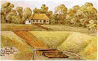
The canal was 9 km long, 9 m wide and 1.5 m deep. Atowpathran on the banks of the canal and on the western shores of lake Esrum. The timber had to pass a 4-metre crater-like ramp calledVæltningen,which connected the upper section of the canal to its lower part. In Dronningmølle, the firewood was loaded onto large cargo ships and sailed to Copenhagen.

The upper part of the canal passed two ponds. One of them, Storedam (Great Pond), was the site of a watermill which was first used as backup for the gunpowder mill inFrederiksværkduring theEnglish Warsand later for the manufacturing of textiles for the army. Transportation of firewood on the canal continued until 1874 and it was later used for leisure trips. It has now dried out and been covered by forest, but Væltningen and other elements are still visible in the landscape.[1]
Ecology
[edit]Characteristic plant species includelarge bittercress(Cardamine amara),marsh-marigold(Caltha palustris) andyellow iris.[2]
See also
[edit]References
[edit]- ^"Pramfarten på Esrum Å"(in Danish). Folk og minder i Nordsjælland. Archived fromthe originalon 2014-02-22.Retrieved2014-12-04.
- ^"Snævret Skov"(in Danish). Danmarks Naturfredningsforening.Retrieved2014-12-04.
