The Black Sea has a positivewater balance,with an annual net outflow of 300 km3(72 cu mi) per year through the Bosporus and theDardanellesinto theAegean Sea.[6]While the net flow of water through the Bosporus and Dardanelles (known collectively as theTurkish Straits) is out of the Black Sea, water generally flows in both directions simultaneously: Denser, moresaline waterfrom the Aegean flows into the Black Sea underneath the less dense, fresher water that flows out of the Black Sea. This creates a significant and permanent layer of deep water that does not drain or mix and is thereforeanoxic.This anoxic layer is responsible for the preservation ofancient shipwreckswhich have been found in the Black Sea, which ultimately drains into theMediterranean Sea,via the Turkish Straits and the Aegean Sea. The Bosporus strait connects it to the smallSea of Marmarawhich in turn is connected to the Aegean Sea via the strait of theDardanelles.To the north, the Black Sea is connected to the Sea of Azov by theKerch Strait.
The water level has varied significantly over geological time. Due to these variations in the water level in the basin, the surroundingshelfand associated aprons have sometimes been dry land. At certain critical water levels, connections with surrounding water bodies can become established. It is through the most active of these connective routes, the Turkish Straits, that the Black Sea joins theWorld Ocean.During geological periods when this hydrological link was not present, the Black Sea was anendorheic basin,operating independently of the global ocean system (similar to theCaspian Seatoday). Currently, the Black Sea water level is relatively high; thus, water is being exchanged with the Mediterranean. TheBlack Sea undersea riveris a current of particularly saline water flowing through the Bosporus Strait and along theseabedof the Black Sea, the first of its kind discovered.[citation needed]
The earliest known name of the Black Sea is the Sea of Zalpa, so called by both theHattians[9]and their conquerors, theHittites.The Hattic city ofZalpawas "situated probably at or near the estuary of the Marrassantiya River, the modernKızıl Irmak,on the Black Sea coast. "[10]
The principalGreeknamePóntos Áxeinosis generally accepted to be a rendering of theIranianword*axšaina-( "dark colored" ).[8]Ancient Greek voyagers adopted the name asÁ-xe(i)nos,identified with the Greek wordáxeinos(inhospitable).[8]The nameΠόντος ἌξεινοςPóntos Áxeinos(Inhospitable Sea), first attested inPindar(c. 475 BC), was considered an ill omen and was euphemized to its opposite,Εὔξεινος ΠόντοςEúxeinos Póntos(Hospitable Sea), also first attested in Pindar. This became the commonly used designation in Greek, although in mythological contexts the "true" namePóntos Áxeinosremained favoured.[8]
Strabo'sGeographica(1.2.10) reports that in antiquity, the Black Sea was often simply called "the Sea" (ὁ πόντοςho Pontos).[11]He thought that the sea was called the "Inhospitable SeaΠόντος ἌξεινοςPóntos Áxeinosby the inhabitants of thePontusregion of the southern shoreline before Greek colonisation due to its difficult navigation and hostile barbarian natives (7.3.6), and that the name was changed to "hospitable" after theMilesianscolonisedthe region, bringing it into the Greek world.[12]
Popular supposition derives "Black Sea" from the dark color of the water or climatic conditions. Some scholars understand the name to be derived from a system ofcolour symbolism representing the cardinal directions,with black or dark for north, red for south, white for west, and green or light blue for east.[8]Hence, "Black Sea" meant "Northern Sea". According to this scheme, the name could only have originated with a people living between the northern (black) and southern(red) seas:this points to theAchaemenids(550–330 BC).[8]
The area surrounding the Black Sea is commonly referred to as theBlack Sea Region.Its northern part lies within theChernozembelt(black soil belt) which goes from eastern Croatia (Slavonia), along theDanube(northern Serbia, northern Bulgaria (Danubian Plain) and southern Romania (Wallachian Plain) to northeast Ukraine and further across theCentral Black Earth Regionand southern Russia intoSiberia.[19]
Thelittoral zoneof the Black Sea is often referred to as thePontic littoralorPontic zone.[20]
These rivers and their tributaries comprise a 2-million km2(0.77-million sq mi) Black Sea drainage basin that covers wholly or partially 24 countries:[24][25][26][27][28]
Short-term climatic variation in the Black Sea region is significantly influenced by the operation of theNorth Atlantic oscillation,the climatic mechanisms resulting from the interaction between the north Atlantic and mid-latitude air masses.[29]While the exact mechanisms causing the North Atlantic Oscillation remain unclear,[30]it is thought the climate conditions established in western Europe mediate the heat and precipitation fluxes reaching Central Europe and Eurasia, regulating the formation of wintercyclones,which are largely responsible for regionalprecipitationinputs[31]and influence Mediterraneansea surface temperatures(SSTs).[32]
The relative strength of these systems also limits the amount of cold air arriving from northern regions during winter.[33]Other influencing factors include the regionaltopography,as depressions and storm systems arriving from theMediterraneanare funneled through the low land around the Bosporus, with thePonticandCaucasusmountain ranges acting as waveguides, limiting the speed and paths of cyclones passing through the region.[34]
The Black Sea is divided into two depositional basins—the Western Black Sea and Eastern Black Sea—separated by the Mid-Black Sea High, which includes the Andrusov Ridge, Tetyaev High, and Archangelsky High, extending south from theCrimean Peninsula.The basin includes two distinct relictback-arc basinswhich were initiated by the splitting of anAlbianvolcanic arcand thesubductionof both thePaleo- and Neo-Tethysoceans, but the timings of these events remain uncertain. Arc volcanism and extension occurred as the Neo-Tethys Ocean subducted under the southern margin ofLaurasiaduring theMesozoic.Uplift and compressional deformation took place as the Neotethys continued to close. Seismic surveys indicate that rifting began in the Western Black Sea in theBarremianandAptianfollowed by the formation of oceanic crust 20 million years later in theSantonian.[35][36][37]Since its initiation, compressional tectonic environments led tosubsidencein the basin, interspersed with extensional phases resulting in large-scalevolcanismand numerousorogenies,causing the uplift of theGreater Caucasus,Pontides,southernCrimean PeninsulaandBalkanidesmountain ranges.[38]
TheYavuz Sultan Selim BridgeinIstanbul,Turkey,crosses theBosporusstrait near its entrance to the Black Sea. Connecting Europe and Asia, it is one of the tallest suspension bridges in the world.
During theMessinian salinity crisisin the neighboringMediterranean Sea,water levels fell but without drying up the sea.[39]The collision between theEurasianandAfricanplates and the westward escape of theAnatolianblock along theNorth AnatolianandEast Anatolianfaults dictates the current tectonic regime,[38]which features enhanced subsidence in the Black Sea basin and significant volcanic activity in the Anatolian region.[40]These geological mechanisms, in the long term, have caused the periodic isolations of the Black Sea from the rest of the global ocean system.
The largeshelfto the north of the basin is up to 190 km (120 mi) wide and features a shallow apron with gradients between 1:40 and 1:1000. The southern edge around Turkey and the eastern edge aroundGeorgia,however, are typified by a narrow shelf that rarely exceeds 20 km (12 mi) in width and a steep apron that is typically 1:40 gradient with numerous submarine canyons and channel extensions. TheEuxine abyssal plainin the centre of the Black Sea reaches a maximum depth of 2,212 metres (7,257.22 feet) just south ofYaltaon theCrimean Peninsula.[41]
The Paleo-Euxinianis described by the accumulation ofeolian siltdeposits (related to theRiss glaciation) and the lowering of sea levels (MIS6, 8 and 10). The Karangatmarine transgressionoccurred during theEemianInterglacial(MIS 5e). This may have been the highest sea levels reached in the latePleistocene.Based on this some scholars have suggested that theCrimean Peninsulawas isolated from the mainland by a shallow strait during the Eemian Interglacial.[42]
The Neoeuxinian transgression began with an inflow of waters from theCaspian Sea.Neoeuxinian deposits are found in the Black Sea below −20 m (−66 ft) water depth in three layers. The upper layers correspond with the peak of the Khvalinian transgression, on the shelf shallow-water sands andcoquinamixed with silty sands and brackish-water fauna, and inside the Black Sea Depressionhydrotroilitesilts. The middle layers on the shelf are sands with brackish-water mollusc shells. Of continental origin, the lower level on the shelf is mostlyalluvialsands with pebbles, mixed with less commonlacustrinesilts and freshwatermollusc shells.Inside the Black Sea Depression they areterrigenousnon-carbonatesilts,and at the foot of thecontinental slopeturbiditesediments.[43]
ThisSeaWiFSview reveals the colorful interplay of currents on the sea's surface.
The Black Sea is the world's largest body of water with ameromicticbasin.[44]The deep waters do not mix with the upper layers of water that receive oxygen from the atmosphere. As a result, over 90% of the deeper Black Sea volume isanoxicwater.[45]The Black Sea's circulation patterns are primarily controlled by basin topography andfluvialinputs, which result in a strongly stratified vertical structure. Because of the extreme stratification, it is classified as asalt wedge estuary.
Inflow from theMediterranean Seathrough theBosporusandDardanelleshas a higher salinity and density than the outflow, creating the classic estuarine circulation. This means that the inflow of dense water from the Mediterranean occurs at the bottom of the basin while the outflow of fresher Black Sea surface-water into theSea of Marmaraoccurs near the surface. According to Gregg (2002), the outflow is 16,000 cubic metres per second (570,000 cubic feet per second) or around 500 cubic kilometres per year (120 cubic miles per year), and the inflow is 11,000 m3/s (390,000 cu ft/s) or around 350 km3/a (84 cu mi/a).[46]
The following water budget can be estimated:[when?]
The southern sill of the Bosporus is located at 36.5 m (120 ft) below present sea level (deepest spot of the shallowest cross-section in the Bosporus, located in front ofDolmabahçe Palace) and has a wet section of around 38,000 m2(410,000 sq ft).[46]Inflow and outflow current speeds are averaged around 0.3 to 0.4 m/s (1.0 to 1.3 ft/s), but much higher speeds are found locally, inducing significant turbulence and vertical shear. This allows for turbulent mi xing of the two layers.[49]Surface water leaves the Black Sea with a salinity of 17practical salinity units(PSU) and reaches the Mediterranean with a salinity of 34 PSU. Likewise, an inflow of the Mediterranean with salinity 38.5 PSU experiences a decrease to about 34 PSU.[49]
Mean surface circulation iscyclonic;waters around the perimeter of the Black Sea circulate in a basin-wide shelfbreakgyreknown as the Rim Current. The Rim Current has a maximum velocity of about 50–100 cm/s (20–39 in/s). Within this feature, two smaller cyclonic gyres operate, occupying the eastern and western sectors of the basin.[49]The Eastern and Western Gyres are well-organized systems in the winter but dissipate into a series of interconnectededdiesin the summer and autumn. Mesoscale activity in the peripheral flow becomes more pronounced during these warmer seasons and is subject to interannual variability.
Outside of the Rim Current, numerous quasi-permanent coastal eddies are formed as a result ofupwellingaround the coastal apron and "wind curl" mechanisms. The intra-annual strength of these features is controlled by seasonal atmospheric and fluvial variations. During the spring, the Batumi eddy forms in the southeastern corner of the sea.[50]
Beneath the surface waters—from about 50 to 100 metres (160 to 330 ft)—there exists ahaloclinethat stops at the Cold Intermediate Layer (CIL). This layer is composed of cool, salty surface waters, which are the result of localized atmospheric cooling and decreased fluvial input during the winter months. It is the remnant of the winter surface mixed layer.[49]The base of the CIL is marked by a majorpycnoclineat about 100–200 metres (330–660 ft), and this density disparity is the major mechanism for isolation of the deep water.
Below the pycnocline is the Deep Water mass, where salinity increases to 22.3 PSU and temperatures rise to around 8.9 °C (48.0 °F).[49]The hydrochemical environment shifts from oxygenated to anoxic, as bacterial decomposition of sunken biomass utilizes all of the free oxygen. Weakgeothermal heatingand longresidence timecreate a very thick convective bottom layer.[50]
TheBlack Sea undersea riveris a current of particularly saline water flowing through the Bosporus Strait and along theseabedof the Black Sea. The discovery of the river, announced on August 1, 2010, was made by scientists at theUniversity of Leedsand is the first of its kind to be identified.[51]The undersea river stems from salty water spilling through the Bosporus Strait from the Mediterranean Sea into the Black Sea, where the water has a lower salt content.[51]
Because of the anoxic water at depth, organic matter, includinganthropogenicartifacts such as boat hulls, are well preserved. During periods of high surface productivity, short-livedalgal bloomsform organic rich layers known assapropels.Scientists have reported an annualphytoplanktonbloom that can be seen in many NASA images of the region.[52]As a result of these characteristics the Black Sea has gained interest from the field ofmarine archaeology,as ancient shipwrecks in excellent states of preservation have been discovered, such as theByzantinewreckSinop D,located in the anoxic layer off the coast ofSinop, Turkey.
Modelling shows that, in the event of anasteroid impacton the Black Sea, the release ofhydrogen sulfideclouds would pose a threat to health—and perhaps even life—for people living on the Black Sea coast.[53]
There have been isolated reports of flares on the Black Sea occurring during thunderstorms, possibly caused by lightning igniting combustible gas seeping up from the sea depths.[54]
The Black Sea supports an active and dynamic marine ecosystem, dominated by species suited to thebrackish,nutrient-rich, conditions. As with all marine food webs, the Black Sea features a range oftrophicgroups, withautotrophicalgae, includingdiatomsanddinoflagellates,acting as primary producers. The fluvial systems draining Eurasia and central Europe introduce large volumes of sediment and dissolved nutrients into the Black Sea, but the distribution of these nutrients is controlled by the degree of physiochemical stratification, which is, in turn, dictated by seasonal physiographic development.[55]
During winter, strong wind promotes convective overturning and upwelling of nutrients, while high summer temperatures result in a marked vertical stratification and a warm, shallow mixed layer.[56]Day length andinsolationintensity also control the extent of thephotic zone.Subsurface productivity is limited by nutrient availability, as the anoxic bottom waters act as a sink for reducednitrate,in the form ofammonia.Thebenthic zonealso plays an important role in Black Sea nutrient cycling, as chemosynthetic organisms and anoxic geochemical pathways recycle nutrients which can be upwelled to the photic zone, enhancing productivity.[57]
In total, the Black Sea's biodiversity contains around one-third of the Mediterranean's and is experiencing natural and artificial invasions or "Mediterranizations".[58][59]
Phytoplanktonblooms and plumes of sediment form the bright blue swirls that ring the Black Sea in this 2004 image.
The main phytoplankton groups present in the Black Sea aredinoflagellates,diatoms,coccolithophoresandcyanobacteria.Generally, the annual cycle of phytoplankton development comprises significant diatom and dinoflagellate-dominated spring production, followed by a weaker mixed assemblage of community development below the seasonal thermocline during summer months, and surface-intensified autumn production.[56][60]This pattern of productivity is augmented by anEmiliania huxleyibloom during the late spring and summer months.
Annual dinoflagellate distribution is defined by an extended bloom period in subsurface waters during the late spring and summer. In November, subsurface plankton production is combined with surface production, due to vertical mi xing of water masses and nutrients such asnitrite.[55]The major bloom-forming dinoflagellate species in the Black Sea isGymnodiniumsp.[61]Estimates of dinoflagellate diversity in the Black Sea range from 193[62]to 267 species.[63]This level of species richness is relatively low in comparison to the Mediterranean Sea, which is attributable to the brackish conditions, low water transparency and presence ofanoxicbottom waters. It is also possible that the low winter temperatures below 4 °C (39 °F) of the Black Sea preventthermophilousspecies from becoming established. The relatively high organic matter content of Black Sea surface water favor the development ofheterotrophic(an organism that uses organic carbon for growth) and mixotrophic dinoflagellates species (able to exploit different trophic pathways), relative to autotrophs. Despite its unique hydrographic setting, there are no confirmedendemicdinoflagellate species in the Black Sea.[63]
The Black Sea is populated by many species of the marine diatom, which commonly exist as colonies ofunicellular,non-motile auto- and heterotrophicalgae.The life-cycle of most diatoms can be described as 'boom and bust' and the Black Sea is no exception, with diatom blooms occurring in surface waters throughout the year, most reliably during March.[55]In simple terms, the phase of rapid population growth in diatoms is caused by the in-wash ofsilicon-bearing terrestrial sediments, and when the supply of silicon is exhausted, the diatoms begin to sink out of the photic zone and produce restingcysts.Additional factors such as predation by zooplankton andammonium-based regenerated production also have a role to play in the annual diatom cycle.[55][56]Typically,Proboscia alatablooms during spring andPseudosolenia calcar-avisblooms during the autumn.[61]
Coccolithophores are a type ofmotile,autotrophicphytoplanktonthat produce CaCO3plates, known ascoccoliths,as part of their life cycle. In the Black Sea, the main period of coccolithophore growth occurs after the bulk of the dinoflagellate growth has taken place. In May, the dinoflagellates move below the seasonalthermoclineinto deeper waters, where more nutrients are available. This permits coccolithophores to utilize the nutrients in the upper waters, and by the end of May, with favorable light and temperature conditions, growth rates reach their highest. The major bloom-forming species isEmiliania huxleyi,which is also responsible for the release ofdimethyl sulfideinto the atmosphere. Overall, coccolithophore diversity is low in the Black Sea, and although recent sediments are dominated byE. huxleyiandBraarudosphaera bigelowii,Holocenesediments have been shown to also contain Helicopondosphaera and Discolithina species.
Cyanobacteria are a phylum ofpicoplanktonic(plankton ranging in size from 0.2 to 2.0μm)bacteriathat obtain their energy viaphotosynthesis,and are present throughout the world's oceans. They exhibit a range of morphologies, including filamentous colonies andbiofilms.In the Black Sea, several species are present, and as an example,Synechococcusspp. can be found throughout the photic zone, although concentration decreases with increasing depth. Other factors which exert an influence on distribution include nutrient availability, predation, and salinity.[64]
The Black Sea along with theCaspian Seais part of the zebra mussel's native range. The mussel has been accidentally introduced around the world and become aninvasive specieswhere it has been introduced.
The common carp's native range extends to the Black Sea along with the Caspian Sea andAral Sea.Like the zebra mussel, the common carp is an invasive species when introduced to other habitats.
Another native fish that is also found in the Caspian Sea. It preys upon zebra mussels. Like the mussels and common carp, it has become invasive when introduced to other environments, like theGreat Lakesin North America.
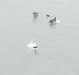
Marine mammals present within the basin include two species of dolphin (common[65]andbottlenose[66]) and theharbour porpoise,[67]although all of these are endangered due to pressures and impacts by human activities. All three species have been classified as distinct subspecies from those in the Mediterranean and the Atlantic and are endemic to the Black andAzovseas, and are more active during nights in the Turkish Straits.[68]However, construction of theCrimean Bridgehas caused increases in nutrients and planktons in the waters, attracting large numbers of fish and more than 1,000 bottlenose dolphins.[69]However, others claim that construction may cause devastating damages on the ecosystem, including dolphins.[70]
Ongoing Mediterranizations may or may not boost cetacean diversity in the Turkish Straits[68]and hence in the Black and Azov basins.
Various species ofpinnipeds,sea otter,andbeluga whale[74][75]were introduced into the Black Sea by mankind and later escaped either by accidental or purported causes. Of these,grey seals[76]and beluga whales[74]have been recorded with successful, long-term occurrences.
Great white sharksare known to reach into the Sea of Marmara and Bosporus Strait andbasking sharksinto the Dardanelles, although it is unclear whether or not these sharks may reach into the Black and Azov basins.[77][78]
Since the 1960s, rapid industrial expansion along the Black Sea coastline and the construction of a major dam has significantly increased annual variability in the N:P:Si ratio in the basin. In coastal areas, the biological effect of these changes has been an increase in the frequency of monospecific phytoplankton blooms, with diatom bloom frequency increasing by a factor of 2.5 and non-diatom bloom frequency increasing by a factor of 6. The non-diatoms, such as the prymnesiophytesEmiliania huxleyi(coccolithophore),Chromulinasp., and the EuglenophyteEutreptia lanowii,are able to out-compete diatom species because of the limited availability of silicon, a necessary constituent of diatom frustules.[79]As a consequence of these blooms, benthic macrophyte populations were deprived of light, while anoxia caused mass mortality in marine animals.[80][81]
The decline in macrophytes was further compounded by overfishing during the 1970s, while the invasive ctenophoreMnemiopsisreduced the biomass ofcopepodsand other zooplankton in the late 1980s. Additionally, an alien species—thewarty comb jelly(Mnemiopsis leidyi)—was able to establish itself in the basin, exploding from a few individuals to an estimated biomass of one billion metric tons.[82]The change inspecies compositionin Black Sea waters also has consequences for hydrochemistry, as calcium-producing coccolithophores influence salinity and pH, although these ramifications have yet to be fully quantified. In central Black Sea waters, silicon levels were also significantly reduced, due to a decrease in the flux of silicon associated with advection across isopycnal surfaces. This phenomenon demonstrates the potential for localized alterations in Black Sea nutrient input to have basin-wide effects.
Pollution reduction and regulation efforts have led to a partial recovery of the Black Sea ecosystem during the 1990s, and an EU monitoring exercise, 'EROS21', revealed decreased nitrogen and phosphorus values, relative to the 1989 peak.[83]Recently, scientists have noted signs of ecological recovery, in part due to the construction of newsewage treatmentplants in Slovakia, Hungary, Romania, and Bulgaria in connection with membership in the European Union.Mnemiopsis leidyipopulations have been checked with the arrival of another alien species which feeds on them.[84]
The Black Sea is connected to theWorld Oceanby a chain of two shallowstraits,theDardanellesand theBosporus.The Dardanelles is 55 m (180 ft) deep, and the Bosporus is as shallow as 36 m (118 ft). By comparison, at the height of thelast ice age,sea levels were more than 100 m (330 ft) lower than they are now.
There is evidence that water levels in the Black Sea were considerably lower at some point during the post-glacial period. Some researchers theorize that the Black Sea had been a landlocked freshwater lake (at least in upper layers) during the last glaciation and for some time after.
In the aftermath of the last glacial period, water levels in the Black Sea and theAegean Searose independently until they were high enough to exchange water. The exact timeline of this development is still subject to debate. One possibility is that the Black Sea filled first, with excess freshwater flowing over the Bosporus sill and eventually into the Mediterranean Sea. There are also catastrophic scenarios, such as the "Black Sea deluge hypothesis"put forward byWilliam Ryan,Walter PitmanandPetko Dimitrov.
TheBlack Sea delugeis a hypothesized catastrophic rise in the level of the Black Seac. 5600 BCdue to waters from theMediterranean Seabreaching a sill in theBosporusStrait. The hypothesis was headlined whenThe New York Timespublished it in December 1996, shortly before it was published in anacademic journal.[85]While it is agreed that the sequence of events described did occur, there is debate over the suddenness, dating, and magnitude of the events. Relevant to the hypothesis is that its description has led some to connect this catastrophe with prehistoricflood myths.[86][87]
Greek presence in the Black Sea began at least as early as the 9th century BC withcoloniesscattered along the Black Sea's southern coast, attracting traders and colonists due to the grain grown in the Black Sea hinterland.[92][need quotation to verify][93]
By 500 BC, permanent Greek communities existed all around the Black Sea, and a lucrative trade-network connected the entirety of the Black Sea to the wider Mediterranean. While Greek colonies generally maintained very close cultural ties to their foundingpolis,Greek colonies in the Black Sea began to develop their ownBlack Sea Greekculture, known today asPontic.The coastal communities of Black Sea Greeks remained a prominent part of theGreek worldfor centuries,[94][page needed]and the realms ofMithridates of Pontus,RomeandConstantinoplespanned the Black Sea to includeCrimeanterritories.
TheCrimean War,fought between 1853 and 1856, saw naval engagements between the French and British allies and the forces ofNicholas I of Russia.On the 2 March 1855 death of Nicholas I,Alexander IIbecame Tsar. On 15 January 1856, the new tsar took Russia out of the war on the very unfavourable terms of theTreaty of Paris (1856),which included the loss of a naval fleet on the Black Sea, and the provision that the Black Sea was to be ademilitarized zonesimilar to a contemporaneous region of theBaltic Sea.
The Black Sea was a significant naval theatre ofWorld War I(1914–1918) and saw both naval and land battles between 1941 and 1945 duringWorld War II.For example,Sevastopolwas obliterated by the Nazis, who even broughtSchwerer Gustavto theSiege of Sevastopol (1941–1942).The Soviet naval base was one of the strongest fortifications in the world. Its site, on a deeply eroded, bare limestone promontory at the southwestern tip of the Crimea, made an approach by land forces exceedingly difficult. The high-level cliffs overlookingSevernaya Bayprotected the anchorage, making an amphibious landing just as dangerous. The Soviet Navy had built upon these natural defenses by modernizing the port and installing heavycoastal batteriesconsisting of 180mm and 305mm re-purposed battleship guns which were capable of firing inland as well as out to sea. The artillery emplacements were protected by reinforced concrete fortifications and 9.8-inch thick armored turrets.
As early as 29 April 2022 submarines of the Black Sea Fleet were used by Russia to bombard Ukrainian cities withKalibrSLCMs.[105][106]The Kalibr missile was so successful that on 10 March 2023 Defense MinisterSergey Shoiguannounced plans to broaden the type of ship which carried it, to include thecorvetteSteregushchiyand the nuclear-powered cruiserAdmiral Nakhimov.[107]
On the morning of 14 March 2023, a RussianSu-27fighter jet intercepted and damaged an AmericanMQ-9 Reaperdrone, causing the latterto crash into the Black Sea.At 13:20 on 5 May 2023 a RussianSu-35fighter jet intercepted and threatened the safety of a PolishL-140 Turboleton a "routineFrontexpatrol mission.. and performed 'aggressive and dangerous' manoeuvres ".[108]The incident, which occurred "in international airspace over the Black Sea about 60km" east of Romanian airspace,[109]"caused the crew of five Polish border guards to lose control of the plane and lose altitude."[110]
Yalta,CrimeaAmasra,Turkey, is located on a small island in the Black Sea.
The Black Sea plays an integral part in the connection between Asia and Europe.[111]In addition to sea ports and fishing, key activities include hydrocarbons exploration for oil and natural gas, and tourism.
According toNATO,the Black Sea is a strategic corridor that providessmugglingchannels for moving legal and illegal goods including drugs, radioactive materials, and counterfeit goods that can be used to finance terrorism.[112]
The Turkish commercial fishing fleet catches around 300,000 tons ofanchoviesper year. The fishery is carried out mainly in winter, and the highest portion of the stock is caught between November and December.[114]
In the 1980s, theSoviet Unionstartedoffshore drillingforpetroleumin the sea's western portion (adjoiningUkraine's coast). Independent Ukraine continued and intensified that effort within itsexclusive economic zone,inviting major international oil companies for exploration. Discovery of the new, massive oilfields in the area stimulated an influx of foreign investments. It also provoked a short-term peacefulterritorial disputewithRomaniawhich was resolved in 2011 by an international court redefining the exclusive economic zones between the two countries.
The Black Sea contains oil and natural gas resources but exploration in the sea is incomplete. As of 2017[update],20 wells are in place. Throughout much of its existence, the Black Sea has had significant oil and gas-forming potential because of significant inflows of sediment and nutrient-rich waters. However, this varies geographically. For example, prospects are poorer off the coast of Bulgaria because of the large influx of sediment from the Danube which obscured sunlight and diluted organic-rich sediments. Many of the discoveries to date have taken place offshore of Romania in the Western Black Sea and only a few discoveries have been made in the Eastern Black Sea.
During theEocene,theParatethysSea was partially isolated and sea levels fell. During this time sand shed off the rising Balkanide, Pontide and Caucasus mountains trapped organic material in the Maykop Suite of rocks through theOligoceneand earlyMiocene.Natural gas appears in rocks deposited in the Miocene and Pliocene by the paleo-Dnieper and paleo-Dniester rivers, or in deep-water Oligocene-age rocks. Serious exploration began in 1999 with two deep-water wells, Limanköy-1 and Limanköy-2, drilled in Turkish waters. Next, the HPX (Hopa)-1 deepwater well targeted late Miocene sandstone units in Achara-Trialet fold belt (also known as the Gurian fold belt) along the Georgia-Turkey maritime border. Although geologists inferred that these rocks might have hydrocarbons that migrated from the Maykop Suite, the well was unsuccessful. No more drilling happened for five years after the HPX-1 well. In 2010, Sinop-1 targeted carbonate reservoirs potentially charged from the nearby Maykop Suite on the Andrusov Ridge, but the well-struck only Cretaceous volcanic rocks. Yassihöyük-1 encountered similar problems.
Other Turkish wells, Sürmene-1 and Sile-1 drilled in the Eastern Black Sea in 2011 and 2015 respectively tested four-way closures above Cretaceous volcanoes, with no results in either case. A different Turkish well, Kastamonu-1 drilled in 2011 did successfully find thermogenic gas in Pliocene and Miocene shale-cored anticlines in the Western Black Sea. A year later in 2012, Romania drilled Domino-1 which struck gas prompting the drilling of other wells in the Neptun Deep. In 2016, the Bulgarian well Polshkov-1 targeted Maykop Suite sandstones in the Polshkov High and Russia is in the process of drilling Jurassic carbonates on the Shatsky Ridge as of 2018.[115]
In August 2020,Turkeyfound 320 billion cubic metres (11 trillion cubic feet) of natural gas in the biggest ever discovery in the Black Sea, and hoped to begin production in theSakarya Gas Fieldby 2023. The sector is near whereRomaniahas also found gas reserves.[116]
In the years following the end of theCold War,the popularity of the Black Sea as atouristdestination steadily increased. Tourism at Black Sea resorts became one of the region's growth industries.[120]
The following is a list of notable Black Searesorttowns:
The1936 Montreux Conventionprovides for free passage of civilian ships between the international waters of the Black and the Mediterranean seas. However, a single country (Turkey) has complete control over the straits connecting the two seas. Military ships are categorised separately from civilian vessels and can pass through the straits only if the ship belongs to a Black Sea country. Other military ships have the right to pass through the straits if they are not in a war against Turkey and if they stay in the Black Sea basin for a limited time. The 1982 amendments to theMontreux Conventionallow Turkey to close the straits at its discretion in both war and peacetime.[122]
The Montreux Convention governs the passage of vessels between the Black, the Mediterranean and Aegean seas and the presence of military vessels belonging to non-littoralstates in the Black Sea waters.[123]
The Soviet hospital shipArmeniawas sunk on 7 November 1941 by German aircraft while evacuating civilians and wounded soldiers fromCrimea.It has been estimated that approximately 5,000 to 7,000 people were killed during the sinking, making it one of the deadliestmaritime disastersin history. There were only eight survivors.[125]
In December 2018, theKerch Strait incidentoccurred, in which the Russian navy and coast guard took control of three Ukrainian vessels as the ships were trying to transit from the Black Sea into theSea of Azov.[126]
In April 2022, during the Russian invasion of Ukraine, theRussian cruiser Moskvawas sunk in the western Black Sea by sea-skimmingNeptunemissiles of theUkrainian armed forces[127]while the Russians claimed that an onboard fire had caused munitions to explode and damage the ship extensively.[128]She was the largest ship to be lost in naval combat in Europe sinceWorld War II.[129]
In late 2023, Russia announced plans to build a naval base on the Black Sea coast ofAbkhazia.[130][131][132]
^The Journal of Indo-European Studies, p.79. United States, n.p, 1985.Google Books
^Burney, Charles. Historical Dictionary of the Hittites, p.333. United States, Rowman & Littlefield Publishers, 2018.Google Books.Accessed 26 February 2024.
^Aydin, Mustafa (2005). "Europe's new region: The Black Sea in the wider Europe neighbourhood".Southeast European and Black Sea Studies.5(2): 257–283.doi:10.1080/14683850500122943.S2CID154395443.
^Svitoch, Alexander A. (2010). "The Neueuxinian basin of the Black Sea and Khvalinian transgression".Quaternary International.225:230–234.doi:10.1016/j.quaint.2009.03.005.
^abcdGregg, M. C., and E. Özsoy (2002), "Flow, water mass changes, and hydraulics in the Bosporus",Journal of Geophysical Research107(C3), 3016,doi:10.1029/2000JC000485
^abKorotaev, G. (2003). "Seasonal, interannual, and mesoscale variability of the Black Sea upper layer circulation derived from altimeter data".Journal of Geophysical Research.108(C4): 3122.Bibcode:2003JGRC..108.3122K.doi:10.1029/2002JC001508.
^Schuiling, Roelof Dirk; Cathcart, Richard B.; Badescu, Viorel; Isvoranu, Dragos; Pelinovsky, Efim (2006). "Asteroid impact in the Black Sea. Death by drowning or asphyxiation?".Natural Hazards.40(2): 327–338.doi:10.1007/s11069-006-0017-7.S2CID129038790.
^Uysal, Z. (2006). "Vertical distribution of marine cyanobacteria Synechococcus spp. in the Black, Marmara, Aegean, and eastern Mediterranean seas".Deep-Sea Research Part II.53(17–19): 1976–1987.Bibcode:2006DSRII..53.1976U.doi:10.1016/j.dsr2.2006.03.016.
^Emek Inanmaz, Özgür; Değirmenci, Özgür; Gücü, Ali Cemal (2014). "A new sighting of the Mediterranean Monk Seal, Monachus monachus (Hermann, 1779), in the Marmara Sea (Turkey)".Zoology in the Middle East.60(3): 278–280.doi:10.1080/09397140.2014.944438.S2CID83515152.
^Humborg, Christoph; Ittekkot, Venugopalan; Cociasu, Adriana; Bodungen, Bodo v. (1997). "Effect of Danube River dam on Black Sea biogeochemistry and ecosystem structure".Nature.386(6623): 385–388.Bibcode:1997Natur.386..385H.doi:10.1038/386385a0.S2CID4347576.
^Sburlea, A.; L. Boicenco; et al. (2006). "Aspects of Eutrophication as a Chemical Pollution with Implications on Marine Biota at the Romanian Black Sea Shore".Chemicals as Intentional and Accidental Global Environmental Threats.NATO Security through Science Series. pp. 357–360.doi:10.1007/978-1-4020-5098-5_28.ISBN978-1-4020-5096-1.
^Gregoire, M.; C. Raick; et al. (2008). "Numerical modeling of the central Black Sea ecosystem functioning during the eutrophication phase".Progress in Oceanography.76(3): 286–333.Bibcode:2008PrOce..76..286G.doi:10.1016/j.pocean.2008.01.002.
^
Haak, Wolfgang; Lazaridis, Iosif; Patterson, Nick; Rohland, Nadin; Mallick, Swapan; Llamas, Bastien; Brandt, Guido; Nordenfelt, Susanne; Harney, Eadaoin; Stewardson, Kristin; Fu, Qiaomei; Mittnik, Alissa; Bánffy, Eszter; Economou, Christos; Francken, Michael; Friederich, Susanne; Pena, Rafael Garrido; Hallgren, Fredrik; Khartanovich, Valery; Khokhlov, Aleksandr; Kunst, Michael; Kuznetsov, Pavel; Meller, Harald; Mochalov, Oleg; Moiseyev, Vayacheslav; Nicklisch, Nicole; Pichler, Sandra L.; Risch, Roberto; Guerra, Manuel A. Rojo; Roth, Christina; Szécsényi-Nagy, Anna; Wahl, Joachim; Meyer, Matthias; Krause, Johannes; Brown, Dorcas; Anthony, David; Cooper, Alan; Alt, Kurt Werner; Reich, David (10 February 2015)."Massive migration from the steppe is a source for Indo-European languages in Europe".bioRxiv.522(7555): 207–211.arXiv:1502.02783.Bibcode:2015Natur.522..207H.bioRxiv10.1101/013433.doi:10.1038/NATURE14317.PMC5048219.PMID25731166.Retrieved5 April2023.This steppe ancestry persisted in all sampled central Europeans until at least ≈3,000 years ago, and is ubiquitous in present-day Europeans. These results provide support for the theory of a steppe origin [...] of at least some of the Indo-European languages of Europe.
^
Allentoft, Morten E.; Sikora, Martin; Sjögren, Karl-Göran; Rasmussen, Simon; Rasmussen, Morten; Stenderup, Jesper; Damgaard, Peter B.; Schroeder, Hannes; Ahlström, Torbjörn; Vinner, Lasse; Malaspinas, Anna-Sapfo; Margaryan, Ashot; Higham, Tom; Chivall, David; Lynnerup, Niels; Harvig, Lise; Baron, Justyna; Della Casa, Philippe; Dąbrowski, Paweł; Duffy, Paul R.; Ebel, Alexander V.; Epimakhov, Andrey; Frei, Karin; Furmanek, Mirosław; Gralak, Tomasz; Gromov, Andrey; Gronkiewicz, Stanisław; Grupe, Gisela; Hajdu, Tamás; Jarysz, Radosław (2015)."Population genomics of Bronze Age Eurasia".Nature.522(7555): 167–172.Bibcode:2015Natur.522..167A.doi:10.1038/nature14507.PMID26062507.S2CID4399103.Our genomic evidence for the spread of Yamnaya people from the Pontic-Caspian steppe to both northern Europe and Central Asia during the Early Bronze Age [...] corresponds well with the hypothesized expansion of the Indo-European languages.
^
Mathieson, Iain; Lazaridis, Iosif; Rohland, Nadin; Mallick, Swapan; Llamas, Bastien; Pickrell, Joseph; Meller, Harald; Guerra, Manuel A. Rojo; Krause, Johannes; Anthony, David; Brown, Dorcas; Fox, Carles Lalueza; Cooper, Alan; Alt, Kurt W.; Haak, Wolfgang; Patterson, Nick; Reich, David (14 March 2015)."Eight thousand years of natural selection in Europe".bioRxiv:016477.doi:10.1101/016477.Retrieved5 April2023– via biorxiv.org.Most present-day Europeans can be modeled as a mixture of three ancient populations related to Mesolithic hunter-gatherers (WHG), early farmers (EEF) and steppe pastoralists (Yamnaya) [...].
^Asimov, Isaac (1970).Constantinople: The Forgotten Empire.Houghton-Mifflin. p. 3.
^
Braun, Thomas (6 December 2012) [1991]. "Ancient Mediterranean Food". In Spiller, Gene A. (ed.).The Mediterranean Diets in Health and Disease(reprint ed.). New York: Springer (published 2012). p. 29.ISBN978-1-4684-6497-9.Retrieved2 April2022.The wheat trade was the reason for Greek colonization of Olbia and other Black Sea ports from c. 615 B.C. on. [...] The Ukraine was the chief source of wheat imports to classical Athens: the sea route from the Crimea through the Bosporus and Dardanelles to the Aegean was Athens' lifeline.
^
Birsay, Cem (2007). "The Integration of Regional Efforts for Strengthening Stability Initiatives in the Wider Black Sea Area and Turkey's Position". In Volten, Peter M. E.; Tashev, Blagovest (eds.).Establishing Security and Stability in the Wider Black Sea Area: International Politics and the New and Emerging Democracies.Volume 26 of NATO science for peace and security series: Human and societal dynamics, ISSN 1874-6276. Amsterdam: IOS Press. p. 91.ISBN978-1-58603-765-9.Retrieved12 April2023.[...] from the 18th century onwards, Russian ambitions fueled Turkish-Russian power conflict over the control of the Turkish Straits and the Black Sea.
^
McGowan, Bruce William (1981). "Chiftlikagriculture, western Macedonia, 1620-1830: The economic role of the district ".Economic Life in Ottoman Europe: Taxation, Trade and the Struggle for Land, 1600-1800.Studies in Modern Capitalism, ISSN 0144-2333. Cambridge: Cambridge University Press. p. 134.ISBN978-0-521-24208-0.Retrieved5 April2023.A virtual cotton boom began with the onset of the American Revolutionary War in 1776, followed by a wheat boom beginning with the relaxation of Ottoman export controls following the French Revolution in 1789.
^Bruce McGowan (4 March 2010).Economic Life in Ottoman Europe: Taxation, Trade and the Struggle for Land, 1600–1800, Studies in Modern Capitalism.Cambridge University Press. p. 134.ISBN978-0-521-13536-8.
^
Compare:
Bruce William McGowan (1981).Economic Life in Ottoman Europe: Taxation, Trade and the Struggle for Land, 1600–1800.Studies in Modern Capitalism ISSN 0144-2333. Cambridge: Cambridge University Press. p. 23.ISBN978-0-521-24208-0.Retrieved2 April2022.[...] a new group of sea-going merchants - Greek and Albanian subjects of the Porte [...] flew the Russian flag after 1783 (making up the bulk of the first foreign flag commercial flotilla on the Black Sea since the departure of the Italians in the fifteenth century), taking up the slack after the collapse of French trade after 1789.
Stella Ghervas, "Odessa et les confins de l'Europe: un éclairage historique", in Stella Ghervas et François Rosset (ed),Lieux d'Europe. Mythes et limites(Paris: Editions de la Maison des sciences de l'homme, 2008), pp. 107–124.ISBN978-2-7351-1182-4
Rüdiger Schmitt, "Considerations on the Name of the Black Sea", in:Hellas und der griechische Osten(Saarbrücken 1996), pp. 219–224
West, Stephanie (2003).'The Most Marvellous of All Seas': the Greek Encounter with the Euxine.Vol. 50. Greece & Rome. pp. 151–167.{{cite book}}:CS1 maint: location missing publisher (link)


 Albania
 Austria
 Belarus
 Bosnia and Herzegovina
 Bulgaria
 Croatia
 Czech Republic
 Georgia
 Germany
 Greece
 Hungary
 Italy
Italy Montenegro
 Moldova
 North Macedonia
 Poland
 Romania
 Russia
 Serbia
 Slovakia
 Slovenia
 Switzerland
 Turkey
 Ukraine


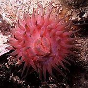
 Actinia

 Bluesponge


