
Fort Matanzas National Monument
Fort Matanzas National Monument | |
 View of fort's western and southernfaçades | |
  | |
| Location | St. Johns County, Florida,US |
|---|---|
| Nearest city | St. Augustine, Florida |
| Coordinates | 29°42′55″N81°14′21″W/ 29.71528°N 81.23917°W |
| Area | 227.76 acres (0.91 km²) |
| Built | 1740-42 |
| Visitation | 1,002,444 (2005) |
| Website | Fort Matanzas National Monument |
| NRHP referenceNo. | 66000098[1] |
| Significant dates | |
| Added to NRHP | October 15, 1966 |
| Designated NMON | October 15, 1924 |
Fort Matanzas National Monument(Spanish:Fuerte Matanzas) is the site where the Spanish built a fort. It was designated aUnited StatesNational Monument on October 15, 1924.[2]The monument consists of a 1740 Spanish fort called Fort Matanzas, and about 100 acres (0.4 km2) ofsalt marshandbarrier islandsalong theMatanzas Riveron the northernAtlanticcoast ofFlorida.It is operated by theNational Park Servicein conjunction with theCastillo de San Marcos National Monumentin the city ofSt. Augustine.
History
[edit]Fort Matanzas was built by the Spanish in 1742 to guardMatanzas Inlet,the southern mouth of theMatanzas River,which could be used as a rear entrance to the city of St. Augustine. Such an approach avoided St. Augustine's primary defense system, centered at Castillo de San Marcos. In 1740, Gov.James OglethorpeofGeorgiaused the inlet to blockade St. Augustine[3]and launch a thirty-nine-day siege. St. Augustine endured the siege, but the episode convinced the Spanish that protecting the inlet was necessary to the security of the town.[4]Under Gov.Manuel de Montiano's orders, construction of the fort began that year and was completed in 1742.[5]Engineer Pedro Ruiz de Olano, who had worked on additions to the Castillo de San Marcos,[6]designed the fortified observation tower.[7]Convicts, slaves, and troops fromCubawere used as labor to erect the structure, which was sited on present-day Rattlesnake Island[8]and had a commanding position over Matanzas Inlet.[9]
The fort, known to the Spanish asTorre de Matanzas(Matanzas Tower),[10][11]is a masonry structure made ofcoquina,[12]a common shellstone building material in the area.[13]The marshy terrain was stabilized by a foundation of pine pilings[7][14]to accommodate a building 50 feet (15 m) long on each side with a 30-foot (9.1 m) high tower. The standard garrison of the fort was one officer in charge, four infantrymen, and two gunners,[15]though more troops could be stationed if necessary. All soldiers at Fort Matanzas served on rotation from their regular duty in St. Augustine. Five cannon were placed at the fort—four six-pounders and one eighteen-pounder.[16]All guns could reach the inlet,[7]which at the time was less than half a mile away.
In 1742, as the fort was nearing completion, the British under Oglethorpe approached the inlet with twelve ships.[17]Cannon fire drove off the scouting boats, and the warships left without engaging the fort.[18]This brief encounter was the only time Fort Matanzas fired on an enemy. Spain lost control of Florida with the1763 Treaty of Paris,and regained control with the1783 Treaty of Paris.With theSpanish Empirefalling apart, Spain spent little effort maintaining the fort after this time. When theUnited Statestook control of Florida in 1821,[19]the fort had deteriorated to the point where soldiers could not live inside.[20]The United States never used the fort and it became aruin.
Fort Matanzas was named for the inlet, which acquired its name afterthe executions,ormatanzas(Spanish: slaughters),[21]on its north shore, ofJean Ribaultand his band ofHuguenotFrenchmen, the last of theFort Carolinecolonists,[22]by the Spanish in 1565.[23][24]
Restoration and modern use
[edit]In 1916, theU.S Department of Warbegan a major restoration of the badly deteriorated fort. By 1924, three vertical fissures in the wall were repaired and the structure was stabilized;[25]in the same year, National Monument status was proclaimed. Fort Matanzas was transferred from the War Department to the National Park Service on August 10, 1933. As a historic area under the Park Service, the National Monument was listed on theNational Register of Historic Placeson October 15, 1966.
Headquarters and Visitor Center
[edit]Fort Matanzas NM Headquarters and Visitor Center | |
 Visitor center | |
| Location | 8635 A1A S., St. Augustine, Florida |
|---|---|
| Built | 1936 |
| Architect | NPS Eastern Div. of Plans & Design |
| Architectural style | NPS Rustic |
| MPS | Florida's New Deal Resources MPS |
| NRHP referenceNo. | 08001245[1] |
| Added to NRHP | December 31, 2008 |
The Fort Matanzas National Monument Headquarters and Visitor Center, located at 8635A1Aabout 15 miles (24 km) south ofSt. Augustine, Florida,was built in 1936. Located onAnastasia Island,it services the Fort Matanzas National Monument, a five-minute boat ride away. It was designed by the National Park Service'sEastern Div. of Plans & Designin what is calledNational Park Service Rusticarchitectural style, and includes a museum. It was listed on theNational Register of Historic Placesin 2008. The listing included twocontributing buildingsand onecontributing siteon 17.3 acres (7.0 ha).[1][26]
The main building is a two-story building with an arched walk-through breezeway that serves as the visitor center and includes a ranger residence as well. The walls of its first floor are made ofcoquinablock masonry, and the second floor is wood framed with wood siding. It has ahipped roof.[26]
The one-story second building, 50 feet (15 m) to the north, is also hip-roofed and has coquina walls. It is a utility building that now serves as a ranger office.[26]
Visitors wait at the center to take a five-minute boat ride to the historicFort Matanzas,which is located acrossMatanzas Inleton Rattlesnake Island.[26]
The buildings and the surrounding landscaping was designed byarchitects of the Eastern Division Branch of Plans and Design of the National Park Service.[26]
Additional designed features include flagstone walkways and sidewalks, an exterior staircase, a retaining wall, parking areas and roads and curbs.[26]
Gallery
[edit]-
 Sentry Box on barbazan, Fort Matanzas, 1937
 -
 Fort Matanzas in the distance
 -
 Map showing strategic location of Fort Matanzas
 -
 Visitor center
 -
 The fort seen from a ferry
 -
 Roof
Roof -
 Gun deck, showing3-pounder gun
 -
 Interior
 -
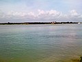
 View from the Matanzas River


See also
[edit]- Fort Matanzas National Monument Headquarters and Visitor Center
- List of national monuments of the United States
- For the etymology of "Matanzas" seeMatanzas River.
- Hispanic Heritage Site
References
[edit]- National Park Service, Department of the Interior.Fort Matanzas - Official Map and Guide.2002.
- ^abc"National Register Information System".National Register of Historic Places.National Park Service.July 9, 2010.
- ^Luis R. Arana; Jean Parker Waterbury (1999).Defenses and Defenders at St. Augustine: A Collection of Writings.St. Augustine Historical Society. p. 145.Retrieved1 May2013.
- ^Albert C. Manucy (1945).The History of Castillo de San Marcos & Fort Matanzas: From Contemporary Narratives and Letters.U.S. Department of the Interior, National Park Service. p. 22.Retrieved2 May2013.
- ^A. M. De Quesada (30 August 2006).A History of Florida Forts: Florida's Lonely Outposts.The History Press. p. 43.ISBN978-1-59629-104-1.Retrieved2 May2013.
- ^Richard R. Henderson; International Council on Monuments and Sites. U.S. Committee; United States. National Park Service (March 1989).A Preliminary inventory of Spanish colonial resources associated with National Park Service units and national historic landmarks, 1987.United States Committee, International Council on Monuments and Sites, for the U.S. Dept. of the Interior, National Park Service. p. 88.Retrieved2 May2013.
- ^James D. Kornwolf (2002).Architecture and town planning in colonial North America.JHU Press. p. 83.ISBN978-0-8018-5986-1.Retrieved2 May2013.
- ^abcHarvey H. Kaiser (20 March 2008).The National Park Architecture Sourcebook.Princeton Architectural Press. p.338.ISBN978-1-56898-742-2.Retrieved2 May2013.
- ^United States. National Park Service (1968).Explorers and settlers: historic places commemorating the early exploration and settlement of the United States.United States Dept. of the Interior, National Park Service. p. 152.Retrieved2 May2013.
- ^Verne Elmo Chatelain (1941).The defenses of Spanish Florida, 1565 to 1763.Carnegie Institution of Washington. p. 167.Retrieved2 May2013.
- ^Arana Waterbury 1999, p. 134.
- ^"Fort Marion and Fort Matanzas NM: Guidebook (1940)".National Park Service U.S. Department of the Interior.Retrieved2 May2013.
- ^Alejandro de Quesada; Stephen Walsh (20 April 2010).Spanish Colonial Fortifications in North America 1565-1822.Osprey Publishing. p. 11.ISBN978-1-84603-507-4.Retrieved1 May2013.
- ^Geological Survey (U.S.) (1897).Bulletin - United States Geological Survey.The Survey. pp. 121–122.Retrieved2 May2013.
- ^Arana Waterbury 1999, p. 95.
- ^"Fort Matanzas National Monument Florida".National Park Service U.S. Department of the Interior.Retrieved3 May2013.
- ^"Fort Matanzas -"(PDF).National Park Service U.S. Department of the Interior. p. 1.Retrieved2 May2013.
- ^David Marley (2008).Wars of the Americas: A Chronology of Armed Conflict in the Western Hemisphere, 1492 to the Present.ABC-CLIO. p. 397.ISBN978-1-59884-100-8.Retrieved2 May2013.
- ^Larry E. Ivers (1974).British Drums on the Southern Frontier: The Military Colonization of Georgia, 1733-1749.University of North Carolina Press. p.172.ISBN978-0-8078-1211-2.Retrieved2 May2013.
- ^Philip Coolidge Brooks (1939).Diplomacy and the Borderlands: The Adams-Onís Treaty of 1819.University of California Press. p. 205.Retrieved1 May2013.
- ^Arana Waterbury 1999, p. 110.
- ^Richard R. Henderson; International Council on Monuments and Sites. U.S. Committee; United States. National Park Service (March 1989).A Preliminary inventory of Spanish colonial resources associated with National Park Service units and national historic landmarks, 1987.United States Committee, International Council on Monuments and Sites, for the U.S. Dept. of the Interior, National Park Service. p. 87.
- ^United States. Office of Archeology and Historic Preservation; Luis R. Arana (1967).Castillo de San Marcos National Monument... and Fort Matanzas National Monument...: historical research management plan.p. 24.Retrieved1 May2013.
- ^Woodbury Lowery (1959).The Spanish settlements within the present limits of the United States.Russell & Russell. p. 195.Retrieved1 May2013.
- ^David J. Weber (17 March 2009).Spanish Frontier in North America: The Brief Edition.Yale University Press. p. 49.ISBN978-0-300-15621-8.Retrieved1 May2013.
- ^Richard R. Henderson; International Council on Monuments and Sites. U.S. Committee; United States. National Park Service (March 1989).A Preliminary inventory of Spanish colonial resources associated with National Park Service units and national historic landmarks, 1987.United States Committee, International Council on Monuments and Sites, for the U.S. Dept. of the Interior, National Park Service. p. 87.Retrieved2 May2013.
- ^abcdefCynthia Walton (June 16, 2008)."National Register of Historic Places Registration: Fort Matanzas NM Headquarters and Visitors Center (HQ/VC)".National Park Service.RetrievedOctober 2,2016.with12 photos from 2008
External links
[edit]- Official website
- Historic American Buildings Survey(HABS) No. FL-15-5, "Fort Matanzas, Saint Augustine, St. Johns County, FL",19 photos, 13 measured drawings, 5 data pages, 1 photo caption page, supplemental material
- Web Archive, read onlineCastillo de San Marcos and Fort Matanzas National Monuments, Florida: Historical Research Management Plan
| Lists by county |
|  |
|---|---|---|
| Lists by city | ||
| Other lists | ||
| International | |
|---|---|
| Other | |
- National Park Service National Monuments in Florida
- National Register of Historic Places in St. Johns County, Florida
- Protected areas established in 1924
- Spanish forts in the United States
- Colonial forts in Florida
- Parks in St. Johns County, Florida
- Museums in St. Augustine, Florida
- Historic American Buildings Survey in Florida
- 1924 establishments in Florida
- Spanish Florida
- Military and war museums in Florida
- Forts on the National Register of Historic Places in Florida
- National Park Service rustic in Florida