Gbarnga
Gbarnga
Gbanga, Gbanka | |
|---|---|
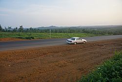
 Highway from Monrovia to Gbarnga | |
| Coordinates:6°59′53″N9°28′23″W/ 6.99806°N 9.47306°W | |
| Country | |
| County | Bong County |
| Elevation | 250 m (820 ft) |
| Population (2008) | |
| • Total | 34,046 |
| Climate | Am |
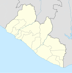
Gbarngais the capital city ofBong County,Liberia,lying north east ofMonrovia.During theFirst Liberian Civil War,it was the base forCharles Taylor'sNational Patriotic Front of Liberia.[1]Cuttington College,a private, Episcopal-affiliated institution, is located near the town. Its campus was once home to the Africana Museum, which was destroyed during the civil war.
As of the 2008 census, Gbarnga has a population of 34,046. Of this, 16,080 were male and 17,966 female; it is the fourth-most populous urban area in Liberia.[2]
Gbarnga is the hometown ofTamba Hali,a former professional football player for theKansas City Chiefsof theNational Football Leaguein the United States.
The town istwinnedwithBaltimore, Maryland,in theUnited States.[3]
Climate
[edit]Köppen-Geiger climate classification systemclassifies its climate astropical monsoon(Am).[4]Its climate is similar to the capitalMonrovia,but less rainy and with cooler night temperatures.
| Climate data for Gbarnga | |||||||||||||
|---|---|---|---|---|---|---|---|---|---|---|---|---|---|
| Month | Jan | Feb | Mar | Apr | May | Jun | Jul | Aug | Sep | Oct | Nov | Dec | Year |
| Mean daily maximum °C (°F) | 32.1 (89.8) |
33.1 (91.6) |
32.5 (90.5) |
32.3 (90.1) |
31.3 (88.3) |
30.4 (86.7) |
29.1 (84.4) |
28.1 (82.6) |
29.8 (85.6) |
31.1 (88.0) |
31.3 (88.3) |
31.5 (88.7) |
31.1 (87.9) |
| Daily mean °C (°F) | 25.1 (77.2) |
25.2 (77.4) |
25.3 (77.5) |
25.7 (78.3) |
25.3 (77.5) |
24.8 (76.6) |
24.1 (75.4) |
23.2 (73.8) |
24.5 (76.1) |
25.5 (77.9) |
25.8 (78.4) |
25.1 (77.2) |
25.0 (76.9) |
| Mean daily minimum °C (°F) | 18.1 (64.6) |
17.4 (63.3) |
18.1 (64.6) |
19.1 (66.4) |
19.3 (66.7) |
19.2 (66.6) |
19.2 (66.6) |
18.3 (64.9) |
19.2 (66.6) |
20 (68) |
20.3 (68.5) |
18.7 (65.7) |
18.9 (66.0) |
| Averageprecipitationmm (inches) | 20 (0.8) |
61 (2.4) |
150 (5.9) |
179 (7.0) |
194 (7.6) |
216 (8.5) |
221 (8.7) |
204 (8.0) |
384 (15.1) |
236 (9.3) |
110 (4.3) |
38 (1.5) |
2,013 (79.1) |
| Source:Climate-Data.org,altitude: 250m[4] | |||||||||||||
Places of worship
[edit]Education
[edit]- Gboveh High School
- St. Martin's Catholic High School
- Williams VS Tubman-Gray united methodist High School
- AB Francis SDA School
- St. Peter Episcopal High School
- Alexandre A. Andrews Academy High School
- Sumo Moye Memorial Institute
- St. Marks Lutheran High School
References
[edit]- ^Stephen Ellis, The Mask of Anarchy
- ^"2008 National Population and Housing Census: Preliminary Results"(PDF).Liberia Institute of Statistics and Geo-Information Services.Government of the Republic of Liberia. June 2008. Archived fromthe original(PDF)on 2012-02-13.Retrieved2008-11-14.
- ^"Baltimore City Mayor's Office of International and Immigrant Affairs - Sister Cities Program".Archived fromthe originalon August 7, 2008.Retrieved2009-07-18.
- ^ab"Climate: Gbarnga - Climate graph, Temperature graph, Climate table".Climate-Data.org.Retrieved4 October2013.

