
Hebi
Hebi
Hạc vách tường thị Hopi | |
|---|---|
From top, left to right:Temple of the Eight Symbols inQi County;Pagoda inXun County;Shancheng DistrictDepartment Store; View nearHebi East railway station | |
 | |
 Location of Hebi inHenan | |
 Hebi Location in theNorth China Plain  Hebi Hebi (China) | |
| Coordinates (Hebi municipal government):35°44′53″N114°17′49″E/ 35.748°N 114.297°E | |
| Country | People's Republic of China |
| Province | Henan |
| Municipal seat | Qibin District |
| Area | |
| •Prefecture-level city | 2,299 km2(888 sq mi) |
| • Urban (2018)[1] | 543 km2(210 sq mi) |
| • Metro | 847.3 km2(327.1 sq mi) |
| Population (2020 census for total, 2018 otherwise)[2] | |
| •Prefecture-level city | 1,565,973 |
| • Density | 680/km2(1,800/sq mi) |
| •Urban (2018)[1] | 667,600 |
| • Urban density | 1,200/km2(3,200/sq mi) |
| •Metro | 574,000 |
| • Metro density | 680/km2(1,800/sq mi) |
| GDP[3][4] | |
| •Prefecture-level city | CN¥77.2 billion US$11.6 billion |
| • Per capita | CN¥ 47,940 US$ 7,217 |
| Time zone | UTC+8(China Standard) |
| Area code | 392 |
| ISO 3166 code | CN-HA-06 |
| MajorNationalities | Han |
| County-level divisions | 5 |
| Township-level divisions | unknown |
| License plate prefixes | DựF |
| Website | hebi |


Hebi(simplified Chinese:Hạc vách tường;traditional Chinese:Hạc vách tường;pinyin:Hèbì[xɤ̂.pî];postal:Hopi) is aprefecture-level cityin northernHenanprovince,China. Situated in mountainous terrain at the edge of theShanxiplateau, Hebi is about 25 miles (40 km) south ofAnyang,40 miles (64 km) northeast ofXinxiangand 65 miles (105 km) north ofKaifeng.
As of the2020 census,its population was 1,565,973 inhabitants and in the 2018 estimate 574,000 lived in the built-up (or metro) area made ofQibin DistrictandQi Countylargely conurbated. One can notice thatShancheng DistrictandHeshan Districtare for the moment, part of another built-up area of 372,600 inhabitants close toAnyang.[2]
Hebi has several coal mines. The city is also home to Hebi New Area, aneconomic development zone.
Administration
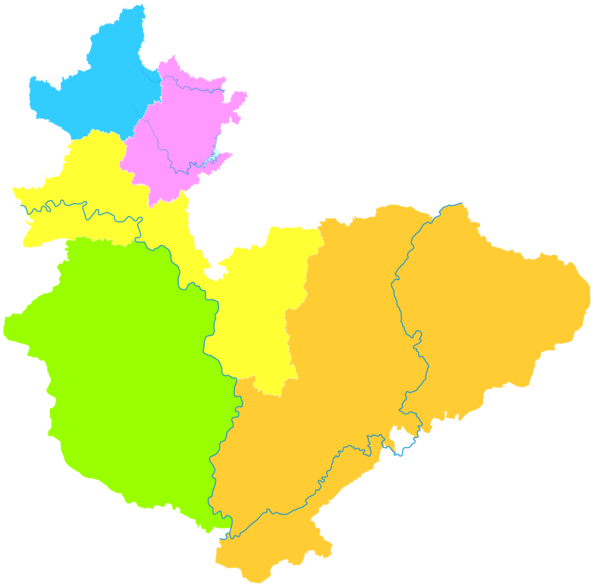
[edit]Theprefecture-level cityof Hebi administers 3districtsand 2counties.
- Qibin District(Kỳ tân khu)
- Shancheng District(Thành phố núi khu)
- Heshan District(Hạc vùng núi)
- Xun County(Tuấn huyện)
- Qi County(Kỳ huyện)
| Map |
|---|
Climate
[edit]| Climate data for Hebi (2010–2020 normals) | |||||||||||||
|---|---|---|---|---|---|---|---|---|---|---|---|---|---|
| Month | Jan | Feb | Mar | Apr | May | Jun | Jul | Aug | Sep | Oct | Nov | Dec | Year |
| Mean daily maximum °C (°F) | 4.3 (39.7) |
8.0 (46.4) |
15.2 (59.4) |
20.7 (69.3) |
27.0 (80.6) |
32.7 (90.9) |
32.5 (90.5) |
30.5 (86.9) |
27.0 (80.6) |
21.3 (70.3) |
13.1 (55.6) |
6.7 (44.1) |
19.9 (67.9) |
| Daily mean °C (°F) | −1.4 (29.5) |
1.8 (35.2) |
8.7 (47.7) |
14.5 (58.1) |
20.9 (69.6) |
26.2 (79.2) |
27.3 (81.1) |
25.6 (78.1) |
20.7 (69.3) |
15.1 (59.2) |
7.5 (45.5) |
0.5 (32.9) |
13.9 (57.1) |
| Mean daily minimum °C (°F) | −6.0 (21.2) |
−3.1 (26.4) |
2.7 (36.9) |
8.4 (47.1) |
14.7 (58.5) |
20.1 (68.2) |
23.0 (73.4) |
21.6 (70.9) |
15.8 (60.4) |
10.2 (50.4) |
2.9 (37.2) |
−4.2 (24.4) |
8.8 (47.9) |
| Averageprecipitationmm (inches) | 6.1 (0.24) |
8.2 (0.32) |
5.9 (0.23) |
42.3 (1.67) |
36.8 (1.45) |
65.1 (2.56) |
155.1 (6.11) |
133.9 (5.27) |
64.3 (2.53) |
24.2 (0.95) |
23.4 (0.92) |
3.4 (0.13) |
568.7 (22.38) |
| Average precipitation days(≥ 0.1 mm) | 2.3 | 2.3 | 2.7 | 5.8 | 6.4 | 7.0 | 10.3 | 9.9 | 7.6 | 5.7 | 5.7 | 1.4 | 67.1 |
| Averagerelative humidity(%) | 62 | 60 | 59 | 67 | 66 | 59 | 76 | 82 | 78 | 69 | 70 | 65 | 68 |
| Source:China Meteorological Administration[5][6] | |||||||||||||
History
[edit]The name of "Hebi" first appears in book "History of Jin".It is believed that during ancient times, cranes would rest on the cliffs of the southern mountains. The southern mountain was then named hạc sơn (HeShan), where hạc means crane. The village near the southern mountain was then named hạc vách tường (Hebi), which literally translates to" Cranes resting on cliffs ").
Relocation of the Urban Area of Hebi
[edit]The urban area of Hebi has undergone three relocations. In 1957, the urban area was selected to be in Hebiji. With the construction of the mine #2 and mine #3, the urban area moved south to what is now known as Zhongshan District in December 1957. Later in 1959, the urban area changed from Zhongshan District to another district that is known as Dahu. However, the surrounding areas of the urban area became mostly subsidence areas, restricting further development of the city. Therefore, in 1992, Hebi government established Qibin Economic Development Zone at the junction of Qi County, Junxian County in the southeast. As the scale of the Qibin Economic Development Zone expands, the political center of the city also moved to Qibin District in May 1999. Qibin District is now the new political, economic center of Hebi City.
References
[edit]- ^abCox, Wendell (2018).Demographia World Urban Areas. 14th Annual Edition(PDF).St. Louis: Demographia. p. 22.
- ^ab"China: Hénán (Prefectures, Cities, Districts and Counties) - Population Statistics, Charts and Map".
- ^Hà Nam tỉnh thống kê cục, quốc gia thống kê cục Hà Nam điều tra tổng đội (November 2017).《 Hà Nam thống kê niêm giám -2017》.Trung Quốc thống kê nhà xuất bản.ISBN978-7-5037-8268-8.Archived fromthe originalon 2018-11-15.Retrieved2018-12-03.
- ^"Hà Nam thống kê niêm giám —2017".ha.stats.gov.cn.Archived fromthe originalon 2018-11-15.Retrieved2018-12-03.
- ^Trung Quốc khí tượng số liệu võng – WeatherBk Data(in Simplified Chinese).China Meteorological Administration.Retrieved7 October2023.
- ^ "Experience Template"Trung Quốc khí tượng số liệu võng(in Simplified Chinese).China Meteorological Administration.Retrieved7 October2023.
External links
[edit]- Government website of Hebi(in Simplified Chinese)
| International | |
|---|---|
| National | |
| Geographic | |
ThisHenanlocation article is astub.You can help Wikipedia byexpanding it. |