
Holt, Alabama
Holt, Alabama | |
|---|---|
 Location inTuscaloosa Countyand the state ofAlabama | |
| Coordinates:33°13′49″N87°29′10″W/ 33.23028°N 87.48611°W | |
| Country | United States |
| State | Alabama |
| County | Tuscaloosa |
| Area | |
| • Total | 3.18 sq mi (8.23 km2) |
| • Land | 3.16 sq mi (8.19 km2) |
| • Water | 0.01 sq mi (0.04 km2) |
| Elevation | 381 ft (116 m) |
| Population (2020) | |
| • Total | 3,413 |
| • Density | 1,078.70/sq mi (416.52/km2) |
| Time zone | UTC-6(Central (CST)) |
| • Summer (DST) | UTC-5(CDT) |
| ZIP code | 35404 |
| Area code(s) | 205, 659 |
| FIPS code | 01-35704 |
| GNISfeature ID | 0120295 |
Holtis anunincorporated communityandcensus-designated place(CDP) inTuscaloosa County,Alabama,United States. At the2020 census,the population was 3,413. It is part of theTuscaloosa, AlabamaMetropolitan Statistical Area.
Geography
[edit]Holt is located at33°13′50″N87°29′11″W/ 33.23056°N 87.48639°W(33.230467, -87.486303).[2]
According to theU.S. Census Bureau,the community has a total area of 3.2 square miles (8.3 km2), all land.
Demographics
[edit]| Census | Pop. | Note | %± |
|---|---|---|---|
| 1950 | 2,453 | — | |
| 1990 | 4,125 | — | |
| 2000 | 4,102 | −0.6% | |
| 2010 | 3,638 | −11.3% | |
| 2020 | 3,413 | −6.2% | |
| U.S. Decennial Census[3] | |||
Holt first appeared on the census in 1950 as the unincorporated community of Holt-Fox. It did not reappear again until 1990 when it was classified as a census-designated place (CDP) as Holt.
As of thecensus[4]of 2000, there were 4,103 people, 1,785 households, and 1,252 families living in the community. The population density was 1,268.0 inhabitants per square mile (489.6/km2). There were 2,006 housing units at an average density of 567.1 per square mile (219.0/km2). The racial makeup of the community was 51.67%White,47.04%BlackorAfrican American,0.44%Native American,0.02%Asian,0.12% fromother races,and 0.71% from two or more races. 1.49% of the population wereHispanicorLatinoof any race.
There were 1,614 households, out of which 31.4% had children under the age of 18 living with them, 41.4% weremarried couplesliving together, 20.4% had a female householder with no husband present, and 33.0% were non-families. 28.5% of all households were made up of individuals, and 9.3% had someone living alone who was 65 years of age or older. The average household size was 2.54 and the average family size was 3.12.
In the community, the population was spread out, with 27.1% under the age of 18, 10.7% from 18 to 24, 27.5% from 25 to 44, 21.6% from 45 to 64, and 13.1% who were 65 years of age or older. The median age was 35 years. For every 100 females, there were 97.2 males. For every 100 females age 18 and over, there were 94.3 males.
The median income for a household in the community was $26,095, and the median income for a family was $33,165. Males had a median income of $28,212 versus $17,048 for females. Theper capita incomefor the community was $13,116. About 11.3% of families and 20.2% of the population were below thepoverty line,including 24.7% of those under age 18 and 23.3% of those age 65 or over.
2010 census
[edit]As of thecensus[5]of 2010, there were 3,638 people, 1,385 households, and 925 families living in the community. The population density was 1,389 inhabitants per square mile (536/km2). There were 1,603 housing units at an average density of 500.9 per square mile (193.4/km2). The racial makeup of the community was 55.2%BlackorAfrican American,39.4%White,0.4%Native American,0.2%Asian,3.2% fromother races,and 1.6% from two or more races. 7.2% of the population wereHispanicorLatinoof any race.
There were 1,385 households, out of which 26.8% had children under the age of 18 living with them, 33.9% weremarried couplesliving together, 25.5% had a female householder with no husband present, and 33.2% were non-families. 28.2% of all households were made up of individuals, and 10.0% had someone living alone who was 65 years of age or older. The average household size was 2.63 and the average family size was 3.18.
In the community, the population was spread out, with 25.2% under the age of 18, 10.5% from 18 to 24, 26.0% from 25 to 44, 26.2% from 45 to 64, and 12.1% who were 65 years of age or older. The median age was 35.6 years. For every 100 females, there were 95.7 males. For every 100 females age 18 and over, there were 100.5 males.
The median income for a household in the community was $28,750, and the median income for a family was $32,731. Males had a median income of $23,517 versus $21,186 for females. Theper capita incomefor the community was $13,964. About 24.7% of families and 31.9% of the population were below thepoverty line,including 56.7% of those under age 18 and 19.0% of those age 65 or over.
Notable people
[edit]- Johnny Shines,bluesguitarist[6]
- Jimmy Walker,American footballandbasketballcoach[7]
See also
[edit]- Cottondale, Alabama— adjacentunincorporated communityin Tuscaloosa County
- Alberta City, Tuscaloosa— adjacentsuburbin Tuscaloosa County
References
[edit]- ^"2020 U.S. Gazetteer Files".United States Census Bureau.RetrievedOctober 29,2021.
- ^"US Gazetteer files: 2010, 2000, and 1990".United States Census Bureau.February 12, 2011.RetrievedApril 23,2011.
- ^"U.S. Decennial Census".Census.gov.RetrievedJune 6,2013.
- ^"U.S. Census website".United States Census Bureau.RetrievedJanuary 31,2008.
- ^"U.S. Census website".United States Census Bureau.RetrievedAugust 13,2015.
- ^"Johnny Shines Dead; Delta Blues Singer, 76".The New York Times.April 21, 1992.
- ^Reed, Delbert (July 17, 1996)."Jimmy Walker is now more than just a name".The Tuscaloosa News.p. 2E.RetrievedJanuary 7,2015.
33°13′50″N87°29′11″W/ 33.230467°N 87.486303°W
Municipalities and communities ofTuscaloosa County, Alabama,United States | ||
|---|---|---|
| Cities | 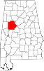 | |
| Towns | ||
| CDPs | ||
| Unincorporated communities | ||
| Ghost town | ||
| Footnotes | ‡This populated place also has portions in an adjacent county or counties | |