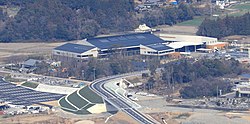
Inabe
Inabe
いなべ thị | |
|---|---|
 Inabe City Hall | |
 Location of Inabe in Mie Prefecture | |
| Coordinates:35°6′56″N136°33′41″E/ 35.11556°N 136.56139°E | |
| Country | Japan |
| Region | Kansai |
| Prefecture | Mie |
| Government | |
| • Mayor | Yasushi Hioki |
| Area | |
| • Total | 219.58 km2(84.78 sq mi) |
| Population (August 2021) | |
| • Total | 43,114 |
| • Density | 200/km2(510/sq mi) |
| Time zone | UTC+9(Japan Standard Time) |
| Phone number | 0594-74-5820 |
| Address | 111 Kasada-shinden, Inabe-chō, Inabe-shi, Mie-ken 511-0293 |
| Website | Official website |

Inabe(いなべ thị,Inabe-shi)is acitylocated inMie Prefecture,Japan.As of 1 August 2021[update],the city had an estimatedpopulationof 43,114 in 17314 households and apopulation densityof 200 persons per km².[1]The total area of the city is 219.58 square kilometres (84.78 sq mi).
Geography
[edit]Inabe is located in the far northeastern tip of theKii Peninsula,and the far northwestern corner of Mie Prefecture, along the border withGifuandShigaprefectures. The Inabe River flows through the city center.
Neighboring municipalities
[edit]Climate
[edit]Inabe has aHumid subtropical climate(KöppenCfa) characterized by warm summers and cool winters with light to no snowfall. The average annual temperature in Inabe is 13.0 °C. The average annual rainfall is 1960 mm with September as the wettest month.[2]
| Climate data for Hokusei ( 1981 - 2010 ) | |||||||||||||
|---|---|---|---|---|---|---|---|---|---|---|---|---|---|
| Month | Jan | Feb | Mar | Apr | May | Jun | Jul | Aug | Sep | Oct | Nov | Dec | Year |
| Averageprecipitationmm (inches) | 74.1 (2.92) |
93.2 (3.67) |
152.4 (6.00) |
178.9 (7.04) |
231.9 (9.13) |
290.4 (11.43) |
289.2 (11.39) |
213.4 (8.40) |
286.4 (11.28) |
144.5 (5.69) |
97.1 (3.82) |
65.9 (2.59) |
2,117.4 (83.36) |
| Average precipitation days(≥ 1.0 mm) | 10.5 | 10.4 | 12.0 | 10.3 | 11.6 | 13.4 | 14.3 | 11.0 | 12.3 | 9.6 | 8.3 | 9.8 | 133.5 |
| Source:Japan Meteorological Agency[3] | |||||||||||||
Demographics
[edit]Per Japanese census data,[4]the population of Inabe has remained relatively steady over the past 30 years.
| Year | Pop. | ±% |
|---|---|---|
| 1920 | 32,074 | — |
| 1930 | 34,058 | +6.2% |
| 1940 | 32,920 | −3.3% |
| 1950 | 43,568 | +32.3% |
| 1960 | 40,007 | −8.2% |
| 1970 | 38,414 | −4.0% |
| 1980 | 41,591 | +8.3% |
| 1990 | 43,882 | +5.5% |
| 2000 | 45,630 | +4.0% |
| 2010 | 45,675 | +0.1% |
History
[edit]The area of modern Inabe was part of ancientIse Provincewas mostly under the control ofKuwana Domainin thenEdo period.With the creation of the modern municipalities system on April 1, 1889, the village of Ageki was established withinInabe District, Mie.Ageki was raised to town status on March 10, 1929 and merged with the neighboring villages of Toyashiro and Yamasato on April 1, 1955 to form the town of Hokusei. The city of Inabe was established on December 1, 2003, from the merger of the former town of Hokusei with neighboringInabe,Daian,andFujiwara.
Government
[edit]Inabe has amayor-councilform of government with a directly elected mayor and aunicameralcity council of 18 members. Inabe, together with the town of Tōin, contributes two members to the Mie Prefectural Assembly. In terms of national politics, the city is part of Mie 3rd district of thelower houseof theDiet of Japan.
Economy
[edit]Inabe is a regional commercial center and has a mixed industrial and agricultural economy.ToyotaMotor,Densoand other automobile-related industries form a strong component of the local economy.
Education
[edit]Inabe has 11 public elementary schools and four public middle schools operated by the city government and one public high school operated by the Mie Prefectural Department of Education.
Transportation
[edit]Railway
[edit]Highway
[edit]Local attractions
[edit]- Freight Railway Museum
Notable people
[edit]- Kiyoshi Itô,mathematician
- Tatsuma Itō,tennis player
- Yūji Nishida,volleyball player
References
[edit]- ^"Inabe city official statistics"(in Japanese). Japan.
- ^Inabe climate data
- ^"Khí tượng sảnh | qua đi の khí tượng データ kiểm tác".Retrieved2014-12-26.
- ^Inabe population statistics
External links
[edit] Media related toInabe, Mieat Wikimedia Commons
 Geographic data related toInabeatOpenStreetMap
- Inabe City official website(in Japanese)


