
Yamuna
| Yamuna | |
|---|---|
 | |
 Map | |
| Location | |
| Country | India |
| State | Uttarakhand,Uttar Pradesh,Haryana,Delhi |
| Cities | Haryana:Yamuna Nagar Uttar Pradesh:KairanaandBaghpat Uttar Pradesh:Noida,Mathura,Vrindavan,Agra,Firozabad,Etawah,AuraiyaandPrayagraj |
| Physical characteristics | |
| Source | Yamunotri |
| • location | Banderpooch peaks,Uttarkashi district,Uttarakhand,India |
| • coordinates | 31°01′0.12″N78°27′0″E/ 31.0167000°N 78.45000°E |
| • elevation | 4,500 m (14,800 ft)[1] |
| Mouth | Ganges |
• location | Triveni Sangam,Prayagraj,India |
• coordinates | 25°25′11.44″N81°53′5.80″E/ 25.4198444°N 81.8849444°E |
• elevation | 74 m (243 ft) |
| Length | 1,376 km (855 mi) |
| Basin size | 366,223 km2(141,399 sq mi) |
| Discharge | |
| • location | Prayagraj[2] |
| • average | 2,950 m3/s (104,000 cu ft/s) |
| Basin features | |
| Tributaries | |
| • left | Hindon,Tons,Hanuman Ganga,Sasur Khaderi |
| • right | Giri, Baghain,Sabi,Chambal,Betwa,Sindh,Ken |
TheYamuna(pronounced[jəmʊnɑː];IAST:Yamunā) is the second-largesttributaryriver of theGangesby discharge and the longest tributary inIndia.Originating from theYamunotriGlacier at a height of about 4,500 m (14,800 ft)[1]on the southwestern slopes ofBandarpunchpeaks of theLower HimalayainUttarakhand,it travels 1,376 kilometres (855 mi) and has adrainage systemof 366,223 square kilometres (141,399 sq mi), 40.2% of the entireGanges Basin.It merges with the Ganges atTriveni Sangam,Allahabad,which is a site of theKumbh Mela,a Hindu festival held every 12 years.
Like the Ganges, the Yamuna is highly venerated inHinduismand worshipped as thegoddess Yamuna.In Hinduism, she is believed to be the daughter of the sun god,Surya,and the sister ofYama,the god of death, and so she is also known as Yami. According to popular Hindu legends, bathing in Yamuna'ssacred watersfrees one from the torments of death.[3][4]
The river crosses several states such asHaryana,Uttar Pradesh,UttarakhandandDelhi.It also meets several tributaries along the way, includingTons,Chambal,its longest tributary which has its own large basin, followed bySindh,theBetwa,andKen.From Uttarakhand, the river flows into the state ofHimachal Pradesh.After passingPaonta Sahib,Yamuna flows along the boundary of Haryana and Uttar Pradesh and after exiting Haryana it continues to flow till it merges with the river Ganges at Sangam or Prayag in Prayagraj (Uttar Pradesh). It helps create the highly fertilealluvialGanges-YamunaDoabregion between itself and the Ganges in theIndo-Gangetic plain.[3][4]
Nearly 57 million people depend on the Yamuna's waters, and the river accounts for more than 70 percent of Delhi's water supply. It has an annual flow of 97 billion cubic metres, and nearly 4 billion cubic metres are consumed every year (of which irrigation constitutes 96%).[3][4]At theHathni Kund Barrage,its waters are diverted into two large canals: the Western Yamuna Canal flowing towards Haryana and the Eastern Yamuna Canal towards Uttar Pradesh. Beyond that point the Yamuna is joined by theSomb,a seasonal rivulet from Haryana, and by the highly pollutedHindon RivernearNoida,byNajafgarh drainnearWazirabadand by various other drains, so that it continues only as a trickling sewage-bearing drain before joining theChambalatPachnadain theEtawah Districtof Uttar Pradesh.[5]
The water quality in Upper Yamuna, as the 375-kilometre (233 mi) long stretch of Yamuna is called from its origin atYamunotritoOkhla barrage,[6]is of "reasonably good quality" until theWazirabad barrageinDelhi.Below this, the discharge of wastewater in Delhi through 15 drains between Wazirabad barrage and Okhla barrage renders the river severely polluted. Wazirabad barrage to Okhla Barrage, 22 km (14 mi) stretch of Yamuna in Delhi, is less than 2% of Yamuna's total length but accounts for nearly 80% of the total pollution in the river.[7]Untreated wastewater and poor quality of water discharged from the wastewater treatment plants are the major reasons of Yamuna's pollution in Delhi. To address river pollution, measures have been taken by theMinistry of Environment and Forests(MoEF) under theYamuna Action Plan(YAP) which has been implemented since 1993 by the MoEF's National River Conservation Directorate (NRCD).
Basin[edit]


Palaeochannels: Sarasvati's tributary[edit]
The presentSarsutiriver which originates in the Shivalik hills inHimachalandHaryanaborder and merges withGhaggar RivernearPehowais thepalaeochannelof Yamuna.[8]Yamuna changed its course to the east due to a shift in the slope of theEarth's crustcaused byplate tectonics.[8]
Sources: Banderpoonch peak and Yamunotri glacier[edit]
The source of Yamuna lies in theYamunotriGlacier at an elevation of 6,387 metres (20,955 ft), on the southwestern slopes of Banderpooch peaks, which lie in theMussoorierange of theLower Himalayas,north ofHaridwarinUttarkashi district,Uttarakhand.[3]Yamunotri temple, a shrine dedicated to the goddess Yamuna, is one of the holiest shrines inHinduism,and part of theChota Char DhamYatracircuit. Also standing close to the temple, on its 13-kilometre (8 mi) trek route that follows the right bank of the river, lies Markendeya Tirtha, where the sageMarkandeyawrote theMarkandeya Purana.[9][10]
Current channel[edit]
The river flows southwards for about 200 kilometres (120 mi), through the Lower Himalayas and theShivalik HillsRange.Morainicdeposits are found along the steep Upper Yamuna, highlighted withgeomorphicfeatures such asinterlocking spurs,steep rockbenches,gorges andstream terraces.Large terraces formed over a long period of time can be seen in the lower course of the river, such as those near Naugoan. An important part of its earlycatchment area,totalling 2,320 square kilometres (900 sq mi), lies inHimachal Pradesh.TheTons,Yamuna's largest tributary, drains a large portion of the upper catchment area and holds more water than the main stream. It rises from the Hari-ki-dun valley and merges after Kalsi nearDehradun.The drainage system of the river stretches between Giri-Sutlejcatchment in Himachal and Yamuna-Bhilangnacatchment inGarhwal,also draining the ridge ofShimla.Kalanag(6,387 metres [20,955 ft]) is the highest point of the Yamuna basin. Other tributaries in the region are the Giri, Rishi Ganga Kunta, Hanuman Ganga and Bata, which drain the upper catchment area of the Yamuna basin.[11]

From the upper catchment area, the river descends onto the plains ofDoon Valley,atDak Patharnear Dehradun. Flowing through theDakpathar Barrage,the water is diverted into a canal for power generation. Further downstream, the Assan River joins the Yamuna at theAsan Barrage,which hosts a bird sanctuary. After passing theSikhpilgrimage town ofPaonta Sahib,the Yamuna reachesTajewalainYamuna Nagar district(named after the river) ofHaryana.A dam built here in 1873 is the origin of two important canals, the Western and EasternYamuna Canals,which irrigate the states of Haryana and Uttar Pradesh. The Western Yamuna Canal (WYC) crossesYamuna Nagar,Karnal,PanipatandSonipatbefore reaching the Haiderpur treatment plant, which contributes toDelhi's municipal water supply. The Yamuna receives wastewater from Yamuna Nagar and Panipat cities; beyond this it is replenished by seasonal streams andgroundwateraccrual.During the dry season, the Yamuna remains dry in many stretches between the Tajewala dam and Delhi, where it enters near thePalla barrageafter traversing 224 kilometres (139 mi).[citation needed]
The Yamuna defines the state borders between Himachal Pradesh and Uttarakhand, and between Haryana, Delhi andUttar Pradesh.When the Yamuna reaches theIndo-Gangetic plain,it runs almost parallel to the Ganges, the two rivers creating the Ganges-YamunaDoabregion. Spread across 69,000 square kilometres (27,000 sq mi), one-third of thealluvialplain, the region is known for its agricultural output, particularly for the cultivation ofbasmatirice. The plain's agriculture supports one-third of India's population.[12]

| State | Catchment area (km2) | % of catchment area |
|---|---|---|
| Uttar PradeshandUttarakhand | 74,208 | 21.5 |
| Himachal Pradesh | 5,799 | 1.6 |
| Haryana | 21,265 | 6.5 |
| Rajasthan | 102,883 | 29.8 |
| Madhya Pradesh | 140,230 | 40.6 |
| Delhi | 1,485 | 0.4 |
Subsequently, the Yamuna flows through the states of Delhi, Haryana and Uttar Pradesh before merging with theGangesat a sacred spot known as Triveni Sangam in Prayagraj. Pilgrims travel by boats to platforms erected in midstream to offer prayers. During theKumbh Mela,held every 12 years, large congregations of people immerse themselves in the sacred waters of the confluence.[13]The cities ofBaghpat,Delhi,Noida,Mathura,Agra,Firozabad,Etawah,Kalpi,Hamirpur,and Prayagraj lie on its banks. At Etawah, it meets it another important tributary,Chambal,followed by a host oftributariesfurther down, including, Sindh, theBetwa,andKen.[4][14]
Important tributaries[edit]

Yamuna's tributaries make up 70.9% of the catchment area and the river has six important tributaries:[3]
- Tons Riveris Yamuna's largest tributary[15]and rises in the 6,315-metre-high (20,719 ft) Bandarpoonch mountain. It meets Yamuna below Kalsi, nearDehradun,Uttarakhand.[15]
- Hindon Riveroriginates from UpperShivalik,in theLower Himalayan Range.It is a rain fed river and has acatchment areaof 7,083 square kilometres (2,735 sq mi) and traverses 400 kilometres (250 mi).[15]
- Chambal River,also known as Charmanvati in ancient texts, flows throughRajasthanand Madhya Pradesh and traverses a total distance of 960 kilometres (600 mi) from its source in theVindhya Range,nearMhow.It has a drainage basin of 143,219 square kilometres (55,297 sq mi) and it supports hydro-power generation atGandhi Sagar dam,Rana Pratap Sagar damand Jawahar Sagar dam. The Chambal river merges with the Yamuna at Sahon village.[15]
- Kali River, rises in the Doon Valley and merges with the Hindon River.[3]
- Ken River,flows throughMadhya Pradeshand Uttar Pradesh. It originates near Ahirgawan village inJabalpur districtand travels a distance of 427 kilometres (265 mi) before merging with the Yamuna at Chilla village, nearFatehpurin Uttar Pradesh. It has an overalldrainage basinof 28,058 square kilometres (10,833 sq mi).[16]
- Betwa Riveroriginates in Bhopal district, in Madhya Pradesh. Its confluence with the Yamuna is in Hamirpur district, Uttar Pradesh. It has a catchment area of 46,580 km2(17,980 sq mi).[16]
Background[edit]


Etymology[edit]
The nameYamunaseems to be derived from theSanskritword "yama", meaning 'twin', and it may have been applied to the river because it runs parallel to the Ganges.[17]
History[edit]
The earliest mention of Yamuna is found at many places in theRig Veda(c. 1500–1000 BCE), which was composed during theVedic periodc. 1700–1100BCE, and also in the laterAtharvaveda,and theBrahmanasincludingAitareya BrahmanaandShatapatha Brahmana.[17]In theRigveda,the story of the Yamuna describes her "excessive love" for her twin,Yama,who in turn asks her to find a suitable match for herself, which she does inKrishna.[18]
Yamuna is mentioned asIomanes(Ioames) in the surveys ofSeleucus I Nicator,an officer ofAlexander the Greatand one of theDiadochi,who visited India in 305 BCE. Greek traveller and geographerMegasthenesvisited India sometime before 288 BCE (the date ofChandragupta's death) and mentioned the river in hisIndica,where he described the region around it as the land of Surasena.[19]InMahabharata,thePandavacapital ofIndraprasthawas situated on the banks of Yamuna, considered to be the site of modern Delhi.[citation needed]
Geological evidence indicates that in the distant past the Yamuna was a tributary of theGhaggar River(identified by some as theVedic Sarasvati River). It later changed its course eastward, becoming a tributary of the Ganges. While some have argued that this was due to atectonicevent, and may have led to the Sarasvati River drying up, the end of manyHarappan civilisationsettlements, and creation of theThar desert,[20][21][22]recent geological research suggests that the diversion of the Yamuna to the Ganges may have occurred during thePleistocene,and thus could not be connected to the decline of the Harappan civilisation in the region.[23]
Most of the greatempireswhich ruled over a majority of India were based in the highly fertile Ganges–Yamuna basin, including theMagadha(c. 600 BCE),Maurya Empire(321–185 BCE),Shunga Empire(185–73 BCE),Kushan Empire(1st–3rd centuries CE), andGupta Empire(280–550 CE), and many had their capitals here, in cities likePataliputraorMathura.These rivers were revered throughout these kingdoms that flourished on their banks; since the period ofChandragupta II(r.375–415 CE), statues both the Ganges and Yamuna became common throughout the Gupta Empire. Further to the South, images of the Ganges and Yamuna are found amidst shrines of the Chalukyas,Rashtrakutas(753–982), and on their royal seals; prior to them, theChola Empirealso added the river into their architectural motifs. The Three River Goddess shrine, next to theKailash rock-cut TempleatEllora,shows the Ganges flanked by the Yamuna and Saraswati.[24]
Use of water[edit]
1994 water sharing agreement[edit]
The stretch of the river from its origin atYamunotritoOkhla barrageinDelhiis called "Upper Yamuna". A Memorandum of Understanding (MoU) was signed amongst the five basin states (Himachal Pradesh, Uttar Pradesh, Uttarakhand, Haryana, Rajasthan, and Delhi) on 12 May 1994 for sharing of its waters. This led to the formation of the Upper Yamuna River Board under India'sMinistry of Water Resources,whose primary functions are: regulation of the available flows amongst the beneficiary states and monitoring the return flows; monitoring conservation and upgrading the quality of surface and groundwater; maintaining hydro-meteorological data for the basin; overviewing plans for watershed management; and monitoring and reviewing the progress of all projects up to and including Okhla barrage.[25]
Flood forecasting systems are established at Poanta Sahib, where Tons, Pawar and Giri tributaries meet. The river take 60 hours to travel from Tajewala to Delhi, thus allowing a two-day advance flood warning period.[3][26][27]The Central Water Commission started flood-forecasting services in 1958 with its first forecasting station on Yamuna at Delhi Railway Bridge.[28]
Barrages[edit]
Yamuna has the following six functionalbarrages(eight including old replaced barrages, nine including a new proposed barrage), from north-west to southeast:[29][30][31][32][needs update]
- Dakpathar Barragein Uttarakhand, managed by the Uttarakhand government.
- Hathni Kund Barragein Haryana, 172 km (107 mi) from the source of Yamuna, built in 1999 and managed by Haryana government.[33][34]
- Tajewala Barragewas built in 1873 and replaced by the Hathni Kund.[33][34]
- Wazirabad barragein north Delhi, 244 km (152 mi) from Hathni Kund barrage, managed by the Delhi government.[35]
- "New Wazirabad barrage", proposed in 2013, to be built 8 km (5.0 mi) north of the Wazirabad barrage.
- ITO barrage(Indraparstha barrage) in central Delhi, managed by the Haryana govt.[35]
- Okhla barrageis 22 km (14 mi) from Wazirabad to south Delhi, managed by the Uttar Pradesh (UP) government.[35]
- New Okhla Barrage,a new barrage, managed by the UP government.[35]
- Palla barragedownstream on "Delhi-Faridabad canal" in Haryana, managed by the Haryana government.
- Gokul barrage(a.k.a. Mathura barrage) is atGokulin Uttar Pradesh, managed by the UP government.
Irrigation[edit]

Use of the Yamuna's waters for irrigation in theIndo-Gangetic Plainsis enhanced by its many canals, some dating to the 14th centuryTughlaq dynasty,which built theNahr-i-Bahisht(Paradise) parallel to the river. TheNahr-i-Bahishtwas restored and extended by theMughalsin the first half of the 17th century, by engineer Ali Mardan Khan, starting from Benawas where the river enters the plains and terminating near the Mughal capital ofShahjahanabad,the present city of Delhi.[36]
Eastern Yamuna Canal[edit]
As the Yamuna enters the Northern Plains nearDakpatharat an elevation of 790 metres (2,590 ft), the Eastern Yamuna Canal commences at theDakpathar Barrageand pauses at theAsanandHathnikund Barragesbefore continuing south.[33][34]
Western Yamuna Canal[edit]
The Western Yamuna Canal (WYC) was built in 1335 CE byFiruz Shah Tughlaq.Excessive silting caused it to stop flowingc. 1750,when theBritish Rajundertook a three-year renovation in 1817 byBengal Engineer Group.TheTajewala Barragedam was built in 1832–33[timeframe?]to regulate the flow of water, and was replaced by the modernHathni Kund Barragein 1999.[37]
The main canal is 86 kilometres (53 mi) long.[37]When including its branches and many major and minor irrigation channels, it has a total length of 325 km (202 mi)[38]The WYC begins at the Hathni Kund Barrage about 38 km (24 mi) from Dakpathar and south ofDoon Valley.The canals irrigate vast tracts of land in the region inAmbala,Karnal,Sonipat,Rohtak,Jind,HisarandBhiwani districts.[37]
The major branch canals are:
- Agra Canal,built in 1874, which starts from theOkhlabarrage beyond the Nizamuddin bridge, joining the Banganga river about 32 kilometres (20 mi) belowAgra.During the dry summer season, the stretch above Agra resembles a minor stream.[4]
- Munak canal,built in 1819[39]and renovated in 2008,[40]originates at Munak inKarnal district[41]and extends 22 km[40]to Delhi, carrying 20 m3/s (700 cu ft/s) of water.[37][42]
- Sirsa Branch, the largest branch of the WYC, constructed in 1889–1895.[37]It originates atIndriand meanders throughJind district,Fatehabad districtandSirsa district.[37][42]
- Hansi Branch, built in 1825[39]and remodelled in 1959.[39]It originates atMunak[41]and meanders throughHansitehsil ofHisar district.[37][42]
- Rohtak Branch[37][42]
Sutlej–Yamuna Link Canal[edit]
A proposed heavy freight canal, the Sutlej–Yamuna Link (SYL), is being built westwards from near Yamuna's headwaters through thePunjab regionnear an ancient caravan route and highlands pass to the navigable parts of theSutlej–Induswatershed.This will connect theGanges,which flows to the east coast of the subcontinent, with points west (via Pakistan). When completed, the SYL will allow shipping from India's east coast to the west coast and theArabian Sea,shortening important commercial links for north-central India's large population. The canal starts near Delhi, and is designed to transfer Haryana's share of 4.3km3(3,500,000 acre⋅ft) from theIndusBasin.[citation needed]
National Waterway[edit]
Yamuna is one of theNational Waterways of India,designated asNW110in Haryana, Delhi and Uttar Pradesh. Some of its sections are being developed for navigation:[43][44]
- Delhi–Faridabad (Wazirabad barragetoPalla barrage,viaITO barrage), is being developed for passenger and cargo ferry service.[43]
- Delhi–Agra (Okhla barragetoAgra Canal), is planned for steamer service by the end of June 2017 with the help of the Netherlands.[44][needs update]
Religious significance[edit]

Purifying waters[edit]
Like the Ganges, the Yamuna River is highly venerated in Hinduism in the form of a river and as the goddess Yamuna. The Yamuna is considered a river of heaven. TheRig Vedaincludes the Yamuna River as one of the seven sacred rivers, along with the Ganges.[45]According to Hindu mythology, the River was brought to Earth by the ascetic practice of theSeven Sageswhere she first descended on Mount Kalinda. Therefore, Yamuna is also known as Kalindi.[45]
ThePadma Puranadescribes Yamuna's purifying properties and states that her waters cleanse the mind from sin. It also mentions that bathing in her sacred waters frees one from the torments of death.[46]Art from theGupta perioddepict Yamuna andGangaon the entrances and doorjambs of temples and sacred places. Upon passing through these doors, visitors were symbolically purified by these rivers.[47]
Some religious figures (notably pilgrim priests ofMathuraandVrindavan) do not regard the physical pollution of the Yamuna to have any effect on the river's spiritual purity. The Braj region is where the worship of the Yamuna and its pollution is most pronounced. However, more and more Hindus no longer ritually bathe in the Yamuna, drink its water, or use its water for worship. In Vrindavan's holy shrines,bottled wateris used instead.[48]
Goddess personified[edit]
In her human form, Yamuna is the daughter ofSurya,the sun god, and his wifeSaranyu.She is the twin sister ofYama,the god of death, and is also known as Yami.[49]TheAgni Puranadescribes Yamuna as having a dark complexion, mounted on a turtle, and holding a pot in her hand.[46]
Devotion[edit]
Yamuna, as a river and goddess, has a close association withKrishna.ThePuranasnarrate many stories about Krishna in relation to the river and its surroundings. One such story is ofKaliya Daman,the subduing ofKaliya,aNāgawhich had inhabited the river and terrorised the people ofBraja.[50][51]Due to Krishna's connection with the River and the Braja region, the Yamuna River is a center of pilgrimage for his devotees. In thePushti Marga,founded by Vallabhacharya and in which Krishna is the main deity, Yamuna is worshipped as a goddess.[46]
TheYamunashtakamis a 16th-centurySanskrithymn composed byVallabhacharyawhich describes the story of Yamuna's descent to meet her beloved Krishna and to purify the world. The hymn also praises her for being the source of all spiritual abilities. And while the Ganges is considered an epitome of asceticism and higher knowledge and can grantMokshaorliberation,it is Yamuna, who, being a holder of infinite love and compassion, can grant freedom, even from death, the realm of her elder brother. Vallabhacharya writes that she rushes down the Kalinda Mountain, and describes her as the daughter of Kalinda, giving her the nameKalindi,the backdrop of Krishna Leela. The text also talks about her water being the colour of Lord Krishna, which is dark (Shyam).[52][53]The river is referred to as Asita in some historical texts.[54]
Shlokas on Yamuna[edit]
NumerousHindu textshaveshlokas(hymns) on Yamuna as follows:
- "One should not give up the process of austerity. If possible, one should bathe in the water of the Yamuna. This is an item of austerity. Therefore, our Krishna consciousness movement has established a center in Vrindavana so that one may bathe in the Yamuna, chant the Hare Krishna mantra and then become perfect and return back to Godhead." (Srimad Bhagavatam 6.5.28 purport)[55]
Ecology[edit]
Fauna[edit]
The Yamuna from the source to its culmination in Ganges is a habitat for fish for approximately 1,400 km (870 mi) stretch and supports a rich diversity of species. Fish from the familyCyprinidaedominate the variety of fish species found in the river. This includes Indiancarpand also invasive species from the family. In a study, 93 species of fish were found in the river includingcatfish.[56][57]Species of non-nativeTilapiahave become established in the river. They have been implicated in the decline of theGhariyal(Indian crocodile) population in the river.[58]Large turtles used to be a common sight on the river a few decades ago but they have mostly disappeared.[59]
Pollution[edit]

In 1909, the waters of the Yamuna were distinguishable as clear blue, when compared to the silt-laden yellow of the Ganges.[60]However, due to high-density population growth and fast industrialisation, Yamuna has become one of the most polluted rivers in the world.[61]The Yamuna is particularly polluted downstream ofNew Delhi,the capital of India, which dumps about 58% of its waste into the river. A 2016 study shows that there is 100%urban metabolismof River Yamuna as it passes through the National Capital Territory (NCT) of Delhi.[62]The most pollution comes from Wazirabad, from where Yamuna enters Delhi.[63]
Causes[edit]
TheWazirabad barrageto theNew Okhla Barragesegment, "22 km stretch of Yamuna in Delhi, is less than 2% of Yamuna's total length but accounts for nearly 80% of the total pollution in the river",[7]22 out of 35 sewage treatment plants in Delhi do not meet the wastewater standards prescribed by the Delhi Pollution Control Committee (DPCC), thus untreated wastewater and poor quality of water discharged from the wastewater treatment plants are the major reasons.[7]As of 2019, the river receives 800 million litres of largely untreated sewage and additional 44 million litres of industrial effluents each day, of which only 35 percent of the sewage released into the river are believed to be treated.[64]In 1994, the states of Uttarakhand, Himachal Pradesh, Uttar Pradesh, Haryana, Rajasthan and Delhi made a water sharing agreement that is due for revision in 2025. To achieve a water quality suitable for bathing (BOD<3 mg/L andDO>5 mg/L) would require a greater rate of water flow in the river. A study has recommended that 23 cubic metres (23,000 L; 5,100 imp gal) per second of water should be released fromHathni Kund Barrageduring the lean season to provide a minimumenvironmental flowin the Yamuna.[7]
The last barrage across the Yamuna river is theMathura barrageatGokulto supply its drinking water. Downstream of this barrage, many pumping stations are constructed to feed the river water for irrigation needs.[65]These pumping stations are near Pateora Danda25°55′09″N80°13′27″E/ 25.91917°N 80.22417°E,Samgara25°41′13″N80°46′27″E/ 25.68694°N 80.77417°E,Ainjhi25°43′35″N80°49′33″E/ 25.72639°N 80.82583°E,Bilas Khadar25°31′35″N81°02′43″E/ 25.52639°N 81.04528°E,and Samari25°27′19″N81°11′43″E/ 25.45528°N 81.19528°E.Depletion of thebase flowsavailable in the river during the non-monsoon months by these pump houses is exacerbating river pollution from Mathura to Prayagraj in the absence of adequate fresh water to dilute the polluted drainage from habitations and industries.[citation needed]
Cleanup efforts[edit]
To address river pollution, measures have been taken by theMinistry of Environment and Forests(MoEF) in 12 towns of Haryana, 8 towns of Uttar Pradesh, and Delhi, under theYamuna Action Plan(YAP) which has been implemented since 1993 by the MoEF's National River Conservation Directorate (NRCD). The Japan Bank for International Cooperation is participating in the YAP in 15 of the towns (excluding 6 towns ofHaryanaincluded later on the direction of theSupreme Court of India) with soft loan assistance of 17.773 billionJapanese yen(equivalent to about₹700 crore [7 billion rupees]) while the government of India is providing the funds for the remaining 6 towns. In 2007, the Indian government's plans to repair sewage lines were predicted to improve the water quality of the river 90% by 2010.[66][67][68][needs update]
Under the YAP- III scheme, a new sewage treatment plant is being built at the largest such facility in India by the Delhi Jal Board (DJB). The plant is predicted to be able to treat 124 million gallons of wastewater per day, amounting to a daily removal of 41,200 kg (90,800 lb) of organic pollutants as well as 61,600 kg (135,800 lb) of solids.[69]
In August 2009, the Delhi Jal Board (DJB) initiated its plan for resuscitating the Yamuna's 22-kilometre (14 mi) stretch in Delhi by constructing interceptor sewers, at the cost of about₹1,800 crore (18 billion rupees).[70]
On 25 April 2014, theNational Green Tribunal Act(NGA) recommended the government to declare a 52-kilometre (32 mi) stretch of the Yamuna in Delhi and Uttar Pradesh as a conservation zone. A report prepared by the Ministry of Environment and Forests (MoEF) panel was submitted to the NGA on the same day.[71]
The High Court in the northern Indian state of Uttarakhand ordered in March 2017 that the Ganges and its main tributary, the Yamuna, be assigned the status of legal entities, making the rivers "legal and living entities having the status of a legal person with all corresponding rights, duties and liabilities".[72]This decision meant that polluting or damaging the rivers is equivalent to harming a person. The court cited the example of the New ZealandWhanganui River,which was also declared to possess full rights of a legal person.[72]
Gallery[edit]
-

-
 Madan Mohan temple, on the Yamuna atVrindavaninUttar Pradesh,1789; the river has since shifted further away
 -
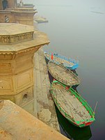 'Keshi Ghat' on the Yamuna atVrindavaninUttar Pradesh
 -
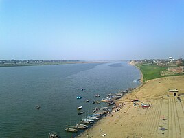 The Yamuna near Prayagraj in Uttar Pradesh, just a few kilometres before it meets theGanges
 -
 The Yamuna near Prayagraj in Uttar Pradesh, during the monsoon
 -
 View of Yamuna fromOkhla Sanctuary
 -
 View of Yamuna fromKesi Ghata
 -
 The Yamuna view fromHathni Kund Barrage


See also[edit]
- Environmental personhood
- List of rivers of India
- Western Jamuna Canal Link
- Yamuna in Hinduism
- Yamuna Pushkaram
- Yamuna Pushta
References[edit]
- ^abGoogle(5 March 2023)."Yamuna"(Map).Google Maps.Google.Retrieved5 March2023.
- ^Jain, Sharad K.; Agarwal, Pushpendra K.; Singh, Vijay P. (2007).Hydrology and water resources of India.Springer. p. 341.Bibcode:2007hwri.book.....J.ISBN978-1-4020-5179-1.Retrieved26 April2011.
- ^abcdefgJain, Sharad K.; Agarwal, Pushpendra K.; Singh, Vijay P. (2007).Hydrology and water resources of India—Volume 57 of Water science and technology library.Springer. pp. 344–354.ISBN978-1-4020-5179-1.
- ^abcdeHoiberg, Dale (2000).Students' Britannica India, Volumes 1-5.Popular Prakashan. pp. 290–291.ISBN0-85229-760-2.
- ^Sharma, Vibha (18 November 2007)."And filthy flows the Yamuna".The Tribune (Chandigarh).
- ^2015,INDIA 2015,New Media Wing.
- ^abcd"Yamuna not fit for bathing, says govt report".The New Indian Express.27 July 2021.Retrieved27 July2021.
- ^abPALAEOCHANNELS OF NORTH WEST INDIA,Central Ground Water Board, last page of prefce.
- ^Yamunotri TempleUttarkashi districtwebsite.Archived31 July 2009 at theWayback Machine
- ^Nand, Nitya; Kumar, Kamlesh (1989).The holy Himalaya: a geographical interpretation of Garhwal – Yamuna Drainage System.Daya Books. p. 49.ISBN81-7035-055-7.
- ^"Rivers of Himachal Pradesh".Webindia123.
- ^Sharma, Deo Prakash (2006).Archaeology of Lower Ganga-Yamuna Doab (circa 1200 B.C. to 1200 A.D.).Bharatiya Kala Prakashan. pp. 10, 214.ISBN81-8090-033-9.
"Doabis aPersianword, fromDo-Ab,literally meaning 'two rivers', or land between two rivers ".
- ^At the Three RiversTIME,23 February 1948.
- ^"State of River Yamuna".Archived fromthe originalon 13 April 2018.Retrieved15 September2009.
- ^abcdSharad K., Jain; Pushpendra K., Agarwal; Vijay P., Singh (16 May 2007).Hydrology and Water Resources of India Volume 57 of Water Science and Technology Library.Springer Science & Business Media, 2007. p. 349– 351.ISBN9781402051807.
- ^abRai, Raveendra Kumar; Upadhyay, Alka; Ojha, C. Shekhar P.; Singh, Vijay P. (25 November 2011).The Yamuna River Basin: Water Resources and Environment.Springer Science. pp. 114–115.
- ^abMacDonell, Arthur Anthony; Keith, Arthur Berriedale (1995).Vedic Index of Names and Subjects (V-208-1333-2).Motilal Banarsidass Publishers. p. 186.ISBN9788120813335.
- ^Gary, Chamberlain (2008).Troubled Waters: Religion, Ethics, and the Global Water Crisis.Rowman & Littlefield, 2008. p. 18.ISBN9780742552456.
- ^Dahlaquist, Allan (1996).Megasthenes and Indian Religion- Volume 11 of History and Culture Series.Motilal BanarsidassPubl. p. 386.ISBN81-208-1323-5.
- ^Ghosh, A. (1991).Encyclopedia of Indian Archaeology.BRILL. p. 214.ISBN90-04-09264-1.
- ^Feuerstein, Georg; Kak, Subhash; Frawley, David (2001).In Search of the Cradle of Civilization.Quest Books. p. 89.ISBN0-8356-0741-0.
- ^Frawley, David(2000).Gods, Sages and Kings: Vedic Secrets of Ancient Civilization.Lotus Press. p. 95.ISBN0-910261-37-7.
- ^Clift et al. 2012. "U-Pb zircon dating evidence for a Pleistocene Sarasvati River and capture of the Yamuna River." Geology, v. 40.[1]
- ^Davis, Richard H. (1999).Lives of Indian images.Princeton University Press. pp. 74–76.ISBN0-691-00520-6.
- ^Upper Yamuna River BoardArchived17 January 2010 at theWayback MachineOfficial website.
- ^Rao, K.L. (1979).India's Water Wealth – Flood Forecasting system of Yamuna.Orient Blackswan. p. 163.ISBN81-250-0704-0.
- ^Negi, Sharad Singh (1991).Himalayan rivers, lakes, and glaciers.Indus Publishing. pp. 141–142.ISBN81-85182-61-2.
- ^Flood Forecasting Network in IndiaMinistry of Water Resourceswebsite.
- ^Bharati Chaturvedi, 2010,Finding Delhi: Loss and Renewal in the Megacity
- ^Regional plan
- ^Bharati Chaturvedi, 2010,Finding Delhi: Loss and Renewal in the Megacity,Page 78.
- ^ML Ahmed, Analysis of Discharge and Gauge-Level Data at Old Railway Bridge, Int'l Conference on Artificial Intelligence, Energy and Manufacturing Engineering (ICAEME’2014), 9–10 June 2014, Kuala Lumpur (Malaysia).
- ^abcTak, Prakash C.; Sati, Jagdish P.; Rizvi, Anjum N. (April 2010)."Status of waterbirds at Hathnikund Barrage wetland, Yamunanagar District, Haryana, India"(PDF).p. 841. Archived fromthe original(PDF)on 17 March 2012.Retrieved10 July2011.
- ^abcHaberman, David L. (2006).River of love in an age of pollution: the Yamuna River of northern India.University of California Press. p. 78.ISBN978-0-520-24789-5.Retrieved2 June2011.
- ^abcdToo many cooks spoil the broth,The Hindu,29 March 2016.
- ^Woodward, David; John Brian Harley (1987).The History of cartography, Volume 2, Part 1.Oxford University Press US. p. 438.ISBN0-226-31635-1.
- ^abcdefghijklm"Western yaumna Canal Project".Archived fromthe originalon 13 November 2017.Retrieved9 April2016.
- ^ab"India Water Portal"(PDF).Archived fromthe original(PDF)on 6 March 2016.Retrieved9 April2016.
- ^abc"Planning Commission of India: Western Yaumna Canal"(PDF).Archived fromthe original(PDF)on 11 February 2017.Retrieved9 April2016.
- ^abMoudgil, Rajesh (9 April 2016)."Munak water supply fully restored to Delhi".Hindustan Times.
- ^abJind district profile
- ^abcdefghiDelhibird
- ^ab"Yamuna water link may get govt nod".Times of India.6 April 2016.
- ^abSultan, Parvez (1 February 2017)."Steamer service to revive navigation in Agra Canal after 143 years".Hindustan Times.
- ^abEck, Diana L. (2012).India: a sacred geography.New York: Harmony Books.
- ^abcHaberman, David L. (2006).River of love in an age of pollution: the Yamuna River of northern India.Berkeley, Calif.: University of California Press.
- ^Dallapiccola, Anna L. (2007).Indian art in detail.Harvard University Press.
- ^Kumar, Bidisha; James, George (2018). "Yamuna". In Jacobsen, Knut A.; Basu, Helene; Malinar, Angelika; Narayanan, Vasudha (eds.).Brill’s Encyclopedia of Hinduism Online.Brill.
- ^Bhagavata Purana8.13.9
- ^Dimmitt, Cornelia (1978).Classical Hindu mythology: a reader in the Sanskrit Purānas.Temple University Press. p. 329.ISBN0-87722-122-7.
- ^"Yamunashtakam Text and Translation".Archived fromthe originalon 25 June 2010.
- ^Shiva, Vandana(2006).Earth democracy: justice, sustainability and peace-G – Reference, Information and Interdisciplinary Subjects Series.Zed Books. pp. 172–173.ISBN1-84277-777-7.
- ^Chamberlain, Gary (2008).Troubled waters: religion, ethics, and the global water crisis.Rowman & Littlefield. p. 18.ISBN978-0-7425-5245-6.
- ^Gopal, Madan (1990). K.S. Gautam (ed.).India through the ages.Publication Division, Ministry of Information and Broadcasting, Government of India. p.72.
- ^"Yamuna River",Mathura-Vrindavan
- ^Sharma, H.S., 2007. Freshwater Fishes. Fauna of Madhya Pradesh (including Chhattisgarh), State Fauna Series, 15(1), pp.147–244.[2]
- ^Sharma, A.P., Das, M.K., Samanta, S., Paul, S.K. and Bhowmick, S., 2014. The ecology and fishery status of river Yamuna. Bulletin, (184), pp.1–32.http://citeseerx.ist.psu.edu/viewdoc/download?doi=10.1.1.709.760&rep=rep1&type=pdf
- ^"Lang, J.W., Chowfin, S. and Ross, J.P., 2019. Gavialis gangeficus".
{{cite journal}}:Cite journal requires|journal=(help) - ^Haberman, David (10 September 2006).River of Love in an Age of Pollution: The Yamuna River of Northern India.University of California Press. pp. 9, 91.ISBN978-0-520-93962-2.
- ^The Ganges and the JumnaThe Imperial Gazetteer of India,1909 v. 1,p. 23.
- ^Chaudhary, Meenakshi; Walker, Tony R. (2019)."River Ganga pollution: Causes and failed management plans (correspondence on Dwivedi et al. 2018. Ganga water pollution: A potential health threat to inhabitants of Ganga basin. Environment International 117, 327–338)".Environment International.126:202–206.doi:10.1016/j.envint.2019.02.033.PMID30802637.
- ^"Urban Metabolism of River Yamuna in the National Capital Territory of Delhi, India".ResearchGate.Retrieved25 November2020.
- ^Sharma, Manju & Chaudhry, Smita. (2015).Impact of Industrial Pollution on Yamuna River: A Review.10.13140/RG.2.1.3632.8401.
- ^Sukanan, Darunee (26 November 2019)."A 'sacred' river in India has become polluted beyond belief".Sustainability Times.Archived fromthe originalon 28 November 2019.Retrieved28 November2019.
- ^"list of head works (Dams,_Barrages, Weirs, Anicuts, Lifts) on Yamuna/Ganga river".Retrieved14 May2015.
- ^Pepper, Daniel (27 July 2007)."India's 'flush-and-forget' mindset".SFGate.San Francisco Chronicle. pp. A17–A18.Retrieved27 July2007.
- ^"CAG castigates Delhi Govt over Yamuna river pollution".Indian Express.8 April 2000.
- ^Pepper, Daniel (4 June 2007)."India's rivers are drowning in pollution".Fortune.
- ^"India's largest sewage treatment plant to come up at Okhla: DJB".The Economic Times.29 May 2019.Retrieved28 November2019.
- ^Gupta, Geeta (31 August 2009)."Inflow to Yamuna to be cleaned up at last".Indian Express.Archived fromthe originalon 14 January 2012.
- ^"Panel: Scrap Yamuna riverfront project".Delhi Daily News.26 April 2014. Archived fromthe originalon 16 July 2014.
- ^abSafi, Michael; Agencies (21 March 2017)."Ganges and Yamuna rivers granted same legal rights as human beings".The Guardian.ISSN0261-3077.Retrieved25 March2019.
Further reading[edit]
- Fraser, James Baillie(1820).Journal of a tour through part of the snowy range of the Himala Mountains, and to the sources of the rivers Jumna and Ganges.Rodwell and Martin, London.
- Haberman, David L. (2006).River of love in an age of pollution: the Yamuna River of northern India.University of California Press.ISBN0-520-24790-6.
- Schumann, A. H. (2001).Sustainable regional water management of Yamuna river basin: A case study.International Association of Hydrological Sciences(IAHS). pp. 25–32.ISBN1-901502-51-1.
External links[edit]
- The Geography of the RigvedaArchived15 January 2018 at theWayback Machine
- Yamuna Action Plan
- The Yamuna, India's most polluted riveronYouTube.The Guardian(7 July 2017)
- Yamuna Mission
- The paintingA Ruin on the Banks of the Jumna, Above the City of Delhiby William Purser, engraved byWilliam Joseph Taylor,as an illustration to
 The Zenana., a poem byLetitia Elizabeth Landon.

| International | |
|---|---|
| National | |
| Geographic | |