Kapooka, New South Wales
Appearance
(Redirected fromKapooka)
| Kapooka Wagga Wagga,New South Wales | |
|---|---|
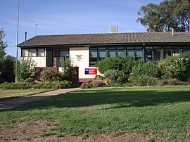
 Kapooka Public School | |
 | |
| Coordinates | 35°9′7.66″S147°18′7.48″E/ 35.1521278°S 147.3020778°E |
| Population | 633 (2016 census)[1] |
| Postcode(s) | 2661 |
| Location |
|
| LGA(s) | City of Wagga Wagga |
| County | Mitchell |
| Parish | Uranquinty |
| State electorate(s) | Wagga Wagga |
| Federal division(s) | Riverina |
Kapookais a suburb in the south-west ofWagga Wagga,New South Wales,Australia.[2]
Kapooka is home to the Department of Defence'sBlamey Barracksfrom where theArmy Recruit Training Centreconducts its operations.
It is located on theOlympic Highway,betweenWagga WaggaandUranquinty.
References
[edit]- ^Australian Bureau of Statistics(27 June 2017)."Kapooka (State Suburb)".2016 Census QuickStats.Retrieved27 June2017.
- ^"Kapooka".Geographical Names Register (GNR) of NSW.Geographical Names Board of New South Wales.Retrieved4 August2013.
External links
[edit] Media related toKapooka, New South Walesat Wikimedia Commons

