
Killingworth, Connecticut
Killingworth, Connecticut | |
|---|---|
| Town of Killingworth | |
 Killingworth Library Association | |
 Seal | |
  | |
   | |
| Coordinates:41°22′50″N72°34′35″W/ 41.38056°N 72.57639°W | |
| Country | |
| U.S. state | |
| County | Middlesex |
| Region | Lower CT River Valley |
| Named | 1667 |
| Government | |
| • Type | Selectman-town meeting |
| • First Selectman | Eric Couture (D) |
| • Selectman | Joel D'Angelo (D) |
| • Selectman | Eric Nunes (R) |
| Area | |
| • Total | 35.8 sq mi (92.7 km2) |
| • Land | 35.3 sq mi (91.5 km2) |
| • Water | 0.5 sq mi (1.2 km2) |
| Elevation | 354 ft (108 m) |
| Population (2020) | |
| • Total | 6,174 |
| • Density | 175/sq mi (67.5/km2) |
| Time zone | UTC-5(Eastern) |
| • Summer (DST) | UTC-4(Eastern In) |
| ZIP code | 06419 |
| Area code(s) | 860/959 |
| FIPS code | 09-40710 |
| GNISfeature ID | 0213448[1] |
| Website | www |
Killingworthis atowninMiddlesex County,Connecticut,United States. The town is part of theLower Connecticut River Valley Planning Region.The population was 6,174 at the2020 United States Census.[2]
History[edit]
Killingworth was established from the area called Hammonasset, taken from the localNative Americantribeof the same name. The area originally incorporated the area of the present town ofClinton,which was separated from Killingworth along ecclesiastical borders in 1838.[3][4]Part ofNew London Countyprior to May 1785, Killingworth was then included in the newly formedMiddlesex County,where it remains today.
The New England town received its name fromKenilworth,England,the previous home of one of the first settlers inNew England,Edward Griswold.[4]Kenilworth's name resembled "Killingworth" during thecolonial American period,though over time the pronunciations and spellings of the names drifted toward the two distinct modern ones.[3]A town and village in England calledKillingworthandKillingworth Village,in the county ofTyne and Wear,do not appear to have any connection with Killingworth, Connecticut.
In the late 17th century, Killingworth became the birthplace of what would eventually becomeYale University.The Rev.Abraham Pierson,the college's first president, taught some of the first classes in his Killingworth home—which is actually in present-dayClinton, Connecticut.However, in 1701, the college's first official home was constructed inOld Saybrookon the peninsula known as Saybrook Point donated by Yale's first Treasurer Nathanial Lynde. Eventually the school was moved to its present-day home inNew Haven.[5]
Geography[edit]
According to theUnited States Census Bureau,the town has an area of 35.8 square miles (93 km2). Of this total, 35.3 square miles (91 km2) is dry land and 0.5 square miles (1.3 km2) – or 1.34% – is water-covered.[citation needed]
Killingworth also containsChatfield Hollow State Park.[citation needed]
Government[edit]
Killingworth is governed by aBoard of Selectmen,currently headed byFirst Selectman,Eric Couture, with Joel A. D’Angelo and Eric J. Nunes also on the board.[6]

Demographics[edit]
| Census | Pop. | Note | %± |
|---|---|---|---|
| 1790 | 2,156 | — | |
| 1800 | 2,047 | −5.1% | |
| 1810 | 2,244 | 9.6% | |
| 1820 | 2,342 | 4.4% | |
| 1830 | 2,484 | 6.1% | |
| 1840 | 1,130 | −54.5% | |
| 1850 | 1,107 | −2.0% | |
| 1860 | 1,126 | 1.7% | |
| 1870 | 856 | −24.0% | |
| 1880 | 748 | −12.6% | |
| 1890 | 582 | −22.2% | |
| 1900 | 651 | 11.9% | |
| 1910 | 660 | 1.4% | |
| 1920 | 531 | −19.5% | |
| 1930 | 482 | −9.2% | |
| 1940 | 1,230 | 155.2% | |
| 1950 | 677 | −45.0% | |
| 1960 | 1,098 | 62.2% | |
| 1970 | 2,435 | 121.8% | |
| 1980 | 3,976 | 63.3% | |
| 1990 | 4,814 | 21.1% | |
| 2000 | 6,018 | 25.0% | |
| 2010 | 6,525 | 8.4% | |
| 2020 | 6,174 | −5.4% | |
| U.S. Decennial Census[7] | |||
As of thecensus[8]of July 1, 2015, there were 6,455 people, 2,513 households, and 1,765 families residing in the town. The population density was 184.7 inhabitants per square mile (71.3/km2). There were 2,598 housing units at an average density of 70.6 per square mile (24.9/km2). The racial makeup of the town was 96.4%White,0.7%African American,0.2%Native American,1.1%Asian,0.1% Native Hawaiian and Other Pacific Islander, 2.2% Hispanic or Latino, and 1.3% Two or More Races.
There were 2,513 households, with a 95.3% occupancy rate, out of which 23.9% had children under the age of 18 living with them, 73.8% weremarried couplesliving together, 4.3% had a female householder with no husband present, and 19.6% were non-families. 16.1% of all households were made up of individuals, and 8.0% had someone living alone who was 65 years of age or older. The average household size was 2.74 and the average family size was 3.08.
In the town, the population was spread out, with 4% under the age of 5, 23.9% under the age of 18, 3.6% from 18 to 24, 29.4% from 25 to 44, 28.0% from 45 to 64, and 16% who were 65 years of age or older. The median age was 40 years. For every 100 females, there were 98.4 males. For every 100 females age 18 and over, there were 96.8 males.
The median income for a household in the town was $112,137. Theper capita incomefor the town was $48,537. None of the families and 1.7% of the population were living below thepoverty line,including no under eighteens and 1.4% of those over 64.
| Voter Registration and Party Enrollment as of October 31, 2023[9] | |||||
|---|---|---|---|---|---|
| Party | Total voters | Percentage | |||
| Unaffiliated | 2,310 | 43.4% | |||
| Democratic | 1,437 | 27% | |||
| Republican | 1,502 | 28.2% | |||
| Minor parties | 79 | 1.48% | |||
| Total | 5,328 | 100% | |||
Education[edit]
Students attending school in Killingworth are a part of Connecticut's Regional School District #17, which consists ofHaddamand its villages of Haddam Neck (located on the eastern bank of theConnecticut River) andHigganum.The high school, Haddam-Killingworth High School (often abbreviated as simply "HK" ), is located in Higganum. The middle-school, Haddam Killingworth Intermediate-Middle School,[10]was built in Killingworth in 2006 and houses grades 4 through 8. The elementary schools, Burr Elementary School and Killingworth Elementary School are located in Higganum and Killingworth respectively. The school's sports teams are called the 'Cougars'.
Transportation[edit]

TheEstuary Transit Districtprovides public transportation throughout Killingworth and the surrounding towns through its 9 Town Transit Service. Services include connections to the Old Saybrook Train Station, served byAmtrakandShoreline Eastrailroads.
Popular culture[edit]
The town was the subject of the poetHenry Wadsworth Longfellow's poem "The Birds of Killingworth" published inTales of a Wayside Inn.
1999: The largest tree in Rockefeller Center history, 100 feet (30 m) high, was chosen from Killingworth, CT.
Notable people[edit]
- Jeff Bagwell,Hall of FameMajor League Baseballplayer for theHouston Astros
- Carleton Beals,journalist, author, historian, and a crusader with special interests inLatin America[11]
- Abel Buell,publisher of the first map of the new United States created by an American[12]
- Jonathan Bush,American banker, brother ofPresidentGeorge H. W. Bush[citation needed]
- Titus Coan,missionary to Hawaii
- Silas Halsey,former US Congressman
- Haynes Johnson,Pulitzer Prize–winning journalist, author and political analyst
- Camille Kostek,model who was on the cover ofSports IllustratedSwimsuit Issue
- Ricki Lake,television personality
- Hugh Lofting,author of theDoctor Dolittleseries
- Washington F. Willcox,U.S. Congressman (March 4, 1889 – March 3, 1893), born on North Chestnut Hill on August 22, 1834
Listings on the National Register of Historic places[edit]
- Emmanuel Church,added August 5, 1999
- Oak Lodge,added September 4, 1986
- Parmelee House (Killingworth, Connecticut).
References[edit]
- ^abU.S. Geological Survey Geographic Names Information System: Killingworth, Connecticut
- ^"Census - Geography Profile: Killingworth town, Middlesex County, Connecticut".RetrievedDecember 17,2021.
- ^abKillingworth Historical SocietyArchivedOctober 12, 2008, at theWayback Machine
- ^abTown of Killingworth Historical Sign, 1981
- ^"History of Killingworth".Archived fromthe originalon October 12, 2008.RetrievedSeptember 9,2007.
- ^"Town of Killingworth".townofkillingworth.RetrievedApril 11,2018.
- ^"Census of Population and Housing".Census.gov.RetrievedJune 4,2015.
- ^"U.S. Census website".United States Census Bureau.RetrievedJanuary 31,2008.
- ^"Registration and Party Enrollment Statistics as of October 31, 2023"(PDF).Connecticut Secretary of State.RetrievedNovember 8,2023.
- ^Cassandra Day (March 8, 2019)."Plans to close Haddam Elementary School 'complete,' officials say".The Middletown Press.RetrievedJanuary 20,2020.
- ^United States. Congress. Senate. Committee on the Judiciary (April 11, 1961)."Fair Play for Cuba Committee. Hearings before the Subcommittee to Investigate the Administration of the Internal Security Act and Other Internal Security Laws of the Committee on the Judiciary, United States Senate, Eighty-seventh Congress, first session."Washington, U.S. Govt. Print. Off.RetrievedApril 11,2018– via Internet Archive.
- ^"Abel Buell".Archived from the original on May 14, 2008.RetrievedJune 3,2008.
{{cite web}}:CS1 maint: unfit URL (link)
External links[edit]
Municipalities and communities ofMiddlesex County, Connecticut,United States | ||
|---|---|---|
| City |  | |
| Towns | ||
| Borough | ||
| CDPs | ||
| Other communities | ||
Municipalities and communities ofLower Connecticut River Valley Planning Region, Connecticut,United States | ||
|---|---|---|
| Cities | 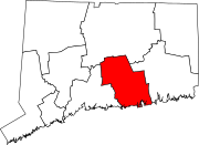 | |
| Towns | ||
| International | |
|---|---|
| National | |
| Other | |