
Kiowa County, Kansas
Kiowa County | |
|---|---|
 Renovated County Courthouse inGreensburg(2009) after a tornado damaged it in 2007. Construction of the building started in 1920. | |
 Location within the U.S. state ofKansas | |
 Kansas's location within theU.S. | |
| Coordinates:37°34′00″N99°17′00″W/ 37.5667°N 99.2833°W | |
| Country | |
| State | |
| Founded | February 26, 1867 |
| Named for | Kiowa tribe |
| Seat | Greensburg |
| Largest city | Greensburg |
| Area | |
| • Total | 723 sq mi (1,870 km2) |
| • Land | 723 sq mi (1,870 km2) |
| • Water | 0.2 sq mi (0.5 km2) 0.03% |
| Population | |
| • Total | 2,460 |
| • Density | 3.4/sq mi (1.3/km2) |
| Time zone | UTC−6(Central) |
| • Summer (DST) | UTC−5(CDT) |
| Congressional district | 4th |
| Website | kiowacountyks.org |
Kiowa Countyis acountylocated in theU.S. stateofKansas.Itscounty seatand largest city isGreensburg.[2]As of the2020 census,the county population was 2,460.[1]The county is named after theKiowa tribe.
History
[edit]19th century
[edit]In 1854, theKansas Territorywas organized, then in 1861Kansasbecame the 34thU.S. state.In 1867,Kiowa Countywas established and named after theKiowatribe.[3]In 1875. The county’s land was given to nearby county, but in 1886, Kiowa County was reestablished and organized.[4]
The Santa Fe Railroad was built into the county around the time it was organized. The Greensburg Well, one of the largest hand-dug wells in the world, was built in 1887-1888. It has been a popular tourist attraction since 1939. The well is listed in the National Register of Historic Places.[4]
The first oil well in Kiowa County was drilled in 1917.[4]
Mabel Chase ran for county sheriff after her husband’s time in the office was term-limited and became the state's first female sheriff. Her husband provided her the family’s armored 1926 Hudson Super Six, and she was the first sheriff in Kansas to be supplied with aThompson submachine gun.Chase conducted raids on local stills.[4]
21st century
[edit]On the evening of May 4, 2007,Greensburgwas devastated by anEF5 tornadoduring theMay 2007 tornado outbreak.It killed 11 and destroyed 95% of the community.
The Kiowa County Courthouse was renovated with new windows and roof after the 2007 tornado damaged it. Originally, construction of the building started in 1920.
Geography
[edit]According to theU.S. Census Bureau,the county has a total area of 723 square miles (1,870 km2), of which 723 square miles (1,870 km2) is land and 0.2 square miles (0.52 km2) (0.03%) is water.[5]
Kiowa County has a large number of iron-richmeteoritesin its soil due to theBrenham meteorfall over 10 thousand years ago.
Adjacent counties
[edit]- Edwards County(north)
- Pratt County(east)
- Barber County(southeast)
- Comanche County(south)
- Clark County(southwest)
- Ford County(west)
Major highways
[edit]- US 54
- US 183
- US 400
Kiowa County has only U.S. highways, no state highways.
Demographics
[edit]
| Census | Pop. | Note | %± |
|---|---|---|---|
| 1890 | 2,873 | — | |
| 1900 | 2,365 | −17.7% | |
| 1910 | 6,174 | 161.1% | |
| 1920 | 6,164 | −0.2% | |
| 1930 | 6,035 | −2.1% | |
| 1940 | 5,112 | −15.3% | |
| 1950 | 4,743 | −7.2% | |
| 1960 | 4,626 | −2.5% | |
| 1970 | 4,088 | −11.6% | |
| 1980 | 4,046 | −1.0% | |
| 1990 | 3,660 | −9.5% | |
| 2000 | 3,278 | −10.4% | |
| 2010 | 2,553 | −22.1% | |
| 2020 | 2,460 | −3.6% | |
| 2023 (est.) | 2,374 | [6] | −3.5% |
| U.S. Decennial Census[7] 1790-1960[8]1900-1990[9] 1990-2000[10]2010-2020[1] | |||
As of thecensus[11]of 2000, there were 3,278 people, 1,365 households, and 924 families residing in the county. Thepopulation densitywas 4 people per square mile (1.5 people/km2). There were 1,643 housing units at an average density of 2 per square mile (0.77/km2). The racial makeup of the county was 97.19%White,0.21%BlackorAfrican American,0.61%Native American,0.27%Asian,0.98% fromother races,and 0.73% from two or more races. 2.04% of the population wereHispanicorLatinoof any race.
There were 1,365 households, out of which 27.70% had children under the age of 18 living with them, 59.60% weremarried couplesliving together, 5.30% had a female householder with no husband present, and 32.30% were non-families. 30.50% of all households were made up of individuals, and 15.50% had someone living alone who was 65 years of age or older. The average household size was 2.32 and the average family size was 2.89.
In the county, the population was spread out, with 24.00% under the age of 18, 8.20% from 18 to 24, 21.80% from 25 to 44, 24.60% from 45 to 64, and 21.30% who were 65 years of age or older. The median age was 42 years. For every 100 females there were 96.30 males. For every 100 females age 18 and over, there were 95.10 males.
The median income for a household in the county was $31,576, and the median income for a family was $40,950. Males had a median income of $29,063 versus $20,764 for females. Theper capita incomefor the county was $17,207. About 7.40% of families and 10.80% of the population were below thepoverty line,including 13.50% of those under age 18 and 8.70% of those age 65 or over.
Government
[edit]Presidential elections
[edit]| Year | Republican | Democratic | Third party | |||
|---|---|---|---|---|---|---|
| No. | % | No. | % | No. | % | |
| 2020 | 980 | 84.12% | 156 | 13.39% | 29 | 2.49% |
| 2016 | 900 | 82.42% | 114 | 10.44% | 78 | 7.14% |
| 2012 | 976 | 85.31% | 163 | 14.25% | 5 | 0.44% |
| 2008 | 912 | 80.35% | 200 | 17.62% | 23 | 2.03% |
| 2004 | 1,275 | 81.47% | 256 | 16.36% | 34 | 2.17% |
| 2000 | 1,262 | 78.48% | 294 | 18.28% | 52 | 3.23% |
| 1996 | 1,264 | 70.97% | 331 | 18.59% | 186 | 10.44% |
| 1992 | 1,057 | 55.90% | 355 | 18.77% | 479 | 25.33% |
| 1988 | 1,276 | 71.09% | 485 | 27.02% | 34 | 1.89% |
| 1984 | 1,537 | 79.51% | 361 | 18.68% | 35 | 1.81% |
| 1980 | 1,433 | 72.16% | 438 | 22.05% | 115 | 5.79% |
| 1976 | 1,180 | 59.48% | 764 | 38.51% | 40 | 2.02% |
| 1972 | 1,559 | 76.35% | 406 | 19.88% | 77 | 3.77% |
| 1968 | 1,484 | 70.87% | 481 | 22.97% | 129 | 6.16% |
| 1964 | 1,135 | 53.29% | 970 | 45.54% | 25 | 1.17% |
| 1960 | 1,662 | 74.56% | 555 | 24.90% | 12 | 0.54% |
| 1956 | 1,717 | 76.18% | 517 | 22.94% | 20 | 0.89% |
| 1952 | 1,838 | 78.61% | 432 | 18.48% | 68 | 2.91% |
| 1948 | 1,258 | 59.79% | 722 | 34.32% | 124 | 5.89% |
| 1944 | 1,479 | 69.60% | 618 | 29.08% | 28 | 1.32% |
| 1940 | 1,571 | 64.10% | 844 | 34.43% | 36 | 1.47% |
| 1936 | 1,280 | 47.32% | 1,417 | 52.38% | 8 | 0.30% |
| 1932 | 1,306 | 52.24% | 1,159 | 46.36% | 35 | 1.40% |
| 1928 | 1,929 | 82.09% | 406 | 17.28% | 15 | 0.64% |
| 1924 | 1,541 | 70.08% | 498 | 22.65% | 160 | 7.28% |
| 1920 | 1,411 | 69.51% | 587 | 28.92% | 32 | 1.58% |
| 1916 | 901 | 40.97% | 956 | 43.47% | 342 | 15.55% |
| 1912 | 276 | 19.59% | 506 | 35.91% | 627 | 44.50% |
| 1908 | 699 | 59.49% | 409 | 34.81% | 67 | 5.70% |
| 1904 | 494 | 59.23% | 251 | 30.10% | 89 | 10.67% |
| 1900 | 322 | 51.52% | 293 | 46.88% | 10 | 1.60% |
| 1896 | 250 | 49.80% | 245 | 48.80% | 7 | 1.39% |
| 1892 | 398 | 50.44% | 0 | 0.00% | 391 | 49.56% |
| 1888 | 525 | 50.34% | 381 | 36.53% | 137 | 13.14% |
Like all of the High Plains, Kiowa County is Republican. The only Democrat to ever win a majority in the county has beenFranklin D. Rooseveltin 1936, who ironically achieved the feat against incumbent Kansas governorAlf Landon.Woodrow Wilsonwon a plurality in 1916, but since 1944 only three Democrats have reached thirty percent of the county's vote, andMichael Dukakisin 1988 duringa major droughtand consequent farm crisis is the last Democrat to receive so much as twenty percent.
Education
[edit]Colleges
[edit]- Barclay College,Haviland
Unified school districts
[edit]Communities
[edit]
List of current townships / incorporated cities / unincorporated communities / extinct former communities within Kiowa County.[13]
Incorporated cities
[edit]- Greensburg(county seat)
- Haviland
- Mullinville
Unincorporated communities
[edit]Townships
[edit]Kiowa County has only onetownship,and none of the cities within the county are consideredgovernmentally independent;all figures for the township include those of the cities.
| Township | FIPS | Population | Population density /km2(/sq mi) |
Land area km2(sq mi) |
Water area km2(sq mi) |
Water % | Geographic coordinates |
|---|---|---|---|---|---|---|---|
| Kiowa Rural | 37185 | 3,278 | 2 (5) | 1,871 (722) | 1 (0) | 0.03% | 37°34′45″N99°15′28″W/ 37.57917°N 99.25778°W |
See also
[edit]- Community information for Kansas
- Kansas locations by per capita income
- List of counties in Kansas
- List of townships in Kansas
- List of cities in Kansas
- List of unincorporated communities in Kansas
- List of ghost towns in Kansas
References
[edit]- ^abc"QuickFacts; Kiowa County, Kansas; Population, Census, 2020 & 2010".United States Census Bureau.Archivedfrom the original on August 18, 2021.RetrievedAugust 17,2021.
- ^"Find a County".National Association of Counties. Archived fromthe originalon May 31, 2011.RetrievedJune 7,2011.
- ^Gannett, Henry (1905).The Origin of Certain Place Names in the United States.Govt. Print. Off. pp.176.
- ^abcd"Kiowa County, Kansas - Kansapedia - Kansas Historical Society".kshs.org.RetrievedFebruary 13,2024.
- ^"US Gazetteer files: 2010, 2000, and 1990".United States Census Bureau.February 12, 2011.RetrievedApril 23,2011.
- ^"Annual Estimates of the Resident Population for Counties: April 1, 2020 to July 1, 2023".United States Census Bureau.RetrievedApril 3,2024.
- ^"U.S. Decennial Census".United States Census Bureau.RetrievedJuly 26,2014.
- ^"Historical Census Browser".University of Virginia Library.RetrievedJuly 26,2014.
- ^"Population of Counties by Decennial Census: 1900 to 1990".United States Census Bureau.RetrievedJuly 26,2014.
- ^"Census 2000 PHC-T-4. Ranking Tables for Counties: 1990 and 2000"(PDF).United States Census Bureau.Archived(PDF)from the original on March 27, 2010.RetrievedJuly 26,2014.
- ^"U.S. Census website".United States Census Bureau.RetrievedJanuary 31,2008.
- ^"Dave Leip's Atlas of U.S. Presidential Elections".
- ^ab"General Highway Map of Kiowa County, Kansas"(PDF).Kansas Department of Transportation(KDOT). July 2009.Archived(PDF)from the original on February 8, 2023.
- Notes
Further reading
[edit]- Standard Atlas of Kiowa County, Kansas;Geo. A. Ogle & Co; 53 pages; 1906.
External links
[edit]- County
- Historical
- Kiowa Countyfrom American History and Genealogy Project (AHGP)
- Maps
- Kiowa County Maps:Current,Historic,KDOT
- Kansas Highway Maps:Current,Historic,KDOT
- Kansas Railroad Maps:Current,1996,1915,KDOT and Kansas Historical Society
Places adjacent to Kiowa County, Kansas | ||||||||||||||||
|---|---|---|---|---|---|---|---|---|---|---|---|---|---|---|---|---|
| ||||||||||||||||
Municipalities and communities ofKiowa County, Kansas,United States | ||
|---|---|---|
| Cities | 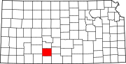 | |
| Unincorporated communities | ||
| Township | ||
| International | |
|---|---|
| National | |