
Kukës
Kukës | |
|---|---|
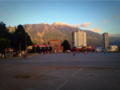
From the top, View over Kukës, Palace of Culture, Kukës street scene, Ethnographic Museum, Drini Bridge | |
 Flag  Emblem | |
 Kukës | |
| Coordinates:42°5′N20°25′E/ 42.083°N 20.417°E | |
| Country | |
| County | Kukës |
| Government | |
| •Mayor | Albert Halilaj (PS) |
| Area | |
| • Municipality | 934.80 km2(360.93 sq mi) |
| • Municipal unit | 8.2 km2(3.2 sq mi) |
| Elevation | 350 m (1,150 ft) |
| Population (2011) | |
| • Municipality | 47,985 |
| • Municipality density | 51/km2(130/sq mi) |
| • Municipal unit | 16,719 |
| • Municipal unit density | 2,000/km2(5,300/sq mi) |
| Demonym | Kuksian/e |
| Time zone | UTC+1(CET) |
| • Summer (DST) | UTC+2(CEST) |
| Postal Code | 8501, 8502, 8503 |
| Area Code | (0)24 |
| Website | kukesi |


Kukës(Albanian:[ˈkukəs];Albaniandefinite form:Kukësi) is a city in theRepublic of Albania.The city is the capital of the surrounding municipality of Kukës and county ofKukës,one of 12 constituentcountiesof the republic. It spans 8.2 square kilometres (3.2 sq mi) and had a total population of 16,719 people as of 2011.[1][2]
Geologically,the surrounding area is dominated by mountainous and high terrain. The city sprawls across theLuma Plainwithin theAlbanian Alpsbetween the banks ofLake Fierzaand the hills of the northernmostKorab Mountainsand westernmostSharr Mountains.At the confluence of theBlackandWhite Drin,theDrin Riveroriginates close to the city's territory.
History
[edit]Early development
[edit]Kukës traces its history back over a thousand years. The region that nowadays corresponds to the city territory was inhabited by several ancientIllyrian tribes(most predominantlyDardanitribe), as most of Albania. Numerous tombs from theIllyrianshave been identified at Këneta andKolshnearby the city. The city was part ofKingdom of Dardaniaduring antiquity. The residential estate served as a stopping point on a branch road leading to theVia Egnatia,which connectedDurrëson theAdriatic Seain the west withConstantinopleon theMarmara Seain the east.

Illyriantombs were found at Këneta andKolshnearby Kukës.[3]It was a small Roman settlement, a stopping point on a branch road leading to theVia Egnatia,and a minor Ottoman market centre and trading post on the road to southern Kosovo. It was there (Qafa e Kolosjanit) where Albanian resistance stood up against retreating Serbian army in 1912.
Modern development
[edit]
The old Kukës was located at the confluence of theWhite DrinandBlack Drin.In 1976 the town was submerged beneath theFierza Reservoir,which is held back by adam. The new town (Kukësi i Ri- "New Kukës" ) was built in the 1970s in the plateau nearby which is 320m over the sea level. Kukësi i Ri is surrounded by the artificial lake of Fierza and it looks like a peninsula from the above. It is linked with the other parts of the country by three bridges. On the east it faces the snow-covered mountain of Gjallica, 2468 m above sea level. Inmodern timesand due to the close proximity to Kosovo, the city achieved worldwide recognition during theKosovo Waras thousands ofKosovo-Albanianrefugees crossed the border and found security in the city. Kukës attracted international attention during theKosovo conflictwhen 450,000 Kosovo Albanianrefugeescrossed the frontier and were housed in camps in and around Kukës.
Contemporary
[edit]The city was nominated for the 2000Nobel Peace Prizein regard to hospitality and for embracing thousands of refugees during theKosovo War.[4]It was the first time a town was nominated for the prize.[5]In 2017, the city applied for the 2018European Green Capital Awardto becomeEurope's Green Capital.[6] There is amosqueand a closed alpine-stylehotel,part of an attempt to establish atourist industrythere. TheOSCEmaintained a villa there.
Environment
[edit]Kukës is situated in the northeast of the country. It lies mostly betweenlatitudes42° and 5° N, andlongitudes20° and 25° E. The city lies on the Luma Plain and the southern shores ofLake Fierza.[2]It lies approximately 3 kilometres (1.9 mi) in the southeast of the former location of the city, which was relocated as part of ahydroelectricscheme.[2]
Climate
[edit]Like all East Albanians who are in the plain the zone ishumid subtropical(Köppen:Cfa), similar to the north ofItaly,due to its interior location but near theMediterranean.Despite its southern location, its distance to the east compensates for this difference.[7][8]The city experiences mostlycontinental climate.[2][9]This means that the winters are cold and snowy and the summers are predominantly hot. The city's temperature varies a large deal across the seasons with a mild spring in April and May, hot summer months from June to August, frequently rainy and windy autumn months in September and October and very cold winter months, often with snow and frost, from December to March. The mean monthlytemperatureranges between −25°C(−13°F)[dubious–discuss]in winter and 25 °C (77 °F) in summer.[2]The mean annualprecipitationranges between 900 millimetres (35 inches) and 3,000 millimetres (120 inches) depending onlongitudeandlatitude.[2]
| Climate data for Kukës, elevation: 44 m or 144 ft, 1961-1990 normals and extremes[a] | |||||||||||||
|---|---|---|---|---|---|---|---|---|---|---|---|---|---|
| Month | Jan | Feb | Mar | Apr | May | Jun | Jul | Aug | Sep | Oct | Nov | Dec | Year |
| Record high °C (°F) | 19.7 (67.5) |
23.1 (73.6) |
26.9 (80.4) |
30.6 (87.1) |
35.0 (95.0) |
39.2 (102.6) |
40.2 (104.4) |
38.7 (101.7) |
35.4 (95.7) |
30.6 (87.1) |
25.4 (77.7) |
22.0 (71.6) |
40.2 (104.4) |
| Mean daily maximum °C (°F) | 3.8 (38.8) |
7.2 (45.0) |
12.1 (53.8) |
17.4 (63.3) |
22.5 (72.5) |
25.9 (78.6) |
28.8 (83.8) |
28.8 (83.8) |
24.6 (76.3) |
18.1 (64.6) |
11.3 (52.3) |
5.6 (42.1) |
17.2 (62.9) |
| Mean daily minimum °C (°F) | −2.9 (26.8) |
−1.2 (29.8) |
1.8 (35.2) |
6.2 (43.2) |
10.8 (51.4) |
14.0 (57.2) |
15.6 (60.1) |
15.2 (59.4) |
11.9 (53.4) |
7.0 (44.6) |
3.1 (37.6) |
−0.8 (30.6) |
6.7 (44.1) |
| Record low °C (°F) | −22.0 (−7.6) |
−14.5 (5.9) |
−13.0 (8.6) |
−2.8 (27.0) |
0.5 (32.9) |
4.0 (39.2) |
6.9 (44.4) |
6.4 (43.5) |
0.0 (32.0) |
−3.0 (26.6) |
−16.0 (3.2) |
−16.3 (2.7) |
−22.0 (−7.6) |
| Averageprecipitationmm (inches) | — | — | — | — | — | — | — | — | — | — | — | — | 909.8 (35.82) |
| Average rainy days(≥ 1.0 mm) | — | — | — | — | — | — | — | — | — | — | — | — | 95.0 |
| Average snowy days | — | — | — | — | — | — | — | — | — | — | — | — | 17.0 |
| Averagerelative humidity(%) | — | — | — | — | — | — | — | — | — | — | — | — | 66.0 |
| Mean monthlysunshine hours | — | — | — | — | — | — | — | — | — | — | — | — | 1,973.1 |
| Source:NOAA[10] | |||||||||||||
Politics
[edit]The Kukës municipality was formed in 1923 by the merger of the former municipalitiesArrën,Bicaj,Bushtricë,Grykë-Çajë,Kalis,Kolsh,Kukës,Malzi,Shishtavec,Shtiqën,Surroj,Tërthore,Topojan,UjmishtandZapod,that became municipal units.[11]The municipality spans 934.80 square kilometres (360.93 sq mi) and had a total population of 47,985 people as of 2011.[12][1]
Economy
[edit]After the fall of communism, due to the newly implemented freedom of movement among all Albanians, a significant number of Kukes’population relocated internally or emigrated abroad for better economic opportunities.
The region is well known for their developed agriculture. Kukës has a carpet factory whose products are for domestic and trade use. There is also a copper processing factory as the raw material.
Kukës is a good centre for fishing and walking in the surrounding mountains.
TheA1highway passes through Kukës.
Sister cities
[edit]Gallery
[edit]-
 View of the center of Kukës
 -
 The Skanderbeg square in Kukës during the winter
 -
 In the center of Kukës
 -
 The lake of Kukës during the winter
 -
 The airport of Kukës


See also
[edit]Notes
[edit]- ^Monthly data only for temperatures
References
[edit]- ^ab"Population and housing census - Kukës 2011"(PDF).INSTAT.Retrieved25 September2019.
- ^abcdefBashkia Kukës."PLANI I ZHVILLIMIT I BASHKISE KUKES"(PDF).rasp.org.al(in Albanian). Kukës. Archived fromthe original(PDF)on 14 October 2017.
- ^Boardman, Edwards, John,I. E. S. (1982).The Cambridge Ancient History.Cambridge University Press. p. 235.ISBN9780521224963.Retrieved10 January2016.
{{cite book}}:CS1 maint: multiple names: authors list (link) - ^"Kukësi, kryeqendra shqiptare më 16 prill".gazeta-shqip(in Albanian). p. 1.Retrieved16 April2014.
- ^Collett, Richard (8 December 2023)."Kukës: The first city ever nominated for a Nobel Prize".BBC.Retrieved14 December2023.
- ^"European Green Capital".ec.europa.eu.Retrieved27 August2017.
- ^"Kukës climate: Average Temperature, weather by month, Kukës weather averages - Climate-Data.org".en.climate-data.org.Retrieved12 May2019.
- ^Peterson, Adam (2 November 2016),English: Köppen climate types of Albania,retrieved12 May2019
- ^Bashkia Kukës."Programi i Zonës Funksionale Kukës"(PDF).km.dldp.al(in Albanian). Kukës. pp. 11–12.
- ^"Kukës (13610) - WMO Weather Station".NOAA.Retrieved28 August2019.
- ^"Law nr. 115/2014"(PDF)(in Albanian). p. 6373.Retrieved25 February2022.
- ^"Correspondence table LAU – NUTS 2016, EU-28 and EFTA / available Candidate Countries"(XLS).Eurostat.Retrieved25 September2019.
| ||||||||||||||||||||||||||||||||||||||||||||||||||||||||||||||||||||||||||||||||||


| International | |
|---|---|
| National | |
| Geographic | |