
Kyzyl-Kala
Kyzyl-Kala | |
  Kyzyl-Kala fortress, 1st-4th century AD: original ruins, and reconstruction (left third portion simulated) | |
 Shown within West and Central Asia  Kyzyl-Kala (Uzbekistan) | |
| Alternative name | Kyzyl-Kala |
|---|---|
| Location | Karakalpakstan,Uzbekistan |
| Coordinates | 41°55′48.1″N60°47′02.8″E/ 41.930028°N 60.784111°E |
| Type | Settlement |
| History | |
| Periods | Parthian,Sasanian |
| Site notes | |
| Condition | Ruined |
Kyzyl-Kala,alsoQyzyl Qala( "Red fortress" ), in modernKarakalpakstan,Uzbekistan,was an ancient fortress inChorasmiabuilt in the 1st-4th century AD.[1][2]The small fortress of Kyzyl-Kala is located nearToprak-Kala,about 1 km to the west, and was also built in the 1st-4th century AD, possibly as a fortified defense for the site of Toprak-Kala. Kyzyl-Kala was once restored in the 12th century. It has also been the subject of a modern renovation program, with the objective of showing what a fortress looked like originally. It is part of the "Fifty fortresses oasis" in modern-dayUzbekistan.[3]It was last occupied byMuhammad II of Khwarazm(1169, 1200-20), ruler of theKhwarazmian Empire,before it fell to theMongol conquest of Khwarazmia.
-
 Kyzyl-Kala under restoration (2018)
 -
 Old and new walls
 -
 Kyzyk-Kala, details of new walls
 -
 Location of the Kyzyl-Kala fortress, next toToprak-Kalain theChorasmianoasis, in relation to other main fortresses
 -
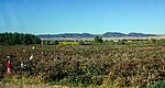 Cotton picking near Kyzyl-Kala.
 -
 Mina'i bowldepiction of a fortress under siege, circa 1200, Iran


References[edit]
Wikimedia Commons has media related toKyzyl-Kala.
- ^Ducke, Isa; Thoma, Natascha (2015).Usbekistan(in German). Dumont Reiseverlag. p. 385.ISBN978-3-7701-7739-4.
- ^Adrianov, Boris V.; Mantellini, Simone (31 December 2013).Ancient Irrigation Systems of the Aral Sea Area.Oxbow Books, Limited. p. 162.ISBN978-1-78297-167-2.
- ^Adrianov, Boris V.; Mantellini, Simone (31 December 2013).Ancient Irrigation Systems of the Aral Sea Area.Oxbow Books, Limited. p. 38.ISBN978-1-78297-167-2.
