Jump to content

44th parallel north

From Wikipedia, the free encyclopedia
(Redirected fromLatitude 44 degrees N)
Line across the Earth
44°
44th parallel north

The44th parallel northis acircle of latitudethat is 44degreesnorthof theEarth'sequatorial plane.It crossesEurope,theMediterranean Sea,Asia,thePacific Ocean,North America,and theAtlantic Ocean.

At this latitude, astronomically, the dusk is visible circa 15 hours 29 minutes before the dawn during thesummer solstice(at the Equator circa 12 hours 7 minutes) and 8 hours, 53 minutes during thewinter solstice.[1]

Around the world[edit]

Starting at thePrime Meridianand heading eastwards, the parallel 44° north passes through:

Co-ordinates Country, territory or sea Notes
44°0′N0°0′E/ 44.000°N 0.000°E/44.000; 0.000(Prime Meridian) France Passing throughMontauban
44°0′N7°39′E/ 44.000°N 7.650°E/44.000; 7.650(Italy) Italy
44°0′N8°10′E/ 44.000°N 8.167°E/44.000; 8.167(Mediterranean Sea) Mediterranean Sea Gulf of Genoa
44°0′N10°6′E/ 44.000°N 10.100°E/44.000; 10.100(Italy) Italy Passing just north ofSan Marino
44°0′N12°40′E/ 44.000°N 12.667°E/44.000; 12.667(Adriatic Sea) Adriatic Sea
44°0′N15°2′E/ 44.000°N 15.033°E/44.000; 15.033(Croatia) Croatia Islands ofDugi Otok,Pašman,and the mainland
44°0′N16°32′E/ 44.000°N 16.533°E/44.000; 16.533(Bosnia and Herzegovina) Bosnia and Herzegovina
44°0′N19°14′E/ 44.000°N 19.233°E/44.000; 19.233(Serbia) Serbia For about 3 km
44°0′N19°16′E/ 44.000°N 19.267°E/44.000; 19.267(Bosnia and Herzegovina) Bosnia and Herzegovina
44°0′N19°34′E/ 44.000°N 19.567°E/44.000; 19.567(Serbia) Serbia Passing throughKragujevac
44°0′N22°25′E/ 44.000°N 22.417°E/44.000; 22.417(Bulgaria) Bulgaria Passing throughVidin
44°0′N22°55′E/ 44.000°N 22.917°E/44.000; 22.917(Romania) Romania Passing just north ofAlexandria
44°0′N26°13′E/ 44.000°N 26.217°E/44.000; 26.217(Bulgaria) Bulgaria
44°0′N27°41′E/ 44.000°N 27.683°E/44.000; 27.683(Romania) Romania For about 15 km
44°0′N27°53′E/ 44.000°N 27.883°E/44.000; 27.883(Bulgaria) Bulgaria For about 4 km
44°0′N27°56′E/ 44.000°N 27.933°E/44.000; 27.933(Romania) Romania
44°0′N28°40′E/ 44.000°N 28.667°E/44.000; 28.667(Black Sea) Black Sea
44°0′N39°11′E/ 44.000°N 39.183°E/44.000; 39.183(Russia) Russia Passing just south ofPyatigorsk
44°0′N47°23′E/ 44.000°N 47.383°E/44.000; 47.383(Caspian Sea) Caspian Sea Passing just north ofChechen Island,Russia
44°0′N50°55′E/ 44.000°N 50.917°E/44.000; 50.917(Kazakhstan) Kazakhstan
44°0′N56°0′E/ 44.000°N 56.000°E/44.000; 56.000(Uzbekistan) Uzbekistan
44°0′N61°26′E/ 44.000°N 61.433°E/44.000; 61.433(Kazakhstan) Kazakhstan
44°0′N80°27′E/ 44.000°N 80.450°E/44.000; 80.450(China) People's Republic of China Xin gian g— passing about 22 km north ofÜrümqi
44°0′N95°30′E/ 44.000°N 95.500°E/44.000; 95.500(Mongolia) Mongolia
44°0′N111°50′E/ 44.000°N 111.833°E/44.000; 111.833(China) People's Republic of China Inner Mongolia
Jilin— passing just north ofChangchun
Heilong gian g
Jilin - for about 2 km
Heilong gian g - for <1 km
Jilin - for about 10 km
Heilong gian g
Jilin - for about 5 km
Heilong gian g
44°0′N131°15′E/ 44.000°N 131.250°E/44.000; 131.250(Russia) Russia
44°0′N135°32′E/ 44.000°N 135.533°E/44.000; 135.533(Sea of Japan) Sea of Japan
44°0′N141°39′E/ 44.000°N 141.650°E/44.000; 141.650(Japan) Japan Island ofHokkaidō:
— Hokkaidō Prefecture
44°0′N144°17′E/ 44.000°N 144.283°E/44.000; 144.283(Sea of Okhotsk) Sea of Okhotsk
44°0′N144°54′E/ 44.000°N 144.900°E/44.000; 144.900(Japan) Japan Island ofHokkaidō:
— Hokkaidō Prefecture -Shiretoko Peninsula
44°0′N145°10′E/ 44.000°N 145.167°E/44.000; 145.167(Nemuro Strait) Nemuro Strait
44°0′N145°39′E/ 44.000°N 145.650°E/44.000; 145.650(Kuril Islands) Kuril Islands Kunashir Island,administered byRussiabut claimed byJapan
44°0′N145°48′E/ 44.000°N 145.800°E/44.000; 145.800(Pacific Ocean) Pacific Ocean Passing just north of the island ofShikotan,administered byRussia,claimed byJapan
44°0′N124°8′W/ 44.000°N 124.133°W/44.000; -124.133(United States) United States
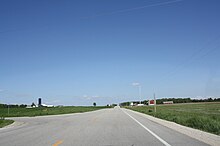
44th parallel inWisconsin,United States
Oregon- passing just south ofEugeneandBend
Idaho
Wyoming
South Dakota- passing just south ofRapid City
Minnesota- passing throughRochester
Wisconsin- passing throughOshkosh
44°0′N87°41′W/ 44.000°N 87.683°W/44.000; -87.683(Lake Michigan) Lake Michigan
44°0′N86°28′W/ 44.000°N 86.467°W/44.000; -86.467(United States) United States Michigan
44°0′N82°45′W/ 44.000°N 82.750°W/44.000; -82.750(Lake Huron) Lake Huron
44°0′N81°44′W/ 44.000°N 81.733°W/44.000; -81.733(Canada) Canada Ontario
44°0′N77°0′W/ 44.000°N 77.000°W/44.000; -77.000(Lake Ontario) Lake Ontario
44°0′N76°16′W/ 44.000°N 76.267°W/44.000; -76.267(United States) United States New York- passing just north ofWatertown
Vermont- passing throughMiddlebury
New Hampshire
Maine
44°0′N69°8′W/ 44.000°N 69.133°W/44.000; -69.133(Atlantic Ocean) Atlantic Ocean Gulf of Maine- passing just south ofVinalhaven IslandandIsle au Haut,Maine,United States
44°0′N66°9′W/ 44.000°N 66.150°W/44.000; -66.150(Canada) Canada Nova Scotia
44°0′N64°40′W/ 44.000°N 64.667°W/44.000; -64.667(Atlantic Ocean) Atlantic Ocean
44°0′N59°46′W/ 44.000°N 59.767°W/44.000; -59.767(Canada) Canada Nova Scotia -Sable Island
44°0′N59°45′W/ 44.000°N 59.750°W/44.000; -59.750(Atlantic Ocean) Atlantic Ocean
44°0′N1°21′W/ 44.000°N 1.350°W/44.000; -1.350(France) France

See also[edit]

References[edit]

  1. ^"Duration of Daylight/Darkness Table for One Year".U.S. Naval Observatory.2019-09-24. Archived fromthe originalon 2019-10-12.Retrieved2021-03-10.