
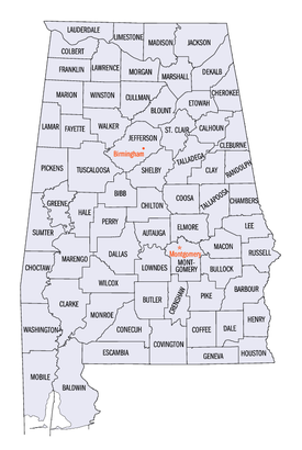
List of counties in Alabama
| Counties of Alabama | |
|---|---|
 | |
| Location | State of Alabama |
| Number | 67 |
| Populations | Greatest: 662,895 (Jefferson) Least: 7,341 (Greene) Average: 76,246 (2023) |
| Areas | Largest: 1,590 sq mi (4,100 km2) (Baldwin) Smallest: 535 sq mi (1,390 km2) (Etowah) Average: 782 sq mi (2,030 km2) |
| Government | |
| Subdivisions |
|
The U.S. state ofAlabamahas 67counties.[1]Each county serves as the local level of government within its borders. The land enclosed by the present state borders was joined to the United States of America gradually. Following theAmerican Revolutionary War,West Florida was ceded to Spain by treaty while the remainder was organized primarily as theMississippi Territory,and later theAlabama Territory.[2]The territorial assembly established some of the earliest county divisions that have survived to the present, including the earliest county formation, that ofWashington County,created on June 4, 1800.[3]In 1814, theTreaty of Fort Jacksonopened the territory to American settlers, which in turn led to a more rapid rate of county creation. Alabama was admitted to the Union as the 22nd state in 1819.[4]The Alabama state legislature formed additional counties from former native lands as theIndian Removal Acttook effect and settlers populated different areas of Alabama.[5]In 1820, Alabama had 29 counties. By 1830 there were 36 and Native Americans still occupied large areas of land in northeast and far western Alabama. By 1840, 49 counties had been created; 52 by 1850; 65 by 1870; and the present 67 counties by 1903.[6]Houston Countywas the last county created in the state, on February 9, 1903.[3]
According to 2023 U.S. Census data, the average population of Alabama's 67 counties is 76,246, withJefferson Countyas the most populous (662,895), andGreene County(7,341) the least.[7]The average land area is 756 sq mi (1,958 km2). The largest county isBaldwin(1,590 sq mi, 4,118 km2) and the smallest isEtowah(535 sq mi, 1,386 km2).[8]TheConstitution of Alabamarequires that any new county in Alabama cover at least 600 square miles (1,600 km2) in area, effectively limiting the creation of new counties in the state.[9]
The Alabama Department of Revenue's Motor Vehicle Division issuesstandard automobile license platesthat bear a one- or two-digit number identifying the county in which the vehicle is registered. This number is given in the fourth column in the table below. The first three prefixes are reserved for the state's historically most populous counties, and thereafter proceed Alpha betically. Individual license plate numbers are assigned sequentially in each licensing office. The numbers are in the formatXAA1111orXXAA111,depending on whether the prefix is one or two digits. Overflow registrations are accommodated by substituting a letter for one of the registration numbers, such that XXZ999Z is followed by XXA0A0A.[10]
TheFederal Information Processing Standard(FIPS) code, used by the United States government to uniquely identify counties, is provided with each entry. The FIPS code links in the table point to U.S. Census "quick facts" pages for each county. Alabama'sFIPS state codeis01.
Counties[edit]
| County |
FIPScode[11] | County seat[3] | License # [12] |
Est.[3] | Formed from[13] | Etymology[6][14] | Density |
Population (2023)[15] |
Land Area[16] | Map |
|---|---|---|---|---|---|---|---|---|---|---|
| Autauga County | 001 | Prattville | 4 | 1818 | Montgomery County | The Autauga or Atagi people, Native Americans who were a sub-group of theAlibamu | 101.5 | 60,342 | 594.44sq mi (1,540km2) |

|
| Baldwin County | 003 | Bay Minette | 5 | 1809 | Washington County andWest Florida | Abraham Baldwin(1754–1807),U.S. legislatorfromGeorgia | 159.5 | 253,507 | 1,589.78sq mi (4,118km2) |

|
| Barbour County | 005 | Clayton | 6 | 1832 | Pike County | James Barbour(1775–1842),Governor of VirginiaandU.S. Senator | 27.8 | 24,585 | 884.88sq mi (2,292km2) |

|
| Bibb County | 007 | Centreville | 7 | 1818 | Montgomery County (as Cahawba County) | William Wyatt Bibb(1781–1820), 1stGovernor of Alabama | 35.1 | 21,868 | 622.58sq mi (1,612km2) |

|
| Blount County | 009 | Oneonta | 8 | 1818 | Montgomery County and Creek territories | Willie Blount(1768–1835),Governor of Tennessee | 92.8 | 59,816 | 644.78sq mi (1,670km2) |

|
| Bullock County | 011 | Union Springs | 9 | 1866 | Barbour, Macon, Montgomery, and Pike counties | Edward Bullock(1822–1861),colonelin theConfederate States Army | 15.9 | 9,897 | 622.80sq mi (1,613km2) |

|
| Butler County | 013 | Greenville | 10 | 1819 | Conecuh and Monroe counties | William Butler(1759–1818),captaininCreek War | 23.7 | 18,382 | 776.83sq mi (2,012km2) |

|
| Calhoun County | 015 | Anniston | 11 | 1832 | St. Clair County (as Benton County) | John C. Calhoun(1782–1850), 7thU.S. Vice President | 192.2 | 116,429 | 605.87sq mi (1,569km2) |

|
| Chambers County | 017 | LaFayette | 12 | 1832 | Montgomery County | Henry H. Chambers(1790–1826),U.S. Senator | 57.1 | 34,079 | 596.53sq mi (1,545km2) |

|
| Cherokee County | 019 | Centre | 13 | 1836 | Cherokeeterritory | Cherokeepeople, whose lands included Northeast Alabama | 46.4 | 25,666 | 553.70sq mi (1,434km2) |

|
| Chilton County | 021 | Clanton | 14 | 1868 | Autauga, Bibb, Perry, and Shelby counties (as Baker County) | William Parish Chilton(1810–1871),Alabama Supreme CourtJustice andConfederate congressman | 67.0 | 46,431 | 692.85sq mi (1,794km2) |

|
| Choctaw County | 023 | Butler | 15 | 1847 | Sumter and Washington counties | Choctawpeople, whose lands included Alabama | 13.4 | 12,252 | 913.50sq mi (2,366km2) |

|
| Clarke County | 025 | Grove Hill | 16 | 1812 | Washington County | John Clarke(1766–1832),generalfromGeorgia | 18.0 | 22,337 | 1,238.46sq mi (3,208km2) |

|
| Clay County | 027 | Ashland | 17 | 1866 | Randolph and Talladega counties | Henry Clay(1777–1852),U.S. legislatorfromKentucky | 23.4 | 14,111 | 603.96sq mi (1,564km2) |

|
| Cleburne County | 029 | Heflin | 18 | 1866 | Calhoun, Randolph, and Talladega counties | Patrick Cleburne(1828–1864),Major GeneralinConfederate States Army | 27.9 | 15,639 | 560.10sq mi (1,451km2) |

|
| Coffee County | 031 | ElbaandEnterprise[17] | 19 | 1841 | Dale County | John Coffee(1772–1833), military leader inWar of 1812andCreek War | 82.0 | 55,643 | 678.97sq mi (1,759km2) |

|
| Colbert County | 033 | Tuscumbia | 20 | 1867 | Franklin County | George Colbert(1764–1839) andLevi Colbert(1759–1834),Chickasawchiefs | 98.5 | 58,361 | 592.62sq mi (1,535km2) |

|
| Conecuh County | 035 | Evergreen | 21 | 1818 | Monroe County | TheConecuh River,which flows through the county | 13.1 | 11,174 | 850.16sq mi (2,202km2) |

|
| Coosa County | 037 | Rockford | 22 | 1832 | Montgomery County | TheCoosa River,which flows through the county, and is itself named after a Native American village | 15.8 | 10,268 | 650.93sq mi (1,686km2) |

|
| Covington County | 039 | Andalusia | 23 | 1821 | Henry County | Leonard Covington(1768–1813),Brigadier GeneralinWar of 1812andU.S. Congressman | 36.8 | 37,952 | 1,030.46sq mi (2,669km2) |

|
| Crenshaw County | 041 | Luverne | 24 | 1866 | Butler, Coffee, Covington, Lowndes, and Pike Counties | Anderson Crenshaw(1783–1847),Alabama Supreme Courtjustice and early settler | 21.5 | 13,101 | 608.84sq mi (1,577km2) |

|
| Cullman County | 043 | Cullman | 25 | 1877 | Blount, Morgan, and Winston counties | ColonelJohn G. Cullmann(1823–1895), founder of county seat | 125.2 | 92,016 | 734.84sq mi (1,903km2) |

|
| Dale County | 045 | Ozark | 26 | 1824 | Covington and Henry counties | Samuel Dale(1772–1841),Brigadier Generalandstate legislator | 88.9 | 49,871 | 561.15sq mi (1,453km2) |

|
| Dallas County | 047 | Selma | 27 | 1818 | Monroe and Montgomery counties | Alexander James Dallas(1759–1817),U.S. Secretary of Treasury | 37.0 | 36,165 | 978.69sq mi (2,535km2) |

|
| DeKalb County | 049 | Fort Payne | 28 | 1836 | Cherokeeterritory | Johann de Kalb(1721–1780),major generalinAmerican Revolutionary War | 93.4 | 72,569 | 777.09sq mi (2,013km2) |

|
| Elmore County | 051 | Wetumpka | 29 | 1866 | Autauga, Coosa, Montgomery, and Tallapoosa counties | John Archer Elmore(1762–1834),Revolutionary Warveteran | 146.2 | 90,441 | 618.48sq mi (1,602km2) |

|
| Escambia County | 053 | Brewton | 30 | 1868 | Baldwin and Conecuh counties | Escambia Creek, a tributary of theConecuh River | 38.7 | 36,558 | 945.08sq mi (2,448km2) |

|
| Etowah County | 055 | Gadsden | 31 | 1866 | Blount, Calhoun, Cherokee, DeKalb, Marshall, and St. Clair counties (as Baine County) | Etowah Indian Mounds | 193.0 | 103,241 | 534.99sq mi (1,386km2) |

|
| Fayette County | 057 | Fayette | 32 | 1824 | Marion, Pickens, Tuscaloosa, and Walker counties | Gilbert du Motier, marquis de La Fayette(1757–1834),Revolutionary Warcommander | 25.4 | 15,967 | 627.66sq mi (1,626km2) |

|
| Franklin County | 059 | Russellville | 33 | 1818 | Cherokeeterritory | Benjamin Franklin(1706–1790), politician, diplomat, inventor, and publisher | 50.2 | 31,802 | 633.82sq mi (1,642km2) |

|
| Geneva County | 061 | Geneva | 34 | 1868 | Coffee, Dale, and Henry counties | Named afterGeneva, New York,the origin of several early settlers | 47.0 | 26,988 | 574.41sq mi (1,488km2) |

|
| Greene County | 063 | Eutaw | 35 | 1819 | Marengo and Tuscaloosa counties | Nathanael Greene(1742–1786),Revolutionary Wargeneral | 11.3 | 7,341 | 647.11sq mi (1,676km2) |

|
| Hale County | 065 | Greensboro | 36 | 1867 | Greene, Marengo, Perry, and Tuscaloosa counties | Stephen F. Hale(1816–1862), lieutenant colonel inConfederate States Army | 23.1 | 14,888 | 643.94sq mi (1,668km2) |

|
| Henry County | 067 | Abbeville | 37 | 1819 | Conecuh County | Patrick Henry(1736–1799),Revolutionary Warpatriot andGovernor of Virginia | 31.9 | 17,899 | 561.75sq mi (1,455km2) |

|
| Houston County | 069 | Dothan | 38 | 1903 | Dale, Geneva, and Henry counties | George S. Houston(1811–1879), 24thGovernor of AlabamaandU.S. Congressman | 187.1 | 108,462 | 579.82sq mi (1,502km2) |

|
| Jackson County | 071 | Scottsboro | 39 | 1819 | Cherokeeterritory | Andrew Jackson(1767–1845), 7th U.S. President | 49.6 | 53,467 | 1,077.87sq mi (2,792km2) |

|
| Jefferson County | 073 | Birmingham | 1 | 1819 | Blount County | Thomas Jefferson(1743–1826), 3rd U.S. President | 596.5 | 662,895 | 1,111.28sq mi (2,878km2) |

|
| Lamar County | 075 | Vernon | 40 | 1867 | Fayette and Marion counties (as Jones County) | Lucius Q. C. Lamar(1825–1893),U.S. Supreme Court justice | 22.6 | 13,661 | 604.85sq mi (1,567km2) |

|
| Lauderdale County | 077 | Florence | 41 | 1818 | CherokeeandChickasawterritories | James Lauderdale(1780–1814), Colonel inWar of 1812 | 145.0 | 96,814 | 667.70sq mi (1,729km2) |

|
| Lawrence County | 079 | Moulton | 42 | 1818 | Cherokeeterritory | James Lawrence(1781–1813), naval officer inWar of 1812 | 48.5 | 33,502 | 690.68sq mi (1,789km2) |

|
| Lee County | 081 | Opelika | 43 | 1866 | Chambers, Macon, Russell, and Tallapoosa counties | Robert E. Lee(1807–1870), Commander of theConfederate States Army | 301.6 | 183,215 | 607.54sq mi (1,574km2) |

|
| Limestone County | 083 | Athens | 44 | 1818 | Elk and Madison counties | Limestone Creek,named for local geological deposits | 204.8 | 114,654 | 559.94sq mi (1,450km2) |

|
| Lowndes County | 085 | Hayneville | 45 | 1830 | Butler, Dallas, and Montgomery counties | William Lowndes(1782–1822),U.S. CongressmanfromSouth Carolina | 13.6 | 9,717 | 715.91sq mi (1,854km2) |

|
| Macon County | 087 | Tuskegee | 46 | 1832 | Montgomery County | Nathaniel Macon(1758–1837),U.S. legislatorfromNorth Carolina | 30.2 | 18,370 | 608.89sq mi (1,577km2) |

|
| Madison County | 089 | Huntsville | 47 | 1808 | CherokeeandChickasawterritories | James Madison(1751–1836), 4th U.S. President | 514.7 | 412,600 | 801.59sq mi (2,076km2) |

|
| Marengo County | 091 | Linden | 48 | 1818 | Choctawterritory | Battle of Marengo | 19.1 | 18,684 | 976.88sq mi (2,530km2) |

|
| Marion County | 093 | Hamilton | 49 | 1818 | Tuscaloosa County | Francis Marion(1732–1795), military leader inAmerican Revolutionary War | 39.4 | 29,244 | 742.29sq mi (1,923km2) |

|
| Marshall County | 095 | Guntersville | 50 | 1836 | Blount and Jackson counties andCherokeeterritory | John Marshall(1755–1835),Chief Justice of the United States1801–1835 | 178.1 | 100,756 | 565.84sq mi (1,466km2) |

|
| Mobile County | 097 | Mobile | 2 | 1812 | Mobile DistrictofWest Floridaafter annexation intoMississippi Territory | Mobile Bay,on which county is located, and which is itself named after the Maubila tribe of Native Americans | 334.8 | 411,640 | 1,229.44sq mi (3,184km2) |

|
| Monroe County | 099 | Monroeville | 51 | 1815 | Creekterritory | James Monroe(1758–1831), 5th U.S. President | 18.7 | 19,229 | 1,025.67sq mi (2,656km2) |

|
| Montgomery County | 101 | Montgomery | 3 | 1816 | Monroe County | Lemuel P. Montgomery(1786–1814), Major inCreek War | 286.9 | 224,980 | 784.25sq mi (2,031km2) |

|
| Morgan County | 103 | Decatur | 52 | 1818 | Cherokeeterritory (as Cotaco County) | Daniel Morgan(1736–1802),U.S. Congressman | 216.0 | 125,133 | 579.34sq mi (1,500km2) |

|
| Perry County | 105 | Marion | 53 | 1819 | Cahawba, Dallas, Marengo, and Tuscaloosa counties | Oliver Hazard Perry(1795–1819), naval officer inWar of 1812 | 10.8 | 7,738 | 719.66sq mi (1,864km2) |

|
| Pickens County | 107 | Carrollton | 54 | 1820 | Tuscaloosa County | Andrew Pickens(1739–1817), General in theRevolutionary War | 21.2 | 18,688 | 881.41sq mi (2,283km2) |

|
| Pike County | 109 | Troy | 55 | 1821 | Henry and Montgomery counties | Zebulon Pike(1779–1813), explorer and officer inWar of 1812 | 49.3 | 33,137 | 672.09sq mi (1,741km2) |

|
| Randolph County | 111 | Wedowee | 56 | 1832 | St. Clair and Shelby counties | John Randolph(1773–1833),U.S. SenatorfromVirginia | 39.2 | 22,786 | 580.55sq mi (1,504km2) |

|
| Russell County | 113 | Phenix City | 57 | 1832 | Barbour, Bullock, Lee and Macon counties | Gilbert C. Russell(1782–1861), officer inCreek War | 91.6 | 58,744 | 641.14sq mi (1,661km2) |

|
| St. Clair County | 115 | AshvilleandPell City | 59 | 1818 | Shelby County | Arthur St. Clair(1736–1818), President ofContinental Congress | 151.2 | 95,552 | 631.90sq mi (1,637km2) |

|
| Shelby County | 117 | Columbiana | 58 | 1818 | Montgomery County | Isaac Shelby(1750–1826),Governor of Kentucky | 296.8 | 233,000 | 784.93sq mi (2,033km2) |

|
| Sumter County | 119 | Livingston | 60 | 1832 | Choctawterritory | Thomas Sumter(1734–1832),U.S. CongressmanfromSouth Carolina | 13.0 | 11,727 | 903.89sq mi (2,341km2) |

|
| Talladega County | 121 | Talladega | 61 | 1832 | St. Clair and Shelby counties | Talatigi,Creek Indianname for the county seat, meaning "border town" | 110.1 | 81,132 | 736.78sq mi (1,908km2) |

|
| Tallapoosa County | 123 | Dadeville | 62 | 1832 | Montgomery and Shelby counties | Tallapoosa River | 56.8 | 40,677 | 716.52sq mi (1,856km2) |

|
| Tuscaloosa County | 125 | Tuscaloosa | 63 | 1818 | Montgomery County andChoctawterritory | Iroquoianname for theBlack Warrior River | 179.6 | 237,373 | 1,321.75sq mi (3,423km2) |

|
| Walker County | 127 | Jasper | 64 | 1823 | Blount, Jefferson, and Tuscaloosa counties | John Williams Walker(1783–1823),U.S. SenatorfromAlabama | 81.8 | 64,728 | 791.19sq mi (2,049km2) |

|
| Washington County | 129 | Chatom | 65 | 1800 | AdamsandPickering countiesofMississippi Territory | George Washington(1732–1799), 1st U.S. President | 13.9 | 15,022 | 1,080.21sq mi (2,798km2) |

|
| Wilcox County | 131 | Camden | 66 | 1819 | Dallas and Monroe counties | Joseph M. Wilcox(1790–1814), lieutenant inCreek War | 11.2 | 9,944 | 888.50sq mi (2,301km2) |

|
| Winston County | 133 | Double Springs | 67 | 1850 | Walker County (as Hancock County) | John A. Winston(1812–1871), 15thGovernor of Alabama | 38.5 | 23,611 | 612.98sq mi (1,588km2) |

|
Former county names[edit]
| County[6] | Named for[6] | Changed to[3] |
|---|---|---|
| Baine County | David W. Baine,Colonel in theCivil War | Etowah Countyin 1868 |
| Baker County | Alfred Baker,a local landowner | Chilton Countyin 1874 |
| Benton County | Thomas Hart Benton,U.S. Senator from Missouri | Calhoun Countyin 1858, honoring Benton's rivalJohn C. CalhounofSouth Carolinaafter Benton's renunciation of slavery |
| Cahawba County | former state capital ofCahawba | Bibb Countyin 1820 |
| Cotaco County | Cotaco Creek, a tributary of theTennessee River | Morgan Countyin 1821 |
| Hancock County | John Hancock,signer of theDeclaration of Independence | Winston Countyin 1858 |
| Jones County | Josiah Jones,a local political leader | Covington County(its former name) in 1868 after Jones refused the honor |
| Jones County | E.P. Jones,a local landowner | Sanford County, which subsequently becameLamar Countyin 1877 |
| Sanford County | H.C. Sanford,a local landowner | Lamar Countyin 1877 |
Former counties[edit]
| County | Established | Dissolved | Named for | Notes |
|---|---|---|---|---|
| Decatur County | December 7, 1821 | December 28, 1825 | CommodoreStephen Decaturof theUnited States Navy. | Created in 1822 withWoodvilleas its county seat. Abolished several years later, divided betweenMadison CountyandJackson County. |
| Elk County[18] | May 9, 1817 | January 26, 1818 | Elk River | Established byMississippi Territoryprior to Mississippi–Alabama split; abolished prior to Alabama statehood |
See also[edit]
References[edit]
- Specific
- ^"List of Alabama Counties".Bama Politics.October 23, 2018.RetrievedAugust 4,2020.
- ^"Alabama History Timeline, 1701–1800".Alabama Department of Archives and History.RetrievedMay 18,2009.
- ^abcdeNational Association of Counties."NACo – Find a county".Archived fromthe originalon March 9, 2008.RetrievedApril 30,2008.
- ^"Alabama History Timeline, 1801–1860".Alabama Department of Archives and History.RetrievedMay 18,2009.
- ^"Alabama Counties: Cherokee".Alabama Department of Archives and History.RetrievedDecember 29,2008.
- ^abcdFoscue, Virginia O. (1989)Place Names in Alabama.Tuscaloosa, Alabama: University of Alabama Press.ISBN0-8173-0410-X
- ^"U.S. Census website".U.S. Census Bureau.RetrievedMarch 20,2024.
- ^"2010 Census U.S. Gazetteer Files".U.S. Census Bureau.RetrievedMarch 13,2011.
- ^Wikisource:Alabama State Constitution of 1901/Initial Constitution#Section 39
- ^Nicholson, David."Alabama License Plates, 1969–present".License Plates of North America, 1969–present.RetrievedAugust 8,2007.
- ^"EPA County FIPS Code Listing".U.S. Environmental Protection Agency. Archived fromthe originalon October 8, 2012.RetrievedFebruary 23,2008.
- ^Nicholson, David."Alabama County Codes".License Plates of North America, 1969–present.RetrievedMay 25,2009.
- ^Owen, Thomas McAdory; Owen, Marie Bankhead (1921).History of Alabama and Dictionary of Alabama Biography.Chicago: S.J. Clarke Publishing Company.
- ^"Alabama Counties".Alabama Department of Archives and History. Archived fromthe originalon November 20, 2008.RetrievedJune 1,2009.
- ^U.S. Census Bureau."QuickFacts: Alabama".RetrievedMarch 20,2024.
- ^"Community Facts".U.S. Census Bureau.RetrievedAugust 9,2017.
- ^Coffee County, Alabama."History of Coffee County".Archived fromthe originalon October 27, 2011.RetrievedAugust 19,2011.
- ^McDonald, William Lindsey (2003) [1997].A Walk Through the Past: People and Places of Florence and Lauderdale County, Alabama.Killen, Alabama: Bluewater Publications. pp. 223–224.ISBN9780971994560.RetrievedMay 8,2012.
- General
- "CountyState.info Alabama".Official County Websites.RetrievedSeptember 13,2007.
External links[edit]
- Map seriesshowing evolution of county boundaries. Cartographic Research Laboratory. University of Alabama Department of Geography.
- Alabama CountiesAlabama Counties Features. Digital Alabama