
Luzon
 Luzon satellite image captured bySentinel-2in 2016 | |
 | |
| Geography | |
|---|---|
| Location | Southeast Asia |
| Coordinates | 16°N121°E/ 16°N 121°E |
| Archipelago | Philippines |
| Adjacent to | |
| Major islands | |
| Area | 109,965 km2(42,458 sq mi)[1] |
| Area rank | 15th |
| Coastline | 3,249.6 km (2019.21 mi)[1] |
| Highest elevation | 2,928 m (9606 ft) |
| Highest point | Mount Pulag |
| Administration | |
Philippines | |
| Regions | |
| Provinces | List
|
| Largest settlement | Quezon City(pop. 2,960,048[2]) |
| Demographics | |
| Demonym | Luzonian (modern) Luzonense (occasional) Luções/Luzones(archaic) |
| Population | 64,260,312 (2021) (estimate) |
| Pop. density | 490/km2(1270/sq mi) |
| Ethnic groups | |
Luzon(/luːˈzɒn/,loo-ZON;Tagalog pronunciation:[luˈson]) is the largest and most populousislandin thePhilippines.Located in the northern portion of thePhilippine archipelago,it is the economic and political center of the nation, being home to the country's capital city,Manila,as well asQuezon City,the country's most populous city. With a population of 64 million as of 2021[update],[3]it contains 52.5% of the country's total population and is the4th most populous islandin the world.[4]It is the15th largest islandin the world byland area.
Luzonmay also refer to one of the three primaryisland groups in the country.In this usage, it includes the LuzonMainland,theBatanesandBabuyangroups of islands to the north,Polillo Islandsto the east, and the outlying islands ofCatanduanes,MarinduqueandMindoro,among others, to the south.[5]The islands ofMasbate,PalawanandRomblonare also included, although these three are sometimes grouped with another of the island groups, theVisayas.
Etymology[edit]

The nameLuzonis thought to derive fromᜎᜓᜐᜓᜅ᜔lusong,aTagalogword referring to a particular kind of large woodenmortarused in dehusking rice.[6][7]A 2008 research paper by Eulito Bautista and Evelyn Javier provides an image of a lusong, explaining:
Traditional milling was accomplished in the 1900s by pounding the palay with a wooden pestle in a stone or wooden mortar called lusong. The first pounding takes off the hull and further pounding removes the bran but also breaks most grains. Further winnowing with a bamboo tray (bilao) separates the hull from the rice grains. This traditional hand-pounding chore, although very laborious and resulted in a lot of broken rice, required two to three skilled men and women to work harmoniously and was actually a form of socializing among young folks in the villages.[8]
In old Latin, Italian, and Portuguese maps, the island is often called "Luçonia" or "Luconia."[9][10][11][12][13][14][15][16]
Luções,[luˈsõjʃ](alsoLuzonesinSpanish) was ademonym[17]used byPortuguesesailors in Malaysia[18]during the early 1500s, referring to theKapampanganandTagalog peoplewho lived inManila Bay,which was then calledLusong(Kapampangan:Lusung,Portuguese:Luçon), from which Luzon was also derived.[19][20][21][18]The term was also used for Tagalog settlers inSouthern Tagalogregion, where they created intensive contact with the Kapampangans.[22]Eventually, the term "Luzones" would refer to the settlers of Luzon island, and later on, would be exclusive to the peoples ofCentral Luzon.
History[edit]
Before European colonization[edit]
Luzon was originally inhabited byNegritosbeforeAustronesiansfrom Taiwan arrived and displaced them. Some of the Austronesian peoples formed highland mountain civilizations, while others formed lowland coastal states. Among the coastal states, some wereHindu-Buddhistkingdoms, some wereMuslimprincipalities, and others wereethnoreligioustribes. These states had trading connections withIndia,Borneo,Java,Sumatra,Malaya,Indochina,Bengal,Korea,Okinawa,Japanand China.
Before 1000 CE, theTagalog,Kapampangan,andPangasinanpeoples of south and central Luzon had established several major coastalpolities,notablyMaynila,TondoandNamayan.The oldest known Philippine document, written in 900, is theLaguna Copperplate Inscription,which names places in and aroundManila Bayand also mentionsMedan,a place in Indonesia.[23]These coastal Philippine kingdoms werethalassocracies,based on trade with neighboring Asian political entities, and structured by leases between village rulers (Datu) and landlords (Lakan) orRajahs,by whom tributes were extracted and taxes were levied.
There was also a Buddhist polity known asMa-ior Maidh, described in Chinese and Bruneian records in the 10th century AD, although its location is still unknown and scholars are divided on whether it is in modern-dayBay, LagunaorBulalacao,Mindoro.[24][25]

According to sources at the time, the trade in large nativeRuson-tsukuri(literallyLuzon-made,Japanese:LữTốngChế) clay jars used for storinggreen teaandrice winewith Japan flourished in the 12th century, and localTagalog,KapampanganandPangasinanpotters had marked each jar withBaybayinletters denoting the particular urn used and the kiln the jars were manufactured in. Certainkilnswere renowned over others; prices depended on the reputation of the kiln.[27][28]Of this flourishing trade, theBurnayjars ofIlocosare the only large clay jar manufactured in Luzon today with origins from this time.
In the early 1300s the Chinese annals,Nanhai zhi,reported that Hindu Brunei invaded or administeredSarawakandSabahas well as the Philippine kingdoms ofButuan,Sulu,and in Luzon:Ma-i(Mindoro) and Malilu ma lô (present-dayManila);ShahuchongSa hồ trọng (present-day Siocon orZamboanga), Yachen ách trầnOton(Part of theMadja-asKedatuan), and văn đỗ lăng Wenduling (present-dayMindanao),[29]which would regain their independence at a later date.[30]
During the 1360s, theJavanese-centered Hindu-Buddhist Shivaite empire ofMajapahitbriefly ruled over Luzon as recorded in theepic poemNagarakretagama,which reports imperial colonies in the Philippines at Saludong (Manila) and Solot (Sulu). Eventually, the kingdoms of Luzon regained independence from Majapahit after the 1365 Battle of Manila. Sulu also reestablished independence and in vengeanceassaulted the Majapahit province of Poni(Brunei) before a fleet from the capital drove them out.[31]
In 1405, theYongle Emperorappointed a Chinese governor of Luzon, Ko Ch'a-lao, duringZheng He'svoyages.[32][33]China also had vassals among the leaders in the archipelago.[34]China attained ascendancy in trade with the area in Yongle's reign.[35]
Afterwards, some parts of Luzon wereIslamizedwhen the former Majapahit province of Poni broke free, converted toIslam,and importedSharif Ali,a prince fromMeccawho became the Sultan ofBrunei,a nation that then expanded its realms from Borneo to the Philippines and set up theKingdom of Maynilaas its puppet-state.[36]The invasion of Brunei spread Chinese royal descent likeOng Sum Ping's kin and Arab dynasties too into the Philippines like the clan of SultanSharif Ali.However, other Luzon kingdoms resisted Islam, like theWangdom of Pangasinan.It had remained a tributary state of China and was a largelySinifiedkingdom, which maintained trade with Japan.[37]ThePolity of Caintaalso existed as a fortified city-state, armed with walls and cannons.
Interactions with the Portuguese[edit]
ThePortuguesewere the first European explorers who recorded it in their charts asLuçoniaorLuçon,calling the inhabitantsLuções.[38]Edmund Roberts,who visited Luzon in the early 19th century, wrote that Luzon was "discovered" in 1521.[7]
Many people from Luzon were employed within Portuguese Malacca. For example, thespice magnateRegimo de Raja,based in Malacca, was highly influential and was appointed asTemenggong(Sea Lord)—a governor and chief general responsible for overseeing of maritime trade—by the Portuguese. AsTemenggong,de Raja was also the head of anarmadawhich traded and protected commerce in theIndian Ocean,theStrait of Malacca,theSouth China Sea,[39]and themedieval maritime principalities of the Philippines.[40][41]His father and wife carried on his maritime trading business after his death. Another important Malacca trader was Curia de Raja who also hailed from Luzon. The "surname" of "de Raja" or "diraja" could indicate that Regimo and Curia, and their families, were of noble or royal descent as the term is an abbreviation of Sanskritadiraja.[42]
Fernão Mendes Pintonoted that a number of Luções in the Islamic fleets went to battle with the Portuguese in the Philippines during the 16th century. The Sultan of Aceh gave one of them (Sapetu Diraja) the task of holding Aru (northeast Sumatra) in 1540. Pinto also says one was named leader of the Malays remaining in the Moluccas Islands after the Portuguese conquest in 1511.[43]Antonio Pigafettanotes that one of them was in command of the Brunei fleet in 1521.[44]However, the Luções did not only fight on the side of the Muslims. Pinto says they were also apparently among the natives of the Philippines who fought the Muslims in 1538.[43]
OnMainland Southeast Asia,Lusung/Luções warriors aided the Burmese king in his invasion of Siam in 1547 AD. At the same time, Lusong warriors fought alongside the Siamese king and faced the same elephant army of the Burmese king in the defence of the Siamese capital at Ayutthaya.[45]Luções military and trade activity reached as far asSri LankainSouth Asiawhere Lungshanoid pottery made in Luzon were discovered in burials.[46]
Scholars have thus suggested that they could be mercenaries valued by all sides.[19][20][21]
Spanish Colonial Era[edit]

TheSpanisharrival in the 16th century saw the incorporation of the Luções people and the breaking up of their kingdoms and the establishment of theLas Islas Filipinaswith its capitalCebu,which was moved toManilafollowing the defeat of the localRajah Sulaymanin 1570. Under Spain, Luzon also came to be known as theNueva Castillaor theNew Castile.
In Spanish times, Luzon became the focal point for trade between the Americas and Asia. TheManila Galleonsconstructed in theBicol regionbroughtsilvermined fromPeruandMexicoto Manila. The silver was used to purchase Asian commercial goods like Chinesesilk,Indiangemsand Indonesianspices,which were then exported back to the Americas. The Chinese valued Luzon so much, in that when talking about Spain and the Spanish-Americas, they preferred to call it as "Dao Lusong" (Greater Luzon) while the original Luzon was referred to as "Xiao (Small) Lusong" to refer to not only Luzon but the whole Philippines.[47]
Luzon also became a focal point for global migration. The walled city ofIntramuroswas initially founded by 1200 Spanish families.[48]The nearby district ofBinondobecame the center of business and transformed into the world's oldestChinatown.[49]There was also a smaller districtreserved for Japanese migrantsinDilao.Cavite Cityalso served as the main port for Luzon andmany Mexicansoldiers and sailors were stationed in the naval garrisons there.[50][51]When the Spanish evacuated fromTernate,Indonesia; they settled thePapuanrefugees inTernate, Cavitewhich was named after their evacuated homeland. After the shortBritish Occupation of Manila,the IndianSepoysoldiers that mutinied against their British commanders and joined the Spanish, then settled inCainta, Rizal.
Newcomers who were impoverished Mexicans and peninsulares were accused of undermining the submission of the natives. In 1774, authorities from Bulacan, Tondo, Laguna Bay, and other areas surrounding Manila reported with consternation that discharged soldiers and deserters (from Mexico, Spain and Peru) were providing Indios military training for the weapons that had been disseminated all over the territory during the British war.[52]There was also continuous immigration ofTamilsandBengalisinto the rural areas of Luzon: Spanish administrators, native nobles, and Chinese businessmen imported them asslave laborduring this period.[53]
In the 1600s, Fr. Joaqin Martinez de Zuñiga, conducted a census of the Archdiocese of Manila which held most of Luzon under its spiritual care, and he reported 90,243 native Filipino tributes;[54]: 539 10,512 Chinese (Sangley) and mixed Chinese Filipino mestizo tributes;[54]: 537 and 10,517 mixedSpanish Filipinomestizo tributes.[54]: 539 Pure Spaniards are not counted as they are exempt from tribute. Out of these, Fr. Joaqin Martinez de Zuñiga estimated a total population count exceeding half a million souls.[54]: 537
People from the Philippines, primarily from Luzon, were recruited byFrance(then in alliance withSpain), first to defend Indo-ChineseconvertstoChristianitybeing persecuted by their native governments. Eventually, Filipino mercenaries helped the FrenchconquerVietnam and Laos and to re-establish Cambodia as a French Protectorate. This process culminated in the establishment ofFrench Cochinchina,centered inSaigon.[55]
After Spanish colonization[edit]
After many years of Spanish occupation and resistance to reform, theAndres Novalesuprising occurred and it was inspired by theLatin American Wars of Independence.Novales' uprising was primarily supported by Mexicans living in the Philippines[56]as well as immigrant Latinos from the now independent nations ofColombia,Venezuela,Peru,Chile,ArgentinaandCosta Rica.[57]Although the uprising failed it inspired theCavite Mutiny,the suppression of which, lead to the martyrdoms of Priests,Gomburzaand the subsequent execution of the reformist and hero,Jose Rizal.Reeling against this, thePhilippine Revolutionagainst Spain erupted in Cavite and spread all throughout Luzon and the Philippines. Consequently, theFirst Philippine Republicwas established inMalolos, Bulacan.In the meantime,Spainsold the Philippines to the United States and the First Philippine Republic resisted theUnited Statesin thePhilippine–American Warwhich the Republic's forces lost due to its diplomatic isolation (no foreign nation recognized the First Republic) as well as due to the numerical superiority of theAmerican military.[58]The Americans then set up the cool mountain city ofBaguioas a summer retreat for its officials. The Americans also rebuilt the capital, Manila, and established American military bases inOlongapoandAngelescities mainlyClark AirbaseandSubic Naval Base.[59]

During thePacific War,the Philippines were considered to be of great strategic importance because their capture by Japan would pose a significant threat to the U.S. As a result, 135,000 troops and 227 aircraft were stationed in the Philippines by October 1941. Luzon was captured byImperial Japanese forcesin 1942 during theircampaign to capture the Philippines.GeneralDouglas MacArthur—who was in charge of the defense of the Philippines at the time—was ordered to Australia, and the remaining U.S. forces retreated to theBataan Peninsula.[60]
A few months after this, MacArthur expressed his belief that an attempt to recapture the Philippines was necessary. The U.S. Pacific CommanderAdmiralChester NimitzandChief of Naval OperationsAdmiralErnest Kingboth opposed this idea, arguing that it must wait until victory was certain. MacArthur had to wait two years for his wish; it was 1944 before acampaignto recapture the Philippines was launched. The island ofLeytewas the first objective of the campaign, which wascapturedby the end of December 1944. This was followed by theattack on Mindoroand later, Luzon.[60]
The end of the World War necessitateddecolonizationdue to rising nationalist movements across the world's many colonies. Subsequently, the Philippines gained independence from the United States. Luzon then arose to become the most developed island in the Philippines. However, the lingering poverty and inequality caused by the long dictatorship of US-supported dictator,Ferdinand Marcos,gave rise to the Philippine diaspora and many people from Luzon have migrated elsewhere and had established large overseas communities; mainly in the United States, Hong Kong, Singapore andSaudi Arabia.Eventually, thePeople Power Revolutionled byCorazon AquinoandCardinal Jaime Sin,removed Marcos and his cronies from power and they fled toHawaiiwhere the US granted them asylum. The following administrations are subsequently managing the political and economic recovery of the Philippines with the particular aim of spreading development outside of Luzon and into the more isolated provinces of theVisayasandMindanao.During the administration of Ferdinand Marcos' son,Bongbong Marcos,Luzon became a destination of American and Japanese investments, it being the location of the Luzon Economic Corridor.[61]
Geography[edit]

Luzon island alone has an area of 109,964.9 square kilometres (42,457.7 sq mi),[1]making it theworld's 15th largest island.It is bordered on the west by theSouth China Sea(Luzon Seain Philippine territorial waters), on the east by thePhilippine Sea,and on the north by theLuzon Straitcontaining theBabuyanChannel andBalintang Channel.Themainlandis roughly rectangular in shape and has the longBicol Peninsulaprotruding to the southeast.
Luzon is roughly divided into four sections; Northern Luzon, Central Luzon, Southern Luzon, and Southeastern Luzon.
| Regions | Six divisions | Four divisions | Three divisions | Two divisions |
|---|---|---|---|---|
| Ilocos Region | Ilocandia | Northern Luzon | North and Central Luzon | North and Central Luzon |
| Cagayan Valley | ||||
| Cordillera Administrative Region | Cordilleras | |||
| Central Luzon | Central Luzon | |||
| National Capital Region | Metro Manila | Southern Luzon | ||
| Calabarzon | Southern Tagalog | Southern Luzon | Southern Luzon | |
| Mimaropa | ||||
| Bicol Region | Bicolandia | |||
Physical[edit]
Northern Luzon[edit]
The northwestern portion of the island, which encompasses most of theIlocos Region,is characterized by a flat terrain extending east from thecoastlinetoward theCordillera Central mountains.
The Cordillera mountain range, which feature the island's north-central section, is covered in a mixture oftropical pine forestsandmontane rainforests,and is the site of the island's highest mountain,Mount Pulag,rising at 2,922 metres. The range provides the upland headwaters of theAgno River,which stretches from the slopes ofMount Data,and meanders along the southern Cordillera mountains before reaching the plains ofPangasinan.
The northeastern section of Luzon is generally mountainous, with theSierra Madre,the longest mountain range in the country, abruptly rising a few miles from the coastline. Located in between the Sierra Madre and the Cordillera Central mountain ranges is the largeCagayan Valley.This region, which is known for being the second largest producer of rice and the country's top corn-producer, serves as thebasinfor theCagayan River,the longest in the Philippines.
Along the southern limits of the Cordillera Central lies the lesser-knownCaraballo Mountains.These mountains form a link between the Cordillera Central and the Sierra Madre mountain ranges, separating the Cagayan Valley from theCentral Luzonplains.[62]
Image gallery[edit]
-
 North coast of Luzon along theCagayan-Ilocos Norteboundary
 -
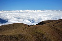 Summit ofMount Pulag,Luzon's highest mountain
 -
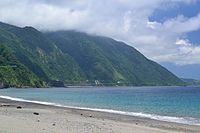
 West coast of Luzon atSan Juanoverlooking theSouth China Sea
 -
 The Cagayan Valley atCabaganwith theSierra Madremountains in the background
 -
 Canoes along upstreamCagayan RiveratQuirinoprovince


Central Luzon[edit]

The central section of Luzon is characterized by a flat terrain, known as the Central Luzonplain,the largest in the island in terms of land area. The plain, approximately 11,000 square kilometres (4,200 sq mi) in size, is the country's largest producer of rice, and is irrigated by two major rivers; theCagayanto the north, and thePampangato the south. In the middle of the plain rises the solitaryMount Arayat.
The western coasts of Central Luzon are typically flat extending east from the coastline to theZambales Mountains,the site ofMount Pinatubo,made famous because of its enormous1991 eruption.These mountains extend to the sea in the north, formingLingayen Gulf,and to the south, forming theBataan Peninsula.The peninsula enclosesManila Bay,a naturalharborconsidered to be one of the best natural ports in East Asia, due to its size and strategic geographical location.
TheSierra Madremountain range continues to stretch across the western section of Central Luzon, snaking southwards into theBicol Peninsula.
Southern Luzon[edit]
 1 2 3 4 5 6 7 8 9 | ||||||||||||||||||||
| ||||||||||||||||||||
Southern Luzon is dominated byLaguna de Bay(Old Spanish,"Lake ofBaytown"), the largestlakein the country. The 949-square-kilometre (366 sq mi) lake is drained intoManila Bayby thePasig River,one of the most important rivers in the country due to its historical significance and because it runs through the center ofMetro Manila.
Located 20 kilometres (12 mi) southwest of Laguna de Bay isTaal Lake,acrater lakecontaining theTaal Volcano,the smallest in the country. The environs of the lake form theuplandTagaytay Ridge,which was once part of a massive prehistoric volcano that covered the southern portion of the province ofCaviteand the whole ofBatangasprovince.
South of Laguna Lake are twosolitarymountains,Mount MakilinginLagunaand Batangas provinces, andMount Banahaw,the highest in the region ofCalabarzon.
Southeastern Luzon[edit]
The southeastern portion of Luzon is dominated by theBicol Peninsula,a mountainous and narrow region extending approximately 150 kilometres (93 mi) southeast from theTayabas IsthmusinQuezonprovince to theSan Bernardino Straitalong the coasts ofSorsogon.The area is home to severalvolcanoes,the most famous of which is the 2,460-metre (8,070 ft) high symmetrically shapedMayon VolcanoinAlbayprovince. TheSierra Madrerange has its southern limits at Quezon province.Ultra-prominentmountains dot the landscape, which includeMount IsarogandMount IrigainCamarines Sur,andMount BulusaninSorsogon.
Thepeninsula's coastline features several smaller peninsulas,gulfsandbays,which includeLamon Bay,San Miguel Bay,Lagonoy Gulf,Ragay Gulf,andSorsogon Bay.

Outlying islands[edit]
Several outlying islands near mainland Luzon are considered part of theLuzon island group. The largest includePalawan,Mindoro,Masbate,Catanduanes,Marinduque,RomblonandPolillo.
Administrative divisions[edit]
The island is covered by 8administrative regions,30provincesand, as of 2014[update],68cities(8 regions, 38 provinces and 71 cities ifassociated islandsare included).
| Region (designation) |
Location | Population (2020)[2] |
Area[i][63][64] | Density | Regional center |
|---|---|---|---|---|---|
| Ilocos Region (Region I) |

|
5,301,139 (4.9%) |
13,012.60 km2 (5,024.19 sq mi) |
410/km2 (1,100/sq mi) |
San Fernando (La Union) |
| Cagayan Valley (Region II) |

|
3,685,744 (3.4%) |
28,228.83 km2 (10,899.21 sq mi) |
130/km2 (340/sq mi) |
Tuguegarao |
| Central Luzon (Region III) |

|
12,422,172 (11.4%) |
22,014.63 km2 (8,499.90 sq mi) |
560/km2 (1,500/sq mi) |
San Fernando (Pampanga) |
| Calabarzon (Region IV-A) |

|
16,195,042 (14.9%) |
16,873.31 km2 (6,514.82 sq mi) |
960/km2 (2,500/sq mi) |
Calamba |
| Southwestern Tagalog Region[ii] (Mimaropa) |

|
3,228,558 (3.0%) |
29,620.90 km2 (11,436.69 sq mi) |
110/km2 (280/sq mi) |
Calapan |
| Bicol Region (Region V) |

|
6,082,165 (5.6%) |
18,155.82 km2 (7,010.00 sq mi) |
330/km2 (850/sq mi) |
Legazpi |
| Cordillera Administrative Region (CAR) |

|
1,797,660 (1.6%) |
19,422.03 km2 (7,498.89 sq mi) |
93/km2 (240/sq mi) |
Baguio |
| National Capital Region (NCR) |

|
13,484,462 (12.4%) |
611.39 km2 (236.06 sq mi) |
22,000/km2 (57,000/sq mi) |
Manila |
Table note(s):
- ^Land area figures are the sum of each region's component provinces (and/or independent cities), derived from the National Statistical Coordination Board (Philippine Statistics Authority) official website.
- ^The list includes theassociated islandsof Luzon (provinces ofMarinduque,Occidental Mindoro,Oriental Mindoro,Palawan,Romblon,Batanes,CatanduanesandMasbate).
Tectonics[edit]

Luzon is part of thePhilippine Mobile Belt,a fast deforming plate boundary zone (Gervasio, 1967) hemmed in between two opposing subduction zones, the west-dippingPhilippine Trench-East Luzon Trenchsubduction zone, and the east-dipping north–south trendingManila Trench-NegrosTrench-Cotabato Trench.[65]ThePhilippine Sea Platesubducts under eastern Luzon along the East Luzon Trench and the Philippine Trench, while theSouth China Seabasin, part of theEurasian plate,subducts under western Luzon along the Manila Trench.
The North-Southeastern trending braided left-lateral strike-slipPhilippine Fault Systemtraverses Luzon, fromQuezon provinceandBicolto the northwestern part of the island. This fault system takes up part of the motion due to the subducting plates and produces large earthquakes. Southwest of Luzon is a collision zone where the Palawan micro-block collides with SW Luzon, producing a highly seismic zone nearMindoroisland. Southwest Luzon is characterized by a highly volcanic zone, called the Macolod Corridor, a region of crustal thinning and spreading.
Using geologic and structural data, seven principal blocks were identified in Luzon in 1989: the Sierra Madre Oriental, Angat,Zambales,Central Cordillera of Luzon,Bicol, andCatanduanes Islandblocks.[66]Using seismic and geodetic data, Luzon was modeled by Galgana et al. (2007) as a series of six micro blocks or micro plates (separated by subduction zones and intra-arc faults), all translating and rotating in different directions, with maximum velocities ~100 mm/yr NW with respect to Sundaland/Eurasia.
Demographics[edit]
| Year | Pop. | ±% p.a. |
|---|---|---|
| 1903 | 4,101,516 | — |
| 1918 | 5,397,401 | +1.85% |
| 1939 | 8,165,778 | +1.99% |
| 1948 | 9,876,263 | +2.14% |
| 1960 | 14,061,448 | +2.99% |
| 1970 | 19,688,100 | +3.42% |
| 1975 | 22,790,274 | +2.98% |
| 1980 | 26,080,694 | +2.73% |
| 1990 | 33,357,887 | +2.49% |
| 1995 | 38,249,776 | +2.60% |
| 2000 | 42,822,686 | +2.45% |
| 2007 | 49,799,956 | +2.10% |
| 2010 | 52,362,999 | +1.84% |
| 2015 | 57,470,097 | +1.79% |
| 2020 | 62,196,942 | +1.57% |
| Source: National Statistics Office[3][67][a] | ||
As of the 2015 census, the population of Luzon Island is 57,470,097 people,[3][a]making it the4th most populated island in the world.
Cities[edit]

Metro Manilais the most populous of the3 defined metropolitan areasin the Philippines and the11th most populousin the world. as of 2007[update],census data showed it had a population of 11,553,427, comprising 13% of the national population.[68]Including suburbs in the adjacent provinces (Bulacan,Cavite,Laguna,andRizal) ofGreater Manila,the population is around 21 million.[68][69]
| Rank | Name | Region | Pop. | Rank | Name | Region | Pop. | ||
|---|---|---|---|---|---|---|---|---|---|
 Quezon City  Manila |
1 | Quezon City | National Capital Region | 2,960,048 | 11 | San Jose del Monte | Central Luzon | 651,813 |  Caloocan  Antipolo |
| 2 | Manila | National Capital Region | 1,846,513 | 12 | Makati | National Capital Region | 629,616 | ||
| 3 | Caloocan | National Capital Region | 1,661,584 | 13 | Las Piñas | National Capital Region | 606,293 | ||
| 4 | Antipolo | Calabarzon | 887,399 | 14 | Muntinlupa | National Capital Region | 543,445 | ||
| 5 | Taguig | National Capital Region | 886,722 | 15 | Calamba | Calabarzon | 539,671 | ||
| 6 | Pasig | National Capital Region | 803,159 | 16 | Imus | Calabarzon | 496,794 | ||
| 7 | Valenzuela | National Capital Region | 714,978 | 17 | Angeles | Central Luzon | 462,928 | ||
| 8 | Dasmariñas | Calabarzon | 703,141 | 18 | Marikina | National Capital Region | 456,059 | ||
| 9 | Parañaque | National Capital Region | 689,992 | 19 | General Trias | Calabarzon | 450,583 | ||
| 10 | Bacoor | Calabarzon | 664,625 | 20 | Pasay | National Capital Region | 440,656 | ||

(2015 Census, 100,000+ inhabitants)[70]
Ethnic groups[edit]

Seven majorPhilippineethnolinguisticgroups predominate Luzon.IlocanosandPangasinensesdominate northern Luzon, particularly in theIlocos Regionto parts of theCagayan Valley,whileKapampangans,Tagalogs,Ilocanos, andSambalspopulateCentral Luzon.Tagalogsdominate theNational Capital Region,Calabarzonand the island provinces ofMarinduque,Mindoroand extending to parts ofPalawanand northernBicol Peninsula,whileBicolanospopulate theBicol peninsula.Visayans,such asMasbateños,Romblomanons,WaraySorsogonons,Cuyunons,mainly populate in the southernBicol peninsulaand island provinces ofMasbate,Romblon,andPalawan.
Other ethnic groups lesser in population include theAetasofZambalesandBataan,theIbanagsofCagayanandIsabela,theGaddangofNueva Vizcaya,theIgorotof theCordilleras,and theMangyansofMindoro.
Due to historical centuries-old migrations, populations of ethnicChinese Filipinos,Spanish Filipinos,Japanese Filipinos,Indian Filipinos,and MuslimMorosfromMindanaohave also been present in urban areas. Historicalmixed mestizopopulations, particularlyChinese mestizos (mestizo de Sangley)andSpanish mestizos,and more recent mixed mesitzos ofAmericans,Japanese,Koreans,Indians(mostlyPunjabis),[71]andArabsare also occasionally present. The historicalSangley Chineseand theirpureandmixed-mestizo descendantsare spread all across Luzon of several generations across the centuries. According to old Spanish censuses, around 1/3rd of the population of Luzon aremestizoadmixed with either or bothSouthern HanChinese(mostly fromManilatoPampanga) and/orHispanic(SpanishorLatino) descent (Mostly in Cavite and Manila).[72]Most Americans have settled in Central Luzon's highly urbanized cities ofAngelesandOlongapodue to the former presence of the U.S. air and naval bases (Clark&Subic) there, while a majority of the Koreans and Japanese have mainly settled in the major cities and towns like Koreatown inAngeles CityandBaguioandSubic.
Languages[edit]

Almost all of the languages of Luzon belong to thePhilippinegroup of theMalayo-Polynesianbranch of theAustronesian language family.Major regional languages include:Tagalog,Ilocano,Bicolano,Kapampangan,andPangasinan.
Englishis spoken by many inhabitants. The use ofSpanishas anofficial languagedeclined following theAmerican occupation of the Philippines.Almost inexistent among the general populace, Spanish is still used by the elderly of some families of great tradition (Rizal, Liboro...).

Religion[edit]
Like most of the Philippines, the major religion in Luzon isChristianity,withRoman Catholicismbeing the majordenomination.Other major sects includesJehovah's Witnesses,Protestantism,thePhilippine Independent Church(Aglipayans), the Church of Jesus Christ of Latter-day Saints (Mormons), and theIglesia ni Cristo.[73]Indigenous traditions and rituals, though rare, are also present.
There are also sizable communities ofHindus,BuddhistsandMuslimsinMetro Manilaand in other, especially, urban areas due to the immigration ofMorosandChineseto the island.

Economy[edit]
The economy of the island is centered inMetro ManilawithMakatiserving as the main economic and financial hub. Major companies such asAyala,Jollibee Foods Corporation,SM Group,andMetrobankare based in the business hubs ofMakati Central Business District,Ortigas Center,andBonifacio Global City.Industry is concentrated in and around the urban areas of Metro Manila while agriculture predominates in the other regions of the island producing crops such as rice, bananas, mangoes, coconuts, pineapple, and coffee.[74]Other sectors include livestock raising, tourism, mining, and fishing.
See also[edit]
Notes[edit]
References[edit]
- ^abc"Islands of Philippines".Island Directory Tables.United Nations Environment Programme. Archived fromthe originalon April 28, 2019.RetrievedApril 18,2016.
- ^abCensus of Population (2020).Table B - Population and Annual Growth Rates by Province, City, and Municipality - By Region.Philippine Statistics Authority.RetrievedJuly 8,2021.
- ^abcCensus of Population (2015).Highlights of the Philippine Population 2015 Census of Population.Philippine Statistics Authority.RetrievedJune 20,2016.
- ^Boquet, Yves (2017).The Philippine Archipelago.Springer. p. 16.ISBN9783319519265.Archivedfrom the original on March 26, 2023.RetrievedDecember 22,2018.
- ^Zaide, Sonia M.The Philippines, a Unique Nation.p. 50.
- ^Keat Gin Ooi (2004).Southeast Asia: A Historical Encyclopedia, from Angkor Wat to East Timor.ABC-CLIO. p. 798.ISBN978-1-57607-770-2.Archivedfrom the original on March 26, 2023.RetrievedSeptember 15,2020.
- ^abRoberts, Edmund (1837).Embassy to the Eastern Courts of Cochin-China, Siam, and Muscat.New York: Harper & Brothers. p. 59.Archivedfrom the original on October 15, 2013.RetrievedOctober 15,2013.
- ^abBautista, Eulito U.; Javier, Evelyn F. (2008)."Rice Production Practices: PIDS Research Paper Series 2008-02"(PDF).Philippine Institute of Development Studies Research Papers Series.Philippine Institute of Development Studies: 44. Archived fromthe original(PDF)on August 15, 2017.RetrievedMay 29,2019.
- ^Van Linschoten, Jan Huygen (1596)."Exacta & Accurata Delineatio cum Orarum Maritimarum tum etjam locorum terrestrium quae in Regionibus China, Cauchinchina, Camboja sive Champa, Syao, Malacca, Arracan & Pegu".Barry Lawrence Ruderman Antique Maps Inc.Archivedfrom the original on September 1, 2019.RetrievedJune 16,2021.
- ^Quad, Matthias; Bussemachaer, Johann (1598)."Asia Partiu Orbis Maxima MDXCVIII".Barry Lawrence Ruderman Antique Maps Inc.Archivedfrom the original on September 1, 2019.RetrievedJune 16,2021.
- ^Hondius, Jodocus (1606)."India Orientalis".Barry Lawrence Ruderman Antique Maps Inc.Archivedfrom the original on June 24, 2021.RetrievedJune 16,2021.
- ^Jansson, Jan (1630)."Indiae Orientalis Nova Descriptio".Barry Lawrence Ruderman Antique Maps Inc.Archivedfrom the original on June 24, 2021.RetrievedJune 16,2021.
- ^Blaeu, Willem Janszoon (1642)."India quae Orientalis dicitur et Insulae Adiacentes".Barry Lawrence Ruderman Antique Maps Inc.Archivedfrom the original on June 24, 2021.RetrievedJune 16,2021.
- ^Blaeu, Willem Janszoon (1635)."Asia Noviter Delineata".Barry Lawrence Ruderman Antique Maps Inc.Archivedfrom the original on June 24, 2021.RetrievedJune 16,2021.
- ^Hondius, Henricus (1636)."India quae Orientalis dicitur et Insulae Adiacentes".Barry Lawrence Ruderman Antique Maps Inc.Archivedfrom the original on June 24, 2021.RetrievedJune 16,2021.
- ^Mariette, Pierre (1650)."Carte Generale Des Indes Orientales et des Isles Adiacentes".Barry Lawrence Ruderman Antique Maps Inc.Archivedfrom the original on June 24, 2021.RetrievedJune 16,2021.
- ^Alfonso, Ian Christopher B. (2016).The Nameless Hero: Revisiting the Sources on the First Filipino Leader to Die for Freedom.Angeles: Holy Angel University Press.ISBN9789710546527.
- ^abScott, William Henry(1994).Barangay: Sixteenth Century Philippine Culture and Society.Quezon City: Ateneo de Manila University Press.ISBN971-550-135-4.
- ^abPires, Tomé(1944).A suma oriental de Tomé Pires e o livro de Francisco Rodriguez: Leitura e notas de Armando Cortesão [1512 – 1515][The Summa Oriental of Tomé Pires and the book by Francisco Rodriguez: Reading and notes by Armando Cortesão [1512 – 1515]] (in Portuguese). Translated by Cortesão, Armando. Cambridge: Hakluyt Society.
- ^abLach, Donald Frederick(1994). "Chapter 8: The Philippine Islands".Asia in the Making of Europe.Chicago: University of Chicago Press.ISBN0-226-46732-5.
- ^abReid, Anthony(1995)."Continuity and Change in the Austronesian Transition to Islam and Christianity".In Peter Bellwood; James J. Fox;Darrell Tryon(eds.).The Austronesians: Historical and comparative perspectives.Canberra: Department of Anthropology, The Australian National University.doi:10.22459/A.09.2006.ISBN978-0-7315-2132-6.Archivedfrom the original on September 2, 2007.RetrievedAugust 30,2015.
- ^Zorc, David (1993). "The Prehistory and Origin of the Tagalog People". In Øyvind Dahl (ed.).Language - a doorway between human cultures: tributes to Dr. Otto Chr. Dahl on his ninetieth birthday(PDF).Oslo: Novus. pp. 201–211.
- ^Morrow, Paul."Laguna Copperplate Inscription".Mts.net.Archived fromthe originalon February 5, 2008.RetrievedDecember 19,2010.
- ^Go, Bon Juan (2005)."Ma'I in Chinese Records – Mindoro or Bai? An Examination of a Historical Puzzle".Philippine Studies.53(1): 119–138.Archivedfrom the original on October 21, 2013.
- ^Scott, William Henry (1989). "Societies in Prehispanic Philippines".Prehispanic Source Materials for the Study of Philippine History.Quezon City: New Day Publishers.ISBN978-9711002268.
- ^Potet, Jean-Paul G. (2013).Arabic and Persian Loanwords in Tagalog.Lulu. p. 444.ISBN9781291457261.[self-published source]
- ^Manansala, Paul Kekai (September 5, 2006)."Quests of the Dragon and Bird Clan: Luzon Jars (Glossary)".Quests of the Dragon and Bird Clan.Archivedfrom the original on September 4, 2007.RetrievedDecember 19,2010.
- ^South East Asia Pottery – Philippines.Seapots. Retrieved on 2010-12-19.ArchivedOctober 19, 2014, at theWayback Machine
- ^Reading Song-Ming Records on the Pre-colonial History of the PhilippinesArchivedFebruary 13, 2023, at theWayback MachineBy Wang Zhenping Page 256.
- ^Ptak, Roderich (1998)."From Quanzhou to the Sulu Zone and beyond: Questions Related to the Early Fourteenth Century".Journal of Southeast Asian Studies.29(2): 280.doi:10.1017/S002246340000744X.JSTOR20072046.S2CID162707729.
- ^History for Brunei Darussalam: Sharing our Past.Curriculum Development Department, Ministry of Education. 2009. p. 44.ISBN978-99917-2-372-3.
- ^Ho 2009,p.33.
- ^Karnow 2010,p.84.
- ^Encyclopædia Britannica, Volume 9.Contributor: Walter Yust. EncyclopÆdia Britannica. 1954. p. 75.Archivedfrom the original on March 26, 2023.RetrievedJune 21,2019.
{{cite book}}:CS1 maint: others (link) - ^"Philippine Almanac & Handbook of Facts" 1977,p. 59.
- ^Frans Welman (August 1, 2013).Borneo Trilogy Brunei: Vol 1.Booksmango. pp. 8–.ISBN978-616-222-235-1.
- ^Scott, William Henry (1989)."Filipinos in China in 1500"(PDF).Asian Studies.21:8. Archived fromthe original(PDF)on July 24, 2015.RetrievedJune 10,2015.
- ^Pires, Tomé, A suma oriental de Tomé Pires e o livro de Francisco Rodriguez: Leitura e notas de Armando Cortesão [1512–1515], translated and edited by Armando Cortesao, Cambridge: Hakluyt Society, 1944.
- ^Antony, Robert J. Elusive Pirates, Pervasive Smugglers: Violence and Clandestine Trade in the Greater China Seas. Hong Kong: Hong Kong University Press, 2010. Print, 76.
- ^Junker, Laura L. Raiding, Trading, and Feasting: The Political Economy of Philippine Chiefdoms. Honolulu: University of Hawaiì Press, 1999.
- ^Wilkinson, R J. An Abridged Malay-English Dictionary (romanised). London: Macmillan and Co, 1948. Print, 291.
- ^Junker, 400.http://sambali.blogspot /2014/12/the-borneo-route.htmlArchivedAugust 3, 2015, at theWayback Machine
- ^abPinto, Fernão Mendes(1989) [1578].The Travels of Mendes Pinto.Translated by Catz, Rebecca D. Chicago: University of Chicago Press.ISBN9780226669519.
- ^Pigafetta, Antonio(1969) [1524].First voyage round the world.Primo viaggio intorno al globo terraqueo.English. Translated by J.A. Robertson. Manila: Filipiniana Book Guild.Archivedfrom the original on June 22, 2019.RetrievedJune 22,2019.
- ^Pigafetta 1969,p. 195.
- ^"Quest of the Dragon and Bird Clan; The Golden Age (Volume III)" -Lungshanoid (Glossary)- By Paul Kekai Manansala
- ^Chinese in Mexico by Chao Romero, pages 203 to 205
- ^Barrows, David P. (1905).A History of the Philippines.New York: American Book Company. p. 179.Archivedfrom the original on February 8, 2019.RetrievedOctober 12,2018– via Guttenburg.
Within the walls, there were some six hundred houses of a private nature, most of them built of stone and tile, and an equal number outside in the suburbs, or "arrabales," all occupied by Spaniards ( "todos son vivienda y poblacion de los Españoles" ). This gives some twelve hundred Spanish families or establishments, exclusive of the religious, who in Manila numbered at least one hundred and fifty, the garrison, at certain times, about four hundred trained Spanish soldiers who had seen service in Holland and the Low Countries, and the official classes.
- ^See, Stanley Baldwin O. (November 17, 2014)."Binondo: New Discoveries in the World's Oldest Chinatown".GMA News Online.Archivedfrom the original on August 18, 2020.RetrievedOctober 12,2018.
- ^Galaup "Travel Accounts" page 375.
- ^Mehl, Eva Maria (2016).Forced Migration in the Spanish Pacific World: From Mexico to the Philippines, 1765–1811.Cambridge: Cambridge University Press. p. 235.doi:10.1017/cbo9781316480120.ISBN978-1-316-48012-0.
- ^"Eva Maria Mehl: Forced migration in the Spanish pacific world: From Mexico to the Philippines, 1765–1811" Page 100.ArchivedMay 16, 2022, at theWayback MachineFrom the original Spanish language source in the archives of Mexico: "CSIC ser. Consultas riel 208 leg.14 (1774)"
- ^Peasants, Servants, and Sojourners: Itinerant Asians in Colonial New Spain, 1571–1720 By Furlong, Matthew J.ArchivedApril 29, 2022, at theWayback Machine"Slaves purchased by the indigenous elites, Spanish and Hokkiens of the colony seemed drawn most often from South Asia, particularly Bengal and South India, and less so, from other sources, such as East Africa, Brunei, Makassar, and Java..." Chapter 2 "Rural Ethnic Diversity" Page 164 Translated from: "Inmaculada Alva Rodríguez, Vida municipal en Manila (siglos xvi–xvii) (Córdoba: Universidad de Córdoba, 1997), 31, 35–36."
- ^abcd"ESTADISMO DE LAS ISLAS FILIPINAS TOMO PRIMERO By Joaquín Martínez de Zúñiga (Original Spanish)"(PDF).Archived(PDF)from the original on March 9, 2016.RetrievedFebruary 3,2024.
- ^Nigel Gooding,Filipino Involvement in the French-Spanish Campaign in Indochina,archivedfrom the original on August 3, 2020,retrievedJuly 4,2008
- ^Garcia de los Arcos has noted that the Regiment of the King, which had absorbed a large percentage of Mexican recruits and deportees between the 1770s and 1811, became the bastion of discontent supporting the Novales mutiny. ~Garcia de los Arcos, "Criollismo y conflictividad en Filipinas a principios del siglo XIX," in El lejano Oriente espanol: Filipinas ( ˜ Siglo XIX). Actas, ed. Paulino Castaneda ˜ Delgado and Antonio Garcia-Abasolo Gonzalez (Seville: Catedra General Casta ´ nos, ˜ 1997), 586.
- ^"Filipino-Mexican-South American Connection".filipinokastila.tripod.Archivedfrom the original on February 25, 2021.RetrievedFebruary 17,2021.
- ^Vidal, Gore; Nielsen, David."Death in the Philippines | David Nielsen".The New York Review of Books.Archivedfrom the original on October 23, 2022.RetrievedOctober 23,2022.
- ^"Clark Air Base History".Clarkab.org.Archivedfrom the original on January 3, 2019.RetrievedJuly 14,2009.
- ^ab"The Philippines".Archived fromthe originalon February 22, 2009.RetrievedDecember 6,2008.
- ^Luzon Economic Corridor project draws foreign investments – Marcos By Filane Mikee Cervantes
- ^Smith, Robert Ross (1993).Triumph in the Philippines(Transcribed and formatted by Jerry Holden for the HyperWar Foundation).Honolulu, HI: University Press of the Pacific. p. 450.ISBN1410224953.Archivedfrom the original on January 25, 2015.RetrievedDecember 25,2014.
- ^"PSGC Interactive; List of Provinces".Philippine Statistics Authority.Archived fromthe originalon January 11, 2013.RetrievedApril 3,2016.
- ^"PSGC Interactive; List of Cities".Philippine Statistics Authority.Archived fromthe originalon April 29, 2011.RetrievedApril 7,2016.
- ^Hashimoto, M, ed.,Accretion Tectonics in the Circum-Pacific Regions,ISBN90-277-1561-0p299
- ^Rangin and Pubellier inTectonics of Circum-Pacific Continental MarginsISBN90-6764-132-4p148 fig 4
- ^Census of Population and Housing (2010).Population and Annual Growth Rates for The Philippines and Its Regions, Provinces, and Highly Urbanized Cities(PDF).National Statistics Office.RetrievedJune 29,2016.
- ^abPhilippine Statistics Authority (April 2008)."Total Population and Annual Population Growth Rates by Region: Population Censuses 1995, 2000, and 2007".Archived fromthe originalon July 16, 2012.RetrievedApril 4,2010.
- ^Demographia. (July 2010).Demographia World Urban Areas (World Agglomerations) Population & ProjectionsArchivedMay 3, 2018, at theWayback Machine(Edition 6.1). Retrieved March 29, 2011.
- ^Census of Population (2015).Highlights of the Philippine Population 2015 Census of Population.Philippine Statistics Authority.RetrievedJune 20,2016.
- ^"Indian Express (2016)".May 18, 2016.Archivedfrom the original on March 3, 2020.RetrievedFebruary 4,2023.
- ^Jagor, Fëdor, et al. (1870).The Former Philippines thru Foreign EyesArchivedJanuary 9, 2021, at theWayback Machine
- ^PHILIPPINES: ADDITIONAL THREE PERSONS PER MINUTEArchived2016-03-05 at theWayback Machine,National Statistics OfficeArchived2013-10-04 at theWayback Machine.Last revised: July 18, 2003. Retrieved November 27, 2006.
- ^"Index of Agriculture and Fishery Statistics".National Statistics Office.Archived fromthe originalon February 21, 2012.RetrievedDecember 19,2010.
Further reading[edit]
- Agoncillo, Teodoro A.; Guerrero, Milagros (1975).History of the Filipino People(4 ed.). R. P. Garcia.ISBN9712345386.RetrievedApril 24,2014.
- Agoncillo, Teodoro A. (1962).Philippine History.Inang Wika Publishing Company.ISBN9712345386.RetrievedApril 24,2014.
- Alip, Eufronio Melo (1954).Political and Cultural History of the Philippines, Volumes 1-2(revised ed.). Alip & Sons.RetrievedApril 24,2014.
- Antonio, Eleanor D.; Dallo, Evangeline M.; Imperial, Consuelo M.; Samson, Maria Carmelita B.; Soriano, Celia D. (2007).Turning Points I' 2007 Ed(unabridged ed.). Rex Bookstore, Inc.ISBN978-9712345388.RetrievedApril 24,2014.
- Bishop, Carl Whiting (1942).War Background Studies, Issues 1-7.Contributor: Smithsonian Institution. Smithsonian Institution.RetrievedApril 24,2014.
- Bishop, Carl Whiting (1942).Origin of Far Eastern Civilizations: A Brief Handbook, Issues 1–7.Contributor: Smithsonian Institution. Smithsonian Institution.RetrievedApril 24,2014.
- Corpuz, Onofre D. (1957).The bureaucracy in the Philippines.Institute of Public Administration, University of the Philippines.RetrievedApril 24,2014.
- Demetrio, Francisco R. (1981).Myths and Symbols: Philippines(2 ed.). National Book Store.RetrievedApril 24,2014.
- Del Castillo y Tuazon, Antonio (1988).Princess Urduja, Queen of the Orient Seas: Before and After Her Time in the Political Orbit of the Shri-vi-ja-ya and Madjapahit Maritime Empire: a Pre-Hispanic History of the Philippines.A. del. Castillo y Tuazon.RetrievedApril 24,2014.
- Farwell, George (1967).Mask of Asia: The Philippines Today.Praeger.RetrievedApril 24,2014.
- Fitzgerald, Charles Patrick (1966).A concise history of East Asia.Praeger.RetrievedApril 24,2014.
- Ho, Khai Leong, ed. (2009).Connecting and Distancing: Southeast Asia and China(illustrated ed.). Institute of Southeast Asian Studies.ISBN978-9812308566.RetrievedApril 24,2014.
- Karnow, Stanley (2010).In Our Image: America's Empire in the Philippines(unabridged ed.). Random House LLC.ISBN978-0307775436.RetrievedApril 24,2014.
- Krieger, Herbert William (1942).Peoples of the Philippines, Issue 4.Vol. 3694 of Publication (Smithsonian Institution). Smithsonian Institution.ISBN9780598408662.RetrievedApril 24,2014.
- Lucman, Norodin Alonto (2000).Moro Archives: A History of Armed Conflicts in Mindanao and East Asia.FLC Press.RetrievedApril 24,2014.
- Liao, Shubert S. C., ed. (1964).Chinese participation in Philippine culture and economy.Bookman. Archived fromthe originalon November 9, 2006.RetrievedApril 24,2014.
- Manuel, Esperidion Arsenio (1948).Chinese Elements in the Tagalog Language: With Some Indication of Chinese Influence on Other Philippine Languages and Cultures, and an Excursion Into Austronesian Linguistics.Contributor: Henry Otley Beyer. Filipiniana Publications.RetrievedApril 24,2014.
- Ostelius, Hans Arvid (1963).Islands of Pleasure: A Guide to the Philippines.G. Allen & Unwin.RetrievedApril 24,2014.
- Panganiban, José Villa; Panganiban, Consuelo Torres (1965).The literature of the Pilipinos: a survey(5 ed.). Limbagang Pilipino.RetrievedApril 24,2014.
- Panganiban, José Villa; Panganiban, Consuelo Torres- (1962).A Survey of the Literature of the Filipinos(4 ed.). Limbagang Pilipino.RetrievedApril 24,2014.
- Quirino, Carlos (1963).Philippine Cartography, 1320–1899(2 ed.). N. Israel.RetrievedApril 24,2014.
- Ravenholt, Albert (1962).The Philippines: A Young Republic on the Move.Van Nostrand.RetrievedApril 24,2014.
- Sevilla, Fred; Balagtas, Francisco (1997).Francisco Balagtas and the roots of Filipino nationalism: life and times of the great Filipino poet and his legacy of literary excellence and political activism.Trademark Pub. Corp.ISBN9789719185802.RetrievedApril 24,2014.
- Spencer, Cornelia (1951).Seven Thousand Islands: The Story of the Philippines.Aladdin Books.RetrievedApril 24,2014.
- Tan, Antonio S. (1972).The Chinese in the Philippines, 1898–1935: A Study of Their National Awakening.R. P. Garcia Publishing Company.RetrievedApril 24,2014.
- Zaide, Gregorio F. (1957).The Philippines since pre-Spanish times.-v. 2. The Philippines since the British invasion.Vol. 1 of Philippine Political and Cultural History (revised ed.). Philippine Education Company.RetrievedApril 24,2014.
- Zaide, Gregorio F. (1979).The Pageant of Philippine History: Political, Economic, and Socio-cultural, Volume 1.Philippine Education Company.RetrievedApril 24,2014.
- Philippines (Republic). Office of Cultural Affairs (1965).The Philippines: a Handbook of Information.Contributor: National Economic Council (Philippines) (revised ed.). Republic of the Philippines, Department of Foreign Affairs.RetrievedApril 24,2014.
- Philippine Chinese Historical Association (1975).The Annals of Philippine Chinese Historical Association, Volumes 5–8(revised ed.).RetrievedApril 24,2014.
- IAHA Conference (1962).Biennial Conference Proceedings, Issue 1.Philippine Historical Association.RetrievedApril 24,2014.
- The Philippines: A Handbook of Information.Contributor: Philippine Information Agency. 1955.RetrievedApril 24,2014.
{{cite book}}:|work=ignored (help)CS1 maint: others (link) - University of Manila Journal of East Asiatic Studies, Volume 7.Contributors: Manila (Philippines) University, University of Manila (revised ed.). University of Manila. 1959.RetrievedApril 24,2014.
{{cite book}}:CS1 maint: others (link) - Unitas, Volume 30, Issues 1–2.Contributor: University of Santo Tomás. University of Santo Tomás. 1957.RetrievedApril 24,2014.
{{cite book}}:CS1 maint: others (link) - The Researcher, Volume 2, Issue 2.Contributors: University of Pangasinan, Dagupan Colleges. Dagupan Colleges. 1970.RetrievedApril 24,2014.
{{cite book}}:CS1 maint: others (link) - Philippine Social Sciences and Humanities Review, Volumes 24–25.Contributor: University of the Philippines. College of Liberal Arts. 1959.RetrievedApril 24,2014.
{{cite book}}:CS1 maint: others (link) - Philippine Social Sciences and Humanities Reviews, Volume 24, Issues 1–2.Contributors: Philippine Academy of Social Sciences, Manila, University of the Philippines. College of Liberal Arts. College of Liberal Arts, University of the Philippines. 1959.RetrievedApril 24,2014.
{{cite book}}:CS1 maint: others (link) - Studies in Public Administration, Issue 4.Contributor: University of the Philippines. Institute of Public Administration. Institute of Public Administration, University of the Philippines. 1957.RetrievedApril 24,2014.
{{cite book}}:CS1 maint: others (link) - Proceedings [of The] Second Biennial Conference, Held at Taiwan Provincial Museum, Taipei, Taiwan. Republic of China, October 6–9, 1962.Tʻai-pei. 1963.RetrievedApril 24,2014.
- Yearbook.1965.RetrievedApril 24,2014.
- Philippine Almanac & Handbook of Facts.1977.RetrievedApril 24,2014.
External links[edit]
 Geographic data related toLuzonatOpenStreetMap
- .The American Cyclopædia.1879.
| 100,000 km2 (38,610 sq mi) and greater | ||
|---|---|---|
| 20,000–99,999 km2 (7,722–38,610 sq mi) |
| |


| International | |
|---|---|
| National | |
| Other | |