Martuba Airbase
Martuba Airbase Martuba Airport | |||||||||||
|---|---|---|---|---|---|---|---|---|---|---|---|
 | |||||||||||
| Summary | |||||||||||
| Airport type | Military/Public | ||||||||||
| Owner | Libyan National Army | ||||||||||
| Operator | Libyan Air Force | ||||||||||
| Location | Martuba,Libya | ||||||||||
| ElevationAMSL | 1,235 ft / 376 m | ||||||||||
| Coordinates | 32°32′30″N22°44′40″E/ 32.54167°N 22.74444°E | ||||||||||
| Map | |||||||||||
| Runways | |||||||||||
| |||||||||||
MartubaAirbaseis aLibyan Air Force(Arabic:القوات الجوية الليبية,Berber:Adwas Alibyan Ujnna) base in theDerna DistrictofLibya,located approximately 27 kilometres (17 mi) south-southeast ofDerna,and 268 kilometres (167 mi) east-northeast ofBenghazi.
History
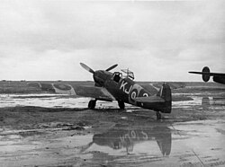
[edit]DuringWorld War IIthe airfield, then known asMartuba Airfield,was used as a military airfield by theUnited States Army Air Force57th Fighter Group,during theNorth African CampaignagainstAxis forces.The 57th flewP-40 Warhawksfrom the airfield 16 November-3 December 1942.[4]
Following theBritishvictory atEl Alameinduring theSecond World War,the airfield at Maturba[5][6]saw heavy fighting in 1942,[7][8]asRommel'sAfrika Korpswas pushed back from theEgyptianborder.
Military use
[edit]The airbase's primary use is by the Libyan Air Force, which has two sections at the base. The first section contains the main buildings and the hangars that houseMil Mi-2andMil Mi-8helicopters. The second section is the flight-line containing taxiways, a ramp, and a single runway. The runway has an additional 300 metres (980 ft) paved overrun on each end.
AnAeritalia G.222is stored on the ramp, but this section of the base appears to be a reserve facility.
Civilian use
[edit]The site is also used for the transportation of oil field workers from production facilities in the area.
See also
[edit]References
[edit]- ^Airport information for Martubah Airportat Great Circle Mapper.
- ^"Martubah Airport".World Airport Codes.Retrieved13 September2018.
- ^"Martubah Airport".Google Maps.Retrieved13 September2018.
- ^
 This article incorporatespublic domain materialfrom theAir Force Historical Research Agency
- Maurer, Maurer.Air Force Combat Units of World War II.Maxwell AFB, Alabama: Office of Air Force History, 1983.ISBN0-89201-092-4.
- Maurer, Maurer, ed. (1982) [1969].Combat Squadrons of the Air Force, World War II(PDF)(reprint ed.). Washington, DC: Office of Air Force History.ISBN0-405-12194-6.LCCN70605402.OCLC72556.
- ^Roy Conyers Nesbit, The Armed Rovers: Beauforts and Beaufighters Over the Mediterraneanp45-46.
- ^Frederick Grice, War's Nomads: A Mobile Radar Unit in Pursuit of Rommel during the Western (Casemate, 2015).p11.
- ^Christopher Shores, Giovanni Massimello,A History of the Mediterranean Air War, 1940-1945:Volume 2: North African Desert, February 1942 - March 1943(Grub Street Publishing, 19 Jul. 2014).
- ^Ken Delve Delve,The Desert Air Force in World War II: Air Power in the Western Desert, 1940-1942(Pen and Sword, 31 Mar. 2017).
External links
[edit]


