
Matong
| Matong New South Wales | |
|---|---|
 The Farmers Home Hotel being rebuilt after a fire | |
 Matong | |
| Coordinates | 34°46′0″S146°55′0″E/ 34.76667°S 146.91667°E |
| Population | 164 (2016 census)[1] |
| Postcode(s) | 2652 |
| Elevation | 192 m (630 ft) |
| Location |
|
| LGA(s) | Coolamon Shire |
| County | Bourke |
| State electorate(s) | Cootamundra |
| Federal division(s) | Riverina |
Matong/məˈtɒŋ/is a town in the central east part of theRiverinaregion ofNew South Wales,Australia. The town is 37 kilometres (23 mi) east ofNarranderaand 26 kilometres (16 mi) west ofCoolamon.At the2016 census,Matong had a population of 164 people.[1]
Sport
[edit]The most popular sport in Matong isAustralian rules football,as it lies on the Canola Way, a geographical pocket stretching from Grong Grong andMarrar,in which Australian football retains a strong following, despiteNew South Walesbeing a largely rugby league supporting state. The local team, Ganmain-Grong Grong-Matong,plays in theRiverina Football Netball League.
Gallery
[edit]-
-
 Mechanics Institute
 -
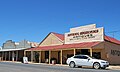 Shop
Shop -

-
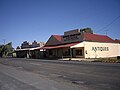
 Hotel
Hotel -
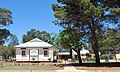 Public School
 -
 Ovals
Ovals -
 Uniting Church


Notes and references
[edit]Wikimedia Commons has media related toMatong.
- ^abAustralian Bureau of Statistics(27 June 2017)."Matong (State Suburb)".2016 Census QuickStats.Retrieved18 February2019.
| Preceding station | Former services | Following station | ||
|---|---|---|---|---|
| Grong Grong towardsHay
|
Hay Line | Ganmain towardsJunee
| ||