
Montville, Connecticut
Montville, Connecticut | |
|---|---|
| Town of Montville | |
 | |
 Seal | |
  | |
   | |
| Coordinates:41°27′50″N72°09′20″W/ 41.46389°N 72.15556°W | |
| Country | |
| U.S. state | |
| County | New London |
| Region | Southeastern CT |
| Incorporated | 1786 |
| Government | |
| • Type | Mayor-council |
| •Mayor | Ron McDaniel (D) |
| Area | |
| • Total | 44.2 sq mi (114.4 km2) |
| • Land | 42.0 sq mi (108.7 km2) |
| • Water | 2.2 sq mi (5.8 km2) |
| Elevation | 259 ft (335 m) |
| Population (2020) | |
| • Total | 18,387 |
| • Density | 420/sq mi (160/km2) |
| Time zone | UTC−5(EST) |
| • Summer (DST) | UTC−4(EDT) |
| ZIP Codes | 06353, 06370, 06382 |
| Area code(s) | 860/959 |
| FIPS code | 09-48900 |
| GNISfeature ID | 0213464 |
| Website | www |
Montvilleis atowninNew London County, Connecticutin the United States. The town is part of theSoutheastern Connecticut Planning Region.The population was 18,387 at the2020 census.[1]
Thevillagesof Chesterfield, Mohegan, Oakdale, andUncasvilleare located within the town; the latter two have their ownZIP Codes.Town residents often identify with these villages more than the Town of Montville as a whole. TheMohegan Suncasino resort is located in the village of Uncasville.
History[edit]
In the 17th century, whenEnglishsettlers arrived, southeastern Connecticut was the scene of rivalry between thePequot people,the dominantNative Americangroup in the New London area, and the newly independentMohegan.The latter became friendly to the English. For defense against the Pequot, the MohegansachemUncashad established a fortified village on a promontory above theThames Riverwithin what is now the town of Montville. The Mohegan village, now known asFort Shantok,was protected on the inland side bypalisadesfirst built in about 1636 at the time of thePequot War,rebuilt during wars with theNarragansett peoplec. 1653–1657, and rebuilt again at the time ofKing Philip's War(1675–1676).
When the boundaries ofNew London(then called "Pequot" ) were first defined in 1646, theOxoboxo Riverformed the northern boundary. Parts of the modern town of Montville lying south of the river were included in New London, while the area north of the river was treated as Mohegan land. Over time the settlers assumed control of the Mohegan lands. The first grants were made by Uncas in 1658 to Richard Houghton and James Rogers, consisting of valuable farms along the river. Some Mohegan grants were gifts of friendship or by fair trade, while others were openly fraudulent.[2]By 1703 the area between the Oxoboxo River andNorwich(now part of the town of Montville) wasannexedby New London.[3]
In 1786 Montville was separated from New London and incorporated as a separate Town. Before incorporation, it was known as the North Parish of New London. In 1819 the adjacent Town ofSalemwas formed from parts of the towns of Montville,Lyme,andColchester.[4]The name "Montville" signifies "mountain village".[5]
National Register of Historic Places[edit]
Four properties in town are listed on theNational Register of Historic Places:
- Bridge No. 1860on Massapeag Side Rd. (Rt. 433) over Shantok Brook, Fort Shantok SP (added August 29, 1993)
- Fort Shantok Archeological District(added April 20, 1986)
- Raymond-Bradford Homesteadon Raymond Hill Rd. (added May 16, 1982)
- Uncasville School,which now serves as the Montville Town Hall, at 310 Norwich-New London Turnpike (added March 23, 2001)
Geography[edit]
According to theUnited States Census Bureau,the town has a total area of 44.2 square miles (114.4 km2), of which 42.0 square miles (108.7 km2) is land and 2.2 square miles (5.8 km2), or 5.06%, is water.[6]
Principal communities[edit]
- Chesterfield
- Kitemaug
- Massapeag
- Mohegan
- Oakdale
- Palmertown
- Uncasville
Town residents often identify with these villages more than the Town of Montville as a whole. The center of Oakdale is small, consisting of only a few private residences and the post office. TheMohegan Suncasino resort is often referred to as being in Uncasville, although the village is three miles to the south. The Mohegan refer to Uncasville as it is named for a prominentsachemof theirs from the 17th century.
Demographics[edit]
| Census | Pop. | Note | %± |
|---|---|---|---|
| 1820 | 1,951 | — | |
| 1850 | 1,848 | — | |
| 1860 | 2,141 | 15.9% | |
| 1870 | 2,495 | 16.5% | |
| 1880 | 2,664 | 6.8% | |
| 1890 | 2,344 | −12.0% | |
| 1900 | 2,395 | 2.2% | |
| 1910 | 2,894 | 20.8% | |
| 1920 | 3,411 | 17.9% | |
| 1930 | 3,970 | 16.4% | |
| 1940 | 4,135 | 4.2% | |
| 1950 | 4,766 | 15.3% | |
| 1960 | 7,759 | 62.8% | |
| 1970 | 15,662 | 101.9% | |
| 1980 | 16,455 | 5.1% | |
| 1990 | 16,673 | 1.3% | |
| 2000 | 18,546 | 11.2% | |
| 2010 | 19,571 | 5.5% | |
| 2020 | 18,387 | −6.0% | |
| U.S. Decennial Census[7] | |||
As of thecensus[8]of 2000, there were 18,546 people, 6,426 households, and 4,678 families residing in the town. The population density was 441.4 inhabitants per square mile (170.4/km2). There were 6,805 housing units at an average density of 162.0 per square mile (62.5/km2). The racial makeup of the town was 86.03%White,5.49%African American,1.46%Native American,1.89%Asian,0.04%Pacific Islander,2.23% fromother races,and 2.86% from two or more races.HispanicorLatinoof any race were 5.45% of the population.
There were 6,426 households, out of which 34.7% had children under the age of 18 living with them, 58.6% were married couples living together, 9.9% had a female householder with no husband present, and 27.2% were non-families. 21.3% of all households were made up of individuals, and 7.4% had someone living alone who was 65 years of age or older. The average household size was 2.63 and the average family size was 3.05.
In the town, the population was spread out, with 23.6% under the age of 18, 8.5% from 18 to 24, 34.2% from 25 to 44, 22.8% from 45 to 64, and 10.8% who were 65 years of age or older. The median age was 36 years. For every 100 females, there were 117.2 males. For every 100 females age 18 and over, there were 119.7 males.
The median income for a household in the town was $55,086, and the median income for a family was $61,643. Males had a median income of $40,922 versus $30,206 for females. Theper capita incomefor the town was $22,357. About 3.1% of families and 4.1% of the population were below thepoverty line,including 4.3% of those under age 18 and 4.5% of those age 65 or over.
Part of Montville is also treated by theU.S. Census Bureauas acensus-designated placecalledOxoboxo River.
American Indians[edit]
TheMoheganNative American Tribal Nation has been a presence in this area of Connecticut since the 16th century, and descended from indigenous cultures in the area for thousands of years. In the seventeenth century, the colony of Connecticut granted them a 700-acre (2.8 km2) reservation, located north of the present-day village of Uncasville. Although the reservation is within the borders of the town of Montville, the tribe is federally recognized as a sovereign nation not subject to local or state laws. In addition to operating theMohegan Sun,a casino resort that opened in 1996, the tribal nation also provides educational programs about their nation's heritage and history.
Residents of Chinese descent[edit]
Since at least the 1990s, people of Chinese descent have moved into the area drawn either by the work available at Mohegan Sun and the rising prices in the Northeast'sChinatowns.Their presence, the subject of an exhibition that travelled from theLyman Allyn MuseuminNew LondontoNew York City'sMuseum of Chinese in America,has sparked at least one allegedly racist incident.[9]
Education[edit]

Public schools in Montville are overseen byMontville Public Schools,the town's public school system, operated by a board that includes nine elected members and two high school student representatives.[10]The school system operates a regularhigh school,analternative high school,amiddle school,and threeelementary schools.[11]
Montville High Schoolserves grades 9 through 12. Enrollment is approximately 800 students.[11]
Economy[edit]
Power plant[edit]
NRG EnergyInc., based inLa Jolla, California,operates an oil and natural gas-powered electricity generating plant in Montville, labeled by environmentalists as one of the "Sooty Six", the dirtiest power plants in the state. The plant was required to install pollution controls to comply with the state's 2002 power plant pollution law. In June 2006 the company proposed building a new type of coal-powered plant on the site for $1.6 billion.[12]
In return for building the plant, the company demanded that the state guarantee NRG long-term contracts for buying the electricity it generates and pick NRG's proposal over other plans for building new power plants in the state. At the time of NRG's proposal, only 18 plants in the world and two in North America used the Integrated Gasification Combined-Cycle technology which the company suggested.[12]Contracts were to be awarded by the DPUC in early 2007. The company said the new plant could open in 2012.NRG Energyannounced plans on August 5, 2013, to add fuel cells, solar and biomass conversion to the plant[13]
Notable people[edit]

- George Miller Beard(1839–1883), neurologist who coined the term "neurasthenia"in 1869
- Charles W. Comstock(1857–1917),United States Attorneyfor the District of Connecticut and former Connecticut Judge
- Sidney E. Frank(1919–2006), billionaire businessman who promotedGrey Goosevodka andJägermeister
- Ned Hanlon(1857–1937), member of theBaseball Hall of Fame[14]
- James Hillhouse(1754–1832), real estate developer who constructed significant areas ofNew Haven.He was a congressman, U.S. senator and, for many years, treasurer of Yale University
- David Jewett(1772–1842), 19th Century naval commander
- Samson Occom(1723–1792), Mohegan minister and preacher
- Oliver Hillhouse Prince(1787–1837), represented Georgia in the U.S. Senate for less than a year
Politics[edit]
| Voter Registration and Party Enrollment as of October 25, 2005[15] | |||||
|---|---|---|---|---|---|
| Party | Active Voters | Inactive Voters | Total Voters | Percentage | |
| Democratic | 2,613 | 80 | 2,693 | 27.69% | |
| Republican | 1,517 | 70 | 1,587 | 16.32% | |
| Unaffiliated | 5,142 | 286 | 5,428 | 55.81% | |
| Minor parties | 16 | 1 | 17 | 0.17% | |
| Total | 9,288 | 437 | 9,725 | 100% | |
See also[edit]
References[edit]
- ^"Census - Geography Profile: Montville town, New London County, Connecticut".United States Census Bureau.RetrievedDecember 17,2021.
- ^Baker, Henry Augustus (1896).History of Montville, Connecticut.
- ^Town of Montville Plan of Conservation and Development 2010ArchivedMarch 25, 2012, at theWayback Machine,May 15, 2010
- ^HistoryArchivedJuly 28, 2011, at theWayback Machine,Town of Montville website, accessed June 11, 2011
- ^The Connecticut Magazine: An Illustrated Monthly.Connecticut Magazine Company. 1903. p. 333.
- ^"Geographic Identifiers: 2010 Demographic Profile Data (G001): Montville town, New London County, Connecticut".United States Census Bureau.RetrievedOctober 25,2012.
- ^"Census of Population and Housing".Census.gov.RetrievedJune 4,2015.
- ^"U.S. Census website".United States Census Bureau.RetrievedJanuary 31,2008.
- ^Rajagopal, Avinash (November 2015)."Chinatown in Connecticut".Metropolis Magazine.Archived fromthe originalon November 26, 2015.RetrievedNovember 25,2015.
- ^Board of EducationArchivedJuly 18, 2011, at theWayback Machine,Town of Montville website, accessed June 11, 2011
- ^abOur SchoolsArchivedJune 12, 2011, at theWayback Machine,Montville Public Schools website, accessed June 11, 2011
- ^abKenneth R. Gosselin, "Firm unveils plan to boost electric capacity: Proposal includes upgrades in Norwalk, Greenwich",Hartford Courant;reprinted June 22, 2006,The Advocate,Stamford, Connecticut
- ^[1],NRG plans to add fuel cells, solar to Montville power plant, accessed September 15, 2013
- ^Reichler, Joseph L., ed. (1979) [1969].The Baseball Encyclopedia(4th ed.). New York: Macmillan Publishing.ISBN0-02-578970-8.
- ^"Registration and Party Enrollment Statistics as of October 25, 2005"(PDF).Connecticut Secretary of State. Archived fromthe original(PDF)on September 23, 2006.RetrievedOctober 2,2006.
External links[edit]
Municipalities and communities ofNew London County, Connecticut,United States | ||
|---|---|---|
| Cities |  | |
| Towns | ||
| Boroughs | ||
| CDPs | ||
| Other communities | ||
| Indian reservations | ||
| Footnotes | ‡This populated place also has portions in an adjacent county or counties | |
Municipalities and communities ofSoutheastern Connecticut Planning Region, Connecticut,United States | ||
|---|---|---|
| Cities | 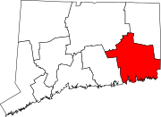 | |
| Towns | ||
| Authority control databases:Geographic |
|---|