
North Region (Cameroon)
North Region | |
|---|---|
 Location of North Region within Cameroon | |
| Coordinates:8°30′N14°00′E/ 8.500°N 14.000°E | |
| Country | Cameroon |
| Capital | Garoua |
| Departments | Bénoué,Faro,Mayo-Louti,Mayo-Rey |
| Government | |
| • Governor | Roger-Moïse Eyène Lom |
| Area | |
| • Total | 66,090 km2(25,520 sq mi) |
| Population (2015) | |
| • Total | 2,442,578 |
| • Density | 37/km2(96/sq mi) |
| HDI(2017) | 0.430[1] low·9th of 10 |
TheNorth Region(French:Région du Nord) makes up 66,090 km2of the northern half ofThe Republic of Cameroon.Neighbouring territories include theFar North Regionto the north, theAdamawa Regionto the south,Nigeriato the west,Chadto the east, andCentral African Republicto the southeast. The city ofGarouais both the political and industrial capital. Garoua is Cameroon's third largestport,despite the fact that theBénoué Riverupon which it relies is only navigable for short periods of the year.
Majorethnic groupsinclude theFula or Fulani(Fula:Fulɓe;French:Peul), who are Islamicpastoralists,and numerous Muslim andanimistspeakers ofAdamawa,Chadic,andNilo-Saharan languages.French is the language of formal education, andFulfulde,the language of the Fulbe, is widespread as alingua franca.
2008 Presidential Decree
[edit]In 2008, the President of the Republic of Cameroon,President Paul Biyasigned decrees abolishing "Provinces" and replacing them with "Regions". Hence, all of the country's ten provinces are now known as Regions.
Geography
[edit]Land
[edit]Bands of alternatingmetamorphicandsedimentary rockinterspersed withgranitecharacterise the north's geology. Granite covered in volcanicbasaltmakes up the southernmost reaches, which form part of theAdamawa Plateau.A series offaultslies north of this and separate the plateau from the band of metamorphic stone to its north. Random granite deposits also characterise this area. TheMayo ReyandVina Rivercut north of this portion, leaving deposits of sedimentary stone except in the granite east. North of this lies a band of sedimentaryalluvium,clay,limestone,andsandstone.Faults tentatively follow the Bénoué River north of this and form a barrier to split the remainder of the province, with metamorphic rocks such asgneiss,mica,andschistsdominating to the south and sedimentary stone making up the north. Another large band of metamorphic rock makes up the territory northwest of the Bénoué basin. TheMandara Mountains,which run roughly north–south at the province's Nigerian border, are irregular in that they arevolcanic,composed mostly ofcrystallineand metamorphic rock and granite.
The Adamawa Plateau divides the province into two main soil types. Those to the north are mostly shallow andferruginous,brown or brownish red in colour. On the plateau itself, they are mostlyferraliticorlateritic.The region's annual rainy/dry cycle erodes the landscape and aids in the formation of iron deposits calledduricrustorhardpansnear the surface. in addition, the area between the Vina andMbere Riversand theMayo Deovalley ishydromorphic,while the volcanic Mandara andAtlantika Mountains,other high points in the province, and theMayo Oulovalley are composed of relatively young soils high in raw mineral content. The bottom of the Bénoué basin isalluvialsoil.
Drainage
[edit]All rivers in the province experience atropical regime,with a period of high water during the rainy season during which flooding may occur. The Bénoué, Mayo Oulo,Mayo Kébi,andMayo Godiare particularly susceptible to this (mayois the Fulfulde word for river). In contrast, however, the rivers mostly dry up during the dry season, many disappearing completely into the sand. Animals and humans must dig during this period to retrieve water. This means that the port of Garoua on the Bénoué is only functional during a small portion of the year.
The Bénoué River (Benue) serves as the North's primary waterway, as it passes through the port at Garoua. It flows down from the Adamawa Plateau and is enlarged by the Mayo Rey, the Mayo Kebi (which flows into the area from Chad), the Mayo Louti (which flows down from the Mandara mountains) and other rivers. Its valley forms the main part of theBénoué Depression.Several smaller tributaries also flow into the Bénoué. All of these waterways form part of theNiger basin.
TheLagdo Reservoiris formed by a dam atLagdothat traps waters from the Benoue and its smaller tributaries the Mayo Godi, Mayo Rey,Mayo Sina,Mayo Oldiri,and others, many of which rise on the Adamawa Plateau. The reservoir provides an important source ofhydroelectric powerfor Cameroon's three northern provinces. Local villagers also use it as a source of fish, and both the lake and the river are used forirrigation.
Another significant river is the Vina, which rises in the Adamawa Province, flows through the North, and then empties into theLogone Riverin Chad. It is swelled by theMbéré Rivereast ofTouboro.Before this, the Mbéré forms the province's southeastern border with Chad for several kilometers. These are the only major rivers in the province that form part of theChad basin.
Relief
[edit]The Bénoué Depression constitutes the North Province's primary land feature. This basin runs along the Mayo Kébi and Bénoué River and has an elevation of between zero and 200 metres. The valleys surrounding the various rivers that feed the Kébi and later Bénoué reach elevations only slightly higher than this, averaging 200–500 metres in the north and 500–1000 metres in the south (the dividing line is at about 8˙ N). Garoua lies at about 235 metres. Farther north is theKaélé Elevation.A major fault runs north of the Bénoué, roughly parallel to it.
South of the Bénoué Depression lies the Adamawa Plateau. This descends to the Depression inescarpmentsand peaks of between 1000 and 2000 metres that follow a major fault. Past this frontier region, the plateau slopes south and southeast into the Adamawa Province and Chad.
The North's third significant land feature is theMandara Mountainsand their southern extension, the Atlantika Mountains, the likely results oftectonicactivity. These chains form most of the western edge of the province, with peaks as high as 1000 metres. The mountains continue north into the Far North Province and Nigeria, though their elevations gradually drop to as low as 500 metres. The surrounding terrain is hilly. The North's highest elevation isHosséré Vokré(Vokne), an isolated peak of 2,049 metres.
-
 Mountain in the North
 -
 Eroded rock structures
 -
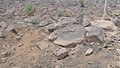 Rocky terrain
 -
 Mountains in the North
 -
 Mandara Mountain
 -
 Mandara Mountain
 -
 Pointed rock on the Mandara Mountain


Climate
[edit]From the bénoué Depression south, the North experiencestropical climateof theSudan type.Average rainfall is between 900 and 1500 mm per year, decreasing from south to north due to elevation. Garoua, the major city, thus receives between 500 and 1000 mm per year. Rainfall in the Bénoué Depression is unpredictable, though it rarely drops to less than 1000 mm in any one year. North of the Bénoué Depression, aSahel climateprevails. Here, the dry season lasts longer, and temperatures reach even higher levels. Provincial temperatures average 24 °C in the south along the plateau. In the Depression, they rise to 26 °C. North of the reservoir, temperatures climb as high as 28 °C.
Seasons follow a wet/dry pattern, with rough divisions in November (dry) and April (wet). The year begins under the influence of theharmattanwinds in the dry season. In this period, temperatures are at their highest and rainfall is virtually nonexistent. This period of stifling heat continues until April, which brings with it torrential rains and lower temperatures. Rains ease up in June, though temperatures remain lower and humidity relatively high. Then in November, the province becomes drier and temperatures cool as a shadow of winter sets in.
Plant and animal life
[edit]-
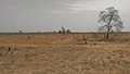 Environmental condition during the dry season
 -
 Animals left with little or no grass to eat during the dry weather
 -
 Dry palms due to hash climatic conditions


The North Province is a land ofsavanna.This begins withwooded savannaon the Adamawa Plateau with its thickgrassesand isolated copses of trees. This territory was once more heavily forested, but repeated burning andlivestocktrampling has left this original vegetation only in the valleys. Moving north, the wooded savanna gradually gives way toSudan savannaorparkland savannain the Bénoué Depression. Here grass cover thins out, and trees become fewer and more isolated, and stuntedshrubsbecome more prevalent. Common species includeacacia,baobab,and variouspalms.Most of these have adapted to the region's harsh dry season and seasonal burning by growing thick bark and shedding their leaves during this period. This area has been categorised by theWorld Wildlife Fundas part of theEast Sudanian savannaecoregion.
After centuries of human habitation and manipulation, very little of the North's indigenous wildlife survives. Of the countless species that once roamed the area, today onlyhippopotami,jackals,various monkeys such asbaboons,and various species ofreptileexist in human-inhabited areas. The region's full diversity of species is today only extant in the handful of protected areas. TheBénoué National Park(Parc National de la Bénoué) protects 1,800 square kilometres southeast of Garoua at the province's centre. It shelters many large mammal species, includinghartebeest,hippopotami,kob,andwaterbuck,as well as smaller numbers ofbuffalo,giant eland,elephants,lionsand reptiles such ascrocodiles.It has been a protected area since 1968.
The 2,200 square kilometresBouba Njida National Park(Parc National de Bouba Ndjida) is southeast of Garoua on the Chad border. Cameroon created the park in 1968 to protect theblack rhinocerosandDerby eland.Many experts today say that the rhinoceros is nowextinctin the area today. Other animals in the park include buffalo, elephants,giraffes,leopards,lions, and hippopotami.
Farthest south isFaro National Park(Parc National du Faro), which protects 3,300 square kilometres of terrain straddling the Adamawa Plateau and the Bénoué Depression. The park houses many reptile species as well as elephants, giraffes, and hippopotami. Today, however, poachers have wiped out much of the park's animal population.
Demographics
[edit]| Year | Pop. | ±% p.a. |
|---|---|---|
| 1976 | 479,158 | — |
| 1987 | 832,165 | +5.15% |
| 2005 | 1,687,959 | +4.01% |
| 2015 | 2,442,578 | +3.76% |
| source:[2] | ||
Settlement patterns
[edit]The North Province is moderately populated, averaging 12 to 25 people per km2in most areas. This density jumps to 25 to 50 people in the river valleys west of the Lagdo Reservoir and in the Bénoué Depression. North of Garoua and in the Mandara Mountains, where large populations of non-Muslim (often known collectively by the derogatory nameKirdi) were forced to flee years ago, density peaks at 50 to 100 people per km2.Due to the major port located there, Garoua was at one point Cameroon's third largest city, though its population is 235,996 (2005 Census). The city is today a mélange of the region, with large populations of Fulbe, non-Muslim Northerners and immigrants from Southern Cameroon, as well as from neighboring Chad and Nigeria.
Dwelling units differ from ethnic group to ethnic group, but many follow a fairly common pattern. The house of thechiefoften forms the centre of a village, and houses are grouped around it withgranariesnearby to help the villagers survive the dry season. Various fields of crops in turn surround homes. A common house type is a round building with a cone-shaped roof. However, houses of cement brick and roofed in sheet metal are quite common in larger settlements. Villages are often clustered along the main roads.
In contrast to the province's various settled peoples, theMbororoFulbe arenomadicand live in portable, tent-like huts (again, Mbororo is a derogatory word). They do establish semi-permanent settlements calledruga,however, to care for the aged and for women to raise children while their husbands are out to pasture.

People
[edit]
With the exception of small populations ofHausa,ShuwaArabs,and expatriate Westerners in Garoua, the ethnic groups of the North speak languages of three major language families: Niger–Congo ('Adamawa'), Chadic, and Central Sudanic.
The Adamawa-language speakers occupy the majority of the territory. TheMbuminhabit much of Faro division and a large southeastern portion of Mayo-Rey division, with theDiioccupying the vast area in between. The land west of the Mayo Rey is home to several peoples on a roughly south–north axis:Chamba,Fanbe,Gimbe,Komandera,andVere.TheDoayolive east of the river, and theNdupa,Dugun,another group of Chamba, and theVokoofPoli villageneighbour them to the south. TheMondcapital is atRey Bouba,and theMundangandMambeyalive on the Chadian border at the northeast of Bénoué division. FourFaligroups, with territories in the Bénoué and Mayo-Louti divisions, form the last member of the Adamawa group: the Fali proper, the Fali Bussime, the Fali Durbeyi, and the Fali Kangu.
At the province's borders live various Chadic-language-speaking peoples. TheNjanyibegin this band at the northwest of the Bénoué division. TheGudelie to their north. Then, from west to east, the northern border is home to the Gawar,Daba,andGuidar.TheBataandZimcomplete the Chadic speakers, with three separate concentrations of the former along the Nigerian border in Bénoué and Faro divisions, and two areas of the latter at the border with Chad and straddling the Bouba-Njida park. The Bata are further divided into the riverain Bata (west of Garoua and along the Bénoué river and into Nigeria) and the inland Bata (or Njirai), who inhabit theZummo-Malabo Hills.
As the only ethnic group in the province to speak aCentral Sudanic language,theNgambaymake up the third linguistic group. They live in a large territory on the border with Chad between the Vina River and the Mayo Godi.
Though relatively newcomers to the region, the Fulbe or Fulani are the North Province's most numerous ethnic group. Their territory stretches through most of the province's centre, primarily in the Bénoué and Mayo Rey divisions. The Fulbe follow two distinct ways of living. The nomadic Fulbe, known to others but not themselves as Mbororo, arecattleherders. They roam the province's grasslands and south into the Adamawa Province, and their settlements are never more than semi-permanent. Mbororo are typically tall, thin people with a mixture of Semitic and African features. In contrast, those Fulbe who have settled are known as sedentary or town Fulbe. They outnumber their pastoral brethren, and they have over many years intermarried with their Sudanese neighbours, whom they now resemble. The North's Fulbe also recognize two main lineages, thewollarbeandyillarga.The groups are traditionally rivals, though they often unite for common cause.
Most North Province peoples speak their own distinct languages. Those with the most speakers includeDaba,Dii,South Fali,Gidar,Adamawa Fulfulde(spoken by Cameroon's Fulbe), andNgambay.Due to the Fulbe's numerical superiority and historical domination, Fulfulde is widely spoken as a lingua franca. French is the language of formal instruction.
Religion
[edit]Islam is the dominant religion in the north due to the cultural and political domination of the Fulbe. Those ethnic groups who resisted the Fulbe are collectively referred to by the pejorative term Kirdi ( "pagans" ), though they are not culturally homogenous and do not necessarily identify as a group. Non-Muslim groups include the Chamba and Fali. Some ethnic groups, such as the Mbum and the Guidar, are divided between Muslims and Christians.
Economy
[edit]As Cameroon's third busiest port, Garoua has long been a site of commercial development in the region. Despite the fact that the port is new but a shade of its former self, Garoua remains the economic centre of the North Province and of Cameroon's Grand North in general. The city is today a crossroads for goods travelling to and from Cameroon, Chad, and Nigeria. The port is only viable during the wet season (July to October).
Agriculture
[edit]Sustenance farming
[edit]Many of the North's ethnic groups farm on small plots forsubsistence.The chief among these are the Mbum and Duru.Sorghum,millet(both fast- and slow-growing), andmaizeare the staple crop throughout most of the province, thoughmanioc(cassava) is also important on the Adamawa Plateau, andriceis especially popular in cities. Other crops includeyamsalong the Lagdo Reservoir and atTcholliréandgroundnutsin the Mayo-Rey division.
Farmers often create their fields by burning an area of its vegetation during the dry season. Only fruit trees or trees useful for animal fodder or firewood are kept, such as baobab,faidherbia,andkarita.Crops are planted at the first rains. Traditional farms are laid out in concentric circles centred on the village. These are surrounded by hedges or fences aimed at keeping outlivestock.In the Mandara Mountains, these circular plots follow the slope of the mountains interraces.Virtually nothing grows during the long dry season, so most food must be ground and stored in granaries for use during the rest of the year. Dry season sorghum (Muskwari) is grown along the river banks, relying on the moisture left behind as the rivers recede.
Commercial agriculture
[edit]Cottongrows well in the North's river valleys and constitutes the majorcash crop.Most cotton farms in the region are under the management of theSociété de Développement du Coton(SODECOTON), which was established in 1974. Groundnuts are also important in the southern half of the province, especially at the edge of theAdamawa Plateau.The plateau is generally unsuited to commercial crops due to its hard soils.
Livestock
[edit]Cattle are an integral part of the Fulbe way of life, particularly for the pastoralWodaabe,who place great importance on the number of cattle an individual owns. They roam throughout the province and beyond while their town cousins keep animals around the province's central and northern settlements. The two major breeds are the humpbackedzebu,both thebrownandwhite Fulanizebu,herded by the town Fulbe, and the leaner, lighter-colouredBororo zebu,herded by the Wodaabe. Primarytranshumanceroutes run through the Faro division and the southeast of the Mayo Rey division and eventually lead toYaoundé,Douala,or farther south. Modernranchingoccurs around the town of Faro, an endeavor made possible by the eradication of thetsetse flyfrom the region in 1974.

Other livestock raised includesheepandgoatsin the Faro division and on the border northeast of the Mayo Rey division. Most of these are long-legged breeds ofsheepandgoatsthat are larger and taller than those of most of the rest of Cameroon.Horsesanddonkeysare used as beasts of burden and transportation throughout, and the Bata are renowned for their expert skills at horse breeding.Fowlare common, particularly in the northern portions.
Industry
[edit]Garoua is the industrial heart of all of Cameroon's Grand North, and numerous factories dot the city. Among the goods produced in Garoua arebeerandsoft drinks,soap,cotton products such astextilesandcottonseed oil,constructionmaterials,processed foods,andshoes.FiguilandPitoaare smaller industrial centres. Figuil's factories producecementand textiles, and those of Pitoa produce oils fromgroundnutsand cottonseeds.Guiderand Touboro also havecotton gins.
Handicraftsare an important cottage industry for many of the North's inhabitants. Many of the region's craftsmen deal with fabrics, andweavingof everything from clothing to prayer mats is an important source of income. The North is also home to many skilledembroidererswho finish the many textiles produced there. Anartisanatat Garoua provides a major outlet for such craftsmen to sell their wares.
Miningforms a small aspect of the North's industrial complex.Limestonedeposits are situated at the province's northern bulge, anduraniumdeposits lie in the Bénoué Depression near Poli. Workers minetinore from the area northwest of the Lagdo Dam.
The Lagdo Dam and Reservoir, which holds 4 cubic kilometres of water, provides a major source ofhydroelectric powerfor Garoua and the area north of it (including the Far North Province).
Transportation
[edit]Travel in the North is relatively easy thanks to its large network of roads, many of which are paved. However, the area where the Adamawa Province descends to the Bénoué Depression is characterised by winding turns, and traffic accidents are not uncommon. In addition, the area is accessible by air. Garoua is the site of an international airport, and aircraft may land at Poli, Tcholliré, and Guider on airstrips. Finally, the port of Garoua makes the region accessible by boat, and the Bénoué is navigable all the way toPort Harcourt,Nigeria. This waterway is impassable in the dry season, however, and road is the preferred means of transporting goods through the area.
Tourism
[edit]
Tourism in the North Province is largely centred on hunting in its national parks. Of these, most travel guides recommend the 1,800 square kilometre Bénoué National Park as the most accessible and leastpoached.The park is popular among fishermen as well. Hunters also visit the Bouba Ndjida Park, though its thick vegetation and large number of rivers make it considerably more difficult to travel in. Faro National Park is little visited, as it is the least accessible to vehicles and it has been mostly poached out. Those who wish simply toviewwildlife usually continue north to visitWaza National Parkin the Far North. There is also a zoo in Garoua where many of the area's indigenous species are on view.


Administration and social conditions
[edit]
The province is divided into fourdepartments
- Bénoué,with its capital atGaroua.
- Faro,with its capital atPoli.
- Mayo-Louti,with its capital atGuider.
- Mayo-Rey,with its capital atTcholliré.
These are in turn broken down into subdivisions. Presidentially appointed senior divisional officers (prefets) and subdivisional officers (sous-prefets) govern each respectively.
The North enjoys a relatively high level of development in infrastructure thanks mainly to its most prominent native son,Ahmadou Ahidjo,Cameroon's first president. During Ahidjo's administration, his hometown of Garoua in particular saw much governmental attention, including state-of-the-art buildings and a modern airport.
Government
[edit]TheUnion Nationale pour la Démocratie et le Progrès(UNDP) is the most important political party in the area due to its large base of Fulbe supporters. The UNDP has not presented much of a front in several years, however, because the ruling party, theRassemblement démocratique du peuple camerounaisRDPC, is careful to represent Fulbe interests.
Traditional political organisation
[edit]In traditional Fulbe culture, severallamidosrule over individual populations of Fulbe subjects. The government of Cameroon allows these individuals to exercise relatively wide-reaching powers, so they can make laws, judge disputes, and intern prisoners. As the Fulbe possessed an independent emirate until relatively recently, they hold this traditional political structure in high regard. However,human rightsgroups have pointed to these extra-governmental leaders as some of Cameroon's most egregious human-rights abusers. The prisons atBibémi,Gashiga,Rey Bouba andTchéboaare particularly maligned, for example, and some groups even accuse lamidos of keepingslavesfrom the various Kirdi ethnic groups.
Many of the North's smaller ethnic groups maintain traditional political organisation. The Bata divide themselves into several independent chiefdoms, for example. In some of these groups, however, traditional chiefs are mere figureheads. In others, the position does not exist at all.
Education
[edit]The population of the North is one of Cameroon's lesser educated due both to traditional culture and to a dearth of schools. The cultural hindrance comes from the traditional role of Fulbe women; girls marry as young as age ten or eleven, and schooling typically stops at this time. Exacerbating the problem is the fact that fewer than 300 schools exist in a province of almost 1,500 villages. This compels parents interested in educating their children to send them away for most of the year, often to large towns where they must fend for themselves or stay with relatives. However, when agriculture forms such an integral part of most of the province's citizens, such a prospect may be tenuous at best.
Health
[edit]Like schools, hospitals in the North must serve a large number of spread-out villages. Most health centres are in larger towns or cities, necessitating long-distance travel for some citizens to receive care.
Malariais a major health concern. Similarly, fly-borne diseases such asdysenterysometimes break out, especially in more urbanised centres.Schistosomiasisis also a concern, though locals claim that the Lagdo Reservoir is free of the snails that carry the disease.
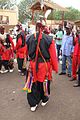
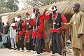
Cultural life
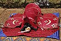
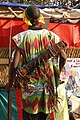
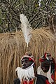
[edit]The Fulbe observe traditional Islamic holidays such asRamadanand theFeast of the Ram.In addition, most of the province's non-Muslim peoples maintain a lively traditional culture that includes a number of special ceremonies, dances, and holidays. One of these is theCock Festival,in which the nephew of the head of a family kills a cock and throws it into a fire; should the cock fall onto its right side, it is considered a good omen. The Tupuri people also perform theGouma,or the Dance of the Cock, a cacophony of drumming and tambourines and circles of long sticks. TheLamof the Guider people is a ceremony to display marriageable girls.
- Traditional dance of the peoples of North Cameroon
-
-
-

-
-
-
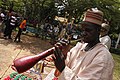
 Tam-tam Player
 -


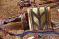
- Traditional dance accessories
-

-

-
-
-
-
-

-

-
-
-

-

-


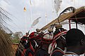
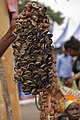
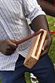
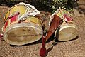
- Traditional musical instruments
-

-
-

-

-
-

-
-

-
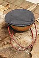
-

-
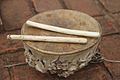 Tam-tam
 -
 Guitar
 -

-


Hair styles and head coverings


History
[edit]Early population movements
[edit]The flood plains of the Bénoué Depression have long attracted human settlement, as archaeological finds in the area and in Garoua attest. The Paleo-Sudanese, such as the Guider, represent the region's oldest continuous inhabitants. These peoples inhabited the region well before the 8th century. By the 9th century, various Neo-Sudanese groups migrated into the territory, among them the Chamba, Doayo, Fali, Mundang, and Mbum. The Chamba and Mbum proved the most warlike, forcing other groups to assimilate or find new homes. Over the years, the Mbum became quite cohesive, with a common language, social order, and ruler.
The Bata entered the area in two main waves. The first settled along the valley of the Bénoué River (River Benue), then the second continued south toDemsa Pwa(old Demsa). During this migration, the Bata fought and absorbed other peoples whom they met. The Bata also settled the site of Garoua (along with the Fali) in the 18th century. Other groups fled the Bata and settle elsewhere, such as the Chamba, Mbum, and Vere. The Chamba continued to migrate (due partially to internal squabbling) well into the colonial period, and they founded many settlements along the way, includingDonga,Suntai,andTissa.
Some of Cameroon's other peoples lived in the territory of the North Province at one time or another. TheBaliof theNorthwest Provincedescend from the Chamba, for example. TheTikarof the Adamawa and Northwest Provinces probably migrated to their present location from the Bénoué Depression.
Kanem-Bornu period
[edit]The territory fell to the control of the IslamicKanem Empireunder Sultan (orMai)Dunama (Dunam) II(r. 1221–1259). Thousands ofcavalrysubdued the area (known as Mabina) during this period. Under Kanem control, a governor presided over Mabina from the Kanem capital. The area was also nominally under the control of thekaigama,the Kanem military commander and ward of its southern provinces.
Kanem control did not last long.Civil warerupted upon Dunama's death, as a succession of warlords occupied the territory in an ever-shifting succession of power. The old empire was not reunited until the reign ofAli Ghaji,who came to power in 1472 and set his capital atBornu.
Slaveryand Islam are the two most enduring legacies of the Kanem-Bornu period. Slaves proved a lucrative commodity, and large numbers of them were transported from the area across theSahara.Kanem-Bornu control brought Islam to the region between 1349 and 1385, though only a handful of elites or rulers ever converted.
Fulbe jihads
[edit]Beginning in the 13th century, small numbers of Fulbe herdsmen and settlers began streaming into the territory from present-day Nigeria. Over time, Fulbe numbers grew, and the immigrants began to shift from subservience to other ethnic groups to settling Fulbe-only settlements. They also embraced Islam beginning in the 17th century. By 1804, Fulbe numbers had reached the point where the herders had to seek new pastureland and the settlers tired of paying homage to non-Fulbe rulers. The sentiment reached its peak when Fulbe mysticUsman Dan Fodiodeclared ajihadin what is today northern Nigeria and Cameroon.Modibo Adamabecame lamido of Fumbina, charged with conquering the territory for Usman'sSokoto Empire.
In areas with sizable Fulbe populations, Adama's task proved fairly simple. The settlements atBundang,Chamba,Chebowa,Deo,Faro, Garoua,Guringa,Kilba,Malaba,Rai,Song,Turua,andZummofell easily, Garoua in 1813. In other areas, Adama met with staunch resistance. He first struck at the Bata of Pema,Tepa,andTuruwa.Fulbe raiders enslaved Bata resisters in great numbers, and those Bata who could fled south to foundDemsa Mosu(new Demsa) andBata Batchamato the north. Those peoples who were unwilling to submit to Fulbe supremacy were forced to flee, many of them to the forbidding Mandara and Atlantika Mountains.
Adama allied with forces from Kanem-Bornu to pursue the Mandara people. He led the charge to conquer Guider by 1810, then he moved on the Mandara capital ofDouolo.Adama took these settlements and other smaller ones. The remainder of the Mandaras fled to the mountains that today bear their name. Adama had reached well into the Adamawa Plateau by 1825.
Upon Adama's death in 1847, almost all of northern Cameroon was under the rule of various Fulbe lamidos of the Sokoto Empire. What is today the North Province fell into the Garoua-Gurin and Song-Guider districts. The centralised administration (headed fromYolain present-day Nigeria) aided communication and trade throughout the region. Slaves formed a large portion of the economy, and were traded for horses and salt. In addition, the jihads cemented Islam as the dominant religion in the area.
Non-Fulbe peoples were forced to either submit to Fulbe control (and the rule of non-native rulers) or to continue their resistance long after Adama's death. The Fali of the Bénoué Depression led the Fulbe to fortify Garoua, which they called Ribadou-Garoua. Meanwhile, the new Muslim empire attracted Muslims from other areas to immigrate, and Hausa, Bornu, and Shuwa Arabs moved in the late 19th century.
European contacts
[edit]TheexplorerDr.Heinrich Barth,a German underBritishpatronage, visited Garoua in 1851 as a guest of the emir at Yola. Dr.Gustav Nachtigal,another German, led a later expedition in 1869. Nachtigal became a guest of the sultan of Bornu, and with his permission penetrated the area south to the Adamawa Plateau, where he remained until 1873. Nachtigal took careful note of the region's various peoples, their relations with one another, and those goods or produce that might prove attractive to German interests.
Germany followed up on Nachtigal's findings by sending two Englishmen,J. H. AshcroftandEdward E. Flegel,and amissionarynamed Hutchinson in 1879. The trio reached Garoua on 4 September and began the exploration of the upper Bénoué River. Flegel led a second expedition in 1882, travelling far and wide and negotiating treaties to give the Germans a monopoly onivoryin the area. He died in 1883, however, cutting the project short. Nonetheless, Germany annexed the "Kameruns" in 1884. Meanwhile, British traders set up trade in Garoua in 1890 for ivory, salt, and textiles.
German administration
[edit]Despite the new overlords, the northern territory of the Kameruns was mostly ignored; it was difficult to reach and its goods were of little priority compared to those of the southern forest zone. The only significant northern focus for the colonials was the port at Garoua. The first German administrators reached the settlement in 1901. The Germans then continued the development of Garoua as a port and a gateway fromNorthtoWest Africa.In 1902, Garoua became the capital of the Ngaoundéré and Garoua administrative unit.
The Germans left much of the administration of the territory to the traditional rulers. They particularly favoured the Fulbe lamidos, and they encouraged other ethnic groups to convert to Islam and thus fall under the control of these rulers. Nevertheless, those lamidos and other rulers who showed too much independence or disregard for German supremacy were ousted or killed.
During World War I, Garoua and the surrounding territory formed a major focus of the British African front. UnderHugh Cunliffe,British troops attacked Garoua on 30 August 1914, but were repulsed. Cunliffe retreated to Yola (at this time also German territory). The Germans counterattacked, leaving Garoua defenseless. Cunliffe took the city and used it as a staging area for further gains against the Germans. After the German surrender of 1918, the present North Province territories fell under aLeague of Nationsmandate, to be administered by France.
French administration
[edit]The French maintained a similar policy of governing the area through the Fulbe. Also like the Germans, recalcitrant rulers found themselves quickly deprived of their positions. Missionaries also entered the region, such as theLutheranFraternal Mission in Garoua in 1919.
Still, the French largely ignored the area except for the Bénoué port, which they enlarged in 1930. They also introduced a hardier variety of cotton (allem) in 1931. The French orchestrated further road building in the area, including a major route fromFoumbanto Garoua via Ngaoundéré. In addition, Garoua received a large airport. The region fell into the Mora-Garoua division, administered from Garoua.
UnderAndré-Marie Mbida,first premier of Cameroon after France granted it self-governance in 1956, the North's Fulbe majority rose in opposition, especially against the 1957Abong-Mbang Resolutions.TheUnion Camerounaisepolitical party with its large Fulbe support base formed the nerve centre for this opposition. In the resolutions, Mbida had called for a "democratisation" of Cameroon's north, which the lamidos saw as an attack on their traditional power. They thus threatened tosecedeto join French Chad, which set into motion a series of events that led to Mbida's resignation. Ahmadou Ahidjo, a northern Muslim, took his place on 18 February 1958.
Post-independence
[edit]On 1 January 1960, Cameroon gained its independence with Ahidjo its firstpresident.The period of Ahidjo's presidency proved a boon to the territory, as the native son relished great projects on Garoua and the surrounding zone, particularly in the road network. He also initiated SODECOTON to supervise and ameliorate the region's cotton-based economy.
The Northern economy, long centered on Garoua, took a severe blow during theBiafra Secessionist War,which broke out in 1967 in Nigeria and severely hampered trade along the Bénoué. Even at the war's end in 1970, the port of Garoua never fully reached its previous levels of commerce.
UnderPaul Biya,Cameroon's second president, the North continued to enjoy some improvements, as Biya was careful to cater to the region's Fulbe majority. Nevertheless, upon Biya's accession to power, the Cameroonian press accused an Ahidjo collaborator namedMoussa Yayaof trying to turn the northern lamidos against the new president. Biya's main change to the region came in his splitting of Cameroon's Grand North into three provinces, the Adamawa, the North, and the Far North in 1983. That same year, Biya reshuffled his cabinet, and Ahidjo retaliated by urging all northern ministers to resign from the government. Biya retaliated by dismissing all ministers who had served under Ahidjo, claiming that some of them had participated in an assassination attempt on him. The alleged plotters were tried and found guilty on 27 February 1984. Ahidjo escaped to Paris. A further affront to Biya's rule came on 6 April 1984 when members of Cameroon's Republican Guard who hailed from the north attacked various government buildings in an attempt to overthrow the government. They also failed.
In the first months of 2014, thousands ofrefugeesfleeing theviolence in the Central African Republicarrived in Cameroon via the border towns of the North Region,East Region,andAdamawa Region.[3]
References
[edit]- ^"Sub-national HDI - Area Database - Global Data Lab".hdi.globaldatalab.org.Retrieved2018-09-13.
- ^Cameroon: Administrative Division population statistics
- ^"Cameroon: Location of Refugees and Main Entry Points (as of 02 May 2014) - Cameroon".ReliefWeb.Retrieved2014-06-08.
- Fanso, V.G.,Cameroon History for Secondary Schools and Colleges, Vol. 1: From Prehistoric Times to the Nineteenth Century.Hong Kong: Macmillan Education Ltd, 1989.
- Neba, Aaron, Ph.D.,Modern Geography of the Republic of Cameroon,3rd ed. Bamenda: Neba Publishers, 1999.
- Ngoh, Victor Julius,History of Cameroon Since 1800.Limbe: Presbook, 1996.