
Omarska
This articleneeds additional citations forverification.(April 2019) |
Omarska
Омарска | |
|---|---|
Town | |
 Main street | |
 Omarska | |
| Coordinates:44°53′30″N16°53′57″E/ 44.89167°N 16.89917°E | |
| Country | |
| Entity | Republika Srpska |
| Municipality | Prijedor |
| Time zone | UTC+1(CET) |
| • Summer (DST) | UTC+2(CEST) |
Omarska(Serbian Cyrillic:Омарска) is a small town nearPrijedorin northwesternBosnia and Herzegovina.The town includes an old iron mine and ore processing plant. During theBosnian Warit was the site of theOmarska concentration camp.
History
[edit]World War II
[edit]DuringWorld War II,a massacre ofBosnian Serbcivilians occurred in Omarska by theUstaše.[1]
Bosnian War
[edit]TheOmarska campwas aconcentration camprun byBosnian Serb forcesin Omarska, set up forBosniakandCroatmen and women during thePrijedor massacre.[2][3]Functioning in the first months of theBosnian Warin 1992, it was one of 677 alleged detention centers and camps set up throughout Bosnia and Herzegovina during the war.[4]While nominally an "investigation center" or "assembly point" for members of the non-Serb population,[2]Human Rights Watchclassified Omarska as a concentration camp.[5]
Geography
[edit]Main Features
[edit]The municipal commonwealth of Omarska consists of Omarska town and 10 villages: Petrov Gaj, Kevljani, Lamovita, Bistrica, Verići, Niševići, Gradina, Jelićka, Krivaja and Marićka. Its geographical coordinates are 44°53'22.00 "N 16°53'43.23" E. It has area of 246.73 km² and it is located 169m abovesea level.The average temperature (over the year) is +12 degreescelsius.The average yearly rain level is 1200mm. The terrain of Omarska is mainly plains, 65% lowlands and 35% highlands.
Hydrography
[edit]The river system in Omarska is extensive. Through the middle of Omarska territory runs the riverGomjenica,which has great agricultural significance locally, because it runs through the most fertile land in this area. Gomjenica is a confluent ofSana.The river joins Sana inPrijedor.
Demographic Features
[edit]Population
[edit]According to the 1971 Yugoslav census, the population of Omarska was 19,044 - of which 16,084 wereSerbs,2,198 wereMuslims,376 wereCroatsand 433 were others. The average population density of the town was 68 per km².[citation needed]
Education
[edit]There is one elementary school in Omarska, OŠ "Vuk Karadžić",which has about 800 pupils. Children from Omarska usually go to high schools inPrijedororBanjaluka.
Sports
[edit]Omarska has a football club, FK Omarska, which competes in the 2nd League-West of theRepublika Srpska.*Željko Buvačwas born here, ex footballer, now assistant manager ofLiverpool FC.
Gallery
[edit]-
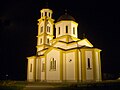 Church ofSt. Tsar Lazar
 -
 Railway Station


References
[edit]- ^Judah, Tim(2000).The Serbs: History, Myth, and the Destruction of Yugoslavia.Yale University Press. p. 234.Retrieved13 April2013.
- ^abSimons, Marlise (3 November 2001)."New York Times: 5 Bosnian Serbs Guilty of War Crimes at Infamous Camp".The New York Times.Retrieved20 May2010.
- ^Osborn, Andrew (3 November 2001)."Guardian: Five Serbs guilty of Omarska camp atrocities".The Guardian.London.Retrieved20 May2010.
- ^United Nations (1994).Final report of the United Nations Commission of Experts established pursuant to security council resolution 780(Report). Archived fromthe originalon 22 October 2010.Retrieved18 February2010.
- ^HRW report
External links
[edit]- http:// omarska.net,local site & forum
- http://eko-omarska.org,local environmental movement's site