
Oswego, Illinois
Oswego, Illinois | |
|---|---|
 Downtown Oswego | |
 Flag Logo | |
 Location of Oswego in Kendall and Will Counties, Illinois | |
 Oswego  Oswego  Oswego | |
| Coordinates:41°41′10″N88°20′30″W/ 41.68611°N 88.34167°W[1] | |
| Country | United States |
| State | Illinois |
| Counties | Kendall,Will |
| Townships | Oswego,Bristol,Wheatland |
| Settled | 1833 |
| Incorporated | 1852 |
| Government | |
| • Village President | Ryan Kauffman |
| Area | |
| • Total | 15.03 sq mi (38.93 km2) |
| • Land | 14.89 sq mi (38.56 km2) |
| • Water | 0.14 sq mi (0.38 km2) |
| Elevation | 659 ft (201 m) |
| Population (2020) | |
| • Total | 34,585 |
| • Density | 2,323.01/sq mi (896.93/km2) |
| Time zone | UTC−6(CST) |
| • Summer (DST) | UTC−5(CDT) |
| ZIP code | 60543 |
| Area codes | 630/331 |
| FIPS code | 17-56887 |
| GNISfeature ID | 2399593[1] |
| Website | www |
Oswego(/ɒsˈwiːɡoʊ/) is avillageinKendallandWillcounties,Illinois,United States. Per the2020 census,the population was 34,485.[3]Oswego is the largest municipality in Kendall County. Part of theChicago metropolitan area,it is anexurbofChicago.[4][5]
History
[edit]
In 1833, William Smith Wilson, his wife Rebecca, and his brother-in-law Daniel Pearce moved to the area now known as Oswego.[6]The land belonged to the localPotawatomi,Ottawa,andChippewatribes, but the United States governmentremovedthe Native Americans when the government started surveying the land along theFox Riverin Kendall County. In 1842, the federal government placed the land for sale at an established price of $1.25 an acre.[7]
After the sale of the land, Lewis Brinsmaid Judson and Levi F. Arnold fromNew Yorklaid out the village and named it "Hudson". However, when a post office was established, its location was given as "Lodi". Confusion over the official name of the area led to a decision in January 1837, when the citizens gathered and voted "Oswego" as the permanent name of the village by a single vote.[8]The village was named afterOswego, New York,"Oswego" being an Iroquois word meaning "mouth of the stream".[9]The ford across the Fox River in the town allowed Oswego to grow economically and as a town, eventually incorporated in 1852 with its village boundaries at the time being Harrison Street to the northwest, Jefferson Street to the northeast, Monroe Street to the southeast, and Benton Street to the southwest.[10]At the advent of the automobile, Oswego continued to see growth as it became a hub for three different state highways (Illinois Route 25,Illinois Route 71,andIllinois Route 31).[6]
Major community developments began whenCaterpillar Inc.andWestern Electricbuilt industrial plants near Oswego in the mid-1950s.[11]This initially allowed nearbyBoulder Hillto develop.[12]The next major development arrived in the mid-1980s during the suburban homebuilding boom, which allowed houses and buildings to populate the village. The rapid growth of the village allowed its limits to expand west of the Fox River into today's boundaries.[6]
Oswego is known to some Chicago-area residents for the towndragstripon State Route 34, which was open from 1955 until 1979, wheremuscle carswere raced by drivers from all over theMidwest.[13][14]The drag days are still celebrated even though the strip has been closed for decades.[15]Although evidence of the drag strip, including parts of the track, still remain, the site is off limits to the public.
Geography
[edit]Oswego is located in northeastern Kendall County on theFox Riverwith a small portion in Will County. It is bordered to the north byBoulder HillandMontgomery,to the east byAurora,and to the west byYorkville,the Kendallcounty seat.
According to the 2010 census, the village of Oswego has a total area of 15.63 square miles (40.5 km2), of which 15.53 square miles (40.2 km2) (or 99.36%) is land and 0.11 square miles (0.28 km2) (or 0.70%) is water.[16]
Downtown
[edit]Downtown Oswego is home to historic buildings and homes, as well as shops and restaurants. The Village of Oswego launched a project to enhance and restore the historic downtown district. This project included significant infrastructure and streetscape improvements, such as the installation of brick pavers, sidewalks, landscaping, and decorative streetlights and benches. Hudson Crossing Park, located along the Fox River, opened in October 2004 where many children and families enjoy the scenery. The Waubonsee Creek Promenade, which stretches from Main Street to the new park, is the final phase of the downtown enhancements.[17]In 2008, the village celebrated its 175th anniversary.
Recreation and leisure
[edit]The Oswego area is home to over 1,100 acres (450 ha) of open land, trails, and parks maintained by the Oswegoland Park District. Established in 1950, this governmental agency is guided to "create opportunities for a healthy community". Overseeing 63 parks, 16 miles (26 km) of walking trails, two aquatic parks, and the Little White School Museum, the park district provides offerings for the community of 20,000 households as well as visitors from farther away.
The Oswego area holds several races for fitness enthusiasts. Several area festivals are coordinated by the park district, such as the annual PrairieFest.[18]
Demographics
[edit]| Census | Pop. | Note | %± |
|---|---|---|---|
| 1880 | 663 | — | |
| 1890 | 641 | −3.3% | |
| 1900 | 618 | −3.6% | |
| 1910 | 600 | −2.9% | |
| 1920 | 676 | 12.7% | |
| 1930 | 932 | 37.9% | |
| 1940 | 978 | 4.9% | |
| 1950 | 1,220 | 24.7% | |
| 1960 | 1,510 | 23.8% | |
| 1970 | 1,862 | 23.3% | |
| 1980 | 3,021 | 62.2% | |
| 1990 | 3,876 | 28.3% | |
| 2000 | 13,326 | 243.8% | |
| 2010 | 30,355 | 127.8% | |
| 2020 | 34,585 | 13.9% | |
| U.S. Decennial Census[19] 2010[20]2020[21] | |||
2020 census
[edit]| Race / Ethnicity(NH = Non-Hispanic) | Pop 2000[22] | Pop 2010[20] | Pop 2020[21] | % 2000 | % 2010 | % 2020 |
|---|---|---|---|---|---|---|
| Whitealone (NH) | 12,079 | 23,700 | 23,400 | 90.64% | 78.08% | 67.66% |
| Black or African Americanalone (NH) | 236 | 1,518 | 2,574 | 1.77% | 5.00% | 7.44% |
| Native AmericanorAlaska Nativealone (NH) | 24 | 26 | 30 | 0.18% | 0.09% | 0.09% |
| Asianalone (NH) | 183 | 1,022 | 1,588 | 1.37% | 3.37% | 4.59% |
| Pacific Islanderalone (NH) | 3 | 9 | 7 | 0.02% | 0.03% | 0.02% |
| Some Other Racealone (NH) | 17 | 45 | 153 | 0.13% | 0.15% | 0.44% |
| Mixed Race or Multi-Racial(NH) | 119 | 479 | 1,417 | 0.89% | 1.58% | 4.10% |
| Hispanic or Latino(any race) | 665 | 3,556 | 5,416 | 4.99% | 11.71% | 15.66% |
| Total | 13,326 | 30,335 | 34,585 | 100.00% | 100.00% | 100.00% |
2019 American Community Survey
[edit]As of thecensus[23]of 2019, there were 36,252 people, 11,215 families living in the village. Thepopulation densitywas 2,025/mi2(782/km2). There were 10,388 housing units at anurban densityof 668.9/mi2(258.3/km2). The racial makeup of the village was 82.0%White,5.6%African American,0.24%Native American,4.79%Asian,0.03%Pacific Islander,3.24% fromother races,and 2.24% from two or more races. 17.1% of the population wereHispanicorLatinoof any race.
There were 9,935 households, out of which 50.3% had children under the age of 18 living with them, 69.2% weremarried couplesliving together, 10.58% had a female householder with no husband present, and 19.2% were non-families.[24]The average household size was 3.08 and the average family size was 3.43.[23]
In the village, the population was spread out, with 34.7% under the age of 20, 17.0% from 20 to 34, 33.2% from 35 to 54, 8.3% from 55 to 64, and 6.8% who were 65 years of age or older. The median age was 33.9 years.[23]
As of the 2019 census, the median income for a household in the village was $117,624, and the median income for a family was $102,110. Males had a median income of $75,849 versus $56,164 for females. Theper capita incomefor the village was $37,839. 1.49% of the population and 1% of families were below thepoverty line.Out of the total population, 1.49% of those under the age of 18 and 1.56% of those 65 and older were living below the poverty line.[23]
Transportation
[edit]Major highway transportation corridors are:
 US 30
US 30 US 34(Walter Payton Memorial Highway)
 IL 25(Madison Street)
 IL 31
IL 31 IL 71
IL 71 IL 126
 CR 20(Orchard Road)
Education
[edit]TheOswego Community Unit School District 308serves Oswego,Boulder Hill,Montgomery,Plainfield,Aurora,YorkvilleandJoliet.It operates 22 schools, including one early learning center, 14 elementary schools for grades K-5, 5 junior high schools for grades 6–8, 2 high schools, and oneopportunity school.[25]Portions of Oswego are withinYorkville Community Unit School District 115,which operatesYorkville High School.[26]
Notable people
[edit]- Rob Baxley,former professional football player[27]
- Arthur M. Beaupre,diplomat; born in Oswego[28]
- Tom Cross,former member of theIllinois House of Representatives[29]
- Slade Cutter,former naval officer and member of theCollege Football Hall of Fame[30]
- Emma Murdock Van Deventer,mystery novelist[31]
- Rita B. Garman,formerChief Justiceof theSupreme Court of Illinois[32]
- Joey Goodspeed,former professional football player; running back for theMinnesota Vikings,St. Louis Rams,andSan Diego Chargers[33]
- John Hamilton,member of theJohn Dillingergang who was buried near here in summer of 1934[34]
- J. Dennis Hastert,formerCongressmanandSpeaker of the United States House of Representatives(1999–2007),[35]convicted child molester[36]
- AJ Johnson,professionalbowleron thePBA Tour
- Alex Magee,former professional football player; defensive end for theKansas City ChiefsandTampa Bay Buccaneers[37]
- Robert Mitchler,Illinois state senator[38]
- Robinson B. Murphy,Civil War Army musician;Medal of Honorrecipient[39]
- Maud N. Peffers,Illinois state representative[40]
- Tom Sharpe,drummer forMannheim Steamrolleras well asDennis DeYoung[41]
- Julianne Sitch,former professionalsoccerplayer. First woman to ever win an NCAA championship as coach of a men's team
- Keith R. Wheeler,member of theIllinois General Assembly[42]
Awards and recognition
[edit]Oswego was ranked #58 in 2011 on CNN/Money Magazine's Top 100 Best Towns to live.[43]CNN Money ranks these towns based on their job opportunities, schools, safety, economic strength, and other qualities. Kendall County has continuously been ranked as one of the fastest-growing counties and a place of rapid job growth.[44]
Gallery
[edit]-
 Village hall
 -
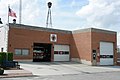 Old fire department
 -
 Veteran's Memorial Plaza
 -
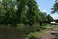 Hudson Crossing Park
 -
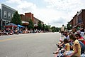 Downtown during PrairieFest parade


References
[edit]- ^abcU.S. Geological Survey Geographic Names Information System: Oswego, Illinois
- ^"2020 U.S. Gazetteer Files".United States Census Bureau.RetrievedMarch 15,2022.
- ^"Oswego village, Illinois".United States Census Bureau.RetrievedApril 15,2022.
- ^"Living in Oswego".Niche.Retrieved2022-12-01.
- ^"Could new Metra service to Kendall County enable a fantastical journey to Oswego? - Streetsblog Chicago".chi.streetsblog.org.2021-04-06.Retrieved2023-07-31.
- ^abc"History".OswegoIL.org.Archivedfrom the original on 20 December 2014.Retrieved15 December2014.
- ^Matile, Roger (April 30, 2008). "2".Oswego Township.Arcadia Publishing. p. 23.ISBN978-0738552088.
- ^Matile, Roger (April 30, 2008).Oswego Township.Arcadia Publishing. p. 7.ISBN978-0738552088.
- ^"About Us".oswegotownship.org.Retrieved12 March2023.
- ^"Archived copy"(PDF).Archived(PDF)from the original on 2016-12-25.Retrieved2017-02-02.
{{cite web}}:CS1 maint: archived copy as title (link) - ^Roger, Matile (2008).Oswego Township.Charleston, SC: Arcadia Pub. p. 8.ISBN978-0738552088.
- ^Dardick, Hal (January 2, 1991)."Boulder Hill has it all but a town that it can call its own".Chicago Tribune.Chicago Tribune.Archivedfrom the original on 13 August 2016.Retrieved28 June2016.
- ^Alaimo, Salvatore (August 24, 2011)."Oswego Dragstrip in Oswego, Illinois Holds Many Drag Racing Memories".Dragzine.Power Automedia.Archivedfrom the original on 14 September 2016.Retrieved28 June2016.
- ^Lohnes, Brian (July 27, 2011)."Wednesday Time Killer: Awesome Photos and History From Oswego Dragway, Including Grumpy Jenkins Wreckage!".BangShift.Archivedfrom the original on 10 August 2016.Retrieved28 June2016.
- ^Antinori, Shannon (July 14, 2014)."New Museum Exhibit Highlights Oswego Drag Raceway".Oswego Patch.Patch Media.Archivedfrom the original on 4 August 2016.Retrieved28 June2016.
- ^"2010 Census U.S. Gazetteer Files for Places – Illinois".United States Census.Archivedfrom the original on 2012-08-10.Retrieved2012-10-13.
- ^Brack-Johnson, Ann (November 24, 1998)."Oswego Looks Creekward".Chicago Tribune.Chicago Tribune.Archivedfrom the original on 13 August 2016.Retrieved28 June2016.
- ^http:// oswegolandparkdistrict.org.aspx[dead link]
- ^"Decennial Census of Population and Housing by Decades".US Census Bureau.
- ^ab"P2 Hispanic or Latino, and Not Hispanic or Latino by Race – 2010: DEC Redistricting Data (PL 94-171) – Oswego village, Illinois".United States Census Bureau.
- ^ab"P2 Hispanic or Latino, and Not Hispanic or Latino by Race – 2020: DEC Redistricting Data (PL 94-171) – Oswego village, Illinois".United States Census Bureau.
- ^"P004: Hispanic or Latino, and Not Hispanic or Latino by Race – 2000: DEC Summary File 1 – Oswego village, Illinois".United States Census Bureau.RetrievedJanuary 26,2024.
- ^abcd"U.S. Census website".United States Census Bureau.Archivedfrom the original on 1996-12-27.Retrieved2016-06-27.
- ^"U.S. Census Bureau QuickFacts: Oswego village, Illinois".U.S. Census.U.S. Census Bureau.Archived(PDF)from the original on 16 September 2016.Retrieved19 December2016.
- ^"District Building Information".Community Unit School District 308.Archivedfrom the original on 2013-05-22.Retrieved2013-04-17.
- ^"About Our School District"(Archive).Yorkville Community Unit School District 115.Retrieved on June 9, 2015.
- ^"Rob Baxley".profootballarchives.Archivedfrom the original on March 4, 2016.RetrievedJune 27,2016.
- ^Newton Bateman, Paul Selby,Historical Encyclopedia of Illinois,Volume 2, 1904, page 739
- ^"Former State GOP Leader Tom Cross Has Painful Connection To Hastert Case".WBBM-TV.April 27, 2016.RetrievedFebruary 4,2021.
- ^"Slade Cutter".National Football Foundation.RetrievedFebruary 4,2021.
- ^How Oswego's Emily Murdock became mystery writer Lawrence L. Lynch(PDF).Little White School Museum.
- ^"Rita B. Garman, Supreme Court Chief Justice: Fourth District".IllinoisCourts.gov.Archivedfrom the original on June 26, 2016.RetrievedJune 27,2016.
- ^"Joey Goodspeed".Scout.Scout.Archivedfrom the original on 10 April 2016.Retrieved28 June2016.
- ^Newton, M. (2002).The Encyclopedia of Robberies, Heists, and Capers. Checkmark Books, an imprint of Facts on File, Inc.ISBN0-8160-4489-9.pp. 128-129.
- ^"HASTERT, John Dennis".History, Art, and Archives.United States House of Representatives.Archivedfrom the original on 16 August 2016.Retrieved28 June2016.
- ^Jason Meisner, Jeff Coen & Christy Gutowski,Dennis Hastert, former U.S. House speaker, sentenced to 15 months in prison,Chicago Tribune(April 27, 2016).
- ^"Alex Magee".NFL.NFL Enterprises LLC.Archivedfrom the original on 17 August 2016.Retrieved28 June2016.
- ^'Illinois Blue Book 1979-1980,' Biographical Sketch of Robert Mitchler, pg. 144
- ^"Musician Robinson B. Murphy, Civil War Medal of Honor Recipient".
- ^'Illinois Blue Book 1955-1956,' Biographical Sketch of Maud N. Peffers, pg. 228-229
- ^Gire, Dann (24 February 2015)."Mannheim Steamroller drummer from Oswego writes symphony".Archivedfrom the original on 28 February 2018.Retrieved30 January2020.
- ^"Representative Keith R. Wheeler (R)".Illinois General Assembly.RetrievedFebruary 4,2021.
- ^"Money Magazine" Best Places to Live 2011 "".BestPlaces.net.Archivedfrom the original on 15 January 2015.Retrieved15 December2014.
- ^Christie, Les (16 June 2010)."Fastest growing counties in the U.S."Archivedfrom the original on 1 December 2014.Retrieved15 December2014.
External links
[edit] Media related toOswego, Illinoisat Wikimedia Commons
- Official website
Municipalities and communities ofKendall County, Illinois,United States | ||
|---|---|---|
| Cities |  | |
| Villages | ||
| Townships | ||
| CDP | ||
| Other unincorporated communities | ||
| Footnotes | ‡This populated place also has portions in an adjacent county or counties | |
Municipalities and communities ofWill County, Illinois,United States | ||
|---|---|---|
| Cities |  | |
| Villages |
| |
| Townships | ||
| CDPs | ||
| Other communities | ||
| Ghost town | ||
| Footnotes | ‡This populated place also has portions in an adjacent county or counties | |
| Major city |  | |
|---|---|---|
| Cities (over 30,000 in2020) | ||
| Towns and villages (over 30,000 in2020) |
| |
| Counties | ||
| Regions | ||
| Sub-regions | ||
| International | |
|---|---|
| National | |
| Geographic | |