R154 road (Ireland)
| R154 road | |
|---|---|
| Bóthar R154 | |
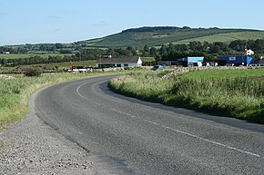
 R154 south of Oldcastle,Slieve na Calliaghin the background | |
| Route information | |
| Length | 91 km (57 mi) |
| Location | |
| Country | Ireland |
| Primary destinations |
|
| Highway system | |
TheR154 roadis aregional roadinIreland,linking theR147nearClonee,County MeathtoCrossdoney(nearCavan) inCounty Cavan.The road is single carriageway throughout. Many parts of the route have dangerous bends.
Route
[edit]The route leaves theR147nearBlack Bullin the townland of Piercetown, roughly 10 km (6.2 mi) north ofCloneeinCounty Meath.The route passes through small settlements and townlands, includingKiltale,on the way toTrim.At Trim, the route bypasses the town centre along theInner Relief Road,with junctions to theR160,R158andR161.From Trim the R154 runs north to meet theN51atAthboy.
The route leaves the N51 on the west side of Athboy, and runs north to cross theN52just south ofKilskeer.The route continues north/northwest toOldcastle,meeting theR163along the way, just north ofCrossakeel.At Oldcastle the R154 crosses theR195.The route continues northeast throughMount NugentinCounty Cavan,joining theR194after that at a staggered junction. The route leaves the R194, continuing northeast throughKilnaleck,and across theN55atBallinagh.The route ends atCrossdoney,meeting theR198about 10 km (6.2 mi) southwest ofCavan.

