
Musandam Peninsula
|
جَزِيْرَة مُسَنْدَم رَأْس مُسَنْدَم | |
|---|---|
 The peninsula as seen from space. Al-Khasabto the north (top) shown in green, is contrasted between the more subtle rainbow tones of the surrounding rock in this false-colour image. The termKhasabrefers to the fertility of the soil. | |
| Coordinates:25°54′N56°12′E/ 25.900°N 56.200°E | |
| Governorates of OmanandEmirates of the United Arab Emirates | Musandam Governorate(Oman) Ras Al Khaimah(UAE) |
TheMusandam Peninsula(Arabic:جَزِيْرَة مُسَنْدَم \ رَأْس مُسَنْدَم,romanized:Jazīrat Musandam / Raʾs Musandam), locally known asRuus Al Jibal(Arabic:رُؤُوْس ٱلْجِبَال,romanized:Ruʾūs al-JibālCapes of the Mountains),[3]is apeninsulathat forms the northeastern point of theArabian Peninsula.
Geography
[edit]The peninsula lies to the south of theStrait of Hormuz,between thePersian Gulfand theGulf of Oman.[4]It is inhabited by theShihuhtribe and is mainly governed byOmanas theMusandam Governoratewith certain parts governed by theUnited Arab Emirates,includingRas Al Khaimahand parts ofDibba.[1][2]
Land features include theWestern Hajar Mountains.Since these are the northernmost of theHajar range,they and the peninsula are referred to asRuʾūs al-Jibāl(Arabic:رُؤُوْس ٱلْجِبَال,romanized:Capes of the Mountains).[1][2]The largestwadiin Mussandam isWadi Bih,which forms the centraldrainage basin.[5][6]The highest Mountain in Mussandam, and Ru'us al Jibal, isJebel Harim.
Climate
[edit]During winter, the region can be fairly cool, particularly the mountains of Jais, Yanas and Mebrah.[7][8]
Environment
[edit]Faunainclude theRuus al Jibal fan-footed gecko,[9]Arabian tahrandcaracal.It is unknown if theArabian leopardis still present.[1][2]
Important Bird Areas
[edit]The mountainous northern end of the peninsula has been designated anImportant Bird Area(IBA) byBirdLife Internationalbecause it supports significant populations of bird species, whether resident, breeding, wintering or on passage. These includepallid scops-owl,plain leaf-warbler,hooded,variable,Hume'sandred-tailed wheatears,andpale rockfinch.[10]
The islands scattered around the tip of the peninsula are in a separate IBA because of their importance forseabirds,includingred-billed tropicbird,Persian shearwater,Socotra cormorantandbridled tern.[11]
History
[edit]In the past, the region was an unstable region, and was repeatedly invaded by Persian empires such as theAchaemenid Empireand theSassanian Empire.Then these empires declined until the Islamic era arrived.
Modern Era
[edit]In the modern era, the occupation of the region continued. In the beginning, thePortugueseinvasion arrived, which destroyed the region after it was a global navigation center at that time. Then a new force appeared, theYa'rubidsstate, and expelled the Portuguese invasion of the Gulf and occupied the peninsula region. Then cameBritish colonialism.After the withdrawal of British colonialism, theUAEwas formed, butRas Al Khaimahdid not join the UAE at that time. In 1972 AD, the Emirate of Ras Al Khaimah joined the United Arab Emirates. Then the Emirati-Omani border has been officially settled.
Gallery
[edit]-
 View ofJebal Harimfrom the Green Valley, March 2013
 -
 View of the mountains of Musandam, December 1971
 -
 View of theRu'us al-JibalfromJebel Qihwi
 -
 The mountainous area ofKumzar,c. 1908
 -
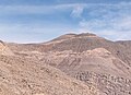
 Sedimentary rock layers nearKhasabinMusandam Governorate,Oman
 -
-
 African monarch butterfly (Danaus chrysippus) in Zhighy Bay, Musandam Governorate
 -
 Blue basker dragonfly (Urothemis edwardsii)
 -


Hills andmountains on the Arabian Peninsula | ||||||||||||||||||||||||||||||||||||||
|---|---|---|---|---|---|---|---|---|---|---|---|---|---|---|---|---|---|---|---|---|---|---|---|---|---|---|---|---|---|---|---|---|---|---|---|---|---|---|
| ||||||||||||||||||||||||||||||||||||||
Note:Mountains are sorted in Alpha betical order, unless where it concerns ranges. The highest confirmed mountains in each country are indicated with 'HP', and those with the highest peak are indicated with 'HP', bearing in mind that in the UAE, the highest mountain and the mountain with the highest peak are different.Outcropsare indicated with 'OC', andoutlierswith 'OL', andanticlineswith 'AC'.Volcanoesare indicated with 'V',volcanic craterswith 'VC',lava fieldswith 'LF', andvolcanic fieldswith 'VF'.
Other notes:
| ||||||||||||||||||||||||||||||||||||||


References
[edit]- ^abcdEdmonds, J.-A.; Budd, K. J.; Al Midfa, A. & Gross, C. (2006)."Status of the Arabian Leopard in United Arab Emirates"(PDF).Cat News(Special Issue 1): 33–39.
- ^abcdSpalton, J. A. & Al-Hikmani, H. M. (2006)."The Leopard in the Arabian Peninsula – Distribution and Subspecies Status"(PDF).Cat News(Special Issue 1): 3–47.
- ^Thomas, B. (March 1927).Travels in Oman. Visit of B. Thomas to the Musandam Peninsula. 1928. Notes on Shihuh dialects & people, also Kumzaris' [10r].British Library: India Office Records and Private Papers. p. 9.
- ^Diba, B. A. (2011).Is Iran legally permitted to close Strait of Hormuz to countries that impose sanctions against Iran's oil?.Cupertino, California: Payvand Iranian-American Website.
- ^Lancaster, Fidelity; Lancaster, William (2011).Honour is in Contentment: Life Before Oil in Ras Al-Khaimah (UAE) and Some Neighbouring Regions.Berlin,New York:Walter de Gruyter.pp. 3–598.ISBN978-3-1102-2339-2.
- ^Allen, Calvin H. Jr. (2016-02-05)."1: Land and People".Oman: the Modernization of the Sultanate.Abingdon,New York:Routledge.pp. 1–8.ISBN978-1-3172-9164-0.
- ^Al Serkal, Mariam M. (2019-03-10)."UAE to see cold days ahead, temperatures drop to 2.6°C".Gulf News.Retrieved2019-03-17.
- ^Al Serkal, Mariam M. (2019-02-28)."UAE to get 5 days of rain and" significant drop in temperature "".Gulf News.Retrieved2019-03-17.
- ^Simó-Riudalbas, M.; Metallinou, M.; De Pous, P.; Els, J.; Jayasinghe, S.; Péntek-Zakar, E.; Wilms, Thomas; Al-Saadi, Saleh; Carranza, Salvador (2017-08-02), "Cryptic diversity inPtyodactylus(Reptilia: Gekkonidae) from the northern Hajar Mountains of Oman and the United Arab Emirates uncovered by an integrative taxonomic approach ",PLOS ONE,12(8): e0180397,Bibcode:2017PLoSO..1280397S,doi:10.1371/journal.pone.0180397,PMC5540286,PMID28767644,e0180397
- ^"Musandam (mainland)".BirdLife Data Zone.BirdLife International. 2024.Retrieved2024-09-06.
- ^"Musandam islands".BirdLife Data Zone.BirdLife International. 2024.Retrieved2024-09-06.