
Safed
Safed (Tzfat)
| |
|---|---|
| Tzfat | |
| Hebrew transcription(s) | |
| •ISO 259 | Çpat |
| • Translit. | Tz'fat |
| • Also spelled | Tsfat, Tzefat, Zfat, Sfat, Ẕefat (official) |
     | |
 | |
 Safed (Tzfat)  Safed (Tzfat) | |
| Coordinates:32°57′57″N35°29′54″E/ 32.96583°N 35.49833°E | |
| Country | |
| District | Northern |
| Sub-district | Safed |
| Founded | 1500 BCE[1] |
| Government | |
| • Mayor | Yossi Kakon |
| Elevation | 850 m (2,790 ft) |
| Population (2024)[2] | |
| • Total | 42,117 |
| Website | http:// zefat.muni.il |
Safed(also known asTzfat;Hebrew:צְפַת,Ṣəfaṯ;Arabic:صفد,Ṣafad)[3][4]is a city in theNorthern DistrictofIsrael.Located at an elevation of up to 937 m (3,074 ft), Safed is the highest city in theGalileeand in Israel.[5]
Safed has been identified withSepph(Σέπφ), a fortified town in theUpper Galileementioned in the writings of theRoman JewishhistorianJosephus.TheJerusalem Talmudmentions Safed as one of five elevated spots where fires were lit to announce theNew Moonand festivals during theSecond Temple period.Safed attained local prominence under theCrusaders,who built a large fortress there in 1168. It was conquered bySaladin20 years later, and demolished by his grandnephewal-Mu'azzam Isain 1219. After reverting to the Crusaders in a treaty in 1240, a larger fortress was erected, which was expanded and reinforced in 1268 by theMamluksultanBaybars,who developed Safed into a major town and the capital of a new province spanning the Galilee. After a century of general decline, the stability brought by theOttomanconquest in 1517 ushered in nearly a century of growth and prosperity in Safed, during which time Jewish immigrants from across Europe developed the city into a center forwool and textile productionand the mysticalKabbalahmovement. It became known as one of theFour Holy Citiesof Judaism. As the capital of theSafad Sanjak,it was the main population center of the Galilee, with large Muslim and Jewish communities. Besides during the fortunate governorship ofFakhr al-Din IIin the early 17th century, the city underwent a general decline and by the mid-18th century was eclipsed byAcre.Its Jewish residentswere targetedinDruzeand local Muslim raids in the 1830s, and many perished in anearthquakein that same decade – through the philanthropy ofMoses Montefiore,its Jewish synagogues and homes were rebuilt.
Safed's population reached 24,000 toward the end of the 19th century; it was amixed city,divided roughly equally between Jews and Muslims with a small Christian community. Its Muslim merchants played a key role as middlemen in thegrain tradebetween the local farmers and the traders of Acre, while the Ottomans promoted the city as a center ofSunnijurisprudence.Safed's conditions improved considerably in the late 19th century, a municipal council was established along with a number of banks, though the city's jurisdiction was limited to the Upper Galilee. By 1922, Safed's population had dropped to around 8,700, roughly 60% Muslim, 33% Jewish and the remainder Christians. Amid rising ethnic tension throughoutMandatory Palestine,Safed's Jews were attacked in anArab riot in 1929.The city's population had risen to 13,700 by 1948, overwhelmingly Arab, though the city was proposed to be part of a Jewish state in the1947 UN Partition Plan.During the1948 war,Arab factions attacked and besieged the Jewish quarter which held out until Jewish paramilitary forces captured the city after heavy fighting, precipitating British forces to withdraw.[6]Most of the city's predominantly Palestinian-Arab populationfled or were expelledas a result ofattacks by Jewish forcesand the nearbyEin al-Zeitun massacre,and were not allowed to return after the war, such that today the city has an almost exclusively Jewish population.[6][7]That year, the city became part of the then-newly established state of Israel.
Safed has a largeHaredicommunity and remains a center for Jewish religious studies. Safed today hosts the Ziv Hospital as well as theZefat Academic College.Safed is a major subject in Israeli art, it hosts anArtists' Quarter.Several prominent art movements played a role in the city, most notably theÉcole de Paris.[8]However theArtists' quarterhas declined since its golden age in the second half of the 20th century.[9][10]Due to its high elevation, the city has warm summers and cold, often snowy winters.[11]Its mild climate and scenic views have made Safed a popular holiday resort frequented by Israelis and foreign visitors.[12]In 2022 it had a population of 38,029.[2]
Biblical reference[edit]
Legend has it that Safed was founded by a son ofNoahafter theGreat Flood.[11]According to theBook of Judges(Judges 1:17), the area where Safed is located was assigned to thetribe of Naphtali.[13]
It has been suggested thatJesus' assertion that "a city that is set on a hill cannot be hidden"[14]referred to Safed.[15]
History[edit]
Antiquity[edit]
Safed has been identified withSepph,a fortified town in theUpper Galileementioned in the writings of the Roman-Jewish historianJosephus.[16]Safed is mentioned in theJerusalem Talmudas one of five elevated spots where fires were lit to announce theNew Moonand festivals during theSecond Temple period.[17]
Crusader era[edit]
Pre-Crusader village and tower[edit]


There is scarce information about Safed before theCrusaderconquest.[18][19]A document from theCairo Geniza,composed in 1034, mentions a transaction made in Tiberias in 1023 by a certain Jew, Musa ben Hiba ben Salmun with thenisba(Arabic descriptive suffix) "al-Safati" (of Safed),[18]indicating the presence of a Jewish community living alongside Muslims in Safed in the 11th century.[20]According to the Muslim historianIbn Shaddad(d. 1285), at the beginning of the 12th century, a "flourishing village" beneath a tower called Burj Yatim had existed at the site of Safed on the eve of the Crusaders' capture of the area in 1101–1102 and that "nothing" about the village was mentioned in "the early Islamic history books".[21]Although Ibn Shaddad mistakenly attributes the tower's construction to theKnights Templar,the modern historianRonnie Ellenblumasserts that the tower was likely built during the early Muslim period (mid-7th–11th centuries).[21]
First Crusader period[edit]
The Frankish chroniclerWilliam of Tyrenoted the presence of aburgus(tower) in Safed, which he called "Castrum Saphet" or "Sephet", in 1157.[22]Safed was the seat of acastellany(area governed by a castle) by at least 1165, when itscastellan(appointed castle governor) was Fulk, constable ofTiberias.[23]The castle of Safed was purchased from Fulk by KingAmalric of Jerusalemin 1168.[22]He subsequently reinforced the castle and transferred it to the Templars in the same year.[22]Theoderich the Monk,describing his visit to the area in 1172, noted that the expanded fortification of the castle of Safed was meant to check the raids of the Turks (the TurkicZengid dynastyruled the area east of the Kingdom).[24]Testifying to the considerable expansion of the castle, the chroniclerJacques de Vitry(d. 1240) wrote that it was practically built anew.[25]The remains of Fulk's castle can now be found under the citadel excavations, on a hill above the old city.[26]
In the estimation of modern historian Havré Barbé, thecastellanyof Safed comprised approximately 376 square kilometers (145 sq mi).[20]According to Barbé, its western boundary straddled the domains of Acre, including the fief ofSt. George de la Beyne,which includedSajurandBeit Jann,and the fief of Geoffrey le Tor, which includedAkbaraandHurfeish,and in the southwest ran north ofMagharandSallama.[27]Its northern boundary was marked by theNahal Dishon(Wadi al-Hindaj) stream,[28]its southern boundary was likely formed near Wadi al-Amud, separating it from the fief of Tiberias,[29]while its eastern limits were the marshes of theHula Valleyand upperJordan Valley.[30]There were several Jewish communities in thecastellanyof Safed, as testified in the accounts of Jewish pilgrims and chroniclers between 1120 and 1293.[31]Benjamin of Tudela,who visited the town in 1170, does not record any Jews living in Safed proper.[32]
Ayyubid interregnum[edit]
Safed was captured by theAyyubidsled by SultanSaladinin 1188 aftera month-long siege,following theBattle of Hattinin 1187.[33]Saladin ultimately allowed its residents to relocate toTyre.[33]He granted Safed and Tiberias as aniqta(akin to a fief) to Sa'd al-Din Mas'ud ibn Mubarak (d. 1211), the son of his niece, after which it was bequeathed to Sa'd al-Din's son Ahmad.[34]Samuel ben Samson,who visited the town in 1210, mentions the existence of a Jewish community of at least fifty there.[35]He also noted that two Muslims guarded and maintained the cave tomb of a rabbi, Hanina ben Horqano, in Safed.[36]Theiqtaof Safed was taken from the family of Sa'd al-Din by the Ayyubid emir ofDamascus,al-Mu'azzam Isa,in 1217.[37]Two years later, during the Crusadersiege of Damietta,al-Mu'azzam Isa had the Safed castle demolished to prevent its capture and reuse by potential future Crusaders.[37]
Second Crusader period[edit]
As an outcome of the treaty negotiations between the Crusader leaderTheobald I of Navarreand the Ayyubid emir of Damascus,al-Salih Isma'il,in 1240 Safed once again passed to Crusader control.[37]Afterward, the Templars were tasked with rebuilding the town'sfortress,with efforts spearheaded byBenoît d'Alignan,Bishop of Marseille.[37]The rebuilding is recorded in a short treatise,De constructione castri Saphet,from the early 1260s.[38]The reconstruction was completed at the considerable expense of 40,000bezantsin 1243.[37][39]The new fortress was larger than the original, with a capacity for 2,200 soldiers in time of war, and with a resident force of 1,700 in peacetime.[39][40]The garrison's goods and services were provided by the town or large village growing rapidly beneath the fortress, which, according to Benoit's account, contained a market, "numerous inhabitants" and was protected by the fortress.[41]The settlement also benefited from trade with travelers on the route betweenAcreand the Jordan Valley, which passed through Safed.[37]
Mamluk period[edit]

The Ayyubids of Egypt had been supplanted by theMamluksin 1250 and the Mamluk sultanBaybarsenteredSyriawith his army in 1261. Thereafter, he led a series of campaigns over several years against Crusader strongholds across the Syrian coastal mountains.[42]Safed, with its position overlooking the Jordan River and allowing the Crusaders early warnings of Muslim troop movements in the area, had been a consistent aggravation for the Muslim regional powers.[43]After a six-week siege,[41]Baybarscaptured Safedin July 1266,[18]after which he had nearly the entire garrison killed.[44]The siege occurred during a Mamluk military campaign to subdue Crusader strongholds inPalestineand followed a failed attempt to capture the Crusaders' coastal stronghold of Acre.[18]Unlike the Crusader fortresses along the coastline, which were demolished upon their capture by the Mamluks, Baybars spared the fortress of Safed.[45]He likely preserved it because of the strategic value stemming from its location on a high mountain and its isolation from other Crusader fortresses.[45]Moreover, Baybars determined that in the event of a renewed Crusader invasion of the coastal region, a strongly fortified Safed could serve as an ideal headquarters to confront the Crusader threat.[46]In 1268, he had the fortress repaired, expanded and strengthened.[45]He commissioned numerous building works in the town of Safed, includingcaravanserais,marketsand baths, and converted the town's church into a mosque.[47]The mosque, called Jami al-Ahmar (the Red Mosque), was completed in 1275.[48]By the end of Baybars's reign, Safed had developed into a prosperous town and fortress.[47]
Baybars assigned fifty-fourmamluks,at the head of whom was Emir Ala al-Din Kandaghani, to oversee the management of Safed and its dependencies.[49]From the time of its capture, the city was made the administrative center of Mamlakat Safad,[50]one of sevenmamlakas(provinces), whose governors were typically appointed fromCairo,which made upMamluk Syria.[51]Initially, its jurisdiction corresponded roughly with the Crusadercastellany.[49]After the fall of theMontfort Castleto the Mamluks in 1271, the castle and its dependency, theShaghurdistrict, were incorporated into Mamlakat Safad.[52]The territorial jurisdiction of themamlakaeventually spanned the entire Galilee and the lands further south down toJenin.[50]

The geographeral-Dimashqi,who died in Safed in 1327, wrote around 1300 that Baybars built a "round tower and called it Kullah..." after leveling the old fortress. The tower was built in three stories, and provided with provisions, halls, andmagazines.Under the structure, acisterncollected enough rainwater to regularly supply the garrison.[53]The governor of Safed, Emir Baktamur al-Jukandar (the Polomaster;r. 1309–1311), built a mosque later called after him in the northeastern section of the city.[54]The geographerAbu'l Fida(1273–1331), the ruler ofHama,described Safed as follows:
[Safed] was a town of medium size. It has a very strongly built castle, which dominates theLake of Tabariyyah[Sea of Galilee]. There are underground watercourses, which bring drinking-water up to the castle-gate...Its suburbs cover three hills... Since the place was conquered by Al Malik Adh Dhahir [Baybars] from the Franks [Crusaders], it has been made the central station for the troops who guard all the coast-towns of that district. "[55]
The nativeqadi(Islamic head judge) of Safed, Shams al-Din al-Uthmani, composed a text about Safed calledTa'rikh Safad(the History of Safed) during the rule of its governor Emir Alamdar (r. 1372–1376).[56]The extant parts of the work consisted of ten folios largely devoted to Safed's distinguishing qualities, its dependent villages, agriculture, trade and geography, with no information about its history.[57]His account reveals the city's dominant features were its citadel, the Red Mosque and its towering position over the surrounding landscape.[58]He noted Safed lacked "regular urban planning",madrasas(schools of Islamic law),ribats(hostels for military volunteers) and defensive walls, and that its houses were clustered in disarray and its streets were not distinguishable from its squares.[59]He attributed the city's shortcomings to the dearth of generous patrons.[60]A device for transporting buckets of water called thesaturaexisted in the city mainly to supply the soldiers of the citadel; surplus water was distributed to the city's residents.[61]Al-Uthmani praised the natural beauty of Safed, its therapeutic air, and noted that its residents took strolls in the surrounding gorges and ravines.[60]
TheBlack Deathbrought about a decline in the population in Safed from 1348 onward.[44]There is little available information about the city and its dependencies during the last century of Mamluk rule (c. 1418– c. 1516), though travelers' accounts describe a general decline precipitated by famine, plagues, natural disasters and political instability.[62]
Ottoman era[edit]
Sixteenth-century prosperity[edit]

The Ottomans conquered Mamluk Syria following their victory at theBattle of Marj Dabiqin northern Syria in 1516.[63]Safed's inhabitants sent the keys of the town citadel to SultanSelim Iafter he captured Damascus.[64]No fighting was recorded around Safed, which was bypassed by Selim's army on the way to Mamluk Egypt.[63]The sultan had placed the district of Safed under the jurisdiction of the Mamluk governor of Damascus,Janbirdi al-Ghazali,who defected to the Ottomans.[64]Rumors in 1517 that Selim was slain by the Mamluks precipitated a revolt against the newly appointed Ottoman governor by the townspeople of Safed, which resulted in wide-scale killings, many of whichtargeted the city's Jews,who were viewed as sympathizers of the Ottomans.[65]Safed became the capital of theSafed Sanjak,roughly corresponding with Mamlakat Safad but excluding most of the Jezreel Valley and the area ofAtlit,[66]part of the larger province ofDamascus Eyalet.[67]
In 1525/26, the population of Safed consisted of 633 Muslim families, 40 Muslim bachelors, 26 Muslim religious persons, nine Muslim disabled, 232 Jewish families, and 60 military families.[68]In 1549, under SultanSuleiman the Magnificent,a wall was constructed and troops were garrisoned to protect the city.[69]In 1553/54, the population consisted of 1,121 Muslim households, 222 Muslim bachelors, 54 Muslim religious leaders, 716 Jewish households, 56 Jewish bachelors, and 9 disabled persons.[70]At least in the 16th century, Safed was the onlykasaba(city) in the sanjak and in 1555 was divided into nineteenmahallas(quarters), seven Muslim and twelve Jewish.[71]The total population of Safed rose from 926 households in 1525–26 to 1,931 households in 1567–1568.[72]Among these, the Jewish population rose from a mere 233 households in 1525 to 945 households in 1567–1568.[72]The Muslim quarters were Sawawin, located west of the fortress; Khandaq (the moat); Ghazzawiyah, which had likely been settled byGazans;Jami' al-Ahmar (the Red Mosque), located south of the fortress and named for the local mosque; al-Akrad,[73]which dated to the Middle Ages and continued to exist through the 19th century,[74]and whose inhabitants were mostlyKurds;al-Wata (the lower), the southernmost quarter of Safed and situated below the city; and al-Suq, named after the market or mosque located within the quarter.[73]The Jewish quarters were all situated west of the fortress. Each quarter was named for the place of origin of its inhabitants: Purtuqal (Portugal), Qurtubah (Cordoba), Qastiliyah (Castille), Musta'rib (Jews of local, Arabic-speaking origin), Magharibah (northwestern Africa), Araghun ma' Qatalan (AragonandCatalonia), Majar (Hungary), Puliah (Apulia), Qalabriyah (Calabria), Sibiliyah (Seville), Taliyan (Italian) and Alaman (German).[73]

In the 15th and 16th centuries there were a number of well-knownSufi(Muslim mysticism) followers ofIbn Arabiliving in Safed.[75]The Sufi sage Ahmad al-Asadi (1537–1601) established azawiya(Sufi lodge) called Sadr Mosque in the city.[76]Safed became a center ofKabbalah(Jewish mysticism) during the 16th century.[77]
After the expulsion of the Jews from Spain in 1492, many prominentrabbisfound their way to Safed, among them the KabbalistsIsaac LuriaandMoshe Kordovero;Joseph Caro,the author of theShulchan Aruch[78]andShlomo Halevi Alkabetz,composer of theSabbathhymn "Lecha Dodi".The influx ofSephardi Jews—reaching its peak under the rule of Sultans Suleiman the Magnificent andSelim II—made Safed a global center for Jewish learning and a regional center for trade throughout the 15th and 16th centuries.[77][79]Sephardi Jews and other Jewish immigrants by then outnumbered the indigenous (Musta'rib) Jews in the city.[44]During this period, the Jewsdeveloped the textile industry in Safed,transforming the town into an important and lucrative centre for wool production and textile manufacturing.[80]There were more than 7,000 Jews in Safed in 1576 whenMurad IIIissued an edict for the forced deportation of 1,000 wealthy Jewish families toCyprusto boost the island's economy. There is no evidence that the edict, or a second one issued the following year for the removal of 500 families, was enforced.[81]AHebrewprinting press, the first in Western Asia, was established in Safed in 1577 by Eliezer Ashkenazi and his son, Isaac of Prague.[17][82]In 1584, there were 32 synagogues registered in the town.[83]
Political decline, attacks and natural disasters[edit]

By the early part of the 17th century, Safed was a small town.[44]In 1602 the paramount chief of theDruzeinMount Lebanon,Fakhr al-Dinof theMa'n dynasty,was appointed thesanjak-bey(district governor) of Safed, in addition to his governorship of neighboringSidon-Beirut Sanjakto the north. In the preceding years, the Safed Sanjak had entered a state of ruin and desolation, and was often the scene of conflict between the local Druze and Shia Muslim peasants and the Ottoman authorities. By 1605 Fakhr al-Din had established peace and security in the sanjak, with highway brigandage andBedouinraids having ceased under his watch. Trade and agriculture consequently thrived and the population prospered.[85]He formed close relations with the city'sSunni Muslimulema(religious scholars), particularly themuftiAhmad al-Khalidiof theHanafifiqh(school of jurisprudence), who became his practical court historian.[86]Fakhr al-Din was driven into European exile by the Ottomans in 1613, but his son Ali became governor in 1615.[87]Fakhr al-Din returned to his domains in 1618 and five years later regained the governorship of Safed, which the Ma'ns had lost, after his victory against the governor of Damascus at theBattle of Anjar.[88]Inc. 1625,the orientalistQuaresmiusspoke of Safed being inhabited "chiefly by Hebrews, who had their synagogues and schools, and for whose sustenance contributions were made by the Jews in other parts of the world."[89]According to the historian Louis Finkelstein, the Jewish community of Safed was plundered by the Druze underMulhim ibn Yunus,nephew of Fakhr al-Din.[90]Five years later, Fakhr al-Din was routed by the Ottoman governor of Damascus, Mulhim abandoned Safed, and its Jewish residents returned.[90][dubious–discuss]
The Druze again attacked the Jews of Safed in 1656.[90]During thepower struggle between Fakhr al-Din's heirs(1658–1667), each faction attacked Safed.[90]In 1660, in the turmoil following the death of Mulhim, the Druzedestroyed Safedwith only a few of the former Jewish residents returning to the city by 1662.[91][92]Safed Sanjak and the neighboringSidon-Beirut Sanjakto the north were administratively separated from Damascus in 1660 to form theSidon Eyalet,of which Safed was briefly the capital.[93]The province was created by the imperial government to check the power of the Druze of Mount Lebanon, as well as the Shia ofJabal Amil.[93]
As nearbyTiberiasremained desolate for several decades, Safed gained the key position among Galilean Jewish communities. In 1665, theSabbatai Sevimovement is said to have arrived in the town.[citation needed]In the 1670s, the account of the Turkish travelerEvliya Çelebirecorded that Safed contained three caravanserais, several mosques, seven Sufi lodges and six publicbathhouses.[44]The Red Mosque was restored by Safed's governor Salih Bey in 1671/72, at which point it measured about 120 by 80 feet (37 m × 24 m), had all masonry interior, a cistern to collect rain water in the winter for drinking and a tall minaret over its southern entrance; the minaret had been destroyed before the end of the 17th century.[94]
The Tiberias-based sheikhZahir al-Umarof the local ArabZaydanclan, whose fatherUmar al-Zaydanihad been the governor and tax farmer of Safed in 1702–1706, wrested control of Safed and itstax farmfrom its native strongman, Muhammad Naf'i, through military pressure and diplomacy by 1740.[95]The Naf'i, Shahin, and Murad families continued to farm the taxes of Safed and its countryside into the 1760s as Zahir's subordinates.[96]By the 1760s, Zahir entrusted Safed to his son Ali, who made the town his headquarters.[97]After Zahir was killed by Ottoman imperial forces, the governor of Sidon,Jazzar Pasha,moved to oust Zahir's sons from their Galilee strongholds. Ali made a final, unsuccessful stand against Jazzar Pasha from Safed, which was afterward captured and garrisoned by the governor.[98]The concomitant rise of Acre, established by Zahir as his capital in 1750 and which served as the capital of the Sidon Eyalet under Jazzar Pasha (1775–1804) and his successors,Sulayman Pasha al-Adil(1805–1819) andAbdullah Pasha(1820–1831), contributed to the political decline of Safed. It became a subdistrict center with limited local influence, belonging to theAcre Sanjak.[67]
Underdevelopment and a series of natural disasters further contributed to Safed's decline during the 17th–mid-19th centuries.[67]An outbreak of plague decimated the population in 1742 and theNear East earthquakes of 1759left the city in ruins, killing 200 residents.[99]An influx ofRussian Jewsin 1776 and 1781, and ofLithuanian Jewsof thePerushimmovement in 1809 and 1810, reinvigorated the Jewish community.[100]In 1812, another plague killed 80% of the Jewish population.[101]Following Abdullah Pasha of Acre's ordered killing of his Jewish vizierHaim Farhi,who served the same post under Jazzar and Sulayman, the governor imprisoned the Jewish residents of Safed on 12 August 1820, accusing them of tax evasion under the concealment of Farhi; they were released upon paying a ransom.[101][102]The war between Abdullah Pasha and the influential Farhi brothers inConstantinopleand Damascus in 1822–1823 prompted Jewish flight from the Galilee in general, though by 1824 Jewish immigrants were steadily moving to the city.[103]
TheEgyptianforces ofMuhammad Aliwrested control of the Levant from the Ottomans in 1831 and in the same year many Jews who had fled the Galilee, including Safed, under Abdullah Pasha returned as a result of Muhammad Ali's liberal policies toward Jews.[104]Safed was raided by Druze in 1833 at the approach ofIbrahim Pasha,the Egyptian governor of the Levant.[101]In the following year, the Muslim notables of the city, led by Salih al-Tarshihi, opposed to the Egyptian policy of conscription, joined thepeasants' revolt in Palestine.[105]During the revolt, rebelsplundered the cityfor over thirty days.[106]EmirBashir Shihab IIof Mount Lebanon and his Druze fighters entered its environs in support of the Egyptians and compelled Safed's leaders to surrender.[105]TheGalilee earthquake of 1837killed about half of Safed's 4,000-strong Jewish community,[107]destroyed all fourteen of its synagogues and prompted the flight of 600Perushimfor Jerusalem;[108]the surviving Sephardic and Hasidic Jews mostly remained.[109]Among the 2,158 residents of Safed who had died, 1,507 were Ottoman subjects, the rest foreign citizens.[110]The Jewish community, whose quarter was situated on the hillside, had been particularly hard hit,[107]the southern, Muslim section of the town experiencing considerably less damage.[110]The following year, in 1838, Druze rebels and local Muslimsraided Safedfor three days.
Tanzimat reforms and revival[edit]

Ottoman rule was restored across the Levant in 1840. The Empire-wideTanzimatreforms, which were first adopted in the 1840s, brought about a steady rise in Safed's population and economy.[67]In 1849 Safed had a total estimated population of 5,000, of whom 2,940-3,440 were Muslims, 1,500-2,000 were Jews and 60 were Christians.[111]The population was estimated at 7,000 in 1850–1855, of whom 2,500-3,000 were Jews.[111]The Jewish population increased in the last half of the 19th century by immigration fromPersia,Morocco,andAlgeria.[101]Moses Montefiore(d. 1885) visited Safed seven times and financed much of the rebuilding of Safed's synagogues and Jewish houses.[101]
In 1864 the Sidon Eyalet was absorbed into the new province ofSyria Vilayet.In the new province, Safed remained part of the Acre Sanjak and served as the center of akaza(third-level subdivision), whose jurisdiction covered the villages around the city and the subdistrict ofMount Meron(Jabal Jarmaq).[67]In the Ottoman survey of Syria in 1871, Safed had 1,395 Muslim households, 1,197 Jewish households and three Christian households.[111]The survey recorded a relatively high number of businesses in the city, namely 227 shops, fifteen mills, fourteen bakeries and four olive oil factories, an indicator of Safed's long-established role as an economic hub for the people of the Upper Galilee, theHula Valley,theGolan Heightsand parts of modern-daySouth Lebanon.[112]Through the late 19th century, Safed's merchants served as middlemen in the Galilee grain trade, selling the wheat, pulses and fruit grown by the peasants of the Galilee to the traders of Acre, who in turn exported at least part of the merchandise to Europe.[112]Safed also maintained extensive trade with the port of Tyre.[112]The bulk of trade in Safed, which was traditionally dominated by the city's Jews, largely passed to its Muslim merchants during the late 19th century, particularly trade with the local villagers; Muslim traders offered higher credit to the peasants and were able to obtain government assistance for debt repayments.[112]The wealth of Safed's Muslims increased and a number of the city's leading Muslim families made an opportunity from theOttoman Land Code of 1858to purchase extensive tracts around Safed.[113]The major Muslim landowning clans were the Soubeh, Murad and Qaddura.[114]The latter owned about 50,000dunamstoward the end of the century, including eight villages around Safed.[115]

In 1878 the municipal council of Safed was established.[116]In 1888 the Acre Sanjak, including the Safed Kaza, became part of the new province ofBeirut Vilayet,an administrative state of affairs which persisted until the Empire's fall in 1918.[117]The centralization and stability brought by the imperial reforms solidified the political status and practical influence of Safed in the Upper Galilee.[116]The Ottomans developed Safed into a center forSunni Islamto counterbalance the influence of non-Muslim communities in its environs and the Shia Muslims of Jabal Amil.[118]Along with the three major landowning families, the Muslimulema(religious scholarly) families of Nahawi, Qadi, Mufti and Naqib comprised the urban elite (a'yan) of the city.[113]The Sunni courts of Safed arbitrated over cases inAkbara,Ein al-Zeitunand as far away asMejdel Islim.[74]According to the late 19th-century account of British missionary E. W. G. Masterman, the Muslim families of Safed included Kurds, Damascenes,Algerians,Bedouin from theJordan Valley,and people from the villages around Safed.[119][118]Many Damascenes had been settled in the city by Baybars when he conquered Safed in 1266.[118]Until the late 19th century the Muslims of Safed maintained strong social and cultural connections with Damascus.[118]The government settled Algerian andCircassianexiles in the countryside of Safed in the 1860s and 1878, respectively, possibly in an effort to strengthen the Muslim character of the area.[118]At least two Muslim families in the city itself, Arabi and Delasi, were of Algerian origin, though they accounted for a small proportion of the city's overall Muslim population.[118]Masterman noted that the Muslims of Safed were conservative, "active and hardy", who "dress[ed] well and move[d] about more than the people from the region of southern Palestine".[120]They lived mainly in three quarters of the city: al-Akrad, whose residents were mostly laborers, Sawawin, home to the Muslima'yanhouseholds and the city's Catholic community, and al-Wata, whose inhabitants were largely shopkeepers and minor traders.[118][121]The entire Jewish population lived in the Gharbieh (western) quarter.[121]

Safed's population reached over 15,000 in 1879, 8,000 of whom were Muslims and 7,000 Jews.[118]A population list from about 1887 showed that Safad had 24,615 inhabitants; 2,650 Jewish households, 2,129 Muslim households and 144 Roman Catholic households.[121]Arab families in Safed whose social status rose as a result of the Tanzimat reforms included theAsadi,whose presence in Safed dated to the 16th century, Hajj Sa'id, Hijazi, Bisht, Hadid, Khouri, a Christian family whose progenitor moved to the city from Mount Lebanon during the1860 civil war,and Sabbagh, a long-established Christian family in the city related to Zahir al-Umar's fiscal adviser Ibrahim al-Sabbagh;[113][122][123]many members of these families became officials in the civil service, local administrations or businessmen.[113]When the Ottomans established a branch of the Agricultural Bank in the city in 1897, all of its board members were resident Arabs, the most influential of whom were Husayn Abd al-Rahim Effendi, Hajj Ahmad al-Asadi, As'ad Khouri and Abd al-Latif al-Hajj Sa'id. The latter two also became board members of the Chamber of Commerce and Agriculture branch opened in Safed in 1900.[124]In the last decade of the 19th century, Safed contained 2,000 houses, four mosques, three churches, two public bathhouses, one caravanserai, two publicsabils,nineteen mills, seven olive oil presses, ten bakeries, fifteen coffeehouses, forty-five stalls and three shops.[125]
Mandatory Palestine[edit]


Safed was the centre ofSafad Subdistrict.According to acensusconducted in 1922 by theBritish Mandate authorities,Safed had a population of 8,761 inhabitants, consisting of 5,431 Muslims, 2,986 Jews, 343 Christians and others.[126]Safed remained a mixed city during theBritish Mandate for Palestineand ethnic tensions between Jews and Arabs rose during the 1920s. During the1929 Palestine riots,Safed and Hebron became major clash points. In theSafed massacre20 Jewish residents were killed by local Arabs.[127]Safed was included in the part of Palestine recommended to be included in the proposed Jewish state under theUnited Nations Partition Plan for Palestine.[128]
By 1948 the city was home to about 12,000 Arabs and about 1,700 Jews, mostly religious and elderly.[11]On 5 January 1948, Arabs attacked the Jewish Quarter.[129]In February 1948, during thecivil war,Muslim Arabs attacked a Jewish bus attempting to reach Safed, and the Jewish quarter of the town came under siege by the Muslims. British forces that were present did not intervene. According toMartin Gilbert,food supplies ran short. "Even water and flour were in desperately short supply. Each day, the Arab attackers drew closer to the heart of the Jewish quarter, systematically blowing up Jewish houses as they pressed in on the central area."[130]
On April 16, the same day that British forces evacuated Safed, 200 local Arab militiamen, supported by over 200Arab Liberation Armysoldiers, tried to take over the city's Jewish Quarter. They were repelled by the Jewish garrison, consisting of some 200Haganahfighters, men and women, boosted by aPalmachplatoon.[131]
The Palmach ground attack on the Arab section of Safed took place on 6 May, as a part ofOperation Yiftach.The first phase of the Palmach plan to capture Safed, was to secure a corridor through the mountains by capturing the Arab village ofBiriyya.[132]The Arab Liberation Army placed artillery pieces on a hill adjacent to the Jewish quarter and started its shelling.[133]The Palmach's Third Battalion failed to take the main objective, the "citadel", but "terrified" the Arab population sufficiently to prompt further flight, as well as urgent appeals for outside help and an effort to obtain a truce.[134]
The secretary-general of the Arab LeagueAbdul Rahman Hassan Azzamstated that the goal of Plan Dalet was to drive out the inhabitants of Arab villages along the Syrian and Lebanese frontiers, particularly places on the roads by which Arab regular forces could enter the country. He noted that Acre and Safed were in particular danger.[135]However, the appeals for help were ignored, and the British, now less than a week away from the end of the British Mandate of Palestine, also did not intervene against the second and final Haganah attack, which began on the evening of 9 May, with a mortar barrage on key sites in Safed. Following the barrage, Palmach infantry, in bitter fighting, took the citadel, Beit Shalva and the police fort, Safed's three dominant buildings. Through 10 May, Haganah mortars continued to pound the Arab neighbourhoods, causing fires in the marked area and in the fuel dumps, which exploded. "The Palmah 'intentionally left open the exit routes for the population to" facilitate "their exodus...'"[136]According to Gilbert, "The Arabs of Safed began to leave, including the commander of the Arab forces,Adib Shishakli(later Prime Minister of Syria). With thepolice forton Mount Canaan isolated, its defenders withdrew without fighting. The fall of Safed was a blow to Arab morale throughout the region... With the invasion of Palestine by regular Arab armies believed to be imminent – once the British had finally left in eleven or twelve days' time – many Arabs felt that prudence dictated their departure until the Jews had been defeated and they could return to their homes.[132]According to Abbasi, the exodus of the Arabs of Safed had three phases.[6]The first was due to the departure of the British compounded by the failure of an attack on the Jewish quarter and a disagreement between the Jordanian and Syrian commanders.[6]The second was due to the fall of nearby Ein al-Zeitun and themassacrethat Jewish forces committed there.[6]The third was due to the deliberate creation of panic by Jewish forces.[6]
Some 12,000 Arabs, with some estimates reaching 15,000, fled Safed and were a "heavy burden on the Arab war effort".[137]Among them was the family ofPalestinian Authority PresidentMahmoud Abbas.[138][a]The city was fully under the control of Jewish paramilitary forces by May 11, 1948.[11]
Early in June, Jewish dignitaries from Safed journeyed to Tel Aviv to ask the government to block the return of Arabs to the city, threatening to abandon it if the latter were allowed back. They reasoned that since most of the Arabs' property had been seized or stolen in the meantime, the Jewish community would be unable to withstand the pressure of the returnees' demands for restitution.[140]
-
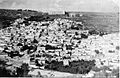
 Safad 1937
 -
 Mandate Police station at Mount Canaan, above Safed (1948)
 -
 Safed (1948)
 -
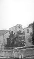
 Safed Citadel (1948)
 -
 Safad Municipal Police Station after the battle (1948)
 -
 Bussel House, Safad, 11 April 1948:Yiftach Brigadeheadquarters
 -
 View of Safed from Mount Canaan (1948)
 -
 Mandate administration building on the eastern outskirts of Safed (1948)
 -
 Yiftach Brigade,with theirHotchkissmachine guns, based at Bussel House, 1948
 -
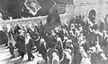 Druze parading in Safed after thePalmachvictory in 1948


State of Israel[edit]
In 1974, 25 Israeli Jews (mainly school children) from Safed, were killed in theMa'alot massacre.Over 1990s and early 2000s, the town accepted thousands of Russian Jewish immigrants and EthiopianBeta Israel.[141]In July 2006,"Katyusha"rockets fired byHezbollahfrom Southern Lebanon hit Safed, killing one man and injuring others. Many residents fled the town for the duration of the conflict.[142]On July 22, four people were injured in a rocket attack.
The town has retained its unique status as a Jewish studies centre, incorporating numerous facilities.[141]In 2010, eighteen senior rabbis led by the chief rabbi of Safed,Shmuel Eliyahu,issued an edicturging the city's residents not to rent or sell property to Arabs, warning of an "Arab takeover"; Arabs constitute a fractional proportion of the population, and the statement was generally perceived to be directed at the 1,300 Arab students enrolled atZefat Academic College.[143][144][145]
Demographics[edit]
In 2008, the population of Safed was 32,000.[146]According toCBSfigures in 2001, the ethnic makeup of the city was 99.2%Jewishand non-Arab, with no significantArabpopulation. 43.2% of the residents were 19 years of age or younger, 13.5% between 20 and 29, 17.1% between 30 and 44, 12.5% from 45 to 59, 3.1% from 60 to 64, and 10.5% 65 years of age or older.
The city is home to a relatively large community ofHaredi Jews.[143]The village ofAkbarain the city's southwestern outskirts, which had a population of about 500 Arab Muslims, most of whom belonged to a single clan, the Halihal, is under Safed's municipal jurisdiction.[147]
Mayors[edit]
- 1948–1955 -Moshe Pedehzur
- 1955–1965 -Avraham Hacohen
- 1965–1967 - Meir Meiber
- 1967–1971 - Yakov Hopert
- 1971–1973 - Eli Kadosh
- 1973–1983 - Aharon-Raphael Nahmias
- 1983–1993 - Zeev Perl
- 1993–1998 - Moshe Hania
- 1998–2001 - Yossef Oz
- 2001–2003 - Oded Hameiri
- 2003–2008 - Yishai Maimon
- 2008–2018 - Ilan Shohat
- 2018–2024 - Shuki Ohana
- 2024-present - Yossi Kakon
Seismology[edit]
The city is located above theDead Sea Transform,and is one of the cities in Israel most at risk ofearthquakes(along with Tiberias,Beit She'an,Kiryat Shmona,andEilat).[148]
Geography[edit]
Safed is 40 kilometers (25 mi) east of Acre and 20 kilometers (12 mi) north of Tiberias.[39]
Climate[edit]
Safed has aMediterranean climate(Köppen climate classification:Csa) with hot, dry summers and cool, rainy and occasionally snowy winters. The city receives 682 mm (27 in) of precipitation per year. Summers are rainless and hot with an average high temperature of 31 °C (88 °F) and an average low temperature of 20 °C (68 °F). Winters are cool and wet, and precipitation is occasionally in the form of snow. Winters have an average high temperature of 10 °C (50 °F) and an average low temperature of 5 °C (41 °F).
| Climate data for Safed (Har Kenaan) (2004-2022, extremes 1939–present) | |||||||||||||
|---|---|---|---|---|---|---|---|---|---|---|---|---|---|
| Month | Jan | Feb | Mar | Apr | May | Jun | Jul | Aug | Sep | Oct | Nov | Dec | Year |
| Record high °C (°F) | 21.7 (71.1) |
26.7 (80.1) |
30.9 (87.6) |
34.5 (94.1) |
38.1 (100.6) |
40.0 (104.0) |
39.0 (102.2) |
42.0 (107.6) |
40.6 (105.1) |
36.0 (96.8) |
30.1 (86.2) |
24.4 (75.9) |
42.0 (107.6) |
| Mean daily maximum °C (°F) | 10.3 (50.5) |
12.2 (54.0) |
15.6 (60.1) |
20.5 (68.9) |
25.3 (77.5) |
28.6 (83.5) |
30.6 (87.1) |
30.4 (86.7) |
28.5 (83.3) |
24.8 (76.6) |
18.1 (64.6) |
12.6 (54.7) |
21.4 (70.5) |
| Daily mean °C (°F) | 7.6 (45.7) |
9.1 (48.4) |
11.7 (53.1) |
15.9 (60.6) |
20.1 (68.2) |
23.1 (73.6) |
25.2 (77.4) |
25.2 (77.4) |
23.4 (74.1) |
20.4 (68.7) |
14.8 (58.6) |
10.0 (50.0) |
17.2 (63.0) |
| Mean daily minimum °C (°F) | 5.0 (41.0) |
6.0 (42.8) |
7.9 (46.2) |
11.3 (52.3) |
14.9 (58.8) |
17.6 (63.7) |
19.9 (67.8) |
20.0 (68.0) |
18.4 (65.1) |
15.9 (60.6) |
11.4 (52.5) |
7.3 (45.1) |
13.0 (55.3) |
| Record low °C (°F) | −6.4 (20.5) |
−9.0 (15.8) |
−3.4 (25.9) |
0.2 (32.4) |
5.7 (42.3) |
8.7 (47.7) |
12.2 (54.0) |
13.0 (55.4) |
10.7 (51.3) |
5.9 (42.6) |
−1.7 (28.9) |
−3.2 (26.2) |
−9.0 (15.8) |
| Average rainfall mm (inches) | 182.1 (7.17) |
122.9 (4.84) |
61.4 (2.42) |
34.8 (1.37) |
12.3 (0.48) |
0.1 (0.00) |
0.0 (0.0) |
0.8 (0.03) |
3.3 (0.13) |
21.3 (0.84) |
72.3 (2.85) |
143.4 (5.65) |
654.7 (25.78) |
| Average rainy days(≥ 0.1 mm) | 14.3 | 11.3 | 9.7 | 5.0 | 2.9 | 0.2 | 0.0 | 0.1 | 1.1 | 4.3 | 7.8 | 11.3 | 67.9 |
| Source: Israel Meteorological Service[149][150] | |||||||||||||
Education[edit]


According to CBS, the city has 25 schools and 6,292 students. There are 18 elementary schools with a student population of 3,965, and 11 high schools with a student population of 2,327. 40.8% of Safed's 12th graders were eligible for a matriculation (bagrut) certificate in 2001. TheZefat Academic College,originally an extension ofBar-Ilan University,was granted independent accreditation by Israel's Council of Higher Education in 2007.[151]For the 2011–2012 school year, the college began a program designed specifically forHaredi Judaism.[152]It was created in order to allow haredi women living in the Upper Galilee access to higher education, while still maintaining strict religious practice.[152]The program accomplishes this goal through separate classes for male and female students.[152]The classes are also taught during certain hours as to allow women to fulfill other aspects of their religiosity.[152]
In October 2011, Israel's fifth medical school opened in Safed, housed in a renovated historic building in the centre of town that was once a branch ofHadassah Hospital.[153]
The Azrieli Faculty of Medicine opened in 2011 as an extension of Bar-Ilan University, created to train physicians in the Upper Galilee region.[154]The schools conducts clinical instructions in six hospitals in the region:
- Baruch Padeh Medical Center
- Ziv Medical Center
- Western Galilee Hospital
- EMMS Nazareth Hospital
- The Holy Family Hospital
- Mazra Mental Health Center[154]
TheLivnot U'Lehibanotprogram in Safed provides an open, non-denominational atmosphere for young Jewish adults that combines volunteering, hiking and study with exploring Jewish heritage.[155]
Sharei Bina is a program for women who have just finished high school and want to study in aseminaryin Safed for one year that teaches young women who want to experience Jewish spirituality in the mystical city of Safed.[156]In comparison to other seminaries, Sharei Bina includes the study of theshekhinahand other Kabbalist rituals in the learning.[157]
On March 8, 2021, the IsraeliPrime-MinisterBenjamin Netanyahuannounced that Israel is to establish its 10th university in Safed, after a growing need for a university in thenorthern district of Israel.Plans have been in place to establish a university in theGalileesince 2005, but no progress was made until 2015 when Netanyahu vowed to start working on the project during a Galilee Conference.[158]
Culture[edit]

Artists' colony[edit]
In the 1950s and 1960s, Safed was known as Israel's art capital. An artists' colony established in the old Arab quarter was a hub of creativity that drew artists from around the country, among themYitzhak Frenkel,Yosl Bergner,Moshe Castel,Menachem Shemi,Shimshon HolzmanandRolly Schaffer.
In honor of the opening of the Glitzenstein Art Museum in 1953, the artistMane Katzdonated eight of his paintings to the city. Today the area contains a large number of galleries and workshops run by individual artists and art vendors. There are several museums and galleries that function in the historical homes of major Israeli artists such as theFrenkel Frenel Museumand theBeit Castelgallery (inMoshe Castel's former home).[159][160][161]
Music[edit]
In the 1960s, Safed was home to the country's top nightclubs, hosting the debut performances ofNaomi Shemer,Aris San,and other singers.[162]Nowadays, Safed has been hailed as theklezmercapital of the world, hosting an annual Klezmer Festival that attracts top musicians from around the globe.[163][164]A school of world music, especially eastern music called Maqamat operates in theArtists' Quarter of Safed.[165]
Museums[edit]
- The Beit Hameiri museum documents Safed's Jewish community over the past 200 years.
- The Museum of the Art of Printing displays the first Hebrew printing press.
Historic sites[edit]

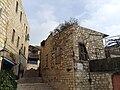
- Citadel Hill
The Citadel Hill, in Hebrew HaMetzuda, rises east of the Old City and is named after the huge Crusader and then Mamluk castle built there during the 12th and 13th centuries, which continued in use until being totally destroyed by the 1837 earthquake. Its ruins are still visible. On the western slope beneath the ruins stands the former British police station, still pockmarked by bullet holes from the 1948 war.
- Old Jewish Quarter
Before 1948, most of Safed's Jewish population used to live in the northern section of the old city. Currently home to 32 synagogues, it is also referred to as the synagogue quarter and includes synagogues named after prominent rabbis of the town: theAbuhav,Alsheich,Karoand two named for RabbiIsaac Luria:oneAshkenazi,the other Sephardi.
- Mamluk-period buildings
Further south are two monumental Mamluk-period buildings:
- the Red Mosque with a khan (1276)
- the Mamluk mausoleum, now used byfreemasons.The mausoleum was built for a Mamlukna'ib(governor) of Safed, Muzaffar ad-Din Musa ibn Hajj al-Ruqtay Musa Muzaffar al-Din ibn Ruqtay al-Hajj, who died in AH 762/AD 1360–61).[166][167]
Southeast of the Artists' Quarter is theSaraya,the fortified governor's residence built by Zahir al-Umar (1689/90–1775).
A report about the "obliteration of non-Jewish historic sites in Safed" mentions a mausoleum, an ancient grave and an ancient mosque that was converted into a clubhouse.[168]
Notable people[edit]
Twin towns — sister cities[edit]
Safed istwinnedwith:
 Erzsébetváros,Budapest,Hungary
 Guarda,Portugal[169]
 Lille,France[170]
 Nikopol,Bulgaria[171]
 Palm Beach County,Florida,United States
 Toledo,Castile–La Mancha,Spain
Gallery[edit]
-
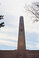 Monument to the Israeli soldiers who fought in the1948 Arab–Israeli War
 -
 Safed in 2009
 -
 View of Safed
 -
 View of Safed
 -
 Houses in Safed
 -
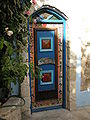 Doorway inBeit Castelgallery, Safed


See also[edit]
- List of clock towers– Safed has its own, the Ottoman clock tower of the "Saraya" (government house), inaugurated in 1900
Notes[edit]
- ^Abbas is quoted as saying "People were motivated to run away... They feared retribution from Zionist terrorist organizations – particularly from the Safed ones. Those of us from Safed especially feared that the Jews harbored old desires to avenge what happened during the 1929 uprising.... They realized the balance of forces was shifting and therefore the whole town was abandoned on the basis of this rationale – saving our lives and our belongings."[138]In 2012 Abbas stated "I visited Safed before once. I want to see Safed. It's my right to see it, but not to live there."[139]
References[edit]
- ^Erhard Gorys (1996).Heiliges Land.Kunst-Reiseführer (in German). Cologne: DuMont. p. 267.ISBN3-7701-3860-0.
Der ägyptische Pharao Thutmosis III (1490-1436) erwähnte in seiner Liste der eroberten Städte Kanaans auch Saft, das möglicherweise mit Zefat identisch war. (The Egyptian PharaoThutmose III(1490-1436) mentioned Saft in hislist of cities conquered in Canaan,which might be identical with Safed.)
- ^ab"Regional Statistics".Israel Central Bureau of Statistics.Retrieved21 March2024.
- ^"Safed | History, Location, & Facts | Britannica".britannica.Retrieved2022-05-21.
- ^"An in depth guide to the mystical city of Tzfat (or Safed)".Time Out Israel.Retrieved2022-05-21.
- ^"Safed".Jewish Virtual Library Article.RetrievedDecember 29,2022.
- ^abcdefAbbasi (2004) pp. 40–42.
- ^Morris (2004) 221–226.
- ^Hecht Museum (2013).After the School Of Paris(in English and Hebrew). Israel.ISBN9789655350272.
{{cite book}}:CS1 maint: location missing publisher (link) - ^"Artist Quarter of Safed".safed.co.il.Retrieved2023-10-24.
- ^"The School of Paris and the Artists' Quarter of Safed".Hecht Museum.24 October 2023.
- ^abcdVilnay, Zev(1972). "Tsefat".A Guide to Israel.Jerusalem,Palestine: HaMakor Press. pp. 522–532.
- ^"Planetware Safed Tourism".Planetware. Archived fromthe originalon 2011-08-12.Retrieved2012-01-07.
- ^"Hadassah Magazine".Hadassah.org. Archived fromthe originalon 2012-08-04.Retrieved2009-05-06.
- ^Matthew 5:14
- ^Ellicott's Commentary for Modern ReadersandMeyer's NT Commentaryon Matthew 5, both accessed 9 December 2016
- ^Geography of Israel: Safed,accessed 9 December 2016
- ^ab"Safed".Encyclopedia Judaica.Vol. 14.Jerusalem,Israel: Keter. 1972. p. 626.
- ^abcdDrory 2004, p. 163.
- ^Luz 2014, p. 33.
- ^abBarbé 2016, p. 63.
- ^abEllenblum 2007, p. 179, note 15.
- ^abcEllenblum 2007, p. 179, note 16.
- ^Barbé 2016, p. 58.
- ^Ellenblum 2007, p. 179.
- ^Ellenblum 2007, p. 180.
- ^Howard M. Sachar,Farewell Espana: The World of the Sephardim Remembered,Random House, 2013 p. 190.
- ^Barbé 2016, pp. 56, 59.
- ^Barbé 2016, p. 56.
- ^Barbé 2016, p. 59.
- ^Barbé 2016, p. 57.
- ^Barbé 2016, pp. 63, 59.
- ^Sachar 1994, p. 120.
- ^abSharon 2007, p.152
- ^Drory 2004, p. 164.
- ^Schechter, Solomon.Studies in Judaism: Second Series (Jewish Studies Classics 3),p. 206. Gorgias Press LLC, 2003.ISBN1-59333-039-1
- ^Barbé 2016, p. 68.
- ^abcdefLuz 2014, p. 34.
- ^Pringle 1985, p. 139.
- ^abcAmitai-Preiss 1995, p. 757.
- ^Luz 2014, pp. 34–35.
- ^abLuz 2014, p. 35.
- ^Holt 1995, p. 11.
- ^Amitai-Preiss 1995, pp. 757–758.
- ^abcdeAmitai-Preiss 1995, p. 758.
- ^abcDrory 2004, p. 165.
- ^Drory 2004, pp. 166–167.
- ^abDrory 2004, p. 166.
- ^Petersen, p. 73.
- ^abBarbé 2016, pp. 71–72.
- ^abSharon, 1997, p.xii
- ^Rhode 1979, pp. 16–17.
- ^Barbé 2016, pp. 72.
- ^Al-Dimashqi, p. 210, quoted in le Strange, p. 524
- ^Petersen, pp. 260–261.
- ^Abu'l Fida, p. 243, quoted in le Strange, p. 525
- ^Luz 2014, pp. 178–180.
- ^Luz 2014, p. 178.
- ^Luz 2014, pp. 178–179.
- ^Luz 2014, pp. 179–180.
- ^abLuz 2014, p. 180.
- ^Luz 2014, p. 179.
- ^Rhode 1979, p. 17.
- ^abRhode 1979, p. 18.
- ^abLayish 1987, p. 67.
- ^Rhode 1979, pp. 18–19.
- ^Rhode 1979, pp. 16–17, 25–26.
- ^abcdeAbbasi 2003, p. 50.
- ^Bernard Lewis (1954). "Studies in the Ottoman Archives–I".Bulletin of the School of Oriental and African Studies.16(3): 469–501.doi:10.1017/s0041977x00086808.S2CID162304704.
- ^Abraham David, 2010.pp. 95–96
- ^Bernard Lewis (1954). "Studies in the Ottoman Archives—I".Bulletin of the School of Oriental and African Studies, University of London.16(3): 469–501.doi:10.1017/S0041977X00086808.S2CID162304704.
- ^Rhode 1979, p. 34.
- ^abPetersen (2001), Gazetteer 6, s,v.Ṣafad
- ^abcRhode 1979, pp. 34–35.
- ^abEbied and Young 1976, p. 7.
- ^Layish 1987, p. 70.
- ^Layish 1987, p. 71.
- ^ab"Safed".Jewish Virtual Library.Retrieved2008-10-25.
- ^Jeseph Caro had true desire to do thenew Rabbinical Institution withHalakhick-Semikhahin fact, afterSpanish diaspora,the "figure ofRav"was not really represented by anyone; Joseph Caro writes that this was not possiblebecause a group of "arrogantmen "have done a little invasion of [his] centre
- ^Keneset Yiśraʼel be-Erets-Yiśraʼel. Ṿaʻad ha-leʼumi (1947).Historical memoranda.General Council (Vaad leumi) of the Jewish Community of Palestine. p. 56.
- ^Rhode 1979, p. 20.
- ^Abraham David (1988)."Demographic Changes in the Safed Jewish Community of the 16th Century".In Róbert Dán (ed.).Occident and Orient: a tribute to the memory of Alexander Scheiber.Brill Archive. pp. 86–87.ISBN9789630540247.
- ^"Ottomans and Safavids 17th Century".Michigan State University.Archived fromthe originalon 2000-08-17.Retrieved2008-10-25.
- ^Abraham David; Dena Ordan (2010).To Come to the Land: Immigration and Settlement in 16th-Century Eretz-Israel.University of Alabama Press. p. 117.ISBN978-0-8173-5643-9.Retrieved24 October2011.
- ^Dave Winter (1999).Israel Handbook: With the Palestinian Authority Areas.Footprint Handbooks. p. 714.ISBN978-1-900949-48-4.
The Saraya was originally built as a caravanserai in the Ottoman period, though it was later used by both the Turks and the British as an administrative building.
- ^Abu-Husayn 1985, pp. 83–84.
- ^Abu-Husayn 1993, pp. 5–7.
- ^Abu-Husayn 1985, p. 99.
- ^Abu-Husayn 1985, p. 121.
- ^Edward Robinson (1841).Biblical Researches in Palestine, Mount Sinai and Arabia Petraea: a journal of travels in the year 1838.Crocker and Brewster. p.333.Retrieved4 October2010.
- ^abcdFinkelstein 1960, p. 63.
- ^Joel Rappel.History of Eretz Israel from Prehistory up to 1882(1980), Vol.2, p.531. "In 1662 Sabbathai Sevi arrived to Jerusalem. It was the time when the Jewish settlements of Galilee were destroyed by the Druze: Tiberias was completely desolate and only a few of former Safed residents had returned..."
- ^Barnai, Jacob.The Jews in Palestine in the Eighteenth Century: under the patronage of the Istanbul Committee of Officials for Palestine(University of Alabama Press 1992)ISBN978-0-8173-0572-7;p. 14
- ^abSalibi 1988, p. 66.
- ^Petersen 2001, p. 261.
- ^Joudah 1987, p. 24.
- ^Cohen 1973, p. 83.
- ^Cohen 1973, pp. 84–85.
- ^Cohen 1973, pp. 93–95.
- ^Sa'ar H.When Israel trembles: former earthquakes.Ynet online. 11.05.2012.(in Hebrew)
- ^Morgenstern 2006, p.
- ^abcdeFranco 1916, p. 633.
- ^Morgenstern 2006, p. 72.
- ^Morgenstern 2006, p. 60.
- ^Morgenstern 2006, p. 61.
- ^abSafi, Khaled M. (2008),"Territorial Awareness in the 1834 Palestinian Revolt",in Roger Heacock (ed.),Of Times and Spaces in Palestine: The Flows and Resistances of Identity,Beirut: Presses de l'Ifpo,ISBN9782351592656
- ^Sicker 1999, p. 13.
- ^abLieber 1992, p.256.
- ^Thomas A. Idinopulos (1998).Weathered by Miracles: A History of Palestine from Bonaparte and Muhammad Ali to Ben-Gurion and the Mufti.Ivan R. Dee. p. 63.ISBN978-1-56663-189-1.
- ^Lieber 1992, pp. 256–257.
- ^abAmbraseys, N. N. (25 November 1997). "The earthquake of 1 January 1837 in Southern Lebanon and Northern Israel".Annals of Geophysics.40(4).doi:10.4401/ag-3887.hdl:2122/1595.
- ^abcAbbasi 2003, p. 52.
- ^abcdAbbasi 2003, p. 54.
- ^abcdAbbasi 2003, p. 56.
- ^Abbasi 2003, p. 55.
- ^Abū Mannah, Weismann and Zachs 2005, p.178.
- ^abAbbasi 2003, p. 51.
- ^Abbasi 2003, pp. 50–51.
- ^abcdefghAbbasi 2003, p. 53.
- ^Masterman, E. W. G. (1914-10-01)."Safed".Palestine Exploration Quarterly.46(4): 169–179.doi:10.1179/peq.1914.46.4.169.ISSN0031-0328.
- ^Abbasi 2003, pp. 53–54.
- ^abcSchumacher, 1888, p.188
- ^Layish 1987, pp. 68, 71.
- ^Deeb 1996, p. 1.
- ^Abbasi 2003, pp. 55–56.
- ^Petersen 2001, p. 259.
- ^Barron, 1923, p.6
- ^"Arab Attack At Safed",The Times,Saturday, August 31, 1929; p. 10; Issue 45296; col D.
- ^General Assembly Resolution of 29 November 1947: Retrieved 3 March 2014Archived24 May 2012 at theWayback Machine
- ^Martin (2005). Routledge Atlas of the Arab-Israeli Conflict. Routledge.ISBN0-415-35901-5.
- ^Martin GilbertIsrael, A historyWilliam Morrow & Co, NY 1998ISBN0-688-12362-7p. 174
- ^Benny Morris,1948, The First Arab-Israeli War,2008 Yale University Press, p. 157
- ^abGilbert, 1998, p. 177
- ^"1948".Yale University Press. April 28, 2008 – via Internet Archive.
- ^Morris, 2004, p. 223
- ^Broadmead to HC, 5 May 1948, SAMECA CP III\5\102. Quoted in Morris, 2004, p. 223
- ^Morris 2004, page 224 quoting unnamed source fromBook of the Palmah II
- ^Morris, 2004, page 224 quotingYigal AllonfromBook of the Palmah II
- ^abSarah Honig(July 17, 2009)."Another Tack: Self-exiled by guilt".The Jerusalem Post.
- ^Harriet Sherwood in Jerusalem (2012-11-04)."Mahmoud Abbas outrages Palestinian refugees by waiving his right to return | World news".The Guardian.London.Retrieved2013-03-12.
- ^Benny Morris,'Was Israeli looting in '48 part of a broader policy to expel Arabs?,'Haaretz3 June 2021.
- ^ab"Safed".safed.co.il.RetrievedMay 12,2012.
- ^Myre, Greg (2006-07-15)."2 More Israelis Are Killed as Rain of Rockets From Lebanon Pushes Thousands South".The New York Times.Retrieved2008-10-25.
- ^abSherwood, Harriet (7 December 2010)."Dozens of Israeli rabbis back call to forbid sale of property to Arabs".The Guardian.Retrieved9 June2020.
- ^Ashkenazi, Eli (28 April 2011)."Safed Rabbi Boasts That anti-Arab Edict Worked".Haaretz.Retrieved9 June2020.
- ^Cook, Jonathan (8 November 2010)."Safed 'the most racist city' in Israel".The National.Retrieved9 June2020.
- ^"Table 3 – Population of Localities Numbering Above 1,000 Residents and Other Rural Population"(PDF).Israel Central Bureau of Statistics.2008-06-30.Retrieved2016-06-04.
- ^Hassin, Tal (4 August 2020)."A New Racist Reality for the Arabs of Safed".Haaretz.Retrieved9 June2020.
- ^Experts Warn: Major Earthquake Could Hit Israel Any TimeBy Rachel Avraham, staff writer for United With Israel Date: Oct 22, 2013
- ^"Climate Atlas".Israel Meteorological Service.RetrievedJanuary 22,2023.
- ^"Meteorological Database".Israel Meteorological Service.RetrievedJanuary 22,2023.
- ^"המכללה האקדמית צפת".
- ^abcdOmer-Man, Michael (9 December 2011)."Safed college opens track for haredi women".The Jerusalem Post.ProQuest913691816.
- ^"New Medical School to Open in Safed".Haaretz.2011-10-30.
- ^ab"About." About | The Azrieli Faculty of Medicine | Bar-Ilan University. Accessed December 02, 2018.http://medicine.biu.ac.il/en/node/3
- ^"Israel Programs – Kahal – Inspiration Center." Livnot U'Lehibanot. November 19, 1970. Accessed December 02, 2018.https:// livnot.org/
- ^"Safed HOME." Rabbi Cordovero. Accessed December 02, 2018.https:// safed.co.il/open-learning-environment-for-women.html
- ^Rothenberg, Jennie (April 2005). "Ghosts, Artists & Kabbalists; the struggle for the soul of Tsfat".Moment.p. 42.ProQuest228062899.
- ^"Israel to establish its 10th university in Safed".ynetnews.2021-03-09.Retrieved2021-03-12.
- ^"Paintings | Moshe Castel Gallery | Israel".Moshecastelgallery.Archived fromthe originalon 2019-08-12.Retrieved2019-08-12.
- ^"FRENKEL FRENEL MUSEUM".frenkel-frenel.org.Retrieved2019-08-10.
- ^Israel Travel News,Spotlight – A Spiritual Journey of Safedaccess date: 24/1/2018
- ^Ashkenazi, Eli."An Inside Job?".Haaretz.Retrieved2008-10-25.
- ^"Klezmer Festival 2019 in Safed".
- ^Davis, Barry (2009-08-10)."You can take the music out of the shtetl".Fr.jpost.Retrieved2012-01-07.
- ^"Maqamat School of Eastern Music - WOMEX".womex.Retrieved2023-12-27.
- ^Thomas Philipp; Ulrich Haarmann, eds. (1998).The Mamluks in Egyptian Politics and Society.Cambridge Studies in Islamic Civilization.Cambridge University Press.ISBN9780521591157.Retrieved24 January2018.
- ^"The Galilee Development Authority website".Archived fromthe originalon 2018-01-25.Retrieved2018-01-24.
- ^Safed’s non-Jewish Treasures Face Disrespect and Vandalism-Haaretz
- ^"Geminações de Cidades e Vilas".Associação Nacional de Municípios Portugueses. Archived fromthe originalon 20 October 2022.Retrieved19 April2021.
- ^"La ville de Lille" met en veille "son jumelage avec Safed en Israël".leparisien.fr.31 August 2015. Archived fromthe originalon 18 December 2014.Retrieved11 December2014.
- ^[1]Archived2015-10-18 at theWayback Machine
Bibliography[edit]
- Abbasi, Mustafa (February 2003)."The Arab Community of Safad 1840–1918: A Critical Period"(PDF).Jerusalem Quarterly.17:49–58.
- Abbasi, Mustafa (February 2004)."The Battle for Safad in the War of 1948: A Revised Study".International Journal of Middle East Studies.36:21–47.
- Abu Mannah, Butrus; Weismann, Itzchak; Zachs, Fruma, eds. (2005).Ottoman Reform and Muslim Regeneration.I.B. Tauris.ISBN1-85043-757-2.
- Amitai-Preiss, R. (1995)."Ṣafad".InBosworth, C. E.;van Donzel, E.;Heinrichs, W. P.&Lecomte, G.(eds.).The Encyclopaedia of Islam, Second Edition.Volume VIII: Ned–Sam.Leiden: E. J. Brill. pp. 757–759.ISBN978-90-04-09834-3.
- Barbé, Hervé (2016). "Safed Castle and its Territory: Frankish Settlement and Colonisation in Eastern Upper Galilee during the Crusader Period". In Sinibaldi, Micaela; Lewis, Kevin J.; Balázs, Major; Thompson, Jennifer A. (eds.).Crusader Landscapes in the Medieval Levant: The Archaeology and History of the Latin East.Cardiff: University of Wales Press. pp. 55–80.ISBN978-1-78316-924-5.
- Barron, J.B., ed. (1923).Palestine: Report and General Abstracts of the Census of 1922.Government of Palestine.
- Cohen, Amnon (1973).Palestine in the 18th Century: Patterns of Government and Administration.Jerusalem: The Magnes Press.ISBN978-0-19-647903-3.
- Deeb, Mary-Jane(1996). "A Biographical Note". In Deeb, Mary-Jane;King, Mary E.(eds.).Hasib Sabbagh: From Palestinian Refugee to Citizen of the World.Lanham, Maryland and London: Middle East Institute and University Press of America.ISBN0-916808-43-2.
- Drory, Joseph (2004)."Founding a New Mamlaka".In Winter, Michael; Levanoni, Amalia (eds.).The Mamluks in Egyptian and Syrian Politics and Society.Brill.ISBN9789004132863.
- Ebied, R. Y.; Young, M. J. L. (1975).Some Arabic Legal Documents of the Ottoman Period: From the Leeds Manuscript Collection University of Leeds, Dept. of Semitic Studies.Brill Archive.ISBN90-04-04401-9.
- Ellenblum, R.(2007).Crusader Castles and Modern Histories.Cambridge: Cambridge University Press.ISBN9781139462556.
- Franco, M. (1916). "Safed".The Jewish Encyclopedia: A Descriptive Record of the History, Religion, Literature, and Customs of the Jewish People from the Earliest Times to the Present Day.Vol. 10. New York and London: Funk and Wagnalls Company. pp. 633–636.
- Government of Palestine, Department of Statistics (1945).Village Statistics, April, 1945.
- Hadawi, S.(1970).Village Statistics of 1945: A Classification of Land and Area ownership in Palestine.Palestine Liberation Organization Research Center.
- Holt, P. M. (1995).Early Mamluk Diplomacy, 1260–1290: Treaties of Baybars and Qalāwūn with Christian Rulers.Leiden and New York: Brill.ISBN90-04-10246-9.
- Layish, Aharon (1987). ""Waqfs" and Ṣūfī Monasteries in the Ottoman Policy of Colonization: Sulṭan Selīm I's "waqf" of 1516 in Favour of Dayr al-Asad ".Bulletin of the School of Oriental and African Studies, University of London.50(1): 61–89.doi:10.1017/S0041977X00053192.JSTOR616894.S2CID161757141.
- Le Strange, G.(1890).Palestine Under the Moslems: A Description of Syria and the Holy Land from A.D. 650 to 1500.Committee of thePalestine Exploration Fund.
- Lieber, Sherman (1992).Mystics and missionaries: the Jews in Palestine, 1799–1840.University of Utah Press. p. [https://archive.org/details/mysticsmissionar0000lieb/.ISBN978-0-87480-391-4.
- Luz, Nimrod (2014).The Mamluk City in the Middle East: History, Culture, and the Urban Landscape.Cambridge: Cambridge University Press.ISBN978-1-107-04884-3.
- Mills, E., ed. (1932).Census of Palestine 1931. Population of Villages, Towns and Administrative Areas.Jerusalem: Government of Palestine.
- Morgenstern, Arie (2006).Hastening Redemption: Messianism and the Resettlement of the Land of Israel.Translated by Joel A. Linsider. New York: Oxford University Press.ISBN978-0-19-530578-4.
- Morris, B.(2004).The Birth of the Palestinian Refugee Problem Revisited.Cambridge University Press.ISBN0-521-00967-7.
- Petersen, Andrew (2001).A Gazetteer of Buildings in Muslim Palestine, Part 1.London: Council for British Research in the Levant.ISBN978-0-19-727011-0.
- Pringle, D.(1985). "Review Article: Reconstructing the Castle of Safad".Palestine Exploration Quarterly.117(2): 139–149.doi:10.1179/peq.1985.117.2.139.
- Rhode, H.(1979).The Administration and Population of the Sancak of Safad in the Sixteenth Century(PhD). Columbia University.
- Salibi, K.(1988).A House of Many Mansions: The History of Lebanon Reconsidered.University of California Press.ISBN978-0-520-07196-4.
- Schumacher, G.(1888)."Population list of the Liwa of Akka".Quarterly Statement - Palestine Exploration Fund.20:169–191.
- Sharon, M.(1997).Corpus Inscriptionum Arabicarum Palaestinae, A.Vol. 1. Brill.ISBN90-04-10833-5.
- Sharon, M.(2007).Corpus Inscriptionum Arabicarum Palaestinae, Addendum.Brill.ISBN978-90-04-15780-4.
- Sicker, Martin (1999).Reshaping Palestine: From Muhammad Ali to the British Mandate, 1831-1922.Westport and London: Praeger.ISBN0-275-96639-9.
External links[edit]
- City Council websiteArchived2021-08-02 at theWayback Machine
- zefat.net(in Hebrew)
- Tourist Information Center
- Nefesh B' Nefesh Community Guide for Tzfat
- Survey of Western Palestine, Map 4:IAA,Wikimedia commons;Safed on thePEFMap

| |||||||||||||||||||
| International | |
|---|---|
| National | |
| Geographic | |
| Other | |
- Safed
- Holy cities
- Cities in Northern District (Israel)
- Jewish pilgrimage sites
- Crusader castles
- Castles and fortifications of the Kingdom of Jerusalem
- Castles and fortifications of the Knights Templar
- Castles in Israel
- Ancient Jewish settlements of Galilee
- Ottoman clock towers
- Clock towers in Israel
- Holy cities of Judaism