
Salajka
Salajka
Салајка | |
|---|---|
 Salajka, Temerinska street | |
| Country | |
| Province | Vojvodina |
| District | South Bačka |
| Municipality | Novi Sad |
| Area | |
| • Total | 12.05 km2(4.65 sq mi) |
| Time zone | UTC+1(CET) |
| • Summer (DST) | UTC+2(CEST) |
| Area code | +381(0)21 |
| Car plates | NS |
Salajka(Serbian:Салајка), also known asSlavija(Serbian:Славија), is an urban neighborhood of the city ofNovi Sad,Serbia.
Borders
[edit]
The western and southern border of Salajka is Kisačka ulica (Kisač Street), the eastern border is Temerinska ulica (Temerin Street), and the northern border isDanube-Tisa-Danubechannel.
Neighbouring city quarters
[edit]The neighbouring city quarters are:Podbarain the east,Stari Gradin the south,Rotkvarijain the south-west,Banatić,Pervazovo NaseljeandIndustrijska Zona Jugin the west, andVidovdansko Naseljein the north, across the channel.
History
[edit]Between 1980 and 1989, the seat of theSlavijamunicipality, one of the former seven municipalities of Novi Sad City, was located in Salajka.
Sport
[edit]The play ground of the football club "Slavija"is located in Salajka.
Gallery
[edit]-
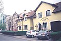
 Salajka, Karađorđeva street
 -
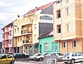
 Salajka, Temerinska street
 -
 Salajka, Jovana Cvijića street
 -
 Spiritual Church of Christ in Salajka


See also
[edit]References
[edit]- Jovan Mirosavljević, Brevijar ulica Novog Sada 1745-2001, Novi Sad, 2002.
- Zoran Rapajić, Novi Sad bez tajni, Beograd, 2002.
- Milorad Grujić, Vodič kroz Novi Sad i okolinu, Novi Sad, 2004.
External links
[edit]Wikimedia Commons has media related toSalajka.
