Salisbury, Connecticut
This articleneeds additional citations forverification.(May 2022) |
Salisbury, Connecticut | |
|---|---|
| Town of Salisbury | |
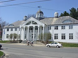
 Salisbury Town Hall | |
| Coordinates:41°59′06″N73°25′20″W/ 41.98500°N 73.42222°W | |
| Country | |
| U.S. state | |
| County | Litchfield |
| Region | Northwest Hills |
| Established / Incorporated | 1741[1] |
| Government | |
| • Type | Selectman-town meeting |
| • First selectman | Curtis G. Rand (D) |
| • Selectman | Chris Williams (D) |
| • Selectman | Don Mayland (R) |
| Area | |
| • Total | 60.1 sq mi (155.6 km2) |
| • Land | 57.3 sq mi (148.3 km2) |
| • Water | 2.8 sq mi (7.3 km2) |
| Elevation | 699 ft (213 m) |
| Population (2020) | |
| • Total | 4,194 |
| • Density | 70/sq mi (27/km2) |
| Time zone | UTC-5(Eastern) |
| • Summer (DST) | UTC-4(Eastern) |
| ZIP codes | 06039, 06068 06079 |
| Area code(s) | 860/959 |
| FIPS code | 09-66420 |
| GNISfeature ID | 0213500 |
| Website | salisburyct |
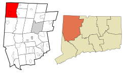
Salisbury(/ˈsɑːlzbɛri/) is atownsituated inLitchfield County, Connecticut,United States. The town is the northwesternmost in the state of Connecticut; the Massachusetts-New York-Connecticut tri-state marker is located at the northwestern corner of the town. The population was 4,194 at the2020 census.[2]The town is part of theNorthwest Hills Planning Region.
History
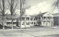
[edit]Salisbury was established and incorporated in 1741,[1][3]and contains several historic homes, though some were replaced by larger modern structures in the late 20th century. Salisbury was named forSalisbury,a city inEngland.[4]Historian Ed Kirby relates that traces of iron were discovered in what was to become Salisbury in 1728, with the discovery of the large deposit at Old Hill (later Ore Hill) in 1731 by John Pell and Ezekiel Ashley. From before theAmerican Revolution,through theFederal Periodof the nation, and untilcirca1920, Salisbury was the seat of an importantiron industry.[5]

Additional iron mines were opened, mostly in the western end of the town, although historian Diana Muir dismisses them as "scarcely big enough to notice," with the further disadvantage of not being near a river large enough to ship iron to market at a reasonable cost. The solution, according to Muir, was to pour labor into the iron, working it into a quality ofwrought ironso high that it could be used even forgun barrels.This fetched a high price and made Salisbury iron the celebrated choice of Connecticut's early nineteenth-century arms industry[6]as well as the preeminent source of cast-iron railroad car wheels until they were superseded by steel wheels. Peter P. Everts, an agent of the mid-19th-century mines, however, stated the quality of Salisbury iron varied.[7]The iron industry in Salisbury became inactive followingWorld War I,a plan to revive it duringWorld War IIwas never implemented, and the mines remain under water.[8]
Scoville Libraryin Salisbury was the first in the United States open to the public free of charge.[9]Salisbury is also home to the oldestMethodistchurch in New England, the Lakeville Methodist Church, constructed in 1789.[10]

Geography
[edit]Salisbury occupies the northwest corner of Litchfield County and the state of Connecticut. It is bordered to the north byBerkshire County, Massachusetts,and to the west byDutchess County, New York.Salisbury is 49 miles (79 km) northwest ofHartford,Connecticut's capital; 38 miles (61 km) south ofPittsfield, Massachusetts;and 39 miles (63 km) northeast ofPoughkeepsie, New York.
According to theUnited States Census Bureau,the town has a total area of 60.1 square miles (155.6 km2), of which 57.3 square miles (148.3 km2) are land and 2.8 square miles (7.3 km2), or 4.72%, are water. Within Salisbury there are several ponds and six lakes:Wononscopomuc,Washinee, Washining, Wononpakook, Riga Lake and South Pond. TheHousatonic Riverforms the eastern boundary of the town. Although the summit ofMount Frisselllies in Massachusetts at an elevation of 2,453 feet (748 m), the south slope of the mountain in Salisbury, is the highest point in Connecticut at 2,380 feet (730 m).
Principal communities
[edit]The town of Salisbury includes the CDP ofLakeville,and the hamlets of Amesville,Lime Rock,Salisbury, and Taconic (formerly Chapinville). Taconic is located in the northern section of Salisbury and is a seasonal community of approximately 200 in population, with a town green and US post office. Historically the areas of Joyceville, Ore Hill, Hammertown, Weatogue and Twin Lakes were recognized as separate communities but are no longer.[citation needed]
Demographics
[edit]| Census | Pop. | Note | %± |
|---|---|---|---|
| 1820 | 2,695 | — | |
| 1850 | 3,103 | — | |
| 1860 | 3,100 | −0.1% | |
| 1870 | 3,303 | 6.5% | |
| 1880 | 3,715 | 12.5% | |
| 1890 | 3,420 | −7.9% | |
| 1900 | 3,489 | 2.0% | |
| 1910 | 3,522 | 0.9% | |
| 1920 | 2,497 | −29.1% | |
| 1930 | 2,767 | 10.8% | |
| 1940 | 3,030 | 9.5% | |
| 1950 | 3,132 | 3.4% | |
| 1960 | 3,309 | 5.7% | |
| 1970 | 3,573 | 8.0% | |
| 1980 | 3,896 | 9.0% | |
| 1990 | 4,090 | 5.0% | |
| 2000 | 3,977 | −2.8% | |
| 2010 | 3,741 | −5.9% | |
| 2020 | 4,194 | 12.1% | |
| U.S. Decennial Census[11] | |||

As of thecensus[12]of 2000, there were 3,977 people, 1,737 households, and 1,042 families residing in the town. The population density was 69.4 inhabitants per square mile (26.8/km2). There were 2,410 housing units at an average density of 42.0 per square mile (16.2/km2). The racial makeup of the town was 95.75%White,1.66%African American,0.33%Native American,0.96%Asian,0.45% fromother races,and 0.85% from two or more races.HispanicorLatinoof any race were 1.53% of the population.
There were 1,737 households, out of which 25.5% had children under the age of 18 living with them, 50.4% weremarried couplesliving together, 7.2% had a female householder with no husband present, and 40.0% were non-families. 33.7% of all households were made up of individuals, and 15.3% had someone living alone who was 65 years of age or older. The average household size was 2.19 and the average family size was 2.81.
In the town, the population was spread out, with 22.4% under the age of 18, 3.7% from 18 to 24, 20.4% from 25 to 44, 31.9% from 45 to 64, and 21.6% who were 65 years of age or older. The median age was 47 years. For every 100 females, there were 89.2 males. For every 100 females age 18 and over, there were 83.4 males.
The median income for a household in the town was $53,051, and the median income for a family was $69,152. Males had a median income of $43,807 versus $29,861 for females. Theper capita incomefor the town was $38,752. About 4.9% of families and 7.8% of the population were below thepoverty line,including 7.6% of those under age 18 and 2.6% of those age 65 or over.
Parks and recreation
[edit]TheAppalachian Trailruns through Salisbury.
Mount Riga State Parkis located in Salisbury.
Sports
[edit]TheSalisbury Winter Sports Associationhostsski jumpingcompetitions at itsSatre Hillvenue in Salisbury. It has hosted United States Eastern Ski Jumping Championships each February since 1952.
The well-known automobile racing course ofLime Rock Parkis in the southeast corner of Salisbury.
Government
[edit]Salisbury has anopen town meetingform of government, with threeselectmen.
Education
[edit]Salisbury is a member of Regional School District 01, which also serves the towns ofCanaan,Cornwall,Kent,North Canaan,andSharon.Public school students attend Salisbury Central School (grades K–8), andHousatonic Valley Regional High School,which is inFalls Village.There are also three boarding schools in the town,Salisbury SchoolandHotchkiss School,both high schools, andIndian Mountain School,Pre-K through grade 9.
Media
[edit]The community is served by a weekly newspaper,The Lakeville Journal,and theRepublican-American,a daily newspaper based inWaterbury.The Salisbury Sampleris a 10-issue-per-year newsletter of community events, notices and news edited by the office of the Selectmen and mailed to all households. The Salisbury Association publishes a bi-annual newsletter covering the land trust, historical and civic committees news and activities. It is mailed to all households.
Infrastructure
[edit]Transportation
[edit]U.S. Route 44is the main east–west highway in the town, whileConnecticut Route 41is the main north–south highway. US 44 leads northeast 7 miles (11 km) toNorth Canaanand southwest 6 miles (10 km) toMillerton, New York.Route 41 leads south 8 miles (13 km) toSharonand north 17 miles (27 km) toGreat Barrington, Massachusetts.Connecticut Route 112runs diagonally, northwest to southeast, and connects withU.S. Route 7,which runs north–south parallel to theHousatonic River.
Notable people
[edit]
This sectionneeds additional citations forverification.(November 2012) |
- Ethan Allen(1738–1789), owned a blast furnace in Lakeville in the 1760s
- Charles B. Andrews(1834–1902),Governor of Connecticut(1878–1881)
- William Henry Barnum(1818–1889),congressmanandUS senator,longest-serving chairman of the U.S. Democratic Committee, president of Barnum & Richardson Company, lived in Lime Rock[13]
- Daniel Chipman(1765–1850), congressman fromVermont[14]
- Nathaniel Chipman(1752–1843), US senator from Vermont and Chief Justice of theVermont Supreme Court[15]
- Martin Chittenden(1763–1840), seventhgovernor of Vermont(1813–1815); born in Salisbury[16]
- Thomas Chittenden(1730–1797), first governor of Vermont[17]
- Jill Clayburgh(1944–2010),Academy Award-nominated actress; lived and died in Lakeville
- Maurice Firuski(1894–1978), bookseller, alumnus of Yale University
- Jeff Greenfield(born 1943), ABC television journalist and commentator
- Margaret Hamilton(1902–1985), actress who played theWicked Witch of the WestinThe Wizard of Oz;spent her last years in town
- Edward Herrmann(1943–2014),Emmy Award-winning actor
- Horace Holley(1781–1827),[18]minister ofHollis Street Churchand president ofTransylvania College
- John M. Holley(1802–1848), US congressman
- Myron Holley(1779–1841),Erie Canalbuilder
- Maria Bissell Hotchkiss(1827–1901), widow ofBenjamin B. Hotchkiss,foundedHotchkiss Schoolin Lakeville
- Josiah S. Johnston(1784–1833), US senator representingLouisiana
- Alfred Korzybski(1879–1950), founded theInstitute of General Semanticsat a country estate in Lime Rock and directed it until his death; institute remained there until 1981[19]
- Richmond Landon(1898–1971), Olympic gold medal winner
- Wanda Landowska(1879–1959),harpsichordist;resident of Lakeville from 1949 until death in 1959
- Laura Linney(born 1964),EmmyandGolden Globeaward-winning actress
- Frederick Miles(1815–1896), congressman from Connecticut[20]
- Peter Buell Porter(1773–1844), U.S. Secretary of War (1828–1829); born in town
- Joseph Schumpeter(1883–1950), economist; died in Taconic in 1950
- Jonathan Scoville(1830–1891), congressman
- Roy Sherwood(1932–2017), ski jumper in 1956 Olympics
- Georges Simenon(1903–1989), prolific Belgian author, most notably ofMaigretnovels; lived in house called "Shadow Rock Farm" in Lakeville
- Meryl Streep(born 1949), multiple Oscar-winning actress; lives in Salisbury with her family
- Rip Torn(1931–2019),Emmy Award-winning and Oscar-nominated actor
- Elisha Whittlesey(1783–1863), congressman
See also
[edit]References
[edit]- ^ab"The Town of Salisbury Connecticut".The Town of Salisbury Connecticut.RetrievedNovember 18,2012.
- ^"Census - Geography Profile: Salisbury town, Litchfield County, Connecticut".United States Census Bureau.RetrievedDecember 21,2021.
- ^Newberry Library -- Connecticut Atlas of Historical County BoundariesArchivedNovember 10, 2013, at theWayback Machine
- ^"Profile for Salisbury Connecticut".ePodunk.RetrievedNovember 18,2012.
- ^Ed Kirby,Echoes of Iron in Connecticut's Northwest Corner,Sharon Historical Society, 1998 p. 6
- ^Diana Muir,Reflections in Bullough's Pond: Economy and Ecosystem in New England,University of New England Press, 2002, p. 126.
- ^"Scientific American".books.google.1866.RetrievedJuly 31,2010.
- ^Hartford Courant,January 25, 1942
- ^"History".Scoville Memorial Library.RetrievedOctober 1,2013.
- ^"Lakeville United Methodist Church".Lakeville United Methodist Church.RetrievedOctober 1,2013.
- ^"Census of Population and Housing".Census.gov.RetrievedJune 4,2015.
- ^"U.S. Census website".United States Census Bureau.RetrievedJanuary 31,2008.
- ^"BARNUM, William Henry, (1818 - 1889)".Biographical Directory of the United States Congress.RetrievedNovember 18,2012.
- ^"CHIPMAN, Daniel, (1765 - 1850)".Biographical Directory of the United States Congress.RetrievedNovember 18,2012.
- ^"CHIPMAN, Nathaniel, (1752 - 1843)".Biographical Directory of the United States Congress.RetrievedNovember 18,2012.
- ^"Vermont Governor Martin Chittenden".National Governors Association.RetrievedNovember 18,2012.
- ^"Vermont Governor Thomas Chittenden".National Governors Association.RetrievedNovember 18,2012.
- ^Lee, Rebecca Smith (1962).Mary Austin Holley: a biography.Elma Dill Russell Spencer Foundation Series (Reprint (1987) ed.). Austin, TX: University of Texas Press. p. 41.ISBN0-292-75098-6.
- ^History of the Institute of General Semantics[permanent dead link]
- ^"MILES, Frederick, (1815 - 1896)".Biographical Directory of the United States Congress.RetrievedNovember 18,2012.


