
Semarang
Semarang | |
|---|---|
| City of Semarang Kota Semarang | |
| Other transcription(s) | |
| •Javanese | ꦏꦸꦛꦯꦼꦩꦫꦁ |
| •Pegon | سٓماراڠ |
Semarang city skyline Aerial view of theGreat Mosque of Central Java | |
 Flag  Coat of arms | |
| Nickname(s): Venetië van Java,LumpiaCity | |
| Motto(s): Kota ATLAS acronym ofAman, Tertib, Lancar, Asri, Sehat (Secure, Orderly, Swift, Beautiful, Healthy) | |
 Location withinCentral Java | |
| Coordinates:06°59′24″S110°25′21″E/ 6.99000°S 110.42250°E | |
| Country | |
| Region | Java |
| Province | |
| Government | |
| • Mayor | Hevearita Gunaryanti Rahayu(PDI-P) |
| • Vice Mayor | Vacant |
| Area | |
| •City | 373.78 km2(144.32 sq mi) |
| • Metro | 5,453.99 km2(2,105.80 sq mi) |
| Population | |
| •City | 1,694,740 |
| • Density | 4,500/km2(12,000/sq mi) |
| •Metro | 6,760,538 |
| • Metro density | 1,200/km2(3,200/sq mi) |
| [3] | |
| Demonym | Semarangan |
| Demographics | |
| •Ethnic groups | Javanese94.24% Chinese3.48% Others 2.28% |
| • Religion (2022)[4] | Islam87.20% Christianity12.05% -Protestant6.93% -Catholic5.12% Buddhism0.65% Hinduism0.07% Confucianismand others 0.02%[5] |
| Time zone | UTC+7(IWST) |
| Area code | (+62) 24 |
| Vehicle registration | H |
| NominalGDP[6] | 2023 |
| - Total | |
| - Per capita | |
| - Growth | |
| HDI(2023) | |
| Website | semarangkota |


Semarang(Javanese:ꦏꦸꦛꦯꦼꦩꦫꦁ,Pegon:سٓماراڠ) is the capital and largest city ofCentral Javaprovince inIndonesia.It was a major port during theDutchcolonial era,and is still an important regional center and port today. The city has been named as the cleanest tourist destination in Southeast Asia by the ASEAN Clean Tourist City Standard (ACTCS) for 2020–2022.[7]
It has an area of 373.78 km2(144.32 sq mi) and had a population of 1,555,984 at the 2010 census[8]and 1,653,524 at the 2020 census,[9]making it Indonesia's ninth most populous city[10]afterJakarta,Surabaya,Bekasi,Bandung,Medan,Depok,TangerangandPalembang;the official population estimate as at mid-2023 was 1,694,740, comprising 838,440 males and 856,310 females.[1]The built-upurban areahad 3,183,516 inhabitants at the 2010 census spread over two cities and 26 districts.[11]TheSemarang metropolitan area(a.k.a.Kedungsepur) has a population of over 6 million in 2020 (see Greater Semarang section). The population of the city is predominantlyJavanesewith significantChinesepresence.
History[edit]
Demak Sultanate(1547–1554)
Mataram Sultanate(1587–1705)
Dutch East India Company(1705–1799)
Dutch East Indies(1800–1942)
Empire of Japan(1942–1945)
United States of Indonesia(1949–1950)
The history of Semarang goes back to the 9th century, when it was known as Bergota. At the end of the 15th century, an Arab named Kyai Pandan Arang founded a village and an Islamic school in this fishing village. On 2 May 1547, Sultan Hadiwijaya of Pajang Kyai declared Pandan Arang the first bupati (mayor) of Semarang, thus creating Semarang administratively and politically.
In 1678, SunanAmangkurat IIpromised to give control of Semarang to theDutch East India Company(VOC) as a part of a debt payment.[12][13]In 1682, the Semarang state was founded by the Dutch colonial power. On 5 October 1705 after years of occupations, Semarang officially became a VOC city when SusuhunanPakubuwono Imade a deal to give extensive trade rights to the VOC in exchange of wiping outMataram's debt. The VOC, and later, theDutch East Indiesgovernment, establishedtobaccoplantations in the region and built roads and railroads, making Semarang an important colonial trading centre.[citation needed]
The historic presence of a large Indo (Eurasian) community in the area of Semarang is also reflected by the fact a creole mix language calledJavindoexisted there.[14]
Classical Indische Town (1678–1870)[edit]

Semarang was handed by theSultan of Mataramto the Dutch East Indies in 1678.[12]The city was pictured as a small settlement with a pious Muslim area calledKauman,a Chinese quarter, and a Dutch fortress. The fortress has a pentagonal form with only one gate in the south and five monitoring towers to protect the Dutch settlement from rebellion actions, segregating the spaces between Dutch settlement and other areas.[15]In fact, the city of Semarang was only referred to the Dutch quarter while the other ethnic settlement were considered as villages outside the city boundary. The city, known as de Europeesche Buurt, was built in classical European style with church located in the centre, wide boulevards, streets and villas.[16]According to Purwanto (2005),[17]the urban and architectural form of this settlement is very similar to the design principles applied in many Dutch cities.
Due to the long and costly Java War, there was not much funding from the Dutch East Indies government, and this affected Semarang's development. Most land in the area was used for rice cultivation and the only small improvement was the development of a surrounding fortress. Although less developed, Semarang is a fairly well organized city, in which urban activities were concentrated along the river and the settlement is linked to a market where different ethnic groups met to trade. The existence of the market, in the later years, become a primary element and a generator of urban economic growth.[18]
After the departure ofHerman Willem Daendels,Napoleonic governor of Java, the Dutch reorganized Java intoResidencies,and Semarang became the seat of the newSemarang Residencyin 1817. An important influence on urban growth was the Great Mail Road project in the 1847, which connected all the cities in the northern coast of Central and East Java and positioned Semarang as the trade centre of agricultural production.[19]The project was soon followed by the development of theStaatsspoorwegen Railwayand the connecting roads into the inner city of Semarang at the end of the 19th century.[18]Colombijn (2002)[19]marked the development as the shift of urban functions, from the former river orientation to all services facing the roads.
Modern city (1870–1922)[edit]

TheDutch East Indies' mail and railway projects improved communication and transportation, bringing an economic boom to the city in the 1870s. Hospitals, churches, hotels, and mansions were built along the new main roads of Mataram Street, Bojongscheweg, and Pontjolscheweg.[16]The Javanese quarters of town known askampongsgrew increasingly densely populated, reaching as many as 1000 inhabitants perhectareand degrading living conditions.[20]Mortality remained high into the early 20th century, with newcomers, overcrowding, and poor hygiene triggeringcholeraandtuberculousoutbreaks.[21]Dysentery,typhoid,andmalariawere also rife.[22]The city doctorWillem T. de Vogeladvocated strenuously for reducing overcrowding and improving living conditions by extending Semarang into the less malarial hill country to its south;[23]his fellow councilmanHendrik Tillemahad campaigned on a platform of combatting malaria and joined De Vogel's scheme, broadening it into a "village improvement" (Dutch:kampongverbetering) movement.[20]Purchasing land in the heights with their own money, the two men and some friends passed it on to the city with an initial zoning plan byKPC de Bazelin 1907 but could never convince a majority of the council to support its development.[22][23]Changing tack, Tillema then worked to improve the existing kampongs in the city's malarial districts by improving drainage and providing more sanitary public toilets and public housing.[20]
A decade later, the town approvedThomas Karsten's revised plan for the area, using it to build larger villas for the Dutch and wealthy Chinese and Javanese rather than allowing its use by the poor.[22][23][24]This area became known as Candi Baru (Dutch:Nieuw Tjandi) and forms the core of the present-day Candisari District. Although it remained highly stratified by class,[16]Candi Baru had less ethnic segregation than the older area of town and incorporated public squares, athletic facilities, and places for public bathing and washing that could be used communally.[25]With most work remaining in the lower city and transportation slow or expensive, few of the lower classes were interested in moving to the district[23]but it set a pattern that was followed with three more successful housing plans between 1916 and 1919. The population grew by 55%, adding 45,000 Javanese, 8500 Chinese, and 7000 Europeans. Karsten's approach to town planning emphasized its aesthetic, practical, and social requirements articulated in economic terms rather than purely racial ones.[25]
Driven by economic growth and spatial city planning, the city had doubled in size and expanded to the south by the 1920s, creating a nucleus of a metropolis where multi-ethnic groups lived and traded in the city. The villages in the suburbs such as Jomblang and Jatingaleh steadily became the satellite towns of Semarang, more populated with a bigger market area. Before the invasion of Japan in 1942, Semarang had already become the capital ofCentral Javaprovince, as the result of trade and industrial success and spatial planning.[16]
-

-
 A Chinese house in Semarang at the turn of the 20th century.
 -
 Aerial picture of Old Semarang area in the 1920s.
 -
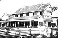
 Old0-6-0locomotive next to theLawang Sewubuilding.


Japanese occupation and early independence[edit]
TheJapanesemilitary occupied the city, along with the rest of Java, in 1942, during thePacific WarofWorld War II.During that time, Semarang was headed by a military governor called a Shiko, and two vice governors known as Fuku Shiko. One of the vice governors was appointed fromJapan,and the other was "chosen" from the local population.[citation needed]
AfterIndonesian independencein 1945, Semarang became the capital ofCentral Javaon 18 August 1945,[26]headed by Mr. Moch.Ichsan.[27]It also became the site of abattlebetween Indonesian and Japanese soldiers in October 1945.[28]
Administration[edit]
Semarang city administration is headed by mayor, with a legislative assembly. Both mayor and the 50 members oflegislative assemblyare elected by direct vote. The government of Semarang City had implemented the smart city concept since 2013.[29][30]
Juridically, Semarang City is a municipality (second level area) consisting of 16districts(kecamatan), which are again divided into 177urban villages(kelurahan). The districts are tabulated below with their areas and their populations at the 2010 census[8]and 2020 census,[9]together with the official estimates as at mid 2023.[1]The table also includes the number and names of the urbanadministrative villagesin each district.
| Kode Wilayah |
District (kecamatan) |
Area in km2 |
Pop'n census 2010 |
Pop'n census 2020 |
Pop'n estimate mid 2023 |
No. of villages |
Administrative villages (kelurahan) |
|---|---|---|---|---|---|---|---|
| 33.74.14 | Mijen
(Javanese:ꦩꦶꦗꦺꦤ꧀,romanized:Mijèn) |
56.52 | 55,708 | 80,906 | 89,950 | 14 | Cangkiran,Bubakan, Jatibarang, Jatisari, Karangmalang, Kedungpane, Mijen, Ngadirgo, Pesantren, Polaman, Purwosari, Tambangan, Wonolopo, Wonoplumbon, |
| 33.74.12 | Gunungpati
(Javanese:ꦒꦸꦤꦸꦁꦥꦛꦶ,romanized:Gunungpathi) |
58.27 | 88,444 | 98,023 | 100,750 | 16 | Cepoko, Gunungpati, Jatirejo, Kalisegoro, Kandri, Mangunsari, Ngijo, Nongkosawit, Pakintelan, Patemon, Plalangan, Pongangan, Sadeng, Sekaran, Sukorejo, Sumurejo |
| 33.74.11 | Banyumanik
(Javanese:ꦧꦚꦸꦩꦤꦶꦏ꧀,romanized:Banyumanik) |
29.74 | 136,368 | 142,076 | 143,430 | 11 | Pudakpayung,Gedawang,Jabungan,Padangsari,Banyumanik,Srondol Wetan, Pedalangan,Sumurboto,Srondol Kulon,Tinjomoyo,Ngesrep |
| 33.74.09 | Gajah Mungkur
(Javanese:ꦒꦗꦃꦩꦸꦁꦏꦸꦂ,romanized:Gajah Mungkur) |
9.34 | 59,911 | 56,232 | 56,350 | 8 | Bendanduwur,Bendanngisor,Bendungan,Gajahmungkur,Karangrejo, Lempongsari,Petompon,Sampangan |
| 33.74.07 | Semarang Selatan (South Semarang) (Javanese:ꦱꦼꦩꦫꦁꦏꦶꦢꦸꦭ꧀,romanized:Sěmarang Kidul |
5.95 | 69,617 | 62,030 | 62,180 | 10 | Barusari, Bulustalan, Lamper Kidul, Lamper Lor, Lamper Tengah, Mugassari, Peterongan, Pleburan, Randusari, Wonodri |
| 33.74.08 | Candisari
(Javanese:ꦕꦤ꧀ꦝꦶꦱꦫꦶ,romanized:Candhisari) |
6.40 | 75,879 | 75,456 | 75,610 | 7 | Candi,Jatingaleh,Jomblang,Kaliwiru,Karanganyargunung,Tegalsari,Wonotingal |
| 33.74.10 | Tembalang
(Javanese:ꦠꦼꦩ꧀ꦧꦭꦁ,romanized:Tĕmbalang) |
39.47 | 159,849 | 189,680 | 198,860 | 12 | Bulusan, Jangli, Kedungmundu, Kramas, Mangunharjo, Meteseh, Rowosari, Sambiroto, Sendangguwo, Sendangmulyo, Tandang, Tembalang |
| 33.74.06 | Pedurungan
(Javanese:ꦥꦼꦢꦸꦫꦸꦔꦤ꧀,romanized:Pědurungan) |
21.11 | 180,468 | 193,151 | 196,530 | 12 | Gemah, Kalicari, Muktiharjo Kidul, Palebon, Pedurungan Kidul, Pedurungan Lor, Pedurungan Tengah, Penggaron Kidul, Plamongan Sari, Tlogomulyo, Tlogosari Kulon, Tlogosari Wetan, |
| 33.74.05 | Genuk
(Javanese:ꦒꦼꦤꦸꦏ꧀,romanized:Genuk) |
25.98 | 92,314 | 123,310 | 132,470 | 13 | Bangetayu Kulon, Bangetayu Wetan, Banjardowo, Gebangsari, Genuksari, Karangroto, Kudu, Muktiharjo Lor, Penggaron Lor, Sembungharjo, Terboyo Kulon, Terboyo Wetan, Trimulyo |
| 33.74.04 | Gayamsari
(Javanese:ꦒꦪꦩ꧀ꦱꦫꦶ,romanized:Gayamsari) |
6.22 | 71,767 | 70,261 | 70,410 | 7 | Gayamsari,Kaligawe,Pandean Lamper,Sambirejo,Sawah Besar,Siwalan,Tambakrejo |
| 33.74.03 | Semarang Timur (East Semarang) (Javanese:ꦱꦼꦩꦫꦁꦮꦺꦠꦤ꧀,romanized:Sěmarang Wétan) |
5.42 | 74,782 | 66,302 | 66,480 | 10 | Bugangan, Karangtempel, Karangturi, Kebonagung, Kemijen, Mlatibaru, Mlatiharjo, Rejomulyo, Rejosari, Sarirejo, Bandarharjo |
| 33.74.02 | Semarang Utara (North Semarang) (Javanese:ꦱꦼꦩꦫꦁꦭꦺꦴꦂ,romanized:Sěmarang Lor) |
11.39 | 117,836 | 117,605 | 117,890 | 9 | Bulu Lor, Dadapsari, Kuningan, Panggung Kidul, Panggung Lor, Plombokan, Purwosari, Tanjungmas |
| 33.74.01 | Semarang Tengah (Central Semarang) (Javanese:ꦱꦼꦩꦫꦁꦩꦢꦾ,romanized:Sěmarang Madyå) |
5.17 | 60,312 | 55,064 | 55,210 | 15 | Bangunharjo, Brumbungan, Gabahan, Jagalan, Karangkidul, Kauman, Kembangsari, Kranggan, Miroto, Pandansari, Pekunden, Pendrikan Kidul, Pendrikan Lor, Purwodinatan, Sekayu |
| 33.74.13 | Semarang Barat (West Semarang) (Javanese:ꦱꦼꦩꦫꦁꦏꦸꦭꦺꦴꦤ꧀,romanized:Sěmarang Kulon) |
21.68 | 154,878 | 148,879 | 149,330 | 16 | Bojongsalaman, Bongsari, Cabean, Gisikdrono, Kalibanteng Kidul, Kalibanteng Kulon, Karangayu, Kembangarum, Krapyak, Krobokan, Manyaran, Ngemplaksimongan, Salamanmloyo, Tambakharjo, Tawangmas, Tawangsari |
| 33.74.16 | Tugu
(Javanese:ꦠꦸꦒꦸ,romanized:Tugu) |
28.13 | 29,436 | 32,822 | 33,800 | 7 | Jerakan, Karanganyar, Mangkang Kulon, Mangkang Wetan, Mangunharjo, Randu Garut, Tugurejo |
| 33.74.15 | Ngaliyan
(Javanese:ꦔꦭꦶꦪꦤ꧀,romanized:Ngaliyan) |
42.99 | 128,415 | 141,727 | 145,500 | 10 | Bambankerep, Beringin, Gondoriyo, Kalipancur, Ngaliyan, Podorejo, Purwoyoso, Tambak Aji, Wonosari |
Geography[edit]
Semarang is located on the northern coast of Java. The city of Semarang is one of the most important cities located on the north coast of Java and is the main hub connectingJakartaandSurabaya,and cities in the southern interior of JavaSurakartaandYogyakarta.Semarang City has a height ranging from 2 m (6.6 ft) below sea level up to 340 m (1,120 ft) above sea level with a slope of 0%–45%. Semarang City is a city that has a unique topographic condition in the form of a narrow lowland area and hilly areas extending from the west side to the east side of Semarang City. The city is located about 558 km (347 mi) east of Jakarta and 312 km (194 mi) west of Surabaya.
Lowland areas in Semarang City are very narrow. The lowland area in western Semarang only has a width of 4 km (2.5 mi) from the coastline, while in the eastern Semarang, the low-lying area has a width of 11 km (6.8 mi) from the coastline. This lowland area is a flood plain from the large rivers that flow in Semarang City, such as Kali Garang (West Flood Canal), Pengkol River, and Bringin River. This low-lying area stretches on the northern side of Semarang and covers almost 40% of the total area of Semarang. This lowland area is known as the lower town (Semarang Ngisor), as well as the center of the city's economic activity. Under these conditions, the lower city area is often hit by annual flooding and its peak during the rainy season. In a number of regions, especially North Semarang, floods are sometimes also caused by overflowing sea tides (tidal floods). The hilly area in Semarang stretches on the south side. These hills are part of a series of northern Java mountain ranges that stretch from Banten to East Java. The hilly area in the city of Semarang is known as the upper city (Semarang Dhuwur). This hilly region is also the upstream area of the big rivers that flow in the city of Semarang. The upper city area is also nearMount Ungaran.
Climate[edit]
Semarang features atropical rainforest climatethat borders on atropical monsoon climate(Am). The city features distinctly wetter and drier months, with June through August being the driest months. However, the average monthly rainfall does not fall below 60 mm (2.4 in), hence the tropical rainforest categorization. Semarang on average sees approximately 2,800 mm (110 in) of rain annually. Average temperatures in the city are relatively consistent, hovering around 28 °C (82 °F).Diurnal temperature variationslightly increases in the dry season.
| Climate data for Semarang | |||||||||||||
|---|---|---|---|---|---|---|---|---|---|---|---|---|---|
| Month | Jan | Feb | Mar | Apr | May | Jun | Jul | Aug | Sep | Oct | Nov | Dec | Year |
| Record high °C (°F) | 39 (102) |
37 (98) |
37 (98) |
37 (99) |
38 (101) |
38 (100) |
41 (106) |
38 (100) |
37 (99) |
38 (100) |
38 (100) |
39 (102) |
41 (106) |
| Mean daily maximum °C (°F) | 29 (85) |
29 (85) |
30 (86) |
31 (88) |
32 (89) |
32 (89) |
32 (89) |
32 (89) |
32 (90) |
32 (90) |
31 (88) |
30 (86) |
31 (88) |
| Daily mean °C (°F) | 27 (81) |
27 (81) |
28 (82) |
29 (84) |
29 (84) |
28 (83) |
28 (83) |
28 (83) |
29 (84) |
29 (84) |
28 (83) |
28 (82) |
28 (83) |
| Mean daily minimum °C (°F) | 25 (77) |
25 (77) |
25 (77) |
26 (78) |
26 (78) |
25 (77) |
24 (76) |
24 (76) |
25 (77) |
26 (78) |
26 (78) |
25 (77) |
25 (77) |
| Record low °C (°F) | 19 (66) |
22 (72) |
22 (72) |
22 (72) |
21 (70) |
20 (68) |
18 (64) |
18 (65) |
18 (64) |
20 (68) |
22 (72) |
22 (72) |
18 (64) |
| Average rainfall mm (inches) | 430 (16.9) |
360 (14.2) |
320 (12.6) |
230 (9.1) |
160 (6.3) |
80 (3.1) |
80 (3.1) |
60 (2.4) |
100 (3.9) |
160 (6.3) |
220 (8.7) |
330 (13.0) |
2,780 (109.4) |
| Average rainy days | 19 | 17 | 17 | 13 | 10 | 8 | 4 | 4 | 4 | 8 | 14 | 17 | 135 |
| Averagerelative humidity(%) | 82 | 82 | 80 | 79 | 75 | 72 | 68 | 67 | 66 | 69 | 76 | 81 | 75 |
| Averagedew point°C (°F) | 23 (74) |
23 (74) |
24 (75) |
23 (74) |
23 (74) |
22 (72) |
22 (71) |
21 (70) |
22 (71) |
22 (72) |
23 (74) |
23 (74) |
23 (73) |
| Mean dailysunshine hours | 5 | 6 | 6 | 8 | 8 | 8 | 10 | 10 | 10 | 9 | 8 | 6 | 8 |
| Mean dailydaylight hours | 12.5 | 12.3 | 12.1 | 12 | 11.8 | 11.7 | 11.8 | 11.9 | 12.1 | 12.3 | 12.4 | 12.5 | 12.1 |
| Averageultraviolet index | 12 | 12 | 12 | 12 | 11 | 10 | 10 | 12 | 12 | 12 | 12 | 12 | 12 |
| Source 1: Weatherbase[31] | |||||||||||||
| Source 2: Weather Atlas[32]and Time and Date[33](humidity only) | |||||||||||||
Semarang River and flood control[edit]
Like Singapore River, Semarang is constructing Semarang River at Banjir Kanal Barat (Garang River) near Karangayu Bridge. In the middle of July 2011, gardens in river banks and some traditional boats are available to use. The project will be finished in 2013 with river gardens, trotoars, garden lighting, water activities, art sites, sport sites and balconies and stairs for sightseeing.[34] In August 2011, a 421 m (1,380 ft) tunnel dodger at Kreo river has been finished and Jatibarang Dam construction can begin, with completion targeted for July 2013. The dam is planned to release 230 m3/s (8,100 cu ft/s) of flood water and will generate 1.5 MW of electricity, provide a drinking water resource and a boost to tourism.[35]
Demographics[edit]
| Year | Pop. | ±% |
|---|---|---|
| 1950 | 371,000 | — |
| 1955 | 424,374 | +14.4% |
| 1960 | 485,444 | +14.4% |
| 1965 | 552,128 | +13.7% |
| 1970 | 626,703 | +13.5% |
| 1975 | 782,967 | +24.9% |
| 1980 | 1,009,460 | +28.9% |
| 1985 | 1,125,836 | +11.5% |
| 1990 | 1,242,737 | +10.4% |
| 1995 | 1,333,157 | +7.3% |
| 2000 | 1,427,341 | +7.1% |
| 2005 | 1,438,733 | +0.8% |
| 2010 | 1,555,984 | +8.1% |
| 2015 | 1,698,777 | +9.2% |
| 2020 | 1,653,524 | −2.7% |
| 2022 | 1,659,975 | +0.4% |
| source:[36][37] | ||
The largest ethnic group in Semarang is theJavanese,followed by minorities of Chinese, Indian, Arabic, and others (including local ethnicities such asSundanese,Batak,Madura,Malay,Balinese,Arabs,Indian,etc.). The dominant religion isIslamwith a significantChristianminority.
Religion in Semarang 2023
Semarang has a large Chinese community. As in other regions of Java, especially in Central Java, they have mingled closely with the local population and use Javanese in communication for hundreds of years. About 3.5% of the city's population is ethnic Chinese, many residing in aChinatownin the vicinity of Gang Pinggir. The Chinatown is called "Kampong Pecinan Semawis" and expresses many aspects of traditional Chinese culture including foods, rituals, and houses of worship.
Economy[edit]
As the capital city of Central Java, and fifth largest city of Indonesia, the economy of Semarang is quite large. Semarang has transformed and changed dynamically towards a better direction. In a period of less than 10 years, Semarang Metropolitan continues to build a vital financial contribution to Indonesia due to the growing trade and industry and services. As a consequence, people's purchasing power increased, capital inflows, consumer confidence, and doing business indexes were relatively conducive to the development of severalCBDssuch asSimpang Lima City Center (SLCC),Pemuda Central Business District (PCBD),andGajahmada Golden Triangle (GGT).Major Indonesian and international financial and banking sectors alikes such asBank Mandiri,BCA,BNI,BRI,Panin Bank,HSBC,Bank Permata,Standard Chartered,RaboBank,Citibank,DBS,UOB,OCBC NISP,KEB Hana Bank,CIMB Niaga,andMaybankhave regional offices in Semarang.
The western part of the city has many industrial parks and factories. Like other metropolitan cities within Indonesia, due to a developing economy and increasing income, Semarang has many shopping malls.
Transportation[edit]
Road[edit]
Semarang is on theIndonesian National Route 1road, which connects it toMerakand Ketapang (Ban dục vọng i).Indonesian National Route 14towardBawenstarts here. Semarang has a toll road, theSemarang Toll Road.[39]The city is connected toSolobySemarang–Solo Toll Road.[40]
Semarang's largest bus terminals are Mangkang and Terboyo.[41]The primary means of public transportation is by minibus, called "bis".Ojek(motorcycle taxis),Angkot(share-taxi) micro-buses, taxi-cabs plays vital role in public transportation of the city.Go-JekandGrabhave online taxi andOjekservices.
Semarang is served bybus rapid transitcalledTrans Semarang,which operates in six routes.[42]Perum DAMRIalso serves in six designated routes in the city.
Rail[edit]

Semarang was connected toSurakarta(Solo) by a rail line in 1870.[43]At present there are two large train stations in Semarang:Semarang PoncolandSemarang Tawang.Semarang is connected toBandung,Jakarta,andSurabayaby inter-city train services.Kedungsepurcommuter rail connects Semarang Poncol Station eastward toNgrombo StationinGrobogan Regency.
Air[edit]

Semarang'sAhmad Yani International Airportis served by a number of operators includingAirAsia,Citilink,Batik Air,Garuda Indonesia,andLion Airwhich provide services toJakarta,Bali,Kuala Lumpur,andSingapore.[44]In 2018, the airport terminal was relocated to a new and much larger site; the old terminal continues to be used for government and military flights.[45]
Sea[edit]
The main seaport is theTanjung Masseaport.
Landmarks and places of interest[edit]


- Semarang old town(Kota Lama), which is sometimes referred to by locals as "Little Netherlands." It was established in the 18th century when Indonesia was a Dutch colony. There are more than 50 well-maintained colonial buildings in Kota Lama, displaying 18th, 19th, and 20th century European-influenced architecture.[46]
- China Town:Chinatownin Semarang has a night market known as 'Pasar Semawis', which is known for its cuisine and Chinese new year celebration.[47]
- Tugu Muda(Youth Monument) is a monument built to commemorate the services of the heroes who have fallen in theBattle of Five Days in Semarang.The height of Tugu Muda is 53 meters. Tugu Muda is located in front ofLawang Sewuat Pemuda street. It depicts the Tugu Muda fighting spirit and patriotism of Semarang residents, especially the youth who are persistent, self-sacrificing in high spirits maintaining the independence of Indonesia.[48]
- Lawang Sewu(Javanesefor "A Thousand Doors" ) was built as the headquarters of theDutch East Indies Railway Company.The colonial era building is reputedly a haunted house.[citation needed]
- Blenduk Church (Nederlandsch Indische Kerk) was built in 1753, the church is one of the oldest building in Kota Lama.
- TheSam Poo Kongtemple is the oldest Chinese temple in the city.[49]Tay Kak Sie Templewas established in 1746, it is dedicated toGuanyinBodhisattva and various Taoist Deities.
- Central Java Grand Mosque:This mosque has a Muslim museum, located at Jl. Gajah Raya. The architecture of the mosque is inspired by the mosques in Mecca and Medina.[50]
- Vihara Buddhagaya Watugong:The 45 m (148 ft) Buddhist temple has been named by MURI as the highest pagoda in Indonesia. It's located at Jl. Perintis Kemerdekaan Watugong, about 45 minutes drive from the center.
- Pancasila Square: Located within the heart of Simpang Lima City Center (SLCC) CBD; is an infamous public arena at the town center. It has tourist pedicabs, cars, bicycles, chairs, pedestrian track, public toilet, roller skates, traditional games, grass field and others.
Culture[edit]

Education[edit]

There are 593 elementary schools, 220 junior high schools, 106 senior high schools, and 88 vocational high schools, both public and private in Semarang.[51]
There are 20 universities in Semarang, 12 of them private and 8 public. The most renowned universities of Semarang areDiponegoro UniversityandSoegijapranataUniversity.
- Diponegoro University(UNDIP): It is one of national orstate-owned universitiesin Semarang, founded in 1957. The university has 11 faculties and 2 schools: Faculty of Economics and Business, Faculty of Social and Political Sciences, Faculty of Humanities, Faculty of Law, Faculty of Medicine, Faculty of Engineering, Faculty of Fishery and Marine Sciences, Faculty of Natural Sciences and Mathematics, Faculty of Public Health, Faculty of Animal Agriculture, Faculty of Psychology, Vocational School, and Postgraduate School. The university also offers a postgraduate program. Diponegoro University is one of the best university in Indonesia.[52]
- Semarang State UniversityinIndonesianUniversitas Negeri Semarang (UNNES): It is one of national orstate-owned universitiesin Semarang, founded in 1965. The university has 8 faculties and Postgraduate School: Faculty of Science Education, Faculty of Engineering, Faculty of Language and Art, Faculty of Sport Science, Faculty of Social Science, Faculty of Economics, Faculty of Law, and Faculty of mathematics and science.Semarang State Universityis one of the best university in Indonesia.
- Soegijapranata Catholic University(UNIKA): It is one of theprivate universitiesin Semarang, founded in 1982. There are 8 faculties in UNIKA: Faculty of Architecture and Design, Faculty of Law and Communication, Faculty of Engineering, Faculty of Language and Arts, Faculty of Economics and Business, Faculty of Agricultural and Technology, Faculty of Psychology, and Faculty of Computer Science.
- Muhammadiyah University of Semarang(UNIMUS): It is one of theprivate universitiesin Semarang, founded in 1996. On 4 August 1999 the Minister of Education and Culture of the Republic of Indonesia issued an Operational Permit for the University of Muhammadiyah Semarang with number: 139/D/O/1999. 14 study programs that obtained operational permits at the beginning of the opening in 1999 including: Public Health Study Program (Bachelor's degree), Statistics Study Program (Bachelor's degree), MechanicalEngineeringStudy Program (Bachelor and Diploma degree), Electrical Engineering Study Program (Bachelor and Diploma degree), Food Technology Study Program (Bachelor's degree), Agricultural Technology Study Program (Bachelor's degree), Management Study Program (Bachelor's degree), Company Administration Study Program (Diploma degree), Accounting Study Program (Diploma degree), English Language Study Program (Bachelor's degree), English Language Study Program (Diploma degree) and Japanese Language Study Program (Diploma degree).
- In Semarang, there is also a public university providing education through distance learning ordistance educationat Universitas Terbuka (Indonesia Open University).[53]
Sports[edit]
There are several sport centres in Semarang. Jatidiri sport centre orJatidiri Stadiumis one of the biggest sport centres in Semarang, located in Karangrejo, Gajahmungkur. The centre comprises a soccer field, in line skate track, tennis filed, climbing wall, swimming pool, and many others. The capacity of the centre is about 21,000 people.[54]
Knight Stadium is a futsal and basketball centre in Semarang, located in Grand Marina complex. There is a café and fitness centre in Knight Stadium.[55]
Cuisine[edit]

Semarang is widely known for itsbandeng presto(pressure-cooked milkfish),Lumpia,Wingko,Tahu Gimbal,andGanjel Rel.Semarang has also been called 'The city of Jamu' because it is an important centre for the production ofjamuwhich are a range of Indonesian herbal medicines that are popular across Indonesia[56]Semawis Market, also known as Pecinan Semarang (Semarang's Chinatown), hosts a plethora of street food vendors, offering a wide varieties of dishes.[57]
Festivals[edit]
Dugderanis an annual festival in Semarang desecrated to welcome the Ramadan month (a fasting month for Moslems). The word "dug" describes the sound of bedug (traditional Indonesian musical instrument). The word "der" describes the sound of fireworks.
The icon of the festival is a special puppet dragon-like animal called Warak Ngendog. The word "warak" stands for "holy" and the word "ngendog" expresses a reward for Muslims. Warak Ngendog's feet are chained, representing people's desire that should be postponed during this holy month. As Dugderan is a festival unique for Semarang, it represents an important attraction for both local people and visitors.[58]
Media[edit]
Suara Merdekais the major local newspaper in Semarang, as well as Central Java. Other major newspapers includeTribun JatengandWawasan.
Awards[edit]
Semarang has received the Adipura Award 6 times in a row since 2012. The Adipura Award is given for achievement in cleanliness and greenery at parks, streets, markets, shop buildings, premises, schools, even cleanliness of water ways and rivers.[59]Semarang City received the title of Best Smart Living and Best Smart Economy City in the Indonesia Smart Nation Award 2018.[60]
Greater Semarang[edit]
Greater Semarang (known asKedungsepur) was initially defined by the government as Semarang city,Semarang Regency,Salatigacity,Kendal Regency,andDemak Regency.[61]It was later extended to include the western part (12 districts only) ofGrobogan Regency.Despite the definition, rural and urban cores remain distinct and have not amalgamated into a continuous urban sprawl as is the case inGreater Jakarta.
| Administrative division | Area in km2 |
Pop'n 2010 census[63] |
Pop'n 2020 census[64] |
No. of districts |
No. of villages |
|---|---|---|---|---|---|
| City of Semarang | 373.78 | 1,555,984 | 1,653,524 | 16 | 177 |
| City of Salatiga | 57.36 | 170,332 | 192,322 | 4 | 23 |
| Demak Regency | 900.12 | 1,055,579 | 1,203,956 | 14 | 249 |
| Grobogan Regency(part)[65] | 1,396.32 | 797,160 | 888,581 | 12 | 191 |
| Kendal Regency | 1,118.13 | 900,313 | 1,018,505 | 20 | 286 |
| Semarang Regency | 950.21 | 930,727 | 1,053,094 | 19 | 235 |
| TotalKedungsepur | 4,795.92 | 5,410,095 | 6,009,982 | 85 | 1,161 |
Sources: BPS Jateng[66]
Notable people from Semarang[edit]
- Agung Laksono,politician and former Chairman of the House of Representatives.
- Jihane Almira Chedid,beauty queen.
- Anindya Kusuma Putri,Puteri Indonesia 2015and Top 15 ofMiss Universe 2015.
- Anne Avantie,fashion designer.
- Aries Susanti Rahayu,speed climbing world champion.
- Be Biauw Tjoan,Majoor-titulair der Chinezen, magnate,revenue farmerand bureaucrat
- Conrad Emil Lambert Helfrich,Dutch admiral.
- Daniel Sahuleka,Dutch musician.
- F. H. van Naerssen,Dutch professor of Indonesian and Malay and expert on Javanese epigraphy
- Fuad Hassan,politician, former Minister of Education and Culture.
- Hubertus van Mook,Dutch politician.
- Jaya Suprana,musician, writer, TV talkshow host, founder of MURI
- Lee Chin Koon,the father ofLee Kuan Yew,the founding father of modern daySingapore.
- Liem Bwan Tjie,architect.
- Max van Egmond,bass and baritone singer of Baroque and Renaissance music.
- Oei Hui-lan,First Lady of the Republic of China,international socialite and fashion icon.
- Oei Tiong Ham,Majoor-titulair der Chinezen, Chinese Indonesian tycoon.
- P. F. Dahler,politician, member ofInvestigating Committee for Preparatory Work for Independence(BPUPK).
- Purnomo Yusgiantoro,politician and former Minister of Defence.
- Raden Saleh,painter.
- Rob Nieuwenhuys,literary historian and author.
- Sri Oetari Ratna Dewi,politician
- Stella Cornelia,singer and actress, ex-member ofJKT48
- Sutiyoso,chief of Indonesian Intelligence Bureau (BIN).
- Tukul Arwana,comedian and television personality.
- Willem Einthoven,medical doctor, inventedelectrocardiography(ECG),Nobel Prizewinner.
Sister cities[edit]
Semarang istwinnedwith:
See also[edit]
Notes and references[edit]
Notes[edit]
References[edit]
- ^abcBadan Pusat Statistik, Jakarta, 28 February 2024,Kota Semarang Dalam Angka 2024(Katalog-BPS 1102001.3374)
- ^"Indonesia: Java Province (Regencies and Cities) - Population Statistics, Charts and Map".citypopulation.de.Archivedfrom the original on 19 June 2021.Retrieved5 November2020.
- ^Badan Pusat Statistik, Jakarta, 2023,Kota Semarang Dalam Angka 2023(Katalog-BPS 1102001.3374)
- ^"Peringatan".sp2010.bps.go.id.
- ^"Jumlah Penduduk Menurut Kabupaten Kota dan Agama di Provinsi Jawa Tengah, 2020".Badan Pusat Statistik Provinsi Jawa Tengah. 14 April 2021.Archivedfrom the original on 13 September 2022.Retrieved4 March2022.
- ^Badan Pusat Statistik Jawa Tengah(2023)."Provinsi Jawa Tengah Dalam Angka 2023".jateng.bps.go.id.Semarang: Badan Pusat Statistik.Retrieved29 May2024.
- ^"Semarang named cleanest tourist destination in Southeast Asia".The Jakarta Post.Archivedfrom the original on 20 January 2020.Retrieved20 January2020.
- ^abBiro Pusat Statistik, Jakarta, 2011.
- ^abBadan Pusat Statistik, Jakarta, 2021.
- ^"Jumlah Penduduk Kota Semarang"[Population of Semarang] (in Indonesian). Dinas Kependudukan dan Pencatatan Sipil Kota Semarang. October 2015. Archived fromthe originalon 7 August 2020.Retrieved28 December2016.
- ^"Indonesia: Java (Regencies, Cities and Districts) – Population Statistics, Charts and Map".citypopulation.de.Archivedfrom the original on 25 October 2015.Retrieved12 January2016.
- ^abStibbe, D. G., ed. (1919).Encyclopaedie van Nederlandsch-Indië, Derde Deel N-Soema(in Dutch) (2 ed.). s'-Gravenhage: Nijhoff. pp. 740–4.Archivedfrom the original on 29 November 2023.Retrieved13 November2021.
- ^Cribb, R. B. (2000).Historical atlas of Indonesia.Honolulu: University of Hawai'i Press. pp. 86–95.ISBN0-8248-2111-4.
- ^De Gruiter, Miel. "Javindo, a contact language in pre-war Semarang".(Peter Bakker & Maarten Mous. Mixed Languages: 15 Case Studies in Language Intertwining. Amsterdam: IFOTT. 1994.) pp. 151–159.
- ^Purwanto, L. M. F. (2005). Kota Kolonial Lama Semarang. Dimensi Teknik Arsitektur, 33(1), 27-33
- ^abcdPratiwo. (2005). The City Planning of Semarang 1900–1970. In F. Colombijn, M. Barwegen, P. Basundoro & J. A. Khusyairi (Eds.), Old City, New City: The History of the Indonesian City Before and After Independence. Yogyakarta: Penerbit Ombak.
- ^Purwanto, L. M. F. (2005). Kota Kolonial Lama Semarang. Dimensi Teknik Arsitektur, 33(1), 27-33.
- ^abNas, P. J. M., & Pratiwo. (2002). Java and De Groote Postweg, La Grande Route, the Great Mail Road, Jalan Raya Pos’. Bijdragen tot de Taal-, Land-en Volkenkunde, 158(4), 707–725.
- ^abColombijn, F. (2002). Introduction; On the road. Bijdragen tot de Taal-, Land-en Volkenkunde, 158(4), 595-617.
- ^abcCobban, J.L. (1993), "Public Housing in Colonial Indonesia, 1900–1940",Modern Asian Studies,vol. 27, no. 4, pp. 871–896.
- ^Silver, C. (2008),Planning the Megacity: Jakarta in the Twentieth Century,Psychology Press.
- ^abcSnijders, Emilius Paulus (10 March 1953),"Hoofdartikelen: Dr. W. Th. de Vogel 90 Jaar Terugblik op een Rijk Leven"(PDF),Nederlands Tijdschrift voor Geneeskunde,vol. 97, no. 12, pp. 714–717,archived(PDF)from the original on 6 May 2022,retrieved7 May2022.(Dutch)
- ^abcdVan Roosmalen, Pauline Katherina Maria (2017),"Modern Indisch Town Planning",The Life and Work of Thomas Karsten,Amsterdam: Architectura & Natura Press, pp. 265–303,archivedfrom the original on 6 May 2022,retrieved7 May2022.
- ^Winckel, Charles Willem Frederik (19 March 1955),"Personalia: In Memoriam Dr. W. Th. de Vogel"(PDF),Nederlands Tijdschrift voor Geneeskunde,vol. 99, no. 12, pp. 899–900,archived(PDF)from the original on 6 May 2022,retrieved7 May2022.(Dutch)
- ^abCote, J. (2004). Colonial designs: Thomas Karsten and the planning of urban Indonesia. Imprint, 2004, 01-01.
- ^"Tidak Langsung 34, Ada 8 Provinsi yang Baru Dibentuk pada Awal Kemerdekaan - Semua Halaman - Bobo".bobo.grid.id(in Indonesian).Archivedfrom the original on 31 October 2023.Retrieved14 August2020.
- ^"Daftar Walikota Semarang Sejak 1945 Hingga Sekarang".Seputar Semarang(in Indonesian). 5 May 2011.Archivedfrom the original on 17 July 2020.Retrieved14 August2020.
- ^Mukhti, M. F. (19 October 2017)."Orang Semarang Melawan Jepang".Historia(in Indonesian).Archivedfrom the original on 24 May 2019.Retrieved10 June2019.
- ^"Ketimpangan Kota Semarang Membaik meski Ekonomi Lesu".Okezone.Archivedfrom the original on 8 July 2019.Retrieved8 July2019.
- ^"Semarang residents may pay property tax through Go-Pay".The Jakarta Post.Archivedfrom the original on 8 July 2019.Retrieved8 July2019.
- ^"Weatherbase: Weather for Semarang, Indonesia".Weatherbase. 2011.Archivedfrom the original on 18 February 2023.Retrieved1 December2011.
- ^"Monthly weather forecast and climate = Semarang, Indonesia".Weather Atlas.Archivedfrom the original on 25 July 2020.Retrieved25 July2020.
- ^"Climate & Weather Averages in Semarang, Central Java, Indonesia".timeanddate.Archivedfrom the original on 19 October 2020.Retrieved18 October2020.
- ^Isti, Bambang (16 July 2011)."Eloknya Singapore River di Banjirkanal Barat".Suara Merdeka(in Indonesian). Archived fromthe originalon 28 December 2016.Retrieved28 December2016.
- ^Wijaya, Royce (13 August 2011)."Bendungan Utama Waduk Jatibarang Dikerjakan".Suara Merdeka.Archived fromthe originalon 10 May 2013.
- ^"Semarang Population 2020 (Demographics, Maps, Graphs)".Archivedfrom the original on 1 December 2020.Retrieved26 September2020.
- ^Badan Pusat Statistik, Jakarta, 2023.
- ^"Kewarganegaraan, Suku Bangsa, Agama, Bahasa, 2010 (PDF)"(PDF).Archived fromthe original(PDF)on 12 July 2017.Retrieved15 March2019.
- ^"Semarang".Jasa Marga. Archived fromthe originalon 4 December 2016.Retrieved28 December2016.
- ^Munir, Syahrul (6 December 2016). Alexander, Hilda B (ed.)."Tol Bawen-Salatiga Dijadwalkan Beroperasi Maret 2017".Kompas.Archivedfrom the original on 28 December 2016.Retrieved28 December2016.
- ^"Terminal Terboyo Rusak Parah, Terminal Mangkang Sepi".Jawa Pos(in Indonesian). 13 June 2016.Archivedfrom the original on 28 December 2016.Retrieved28 December2016.
- ^Purbaya, Angling Adhitya (8 December 2016)."Pengguna Angkutan Umum Meningkat, Kota Semarang Diganjar Penghargaan".detikNews(in Indonesian).Archivedfrom the original on 28 December 2016.Retrieved28 December2016.
- ^Cohen, Matthew Isaac (2006).The Komedie Stamboel: Popular Theater in Colonial Indonesia, 1891–1903.Ohio University Press. p. 90.ISBN978-0-89680-246-9.Archivedfrom the original on 29 November 2023.Retrieved4 November2020.
- ^"Flights".Semarang.Lonely Planet.Archivedfrom the original on 8 December 2015.Retrieved3 December2015.
- ^"Begini Penampakan Bandara Baru Ahmad Yani Semarang Menjelang Pengoperasian Halaman all".kompas(in Indonesian). 30 May 2018.Archivedfrom the original on 13 December 2019.Retrieved14 November2019.
- ^"The return of Semarang's Old Town".The Jakarta Post.Archivedfrom the original on 8 July 2019.Retrieved8 July2019.
- ^"Thousands flock to Semarang night market to celebrate Chinese New Year".The Jakarta Post.Archivedfrom the original on 8 July 2019.Retrieved8 July2019.
- ^"13 must-visit places in Semarang".The Jakarta Post.Archivedfrom the original on 3 December 2017.Retrieved3 December2017.
- ^Suherdjoko (8 February 2016)."It's Chinese New Year for all in Semarang".Loker Jateng.Archivedfrom the original on 26 November 2021.Retrieved8 February2016.
- ^"13 must-visit places in Semarang".The Jakarta Post.Archivedfrom the original on 8 July 2019.Retrieved8 July2019.
- ^"Data Referensi Pendidikan"(in Indonesian). Ministry of Education.Archivedfrom the original on 29 March 2019.Retrieved18 March2017.
- ^"Universitas Diponegoro (UNDIP) Semarang - Info 2020 & Jurusan | Quipper Campus".campus.quipper(in Indonesian).Archivedfrom the original on 11 October 2023.Retrieved30 September2020.
- ^"Universitas Terbuka Semarang".Archivedfrom the original on 12 June 2023.Retrieved29 November2023.
- ^"GOR Jatidiri".Seputar Semarang.25 May 2011.Archivedfrom the original on 7 April 2017.Retrieved18 March2017.
- ^"Knight Stadium Futsal".Seputar Semarang.4 May 2011.Archivedfrom the original on 1 February 2017.Retrieved18 March2017.
- ^Kamah, Wahyuni (26 March 2012)."Semarang: Indonesia's City of Jamu".The Jakarta Globe.Archived fromthe originalon 21 June 2013.
- ^"A guide to visiting Semarang".The Jakarta Post.Archivedfrom the original on 8 July 2019.Retrieved8 July2019.
- ^"Tradisi Dugderan di Kota Semarang".Mata Sejarah.Archived fromthe originalon 12 April 2017.Retrieved18 March2017.
- ^Yunita, Niken Widya (3 August 2017)."Pemkot Semarang Raih Adipura 6 Kali Berturut-turut".Detik News.Archivedfrom the original on 3 August 2017.Retrieved5 October2018.
- ^"Pemkot Semarang Raih Predikat Best Smart Living City".Tribun News.Archivedfrom the original on 8 July 2019.Retrieved8 July2019.
- ^Soetomo, Sugiono (2004)."Urban Development as the interface of Regional Development from Below in central Java – Indonesia: the Case of Semarang Metropolitan"(PDF).40th ISoCaRP Congress.International Society of City and Regional Planners.Archived(PDF)from the original on 3 March 2016.Retrieved28 December2016.
- ^"Sitarunas".sitarunas.atrbpn.go.id.Archivedfrom the original on 3 December 2020.Retrieved3 September2021.
- ^Biro Pusat Statistik, Jakarta, 2011.
- ^Badan Pusat Statistik, Jakarta, 2021.
- ^Only the western part of Grobogan Regency is included in the metropolitan area; the eastern part (7 districts covering 89 villages) is outside the area.
- ^"Profil Penduduk Jawa Tengah"(PDF).jateng.bps.go.id.Archived fromthe original(PDF)on 27 April 2017.Retrieved15 January2022.
- ^"Semarang – Indonesia".Brisbane City Council. Archived fromthe originalon 15 March 2011.
- ^Mardiani, Dewi (6 September 2012)."Kerja Sama Sister City Semarang-Da Nang Akan Ditingkatkan".Republika.Archivedfrom the original on 30 June 2017.Retrieved28 December2016.
- ^"Marzuki: Hubungan Indonesia-Vietnam Harus Ditingkatkan"(in Indonesian).Antara.5 September 2012. Archived fromthe originalon 6 March 2014 – viaYahoo News.
- Graaf, H. J. de (Hermanus Johannes), 1899-(?), "Chinese Muslims in Java in the 15th and 16th centuries: the Malay Annals of Semarang andCerbon"/ translated and provided with comments by H.J. de Graaf and Th.G.Th. Pigeaud; edited by M.C. Ricklefs. Publisher: [Melbourne]: Monash University, 1984. Description: xiii, 221 p.: folded map; 21 cm.ISBN0-86746-419-4:Series: Monash papers on Southeast Asia; no. 12
External links[edit]
- Official website(in Indonesian)
 Semarangtravel guide from Wikivoyage
Regencies and cities ofCentral Java | ||
|---|---|---|
Capital:Semarang | ||
| Regencies |  | |
| Cities | ||
| |||||||||||||||||||||||||||||||||||
| International | |
|---|---|
| National | |
| Geographic | |
| Other | |