Sespe Creek
| Sespe Creek Arroyo Sespe,Cespai River,Sespe River[1] | |
|---|---|
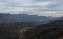
 Sespe Creek flowing through the Sespe Wilderness | |
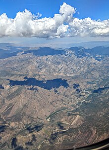
 Map showing Sespe Creek highlighted in the Santa Clara River watershed | |
| Native name | S'eqp'e'(Chumashan) |
| Location | |
| Country | United States |
| State | California |
| Region | Ventura County |
| Physical characteristics | |
| Source | San Emigdio Mountains |
| • location | Potrero Seco Campground, Los Padres National Forest,California,United States |
| • coordinates | 34°37′37″N119°26′31″W/ 34.62694°N 119.44194°W |
| • elevation | 5,280 ft (1,610 m) |
| Mouth | Confluence with theSanta Clara River |
• location | Sespe, California andFillmore, California,Ventura County, California |
• coordinates | 34°22′48″N118°57′17″W/ 34.38000°N 118.95472°W[2] |
• elevation | 355 ft (108 m) |
| Length | 61 mi (98 km) |
| Basin size | 260 sq mi (670 km2) |
| Discharge | |
| • location | Fillmore, California[3] |
| • average | 126 cu ft/s (3.6 m3/s)[3] |
| • minimum | 0 cu ft/s (0 m3/s) |
| • maximum | 85,300 cu ft/s (2,420 m3/s) |
| Basin features | |
| Tributaries | |
| • left | Hot Springs Canyon |
| • right | Lion Canyon, Timber Creek, West Fork Sespe Creek, Little Sespe Creek |
| Type | Wild, Scenic |
| Designated | June 19, 1992 |
Sespe Creek(Chumash:S'eqp'e',"Kneecap"[4]) is astream,some 61 miles (98 km) long,[5]inVentura County,southernCalifornia,in the Western United States.[6]The creek starts at Potrero Seco in the easternSierra Madre Mountains,and is formed by more than thirtytributarystreams of the Sierra Madre andTopatopa Mountains,before it empties into theSanta Clara RiverinFillmore.
Thirty-one miles (50 km) of Sespe Creek is designated as aNational Wild and Scenic Riverand National Scenic Waterway, and is untouched bydamsorconcretechannels. It is one of the last wild rivers inSouthern California.It is primarily within the southernLos Padres National Forest.
The nameSespecan be traced to aChumashIndian village, calledCepsey,Sek-peorS'eqpe'( "Kneecap" ) in theChumash languagein 1791. The village appeared in a MexicanAlta Californialand grant calledRancho Sespeor Rancho San Cayetano in 1833.[1][7]
Watershed
[edit]
The creek remains free from major habitat modifications and is noteworthy for its lack of dams, although one was originally proposed for a site named Topa Topa near Sespe Hot Springs in theSespe Wilderness.[8]After originating above 5,000 feet (1,500 m) in the Sierra Madre Mountains in the northwest corner of the Ojai Ranger District, about 75 percent of the Sespe Creek subwatershed is characterized by numerous rugged slopes and canyon walls of the southern Pine Mountains. It flows intermittently but is characterized by a series of permanent deep pools.[9]Major tributaries include the Lion Canyon, Hot Springs Canyon, Timber, West Fork Sespe and Little Sespe Creeks, although over 30 creeks and springs nourish it. Sespe Creek receives most of its rainfall between January and April, and furnishes 40% of the water flowing in the Santa Clara River.
Conservation
[edit]
Much of Sespe Creek is protected within theLos Padres National Forest.The approximately 219,700-acre (889 km2)Sespe Wildernessencompasses 31.5 miles (50.7 km) of Sespe Creek. Established in 1992, the wilderness area contains a 53,000-acre (210 km2) Sespe Condor Sanctuary. Approximately 10.5 miles (16.9 km) of upper Sespe Creek have been designated as wild and scenic. Furthermore, the stream is designated as a wild trout stream from the Lion Camp area in the upper subwatershed downstream to the Los Padres National Forest boundary north of and near the city ofFillmore.[9]
Ecology
[edit]The Sespe Creek flows through habitas of theCalifornia montane chaparral and woodlands ecoregion,andRiparian woodlands.
The inaccessibility of the Sespe Creek backcountry, related to the Sespe gorge and flash floods which make roads through the gorge impossible to maintain, has made the area an apparent refuge for a number of species who were extirpated elsewhere in southern California, including theCalifornia condor,southern steelhead troutand possibly theCalifornia golden beaver.In addition, theCalifornia grizzly bear(Ursus arctos horribilis) held out in the Sespe area until at least 1905, when a forest ranger reported tracks and separately hunters claimed they saw a grizzly in the vicinity of the Sespe Hot Springs and Alder Creek.[10]
The Sespe is one of southern California's last free flowing southernSteelhead trout(Oncorhynchus mykiss irideus) streams.

Endangered or rare species
[edit]The confluence of Sespe Creek with the Santa Clara River provides an important connection to upland systems and potential migration corridor for four endangered species:southwestern willow flycatcher(Empidonax traillii extimus),least Bell's vireo(Vireo bellii pusillus),arroyo toad(Bufo microscaphus californicus), andCalifornia red-legged frog(Rana aurora draytonii). The Sespe Creek population is the largest known arroyo toad habitat within its current range.[11]
- California condor
The Sespe Creek watershed has the 53,000-acre (210 km2)Sespe Condor Sanctuarycreated in 1947.[6]It protects wilderness habitat of thecritically endangered species,theGymnogyps californianus(California condor).
- California golden beaver
The discovery of a male adult California golden beaver (Castor canadensis subauratus) specimen collected as "wild caught" in May, 1906 (just prior to California instituting statewide protection from 1911–1925) "along the Sespe River inVentura County"is physical evidence that golden beaver were historically extant in coastal streams in southern California.[12][13]The skull of the Sespe Creek specimen is housed at theMuseum of Vertebrate ZoologyinBerkeley, Californiaand was collected by Dr. John Hornung, of Ventura, California, who assembled a large private mammal collection of over 2,000 skulls and made major specimen donations to museums including theAmerican Museum of Natural History.[14][15]Although theCalifornia Department of Fish and Gamere-introduced beaver throughout California the first documented restocking was 1923, well after the 1906 Sespe Creek specimen was collected.[16]
The authenticity of the Sespe Creek specimen is supported by reports of beaver historically in theSanta Clara Riveruntil Europeans arrived, according to oralVentureñoChumashhistory taken by ethnolinguistJohn Peabody Harringtonin the early twentieth century.
The beaver comes and gnaws the tree on the side towards which it leans, and at last falls over. The tree is leaning towards our house. I am beginning to fear that it will fall on us. The beaver builds its house in the river or thecienegasin the time of our ancestors. There were beavers atVenturaand also atSaticoy.[17]
Also there is a Chumash pictograph of a beaver at Painted Rock in theCuyama Riverwatershed due west ofMt. Pinosin the Sierra Madre mountains, about 35 miles (56 km) from the Sespe Creek headwaters.[18]Additionally, the Hearst Museum in Berkeley has a Ventureño Chumash shaman's rain making kit made from the skin of a beaver tail and a tobacco sack.[19]The shaman, "Somik", produced the artifact in the 1870s and resided atFort Tejon.It "was not utilized by his descendants".[20]In Janice Timbrook's "Chumash Ethnobotany" she states, based on linguistJ. P. Harrington's interview with Chumash elder Maria Soares, that the Indians nearTehachapiand also the Chumash believed that "a willow stick that had been cut by a beaver was thought to have the power to bring water. The Chumash would treat the stick with 'ayip ( a ritually powerful substance made from alum) and then plant it in the ground to create a permanent spring of water". In addition the Barbareño and Ventureño Chumash had a Beaver Dance.[21]Finally, the Chumash word for beaver isChipik,spelled "č'ǝpǝk'" in Barbareño and "tšǝ'pǝk" (Timothy Henry personal communication 2011-01-23), and "č'ɨpɨk" in Ineseño (Samala).[22]Taken together, these facts support the hypothesis that beaver ranged throughoutSanta Barbara County, CaliforniaandVentura County, California.
There is a Beaver Campground on Sespe Creek. Andy Bisaccia recalls taking Boy Scouts camping there between 1938 and 1944 and remembers seeing beaver, their dams, and lodges, and that they could be observed off ofHighway 33in that vicinity.[23]Another eyewitness, aUSFSFire Crew Chief, James Jeffery, saw beaver dams about 1.5 miles above Beaver Camp in 1969-1970 (personal communication R. Bisaccia Jan. 2011). Alasdair Coyne reports seeing a beaver dam atWillett Hot Springsabout ten miles east of Rose Valley on the Sespe, in 2000 (personal communication A. Coyne Jan. 2011).
See also
[edit]- Fishes of Sespe Creek, California
- California condor
- Sespe Condor Sanctuary
- Matilija Creek
- Santa Clara River
- Ventura River
- Topatopa Mountains articles
- California Fur Rush
- Sespe Hot Springs
References
[edit]- ^abErwin G. Gudde; William Bright (2004).California Place Names: The Origin and Etymology of Current Geographical Names.University of California Press.ISBN978-0-520-24217-3.RetrievedApr 13,2010.
- ^"Sespe Creek".Geographic Names Information System.United States Geological Survey,United States Department of the Interior.19 January 1981.Retrieved2010-04-15.
- ^ab"USGS Gage #11113000 on Sespe Creek near Fillmore, CA: Water-Data Report 2013"(PDF).National Water Information System.U.S. Geological Survey. 1911–2013.Retrieved2015-03-23.
- ^McCall, Lynne & Rosalind, Perry, red. (1991):The Chumash People: Materials for Teachers and Students.Santa Barbara Museum of Natural History. San Luis Obispo, CA: EZ Nature Books.ISBN0-945092-23-7.Page 29.
- ^U.S. Geological Survey. National Hydrography Dataset high-resolution flowline data.The National Map,accessed March 16, 2011
- ^abMonsma, Bradley John (2004).The Sespe Wild: Southern California's Last Free River.Reno, Nevada: University of Nevada Press.ISBN978-0-87417-536-3.RetrievedApr 11,2010.
- ^McCall, Lynne; Perry, Rosalind (2002).California's Chumash Indians: a project of the Santa Barbara Museum of Natural History Education Center(Revised ed.). San Luis Obispo, Calif: EZ Nature Books. p.36.ISBN0936784156.
- ^"California Rivers - Sespe Creek - Friends of the River".Archived fromthe originalon 2015-04-02.Retrieved2015-03-22.
- ^abSanta Clara River Tributaries Subprofiles(Report).RetrievedApr 13,2010.
- ^Charles F. Outland (1969).Mines, Mountains and Grizzlies: tales of California's Ventura back country.Ventura County Historical Society. p. 134.
- ^David Court; et al. (June 2000).Prioritizing Sites along the Santa Clara River for Conservation of Threatened and Endangered Species, Master's thesis(PDF)(Report). University of California Santa Barbara.RetrievedApr 13,2010.
- ^"MVZ Mammals 4918 Castor canadensis subauratus Sespe River".Berkeley, California: Museum of Vertebrate Zoology.RetrievedJune 4,2010.
- ^Walter P. Taylor (1916).The Status of the Beavers in Western America with a Consideration of the Factors in their Speciation, in University of California Publications in Zoology Vol. 12.Berkeley, California: University of California. p. 449.RetrievedMar 11,2010.
- ^Annual report of the American Museum of Natural History, Volumes 41-42.American Museum of Natural History. 1910. p.69.RetrievedJune 4,2010.
american museum of natural history dr. john hornung.
- ^A. Brazier Howell (May 1923). "The Mammal Collections of North America".Journal of Mammalogy.4(2): 113–120.doi:10.2307/1373543.JSTOR1373543.
- ^Tappe, Donald T. (1942). "The Status of Beavers in California".Game Bulletin No. 3.California Department of Fish & Game.
- ^Chumash Field Notes, John P. Harrington Papers Microfilm edition: Volume 3, Reel 85, Frame 0305 - 0307.National Anthropological Archives, Smithsonian Institution.Retrieved2017-01-02.
- ^Georgia Lee; Stephen Horne (1978)."The Painted Rock Site (SBa-502 and SBa-526): Sapaksi, the House of the Sun".Journal of California Anthropology.5(2).RetrievedApr 27,2010.
- ^"Tobacco sack and skin from a beaver tail, part of shaman's rain-making kit, Ventureño Chumash, 1-84664, 1-84666".Hearst Museum of Anthropology. Archived fromthe originalon June 22, 2010.RetrievedMay 5,2010.
- ^"Catalog Card on 1-84664".Heart Museum of Anthropology. Archived fromthe originalon July 1, 2016.RetrievedMay 7,2010.
- ^Janice Timbrook (2007).Chumash Ethnobotany.Santa Barbara Museum of Natural History. p. 180.ISBN978-1-59714-048-5.
- ^Richard B. Applegate (2007).Samala English Dictionary.Santa Ynez Band of Chumash Indians. p. 476.ISBN978-0-615-13131-3.
- ^personal communication with Andy Bisaccia Jan. 2011
External links
[edit]- National Wild and Scenic Rivers: Sespe Creek webpage
- Keep Sespe Wild and Free—advocacy group.
- The Sespe Fly Fishers
- Description of rafting on Sespe Creek
Sespe Creek.

