
Soto del Barco
Soto del Barco
Sotu'l Barcu (Asturian) | |
|---|---|
 San Juan de la Arena | |
 Flag  Coat of arms | |
 | |
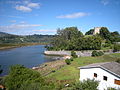
 Soto del Barco Location in Spain | |
| Coordinates:43°33′N6°6′W/ 43.550°N 6.100°W | |
| Country | |
| Autonomous community | |
| Province | Asturias |
| Judicial district | Pravia |
| Capital | Soto |
| Government | |
| •Alcalde | María del Carmen Arango Sánchez (PSOE) |
| Area | |
| • Total | 8.09 km2(3.12 sq mi) |
| Highest elevation | 131 m (430 ft) |
| Population (2023) | |
| • Total | 3,818 |
| • Density | 470/km2(1,200/sq mi) |
| Demonym | murense |
| Time zone | UTC+1(CET) |
| • Summer (DST) | UTC+2(CEST) |
| Postal code | 33138 |
| Website | Official website |
Soto del Barco(Asturian:Sotu'l Barcu) is a small, coastalmunicipalityin theAutonomous Communityof thePrincipality of Asturias,Spain. It is located on the banks of the mouth of theNalónand along theCantabrian coast.As of 2023, the municipality is home to 3,818 people who reside in fiveparishes:Soto del Barco,L'Arena,Ranón,Riberas,andLa Corrada.[1]
After theRoman occupation of Iberia,afort,which had been constructed in the area in order to defend themouthof the Nalón, was either restored or reconstructed byAlfonso III;this fort is still standing and is known as the Castillo de San Martín. Until 1836, Soto del Barco fell under the municipality ofPravia;it became independent on 29 December. Its population reached its peak at over 6,000 in the 1960s; due to the weakening of the localfishingandcanningindustries, the population has fallen markedly since that decade. Theserviceandtourism industriesare now the largest in the municipality.[2]
Gallery
[edit]-
 Castillo de San Martín
 -
 Los Quebrantos Beach


References
[edit]- ^"Nomenclátor: Población del Padrón Continuo por Unidad Poblacional a 1 de enero".Instituto Nacional de Estadística.1 January 2023.Retrieved6 June2024.
- ^Cañada, Silverio."Soto del Barco".Federación Asturiana de Concejos.Retrieved6 June2024.
External links
[edit]43°32′00″N6°04′00″W/ 43.533333°N 6.066667°W
| International | |
|---|---|
| Geographic | |
This article about a location in the Principality of Asturias, Spain, is astub.You can help Wikipedia byexpanding it. |