Sulloniacis
| Sulloniacis | |
|---|---|
 | |
| Location | England,UK |
| Coordinates | 51°38′N0°18′W/ 51.63°N 0.3°W |
| OS grid reference | TQ174940 |
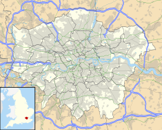
Location inGreater London | |
SulloniacisorSulloniacaewas amansioon theRoman roadknown asWatling StreetinRoman Britain.Its existence is known from only one entry in theAntonine Itinerary,a listing of routes and facilities for thecursus publicus,the official courier service of theRoman Empire.Sulloniacis,which is recorded inIterII (Itinerary II) for the route that ran betweenPortus Ritupis(Richborough,Kent) andDeva Victrix(Chester,Cheshire), was nineRoman milesfromVerulamium(St Albans) and 12 fromLondinium(London). Roman remains found atBrockley HillnearEdgwarein theLondon Borough of Barnethave been identified as those ofSulloniacis.[1]
Toponym
[edit]The name may mean 'Estate of the family/descendants of Sullonios', Sullonios being a personal name which is not known from any other source.[2]However, it could refer to a geographical feature.[1]
Location dispute
[edit]Research onSulloniacisbegan in 1937. Since then, several small-scale excavations have found well-preserved remains of 14 kilns and workshops, clay extraction pits, puddling holes, wells, preparation floors and large accumulations of kiln waste. Evidence showed it had been occupied since AD 60 with production reaching a peak towards the end of the First Century AD. After pottery production ended around AD 160, it became a domestic settlement until the Fourth Century AD. This settlement beingSulloniacismentioned in the Second Century ADAntonine Itinerary.[3]
However, senior British archaeologist Harvey Sheldon, a specialist on Roman London from theMuseum of London,has challenged the claim that the site found at Brockley Hill isSulloniacis.Aside from the evidence of pottery production and some domestic buildings, modern excavations have failed to find any remains ofmutationes(stations for changing horses) ormansiones(accommodation for official travellers). Sheldon suggested several alternative locations, particularly one further south in the vicinity ofEdgware RoadinBurnt Oak Broadway,a location where theHendon and District Archaeological Societyhas already found Roman remains nearby.[1][4]
However it is feasible that all these sites were within the boundaries of the estate namedSulloniacis,together with a possible Roman occupation site nearby on the hill atHendon.[4]
Nature reserve
[edit]A 4.2 ha (10 acres)Site of Borough Importance for Nature Conservation,Grade II, located immediately south-east of the Brockley Hill archaeological site atGrid RefTQ176940has been named Sulloniacis Pastures. The site is on grassland which slopes up eastwards from theA41 road.Located onLondon Clay,it has many flowers typical of clay pasture, such asgreater bird's-foot-trefoilandburnet-saxifrage.[5]
See also
[edit]References
[edit]- ^abcSheldon, Harvey (1996). "In Search of Sulloniacis". In Bird, Joanna; Hassall, Mark; Sheldon; Harvey (eds.).Interpreting Roman London.Oxbow Books. pp. 233–241.ISBN1 900188 02 3.
- ^A.L.F. Rivet and Colin Smith (1981).The place-names of Roman Britain.Book Club Associates.
- ^"SULLONIACAE".pastscape.org.uk.Retrieved8 March2021.
- ^abPamela Taylor, ed. (1989).A Place In Time – The London Borough of Barnet up to c. 1500.Hendon and District Archaeological Society.ISBN0950305065.
- ^Hewlett, Jan; et al. (1997).Nature Conservation in Barnet.London Ecology Unit. p. 67.ISBN1 871045 27 4.
Further reading
[edit]- Applebaum, Shimon (1951).Sulloniacae, 1950: Excavations at Brockley Hill.Transactions of the London and Middlesex Archaeological Society. Bishopsgate Institute.

